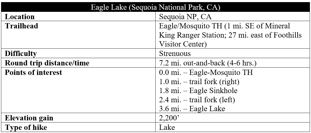
West of the Great Western Divide, California’s Sequoia National Park is effectively bisected by three branches of the Kaweah River—the Marble, Middle, and East Forks—all of which carve deep canyons fed by snowmelt from the 12,000-foot mountain range. Most visitors remain in the vicinity of the first two—Marble and Middle—as the vast sequoias of Giant Forest are wedged on a high shelf in between. Fewer venture on the slow, winding, and tiresome 25-mile road along the East Fork, which culminates at Mineral King, once a modest mining town in the late 19th century. The long entry weeds out the crowds, and the hikes in the Mineral King area are almost all high-altitude and strenuous. But those willing to make the trek are rewarded with sweeping views of broad meadows, alpine lakes, and the Great Western Divide.
One viable day hike—one of the shortest and easiest of a set of difficult climbs—is the 3.6-mile ascent to Eagle Lake, nestled in a granite cirque at 10,000 feet above sea level. While the lake is a worthy destination, it is the expansive vistas of the surrounding range that are the showstoppers. A mix of shade and sun, the refreshing hike is snow-bound much of the year but comes alive with wildflowers and local fauna from June to September.
(Note: Warning! The savvy marmots of the area have developed a taste for radiator hoses and car wiring, so the park recommends wrapping your vehicle in a tarp to prevent access to your undercarriage. There are reportedly some available at the Mineral King Ranger Station. The need for this eases after mid-August or so, when the marmots return to higher ground.)
The hike
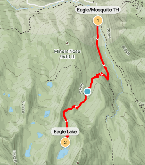
The narrow and bumpy Mineral King Road begins at the town of Three Rivers, just outside Sequoia National Park. Paved for the first several miles, the track crosses the East Fork of Kaweah River and ascends gradually to a shelf several hundred feet above the canyon floor. Eventually the scrubby foothills give way to dense forest, with giant sequoias scattered around Atwell Mill, where there is a campground. Eventually the road passes the Silver City Mountain Resort, which has a very modest store and a decent restaurant and cabins, then breaks out into the open meadows at Mineral King. The road ends with a few spurs. Cross the river to the west bank and park at the Eagle – Mosquito Trailhead, where there is a dead-end parking area on the left and a private residence on the right.
After securing your car, make your way to the trail start, marked with a large sign. Three main day hikes begin from this spot: Mosquito/Mineral Lakes, Eagle Lake, and White Chief. All of them gain more than 2,000 feet and end at granite bowls high above the valley floor.

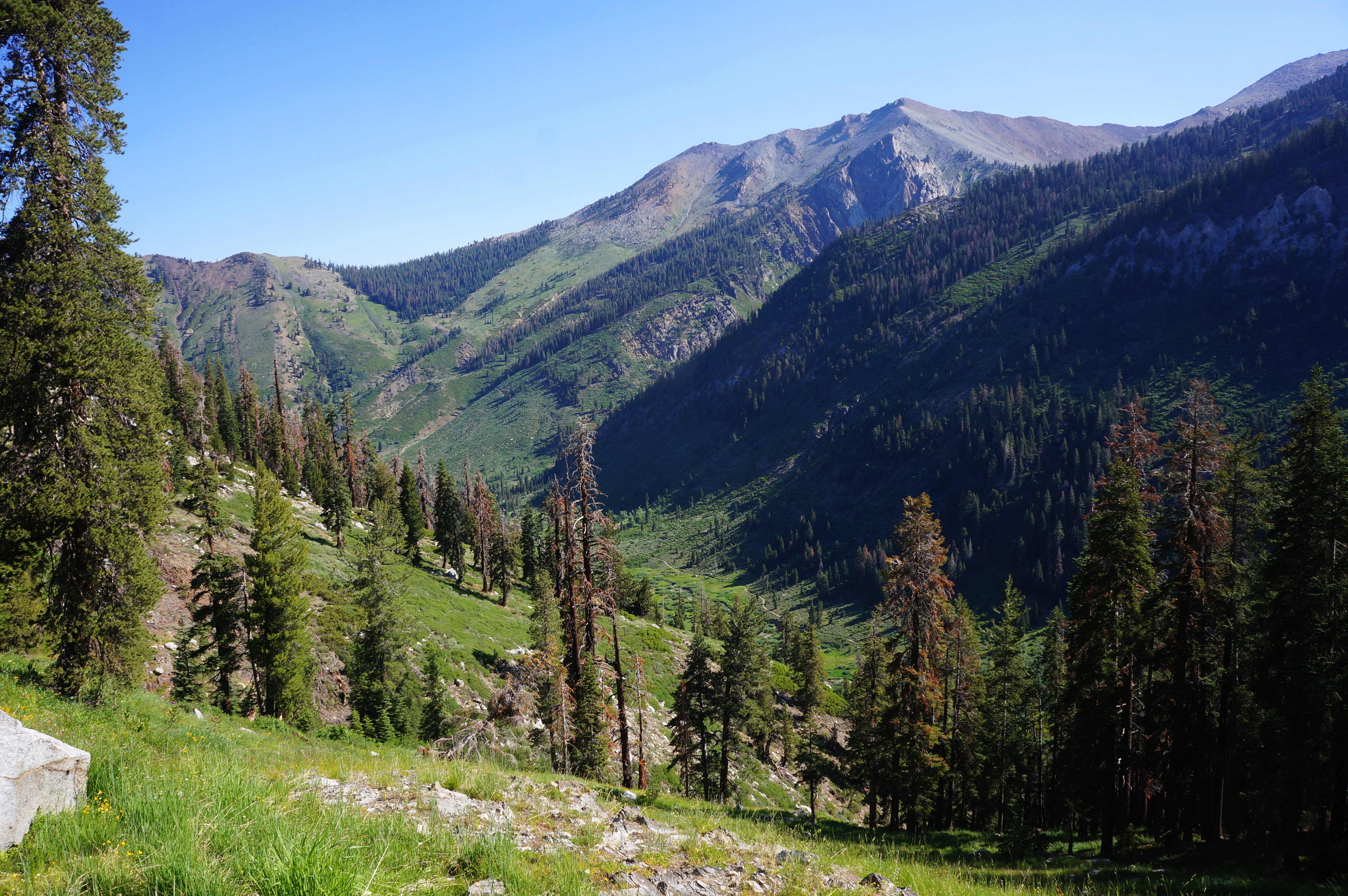
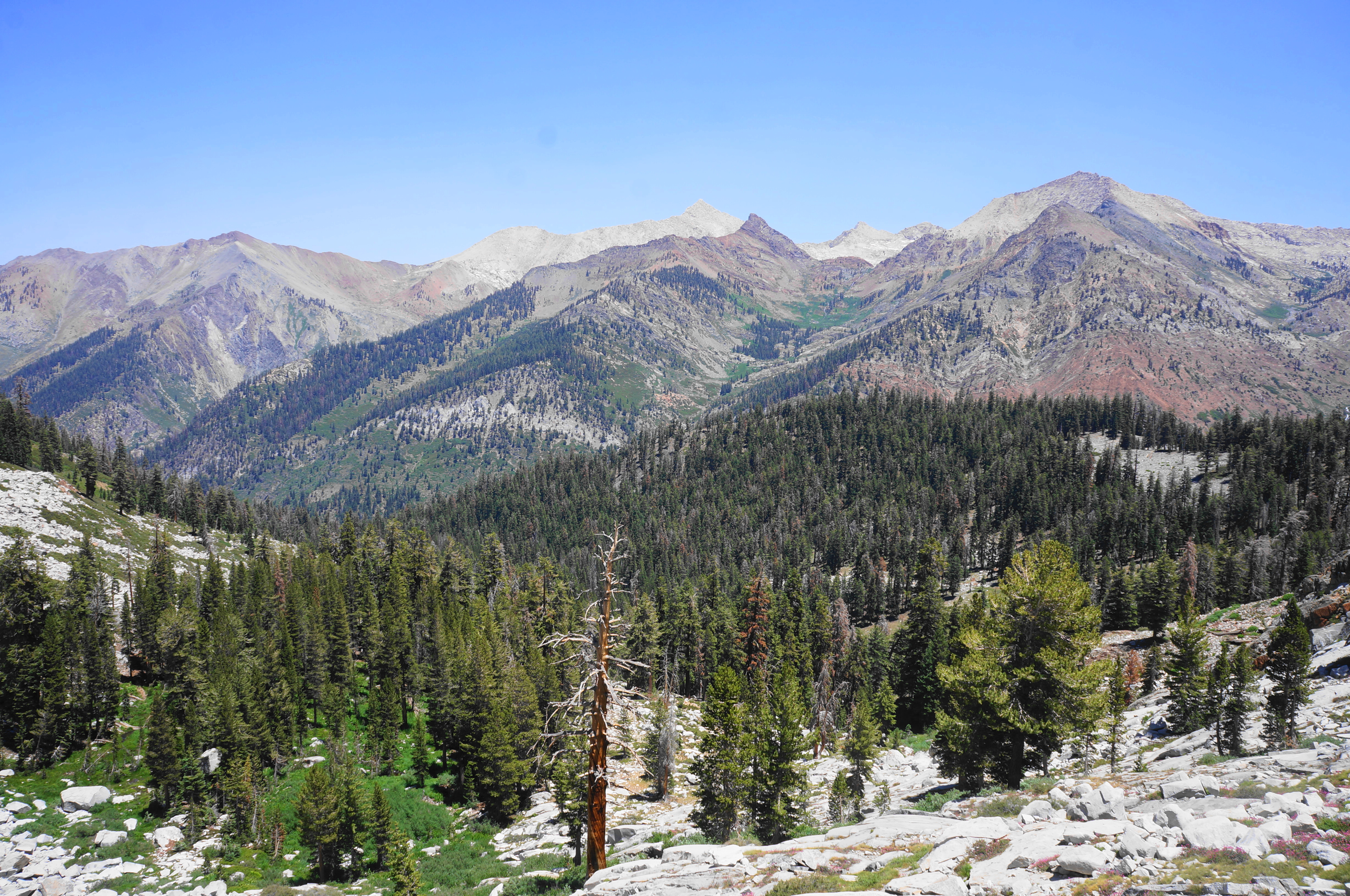
The beginning of the walk, though, is rather mild as it passes the Honeymoon/Point Cabin, constructed in 1914, on the left. Continue southbound through an initial set of conifers and cross a bridge over a tributary stream at ¼ mile. Here one can hear—though not easily see—roaring Tufa Falls, a highly-obscured cascade. Soon thereafter, hikers get better views across the vast meadow (teeming with marmots!). Looking south, one can peer almost to the park’s southern boundary, guarded by the towering heights of Florence Peak (12,432’) and Vandever Mountain (11,957’). (Note: Beyond lies the greatly underexplored Golden Trout Wilderness.) One can also see across the river to another, parallel trail that provides access to Farewell Gap (10,587’) and Franklin Lakes.

Eventually the hillside becomes more crowded with junipers and firs, and the trail rises well above the valley floor, offering views back to Timber Gap (9,511’), Empire Mountain (11,550’), and Mineral Peak (11,615’). The jumping cascades of Crystal Creek (though obscured in the morning shadows) provide reverberations of sound on an otherwise calm, still day.
Cross a small, lush tributary at around 8/10 mile, then make your way up a steeper incline that leads to the hike’s first trail junction at around the 1-mile mark (by now you have gained around 500-550 feet). This marks the split with the White Chief Trail, which continues left. Bear right instead, doubling back northward as the route climbs toward Eagle and Mosquito Lakes.
Now in mixed conifer and scrub, the trail begins a challenging ascent, mounting a set of switchbacks and coursing generally away from the main valley and toward a side canyon fed by Eagle Creek. Round a left, then enter a sudden switchback that brings hikers out to a sunny clearing with views down to the Kaweah valley. The boggy meadow is a favorite for mosquitoes in summer, offering motivation to clear it quickly. But after edging to the east flank, the trail cuts back across the meadow, rising through additional bends until finally reentering the woods on the west side.
Ascent to the edge of a ravine with a sudden, 50-foot dropoff. Curiously, the waterway is usually dry—a perplexing mystery soon to be explained as hikers proceed further. Make your way about 1/10 mile further and drop into the ravine, where one finds the water again—just as it plunges into the abyss: Eagle Sinkhole, where the creek briefly heads underground, concealing it from view. This makes for a reasonable rest point and roughly the half-way mark of the hike.

When ready, continue south and east through a mild section with lots of shade and undergrowth. It is about ½ mile from the sinkhole to the next trail junction; this time the Mosquito Lakes route bears right, skirting Miners Ridge, while the Eagle Lake Trail proceeds left.
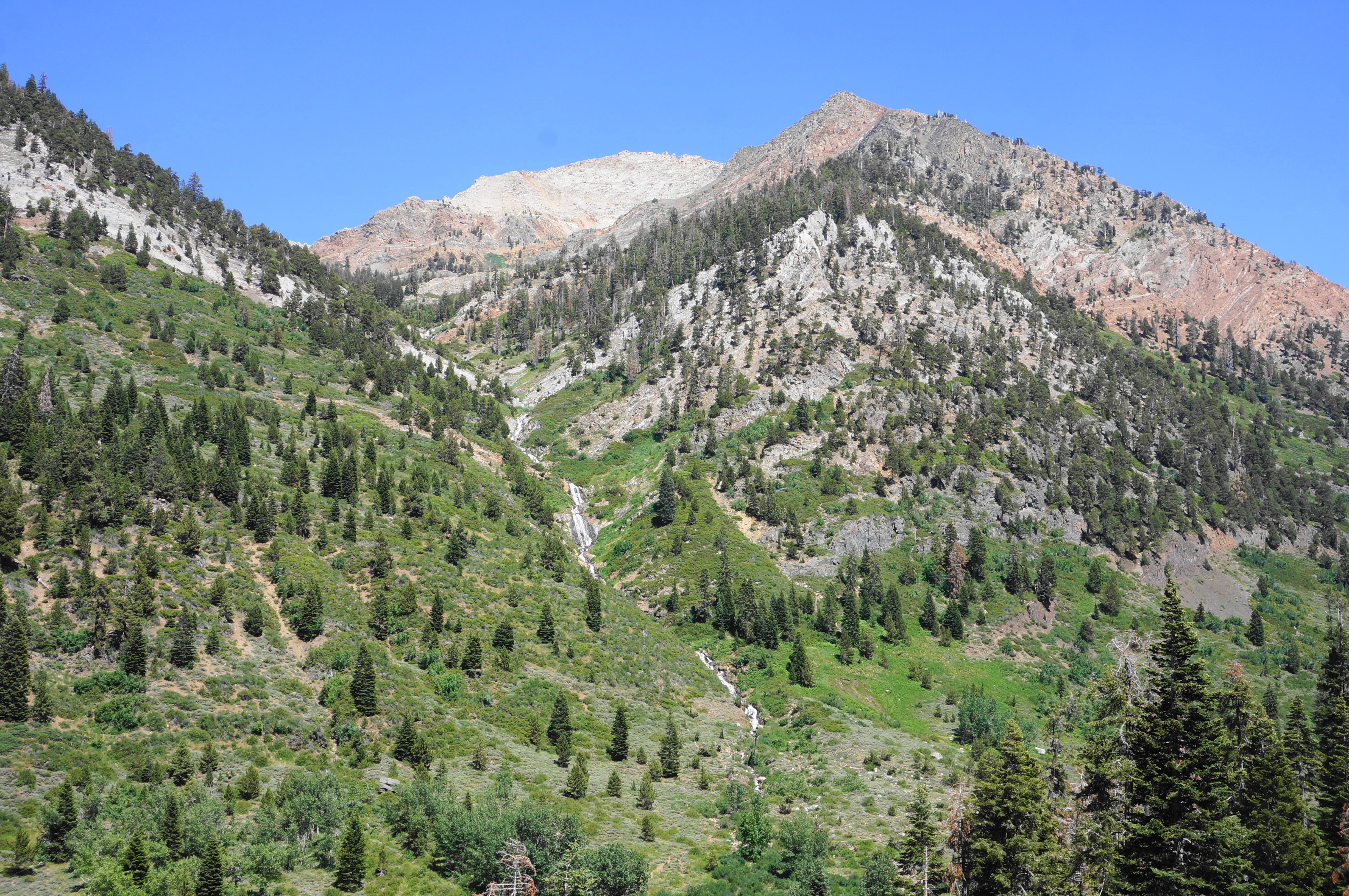
Soon the path emerges at the edge of a scenic meadow with corn lilies, set below an orange-hued mountain face. This leads quickly into another ascent, followed by a seasonal waterfall on the left as the trail bears right. Begin an eight-switchback sequence, followed by a boulder-lined uphill toward the timberline.

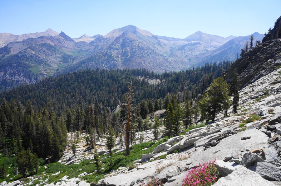
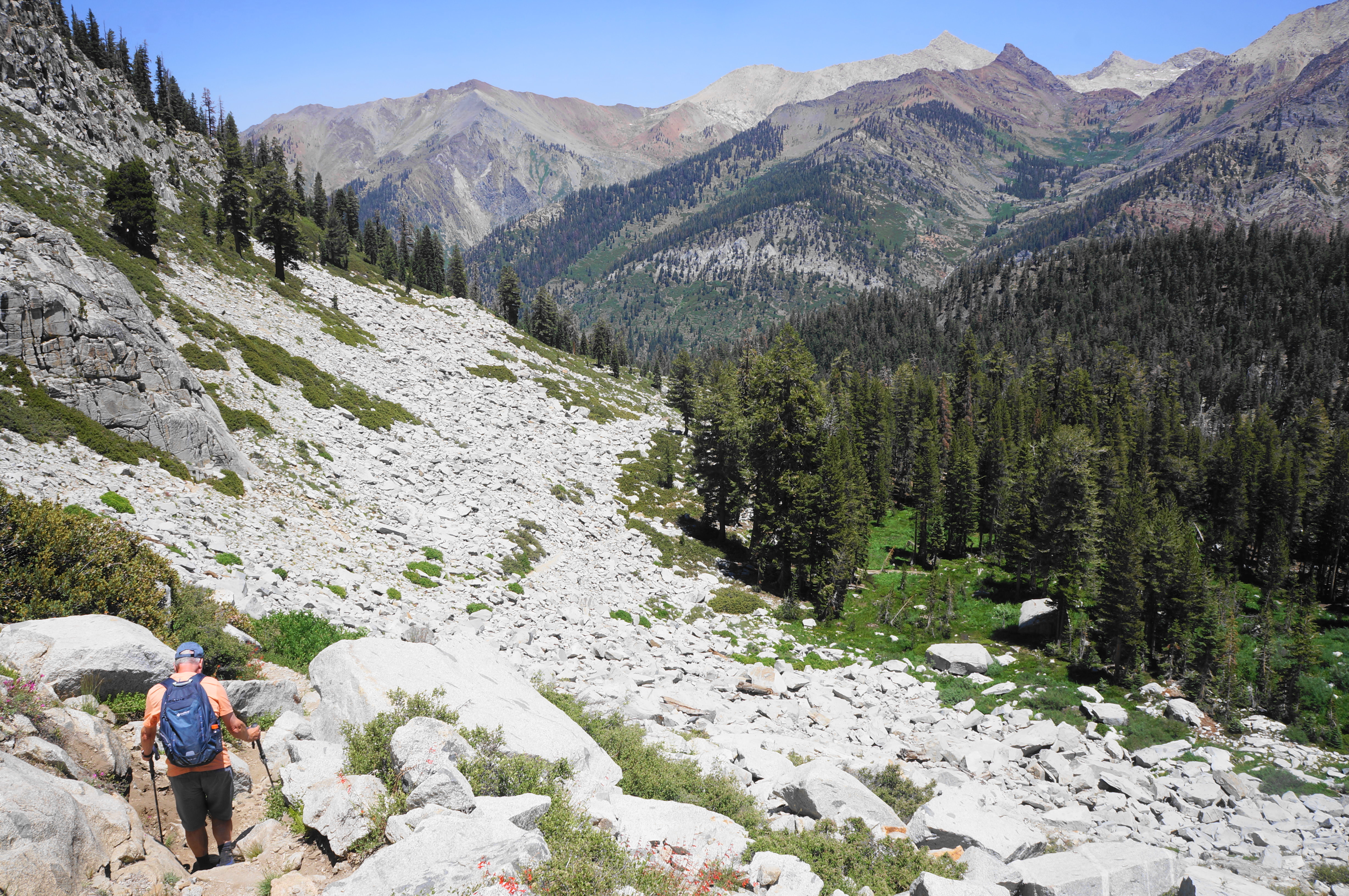
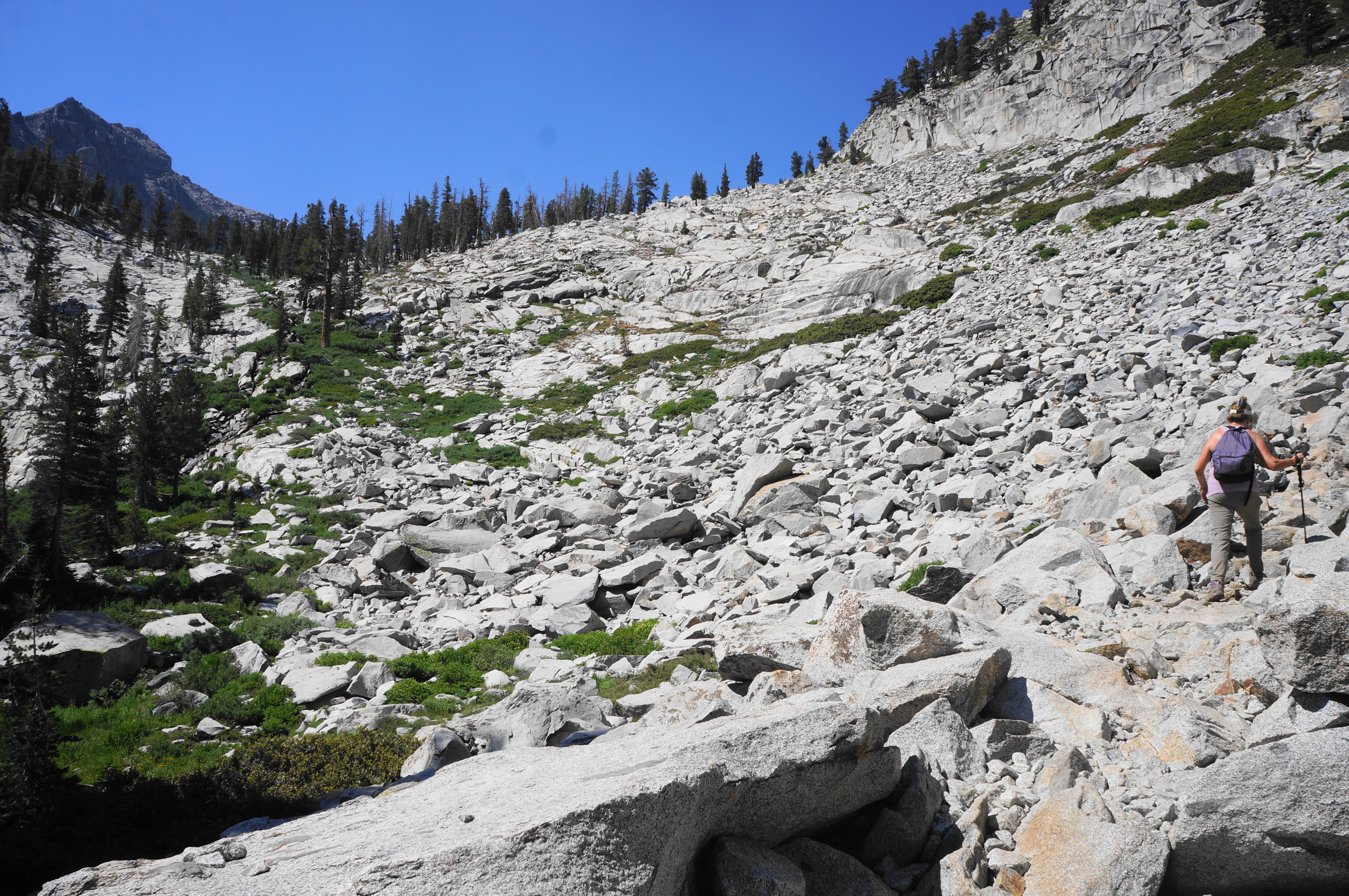
Here begins an arduous, sun-exposed section that traverses an imposing boulder field. Instead of coursing straight up alongside the creek, the trail instead bears right, climbing toward a line of scrub below an exposed ridge. The path effectively chooses to gain the bulk of the elevation now instead of later.


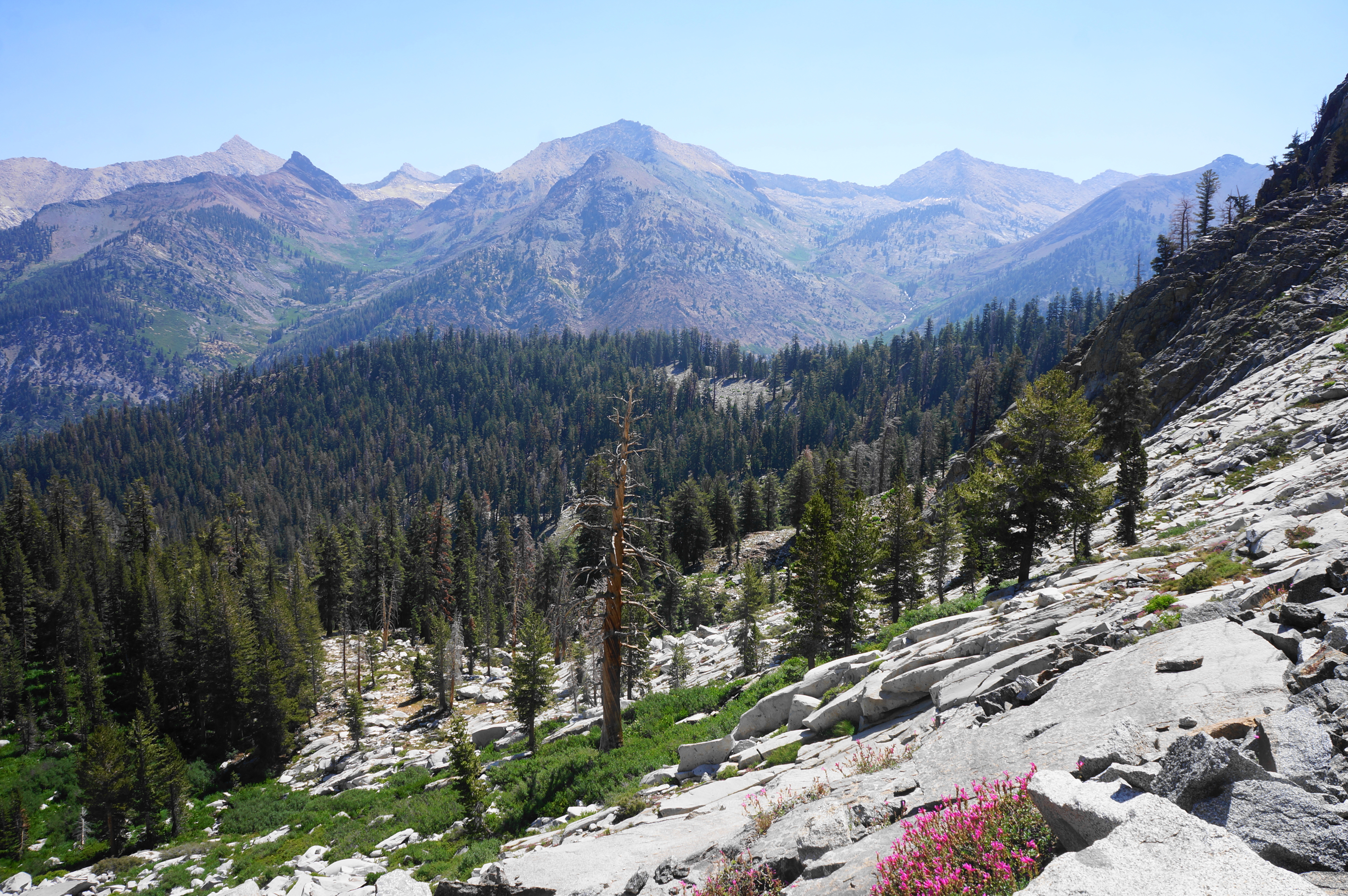
Soon, however, the boulder field becomes unavoidable, and the trail makes it way southward along a treeless slope with excellent views back toward Mineral King. The amphitheater includes Empire Mountain (11,550’), Sawtooth Peak (12,343’), Mineral Peak (11,615’), Rainbow Mountain (12,043’), and Florence Peak (12,432’), separated by high passes on the Great Western Divide. Take a moment to enjoy the splendid views—even better in the afternoon—as one makes a final push up and over the boulder slide, returning to a sub-alpine woodland.


Return creekside as the route ascends slickrock and passes a handful of foxtail pines. There is a brief level section, followed by a lovely wooded meadow, marking the return to the granite shelftops, the final challenge before the lake. At one point, the trail suddenly twists back in the direction you came, but it soon corrects itself and continues southward.
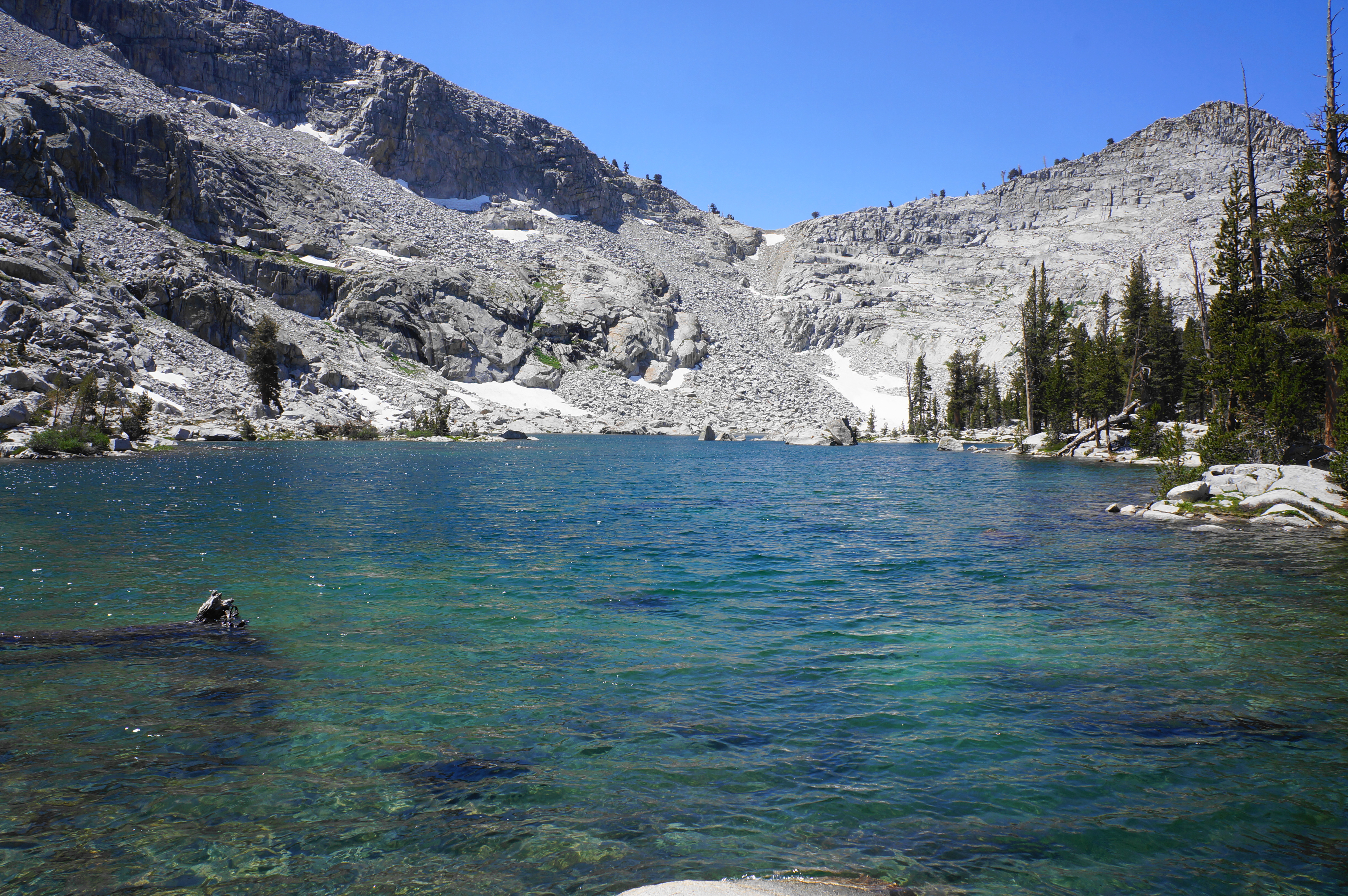
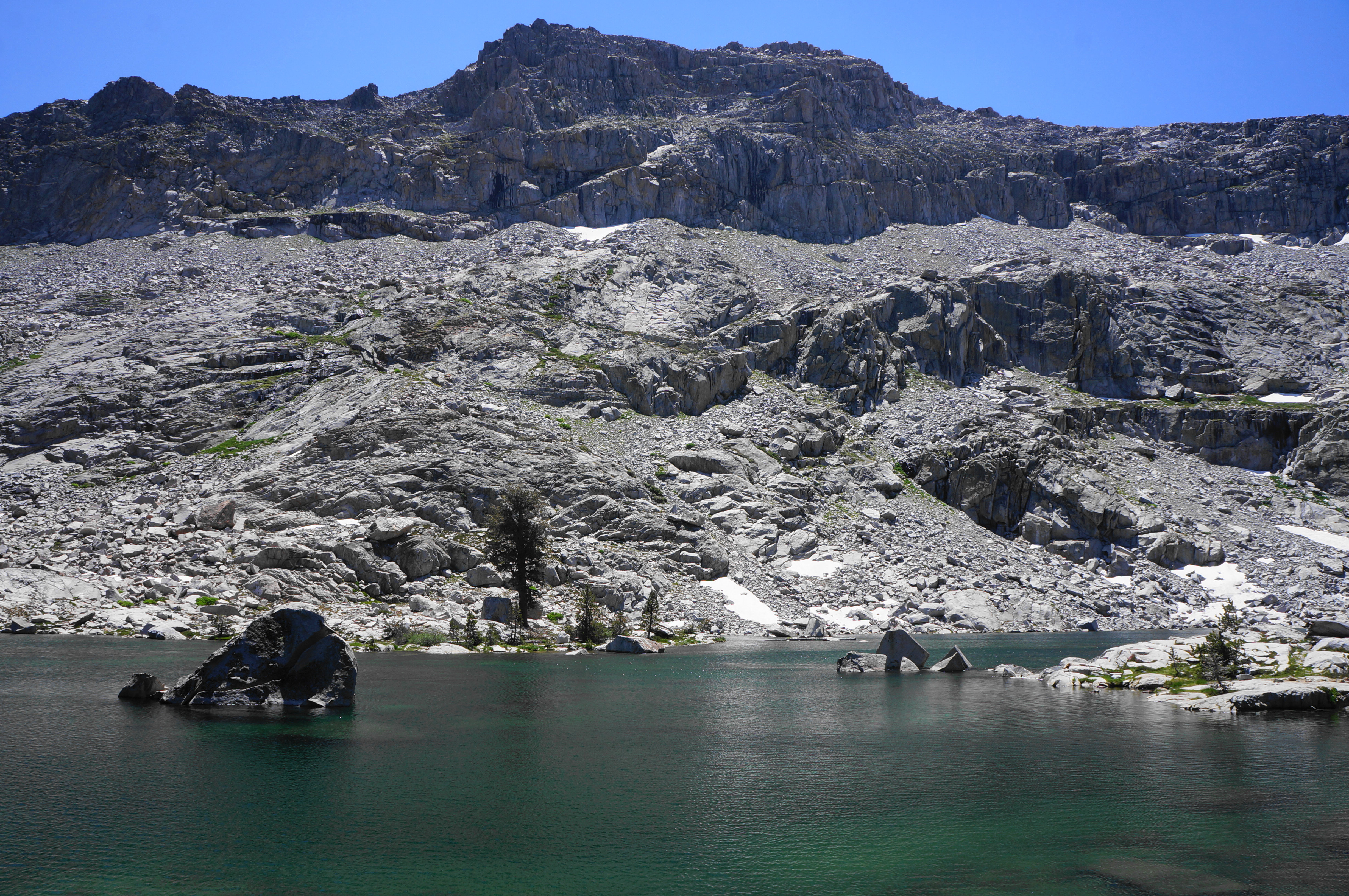
At 3.6 miles, the hike culminates at a neatly-arranged dam, which holds in Eagle Lake. The shimmering, turquoise waters are set against a backdrop of chalky granite. There are plenty of good nooks to stop for lunch or a snack, and the trail technically continues for about another ¼ mile along the west flank of the lake. Explore to your heart’s desire, but avoid the temptation to proceed higher to the gap above, given the perilously loose rock and year-round snow hazards.


Return the way you came, enjoying the clearer views across the valley that come in the afternoon. (Note: In particular, the tumbling cascades of Crystal Creek really shine in the new light.) Ambitious hikers can also add in Mosquito Lakes or White Chief Bowl to make for a 10+-mile endeavor.


Pingback: Top 10 Hikes in 2024 – Live and Let Hike