
The largest island in California and most visited destination in Channel Islands National Park, Santa Cruz Island spans more than 61,000 acres in the Pacific Ocean. Sporting only a modest visitor center, campground, and kayak company—with no restaurants, stores, or other concessions—exploring Santa Cruz Island is a largely wild experience. Once ashore, visitors can access a network of trails that crisscross the eastern portion of the island, reaching secret beaches, brushy canyons, and high coastal bluffs. A good half-day walk combines the popular Cavern Point and Potato Harbor hikes into a 4.5-mile jaunt with some mild elevation gain. Start and end the hike at the Scorpion Ranch Visitor Center and allot 2-3 hours for the full circuit.


The hike
Reaching Santa Cruz Island in California’s Channel Islands National Park is perhaps half the adventure, as the boat trip to/from the island is roughly an hour each way. Sightings of pods of common dolphins are very common, and some lucky visitors may also spot migrating whales. Concessionaire boats generally pull into Scorpion Anchorage at staggered times in the morning (twice during the week and up to four times on weekend days) and then leave in the late afternoon, leaving single-day visitors with around 6-7 hours on the island. Better yet, securing a reservation at the Scorpion Cove Campground allows for multi-day exploration. (Note, however, that there are limited facilities at the campground. Campers will have to bring all of their own gear and food for the trip.)
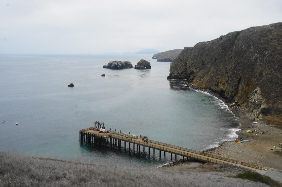
Scorpion Cove—where there is a single, long pier—is the primary starting point for most visitors to Santa Cruz Island and was once a staging location for ranching activities on the island. In 1887, French-born businessman Justinian Caire constructed several structures at Scorpion Cove, including a two-story ranch house and wooden bunkhouse. Today, the National Park Service has recreated the small ranch; the adobe house includes several exhibits on the island’s natural and human history.
To reach the start of the loop hike, walk westward from the anchorage, past a large restroom and several old, rusted farming implements. Kayaks (which can be used on expensive but worthwhile sea cave tours) dot the beach on the left, and some visitors may be found snorkeling in the underwater kelp forest on the north side of the pier. Once at the Visitor Center (where there is a refurbished bunkhouse and adobe), look for the start of the Cavern Point Trail heading right (north). This is the beginning of the 4.5-mile stem-and-loop hike.
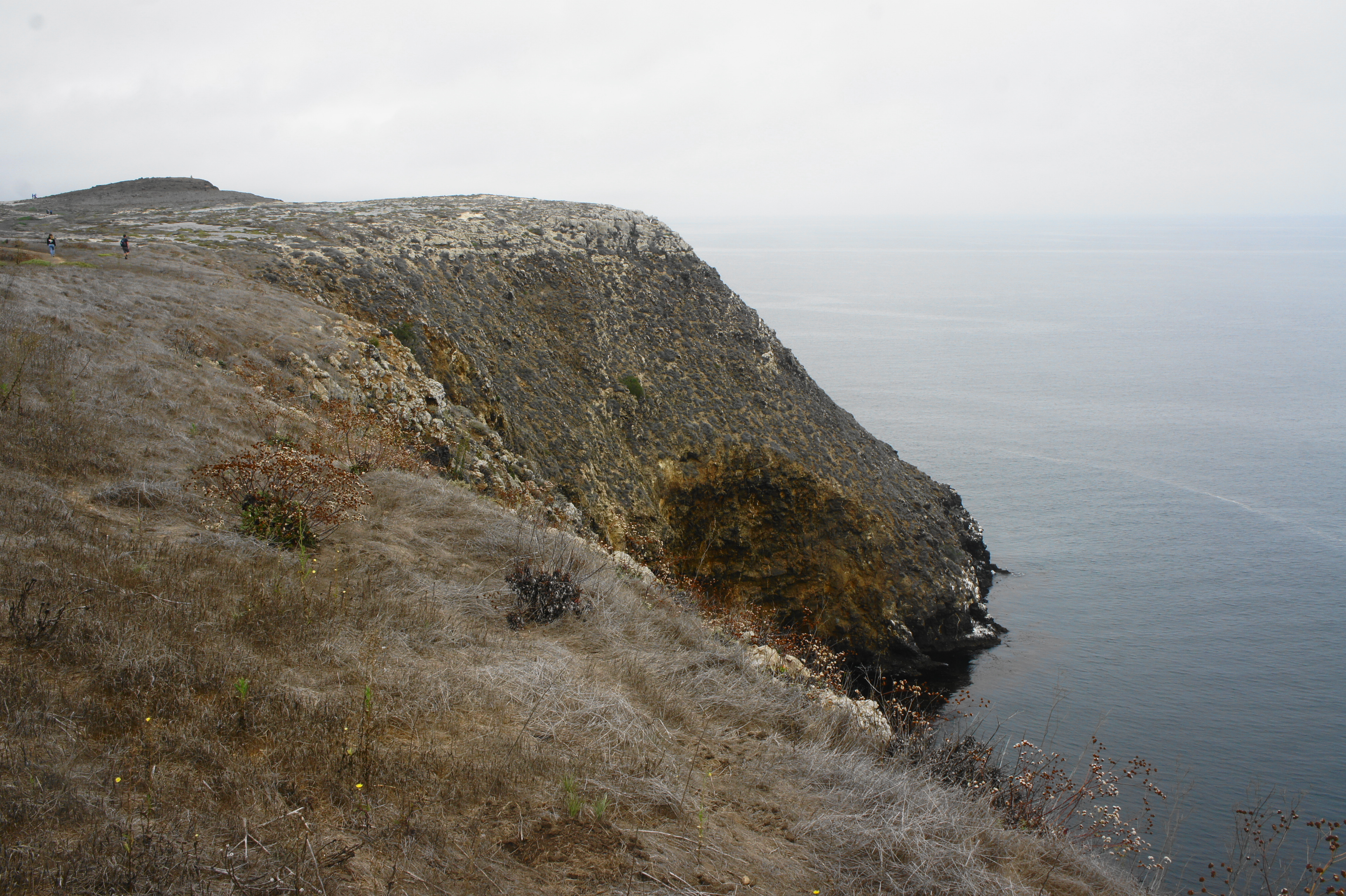
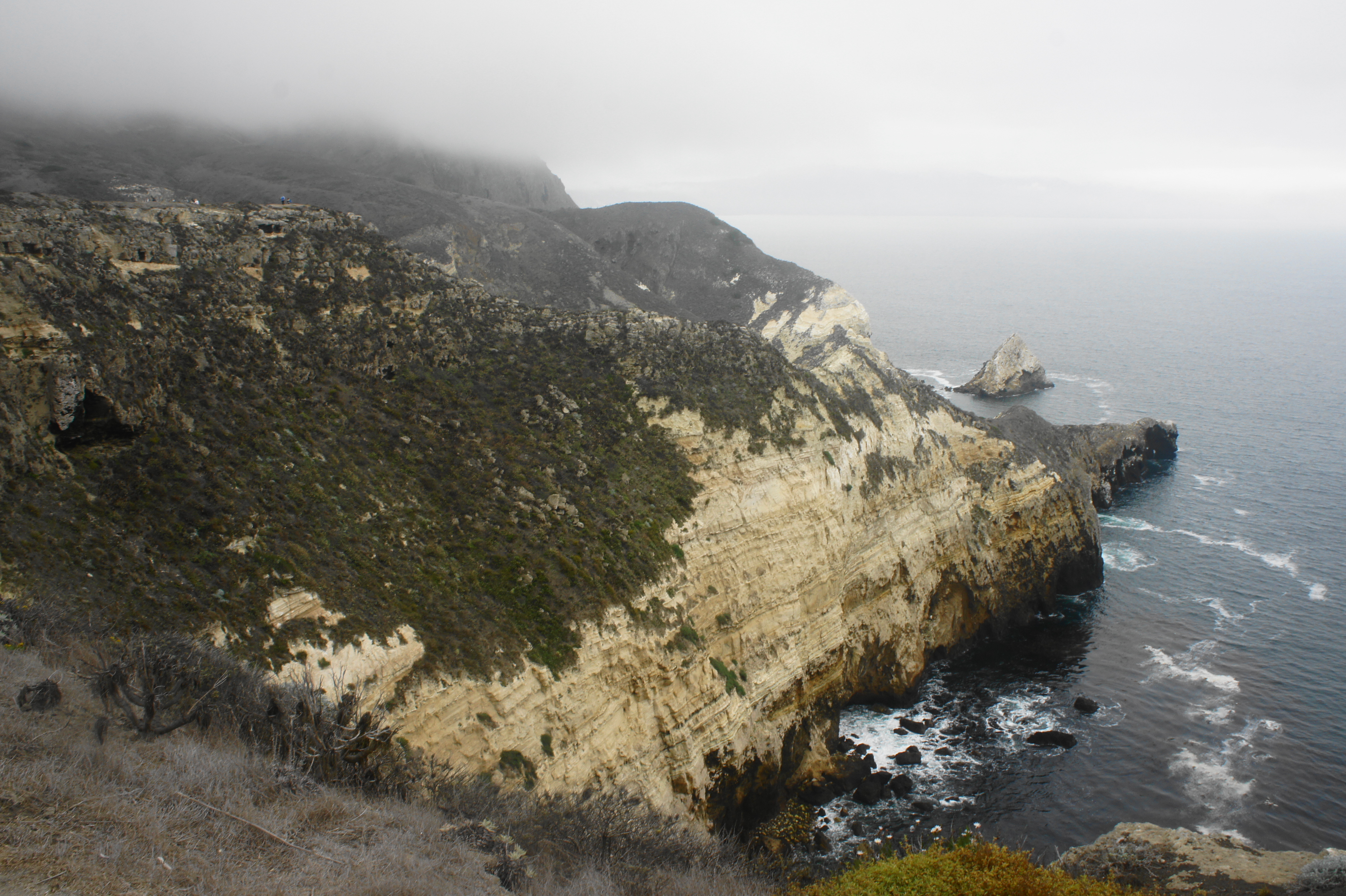
The Cavern Point Trail begins steeply, ascending several sets of staircases and rounding three switchbacks as the path rises out of a woody side drainage. After the switchbacks, the trail bears eastward with open views of Scorpion Anchorage and the imposing cliffs of Santa Cruz Island, with (on clear days) distant Anacapa Island visible beyond.

Rising high out of Scorpion Valley, the Cavern Point Trail turns north and passes an overlook at about ¼ mile. Here one can glimpse some hearty native plants clinging to the edge of the cliffs: after the island was overrun by domesticated sheep and cattle in the late 1800s, much of the native plant life was devastated—surviving only in areas such as the precipice of the bluffs, out of reach for livestock.

The brittle, chalky white rock exposed in many places on the island is called diatomaceous earth, a peculiar sedimentary rock layer composed of microscopic, single-cell sea plans named diatoms. Diatomaceous earth is a key ingredient in chert, produced when diatoms are dissolved in water and recrystallized as a harder form of rock, which was used by the Chumash Indians to create tools and arrowheads.
The Channel Islands were formed by compression forces around five million years ago, when tectonic activity thrust the mixture of sedimentary and volcanic rock upward out of the ocean. Intriguingly, despite being within striking distance of mainland California, the Channel Islands were part of a “super-island” named Santarosae that was never connected to the rest of the continent. This means that all the animal species found on Santa Cruz Island either swam, flew, or were brought by humans. This includes the pygmy mammoth, a dwarf version of the larger Columbian mammoth that once roamed the mainland; paleontologists suspect that the mammoths reached Santarosae by swimming and later went extinct around the end of the Ice Age, some 10,000 years ago.

The geographic isolation of the Channel Islands has facilitated natural evolution that has occurred separately from the mainland, producing 145 endemic or unique plant and animal species. Sixty of these species are found on Santa Cruz.
Unfortunately, as noted, much of the native population of plants and animals was devastated by the introduction of large-scale farming and ranching in the 19th century. Such destruction is evident as hikers bear north from the overlook above Scorpion Cove, passing through matted flatlands that include many non-native grasses. The wide trail edges uphill but now at a much more manageable incline, passing through a mulched section that leads to the first of several trail junctions at about 7/10 mile. Hikers can bear right here to climb to Cavern Point (316’), a local high point overlooking the Pacific. A separate trail bears westward at a junction minutes later; this service road loops back to Scorpion Cove.

Stay right at the junction, continuing on a trail that now descends mildly, with views down to a sheltered cove frequented by kayakers, almost 300 feet below. The high cliffs continue westward in the distance. The shores and small islands off the coast are frequented by pelicans, seagulls, and cormorants.

Shedding around 50 feet of elevation, the trail drops to a dry drainage and another junction at about 1.1 miles. Continue right, following the sign for Potato Overlook. Now hikers embark on the North Bluff Trail, a narrower and rockier path that rises again and follows the cliff’s edge. The trail passes another promontory above a seabird nesting island, revealing views of a new kelp-strewn inlet below.
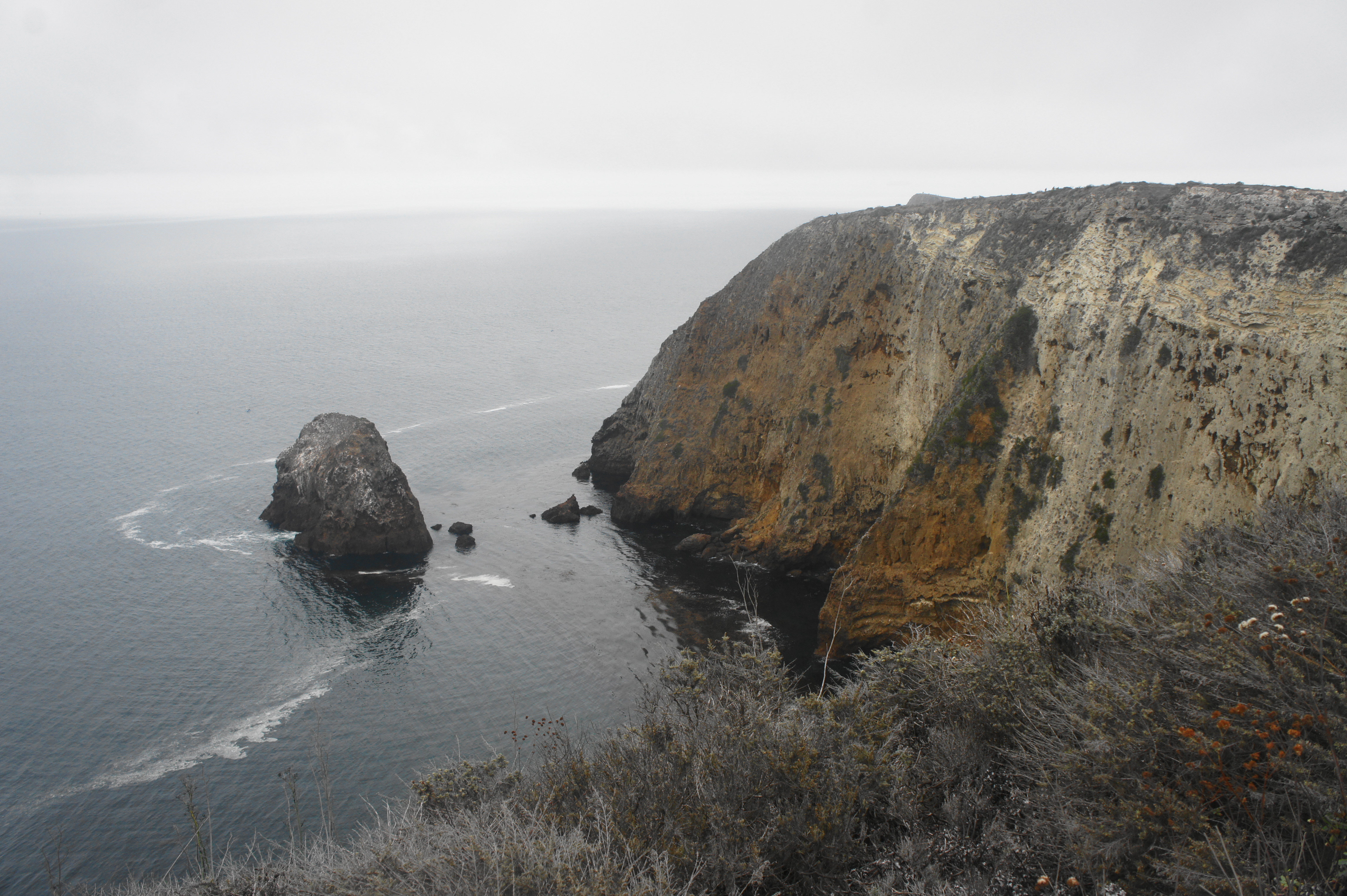
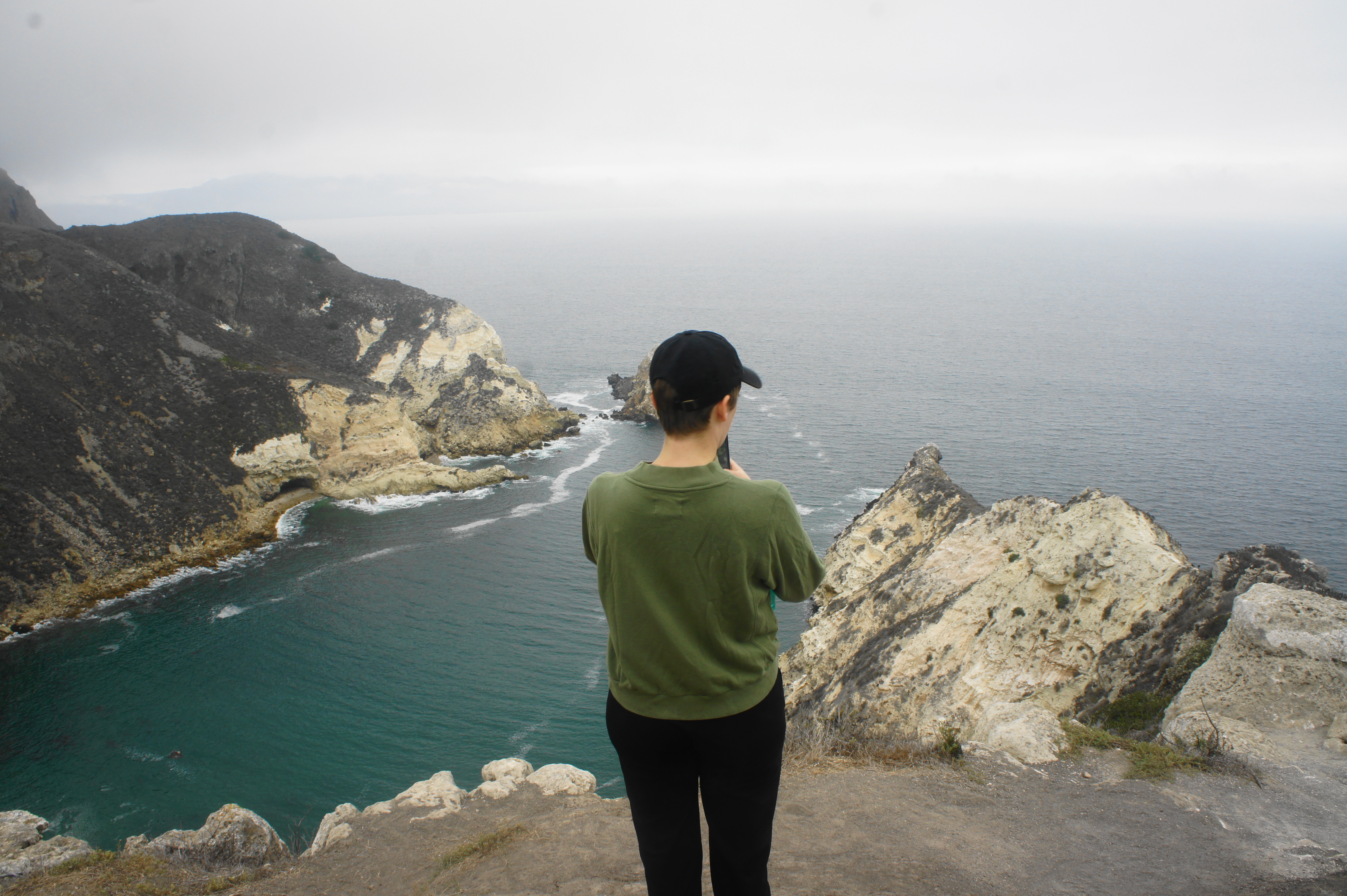
Edging the cliffside for another half-mile, hikers arrive at a point where the North Bluff Trail merges with the wider Potato Harbor Road, a popular thoroughfare for hikers on the island. Bear right, continuing westward along the gravel route. There are fine views of the chalky cliffs from the junction with the unmaintained Montagñon Ridge Trail at 2.4 miles.
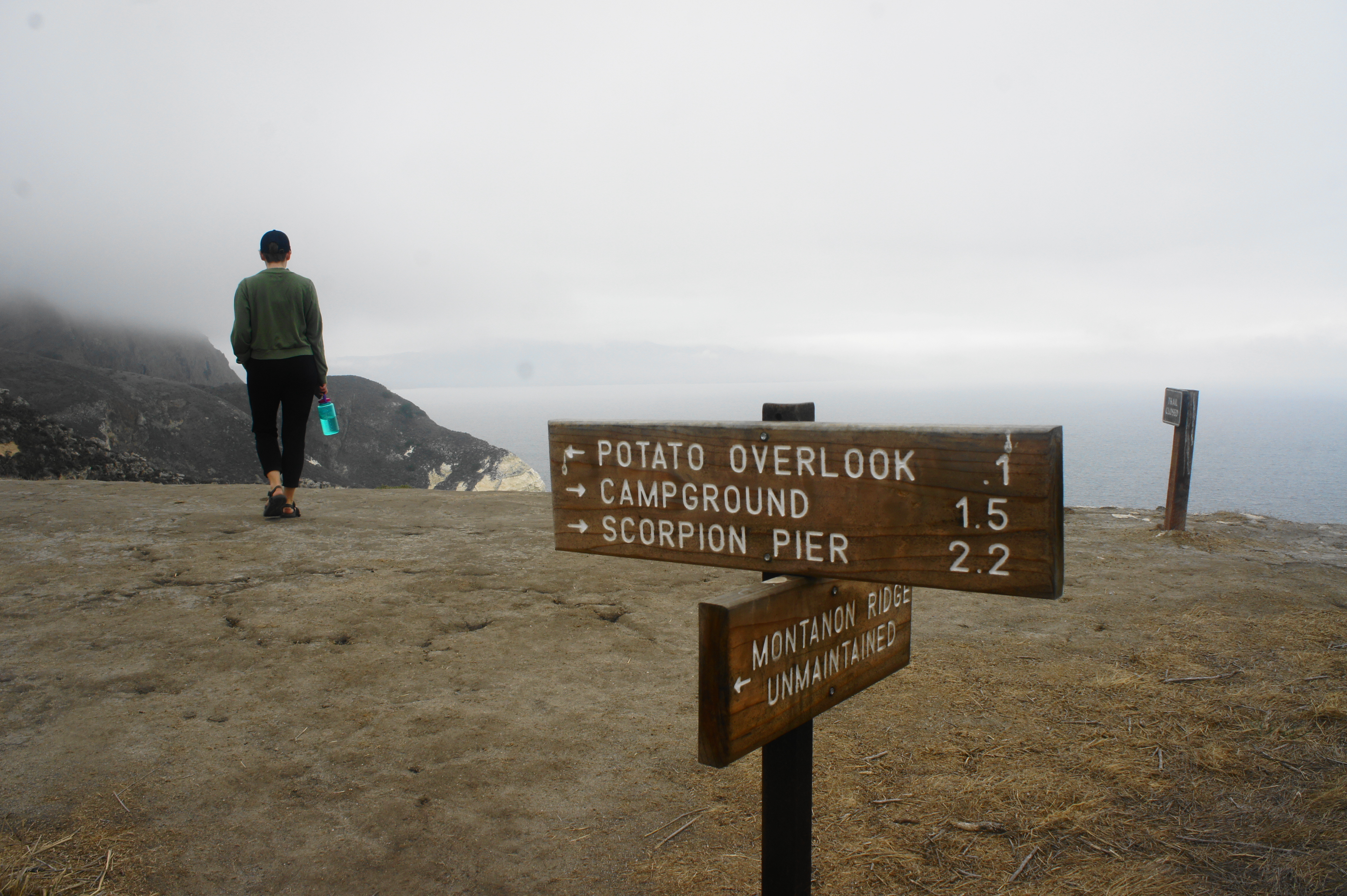
Now bearing south, follow the road for another 1/10 mile to Potato Harbor Overlook. Below is a beautiful, aquamarine-colored bay only accessible by watercraft. Off to the south, hikers can peer up to Montagñon Ridge (1,808’), the highest point in the eastern half of the island. Beyond Potato Harbor, hikers can see across a large bight to the western section of the island, off-limits to visitors without permission from the Nature Conservancy.


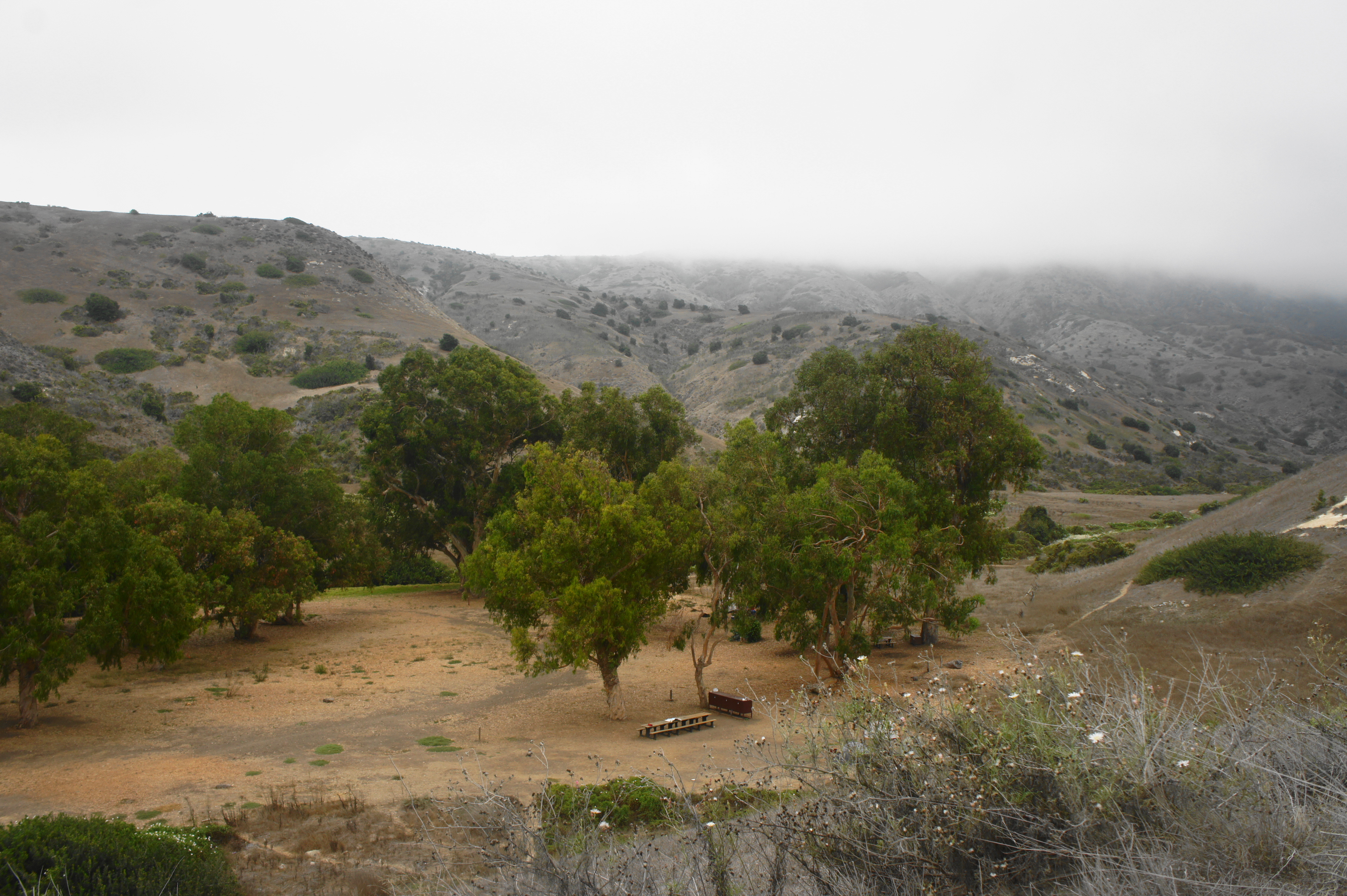
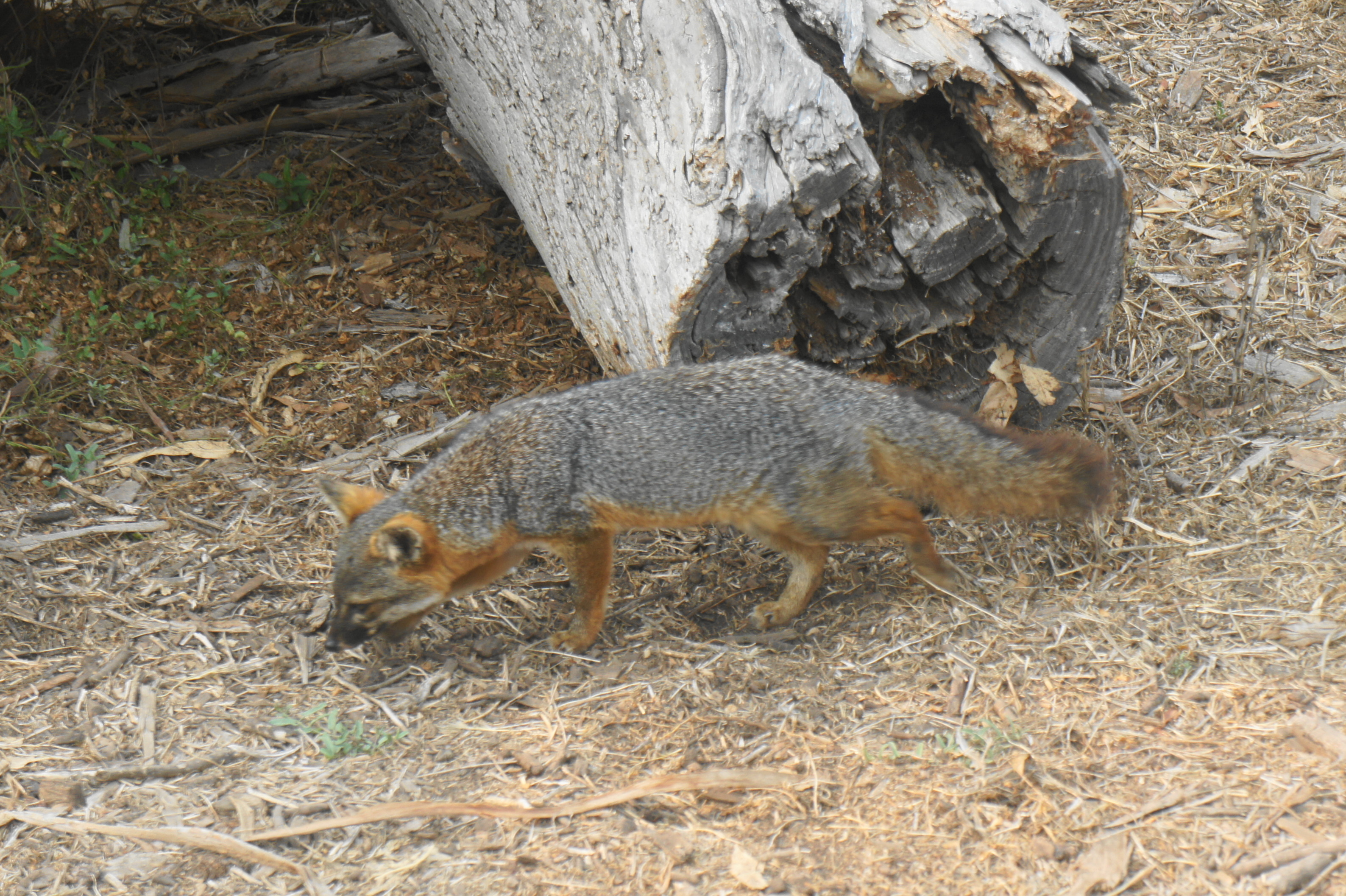
Enjoy this popular viewpoint, then return the way you came for about ¾ mile, returning to the junction of the Potato Harbor Road and North Bluff Trail, this time bearing right. Follow the descending road as it overlooks scrubby Scorpion Canyon and passes several prominent displays of diatomaceous earth on the left. The eucalyptus forest of Upper Scorpion Cove Campground eventually comes into view, and the road descends to a junction at the four-mile mark. Bear left, then walk along the wide and level path, where you are sure to encounter the island fox, a smaller relative of the mainland gray fox that is found only on the Channel Islands.
The island fox population on Santa Cruz almost went extinct in the 1990s as non-native golden eagles developed a taste for the dwarfish fox; an intensive conservation effort in the early 2000s removed the eagles—as well as the island’s feral pig population—leading to a recovery of the fox population. The island foxes in this part of the island have become relatively accustomed to humans, allowing visitors to admire up-close their beautiful orange and grey furs and boundless curiosity. (Note: Campers will have to protect their food from the hungry munchers that prowl through Scorpion Canyon in search of scraps.)
Stay straight on Scorpion Valley Road as it passes another trailhead for Cavern Point on the left, then parallels Lower Scorpion Cove Campground, where one will find the majority of overnight campers on the island. From here it is a short walk back to the Visitor Center at Scorpion Ranch.
All told, the 4.5-mile loop is a moderately strenuous walk that offers a nice introduction to the island, with fine views of the Pacific Ocean and the towering cliffs of Santa Cruz Island. Day visitors may also be able to sneak in another short hike before the afternoon ferry leaves—and overnighters can use the next day to kayak, snorkel, or hike some more.

Pingback: Scorpion Canyon Loop Trail (Channel Islands National Park, CA) | Live and Let Hike
Pingback: Top 10 Hikes in 2021 | Live and Let Hike
Pingback: Top 10 Hikes in 2022 | Live and Let Hike
Pingback: Top 10 Hikes in 2023 | Live and Let Hike
Pingback: Top 10 Hikes in 2024 – Live and Let Hike