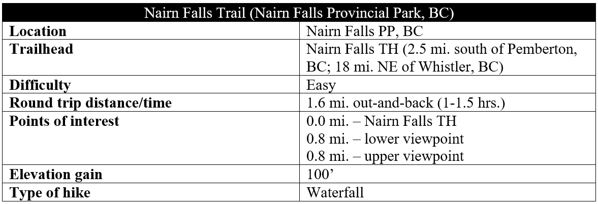
Situated along the Green River, Nairn Falls is a popular destination between Whistler and Pemberton, British Columbia, notable for its frothy, multi-tiered drop through a narrow gorge. Nairn Falls Provincial Park is easily accessible from the Sea to Sky Highway (Route 99), though the parking area fills early on busy weekends. The walk is short and straightforward, paralleling the river before climbing to a pair of viewpoints overlooking the double-drop falls. In an area where much of the hiking options are lengthy and strenuous, this is an exception.
The hike
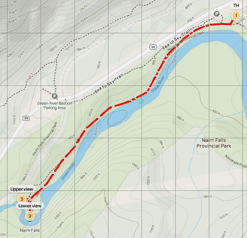
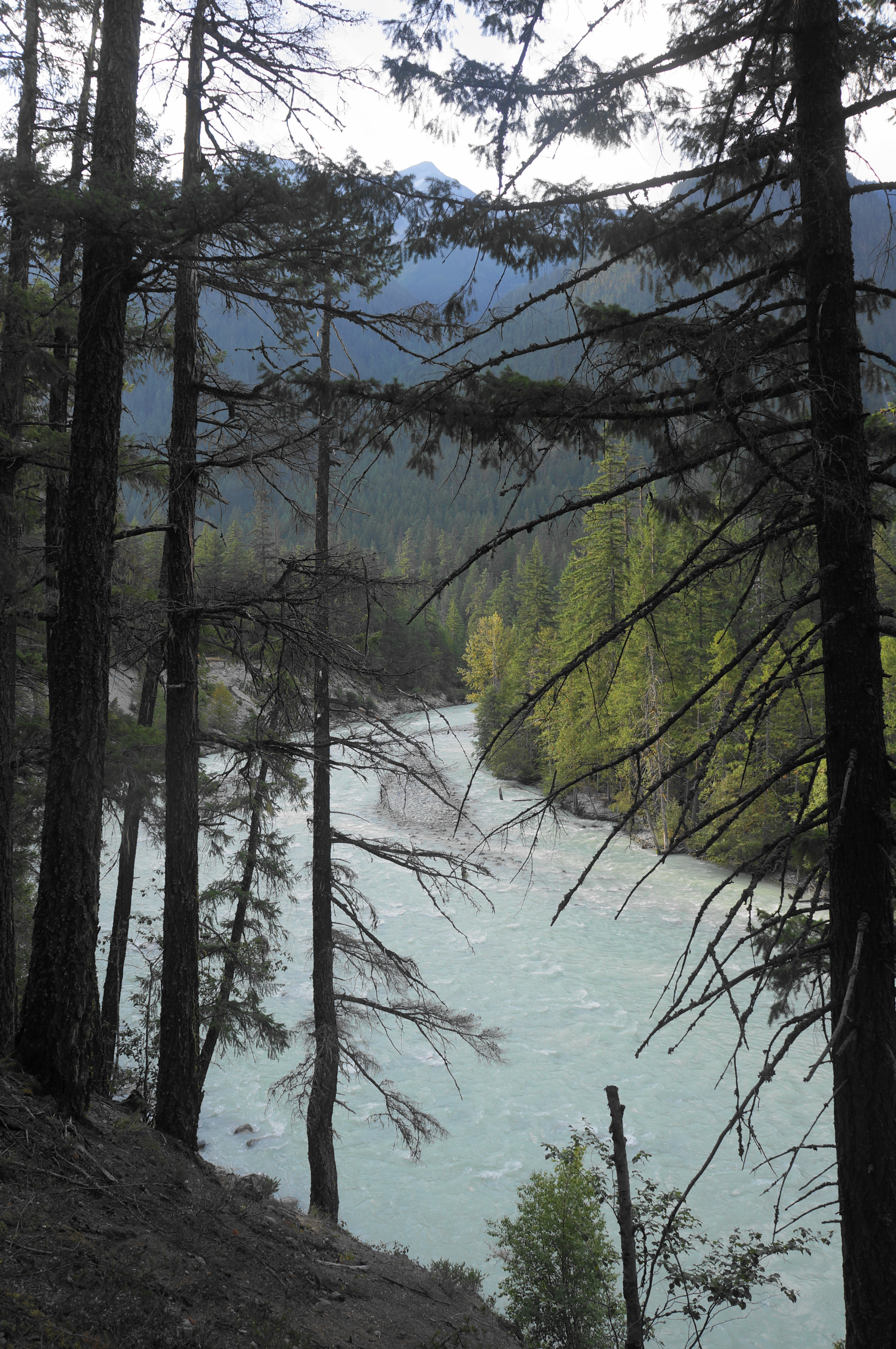
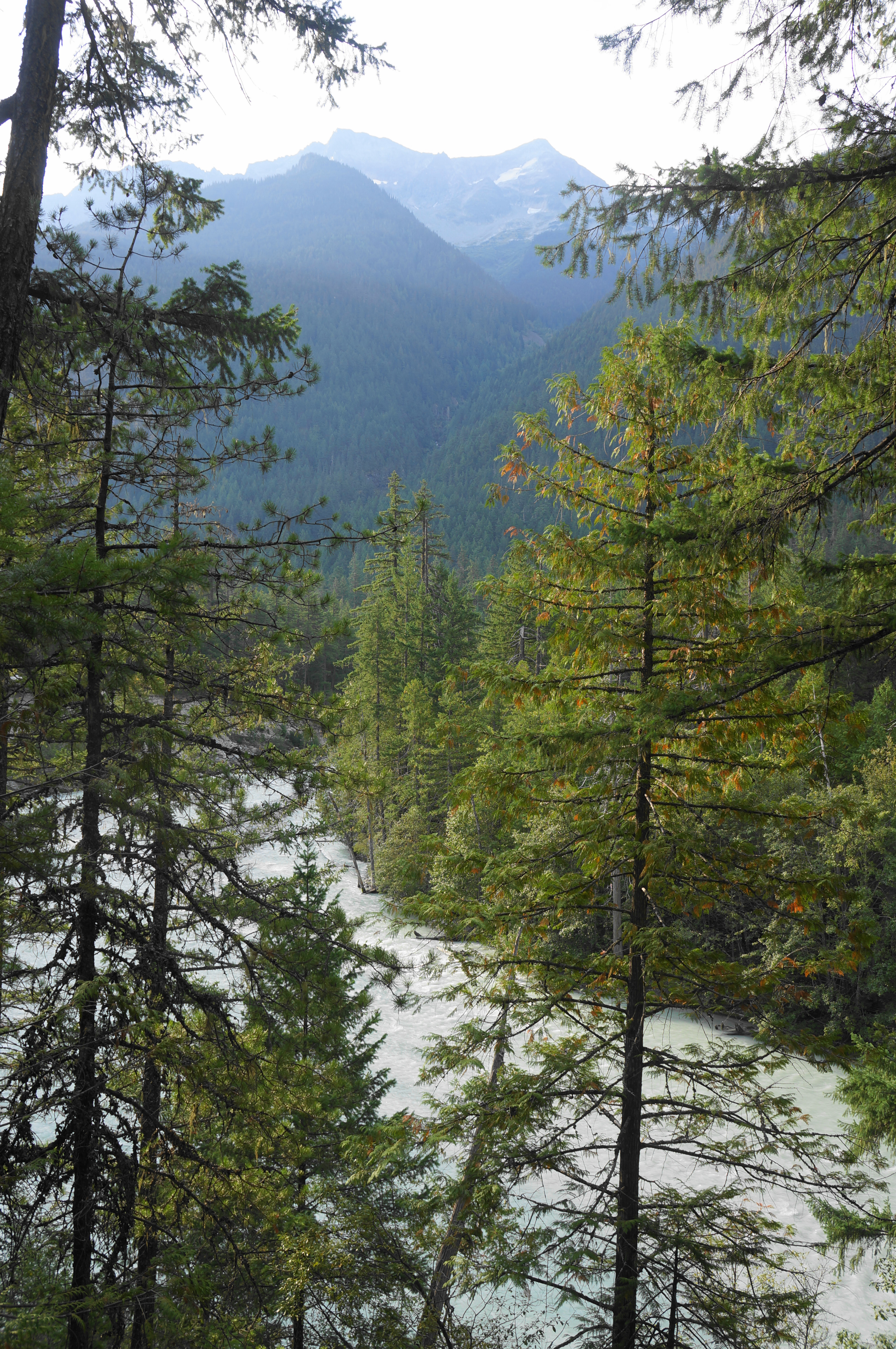
Nairn Falls Provincial Park is a modest, 400-acre park with a large campground and access to the Green River, which forms an angular and scenic canyon above the town of Pemberton, British Columbia. The main parking area is situated just off Route 99 (a.k.a. Sea to Sky Highway), about a 25-minute drive from Whistler.
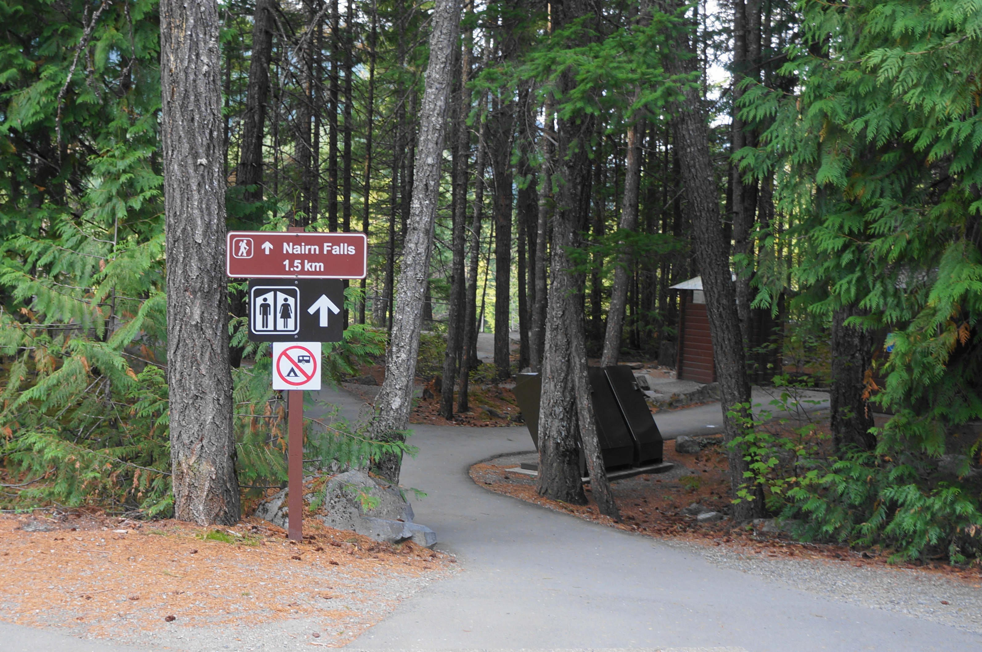
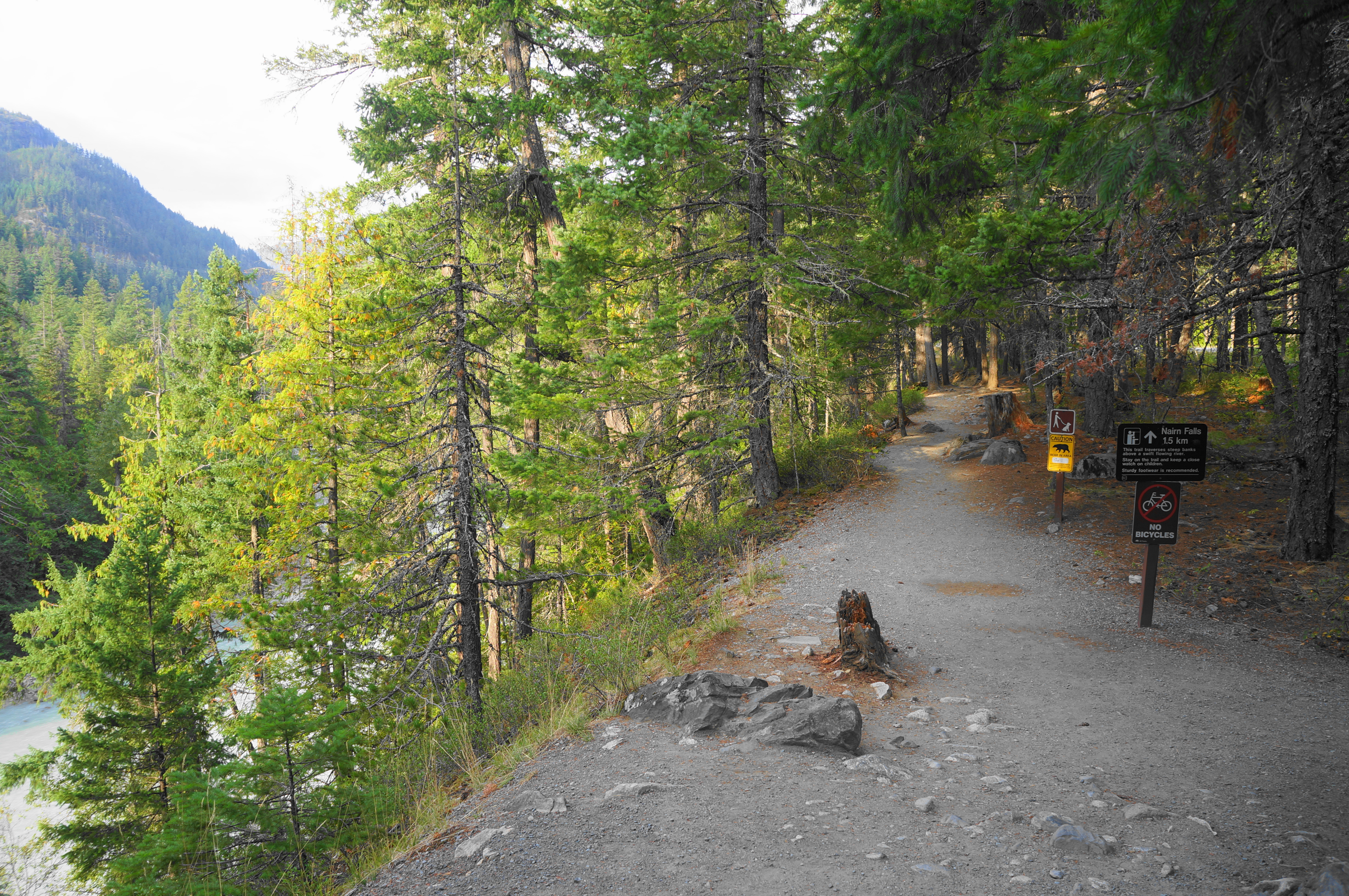
From the day use parking area, find a clearly-marked paved path leading past a set of restrooms to the canyon rim, with partly-obscured views down to the wide and milky Green River. The route is set below the heights of Mount Currie (8,501’), visible above to the south. Stay right as the trail turns from pavement to dirt, descending mildly while paralleling the river below. After around 1/2 mile, the canyon narrows and a spur leads down to the left for shore access.
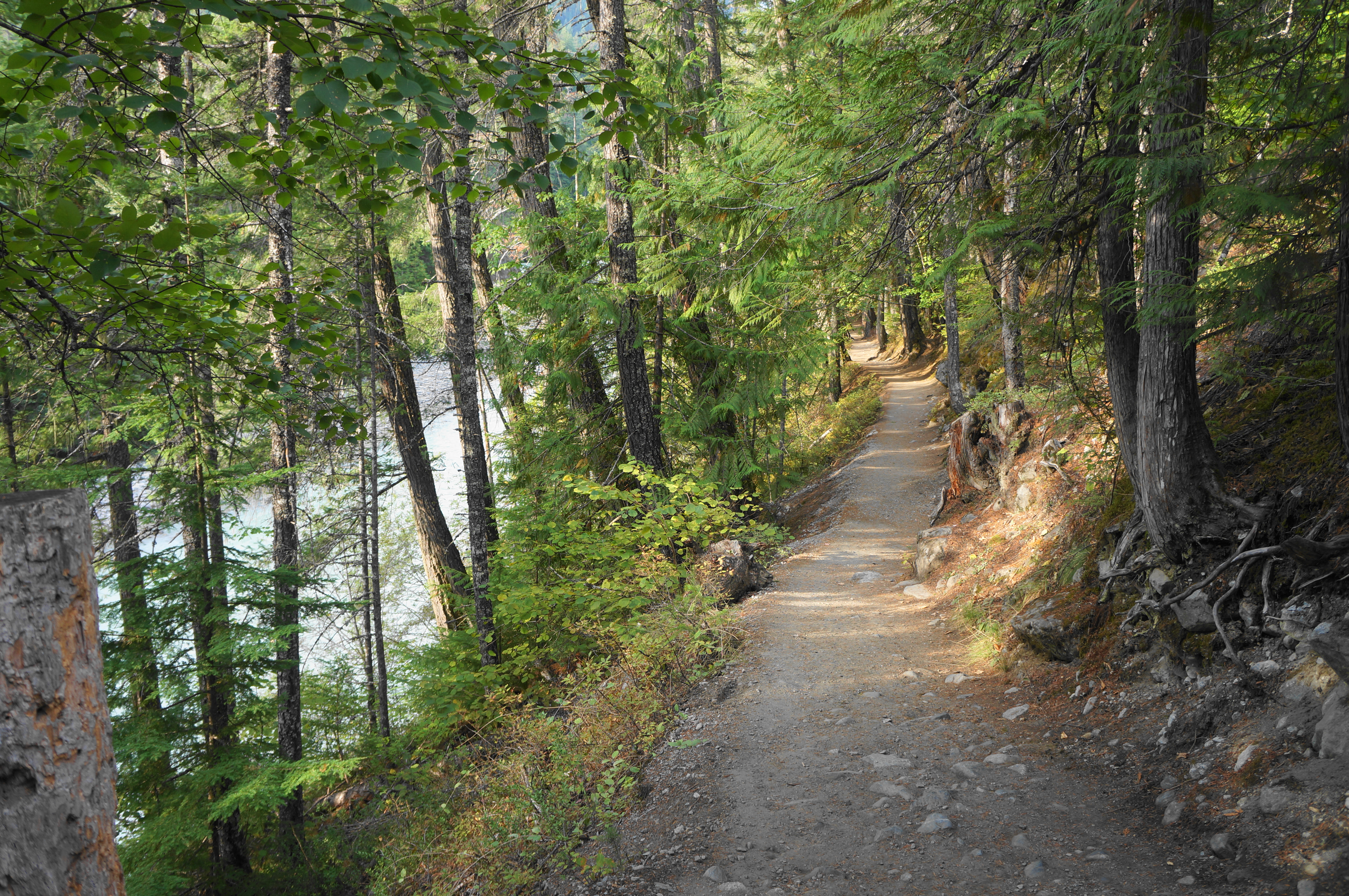
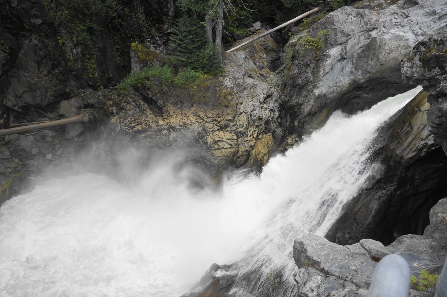
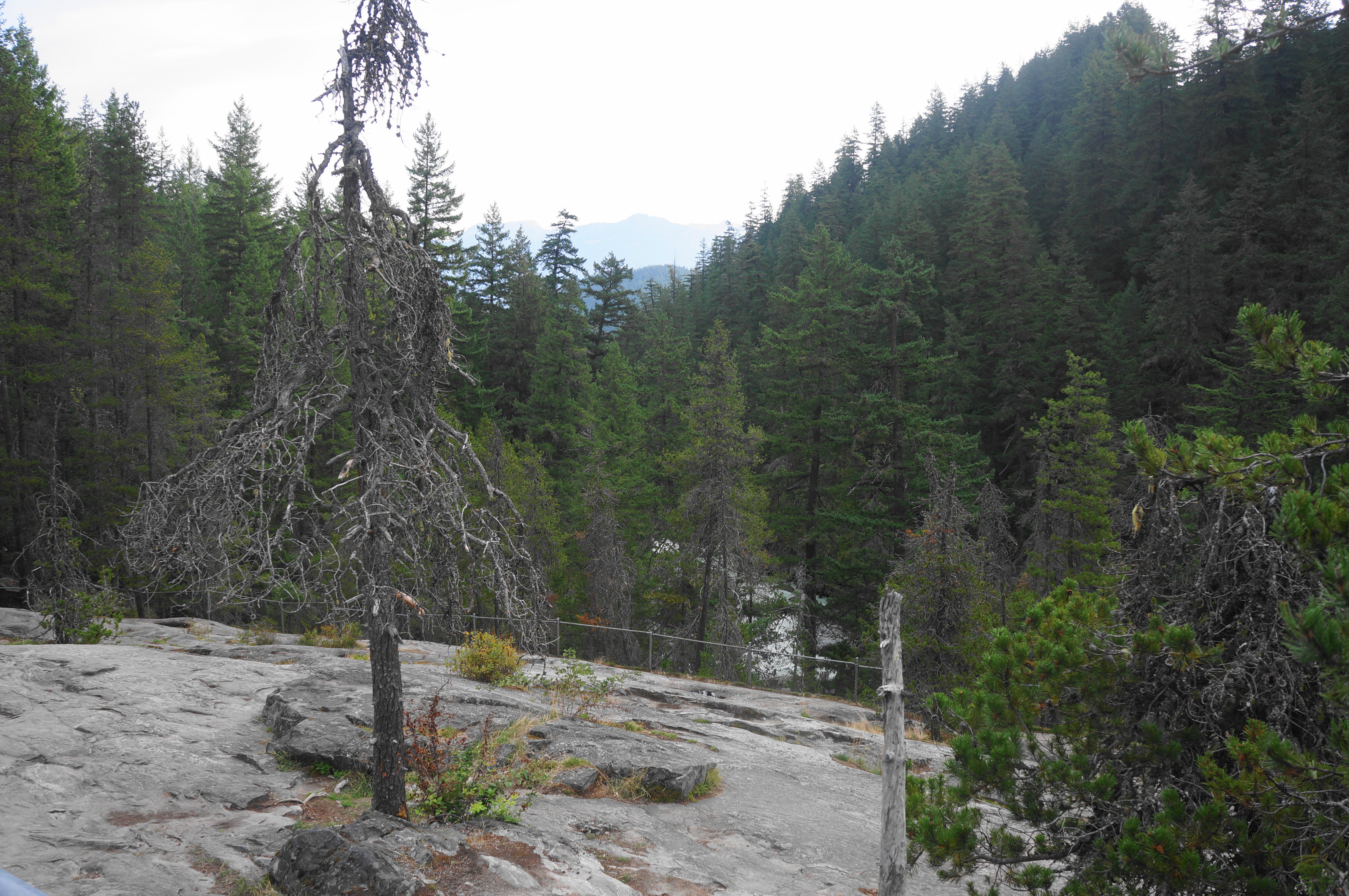
The main trail continues straight, bobbing up and down briefly amid the forest of firs, hemlocks, and spruce. Then, just before the viewpoint, there is a steeper uphill, culminating at a slickrock section, fenced in for safety. Hearing the roar of the falls, head first to the lower viewpoint, which offers a look at the bottom half of Nairn Falls, dropping out of a narrow channel into a plunge pool.

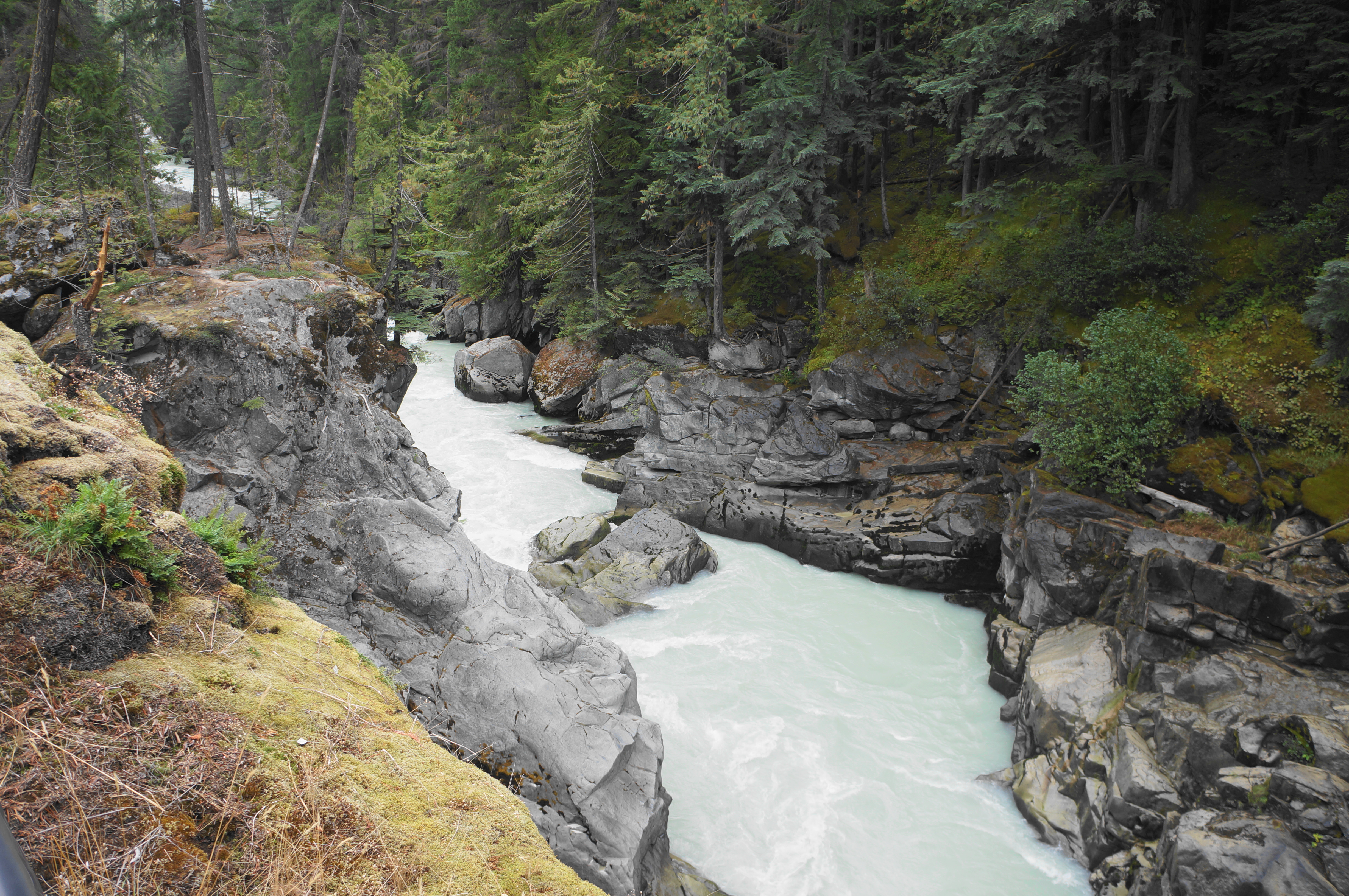
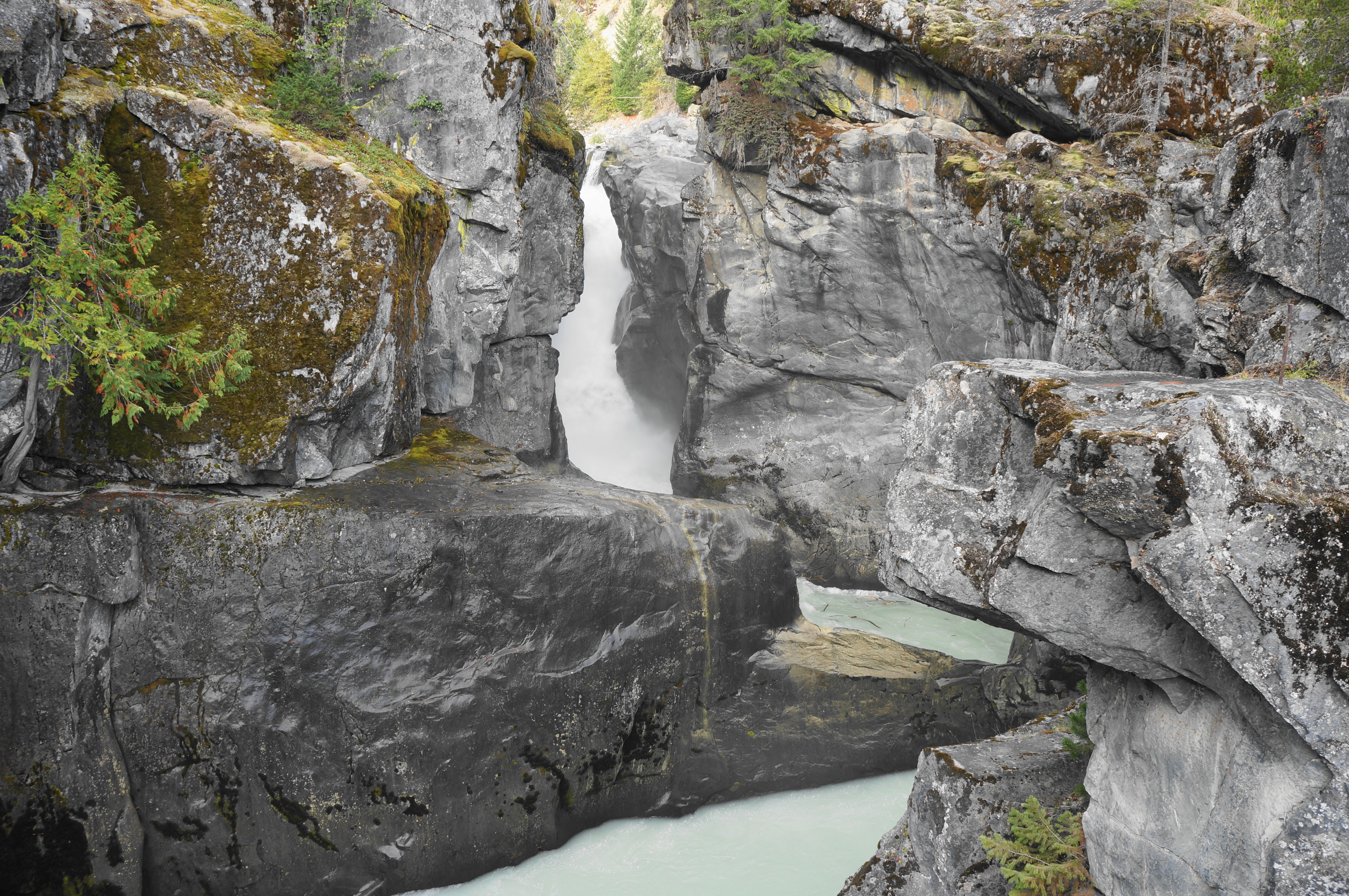
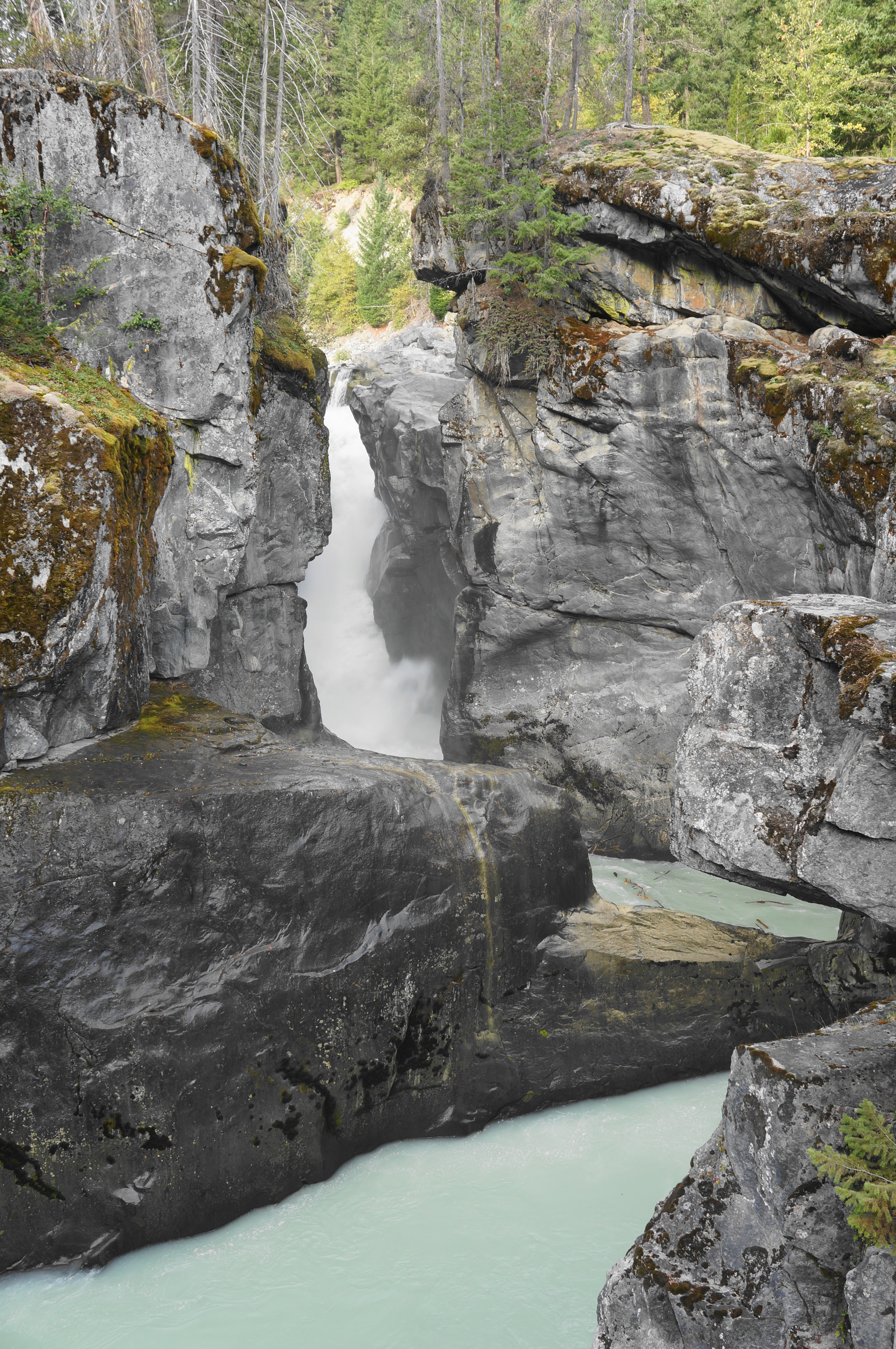
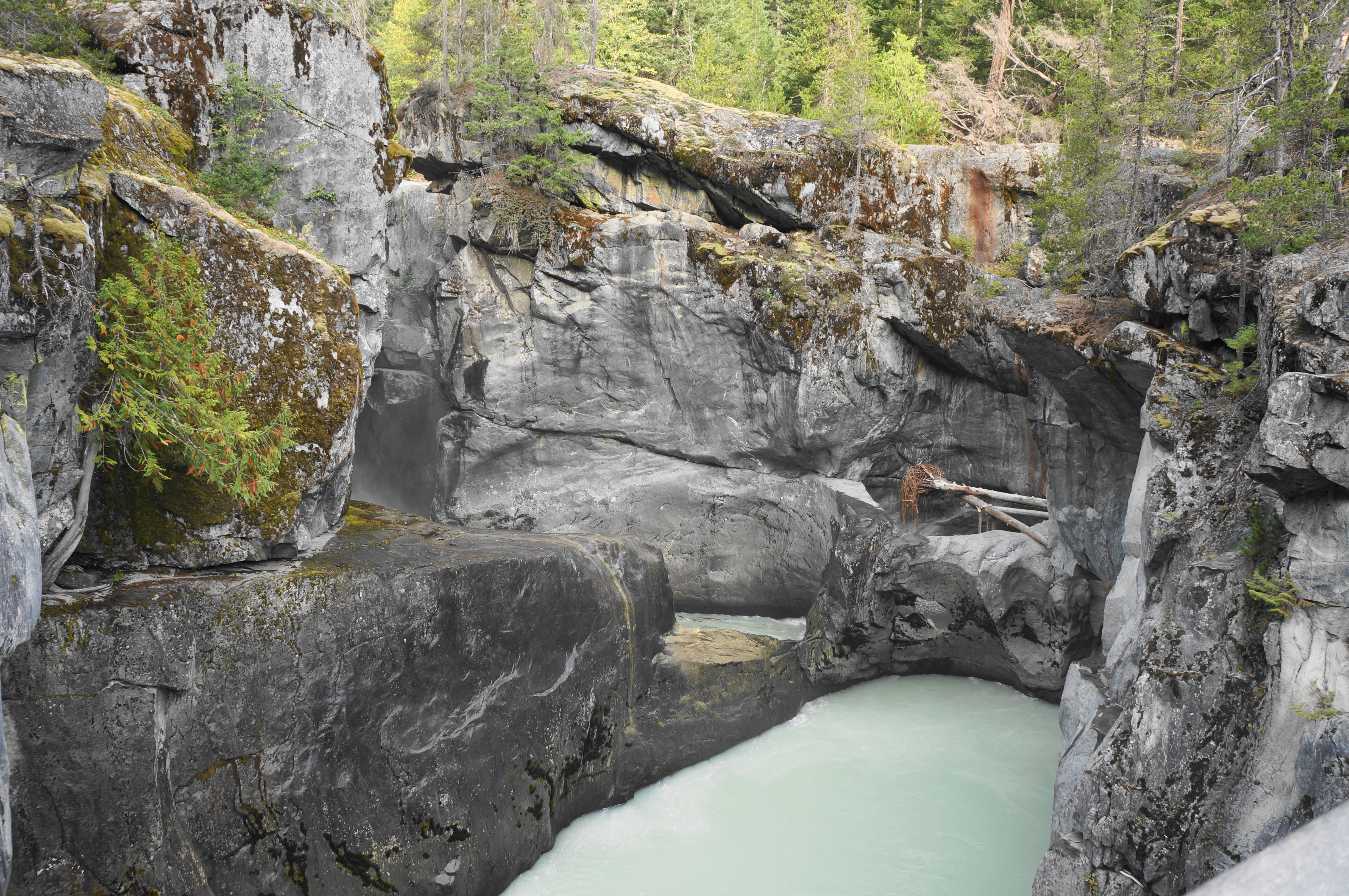
Then check out the upper viewpoint, accessed by way of a modest staircase, ending at an elevated platform. Here visitors can peer into the awesome, winding gorge, where the water drops more than 50 feet, then courses around a hairpin bend. The frothy river is picturesque and the waterfall unique for its setting in a thin, sculpted chasm. A look at the falls makes up for the somewhat unsightly view of the power lines overhead.
When ready, return the way you came on the mild access trail, capping off a 1.6-mile out-and-back.
