
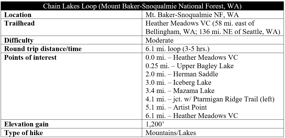
Traversing the highlands between two volcanic behemoths—Mount Baker (10,781’) and Mount Shuksan (9,131’)—the Chain Lakes Loop is a premier day hike in the northern Cascades of Washington’s Mount Baker-Snoqualmie National Forest. There are few dull moments, with open views of the two peaks and beyond, combined with lovely woody moraines and subalpine lakes. The six-mile length is eminently reasonable, and the 1,800 feet in elevation gain is somewhat spaced out and tempered by switchbacks, making this one of the more popular, moderately-difficult hikes in striking distance of Seattle and Bellingham, Washington.
The hike
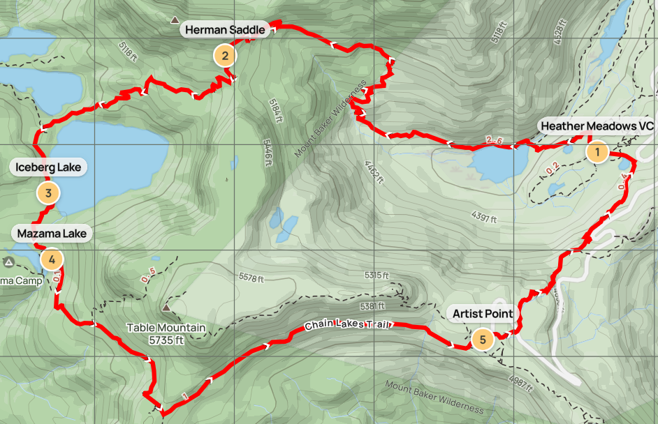
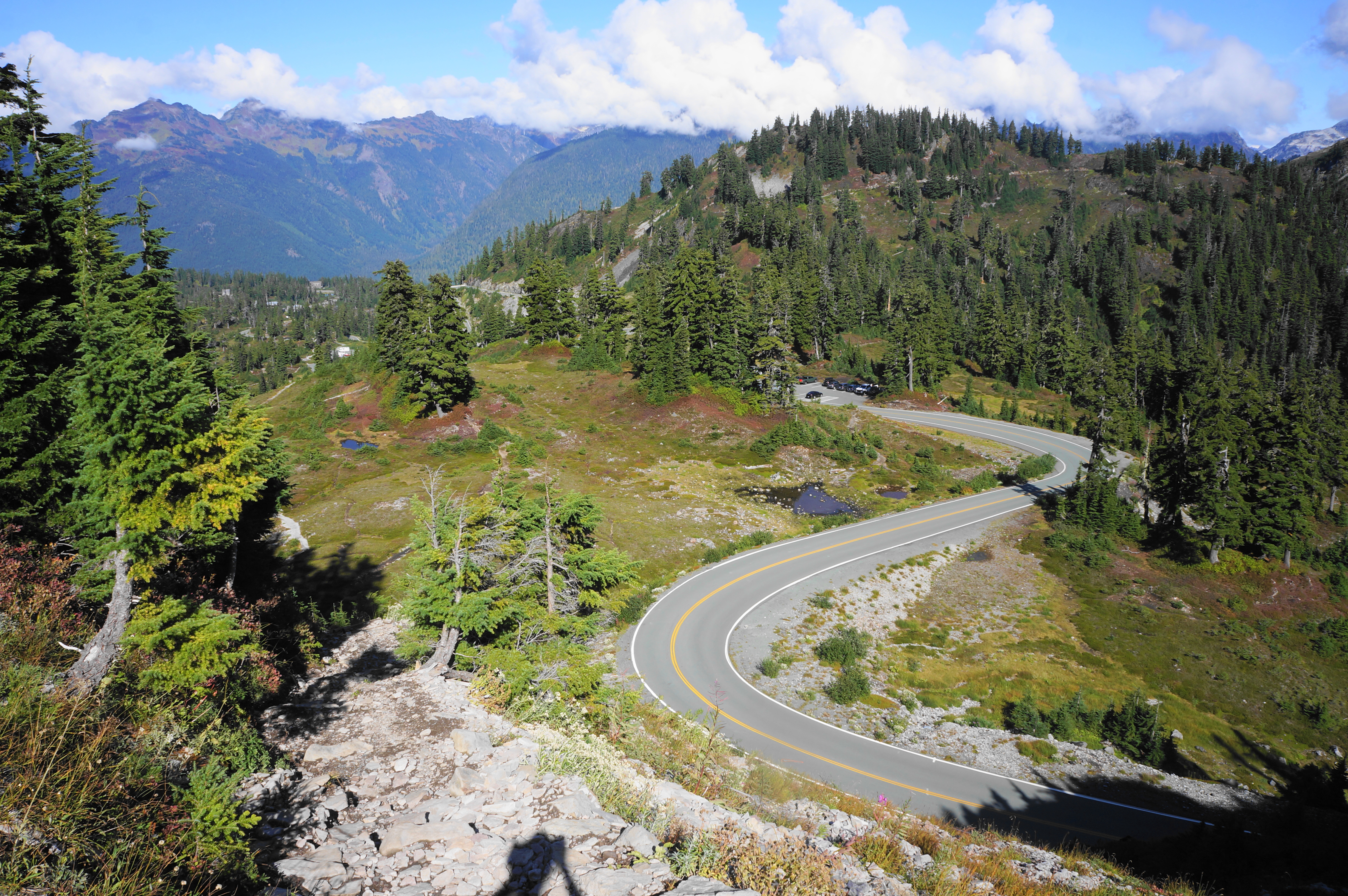
Rising slowly into the Cascades in northwest Washington, Mount Baker Highway (Route 542) squiggles up to a subalpine basin with access to several hiking trails set in the highlands between Mount Baker and Mount Shuksan. The Chain Lakes Loop has three potential trailheads (Artist Point, Bagley Lakes, and Heather Meadows)—yours truly chose the latter as it houses a small Visitor Center, shaves off an extra mile required if heading from Bagley Lakes, and saves the beauty of Artist Point as a surprise for late in the loop hike.
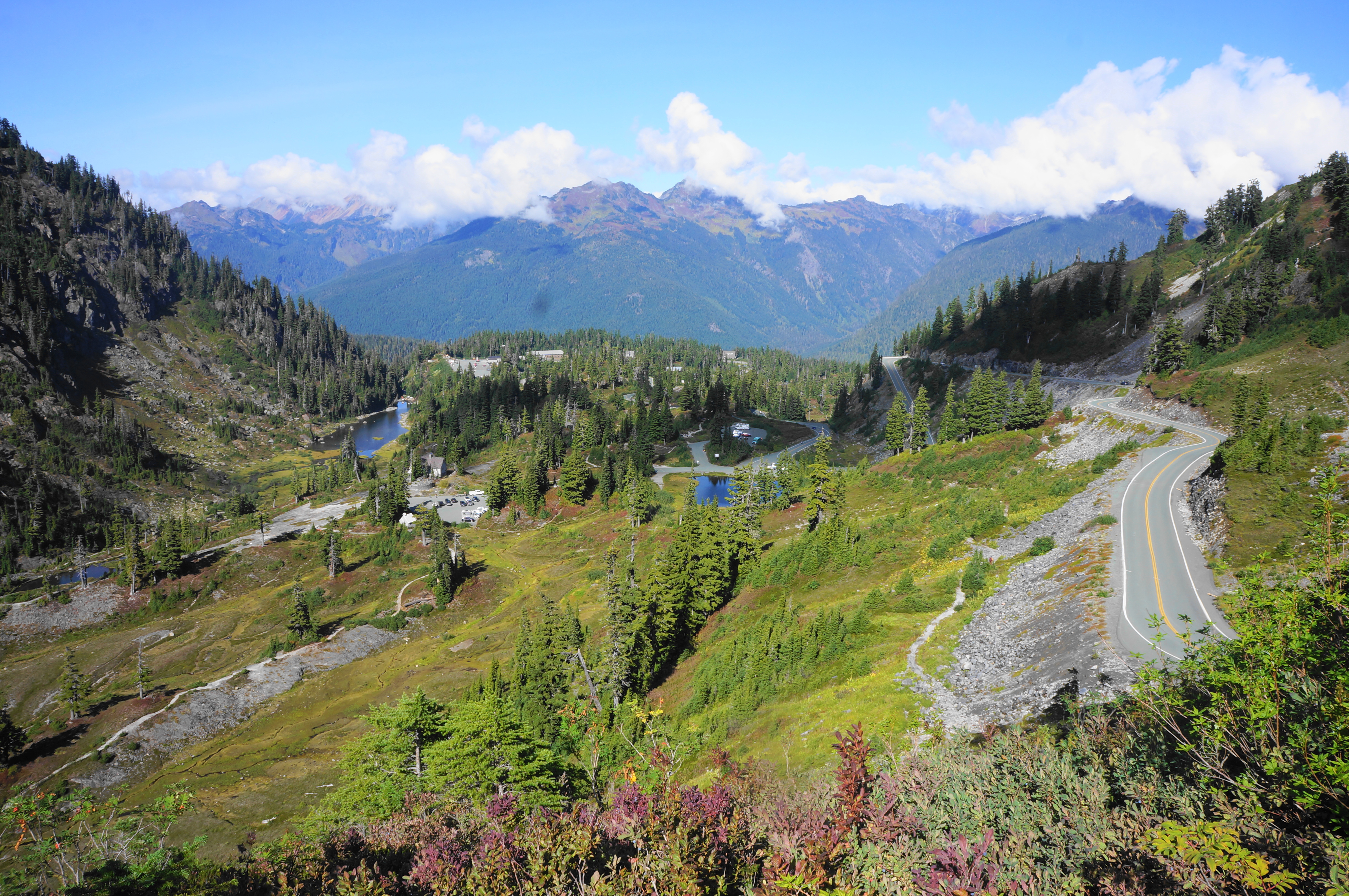
There are parking areas at Heather Meadows Visitor Center and nearby Austin Pass Picnic Area, all set on an upland overlooking a subalpine depression that houses Bagley Lakes, a series of tarns popular for fishing and picnicking. The predominant peak visible from here is Table Mountain (5,735’), an eroded stratovolcano lined with andesite, a bridge of sorts between the complex of arms and saddles surrounding Mount Baker and Mount Shuksan. At its simplest, the Chain Lakes Loop is merely a circumnavigation of Table Mountain. But with the vistas and other attractions along the way, the 6.1-mile is so, so much more.
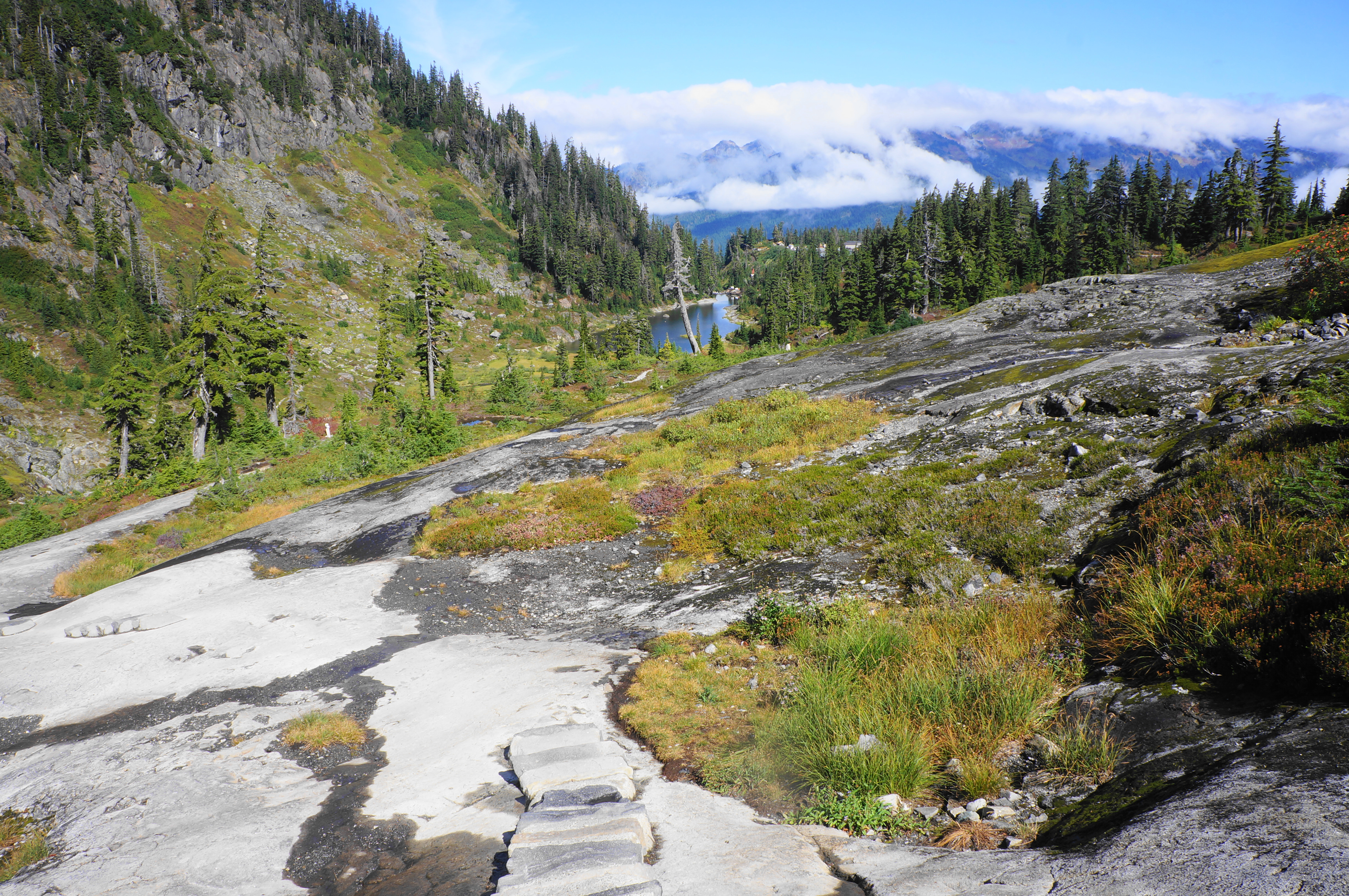
Begin at the parking area for Heather Meadows, tackling the loop in a counter-clockwise direction (to avoid what would have been a brutal ascent from here to Artist Point). Descend along the marked path to clear sloping slickrock, with intermittent stairs to ease the decline. Hikers can spot Lower Bagley Lakes down to the right, and the upper lake set in the bowl to the left. Soon the path settles briefly on a shelf and splits, with the left-hand path skirting a small pond called Austin Pass Lake; heading either way is okay though, as the two meet up soon again within about a minute.
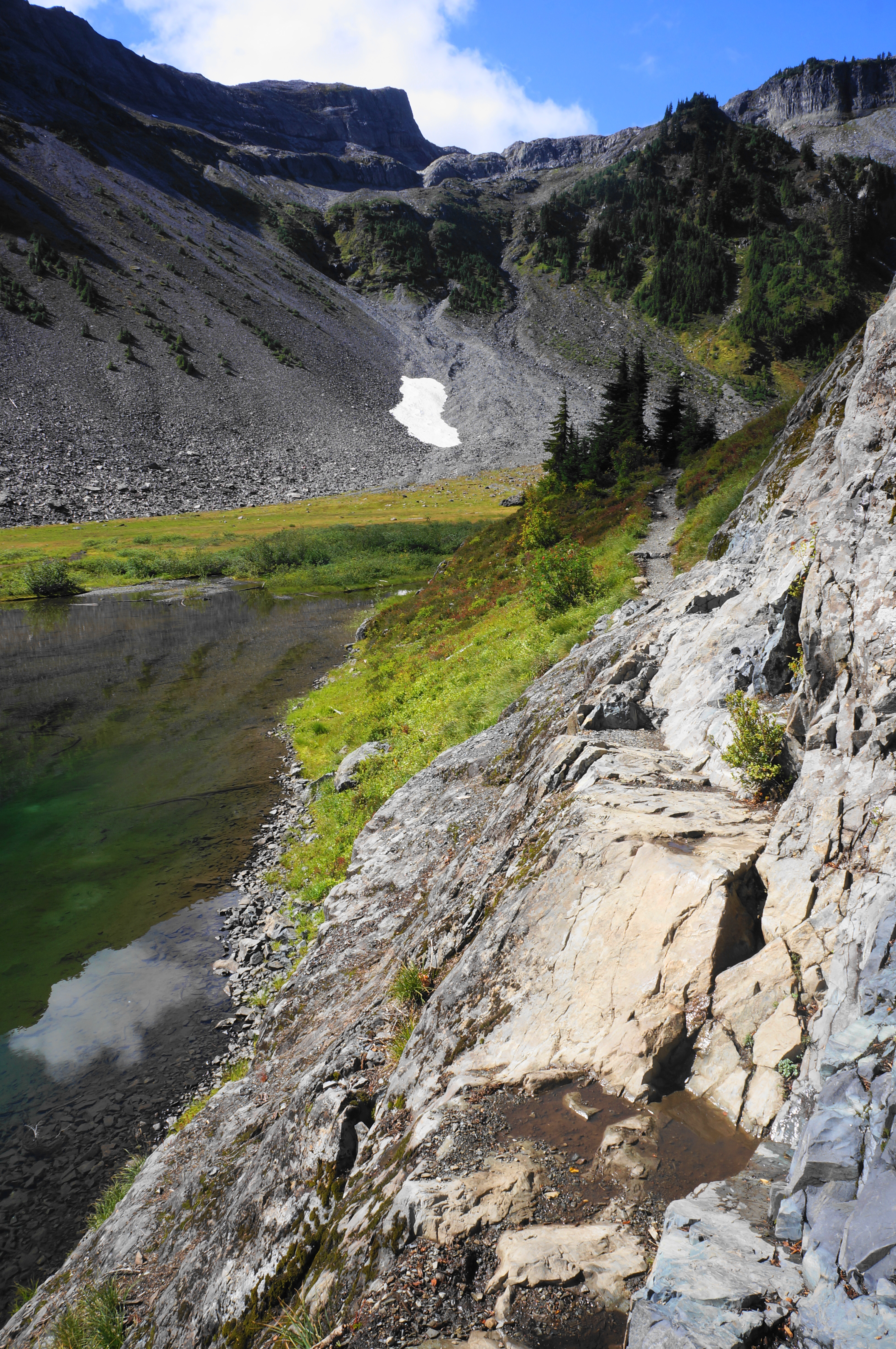
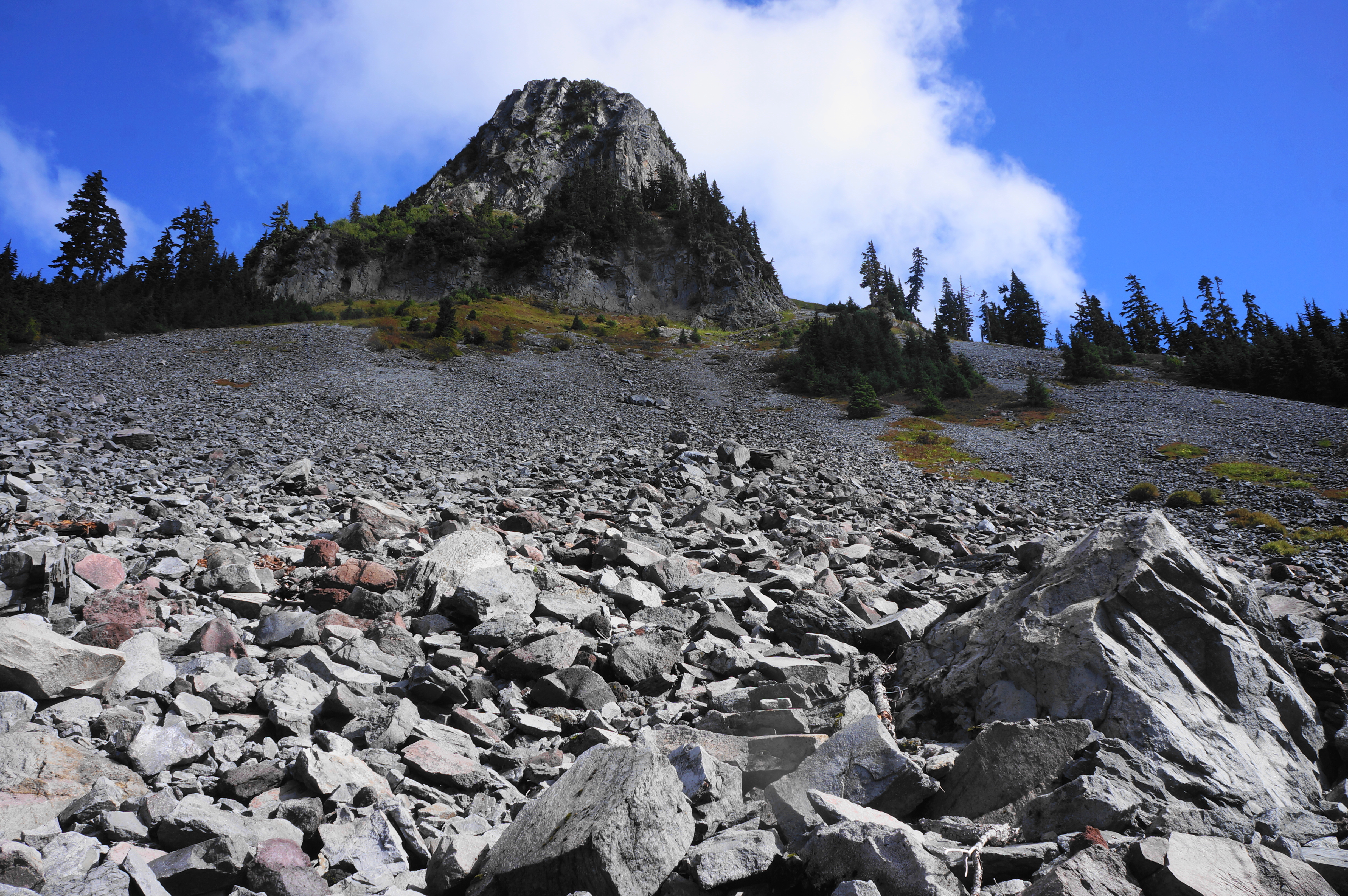
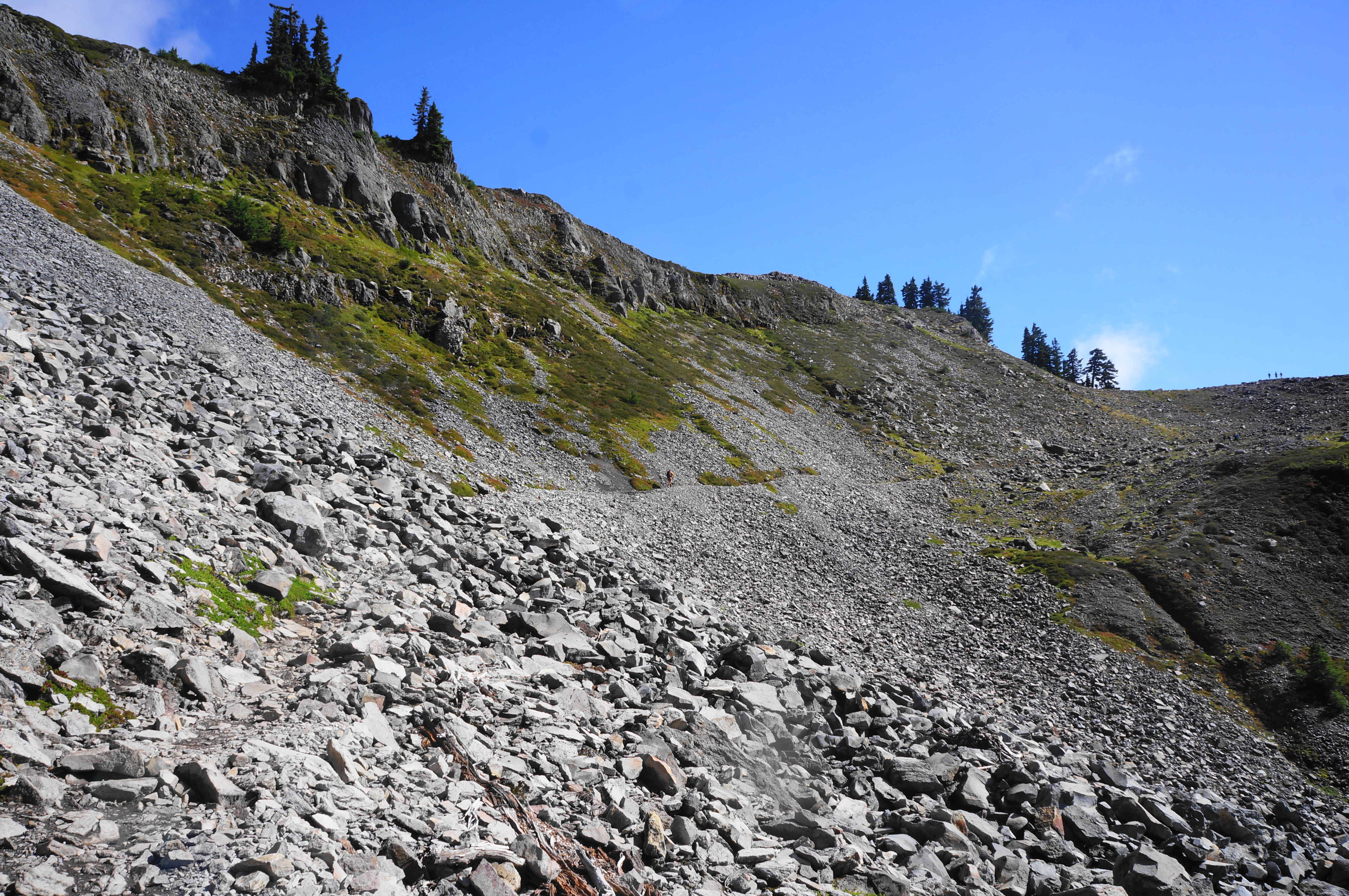
Thereafter the partly-graveled path drops steadily to a pair of junctions and attractive stone bridge over Bagley Creek, just below the mouth of Upper Bagley Lake. Cross and stay left at the two forks, edging westward along the lakeshore and across a brief ledge section with moderate exposure. From here the Chain Lakes Trail ascends mildly and puts the lake in the rear-view window and traverses the first of several boulder fields on the hike. All the while the charcoal tops of Table Mountain tower above, with a mountain pass appearing up to the right: this is Herman Saddle, your soon-to-be destination for this initial leg of the hike.
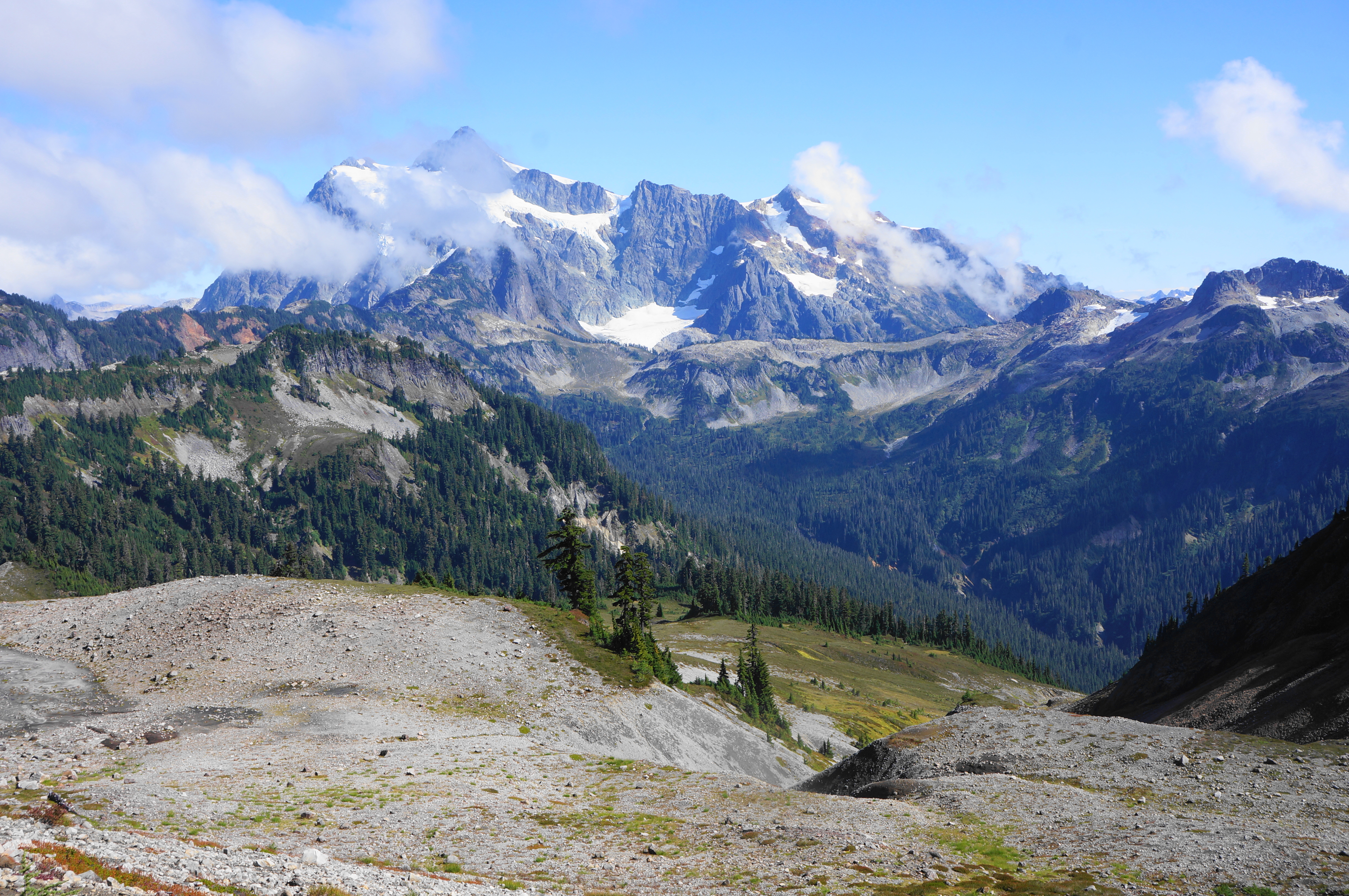
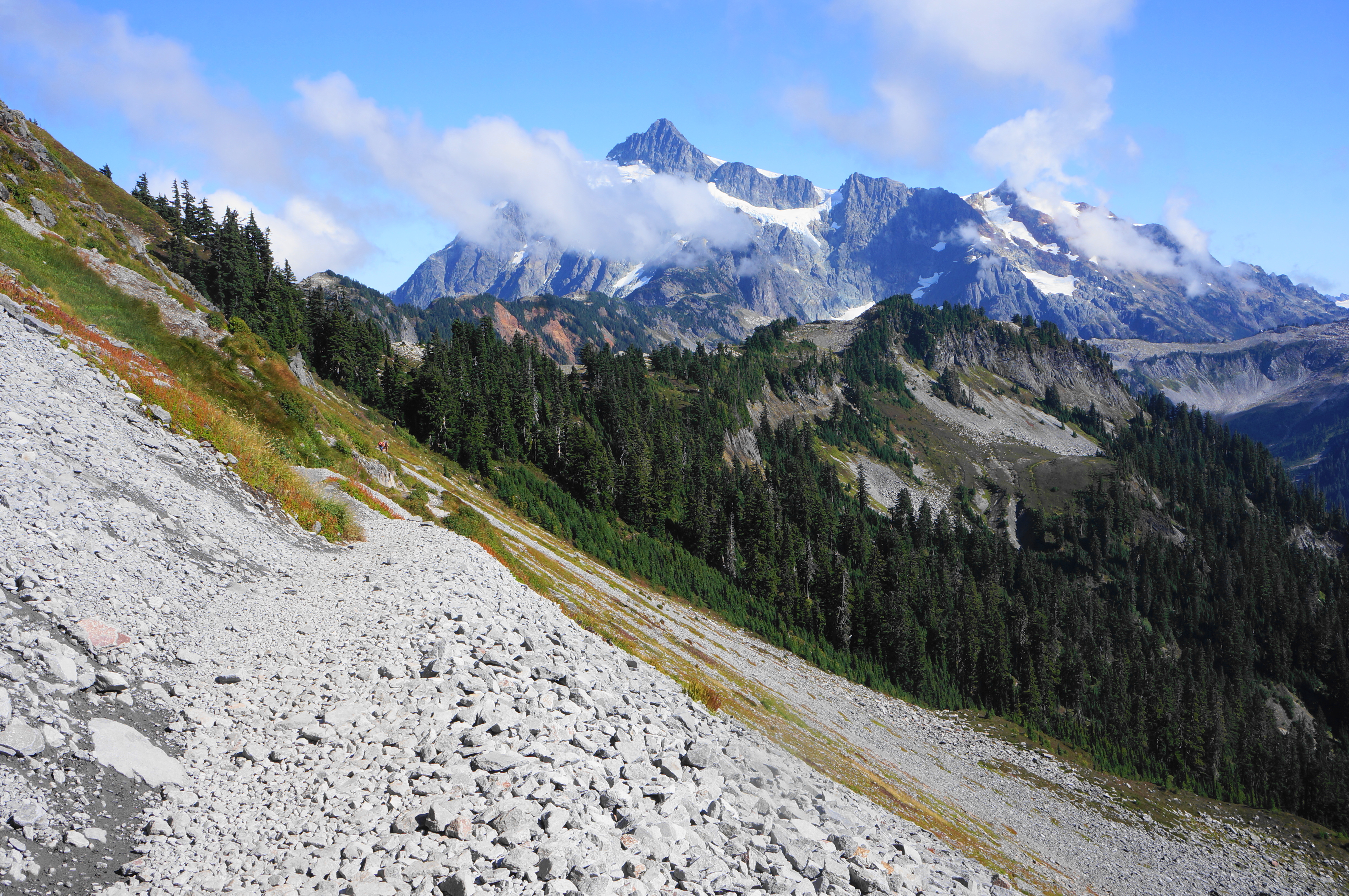
The next section climbs 1,000 in elevation in around 1.25 miles, by far the toughest ascent in the entire loop. As the Chain Lakes Trail enters Mount Baker Wilderness, it winds back and forth through heather-lined switchbacks, with views back to Upper Bagley Lake and, in the distance, Mount Shuksan. Shuksan is a massif set just inside the boundaries of neighboring North Cascades National Park and source of several glaciers. (Note: North Cascades has the highest concentration of glaciers in the contiguous U.S., even more than Glacier National Park!).
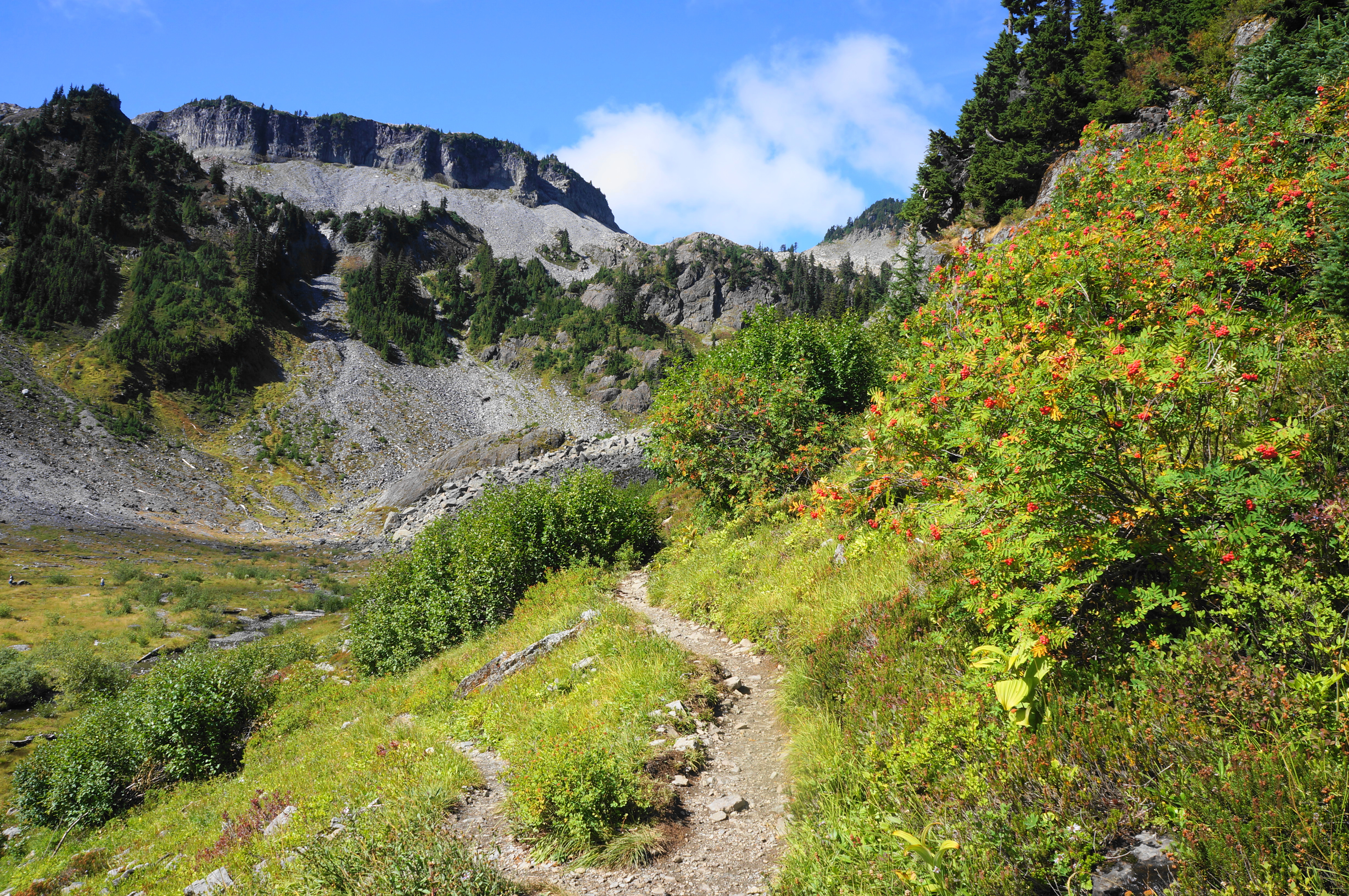
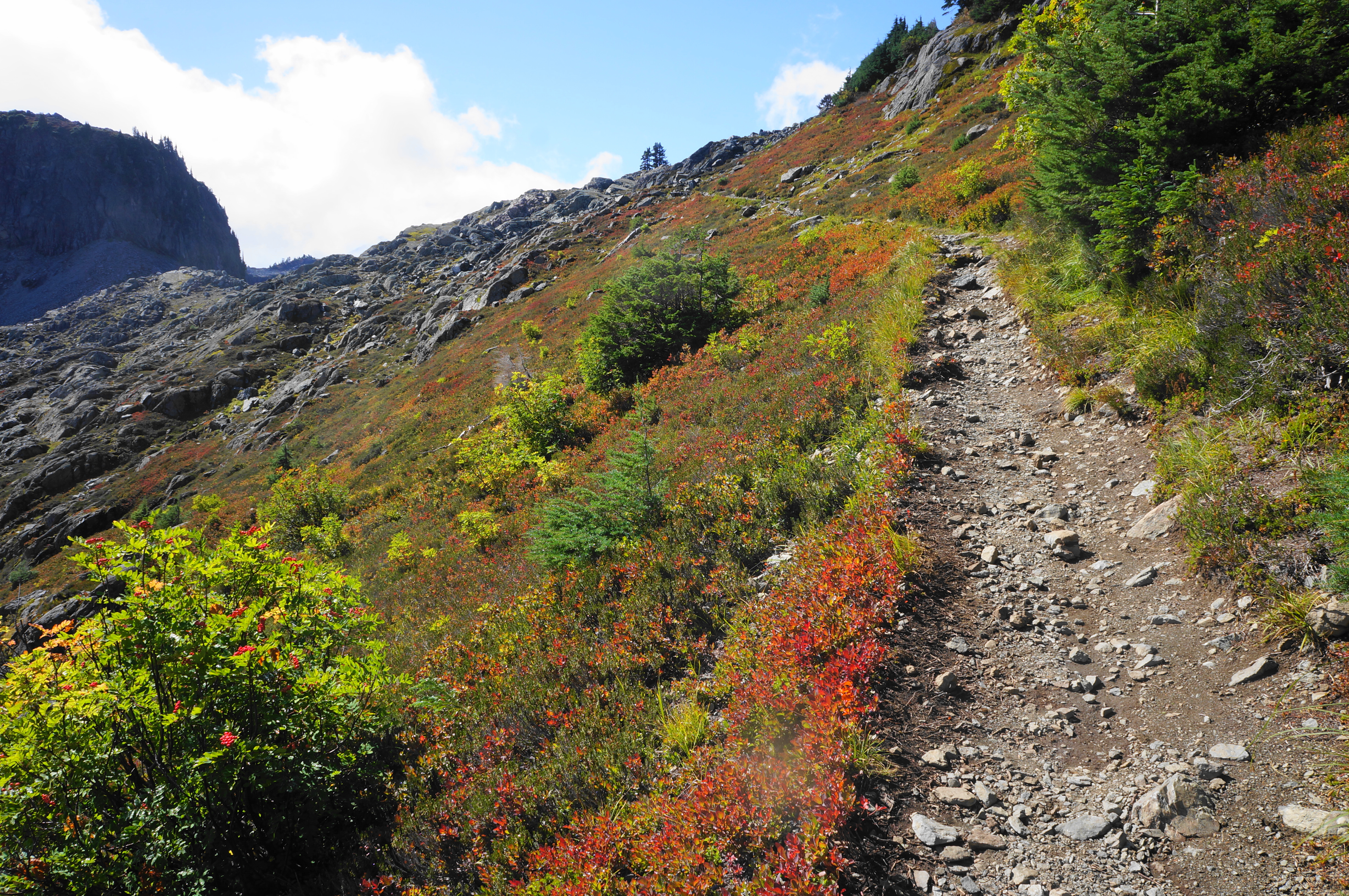
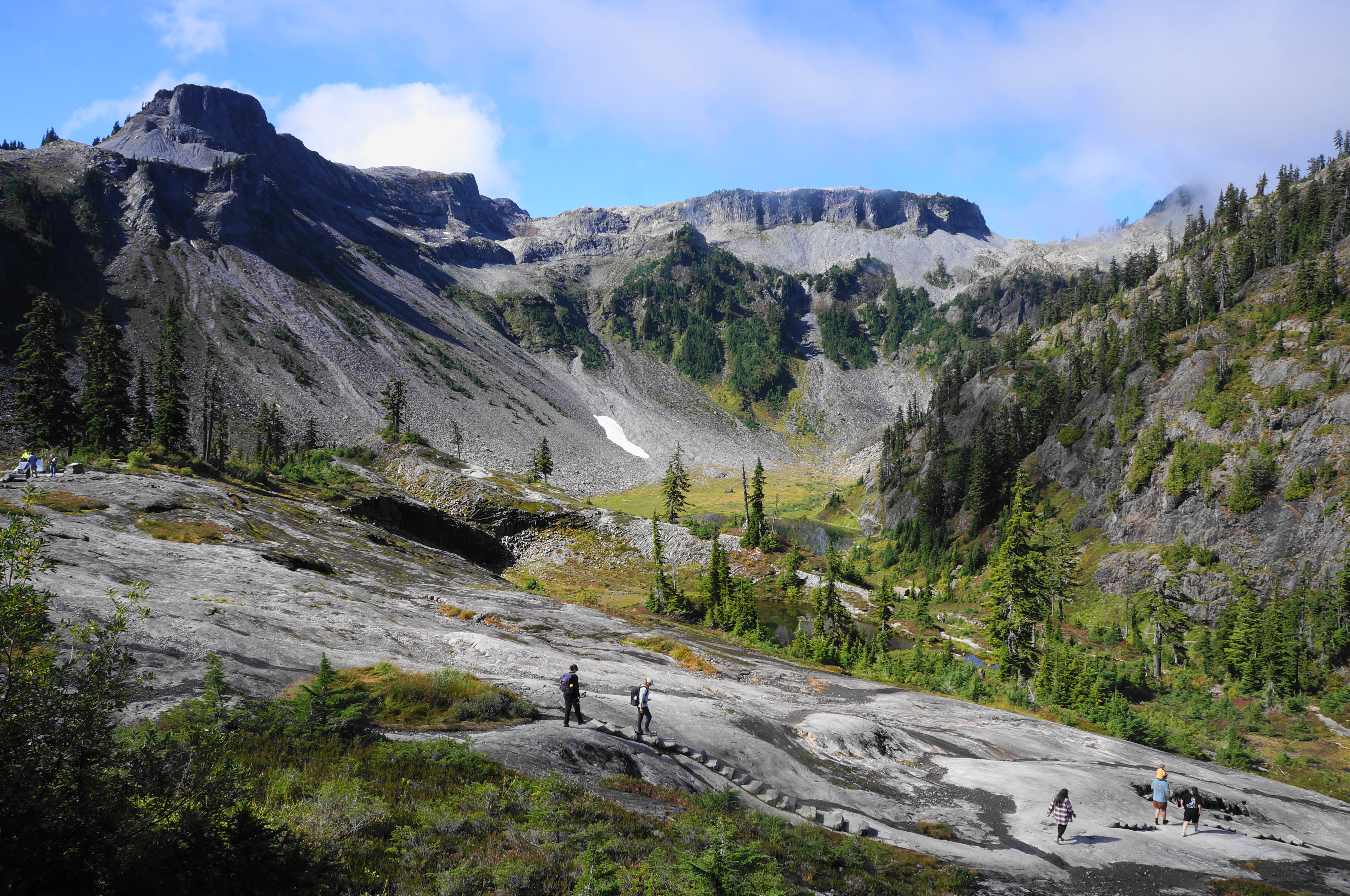
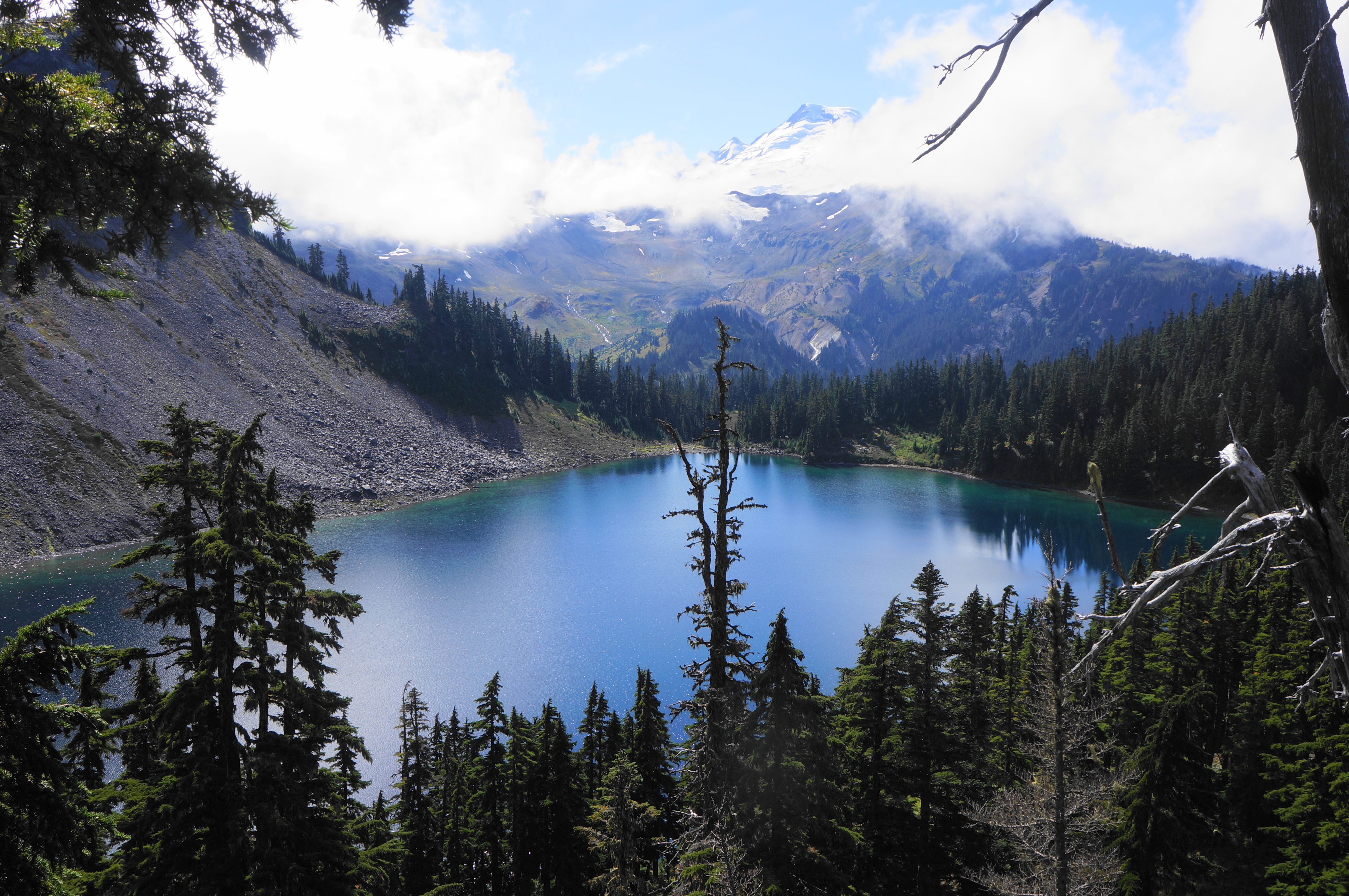
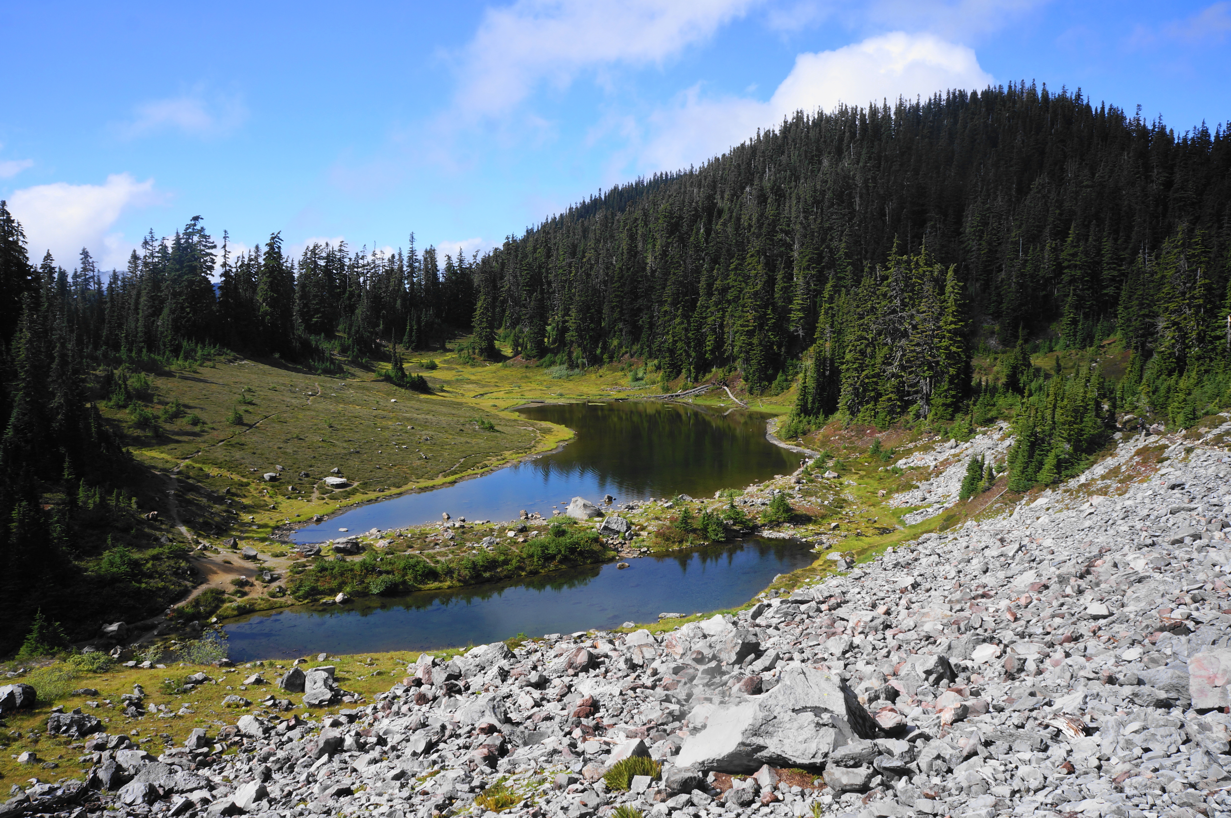
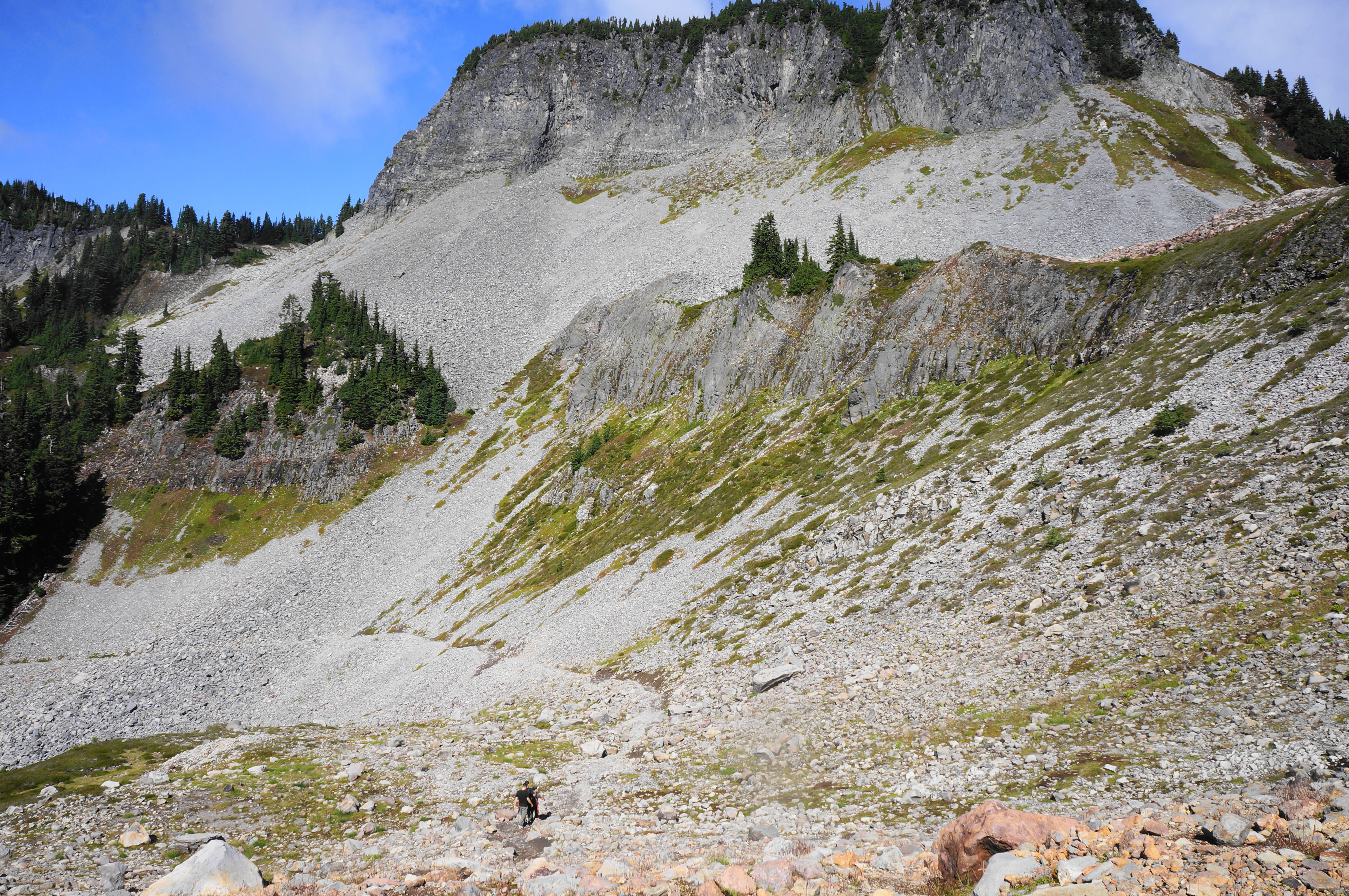
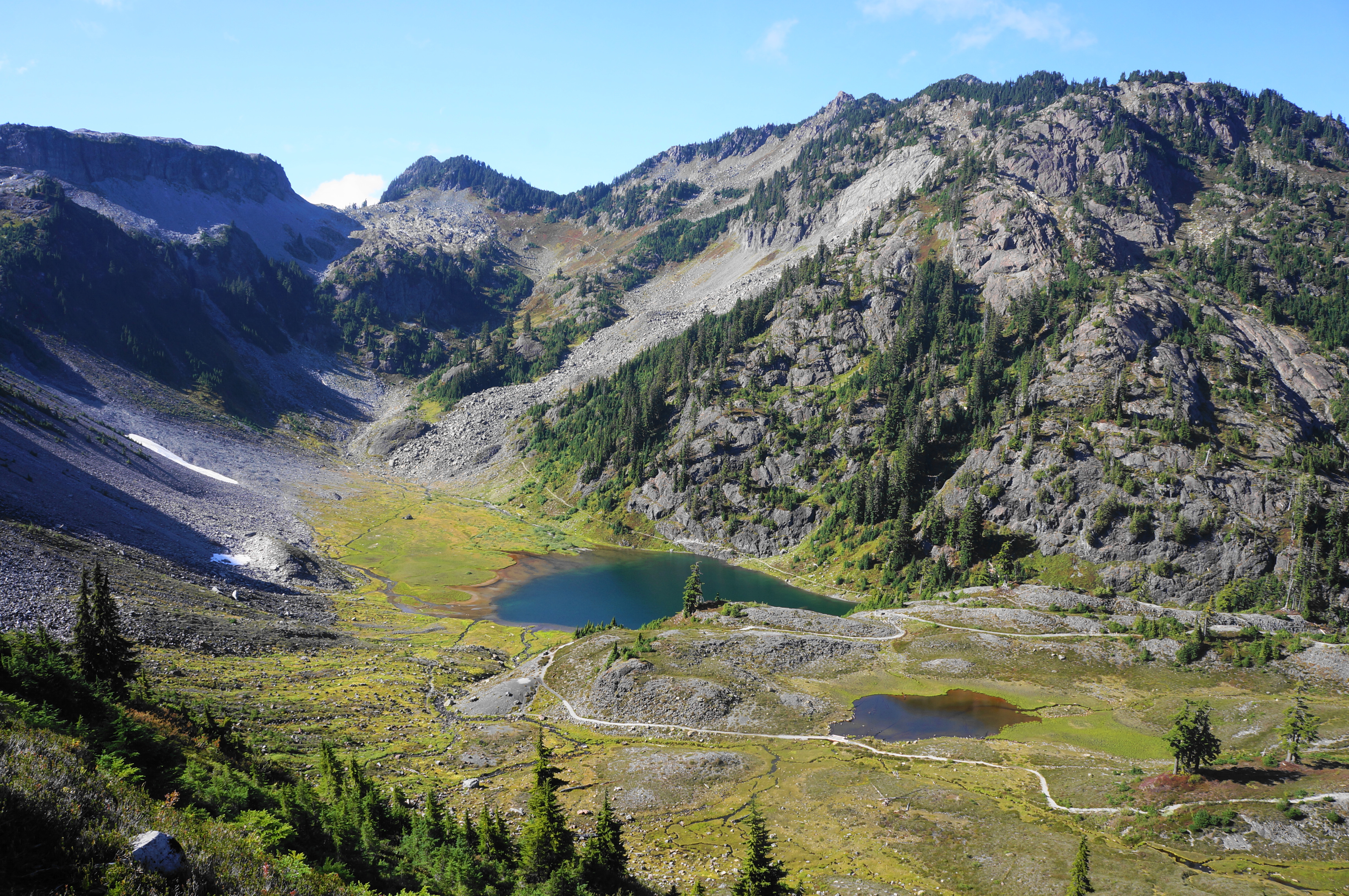
After the initial switches, the trail traverses two large talus slopes with little to no shade, making for a sweaty climb on hot summer days. Negotiate another set of switchbacks before at last cresting Herman Saddle, a milestone about two miles into the hike. From here hikers get their first look at distant Mount Baker, a taller rival to Shuksan and for which the national forest is named. Iceberg Lake is also neatly framed in the valley below, further enhancing the picturesque vista.
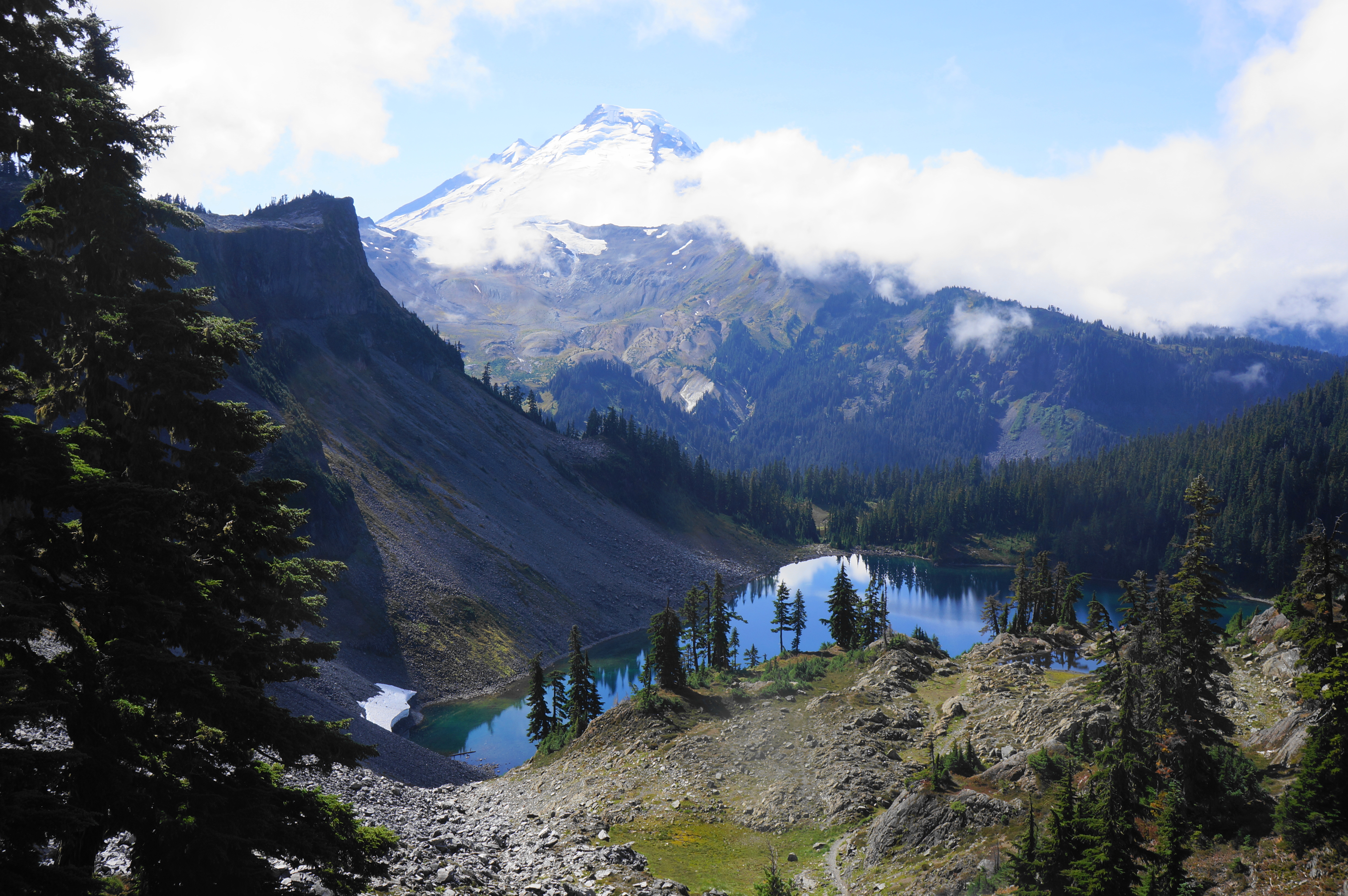
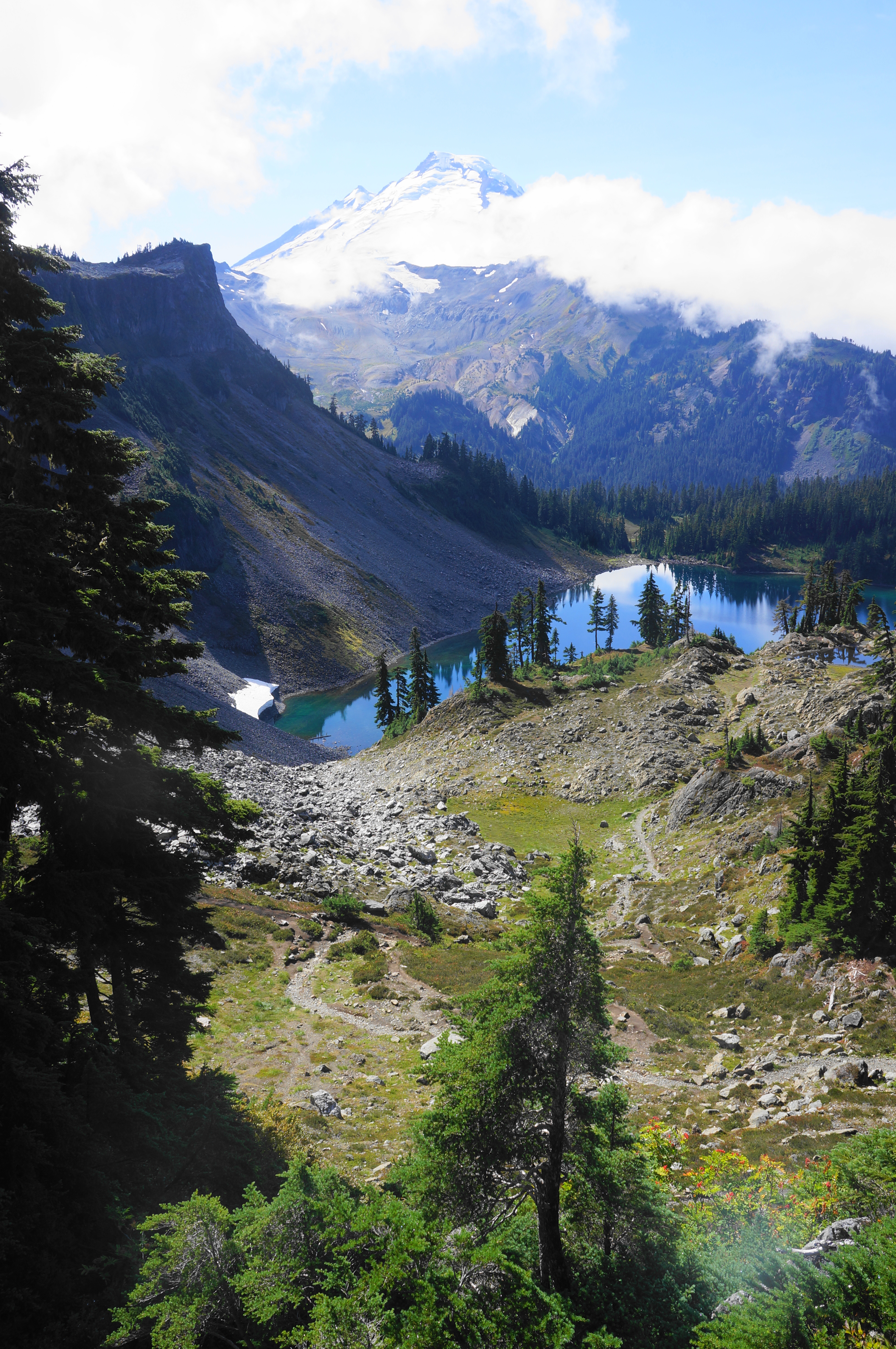
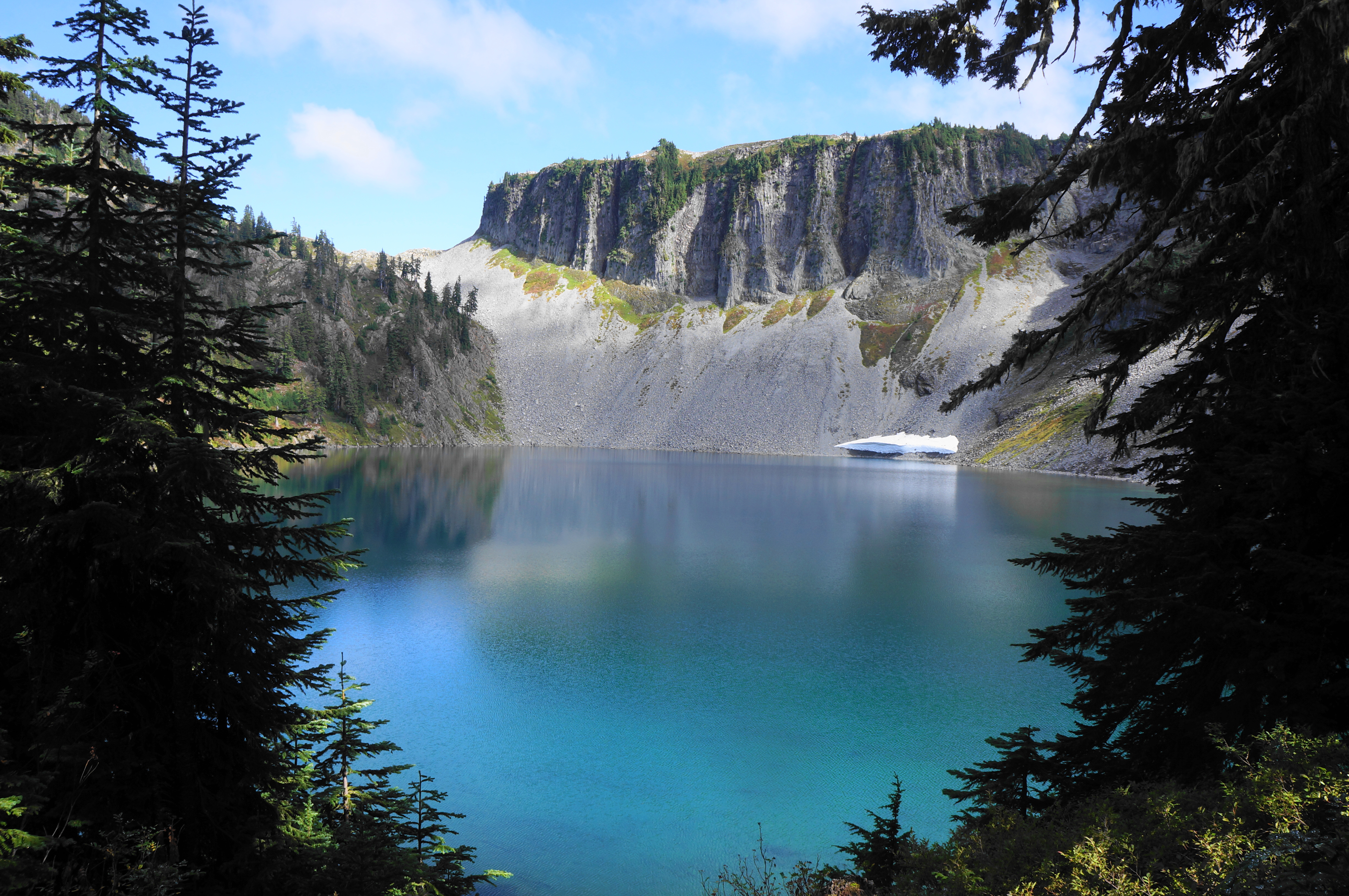
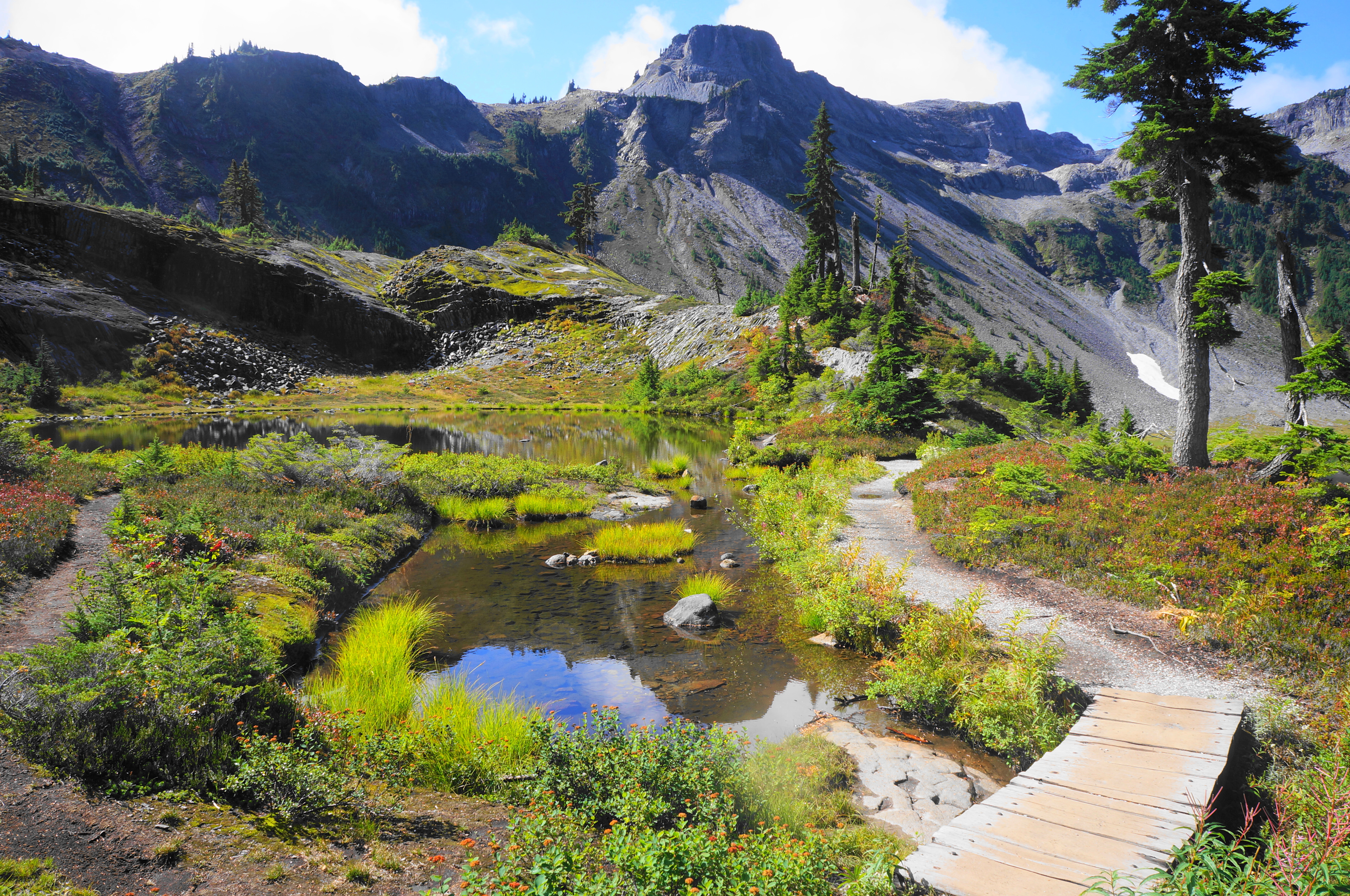
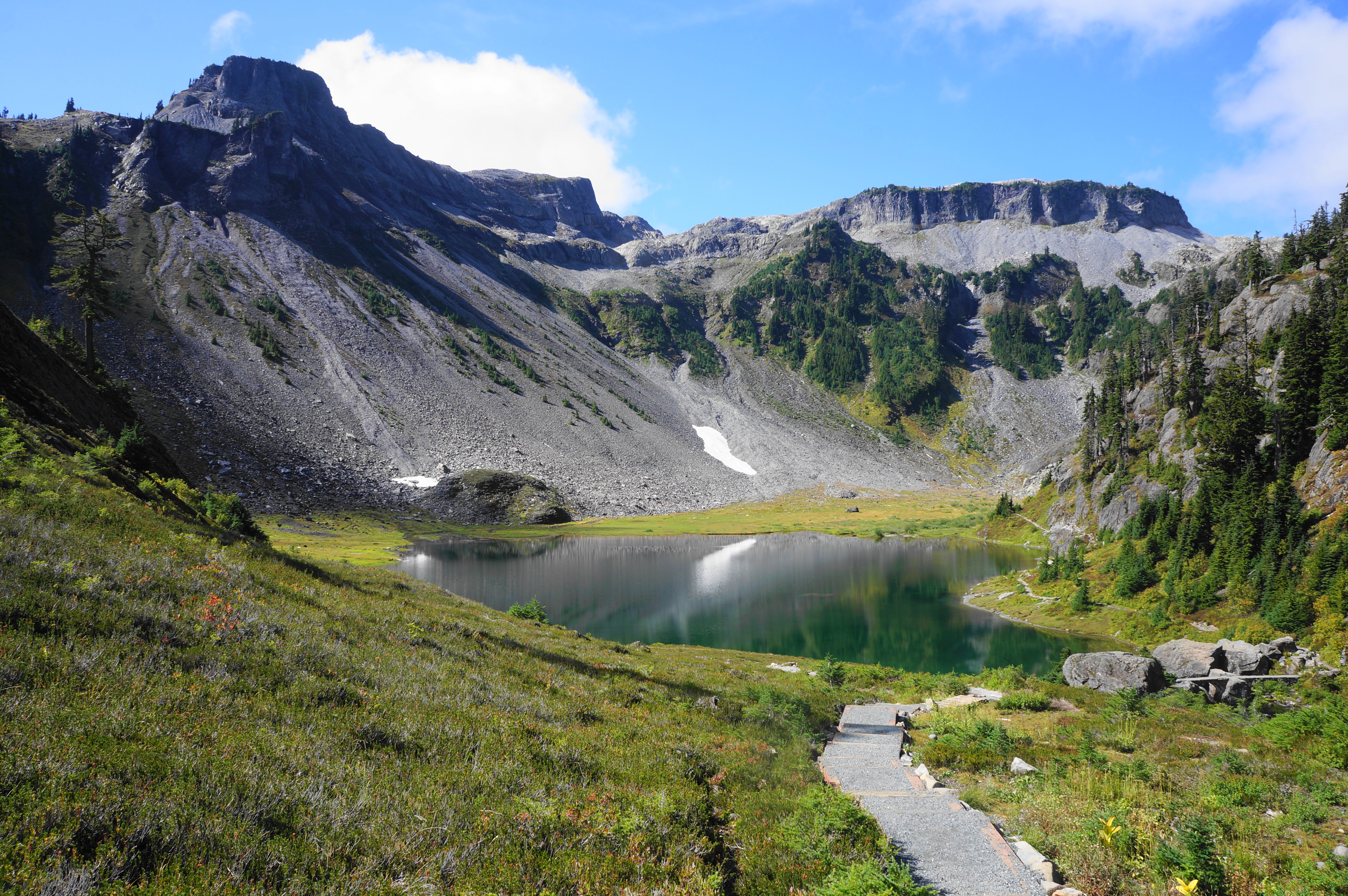
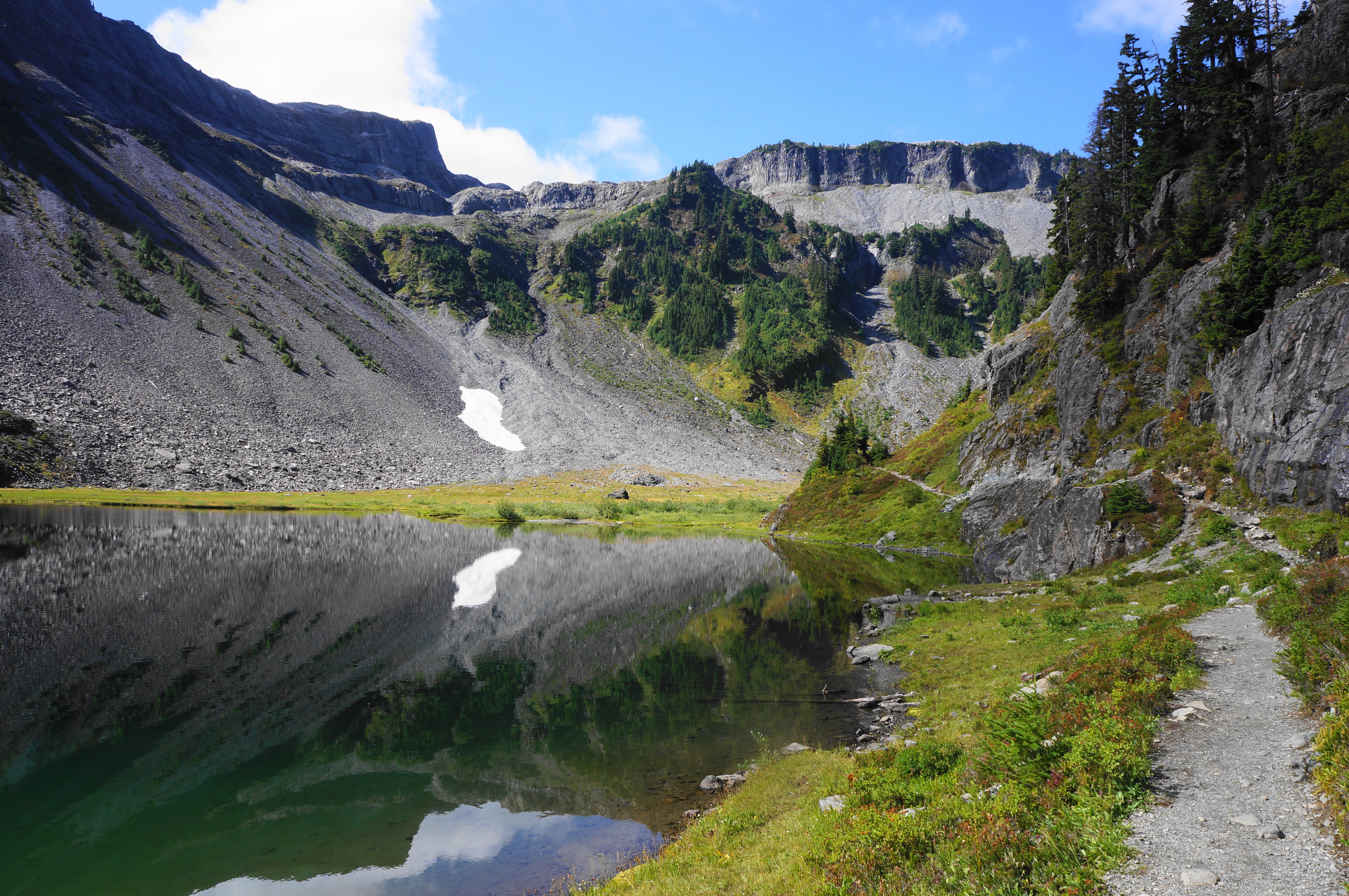
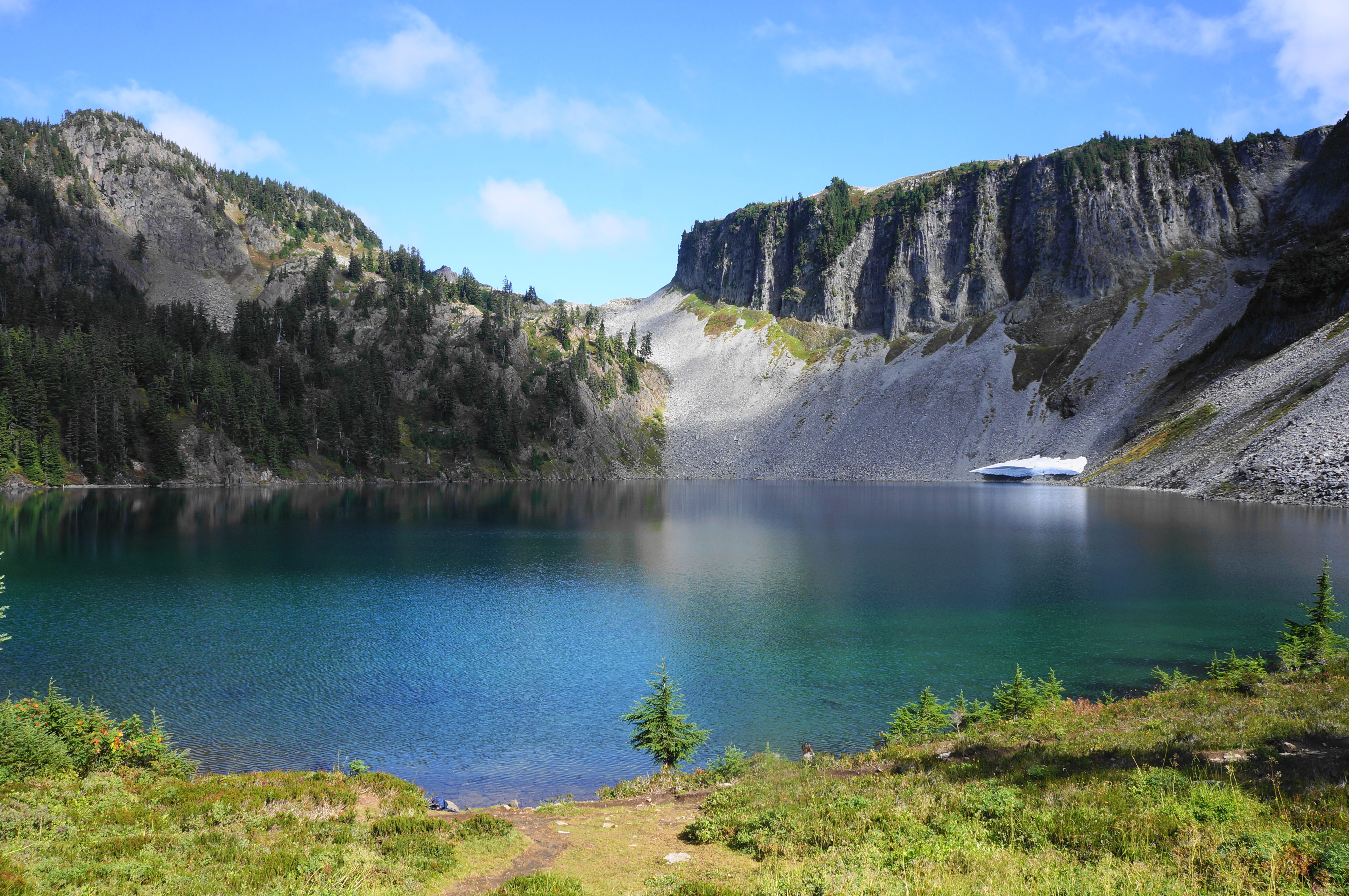
After resting at the saddle, continue on the Chain Lakes Trail as it descends southward and eventually drops westward toward Iceberg Lake. The lake briefly comes out of view as the route follows a boulder-strewn shelf but reappears just before the path drops back into the conifers, with blueberry bushes dotting the hillside. Set below Mazama Dome (5,842’), another local peak, the route drops to a ridge between Iceberg Lake and neighboring Hayes Lake, a popular camping area to the north.
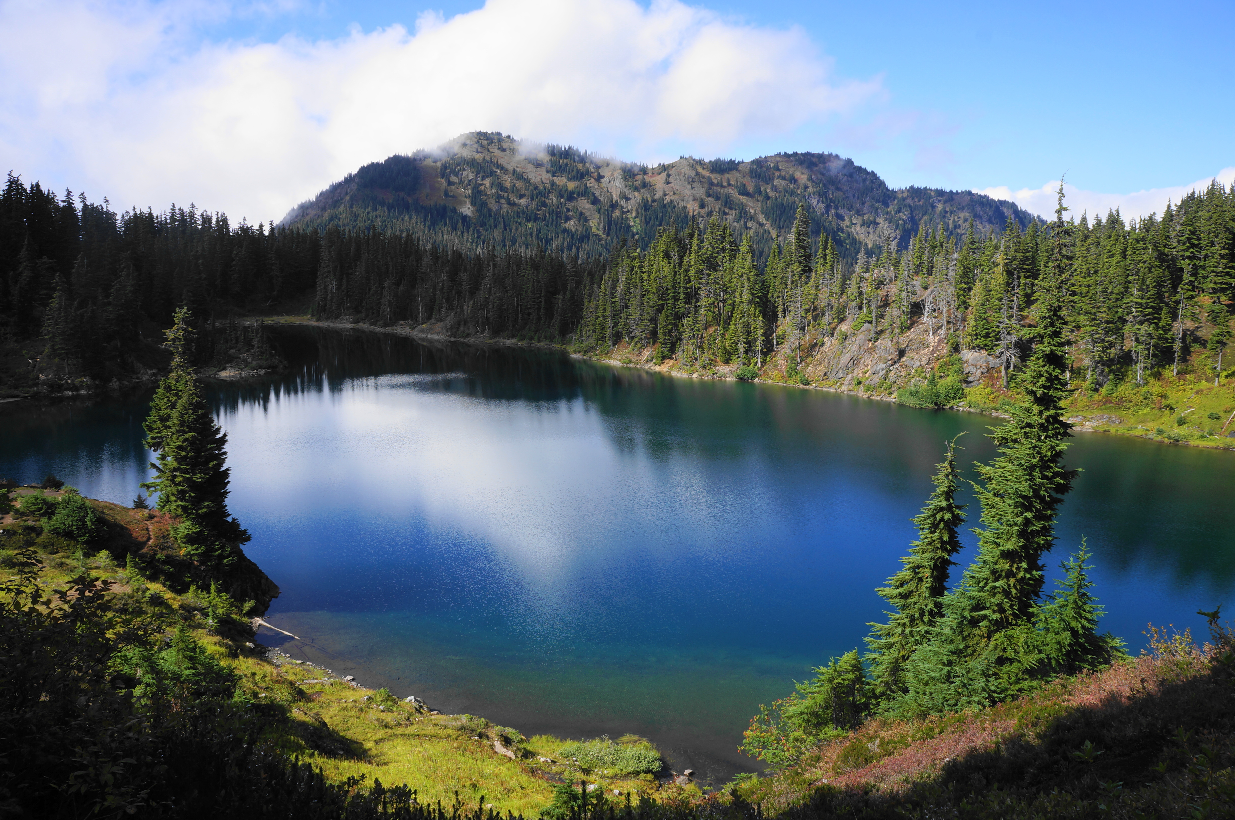
Stay straight as various social trails lead left and right, then tread uphill briefly and course southward to wrap around Iceberg Lake again. Pass markers for a pit toilet and the Galena Lakes Camps, then settle into a pleasant stroll as the trail comes down to lake level. The views back across Iceberg Lake to Table Mountain are fantastic, with snow often persisting on the north-facing slope year-round.
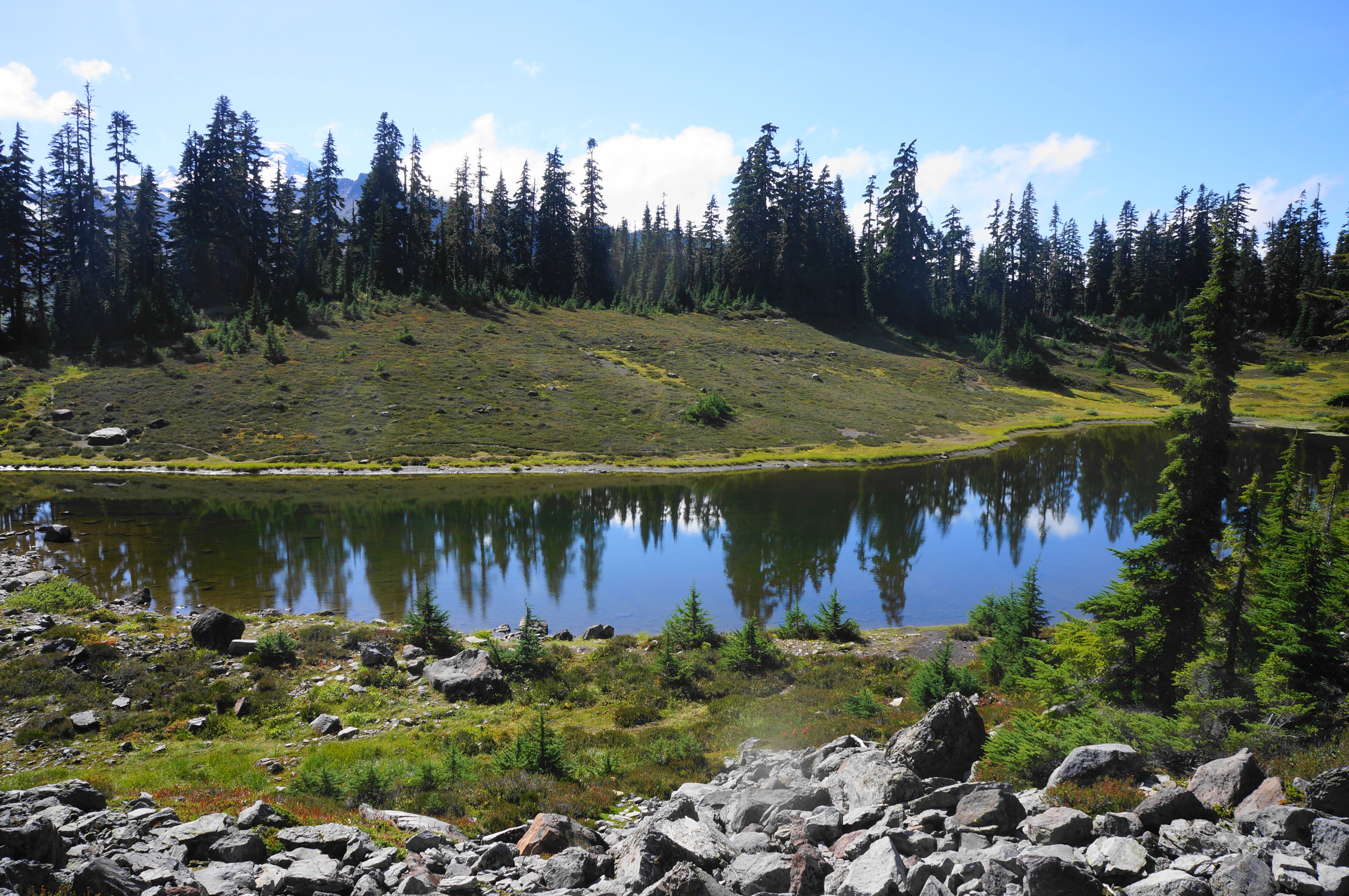
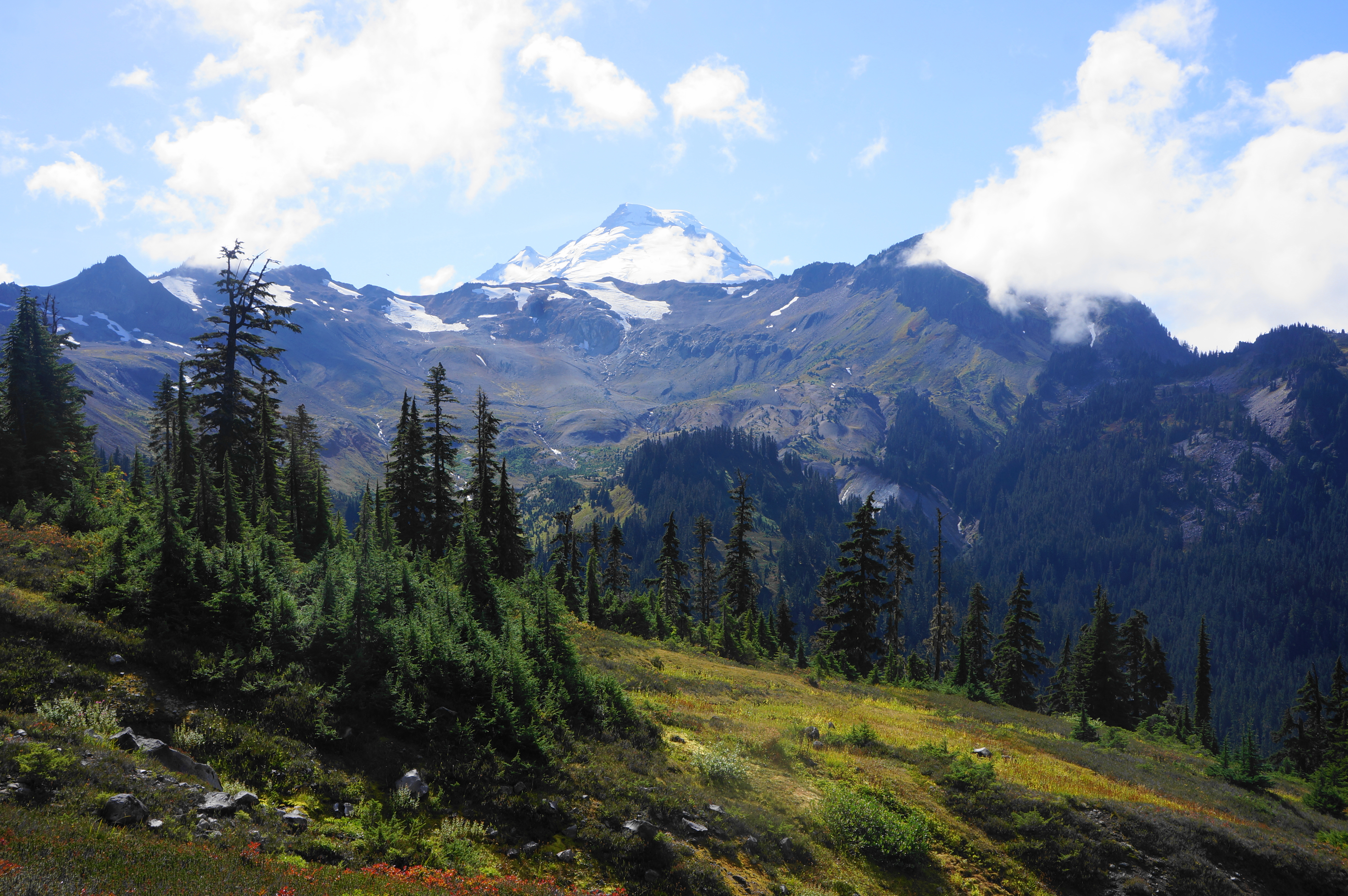
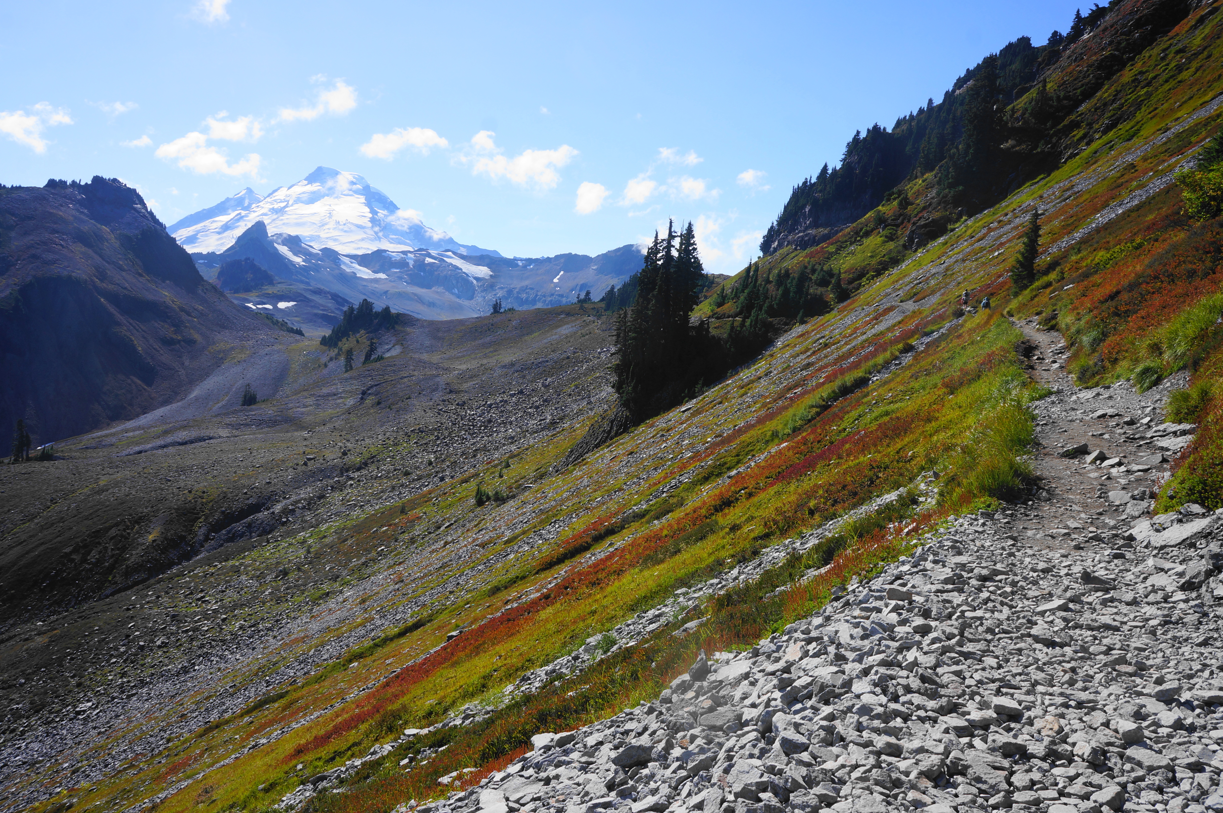
Soon the trail turns away from Iceberg Lake and crosses Wells Creek, which connects Iceberg to Mazama Lake, a smaller and less interesting tarn that soon comes into view on the right. Mazama is notable, however, for its view of Mount Baker, the best yet of the glacial peak on this hike. (Note: Mazama Lake is actually two separate bodies of water, with both leading into a stream that tumbles down a set of cascades into the Wells Creek basin.)
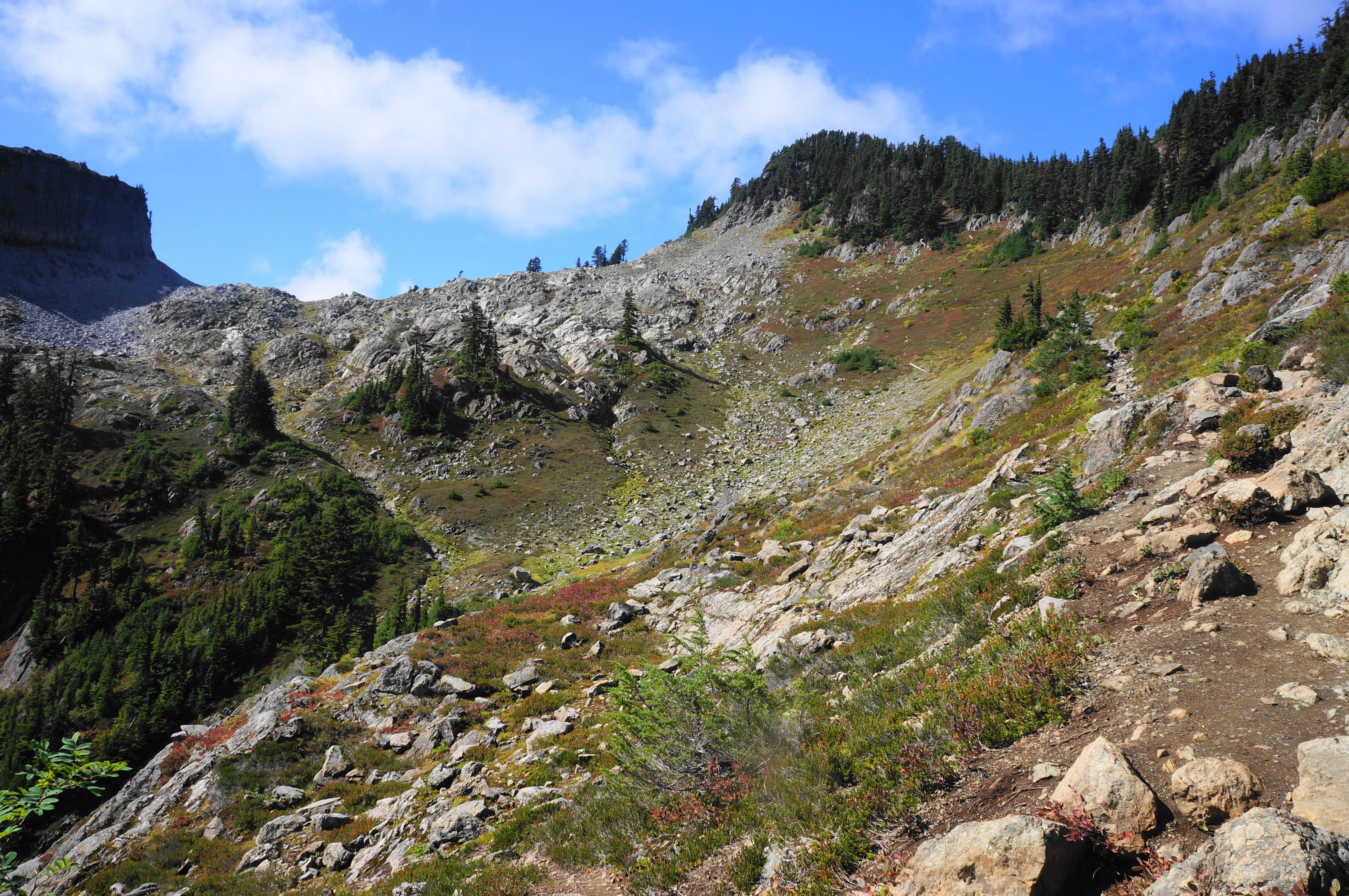
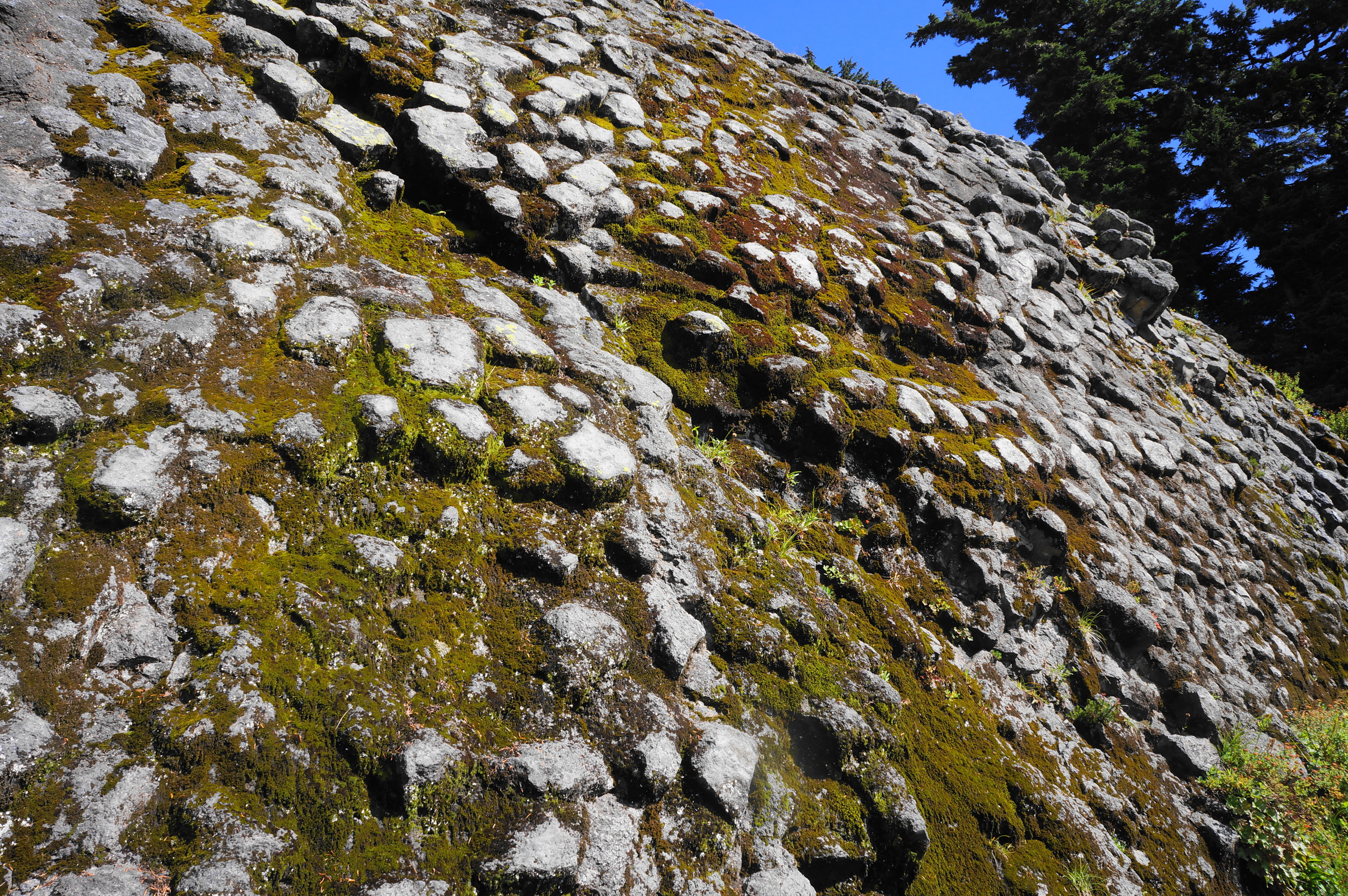
Stay left at the spur leading down to the Mazama Camps, traversing a rock slide with more extended views of Mount Baker. Soon the trail begins climbing again, making up for some of the elevation lost since Herman Saddle, then clears another rock field and various examples of hexagonal columnar jointing in the andesite below Table Mountain.
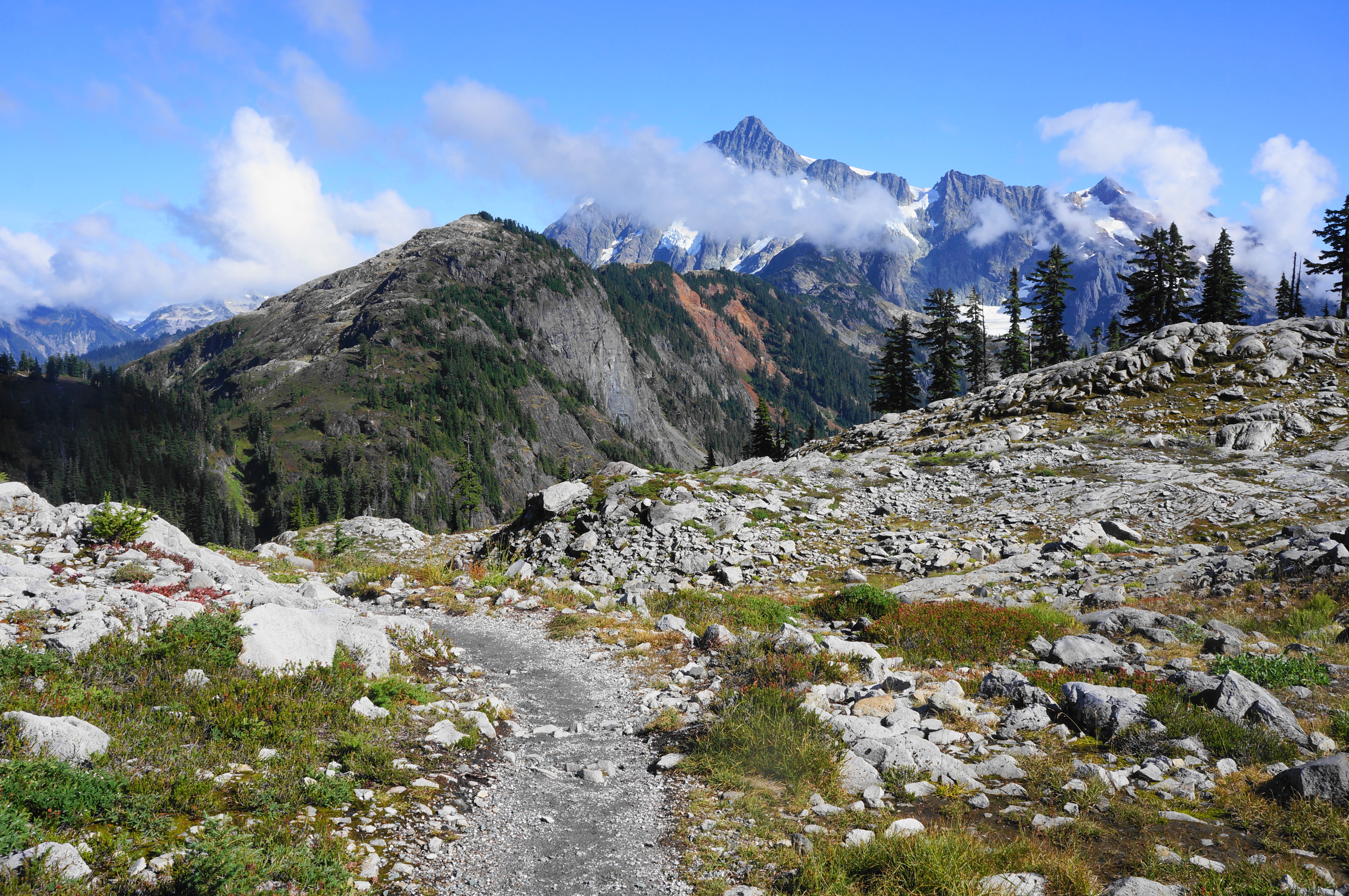
Eventually the incline stiffens, and the trail rises relentlessly to another sun-exposed ridgetop. Now it is possible to see east and south again to Mount Shuksan. Crest the ridgeline and descend briefly to a junction with the Ptarmigan Ridge Trail, another Mount Baker classic best saved for another day. Bear left, continuing on the Chain Lakes Trail.
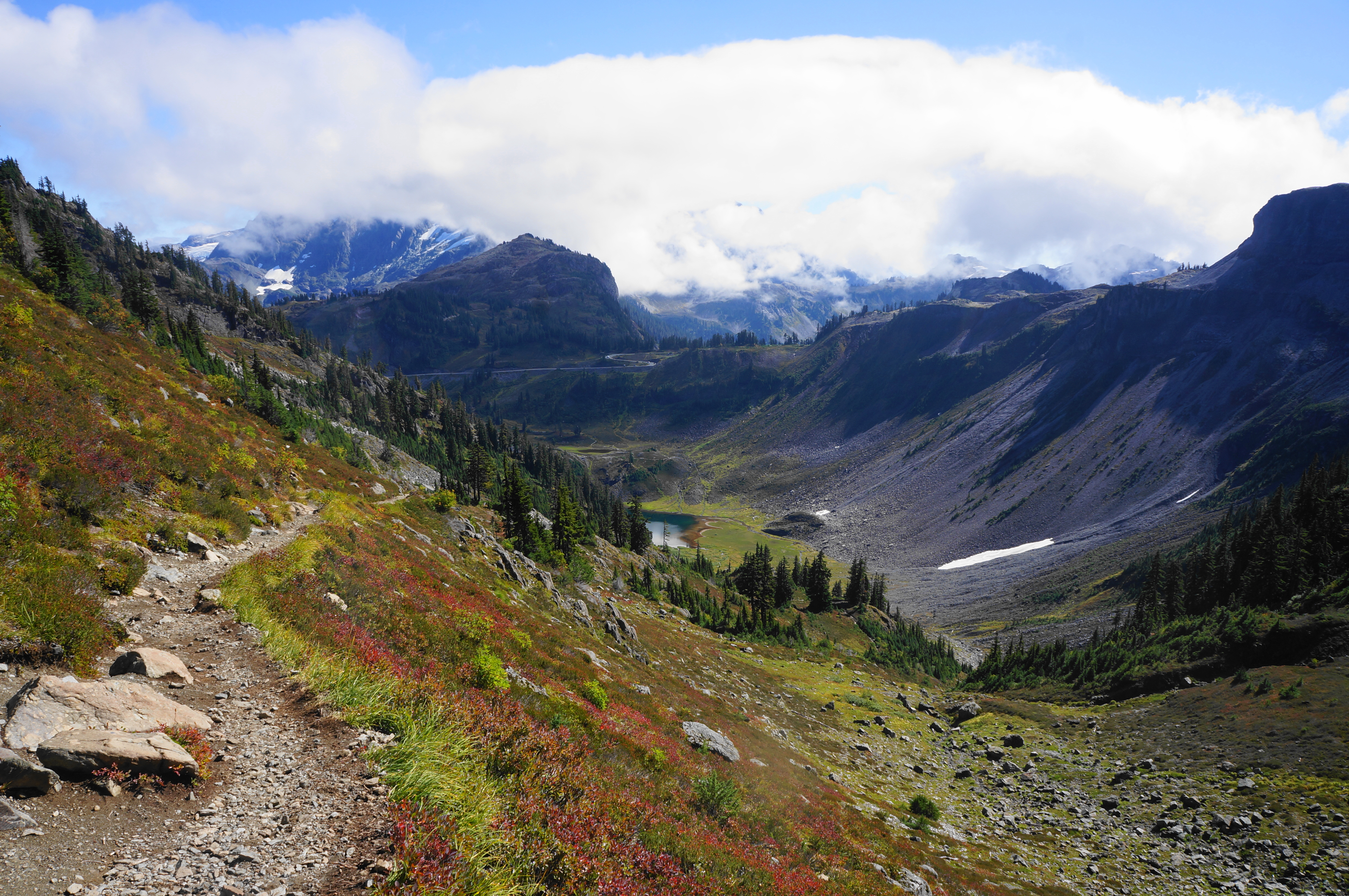
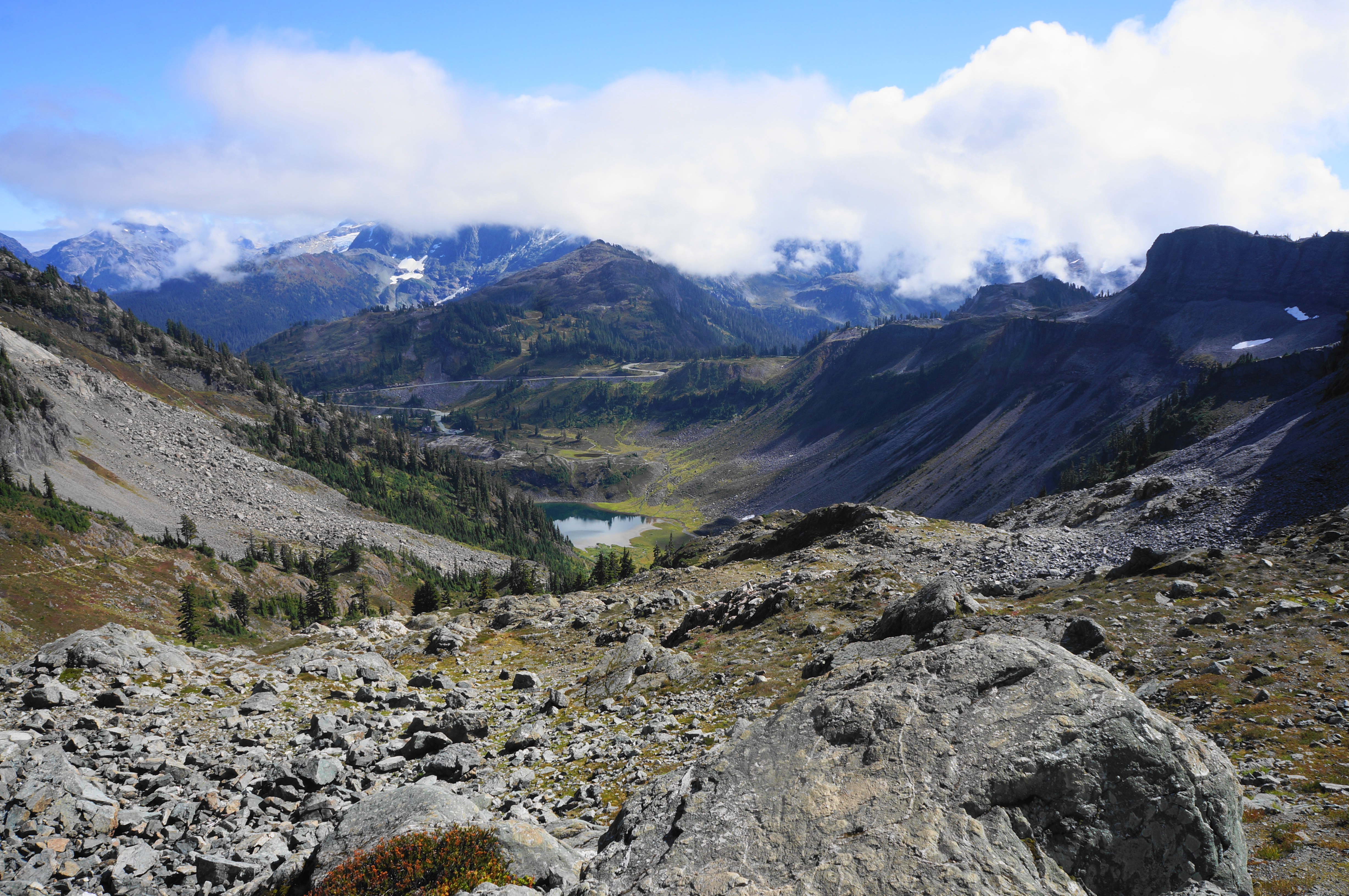
The next section is nearly all sun-exposed and keeps the destination—Artist Point—in sight much of the time. A casual descent offers expansive views down the Swift Creek Valley to Baker Lake. Range upon range of jagged peaks unfold beyond, extending across Washington to the south.
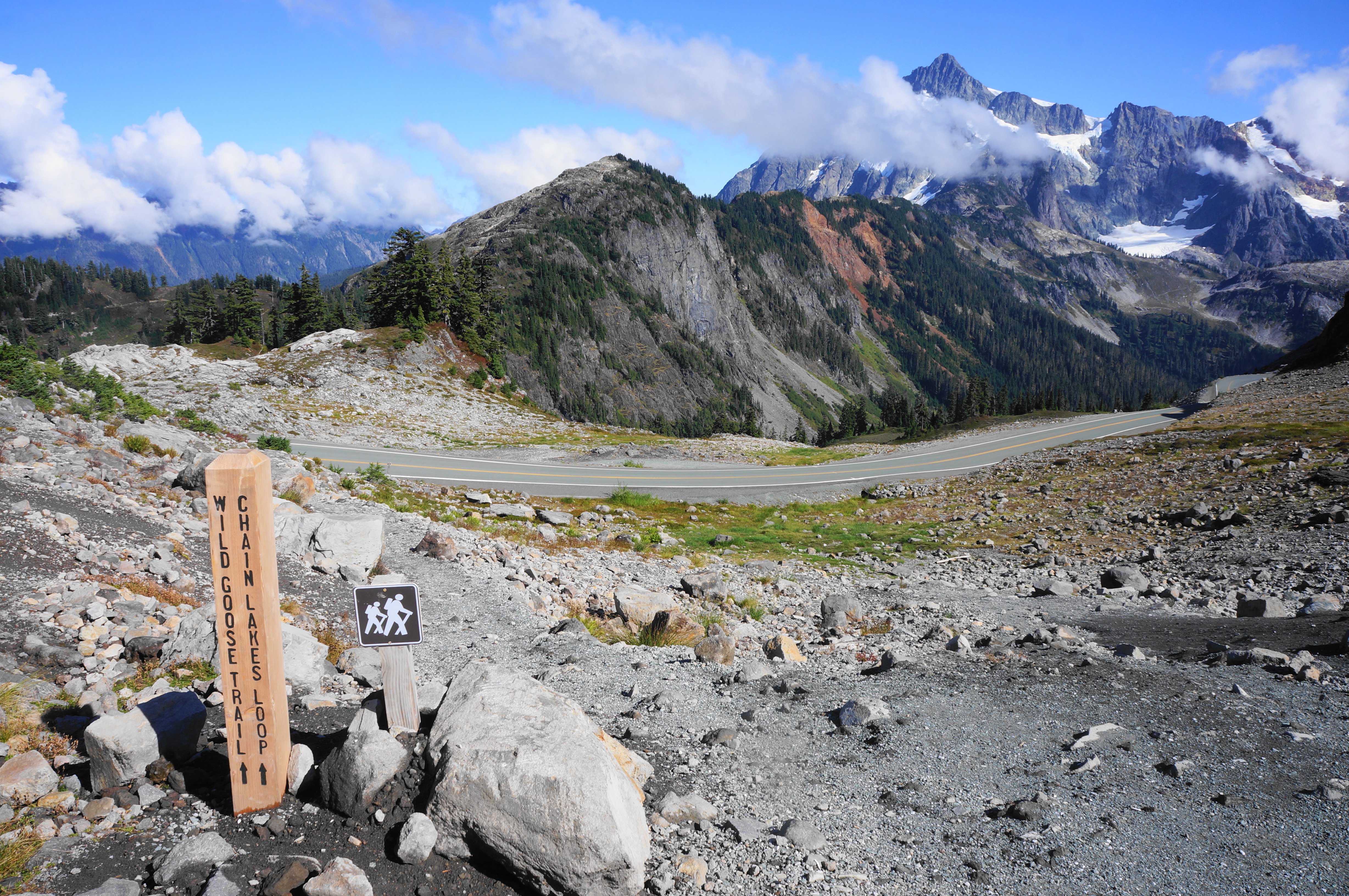
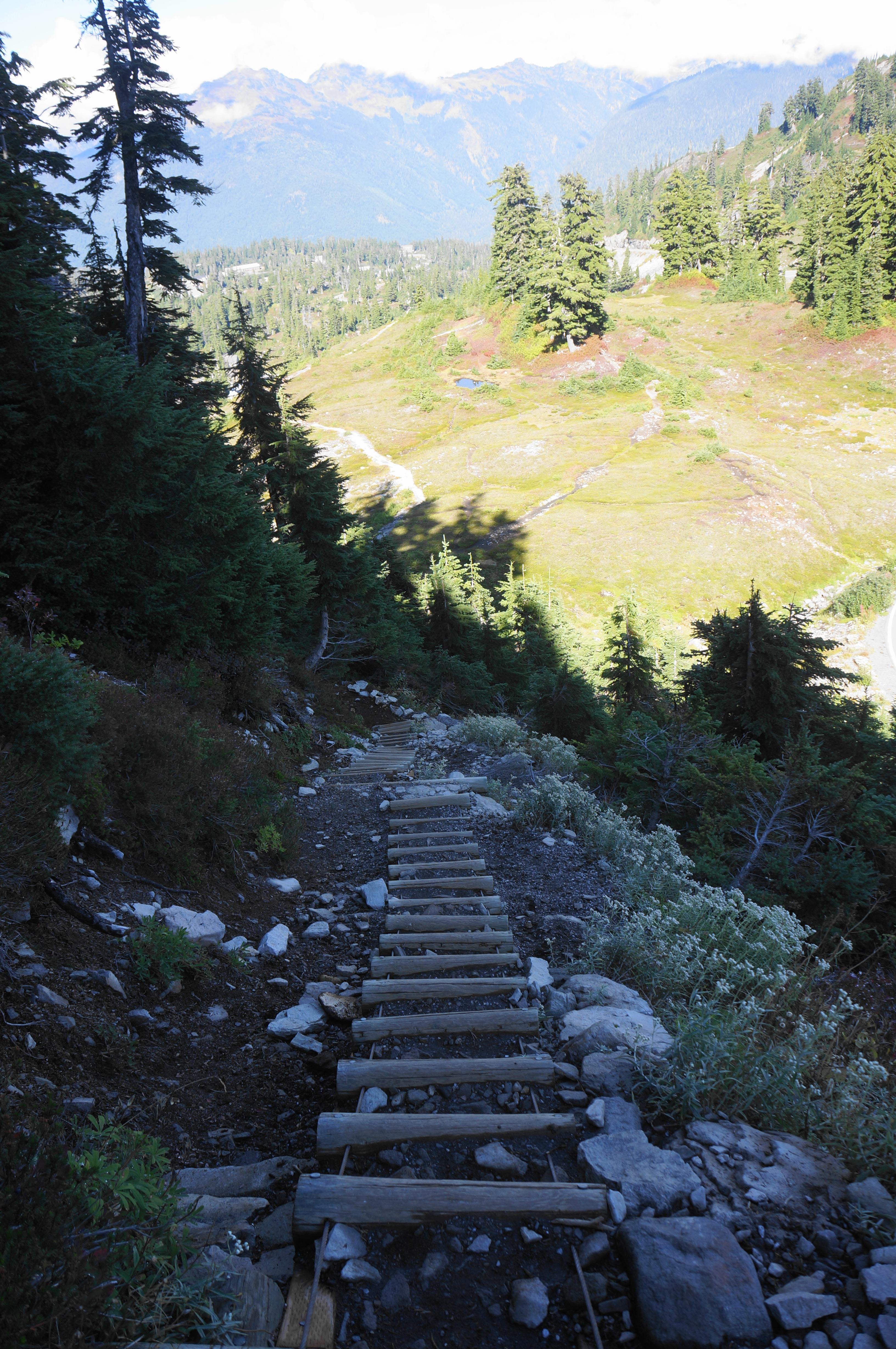
This section extends for a mile, culminating at Artist Point, with a visitor-choked parking area. To complete the loop back to Heather Meadows, cross the parking lot and find the onward track marked Wild Goose Trail (separate from the neighboring Artist Ridge Trail). This connector trail descends sharply, crosses Mount Baker Highway, and continues to drop again, at times so steeply that it uses a wooden ladder as an assist.
With the highway in sight on the right, descend to Austin Pass, with a trail (Lake Ann) leading right, then continue as views back to Bagley Lakes return. The final descent to Heather Meadows offers a look across the entry valley in the direction of the Canadian border. After shedding about 600 feet in the mile since Artist Point, the trail spits out again at the paved road next to a small pond. Bear left on the road to return to Heather Meadows (or Austin Pass Picnic Area) if you have parked there, capping off a 6.1-mile, wildly scenic loop.

Great photos and lots of useful info. I see the date for when you posted this. But (and maybe I missed it) did you provide a date for when you did this hike? That would be very helpful for understanding when might be the best time to visit.
Hi – I did this in September.
Were you thinking of adding “when done” dates to your posts?
I hint at it in the caption of the opening photo (which always has the month in which I hiked). But maybe I should make it explicit – good idea!
This is beautiful!