
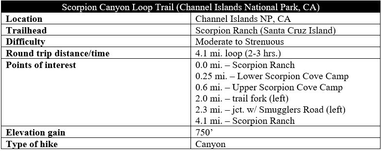
Scorpion Canyon is a usually dry drainage that cuts through the northeastern section of Santa Cruz Island, the largest island in California’s Channel Islands National Park. This moderate-to-strenuous hike follows the lower reaches of the canyon before rising steeply to a landscape of high chapparal hills overlooking the Pacific Ocean and descending back to Scorpion Cove, the starting point for most hikes on the island. (Note: See also the adjacent Cavern Point – Potato Harbor Loop.) This is one of the more challenging day hike options in the Scorpion Cove area but can be completed in a 2- to 3-hour period, well within the 6-7 hours afforded to day visitors to Santa Cruz Island.
The hike
Reaching Santa Cruz Island in California’s Channel Islands National Park is perhaps half the adventure, as the boat trip to/from the island is roughly an hour each way. Sightings of pods of common dolphins are very common, and some lucky visitors may also spot migrating whales. Concessionaire boats generally pull into Scorpion Anchorage at staggered times in the morning (twice during the week and up to four times on weekend days) and then leave in the late afternoon, leaving day use visitors with around 6-7 hours on the island. Better yet, securing a reservation at the Scorpion Cove Campground allows for multi-day exploration. (Note, however, that there are limited facilities at the campground. Campers will have to bring all of their own gear and food for the trip.)
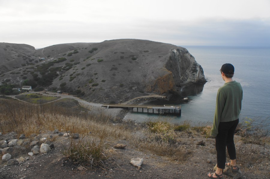
Scorpion Cove—where there is a single, long pier—is the primary starting point for most visitors to Santa Cruz Island and was once a staging location for ranching activities on the island. In 1887, French-born businessman Justinian Caire constructed several structures at Scorpion Cove, including a two-story ranch house and wooden bunkhouse. Today, the National Park Service has recreated the small ranch; the adobe house includes several exhibits on the island’s natural and human history.
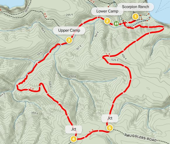
The Scorpion Canyon Loop Trail begins and ends at the Scorpion Cove Visitor Center, which is located about 2/10 mile from the pier at Scorpion Anchorage. Hikers can walk in either a clockwise or counter-clockwise direction. Those seeking to avoid a steep climb should opt for the former, but those looking for a challenge or with a preference for saving the best views for last should proceed in a counter-clockwise direction, heading west from the Visitor Center and adobe house into Scorpion Canyon. This description follows the latter track.
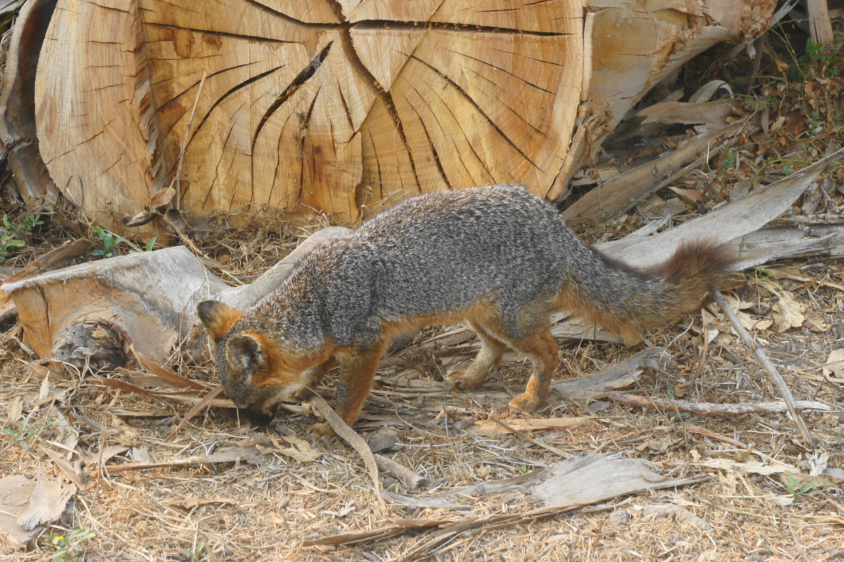
From the Visitor Center, pass the kayak/snorkel rental shop and the Lower Scorpion Cove Campground on the right. Hikers are sure to encounter at least one island fox along this wide path. This dwarf version of the mainland gray fox is found only on the Channel Islands and nearly went extinct before a restoration effort in the early 2000s that helped the population recover after a series of attacks by non-native golden eagles.

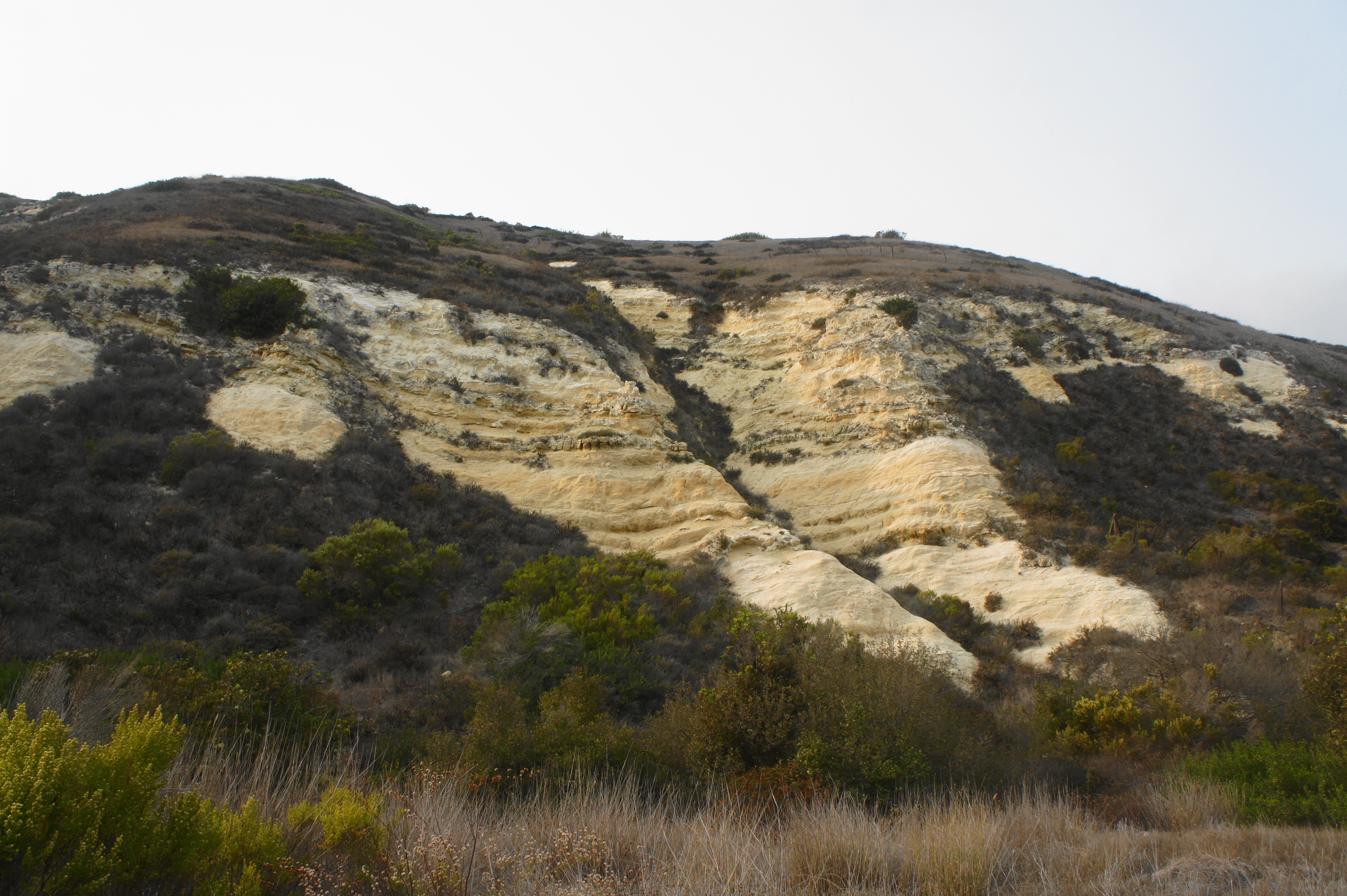
About 4/10 mile later, the trail begins a steady and demanding climb, ascending 700 feet in just over ¾ mile. This rude awakening will be challenging for some, but the increasingly dramatic views of the canyon, Montagñon Ridge, and Pacific Ocean ease some of the pain—as do the bushy wildflowers that dot the slope in some sections. Rise to a confluence with a spur trail that leads down to a set of seasonal cascades in the wash below.

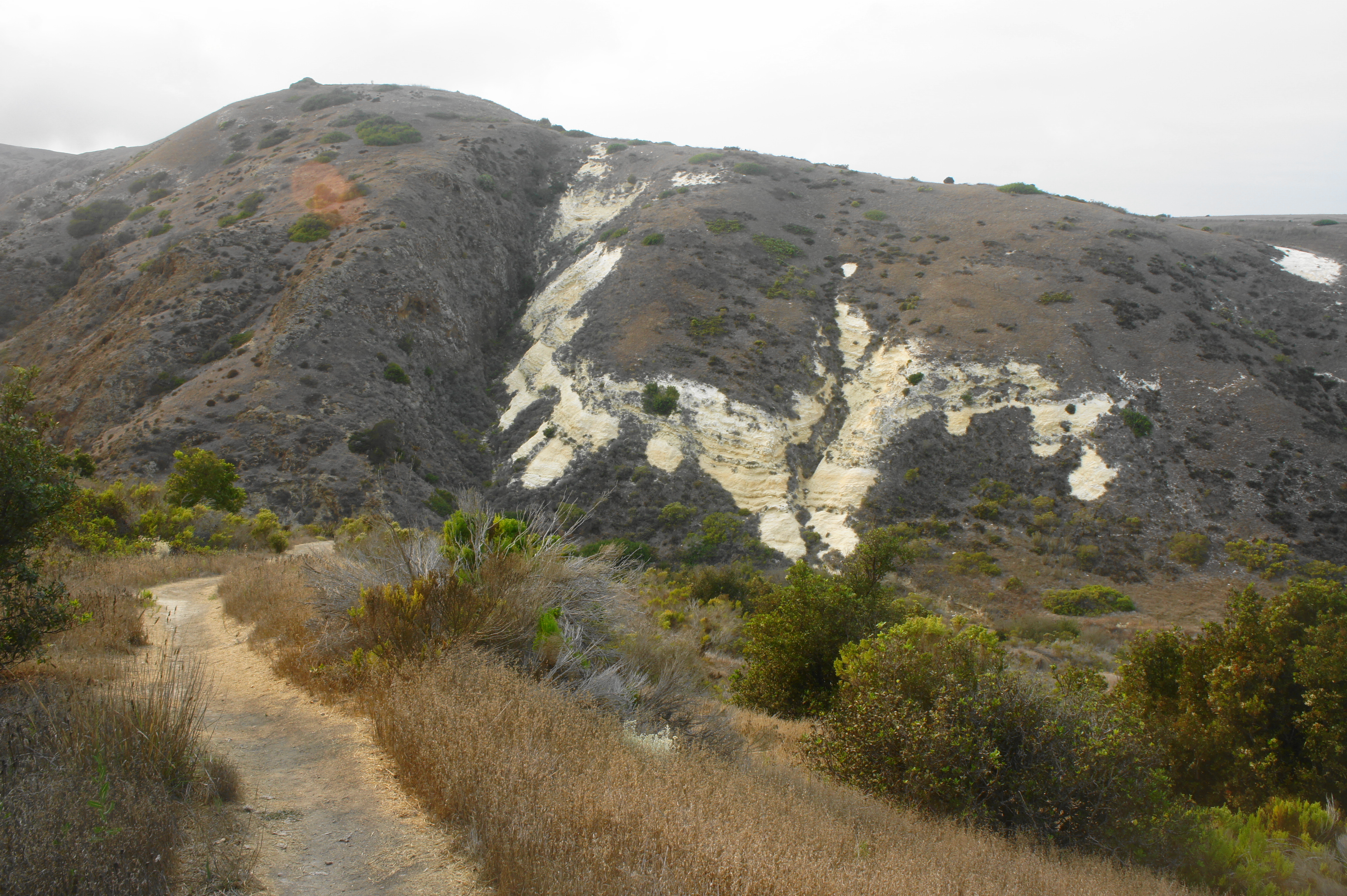
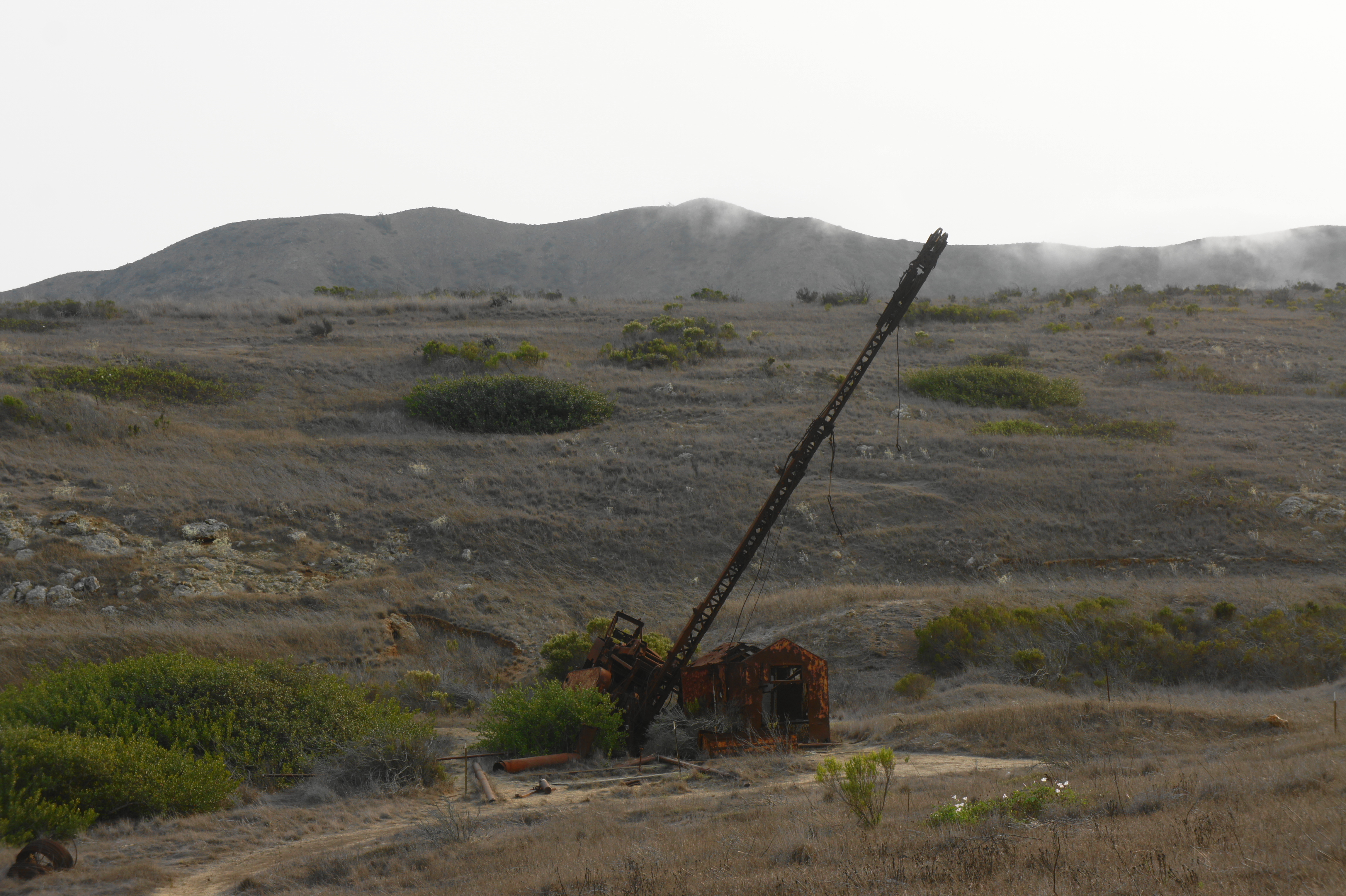
After a brief flat section, the trail continues to rise, this time up a very steep, grassy hillside that leads to what was once a vast pastureland for domesticated sheep and cattle. Scorpion Canyon gradually becomes more and more distant, and the trail follows fence-lines and a side drainage on the left to a junction, about two miles from the start. Look south from here to catch a distant view of a modest oil well that was drilled in 1966 but yielded only water.
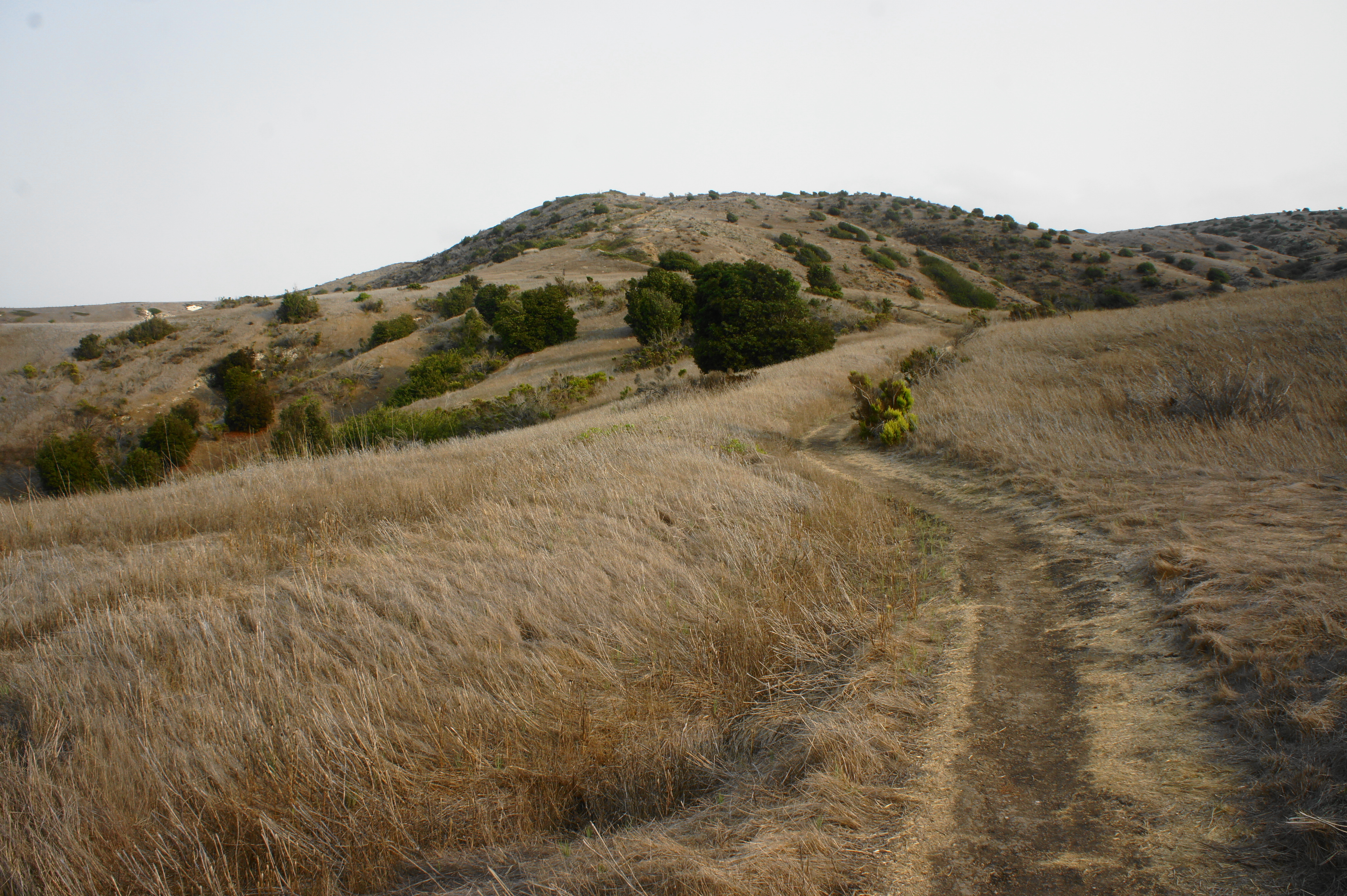

With much more of Montagñon Ridge now visible to the south, bear left at the junction and follow the wide track between drainages on the left and right. At 2.3 miles, bear left on Smugglers Road, a popular trail used to access Smugglers Cove on the far eastern shores of the island. Instead of bearing right toward Smugglers Cove, head left, bearing north in the direction of Scorpion Anchorage.

Here the path is very wide and sun-exposed, with little trace of vegetation beyond the high grasses and occasional brushy shrubs. Look back east for a view of the Anacapa Islands, which are considerably smaller than Santa Cruz but rise dramatically from the Santa Barbara Channel. Clear days also offer views as far as the mainland of California.

After a long left-hand bend, the trail edges northeast toward Scorpion Point, a high headland overlooking Scorpion Anchorage. However, instead of going out to the cliffs overlooking the ocean, the trail suddenly cuts back west, descending a grass-lined pitch for about 250 feet to the mouth of Scorpion Canyon. Passing within sight of the windmill at Scorpion Ranch, the trail crosses the drainage and meets up again with the Scorpion Valley Road at a point between the Visitor Center and the kayak and snorkel rental shop. Bear right to return to the Visitor Center and anchorage.

All told, this moderate to strenuous, 4.1-mile trek takes about 2-3 hours to complete, making it a decent complement to the Cavern Point – Potato Harbor Loop of similar length (4.5 miles).

You choose a great hike on the Island!! I was just there in late December and took in the Potato Harbor hike! Camping in the Upper Loop at Scorpion on Santa Cruz is also spectacular – experiencing the sunset and the stars out there is so peaceful.
Neat terrain. I love the dwarf fox, it’s so tiny!
Pingback: Top 10 Hikes in 2022 | Live and Let Hike
Pingback: Top 10 Hikes in 2024 – Live and Let Hike