In contrast with the friendlier beach terrain of central and southern California, the Pacific Coast north of the Bay Area has a more raw, rugged character—the cliffs are taller, the waves stronger, and the weather often considerably more menacing. But if you catch the coastal bluffs on a nice, sunny day—as I was lucky enough to do on a weekend trip in November—there are few landscapes more enchanting. Encircling the modest seaside town of Mendocino, the Mendocino Headlands Trail is jam-packed with spectacular views of the deep blue ocean, crashing waves, towering cliffs, and—most memorably—a series of natural sea arches. The sandy singletrack is mostly level and easy from end-to-end (follow Ford Street or Lansing Street to complete the loop), making for a lovely morning or evening stroll.
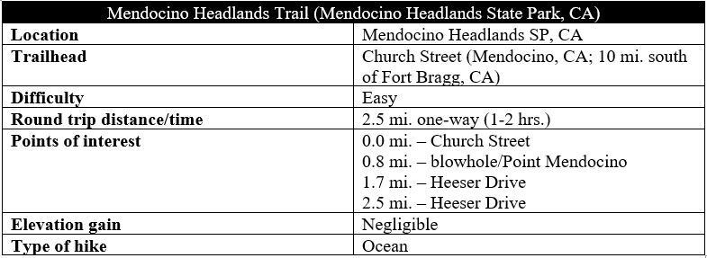

The hike
There are many possible entry points for the Mendocino Headlands Trail, but yours truly started at the southeast end and worked clockwise, beginning at the end of Church Street in Mendocino. (Note: This is within easy walking distance of a number of inns/B&Bs in town.) From the gravel parking lot behind the Mendocino Presbyterian Church, two main walking paths head south; take the westernmost track (the eastern one heads down to Big River Beach). Here one enters Mendocino Headlands State Park.
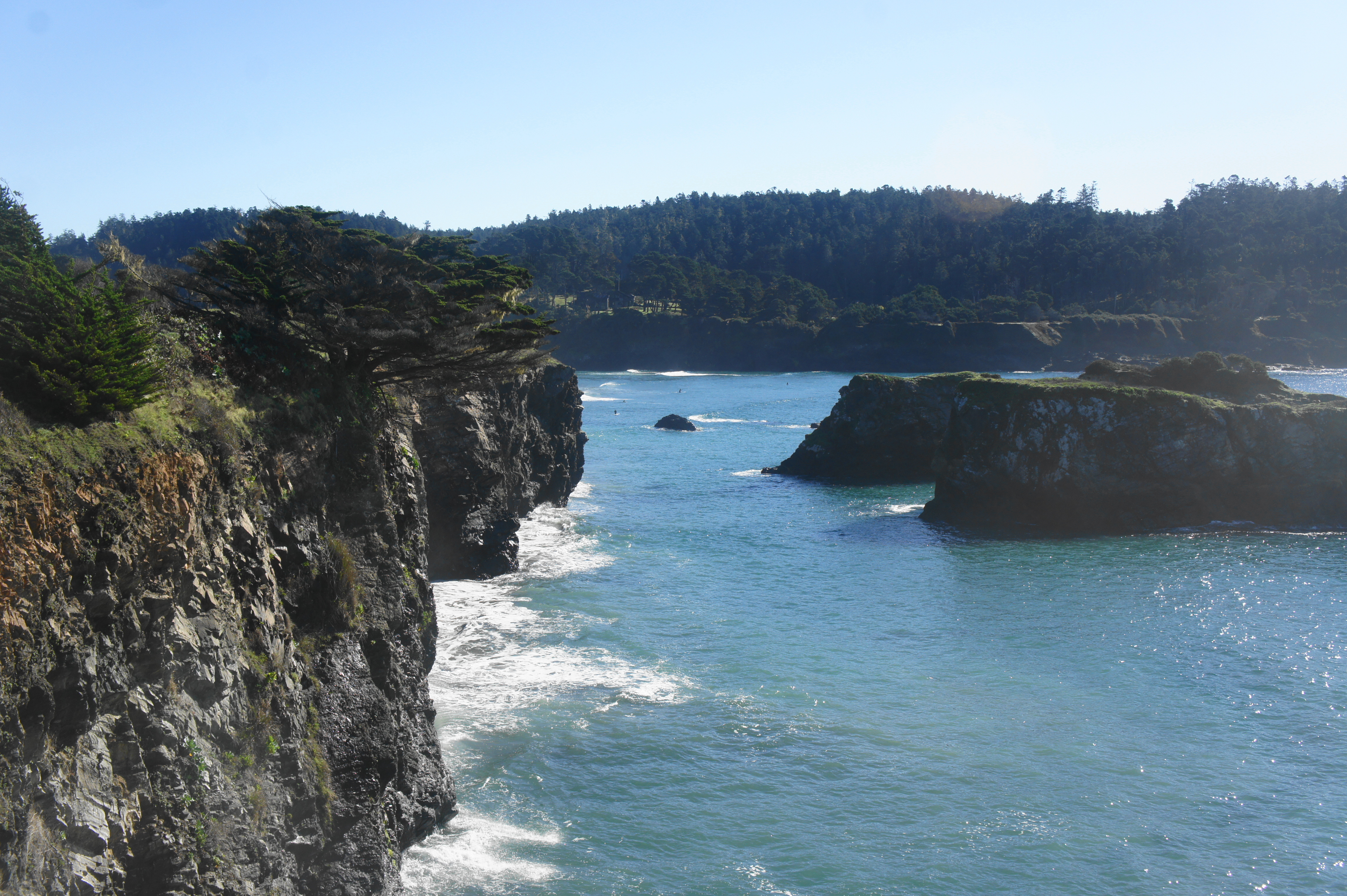
Within seconds, the unmarked path splits in three; take the middle track, heading nearly due south across an open field, toward a clutch of pines at the cliffs’ edge. Head out to a point overlooking the Pacific Ocean, with the sandy terrain of Big River Beach visible below. The Big River drainage, crossed by Highway 1 to the east, features the longest undeveloped estuary in northern California, draining 181 square miles from the Mendocino Range. As fishers and kayakers head east up-river, surfers brave the waves below.


After peering over the edge for your first glimpse, bear right on a faint but well-trodden trail hugging the cliffside as it bounds westward. After traversing the open scrub for 1/10 mile, the Mendocino Headlands Trail reaches a second, pine-studded viewpoint at ¼ mile. From here one can see west to a pair of blocky islands, followed by the exposed peninsula of Point Mendocino, which hikers will reach shortly.

As the trail continues westward, hikers pass the two initial islands, which, at low tide, reveal large archways in the rock, formed through constant weathering by the battering sea. Natural arches and sea caves are ubiquitous in this area, and these initial openings are but a preview of what’s to come.
At 4/10 mile, there is a prominent junction, with a widely-used path heading north to Main Street in Mendocino. Stay left, with the onward trail dipping to clear an eroded ravine with a beautiful Monterey cypress at its mouth. Continue west as the trail passes above Portuguese Beach, a modest patch of sand strewn with kelp and large logs.

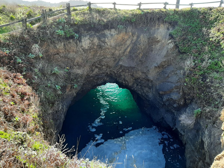
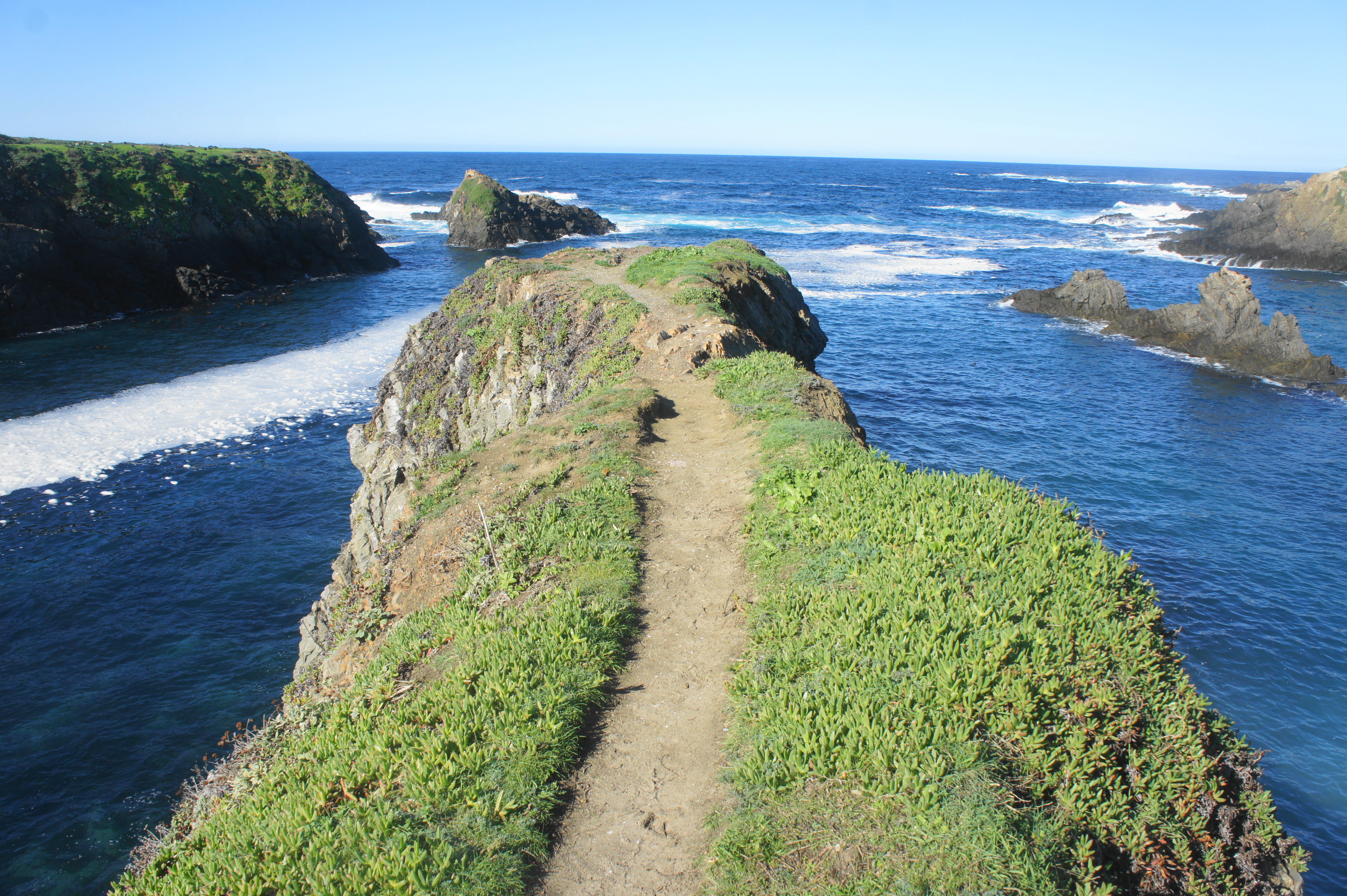
Just after a bench on the right, join with the wider path coming in from the right at about 6/10 mile, then bear south toward Point Mendocino, a flat peninsula bearing surprising secrets—including a spectacular blowhole, where the sea has caused a piece of the headland to cave in, revealing the intruding sea below. The sun glimmers through a large archway connecting the blowhole (a.k.a. punchbowl) with the broader ocean. A fenced path forms a circuit around the fascinating feature.

Just beyond the blowhole is the southernmost tip of the peninsula, after which the onward trail rounds back north, with several spur paths leading down to tidepools left by the receding waves. The highly eroded bluffs are teeming with ice plant—an invasive species brought in to stabilize shores in the early- to mid-20th century but which now has earned the ire of naturalists for crowding out native plants.
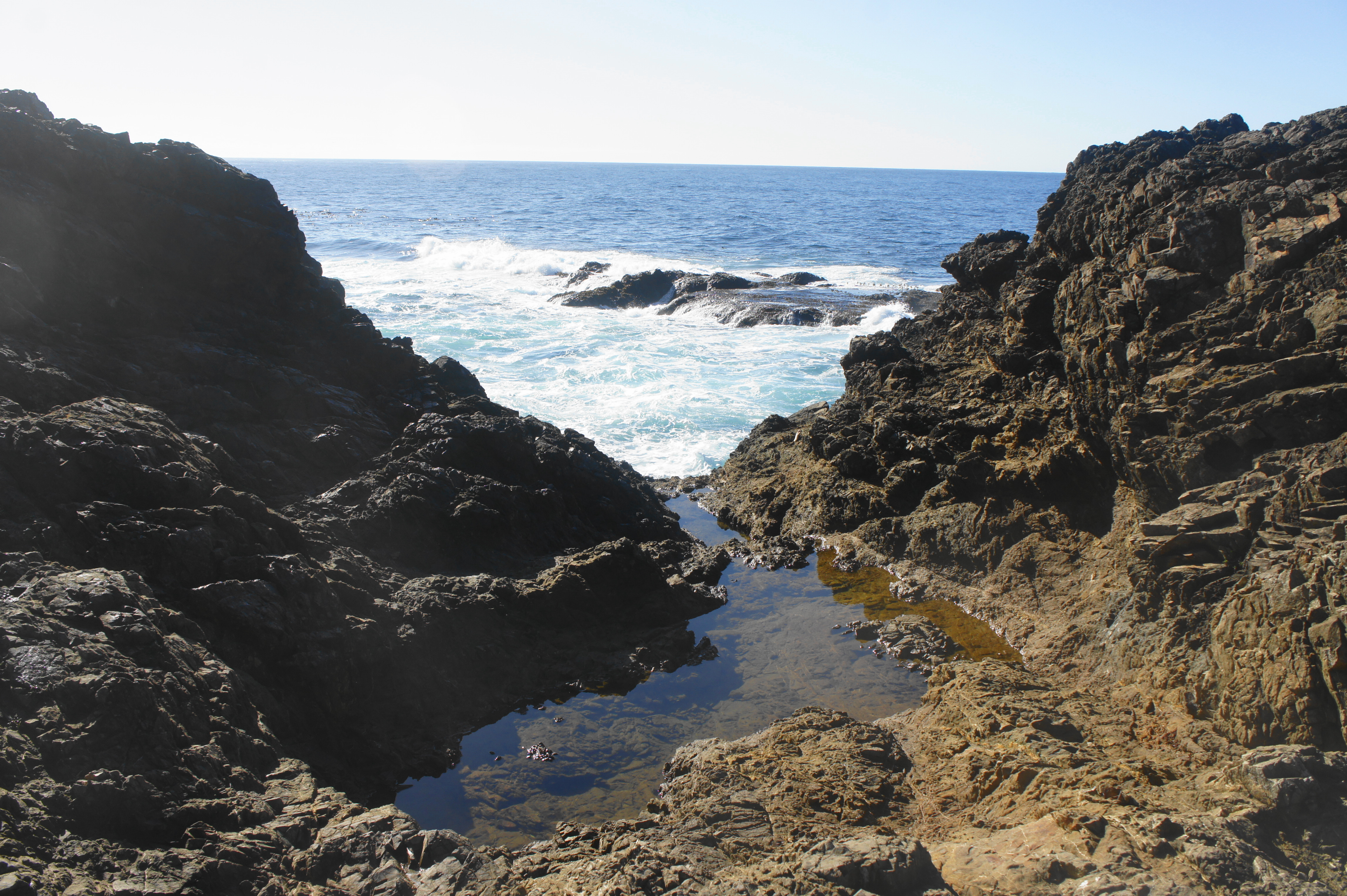


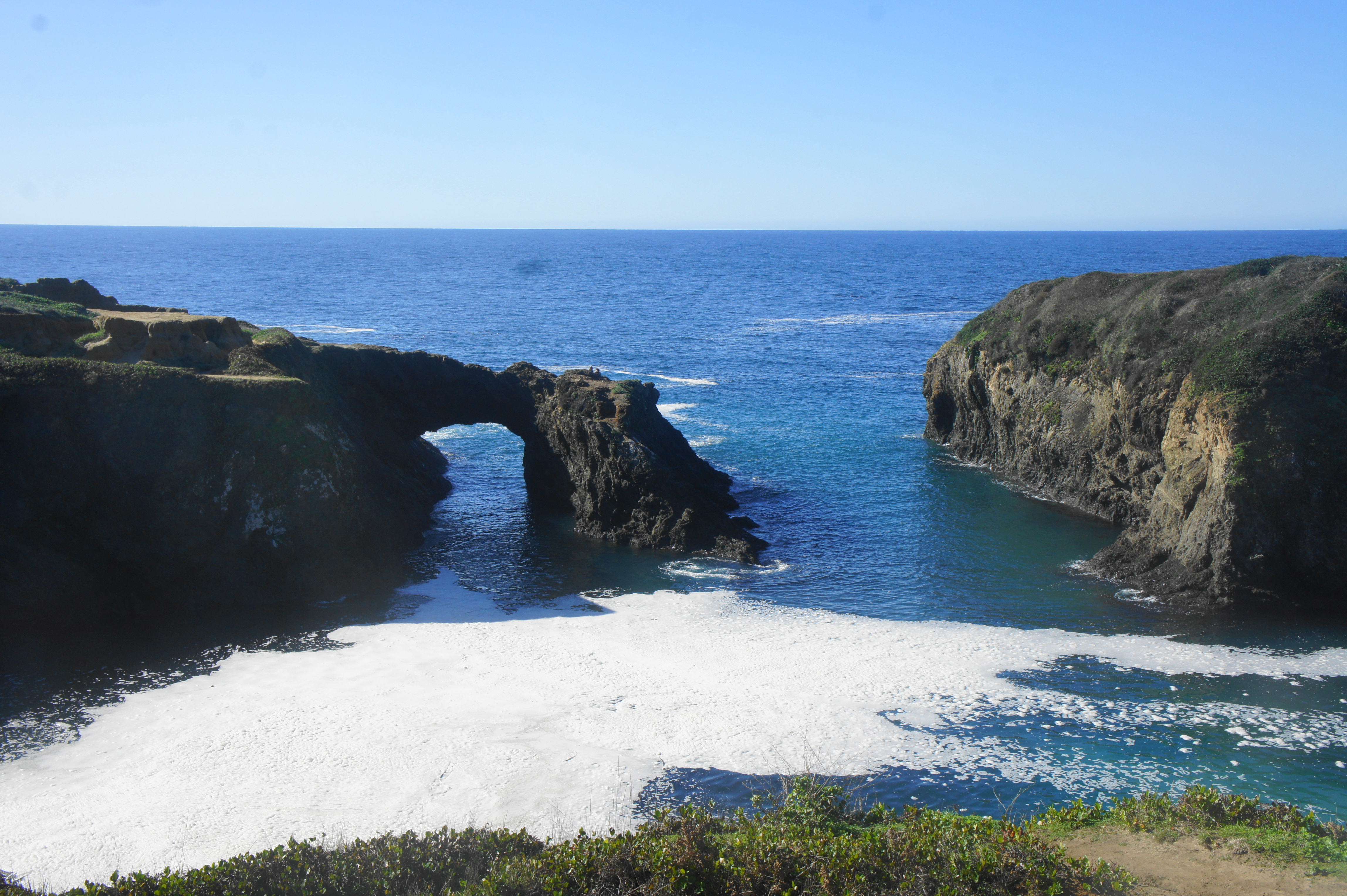
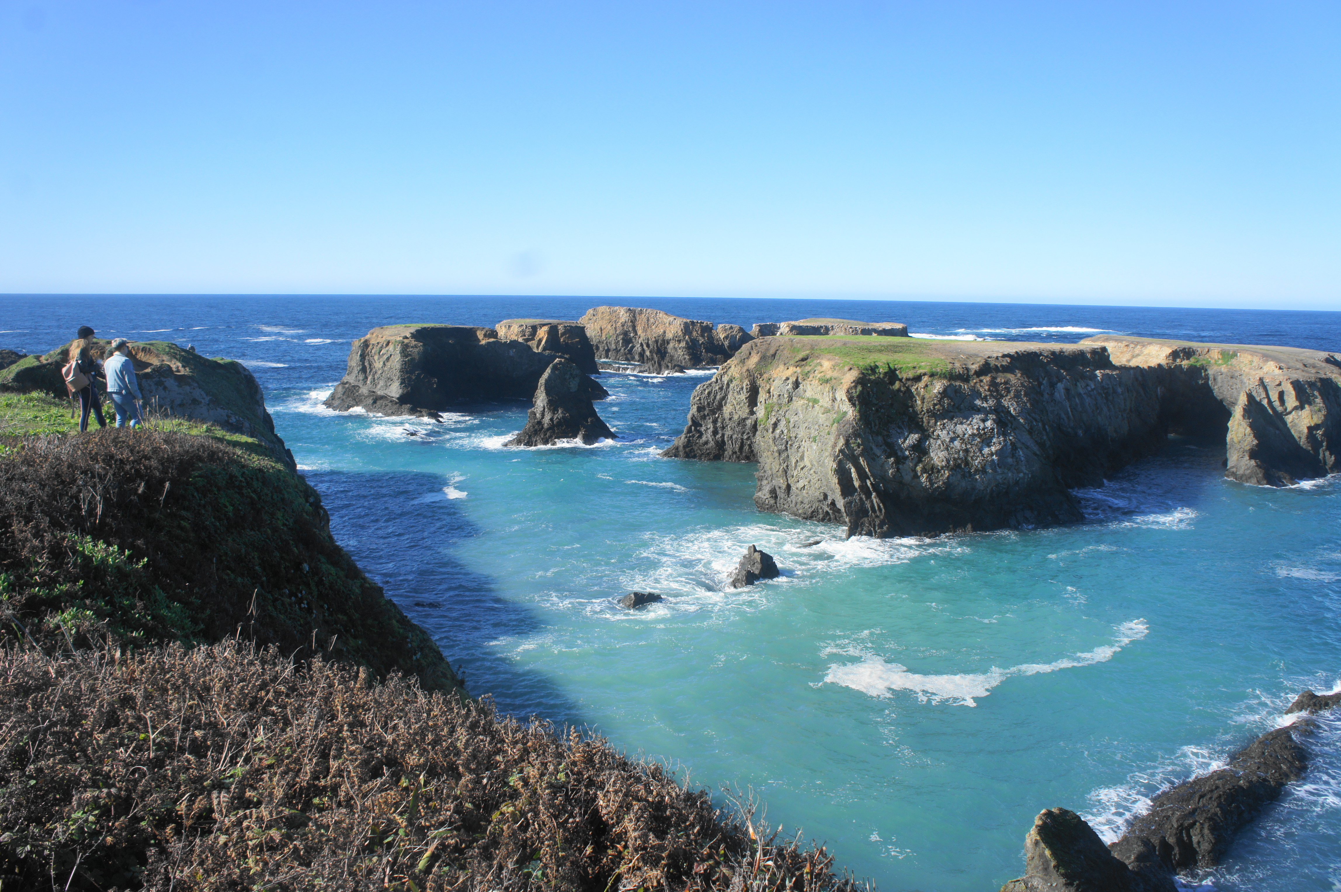
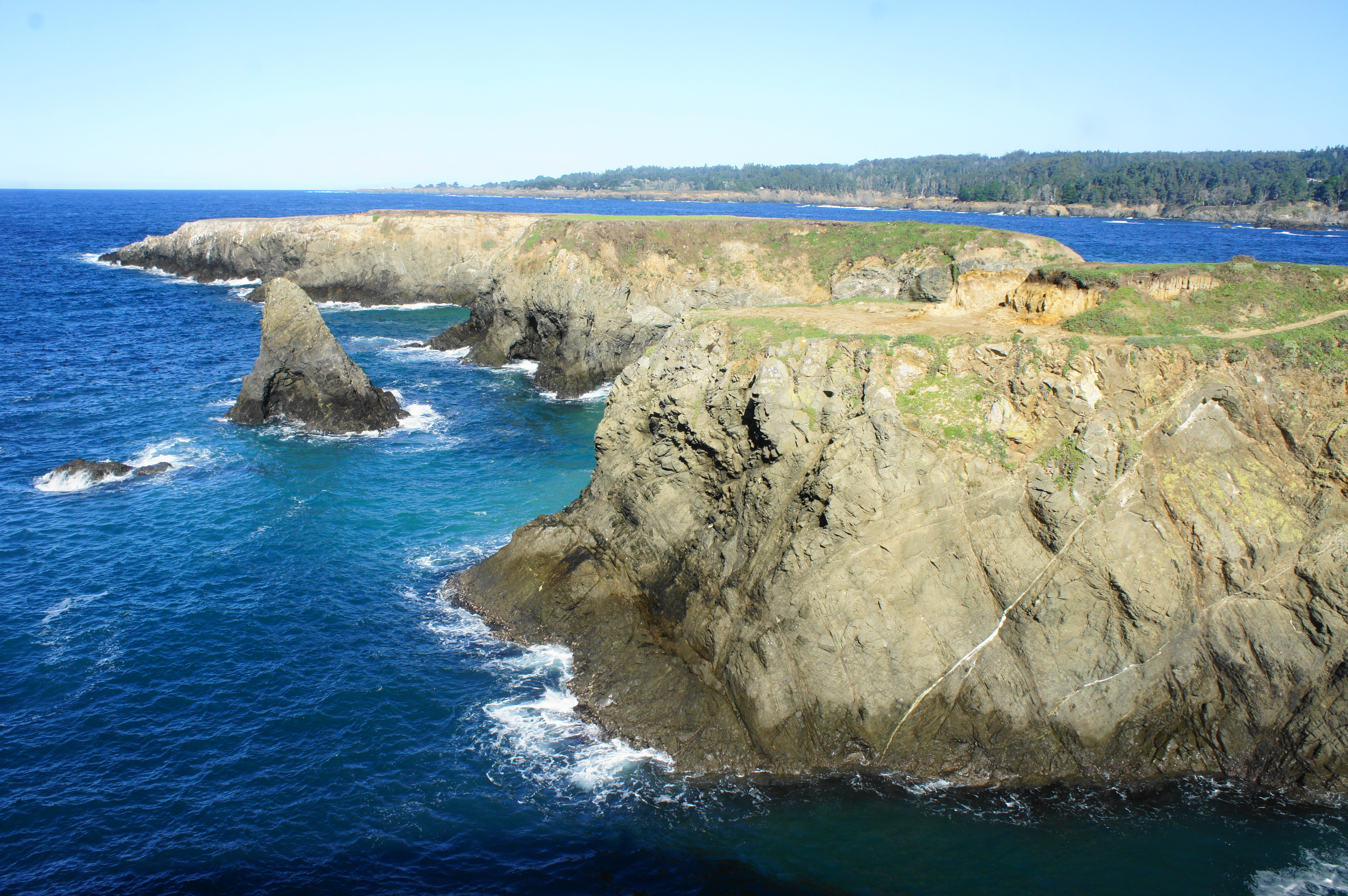
Angling around to the north side of the peninsula, bear left as the main track heads straight, continuing to follow the Mendocino Headlands Trail around a scenic inlet with a gaping arch cutting through the eroded rock below. The best view of the arch comes at around 1.2 miles, after which the trail splits again, and the onward track skirts the cliffs right above the archway.

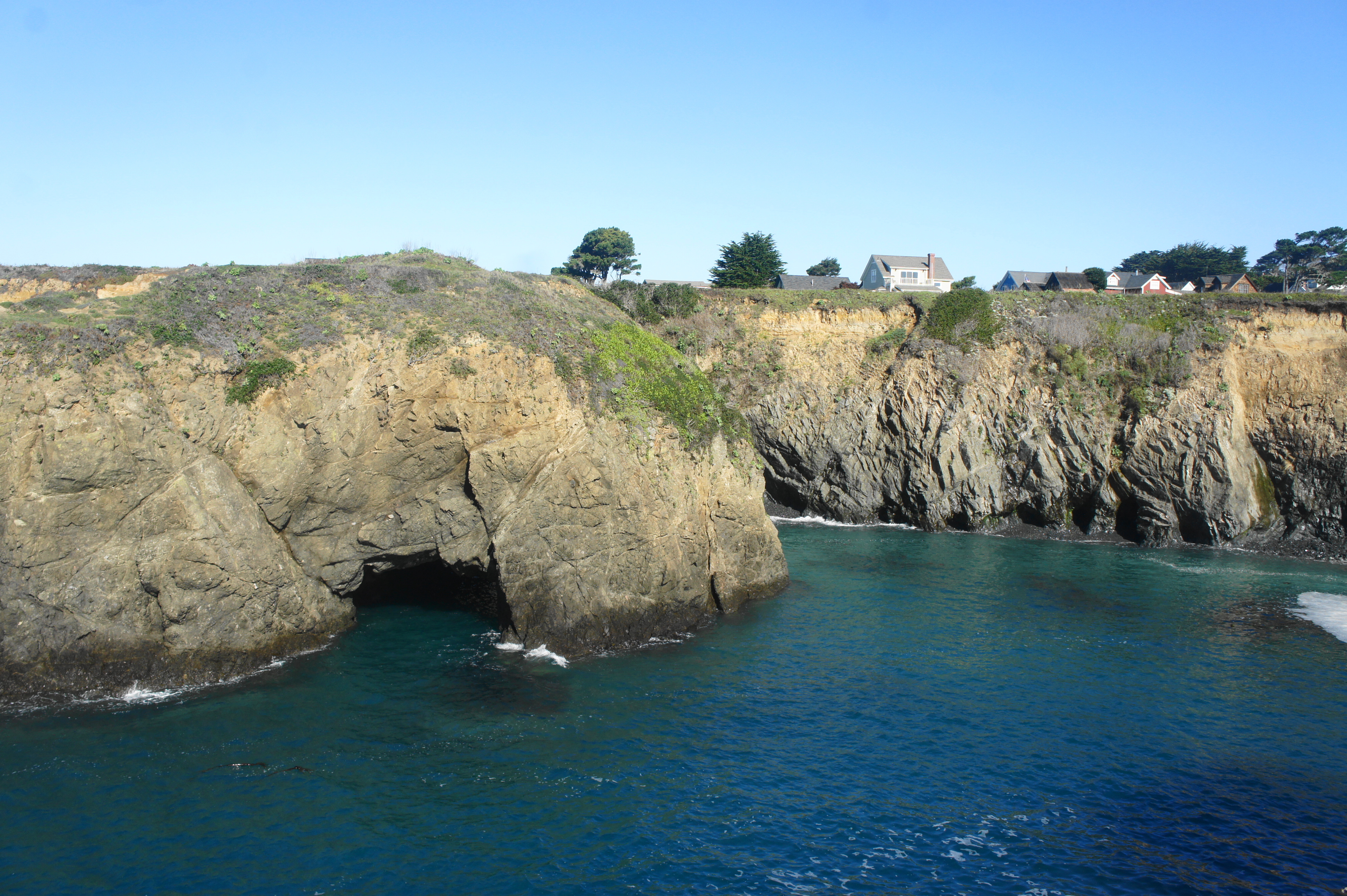

After rounding a bend and heading northwest again, follow the path as it heads all the way around a stony cove with a small beach. After wrapping around another headland, the north-south path faces the open ocean to the west before reaching a parking area at 1.6 miles. Follow the path to another parking area along Heeser Drive, and don’t forget to look back toward the ocean, where the new angle reveals a spectacular sea arch, with the blue depths beyond.


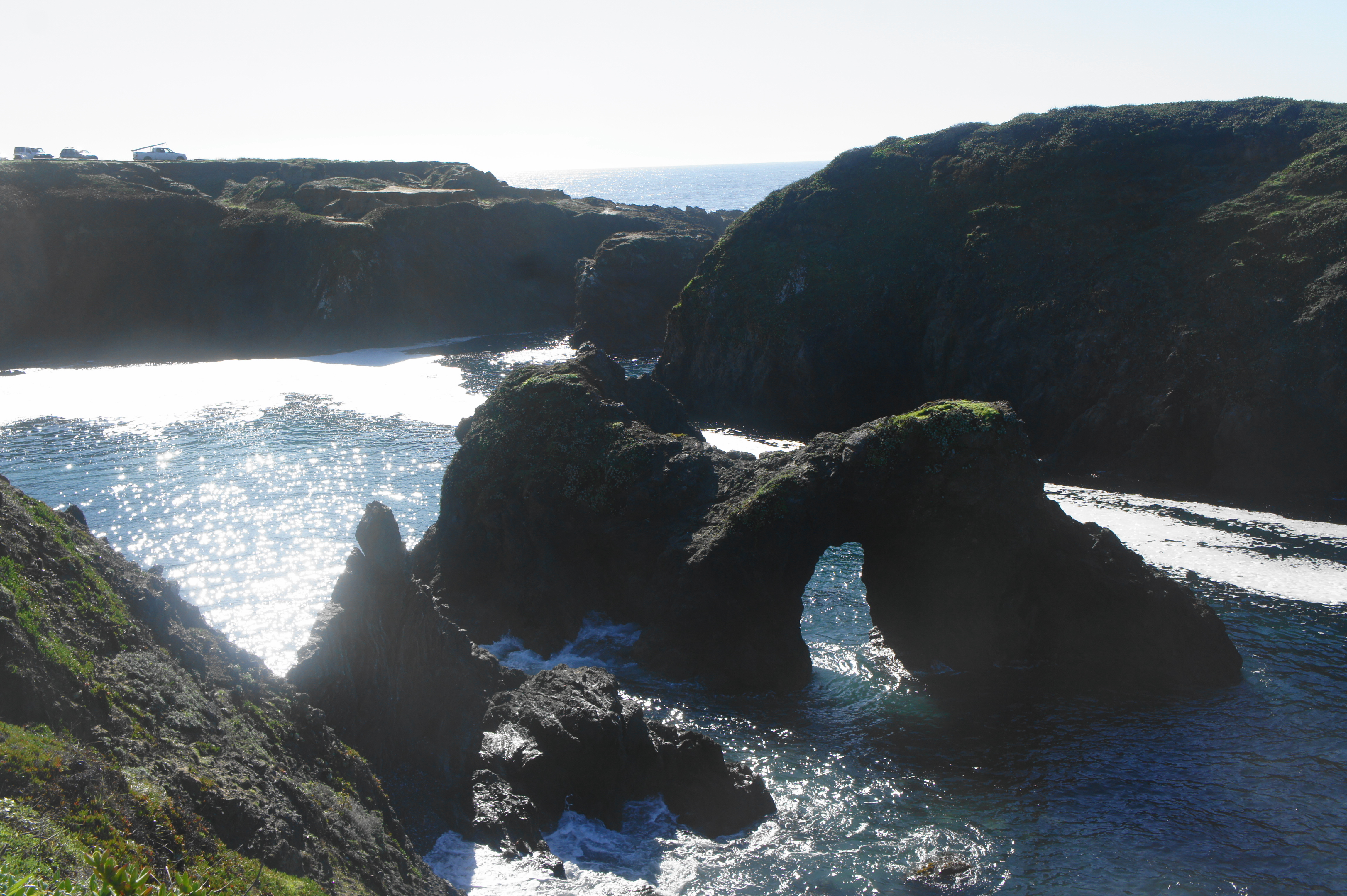
Briefly follow the road to skirt a stand of cypresses, then bear left again on the unmarked but well-worn trail. A short detour leads out to a narrow promontory overlooking the swarming sea, with Goat Island and a set of additional arches in view.


Heading north, with another archway in the distance, the trail keeps the cliffs on its left and Heeser Drive on its right, eventually passing the next arch and leading to another set of islands off the northwest shores of the headlands.


After skirting another cove, the trail passes another small, roadside parking area and angles along the coastline with open views north toward Russian Gulch and Point Cabrillo (one can see the Point Cabrillo lighthouse in the distance). As the trail approaches a cypress grove and Point Kelli, the path abruptly ends, spilling out onto Heeser Drive, where there is a parking area with picnic benches and a restroom.

Russian Gulch
This is the official end of the hike. While requiring a short bit of road-walking, hikers can complete the loop and return to the start by heading east on Heeser Drive and then taking Ford or Lansing Streets south back to Main Street and Church Street. Including this section, the hike covers a little over three miles, a modest distance with a high wow factor along a spectacular stretch of coastline.

Pingback: Top 10 Hikes in 2021 | Live and Let Hike
A well written piece with good guidance along pathways throughout.