
It is a maze of cliffs and terraces… red and white domes, rock platforms gashed with profound canyons, burning plains barren even of sage – all glowing with bright colors and flooded with blazing sunlight…. It is the extreme of desolation, the blankest solitude, a superlative desert. – Clarence E. Dutton, geologist (1880)
The land that now comprises central Utah’s 378-square-mile Capitol Reef National Park is—and has been—a lot of things to a lot of people. To geologists, the park encompasses North America’s longest and most striking monocline in the Waterpocket Fold—that is, a 100-mile long wrinkle in the Earth’s crust. To the Edward Abbeys of the world, it is an escape to peaceful desert serenity. To locals, it is (or once was) a watering hole and a source of fruit, nuts, or fresh-baked pies.
To the resourceful natives now known to archaeologists as the “Fremont culture”—and their descendants—Capitol Reef was a home for hundreds of years, dating to 700 A.D. To the Mormon pioneers who established the tiny community of Fruita in the 1880s, it was a modest settlement of no more than 10 families at any given time…and later even a safe haven for polygamists.
To the average citizen today, however, it is overlooked.
Perhaps my one complaint of my splendid four months working as an interpretive volunteer at Capitol Reef was the flurry of visitors with their budget hiking backpacks passing through who gave the park short thrift—jammed into a 1-2 hour slot before driving away to nearby Bryce Canyon or Arches or the Grand Canyon.
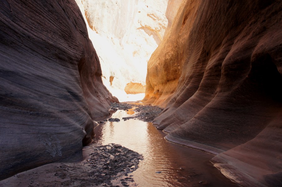
This page—and many of the posts on Live and Let Hike—is an effort to set the record straight, to uncover the wonders of the place, from the vibrant colors to the secret petroglyphs to the twisted network of canyons cutting through the Waterpocket Fold. The lens for discovery is the park’s impressive collection of hiking trails and unmaintained routes.
Before taking your next trip to the southern Utah, consider staying awhile at Capitol Reef…and try one—or several—of the trails, routes, and random adventures from the comprehensive list below, ordered by location, length, and difficulty. None (except perhaps the notorious Old Wagon Trail) is likely to disappoint!
*For those short on patience, skip straight to the best of the best with “Top 10 Hikes in Capitol Reef National Park’s ‘Frontcountry’” or “Top 10 Hikes in Capitol Reef National Park’s ‘Backcountry.’” Or check out the map below!
For the rest, the comprehensive list awaits…
Fremont River District (Central)
Hiking trails (well-defined and maintained)
- Petroglyphs Trail—easy, 0.2 mi. out-and-back#
- Goosenecks Trail—easy, 0.4 mi. out-and-back
- Sunset Point Trail—easy, 0.7 mi. out-and-back
- Grand Wash Trail—easy, 4.8 mi. out-and-back
- Hickman Bridge Trail—moderate, 1.8 mi. out-and-back
- Capitol Gorge Trail and The Tanks—moderate, 2.0+ mi. out-and-back
- Fremont River Trail—moderate, 2.6 mi. out-and-back
- Cohab Canyon Trail—moderate, 3.4 mi. out-and-back
- Frying Pan Trail and Frying Pan Canyon—strenuous, 2.9+ mi. one-way^
- Cassidy Arch Trail—strenuous, 3.4 mi. out-and-back
- Chimney Rock Trail—strenuous, 3.5 mi. stem-and-loop
- Old Wagon Trail—strenuous, 3.8 mi. stem-and-loop
- Golden Throne Trail and Golden Throne Canyon—strenuous, 4.0+ mi. out-and-back^
- Fremont Gorge Overlook Trail—strenuous, 4.6 mi. out-and-back
- Rim Overlook and Navajo Knobs Trail—strenuous, up to 9.4 mi. out-and-back
Hiking routes (unmaintained and rugged but well-trodden)
- The Castle Trail—moderate, 2.4 mi. out-and-back
- Pleasant Creek—moderate, 7.6 mi. out-and-back
- Lower Spring Canyon—moderate, 9.9 mi. one-way*
- Sulphur Creek—strenuous, 5.5 mi. one-way
- Upper Spring Canyon—strenuous, 18.5 mi. one-way
Off-trail adventures (no discernible path; you’re on your own!)
- The Motorman—easy, 0.4 mi. out-and-back
- Pleasant Creek slot canyon—up to 2.2 mi. out-and-back*
- Shinob Canyon—moderate, 2.2 mi. out-and-back
- Point 6,230’—moderate, 2.2 mi. out-and-back
Miscellaneous
- Capitol Reef National Park in Winter—photo collection
- Secrets of Capitol Reef National Park—photo collection
Waterpocket District (South)
Hiking routes (unmaintained and rugged but well-trodden)
- Surprise Canyon—easy, 2.0 mi. out-and-back
- Headquarters Canyon—easy, 3.4 mi. out-and-back*
- Strike Valley Overlook—moderate, 0.8 mi. out-and-back
- Red Canyon—moderate, 4.5 mi. out-and-back
- Oak Creek Canyon—moderate, 5.0+ mi. out-and-back
- Lower Muley Twist Canyon, Upper Section—moderate, 8.0 mi. out-and-back
- Cottonwood Wash—strenuous, 4.5+ mi. out-and-back*
- Burro Wash—strenuous, 8.0 mi. out-and-back*
- Sheets Gulch—strenuous, 9.0+ mi. out-and-back*
- Upper Muley Twist Canyon—strenuous, 9.0+ mi. stem-and-loop*
- Halls Creek Narrows via “airport route”—strenuous, 14.8 mi. stem-and-loop
- Lower Muley Twist Canyon and Hamburger Rocks—strenuous, 17.0 mi. loop
Off-trail adventures (no discernible path; you’re on your own!)
- Bitter Spring Creek—5.0 mi. out-and-back
Scenic byways
Cathedral Valley District (North)
Hiking trails (well-defined and maintained)
- Cathedral Valley Overlook Trail—easy, 0.2 mi. out-and-back
- Morrell Cabin Trail—easy, 0.4 mi. out-and-back
- Upper South Desert Overlook Trail—moderate, 0.4 mi. out-and-back
- Cathedrals Trail—moderate, 2.2 mi. out-and-back
Hiking routes (unmaintained and rugged but well-trodden)
- Lower South Desert Overlook—easy, 0.5 mi. out-and-back
- Lower Cathedral Valley Overlooks—moderate, 2.4 mi. loop
Scenic byways
Fishlake National Forest (West of Capitol Reef)
- Cooks Mesa and Meeks Mesa—strenuous, 4.4 mi. out-and-back
- Durfey Canyon/Boy Scouts Trail—strenuous, 6.0+ mi. out-and-back
# paved, wheelchair accessible trails; ^ maintained trails with off-trail options; * hikes with slot canyons
Thatsweetgift.com, Monicashealthmagazine.com, janeskitchenmiracles.com

The link for Burro connects to the Notom-Bullfrog post.
Thanks John. I fixed the mistake.
Fantastic and detailed website! So glad that I stumbled upon this resource. For Capitol Reef area, do you have any campsite recommendations? I prefer those that are isolated from crowds.
Hi Amanda – if you want to avoid crowds, I would not recommend the main campground at Capitol Reef. Instead, try the Sunglow Campground in nearby national forest land–or set up camp on BLM land that surrounds the park (the downside of the latter, of course, is that there are no services, but you will get solitude!). You can check at the Visitor Center for resources on camping in and around the park. Happy camping!
I just wanted to THANK YOU SO MUCH for all the great info on capitol reef! between your insights and the book by rick stinchfield, we were able to easily navigate and appreciate our time in capitol reef! what a place! trip 2 in the works!!
thanks again!
anita
Glad to hear it! Rick is great – we briefly worked together at Capitol Reef.