
According to historical accounts, it was Almon Harris Thompson’s central Utah expedition in 1872 that gave the name to Pleasant Creek, a beautiful perennial stream now running through 242,000-acre Capitol Reef National Park. Upon discovering the rivulet on a trek to the yet-to-be-mapped Henry Mountains, Thompson’s photographer Jack Hillers wrote of a “beautiful creek flowing rapidly…(with) plenty of good grass…Having slept little the night before, we barely stirred till morning, and in gratitude we called the stream Pleasant Creek without an attempt at originality.” Today, hikers seeking serenity can follow the drainage downstream across the park—and through a landscape of sweeping sandstone cliffs—to Capitol Reef’s eastern boundary. While you may not encounter other humans on the hike, don’t expect to be alone: Pleasant Creek is a heavily-trafficked wildlife corridor, as evidenced by wide variety of tracks left behind in the sand.

The hike
The trailhead for this hike is located at the end of the Pleasant Creek Road, which takes off from the southern end of Capitol Reef’s Scenic Drive. The Pleasant Creek Road (unpaved, but usually passable to 2WD) edges the west-facing cliffs for 2.8 miles before ending at the creek itself—travel beyond (on the rough and tedious South Draw Road) is not advised for vehicles without 4-wheel drive. Park in the lot on the right; the trail begins just to the east, across the dirt track.
Nature photographers are drawn to Pleasant Creek in October each year, when the foliage of the ubiquitous Fremont cottonwood trees turns a fiery yellow-orange color. Any time of year, the gnarly cottonwoods—along with their spiny willow neighbors—predominate, providing shade and flair to the riparian environment.
The cottonwoods are present right from the start, where a use trail angling northeast passes a number of them. The route through Pleasant Creek Canyon is unmaintained, but foot traffic has produced a number of (often zig-zagging) sandy paths.
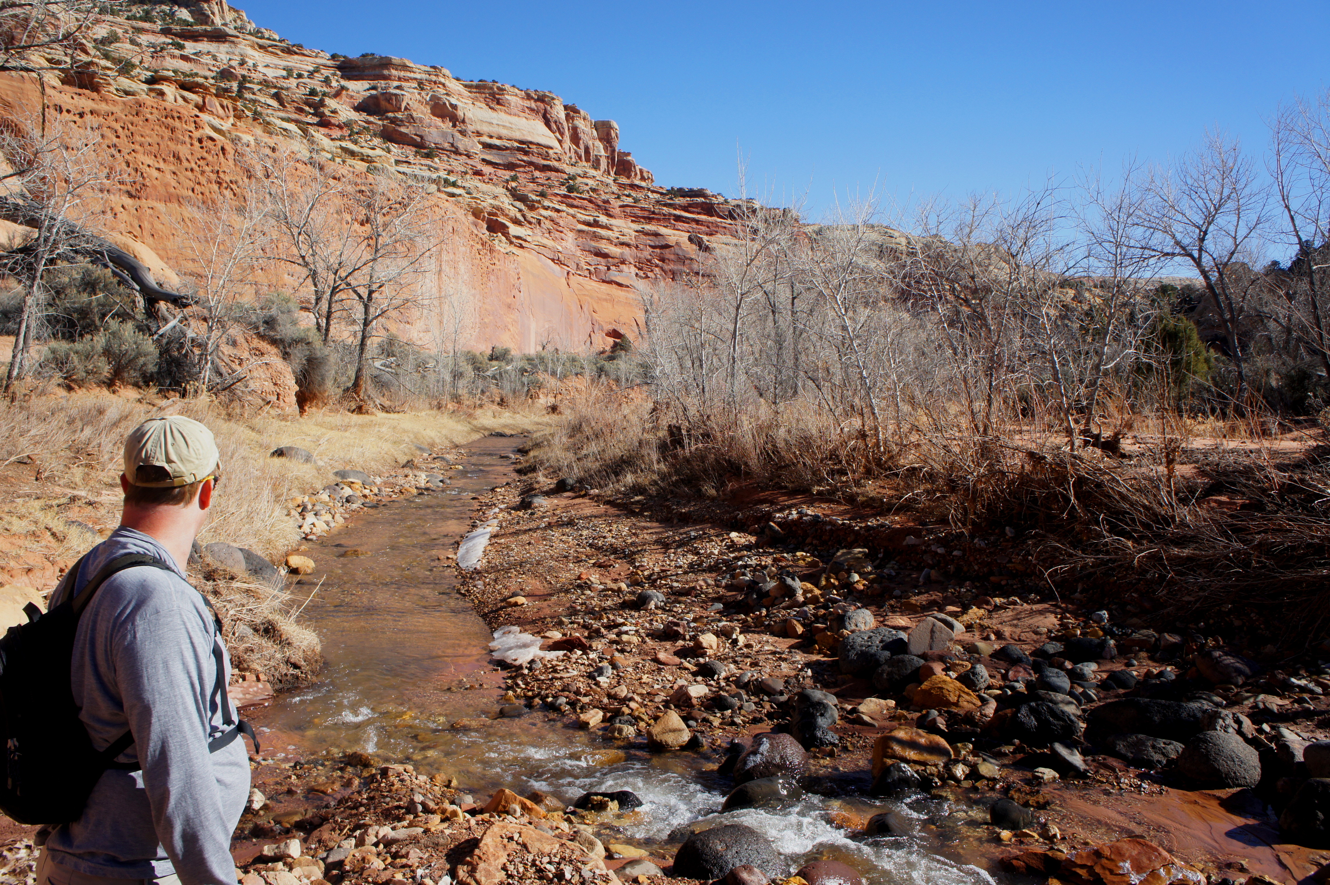
One unavoidable obstacle is the creek itself. Rick Stinchfield, author of Capitol Reef National Park: The Complete Hiking and Touring Guide, counts 16 stream crossings in all, from the trailhead to the park boundary. When I visited in February 2015, I counted 19. Whatever the number (as there is often more than one east-bound trail, it’s likely to vary widely), it’s normally possible to avoid getting your feet wet with some rock-hopping and careful balance—just when you think it’s not possible, a line of conveniently-placed boulders saves the day. (Though on hot summer days, it might be more enjoyable to trudge through the creek itself.)
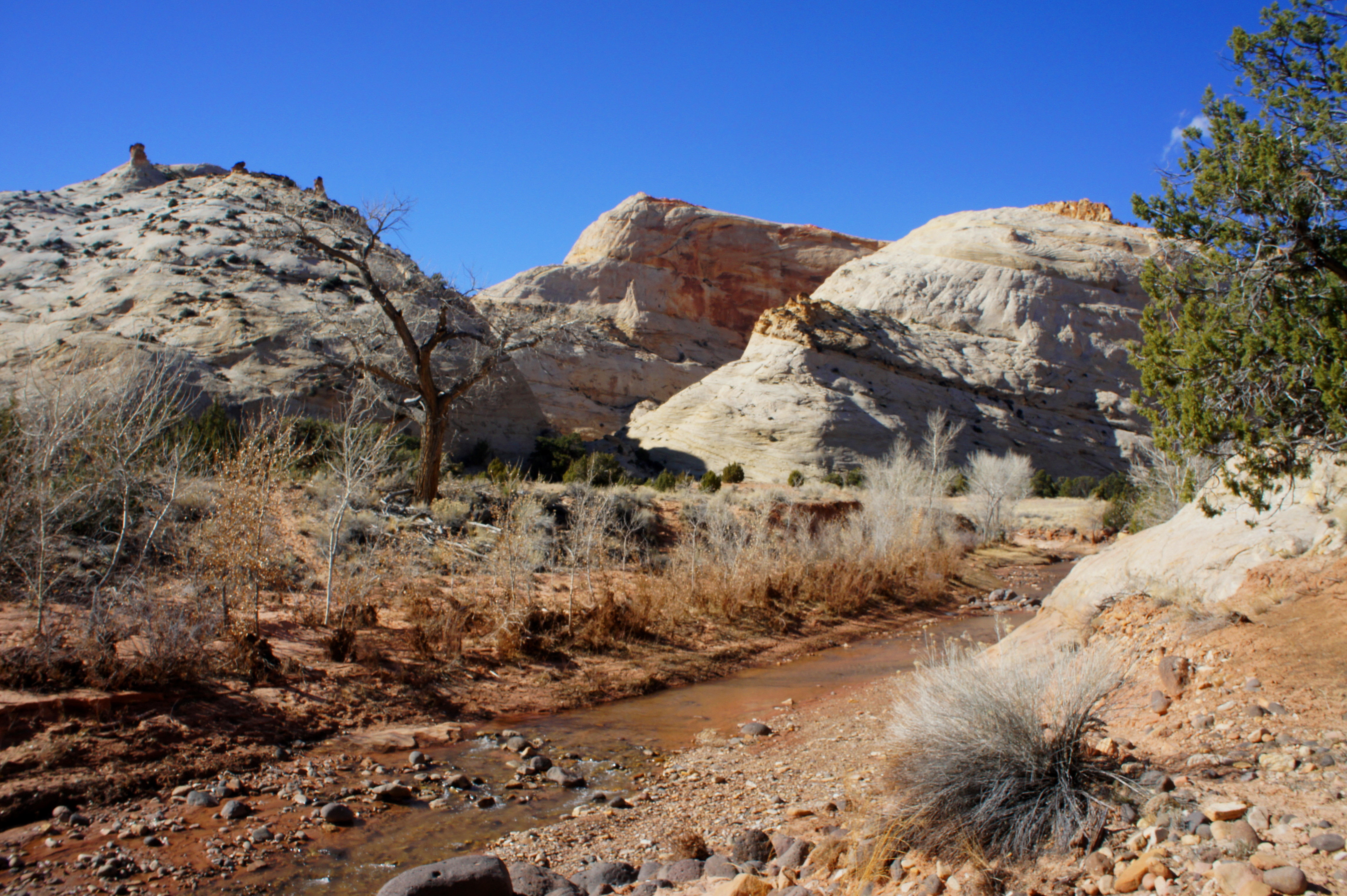
Following a trail along the north bank of the creek, it is possible to delay the first creek crossing as far as 1/2-3/4 mile down-canyon. The gorge in this section is peculiar in that its northern and southern walls don’t match: the cliffs on the left are composed of red-to-yellow Wingate sandstone, while those on the right are several million years younger, mostly cream-to-brown colored Navajo sandstone. Wedged in between is the ledgey Kayenta formation, which sits atop the Wingate but below the Navajo. This layer is visible downstream.

Beyond the first ford, creek crossings become increasingly frequent as the canyon bends and gradually narrows. Past the 1 ½-mile mark, the Wingate and Kayenta mostly disappear, replaced by the whitish domes of the Navajo. A number of side canyons enter on the left and right, feeding into a main drainage that constricts considerably around the 2-mile mark. Though Pleasant Creek Canyon never tightens to the extent of the Zion Narrows or Capitol Reef’s Grand Wash, it is just narrow enough to force hikers to crisscross the creek to avoid dead-ending at precipitous, 300- to 600-foot walls.
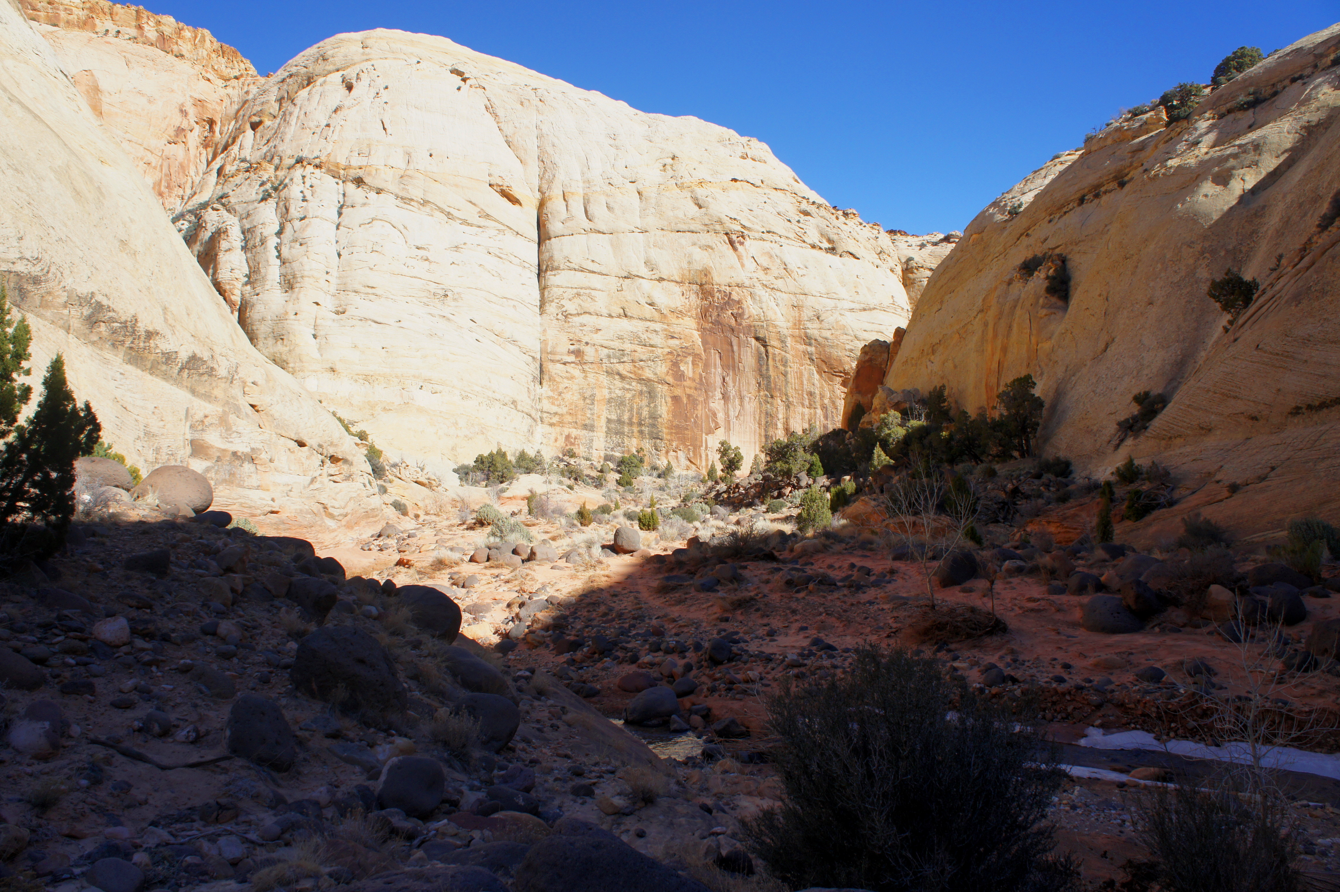
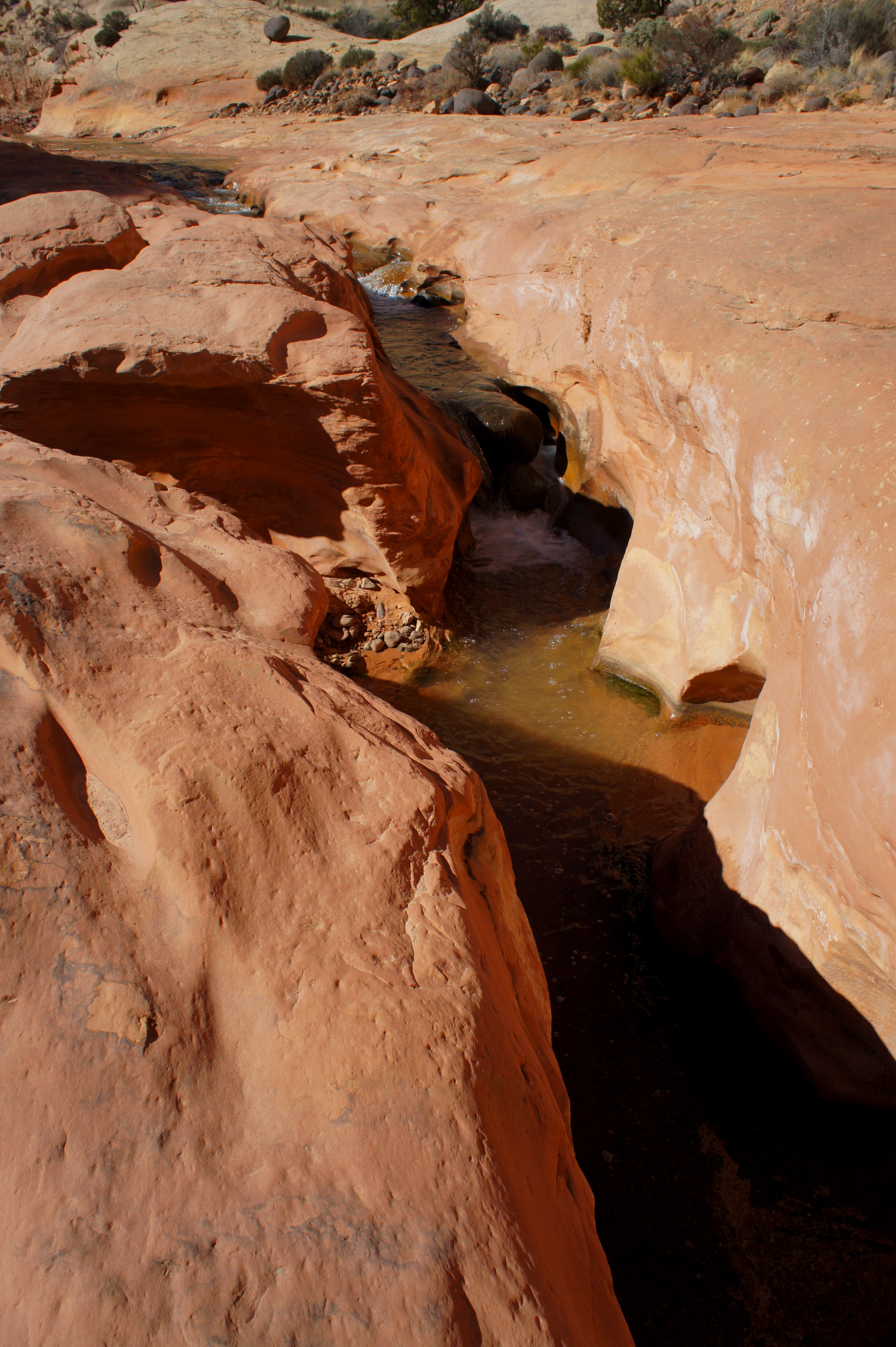
Around 2.25 miles from the trailhead, Pleasant Creek carves a thin channel into the pink-tinted bedrock, forming a handful of small cascades. At 2.7 miles, the narrows end as the cliffs on both sides recede abruptly, revealing a wide open section where pinyon pines, junipers, small grasses, and sand predominate. (This is the starting point for a worthy diversion to a neighboring slot canyon, the subject of my subsequent blog post for Live and Let Hike.)
Beyond the sand flat, hikers will notice a considerable decline in the prominence and steepness of the Navajo sandstone domes. In a number of spots, however, they become arguably more interesting—extensive cross-stratification has sculpted checkered buttes similar in appearance to their more famous counterparts at Zion National Park.

At 3.25 miles, a cairned shortcut route climbs up and over a short gap to bypass a tight meander, affording more of a bird’s eye view of the Pleasant Creek drainage. To the east, the Navajo sandstone is gradually replaced by the Kayenta again, as well as rocks from the late Jurassic-era Carmel formation (here it is an orange-to-bronze color).

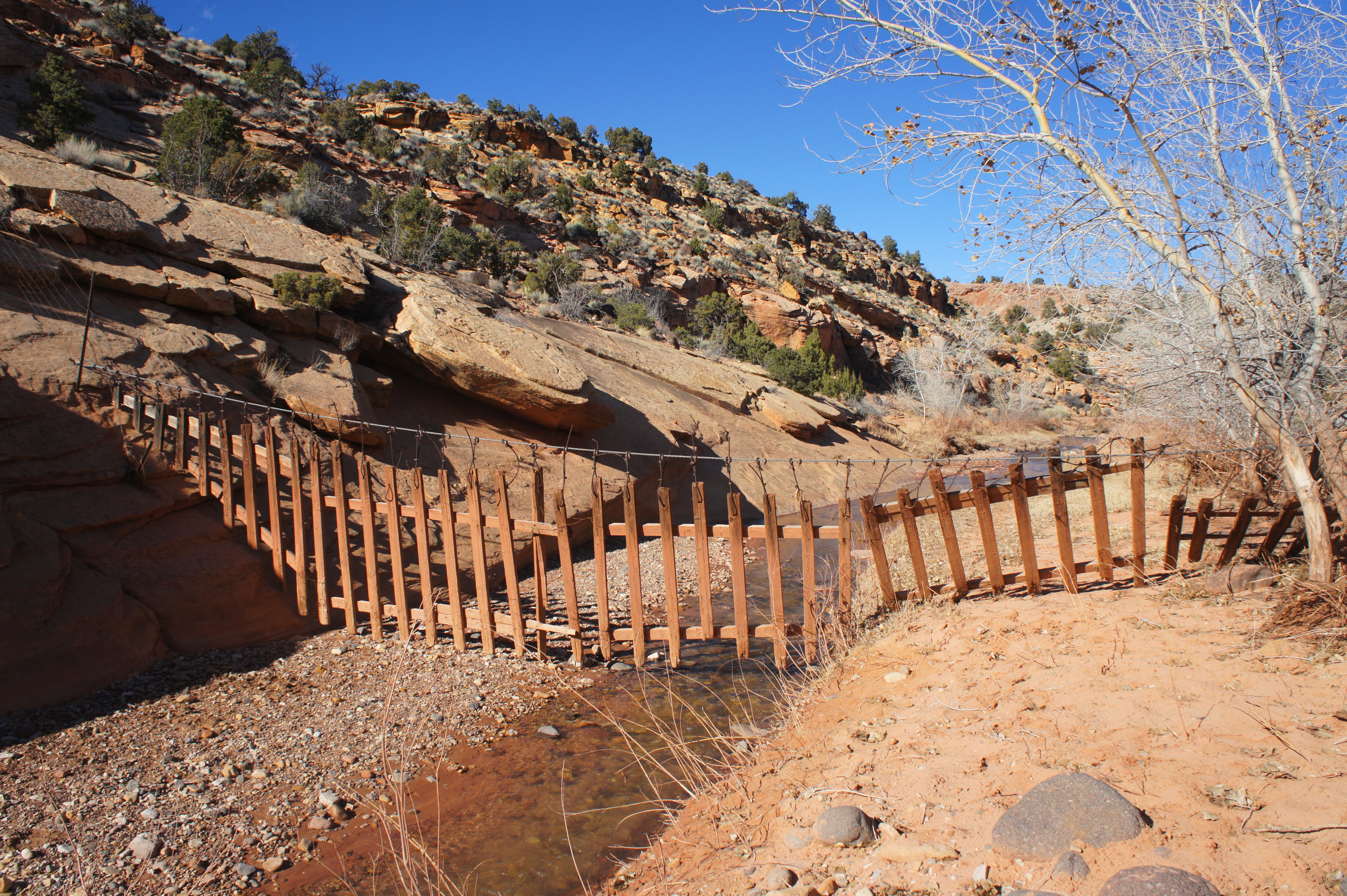
After dropping back to stream level, it’s a short walk (and several wash crossings) to the park boundary, consisting in this area of a wooden fence that dangles over the creek bed. In theory, the trail continues beyond this point to meet up with a 4WD track just outside the park, but it is not at all obvious where one is supposed to go.
From the park boundary, return the way you came. It’s 3.8 miles, 450 feet in elevation gain, and 16-19+ creek-hopping maneuvers back to your car!
Extra credit
At the beginning of the open section at 2.7 miles described above, cross the stream to the south side to spot a use trail that beelines toward an awesome slot canyon. This hidden gem is the subject of a subsequent post. To complete the short but moderately challenging slot, add at least an hour to your total hiking time.


Pingback: Pleasant Creek slot canyon (Capitol Reef National Park, UT) | Live and Let Hike
Pingback: Lower Maidenwater Canyon (North Lake Powell area, UT) | Live and Let Hike
Pingback: Lower Muley Twist Canyon – Upper Section (Capitol Reef National Park, UT) | Live and Let Hike
Pingback: Oak Creek Canyon (Capitol Reef National Park, UT) | Live and Let Hike