

The striated sandstone formation known as “The Wave” attracts flocks of photographers and sightseers to southern Utah each day, and—given its popularity—is now limited by a permit lottery that is next-to-impossible to win. Fortunately, the characteristic undulating Navajo sandstone knobs and ruddy gulches of the Wave/North Coyote Buttes area are relatively ubiquitous across the region, offering other opportunities to witness similar—although perhaps not as iconic—formations up close without need for a day use permit. One such alternative, which has become known as “The New Wave,” is easily accessible from Page, Arizona and is situated just inside the boundary of Glen Canyon National Recreation Area around Glen Canyon Dam. A short, 1.25-mile hike forms a circuit around a clutch of sandstone buttes and spires, culminating with a walk up through a notch between two “Wave”-like knobs for which the hike is named. While generally poorly-advertised outside of a few Internet posts, the New Wave hike is impeccably-marked, lined with stones that guide hikers across the slickrock.
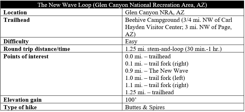
The hike
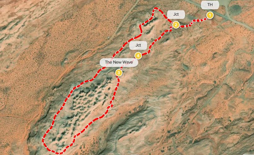
The New Wave Loop (see Google location here) begins and ends at a small dirt parking area just south of the Beehive Campground, a popular but primitive RV destination situated just off Highway 89 (the first left turn west of the Carl Hayden Visitor Center). (Note: There has been discussion of collecting entrance fees at this location, but, as of spring 2021, the status of this project was unclear and may only apply to the campground.) The hike is located within Glen Canyon National Recreation Area, but there are no signs or directions for the trail. Nonetheless, from the parking area, one can easily spot the path leading up into the slickrock to the west. (Note: There is also a dirt road leading south from the parking lot; this is NOT the New Wave hike but rather provides access to the extremely difficult Ropes Trail leading down to Glen Canyon and the Colorado River.)
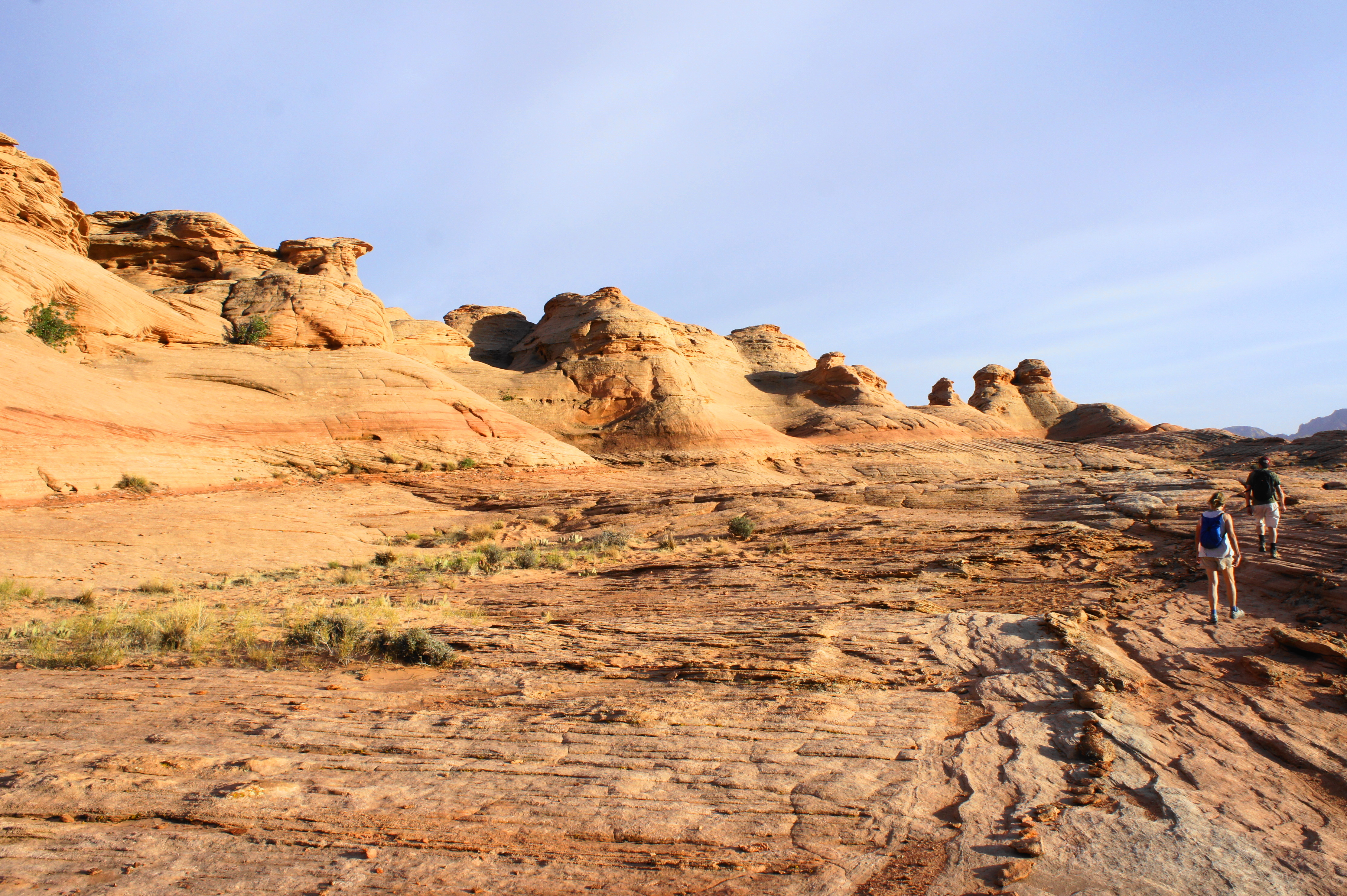
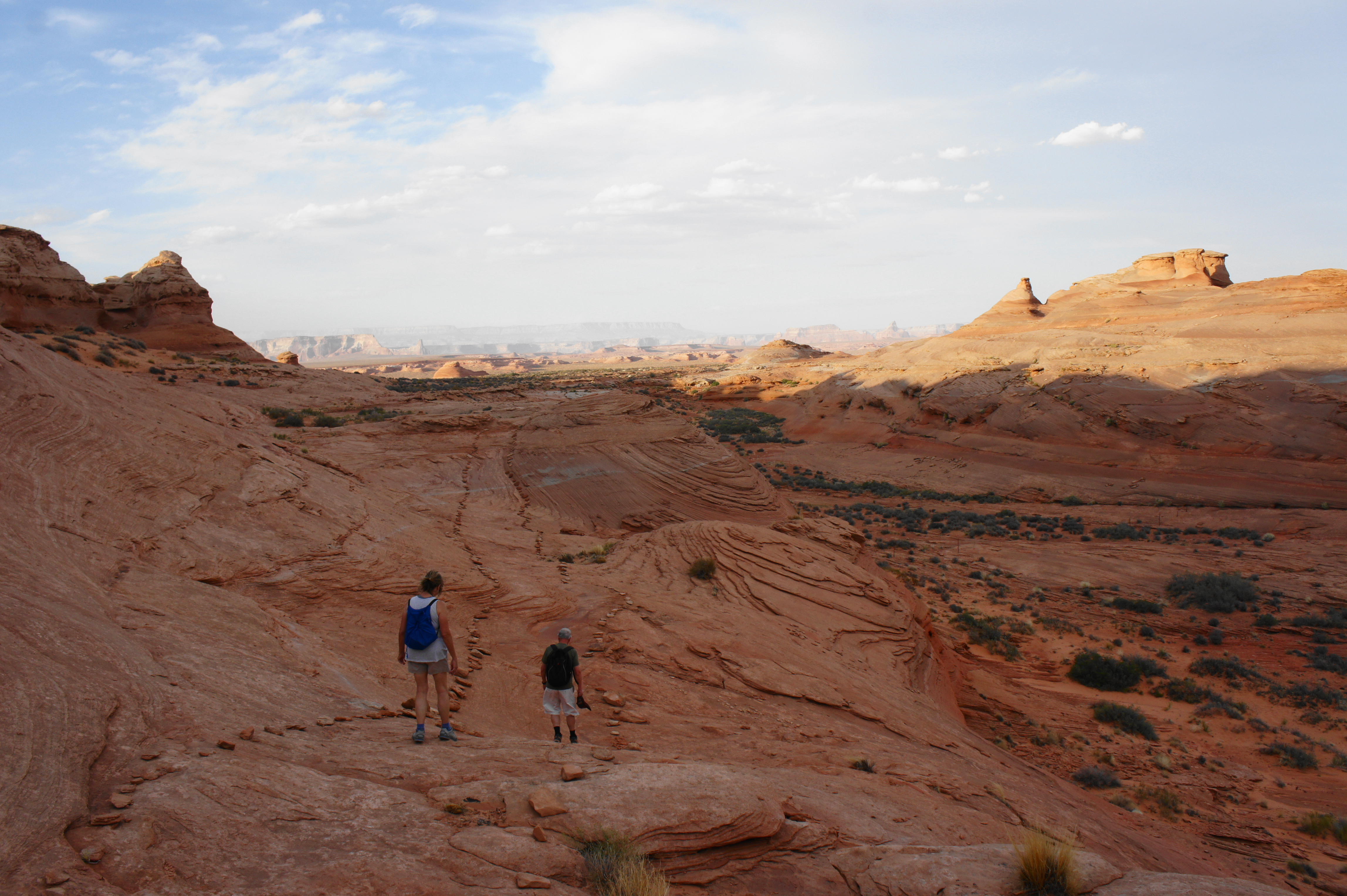
The New Wave Loop is demarcated the entire way by neatly-placed rocks on either side, offering passage across the barren slickrock slopes where footsteps or other markers would be nearly impossible to follow. The path begins by ascending westward and skirting a scrubby drainage on the right, with views back to the north toward Beehive Campground, Wahweap, and Lake Powell.

At 1/10 mile, the route forks, marking the start of the loop portion. While both directions are fine, heading right and completing the hike in a counter-clockwise direction saves the “New Wave” formation for near the end of the walk. Heading in this direction, the path skirts north to clear an initial set of sandstone buttes, striated with nice examples of crossbedding.
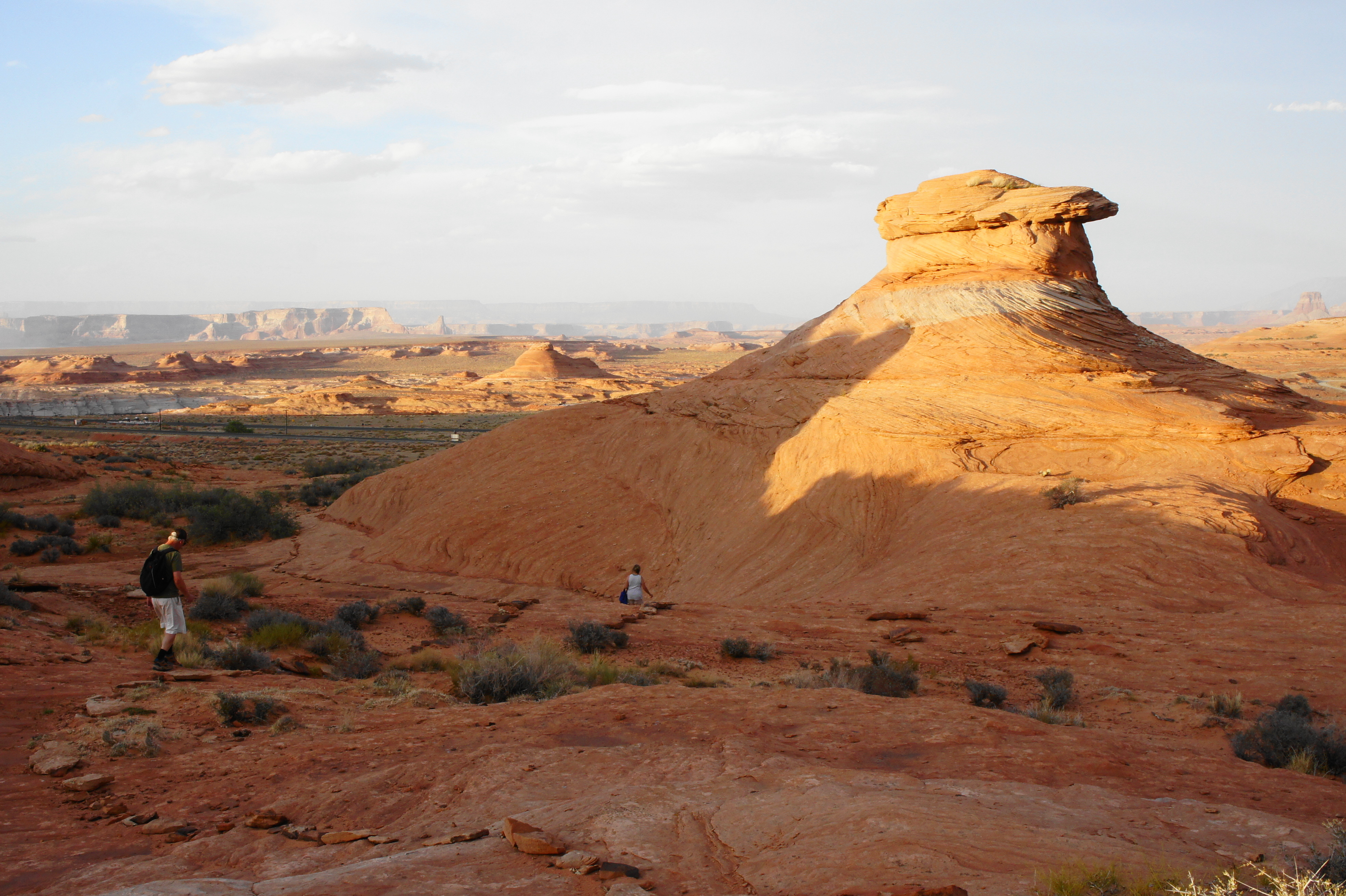
After clearing this initial set of outcrops, the trail descends and then rises again to parallel a second, larger collection of knobs and buttes at around ¼ mile. Here the orange-hued formations peer down over a sweeping valley with a wash that eventually drains into the Colorado River, near Ferry Swale Canyon to the south.
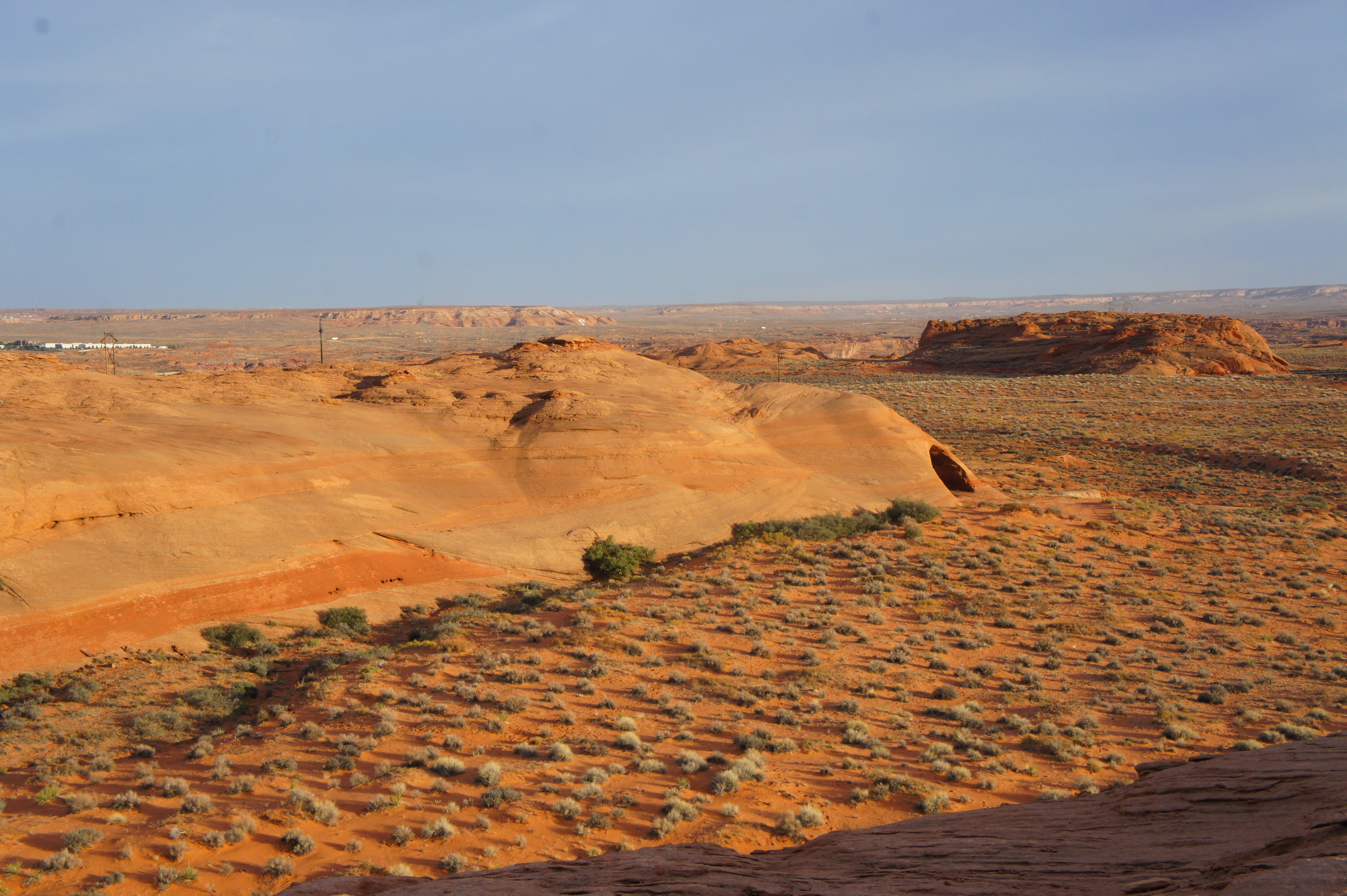
At about 6/10 mile, the route rounds a bend to the west, cutting around the sandstone chunks, revealing another ridge—known as Radio Tower Rock—to the east. From here the path hugs the east flank of the New Wave area outcrops, never descending to the wash floor below.
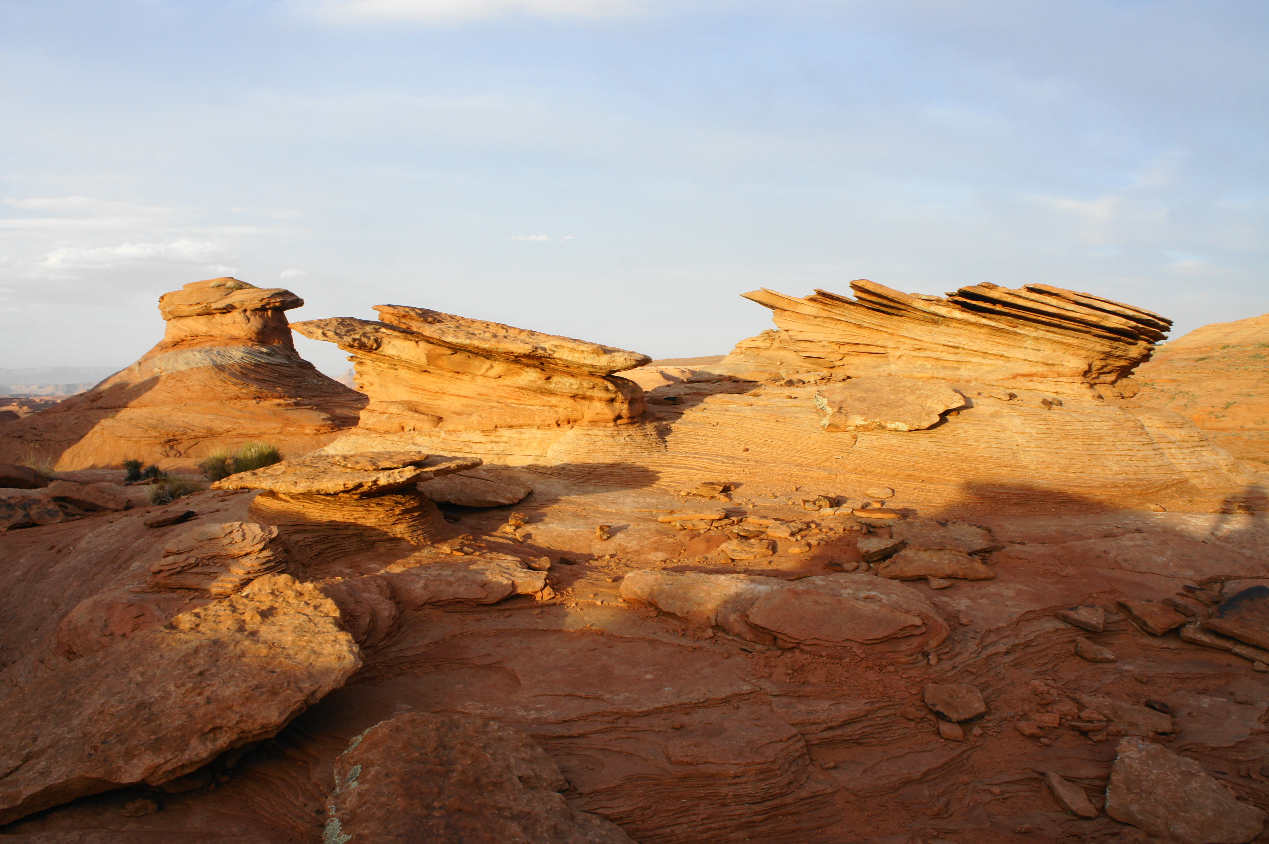
At a point nearly one mile into the hike, the path rises gently to the park’s featured highlight: The New Wave, where deep red and orange colors, streaked with attractive stripes, illuminate the two exposed knobs. Photographers seeking the best light here may want to visit in mid to later afternoon, or perhaps sunrise. At other times, the most attractive streaks are cast partly in shadow, although still beautiful in their own right. This scenic notch is certainly not as impressive as the real Wave, but it’s a not-so-shabby backup.

From The New Wave, the trail drops steadily and encounters a junction at about the one-mile mark. (Note: This spur trail heads right toward Radio Tower Rock.) Stay left on the main track, following photogenic knobs and slickrock slopes back to the initial junction. Head right at the final fork and descend back to the start of the hike, capping off a 1.25-mile journey.

Great article — best I’ve seen about The New Wave yet! Keep up the good work 🙂
Pingback: Top 10 Hikes in 2021 | Live and Let Hike
Very informative! Is it possible to do it independnet or you need a permit? or a guide?
No guide or permit necessary! (Unlike the real “Wave”)
Pingback: Top 10 Hikes in 2022 | Live and Let Hike
Pingback: Plan a memorable trip to beautiful Arizona - The Checklist Travelers
Pingback: Top 10 Hikes in 2023 | Live and Let Hike
Pingback: Top 10 Hikes in 2024 – Live and Let Hike