
Highly weathered and rimmed with chalky hoodoos, natural arches, and tafoni, Wiregrass Canyon is an intriguing side drainage in southern Utah’s Glen Canyon National Recreation Area. The relatively-accessible canyon eventually empties into Glen Canyon and (what’s left of) the reservoir at Lake Powell. Those wishing to shorten the lengthier three miles each way to the waterline, however, can instead opt for a shorter alternative: a 1.6-mile out-and-back to the first of two natural bridges in the canyon, a terrific sight where floods have gradually whittled a hole between two sandy washes in close proximity. This report describes a moderately-difficult round-trip to and from the natural bridge, which should take between 1-2 hours.

The hike
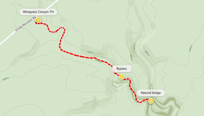
Like many attractions in the area, reaching Wiregrass Canyon requires traversing a gravel road for several miles, although the Smoky Mountain Road leading east from Big Water, Utah is usually well-graded and accessible to two-wheel drive vehicles. (Note: There is one ford required to clear Wahweap Creek, but it should be shallow most of the year. Check at the Big Water Visitor Center for latest conditions.) Once across Wahweap Creek, the road rises to a level plateau below the Mancos shale cliffs of Nipple Bench, itself a branch of broader Smoky Mountain, for which the road is named. After entering Glen Canyon National Recreation Area, the road passes several minor drainages and bends northeast. About 4.5 miles from Big Water, the drive dips to a small parking area on the right, where a sign indicating “Wiregrass Trail” marks the start of the hike.
Park here, and be sure to apply sunscreen/sun protection, as this area is highly exposed with little shade. When ready, follow a narrow but well-trodden path that leads down into a minor drainage on the right, dropping to the wash before continuing partway up the other (south) side. This dry arroyo quickly meets a larger drainage coming in from the left, and the trail eventually drops to wash level. Follow the dry and dusty wash downstream until reaching a short pouroff, relatively easily bypassed via a use trail on the left.
Now heading south, a tributary drainage comes in from the right at around 3/10 mile. Stay left, following the main wash down-canyon, finally reaching some more interesting terrain at about ½ mile. A bathtub-shaped hoodoo on the right is followed by a thin, duck-head turret, which signals the start of a more rugged wash.
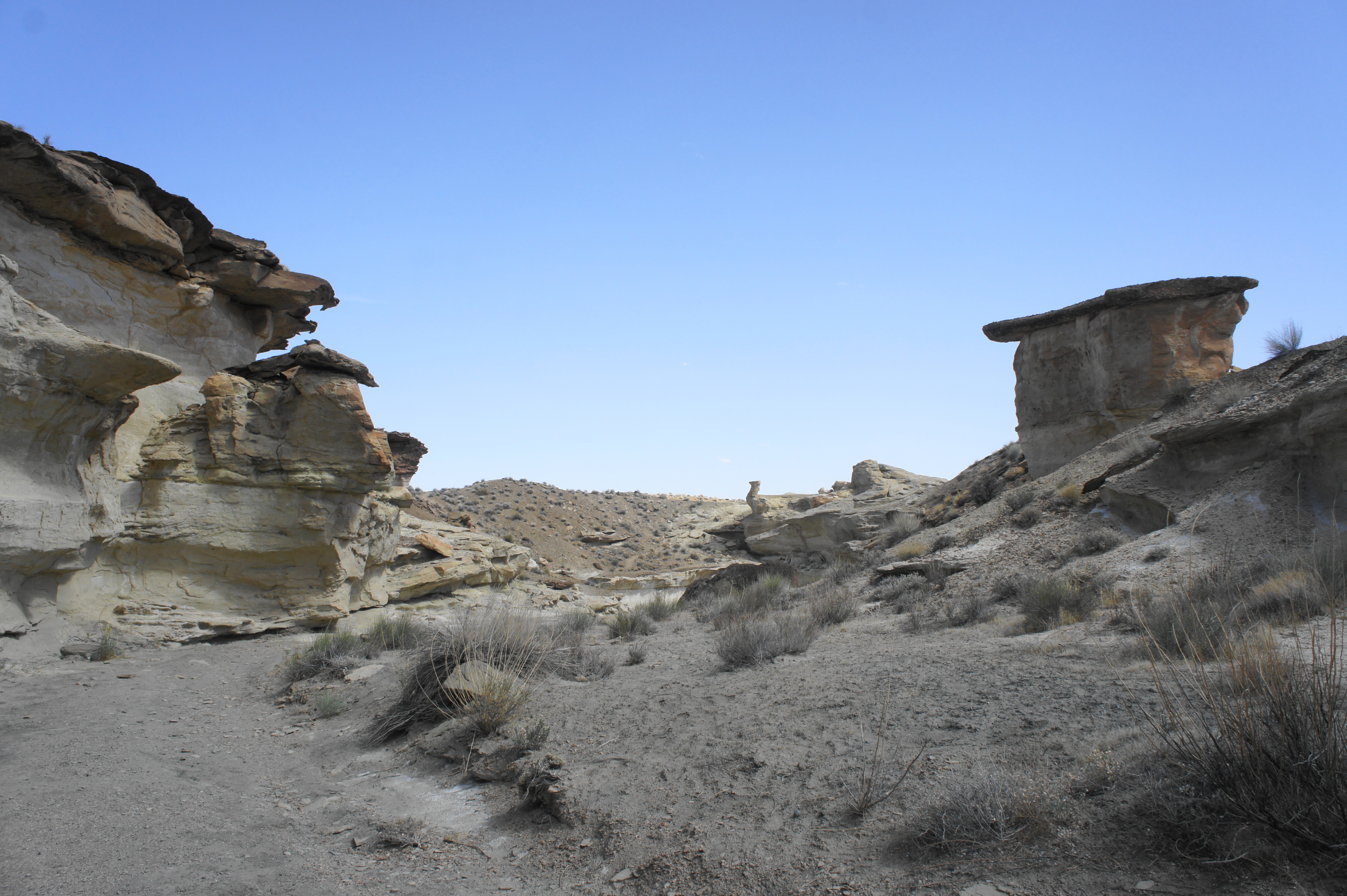
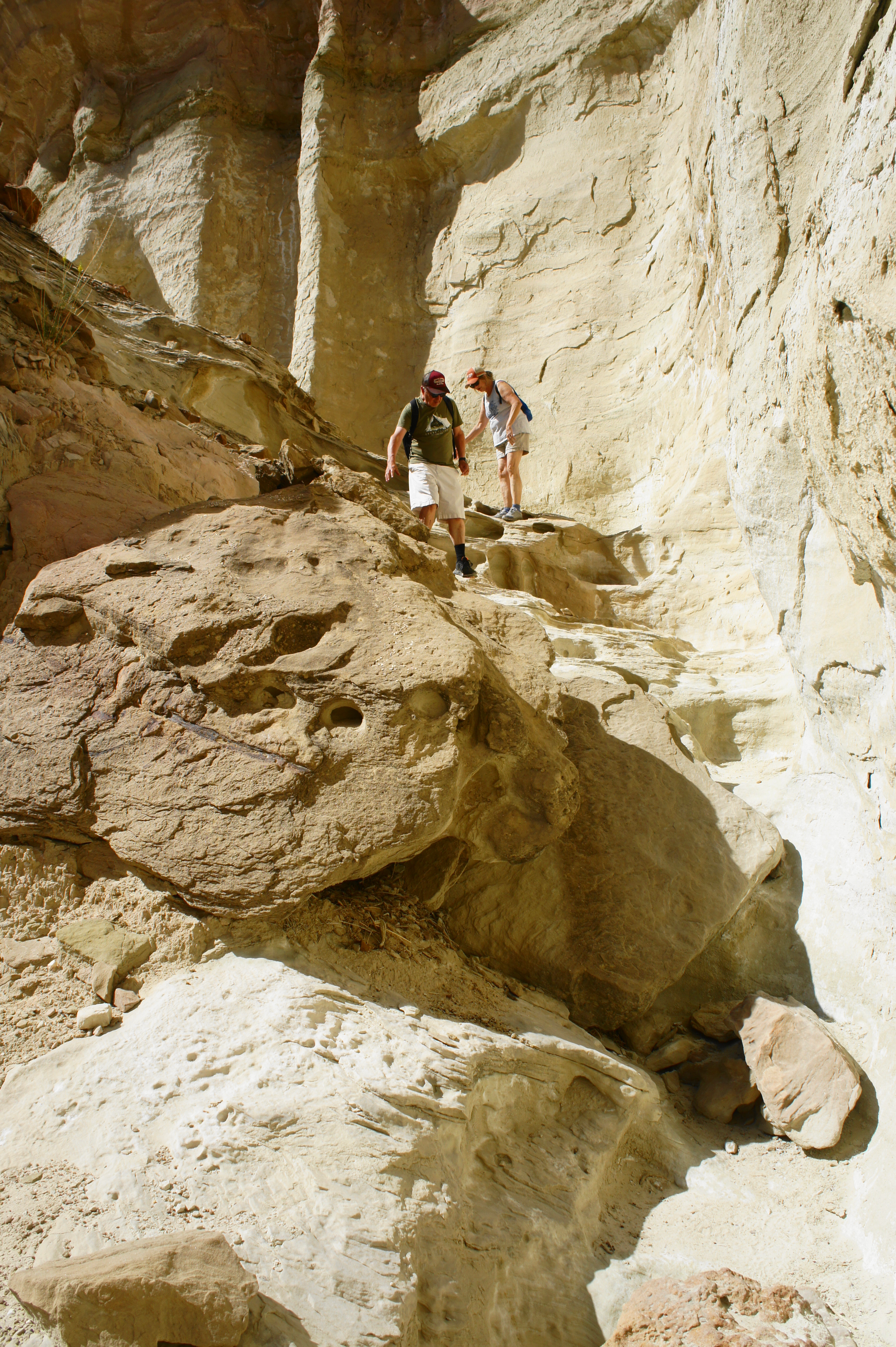
The drainage quickly drops down a series of smooth pouroffs, many of which will be impassable to hikers (but possible for decent down-climbers). Down-canyon travel therefore requires climbing an unmarked but well-trodden bypass route leading up the left bank, climbing steeply to a four-way junction atop a gooseneck ridge. From here, one can head right to reach the duck-shaped spire and peer down into the slot canyon below. But eventually one will head straight, descending sharply back toward the canyon floor. The path leads into a sheltered side drainage, where hikers can relatively easily skirt the walls and drop down a series of minor dryfalls to return to the main wash.

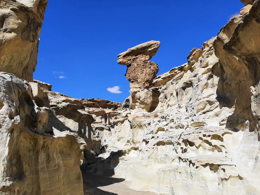
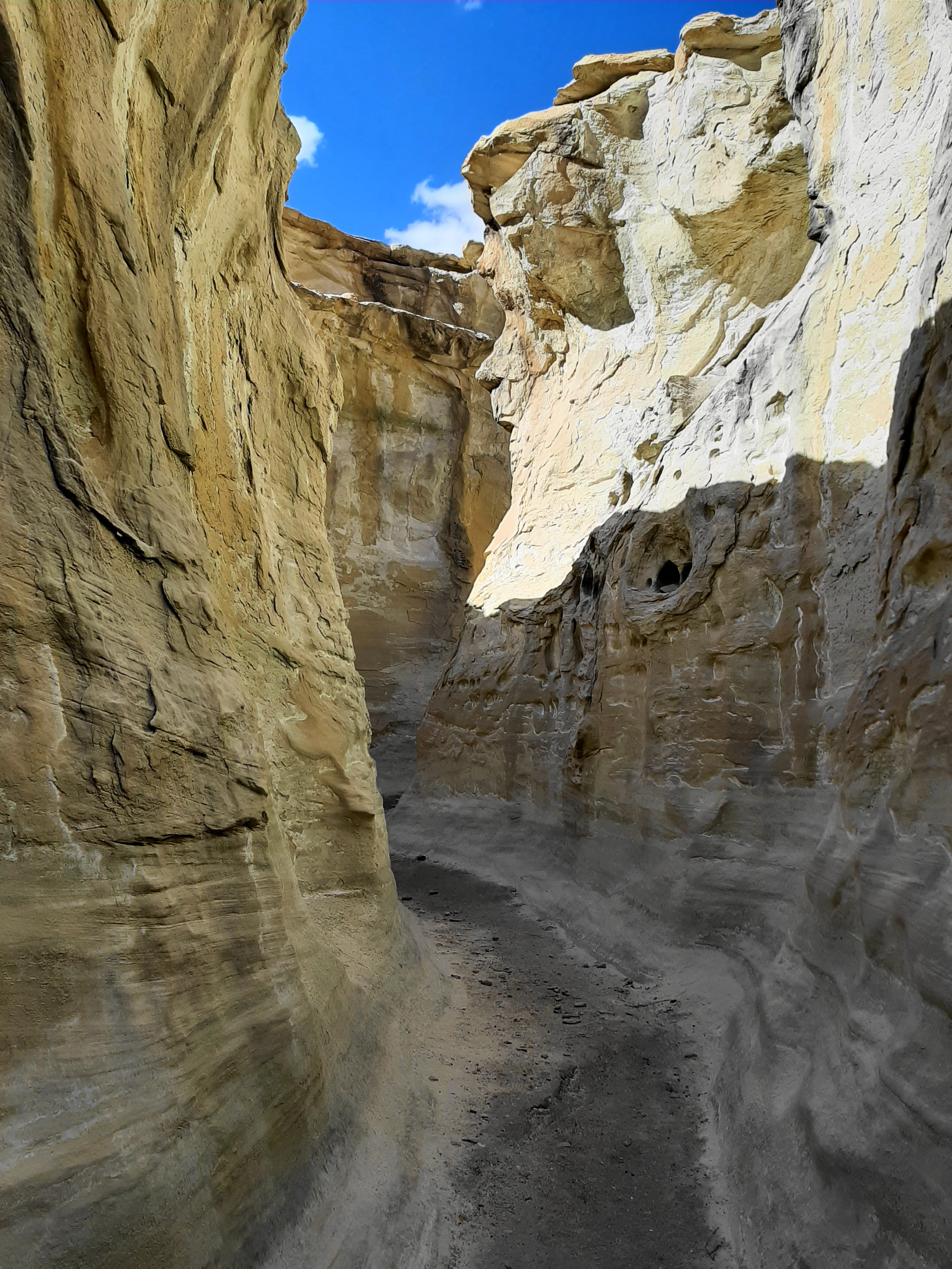
Before continuing down-canyon, first head right for a brief moment to explore the narrows/slot section. This is the finest scenery of the hike, featuring tall hoodoos, narrow and shady passages, and honeycombed walls. Follow the wash until reaching a high pouroff that is at least ten feet tall and difficult to ascend. Turn around here and continue down-canyon.


Narrows section of Wiregrass Canyon 
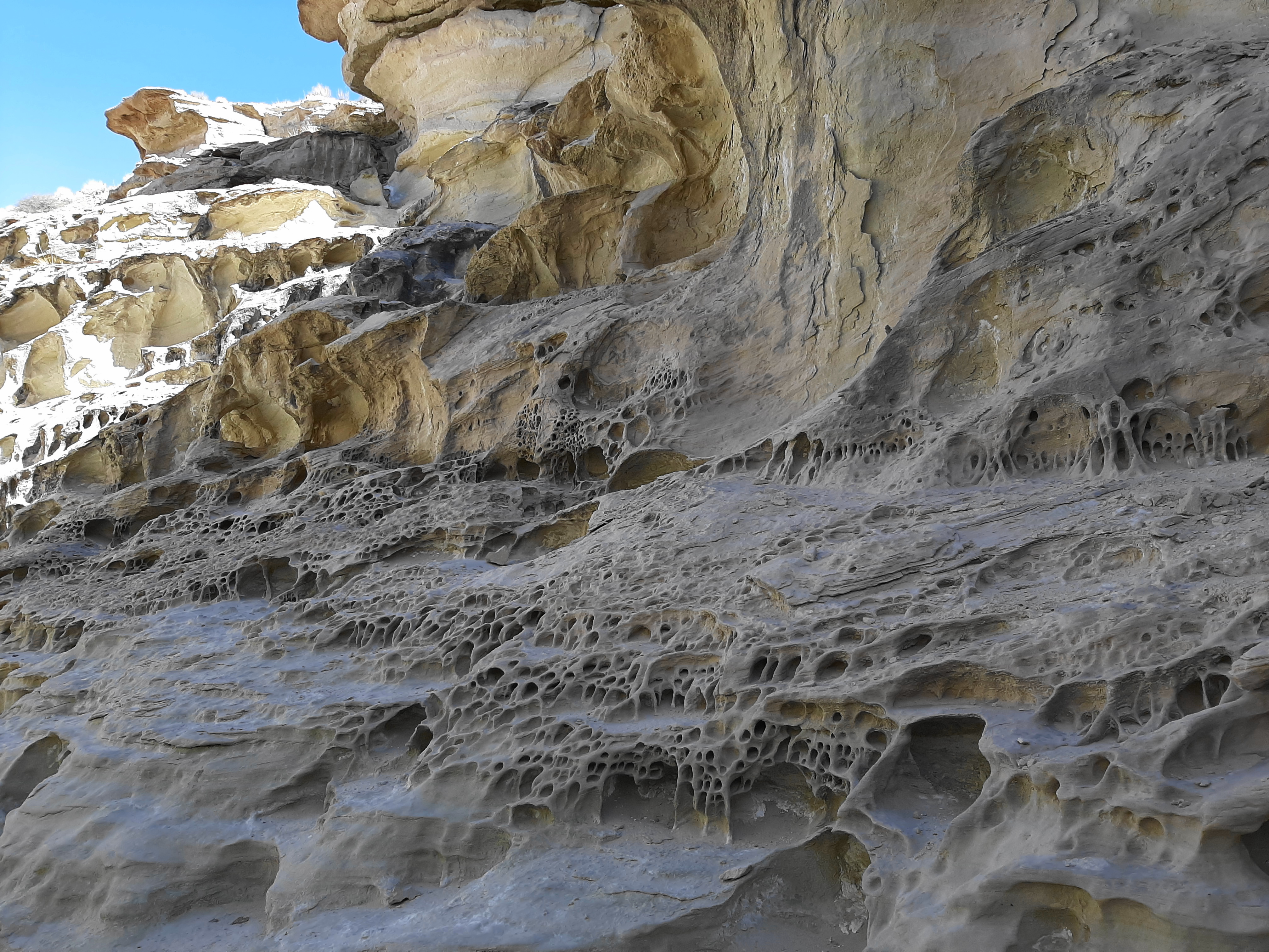
Honeycomb weathering in Wiregrass Canyon
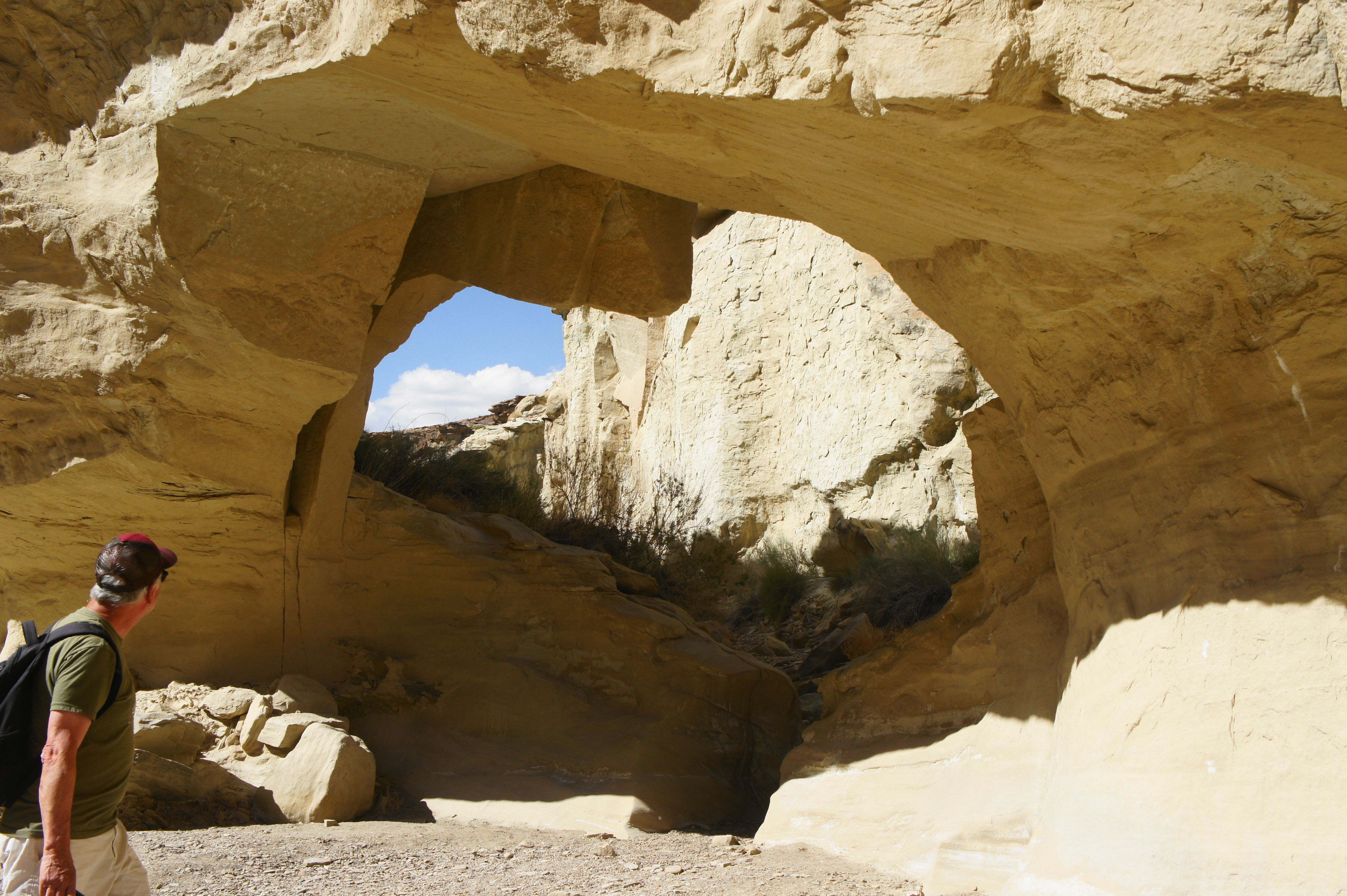
Beyond the end of the bypass route, the canyon deepens, with high, ghostly walls towering above. Amid the deep incisions and spooky landforms, Wiregrass Canyon gradually widens. Finally, all of a sudden, as the wash takes a hard right, the Wiregrass Natural Bridge appears on the left. This small archway was formed when the adjacent drainage (visible through the bridge) whittled away at the canyon wall, producing a shortcut to the wash in which one stands.

From here, hikers can continue for another two miles downstream to reach the shores of Lake Powell, encountering deep alcoves, ever-taller walls, and another natural bridge along the way. But for many, the first bridge is the natural turnaround point. Retrace your steps, up and over the bypass route and through the initial wash, back to the trailhead. All told, this hike takes about 1.5-2 hours depending on pace and comfort with minor scrambling.

Pingback: Top 10 Hikes in 2021 | Live and Let Hike