Nestled in the mountains above the Twin Lakes area in California’s Sierra Nevada lies a wonderland of craggy granite, pristine lakes, and sun-soaked meadows, best explored as part of a multi-day backpacking trip. Here the High Sierra alpine zone separates Yosemite National Park from the much-less travelled Hoover Wilderness in Humboldt-Toiyabe National Forest, combining the pleasures of a well-developed trail system with feelings of relative solitude and wonder. The route featured on Live and Let Hike runs through the best of it, covering a 3-day stem-and-loop with plenty of options for variation. The show-stoppers are the five named lakes along the hike—Barney, Robinson, Crown, Snow, and Peeler—as well as a brief dip into a remote section of Yosemite at Kerrick Meadow. Campsites are abundant, and epic views are interrupted only by peaceful conifer groves or thickets of quaking aspens.
The below description assumes three full days of hiking, with two nights at Crown Lake (the second day is a day-hike loop). (Note: Components of the hike may also be completed as a day hike from the Robinson Creek Trailhead: Barney Lake is a popular destination, while adventurous hikers could make it to Crown Lake or Peeler Lake and back in a long, strenuous day. This area also provides access for the much longer, 50-mile Benson Lake Loop through northern Yosemite.)
Preparation and logistics
As with any backpacking trip, preparation is critical. The first decision to make is when to hike. The Crown/Peeler Lake area is virtually inaccessible to all but the heartiest hikers in wintertime, and dense snowpack generally does not dissipate until at least June. Temperatures drop again in late September, with winter arriving again soon after. So this leaves the June-September window as the best time to hike, although also the most crowded. It is hard to predict when the Sierra’s notorious mosquitoes will be present, so hikers may want to keep an eye on recent trip reports to determine how to avoid this misery-inducing nuisance.
Permits are required for overnight trips in the backcountry of Humboldt-Toiyabe National Forest, where this hike starts and ends. In peak season (June-September), trailhead quotas are in effect, requiring an advance reservation. Fortunately, the Forest Service makes reserving a spot relatively quick and painless online at Recreation.gov. Book an entry date for the Robinson Creek Trailhead, the primary gateway into the Crown/Peeler Lake area. (Note: This is one of more popular trailheads in the area, so booking several weeks ahead—or for a mid-week start date—is recommended.) Permits can also be obtained in person at the Bridgeport Ranger District Office in Bridgeport, California (Google map here).
Once permits are in hand, some more detailed trip planning is required. How long will you spend? Where will you camp? For the best experience, at least three days are suggested—one day in, one day out, with one day of day hiking/rest. I also highly recommend spending the night before the hike somewhere at high elevation in order to acclimate to the altitude. (Note: For travelers coming from Sacramento or the San Francisco Bay Area, I suggest dispersed camping along State Route 108 in the vicinity of Sonora Pass—which is on the way to the Twin Lakes area.) Be prepared to pack in everything you need, as there are no services of any sort beyond the trailhead. In summer, definitely pack a rain jacket and plenty of warm/dry clothes, as afternoon thunderstorms are a near-daily occurrence.
The hike
On the day of your hiking permit, head to the trailhead by following Twin Lakes Road for 13.5 miles from the small tourist town of Bridgeport, California. The namesake pair of lakes is stunning in its own right and is a favorite destination for fishing enthusiasts. As the paved entry road skirts the north flank of Twin Lakes, the towering peaks close in, with Sawmill Ridge and Robinson Peak (10,793’) to the north and the Sierra Crest and Sawtooth Ridge visible to the south. The Twin Lakes area is classic Sierras, with craggy peaks and massive granite formations, inviting backpackers to explore.
The low point of the otherwise fantastic hike is undoubtedly the logistical hurdle of arranging multi-day parking and finding the trailhead. The hike begins and ends at the Mono Village Resort, situated at the western end of Twin Lakes, which is a sprawling RV camping and vacation destination. The number of summer travelers at the resort is preposterously large, with densely-packed RVs, blaring music, a bevy of campfires, and endless car traffic marring an otherwise beautiful destination. Some people like this—a Disneyland complete with a café, general store, dozens of motels/cabins, and evening entertainment—but it is a far cry from the backpacker’s ideal that awaits. The result is a curious mélange of flag-toting, beer-swilling mobile-home dwellers with the minimalist, Patagonia-toting overnight backpackers on a quest for solitude in the High Sierras.
To park at the site, hikers need to pay ($10/day) at the entrance to the resort, a steep price that almost certainly exceeds the cost of the backpacking permit. Backpackers’ parking is in the open, dusty lot along the banks of the lake, near the boating docks. Finding the Robinson Creek Trailhead and start of the Barney Lake Trail, the entry route for the Crown/Peeler Lake Loop, is challenging. To do so, follow the entry road into Mono Village Resort, passing the entrance station, then head straight—through the noisy campground—on the road that passes between trees with yellow blazes. Follow this track to its end, by which time a break in the trees—a pretty green meadow—appears ahead; stay to the right of this meadow, eventually finding another dirt track, roped off for “authorized vehicles only,” that continues beyond the campground. This route leads to overflow parking for the resort. After hugging the edge of the meadow for perhaps ¼ mile, a small wooden sign on the right indicates the start of the Barney Lake Trail. This is the Robinson Creek Trailhead.
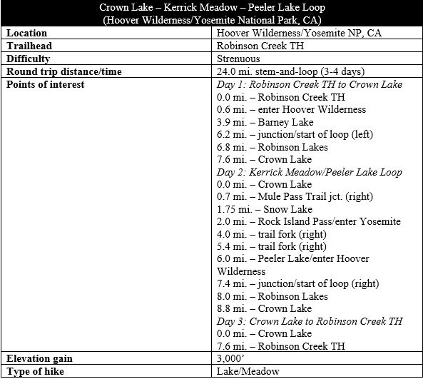
DAY 1: Robinson Creek Trailhead to Crown Lake (7.6 mi. one-way)

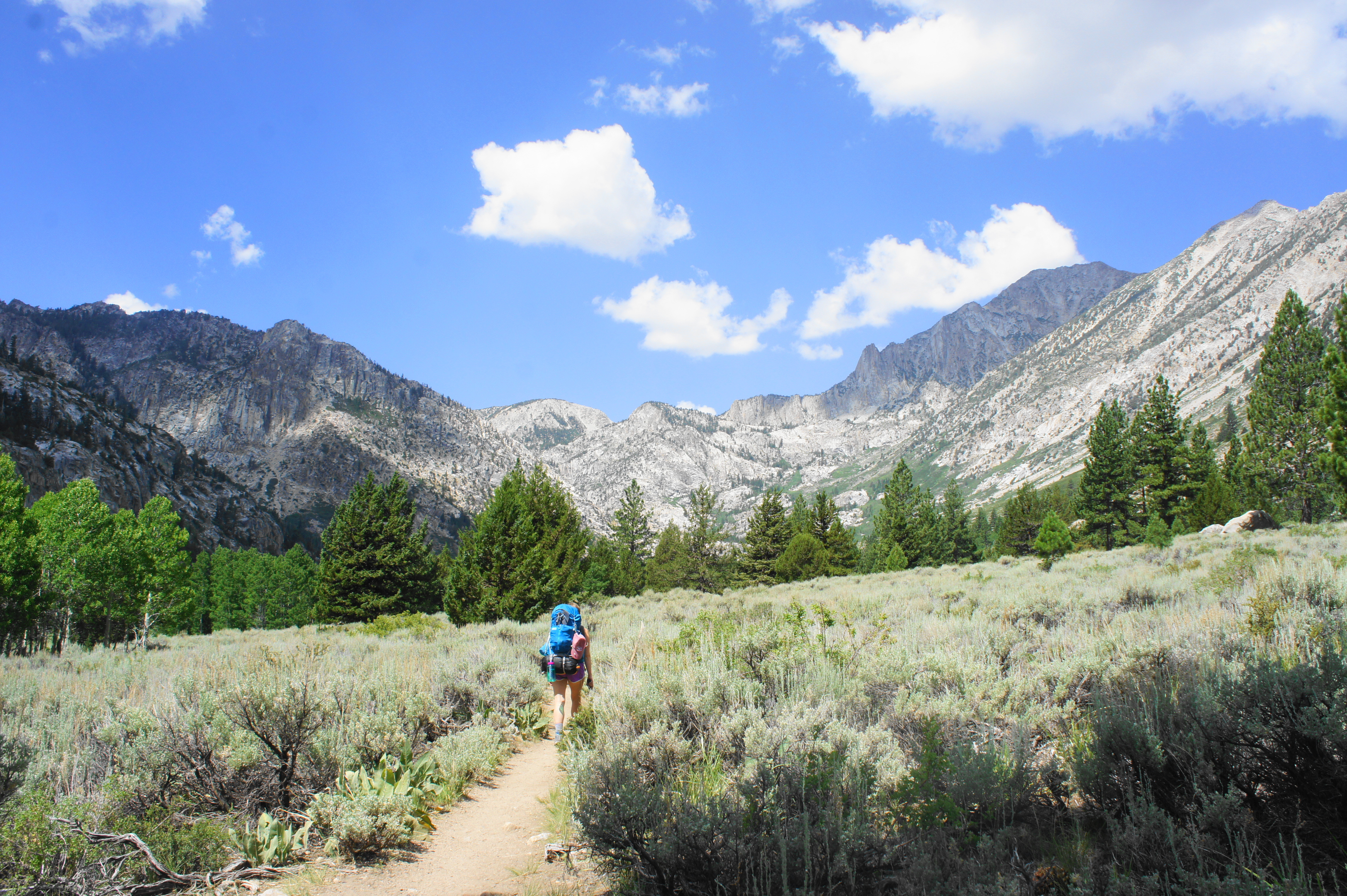
Day 1 of the three-day hike gets hikers up and out of the Robinson Creek drainage—passing terrific meadows and rock outcrops that are only a mere teaser for the beauty to come—and ends at stunning Crown Lake, arguably the most spectacular of the many alpine lakes encountered on the three-day trip. Along the way, hikers cover the entire length of what many visitors do as a day hike: an out-and-back to Barney Lake, a spectacular sight in its own right but that is often crowded. Beyond Barney, the crowds thin and the trail climbs steadily up to a trail junction and high-elevation shelf where Robinson Lakes and Crown Lake reside. All told, this day requires about 7 ½ miles of hiking and nearly 2,500 feet in elevation gain—the hardest day of the hike.
From the start, the Barney Lake Trail begins mildly, bearing north and then west through a dense and shaded conifer forest. The first granite outcrop comes into view on the right after about 250 yards, and a large information board minutes later offers a map and details about the area. After a half-mile—still with relatively little elevation gain—the Barney Lake Trail officially enters the Hoover Wilderness, which spans 128,000 acres and two national forest jurisdictions (Humboldt-Toiyabe and Inyo National Forests).

A few minutes later, the trail crosses a minor tributary of Robinson Creek, offering hikers a choice: a shortcut across the wet stream or a longer but drier workaround that bends off to the right. Both routes meet up again quickly, and the Barney Lake Trail continues onward. At 9/10 mile, the trail passes through a grove of lovely aspens, and then the landscape opens up for the first time as hikers enter the first of several scrubby meadows. However, a better show-stopper lies just ahead (at about 1.1 miles), when the trees give way to epic, unobstructed views of the glacial valley and granite-studded peaks of the Sierra Crest to the west.
Eventually it is back into the trees again, with conifers interrupted occasionally by quaking aspens. At about 1.6 miles, hikers come level with Little Slide Canyon off to the left. This rugged offshoot boasts a towering mass dubbed the “Incredible Hulk,” a popular destination for skilled rock climbers. (Note: Above Little Slide Canyon are two remote lakes—Maltby and Ice Lakes—and it is possible to use Little Slide as an alternative route up to/down from Mule Pass and Crown Lake. The climb is rugged and brutal, however, and route finding is difficult around the two lakes, which are flanked by high walls.)

By 2.3 miles, hikers will begin to hear the babbling waters of Robinson Creek off to the left, with a set of small cascades coming into view minutes later. From here, the trail cuts right and begins ascending the first set of switchbacks, climbing out of the woods to mount a granite shelf with fine views back east down the valley. After reentering the brushy canopy, the Barney Lake Trail levels off again, traverses a minor stream and, at about the three-mile mark, comes close to a set of cascades along Robinson Creek on the left. Another steep climb follows the base of a near-vertical granite slab on the right; from here it is a short jaunt to the northern reaches of Barney Lake.
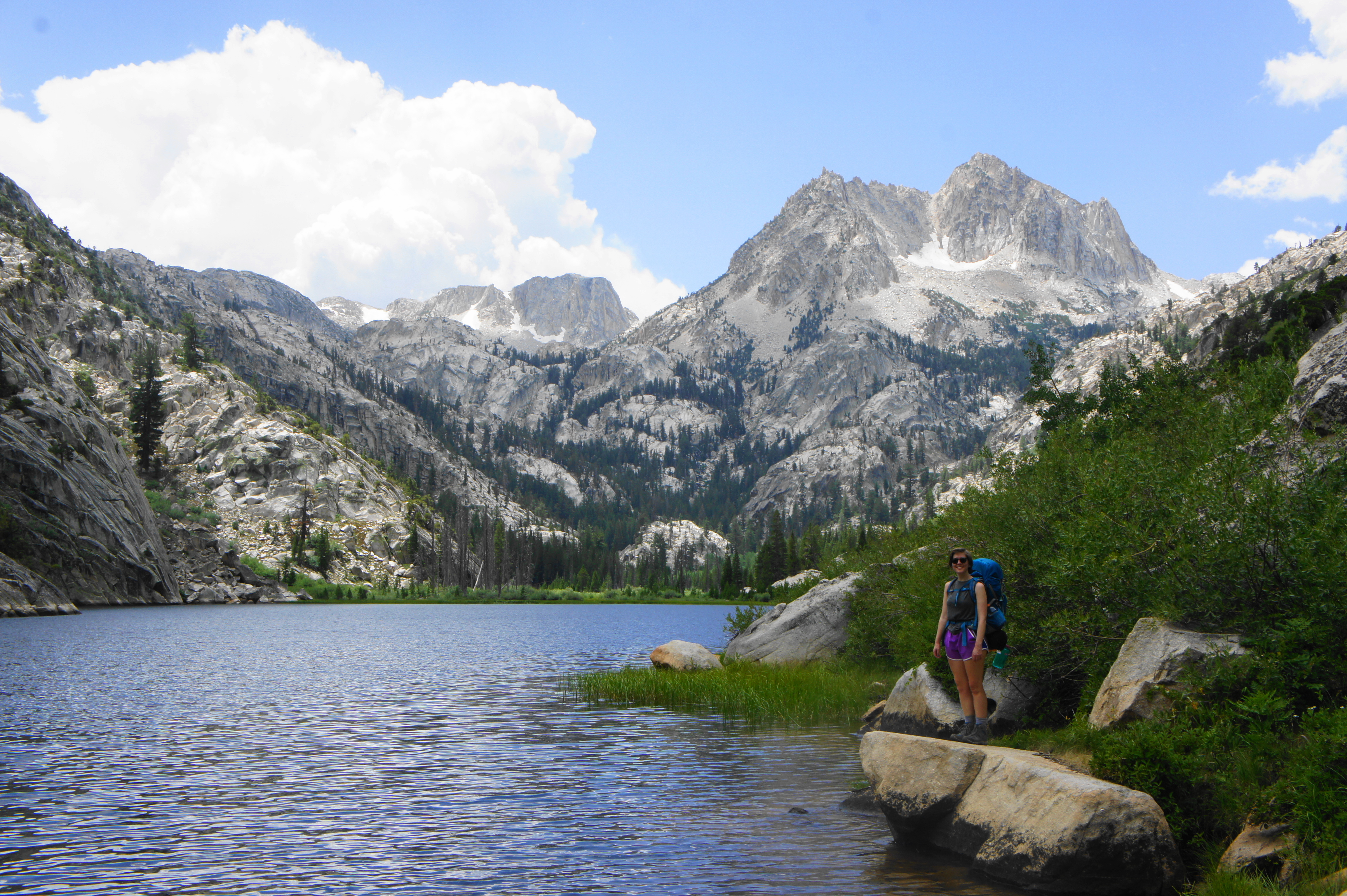
Barney Lake, the first of the five main lakes on the hike, is situated at about 8,250 feet and is a popular destination for day hikers. Flanked by steep slopes to the west and east, the lake also offers the first good views of Crown Point (11,346’) and a ridgetop known to climbers as “The Juggernaut.”

Granite cliffs before Barney Lake 
Afternoon thunderstorm at Barney Lake


There is a sandy beach at the northern end of Barney Lake, with several rocky outcrops along the western flank that offer a fine place to stop for lunch or a snack. (Note: By now, it’s perhaps late morning on Day 1.) Expect to see plenty of crowds on a nice summer day—but the weather can turn fast, with afternoon thunderstorms creeping up almost daily.

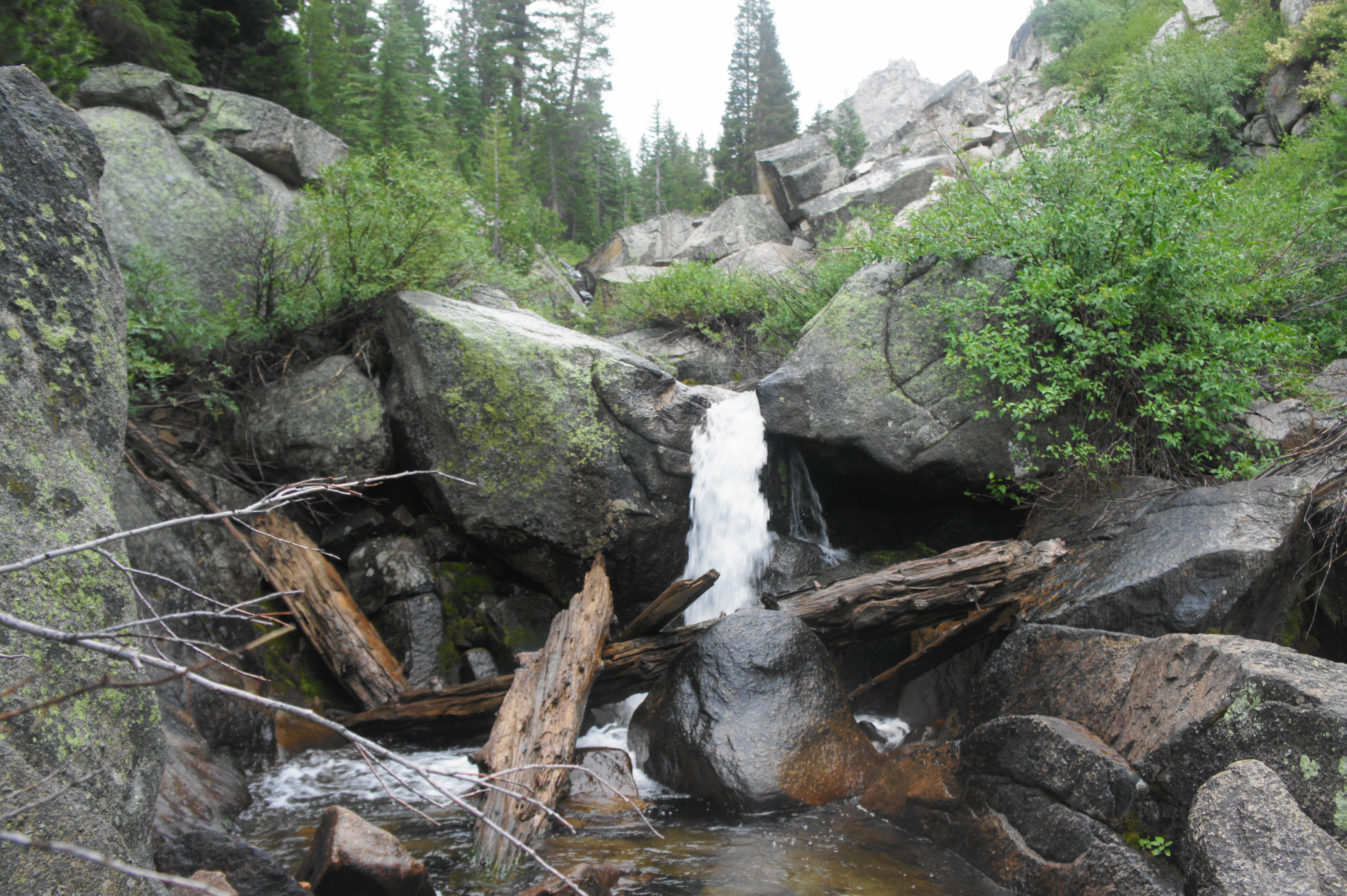
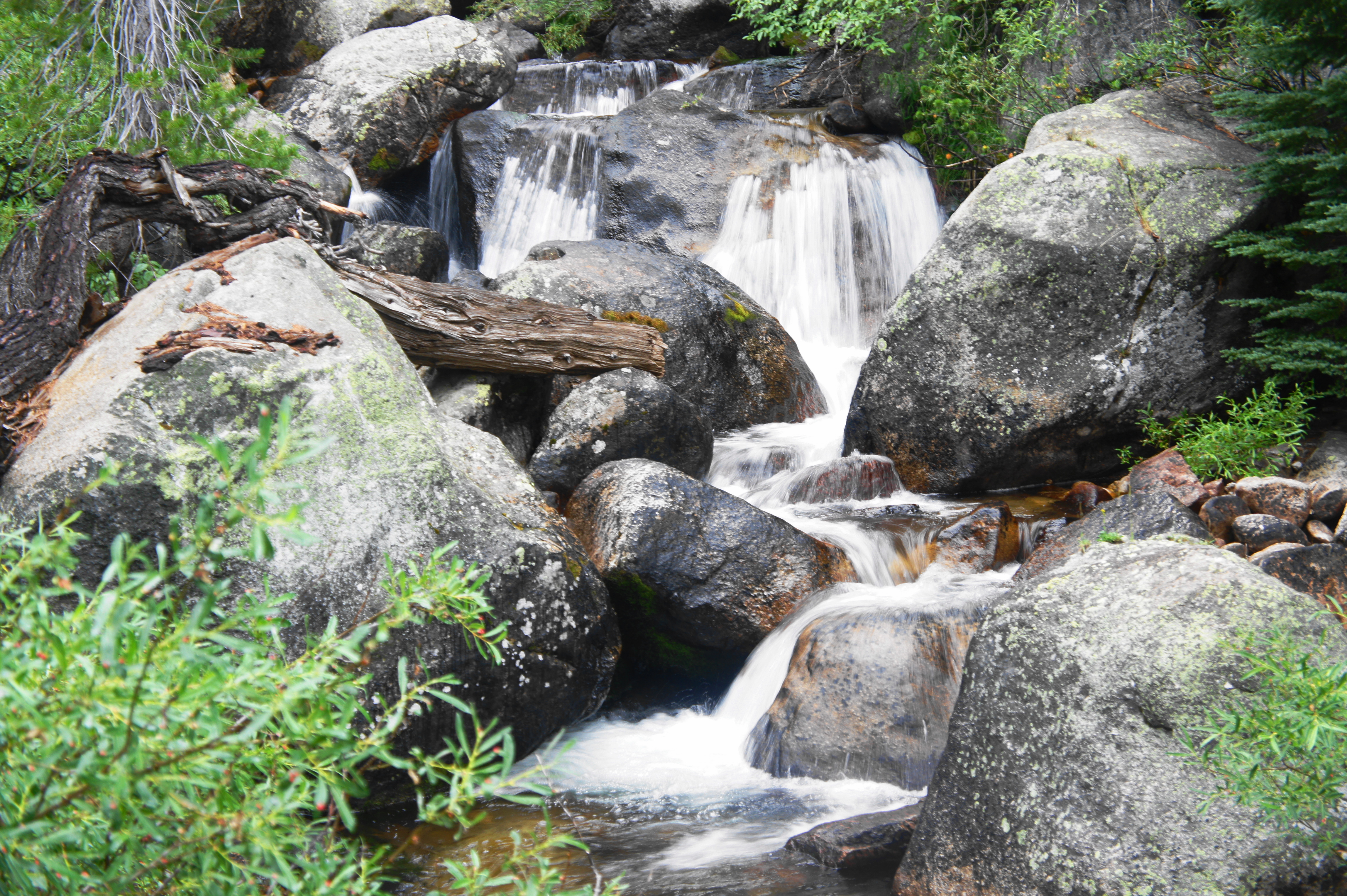
When ready, continue along the Robinson Creek Trail, leaving the day-hiker crowds behind. The next mile is relatively flat and easy, although the path traverses several rocky patches as it follows the western banks of Barney Lake. Beyond the lake, the valley is blanketed by lush green meadows and sporadic pines. At 4.6 miles (about 2/3 mile past the start of Barney Lake), the trail crosses Robinson Creek, where hikers must rock-hop or trudge through the chilly waters to reach the opposite side. Upstream is a beautiful, though small, waterfall, one of the few prominent cascades along the hike.

Small waterfall along Robinson Creek 
Minor cascades
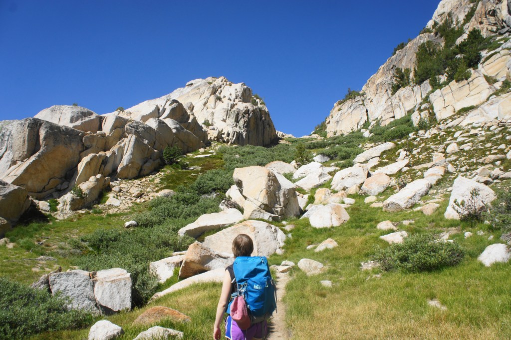
As the vegetation thickens again, plunging the area into day-long shade, the trail follows the east banks of Robinson Creek and then crosses back again to the west side at 4.85 miles. After more than a mile with limited elevation gain, the trail beyond the crossing makes up for lost time: seemingly endless switchbacks lead hikers up into the granite wonderland, ascending about 700 feet in the next half-mile. This brutal stretch is made better by the increasingly picturesque scenery: streaked and cracked granite walls in all directions, plunging down into thickets of conifers, with the Sierra Crest within sight to the south and west.
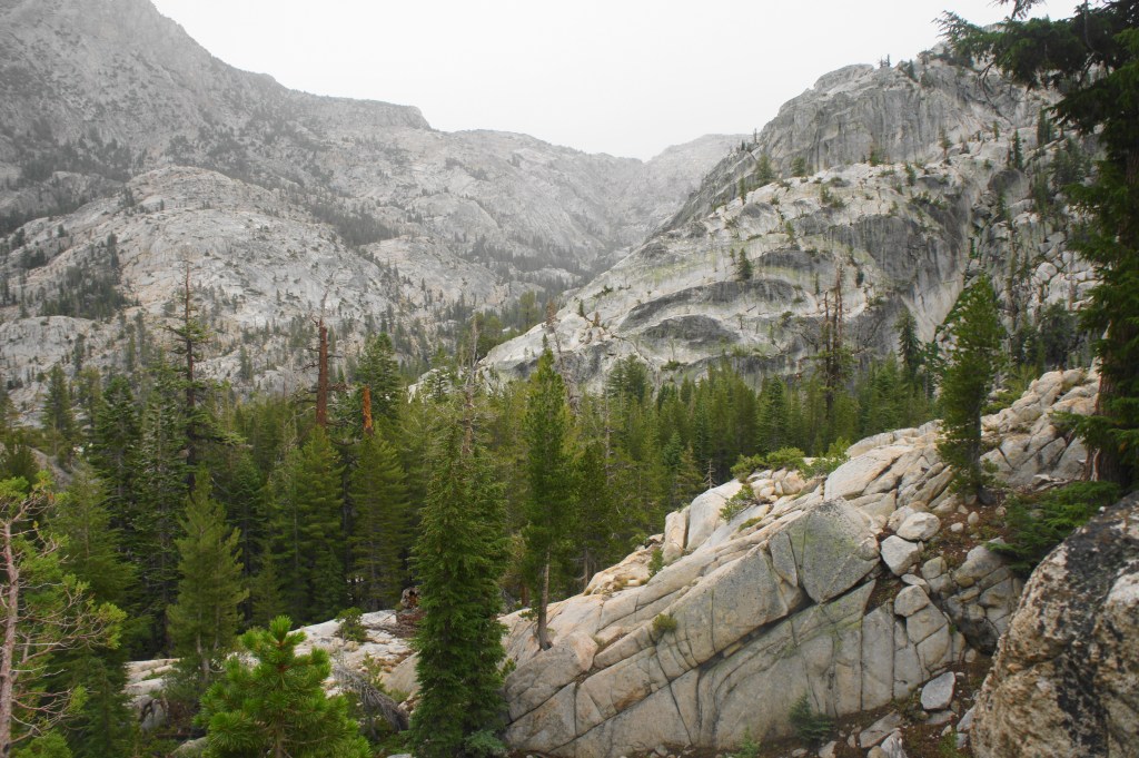
Granite all around as the Robinson Creek Trail ascends the switchbacks 
Narrow notch


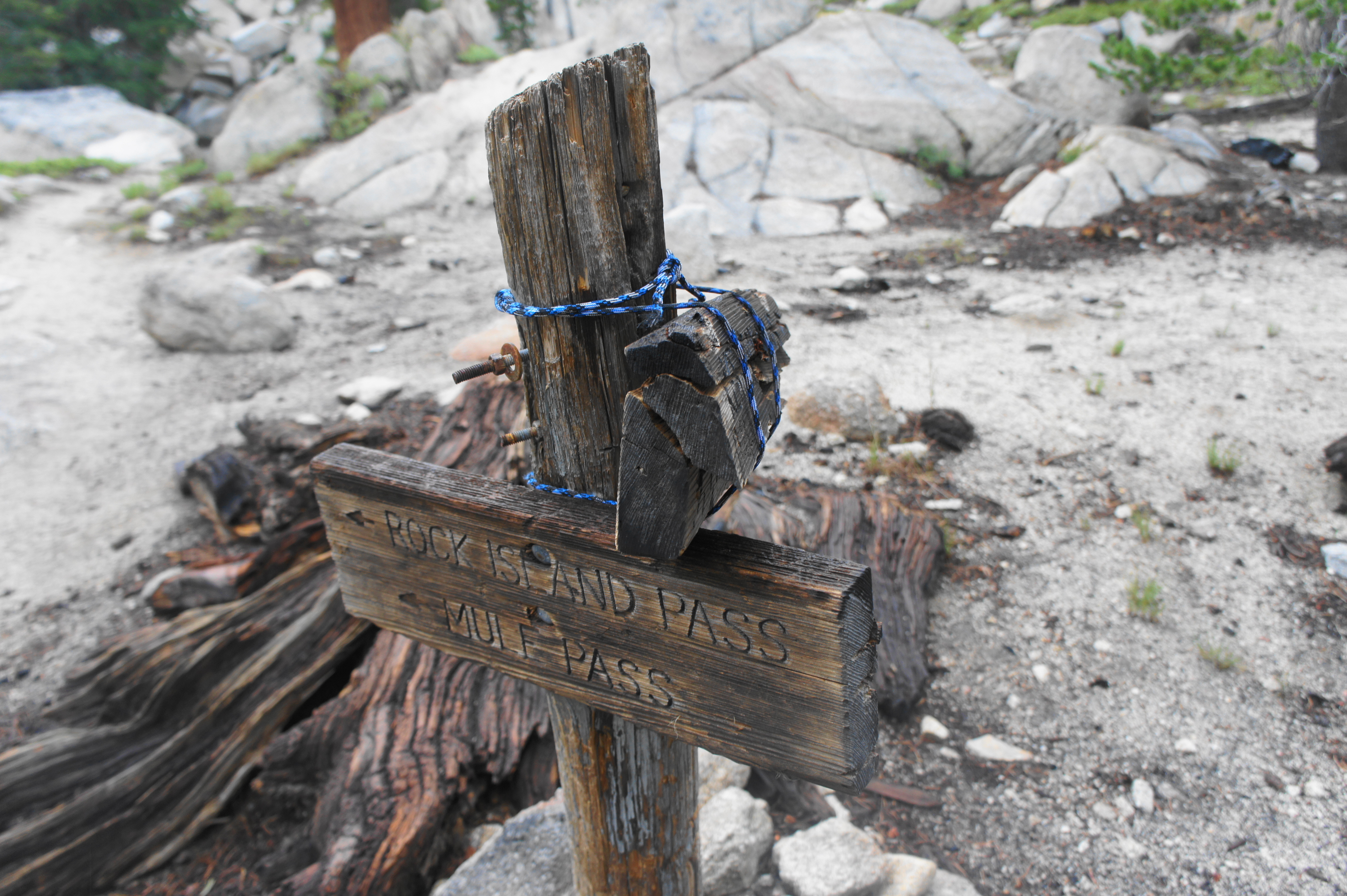
At about 5.4 miles, the relentless switchbacks finally ease, but the trail continues to climb, working through a granite notch at about 5.9 miles. Finally, at 6.2 miles, hikers reach the first junction of the hike—and the start of a loop section that links four magnificent lakes. While most continue right toward Peeler Lake, I recommend heading left toward Robinson Lakes and Crown Lake—the latter being your destination for the night. (Note: Follow the sign for “Rock Island Pass” and “Mule Pass.”)
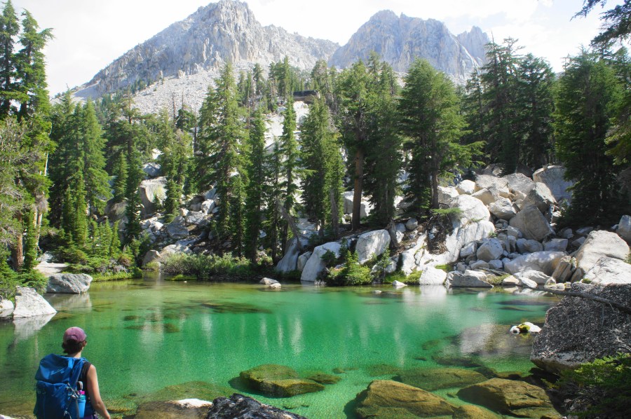
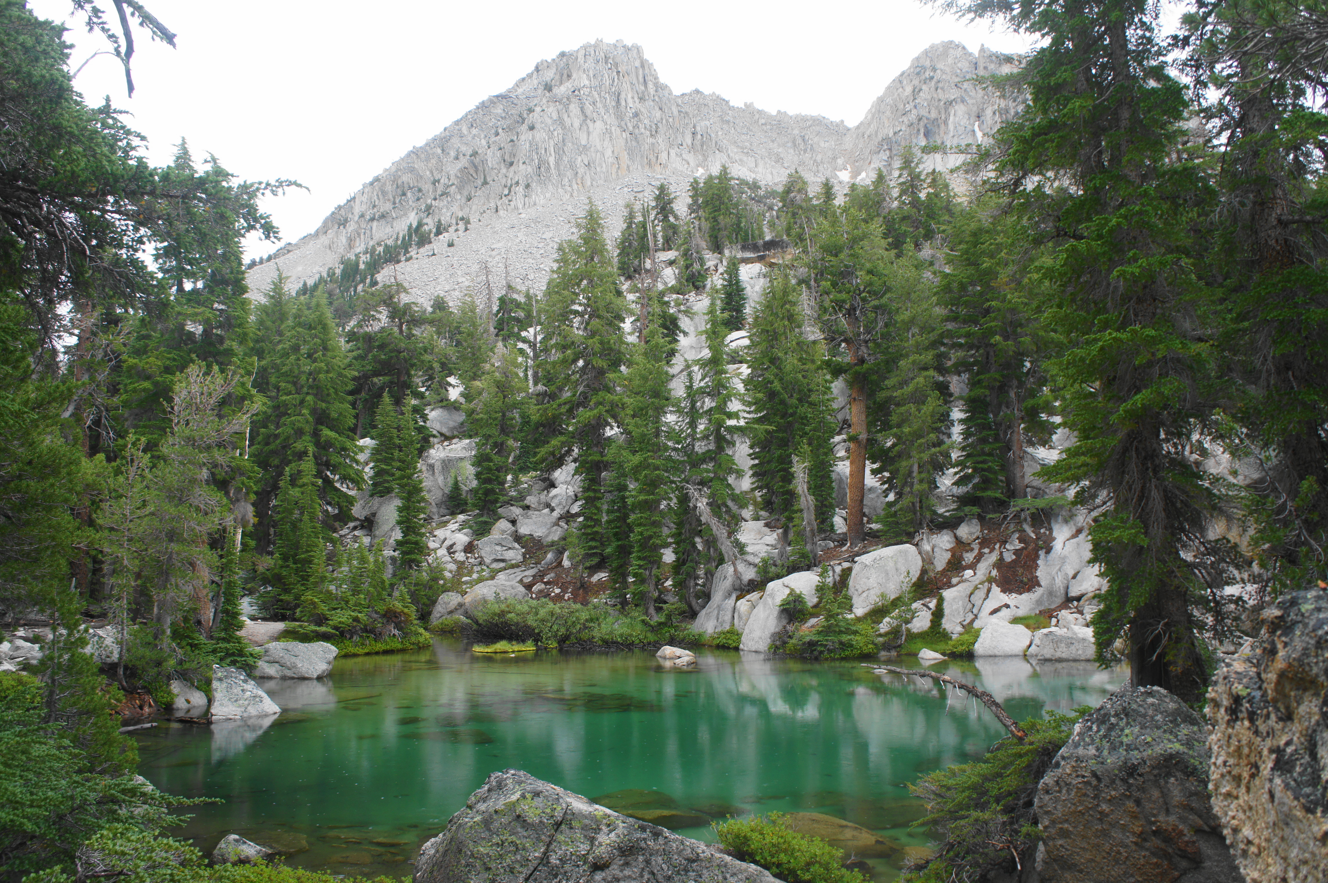
The trail after the junction begins with a dip but eventually settles into some more uphill switchbacks before traversing a graveyard for massive boulders—a conspicuous rock field that cuts through the trees. After the boulder field, hikers encounter the first of several ponds on the right. This one is small and a dark green color, but this is just a preview for a second, larger pond that is significantly more picturesque. This spectacular, nameless body of water is pure snowmelt, taking on a beautiful turquoise hue. A break in the trees reveals the craggy edifice of Crown Point high above. Despite the attraction of swimming in this awesome spot, beware: this is probably the coldest body of water on the entire hike. (Note: Trust me, we tried them all.)
Beyond the turquoise pond, the trail stays to the left of a flowing stream, a remote waterway that is leading to Robinson Lakes, the second of the five main lakes on the hike. The trail hugs the north side of the first Robinson Lake, then follows a narrow isthmus between both lakes before rising to the best viewpoint of the lakes—roughly 20-30 feet above the shores, where one gets a framed vista of the second lake with the Robinson Creek Valley beyond. This is one of the best views on the entire hike.

First Robinson Lake 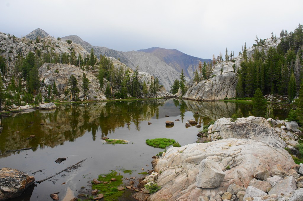
Second of the Robinson Lakes, with the Robinson Creek drainage beyond


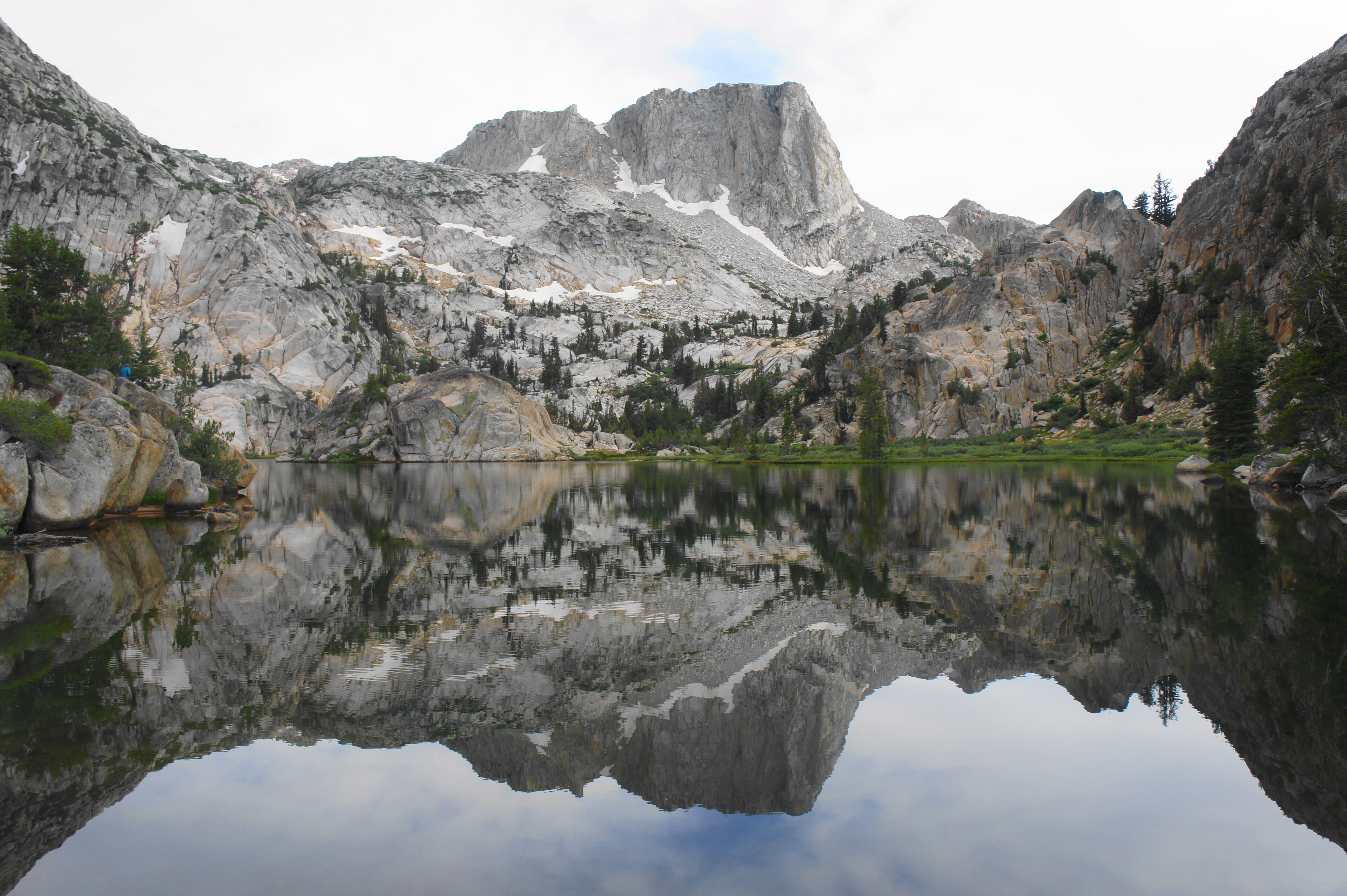
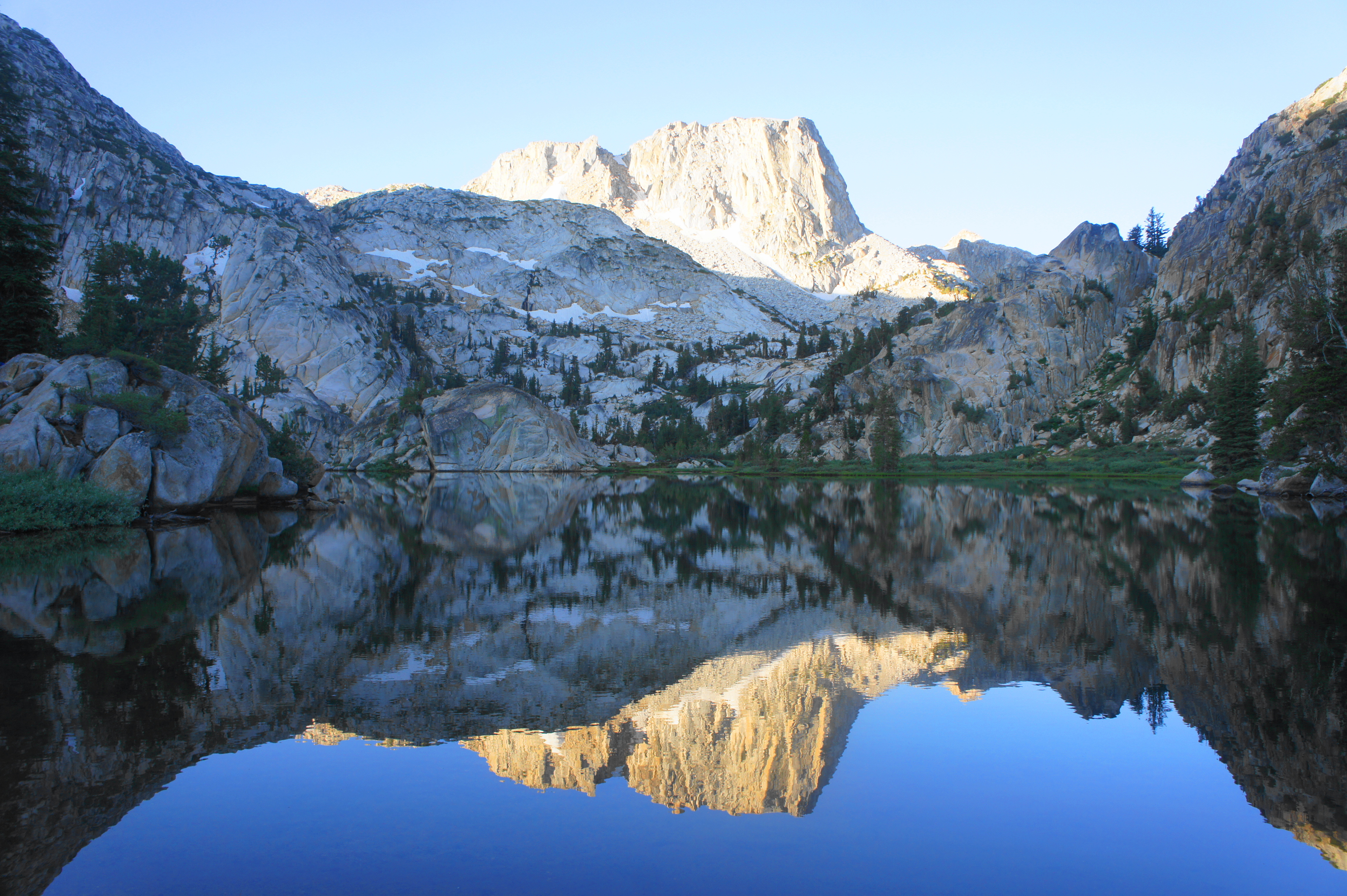
Yet Robinson Lakes is a mere waypoint en route to the main prize…continue eastward as the trail traverses a series of small hills and granite jumbles. By now, the trail seems like it drags on forever. But finally, after 7.6 miles of hiking on the day, it all becomes worth it: hikers arrive at the shores of spectacular Crown Lake, the jewel of the area and one of the most stunning places yours truly has ever seen.

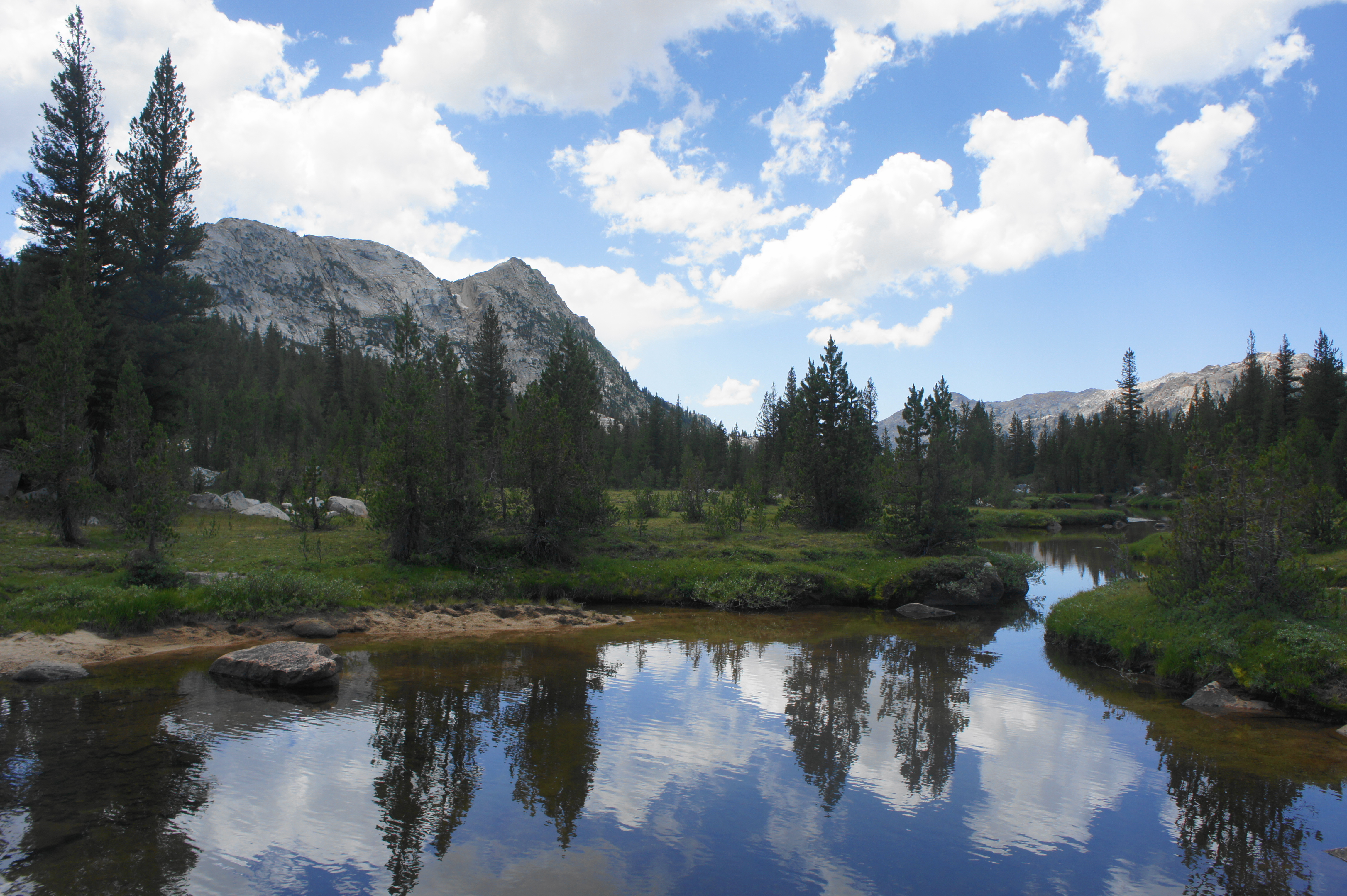
The still waters of Crown Lake sit in a bowl between Crown Point, The Juggernaut, and the western reaches of Sawtooth Ridge—all prominent granite behemoths along the Sierra Crest. Across the lake is a patch of lush green wetlands, as well as a bulging granite knoll that appears to rise right out of the waters. The best views come by crossing the stream at the base of the lake—a traverse that is tricky and may require getting wet feet—then walking a few feet such that The Juggernaut is framed by the spectacular lake. At certain times of day, the reflections in the water are absolutely terrific.

This is your home for the next two nights, so keep an eye out for a camping spot. While camping within 50 yards of the shore is prohibited, there are some decent, previously-disturbed sites on the east side of the creek. Others can travel onward a bit to camp in the verdant meadow—although this offers perhaps not as terrific views of the lake with the cliffs behind. While Hoover Wilderness remains relatively off-the-beaten-path, expect there to be a handful groups at the lake on summer weekends. While remote, it will not feel entirely isolated from humanity.
DAY 2: Crown Lake – Kerrick Meadow – Peeler Lake Loop (8.8 mi. loop)

The sun rises over chilly Crown Lake, the start of a pleasant, easier day than the day prior. Today’s goal is to complete, as a day hike, a roughly nine-mile circuit that dips into an isolated section of Yosemite National Park before returning via Peeler Lake back into the Hoover Wilderness. Along the way, hikers are greeted with stunning vistas, pleasant woodland strolls, and open, flowery meadows.
The circuit begins by returning to the main trail at Crown Lake and continuing southward, hugging the lake’s western banks for a moment before skirting a muddy floodplain on the left. After ¼ mile, the trail begins to switchback again, rising to clear a rock outcrop with fine views looking back at Crown Lake and the Robinson Creek drainage, with Kettle Peak dominating the opposite ridgeline.

After the vista point, the single-track bounds up another set of switches, then traverses a grassy shelf and cuts through a granite notch. Two ponds on the left also offer additional campsites. Amid the brushy scrub, fed by a tributary that gradually tumbles into Crown Lake, hikers reach a trail junction at 2/3 mile. Here the Mule Pass Trail bears off to the left—leading to a spectacular pass that is worthy of visit if you have an additional day at Crown Lake. (Note: The Mule Pass Trail also provides access to the brutal Little Slide Canyon alternative route, mentioned above.) But the main loop bears right, ascending toward Rock Island Pass and Yosemite.
Looking up at the cleft 
Small trout in Snow Lake


A little beyond the trail fork, the path mounts another set of switchbacks and then cuts across a large rock slide. At about one mile, the path approaches the base of a longer set of winding switchbacks, a steady uphill section that ascends through a cleft along the east-facing hillside. As usual, the views of Robinson Creek drainage improve as one gets higher and higher, but they disappear temporarily as hikers reach the top of the switchbacks at 1.4 miles, after which the trail traverses a flat plain and descends. Just beyond, hikers get their first view of Snow Lake—the fourth main lake of the 3-day hike and, at just over 10,000 feet, the highest of the five. This serene lake is perhaps not as spectacular as the others, but it is likely to be all-but-deserted.

After staying high for almost the length of the lake, the trail finally drops down to the banks, where the chilly waters lap up against the scrubby shores, inviting hikers to dip their toes—if even for a second before the alpine chill settles in. One can now see the continuation of the stony mountains beyond—into Yosemite.

Once past Snow Lake, it is a mild climb to Rock Island Pass, which marks the boundary between the Hoover Wilderness and Yosemite National Park, about two miles from Crown Lake. The Yosemite landscape unfolds beyond, and—despite entering one of the country’s most popular national parks—the subsequent section is the most wild and least-travelled part of the whole hike.
After a gradual decline at a low tilt, the trail drops more steadily as it reenters a forest of dense conifers. The trail descends an unnamed offshoot of the Rancheria Creek drainage and Kerrick Canyon, with the main valley eventually coming into view at about 3.5 miles. After crossing a dry wash, the path climbs briefly to a stony crest with partly obscured views of Kerrick Meadow and the broader valley. Beyond, the trail continues its descent, now heading steadily northward, finally reaching a flat meadow area and creek crossing at about 3.9 miles. The area is scattered with lovely, still ponds—making for nice lunch spots in this remote section of Yosemite.

Descending into Kerrick Canyon 
One of several small pools in Kerrick Canyon

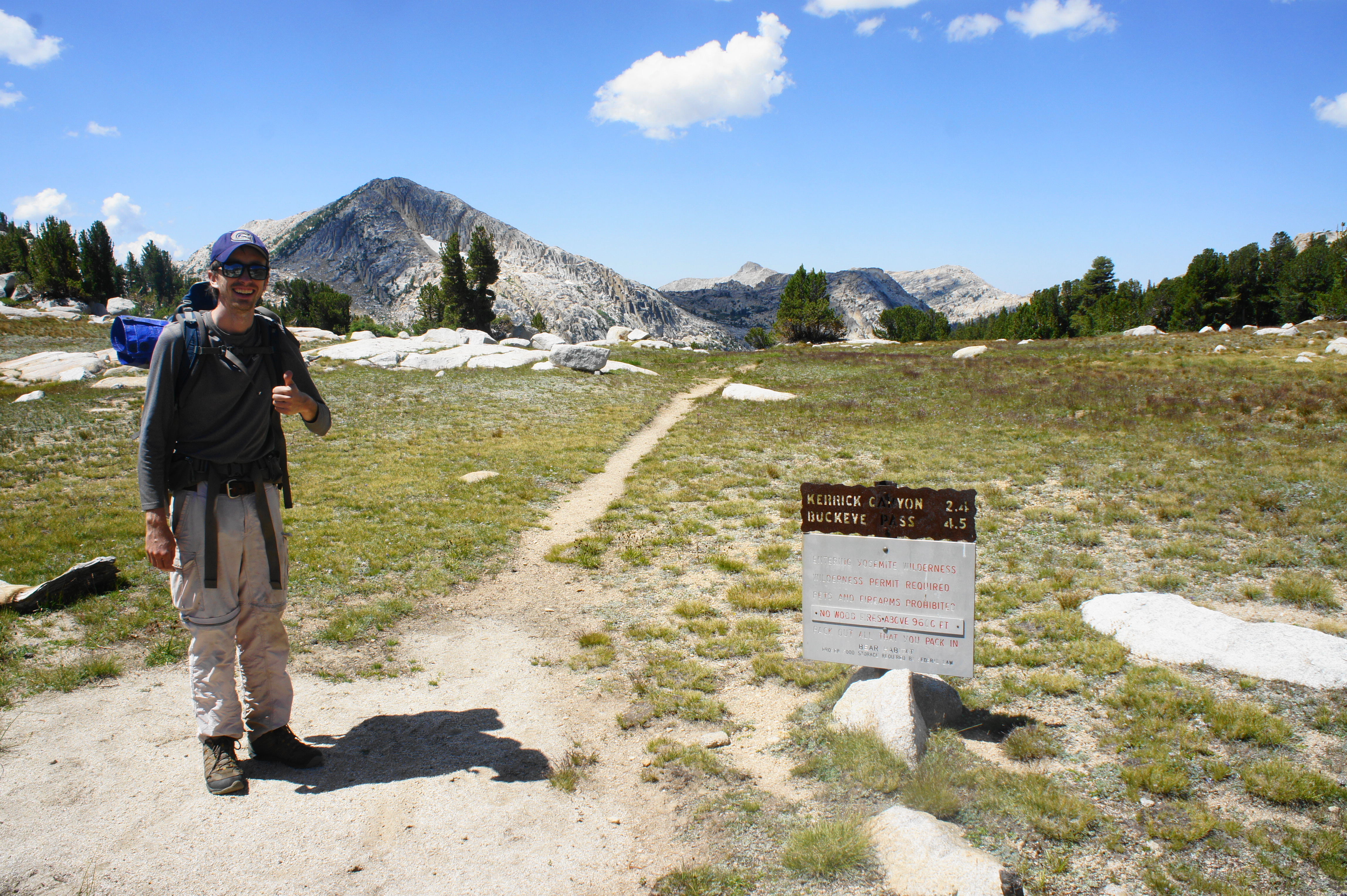
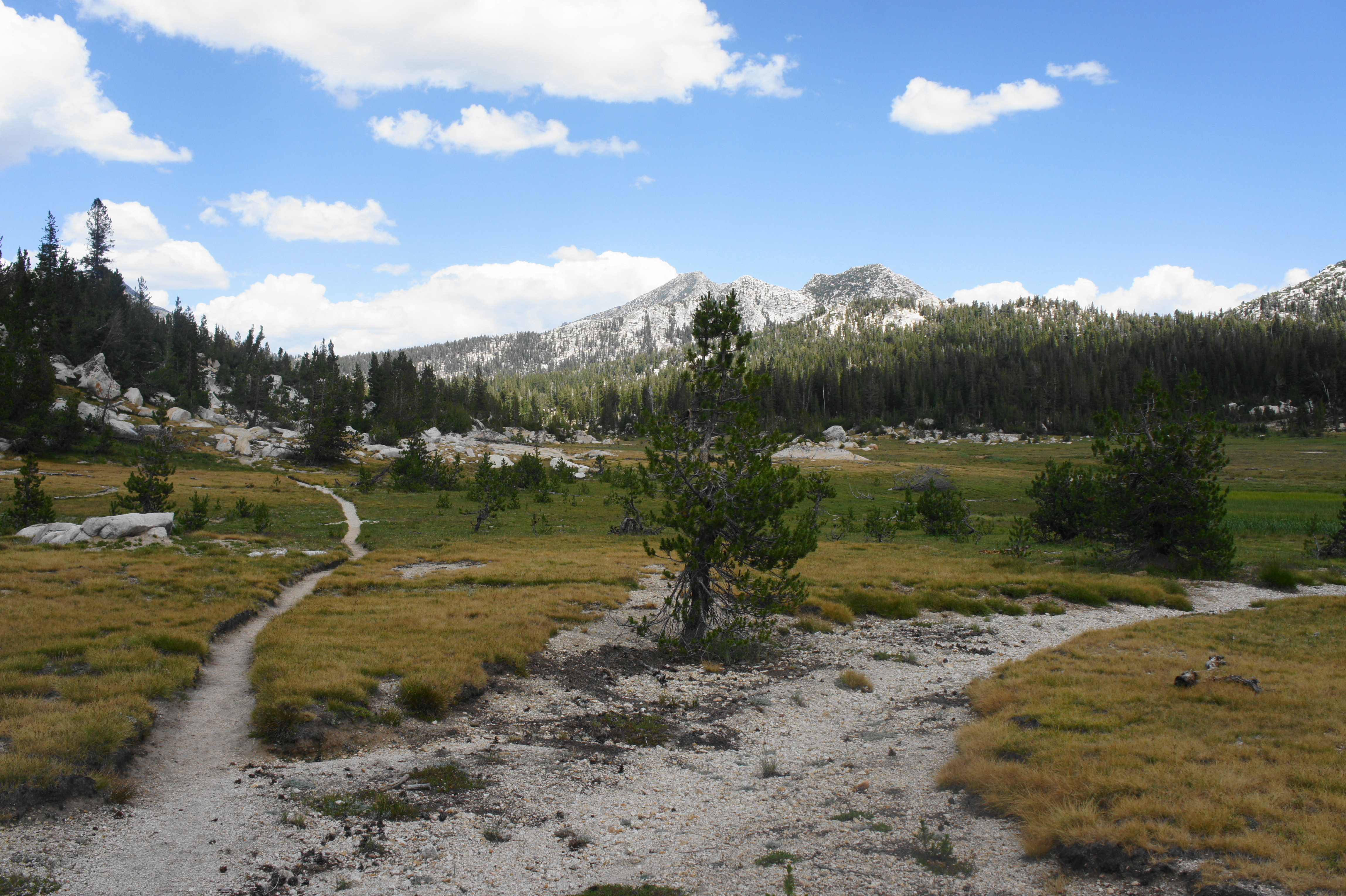
At mile four on the day, the trail reaches another junction. Bear right toward Kerrick Meadow and Peeler Lake, beginning a mild and pleasant jaunt along the length of the meadows. Interrupted occasionally by wooded thickets and stony outcrops, most of the next mile traverses open moraine and is a decent place to spot wildlife—deer, marmots, and perhaps elk or bears. Off to the east, the wooded slopes rise to the granite peak of Crown Point, while to the west, the mountains rise to an unnamed point at 10,339 feet, with Acker Peak (10,988’) beyond.


Kerrick Meadow looking north 
Junction in Kerrick Meadow, looking south
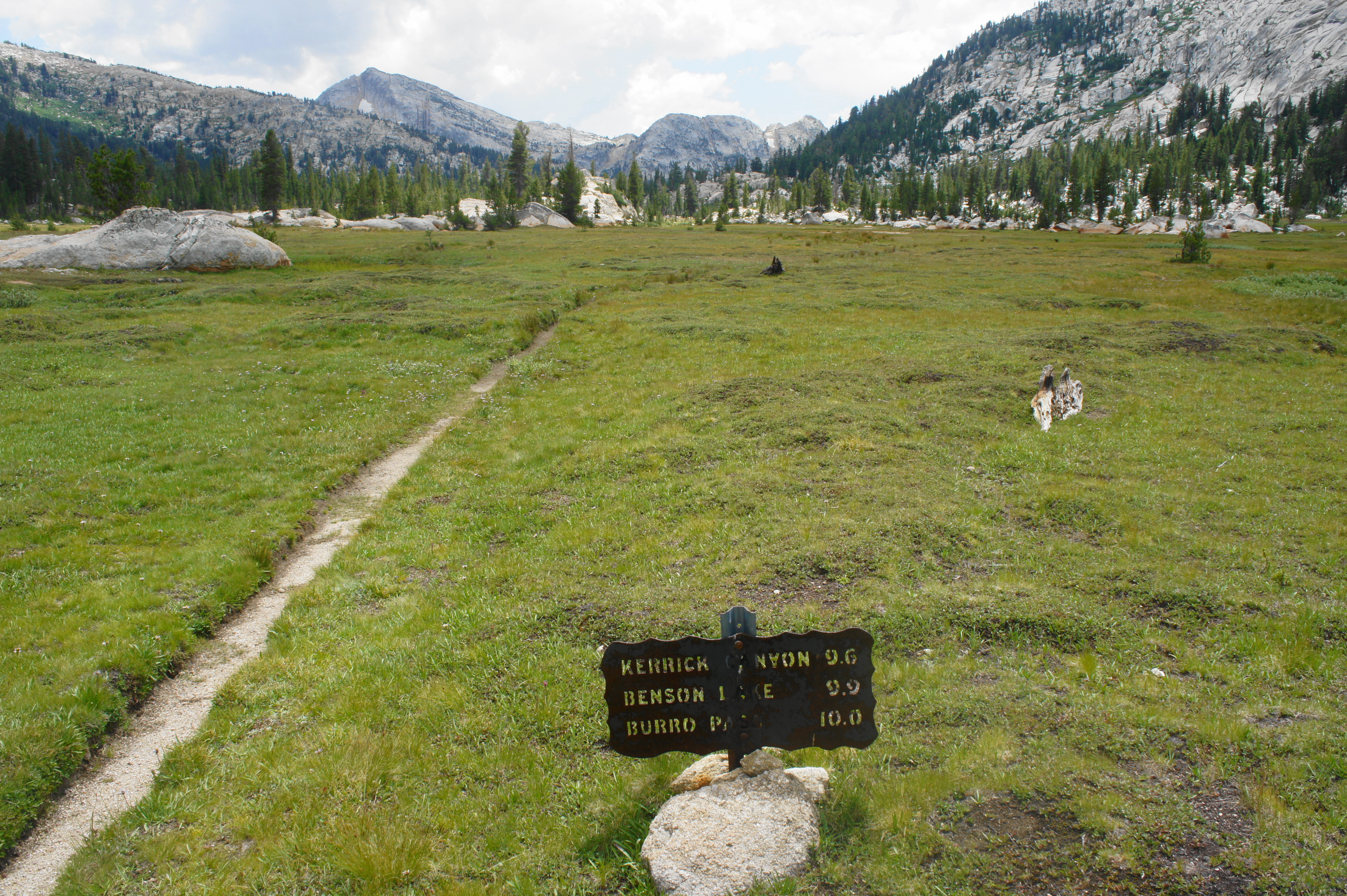
At 5.4 miles, in a particularly open section, the trail forks again. The left turn leads north to Buckeye Pass, while the right turn continues the loop by heading toward Peeler Lake and Hoover Wilderness. Bear right, continuing to hug the edge of the meadow before crossing the tributary creek three times en route to Peeler Lake. At about 5.75 miles, a 10- to 12-foot waterfall careens off an orange-tinted cliff on the left, with the tumbling cascades continuing upstream.

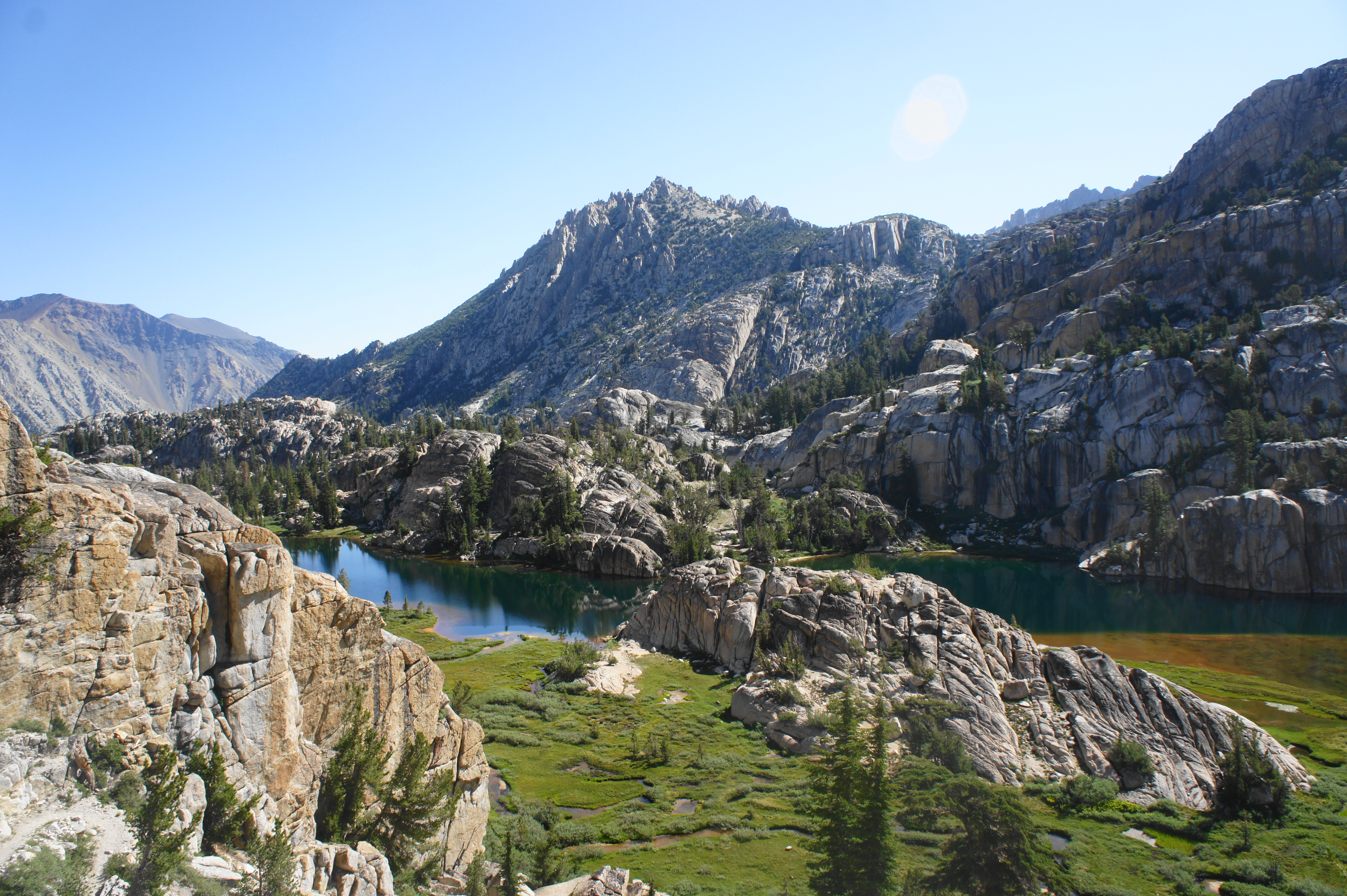
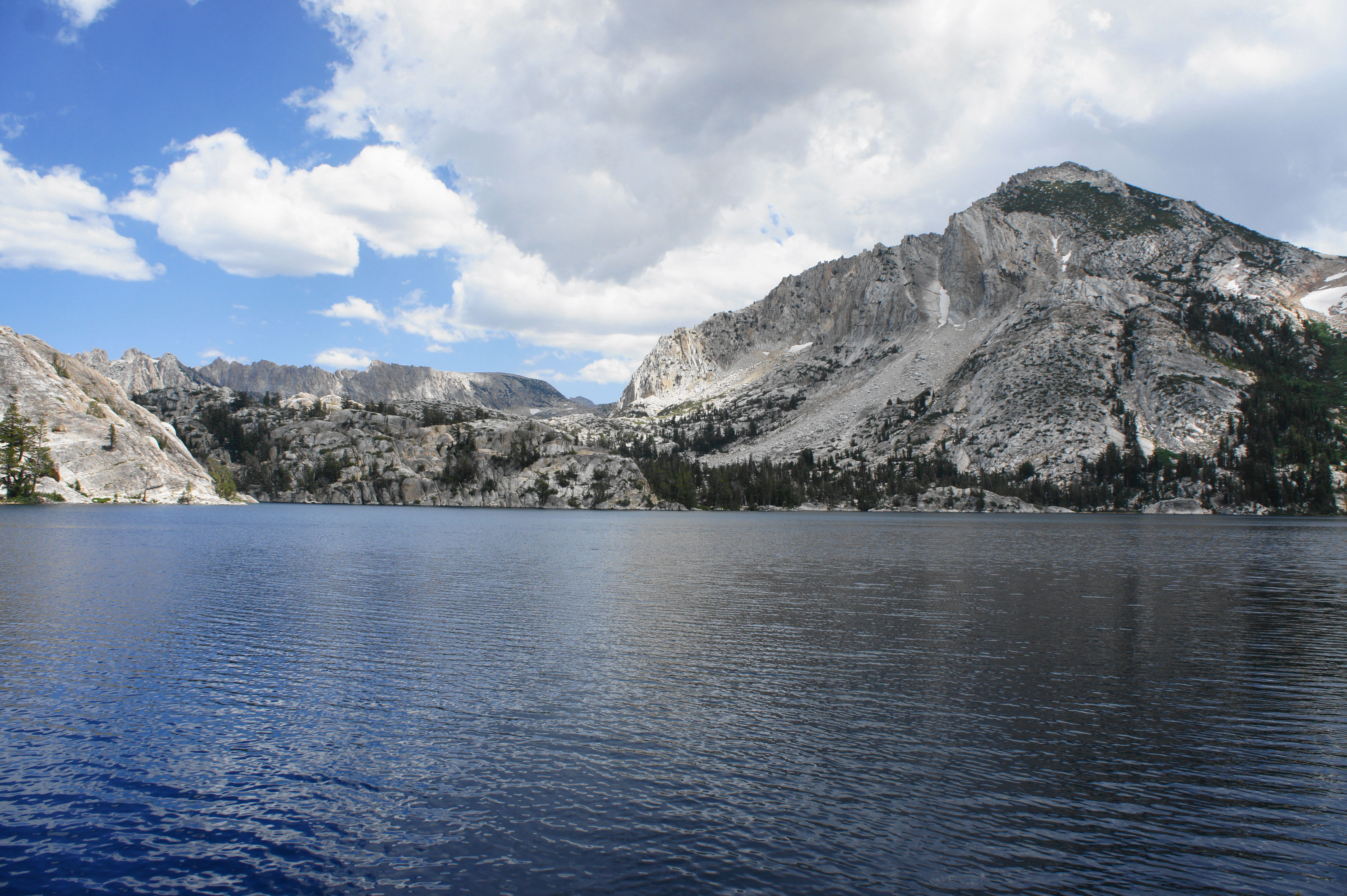
At about the six-mile mark, the ascending trail officially leaves Yosemite and returns to the Hoover Wilderness, and beautiful Peeler Lake—the last and largest of the five—comes into view. This massive glacial spectacle is deep and chilly and flanked on either side by towering peaks—Cirque Mountain (10,714’) to the north and Crown Point to the south.

Second only to Barney in popularity, Peeler Lake is often crawling with visitors on the east side, but the quiet western shores offer continued solitude and arguably better views. After stopping for a break at the lake, continue along the Peeler Lake Trail, which skirts the northern banks for the next half-mile. After passing a popular camping area at 6.3 miles, the path traverses a rocky section to clear a granite slope coming in from the left, and then exits the lake by way of a turquoise-colored cove at the northern end of the waters.

Peeler Lake from the western shores 
Peeler Lake Trail

Cross a boulder-choked ravine beyond the end of the lake, then climb steeply to another, unmarked junction at about 6.7 miles. The onward path continues to follow the right-hand side of a rock-lined canyon, dropping to briefly cross a minor creek before ambling back to the right bank again minutes later. From here it is a short jaunt back to the initial junction—encountered yesterday—that marks the start of the Peeler Lake Loop and provides access to the exit route back down the Robinson Creek Valley toward Twin Lakes.

To return to camp, head right at the fork, retracing your steps from yesterday—dropping down initially before climbing through woods and boulder fields to Robinson Lakes and, finally, Crown Lake. All told, this day hike loop covers about 8.8 miles. Take in the rest of the afternoon and evening at the shores of Crown Lake, resting for the hike out the subsequent day.
DAY 3: Crown Lake to Robinson Creek Trailhead (7.6 mi. one-way)
Unless planning to take the absurdly strenuous alternative route—up Mule Pass, past Maltby and Ice Lakes, and down Little Slide Canyon (really not recommended; trust me, we did it)—your final day will consist of retracing your steps from two days prior, a mostly downhill 7.6 miles back to Mono Village Resort and Twin Lakes. As you descend, enjoy the clear morning skies and wonderful vistas from the shelf above the Robinson Creek Valley, as well as the numerous stream crossings and meadow traverses. The crowds return again at Barney Lake—and the final two miles of easy but monotonous walking through dense woods can feel like an eternity—but soon enough, hikers are back at the start of the Barney Lake Trail.
Return to your car at the banks of Twin Lakes full of satisfaction after completing a three-day, roughly 24-mile excursion into one of the most beautiful stretches of the Sierra Nevada.

Stormy Robinson Creek drainage on the return 
Little Slide Canyon


Pingback: Top 10 Hikes in 2020 | Live and Let Hike
Pingback: Top 10 Hikes in 2021 | Live and Let Hike
Pingback: Washburn Trail (Yosemite National Park, CA) | Live and Let Hike
Pingback: Five Lakes Trail (Granite Chief Wilderness, CA) | Live and Let Hike
Curious why you stayed at crown lake and day hikes? Definitely makes it easier and a good idea but curious. Also how did you choose clockwise vs counter? Assuming you wanted to camp at crown 2 nights?
I’m planning a trip hence the questions
Hi Jennifer – great questions. This is an outstanding hike, although I am not sure of the snow conditions this summer after such a wet winter. We decided to do the day hike option (even though it involve retreading a bit of ground between the start of the loop and Crown Lake) due to the strong desire not to carry a heavy pack longer than needed. The section between Peeler Lake and the start of the loop is quite steep, so we decided to tackle that downhill – hence the clockwise direction (meanwhile the ascent to Rock Island Pass wasn’t so bad). But either way is probably okay. And yes, Crown was amazing so we had no qualms with spending two nights there. Good luck with your planning and hike!
Tim Gnazale, owner, fastbackpack.com: Gorgeous loop! Just did it in 2 days, Sept 15/16, 2024, but due to the threat of snow/storm on the 16th, I went from Twin, to Robinson, to Crown, up to the trail juncture a bit farther, then backtracked to Peeler. There, 30-40 mph wind and dark clouds moving in. I was afraid of snow, which would cover the trail home, plus some steep switchbacks, etc. So, I put my pack back on and hiked just short of Barney to a tiny flat spot by the river/falls. I was exhausted after around 15 miles in 1 day. After putting my food back into the URSACK, I left the top open to brush my teeth 10 feet away around a tree where I would hang my URSACK. No prob. Came back 10 feet and a young bear was in my site!!! Did it materialize from quantum space somehow??? He got a tiny bit into some cereal only, and was staring at my tent. Freaky! Very weird. It’s only about a 15 foot landing where I was, so the bear was 10 feet from me! I waited for mama to appear and maul me to death, but no mama, so it must have been a very young adult. As I scolded it and clapped my hands to scare it away, it simply wanted to play!!! I swear I could have beguiled it to allow me to pet it, but again, suicide if I did. Oh, as I scolded it, it danced a bit and circled around a tree dangling from it with its 8 inch claws, then returned to the tent just in front of me. It came and went away as I scolded it, just wanting to play (screw the open food container, which I promptly closed without getting mauled and hung it). I was so exhausted from the amazing day of backpacking I finally decided to charge the bear (as did John Muir once in his youth at Yosemite) and I threw a rock near its feet. After that, it never returned. The storm never hit either, and it was sunny the next day. So, I returned to Twin Lakes easily.
I found out today, 3 days after my trip, that a dear swimmer friend of mine died just a day before I took off for my trip. He passed at age 50 from cancer, leaving his lovely wife and 2 very young boys behind. It rocked me! He was competitively swimming with us guys 1 month earlier, though he successfully fought off the cancer a year previous…no prob. I feel that the strange, playful bear was inhabited by my friend’s spirit and came one last time to visit me in the wild. No? Why would a young bear, prior to Fall, when a bear must consume tons of food, only poke at a few cereal flakes and leave the food bag alone? Why would you not hear a 300 lb. bear approach your site only 10-15 feet away? Why would a bear in such circumstances, dance around and play when scolded…still leaving the food alone? Why would it freeze and stare at my empty tent, giving me 2nd priority just 10 feet away? All of this was in a 15 foot square area.
I will always remember the Peeler Lake loop with loving memories, of mind, body and spirit on that intense 1.5 day trip. Love you Eric, you 6 foot 7 giant with an innocent soul, and thanks for our one last silly encounter together atop of countless ones previously. Today I am very sad, but honored by your passing. As for the Peeler Lake Lollipop Loop, your beauty will also never be forgotten and thank you for giving my dear friend and I one last play amid Mother Nature.