
Stretching for more than a dozen miles through south-central Utah, the dark, undulating narrows of Buckskin Gulch are a sight to behold, a wonder of the American Southwest. Considered to be the longest slot canyon in the world, Buckskin Gulch is part of the Paria Canyon drainage in Vermilion Cliffs National Monument, a BLM-administered area that spans the border between Utah and Arizona. The most popular access is via the Wire Pass Trail, itself boasting a narrow slot canyon. While Buckskin makes for a popular backpacking destination, the write-up below describes a 10-mile out-and-back day hike through Wire Pass and three scenic miles of Buckskin Gulch. (Note: The turnaround point is somewhat arbitrary—and the stunning beauty of the canyon makes it difficult to know when to stop—but 5 miles each way makes for a good, full-day hike that sheds the initial crowds and captures some of the canyon’s best narrows.)
(Note: Conditions vary dramatically in Buckskin Gulch. While often filled with muddy pools, the upper portions of Buckskin Gulch are sometimes—as of May 2021, for example—nearly bone dry. Check on local conditions before departing—and never enter the slot if there is rain in the forecast: flash floods, while infrequent, would be deadly in this canyon, where there are limited avenues for escape. Also, a day-use permit is required to hike Buckskin Gulch; they are unlimited and available at the trailhead, but it’s best to book online if you don’t have exact change ($6/person).)
Highlights
- Longest slot canyon in the world
- Spectacular narrows stretching for miles and miles
- Crowds dissipate beyond the initial set of narrows (ending at 2.8 miles), giving hikers solitude in the awesome slot
Lowlights
- Increasingly crowded destination, popular with tour groups
- Risk of flash floods and often filled with muddy pools


The hike
The hike to Buckskin Gulch begins at the Wire Pass Trailhead, located just north of the Utah–Arizona border along the unpaved House Rock Valley Road, about 8.4 miles south of U.S. Route 89. (Note: The conditions of this road vary widely, depending on the season. While snowy winter conditions could make the drive impassable, for much of the year the 8.4-mile stretch is relatively easily doable with a standard sedan. Although the road continues south from Wire Pass TH into Arizona, eventually connecting with U.S. Route 89A, this section is generally rockier and sketchier; I recommend accessing from the north. Check the latest road conditions here.) The House Rock Valley Road has historically straddled two jurisdictions: Grand Staircase-Escalante National Monument (GSENM) to the west, and Vermilion Cliffs National Monument to the east. (Note: That is, until the Trump administration cut the size of GSENM in half, leaving this section unprotected.) With Vermilion Cliffs is the Paria Canyon-Vermilion Cliffs Wilderness, a more than 112,000-acre tract that extends from here all the way to Glen Canyon to the east. (Note: After 3.5 miles, the road passes a parking area for the Buckskin Gulch Trailhead; note that this, despite its name, is NOT the start of this hike; while eventually leading to the same place, the upper reaches of Buckskin Gulch take longer to traverse and are not as scenic as the lower sections beyond Wire Pass.) At 8.4 miles, after seemingly driving in the middle of nowhere, visitors will perhaps be surprised to see a large and often bustling parking lot on the right; this is Wire Pass Trailhead.
Even the drive along House Rock Valley Road reveals stunning geology, with sedimentary rock layers spanning the Permian to early Jurassic periods (roughly 300-150 million years ago). Like the nearby Waterpocket Fold in Capitol Reef National Park, the multihued Cockscomb runs north-south and is another example of a monocline, a wrinkle in the earth that produces a fold with one steep side and one more gradual. The Cockscomb is topped with newer rock (I mean, it’s still around 200 million years ago) from the Moenave and Kayenta formations, here taking on reddish and peach hues. Below these layers are the Chinle formation (with its characteristic green, tan, and even violet-colored clays) and Moenkopi (crumbly and a deep red), both dating to the Triassic period. Finally, the mostly desolate hillsides off to the west give way to occasional canyons where the even-older Kaibab limestone and White Rim sandstone reveal themselves. (Note: The latter layers form the top of the Grand Canyon Rim.)
The show-stopper, however, is the Navajo sandstone, an early Jurassic (180 million years ago) layer responsible for most of the area’s slot canyons and stunning features such as the often-photographed feature known as “The Wave.” The House Rock Valley Road begins to cut into this layer as it approaches the Wire Pass Trailhead, with the high, cream-colored walls of The Dive visible to the east and reddish knobs of the Coyote Buttes area to the southeast. Buckskin Gulch is not visible from the trailhead, but the beautiful Navajo sandstone beckons.
The Wire Pass Trailhead has two large parking lots and a check-in kiosk where hikers can sign the trail register and acquire their day passes. This is also the starting point for hikes into the North Coyote Buttes area, which requires a highly-coveted permit that offers access to features such as The Wave.
From the trail register at the southern end of the parking area, look east across the road to the find the start of the Wire Pass Trail, which traverses a sandy sagebrush plain and then drops into Coyote Wash, a usually dry arroyo with sharply cut banks. Hikers can stay in the wash all the way to Buckskin Gulch, but technically the trail continues onward up the right bank for a brief moment, passing through a cattle gate at around 2/10 mile. Shortly thereafter, the trail drops into the wash for good.


Walking along Coyote Wash toward Wire Pass 
Approaching Wire Pass slot
It’s perhaps hard to believe that Wire Pass will soon narrow to a thin slot, as the opening stretches of the hike are wide open in the broad sun. After tracing a right-hand bend, the drainage then cuts around to the left. After another left, a narrow but signed track leads off to the right; this is the spur for Coyote Buttes and The Wave. The route to Buckskin continues in the wash as the scenery around becomes more variegated and interesting: spiraling knobs, ruddy walls, and pinyon-dotted benches.


Wire Pass slot canyon 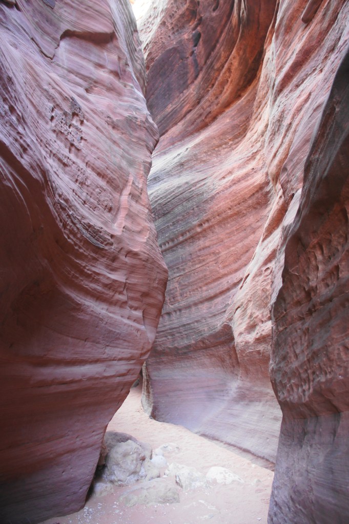
Beautiful, narrow slot
At around 1.1 miles, the drainage is full of small boulders and flirts with narrowing, but after a short stretch, it opens up again. Finally, at around 1.3 miles, the walls begin to rise on both sides and Coyote Wash dramatically narrows. This is the start of the Wire Pass Slot Canyon. The smooth walls, streaked with cross-bedding, are multi-hued with deep oranges, reds, and pinks.

Descending the ladder 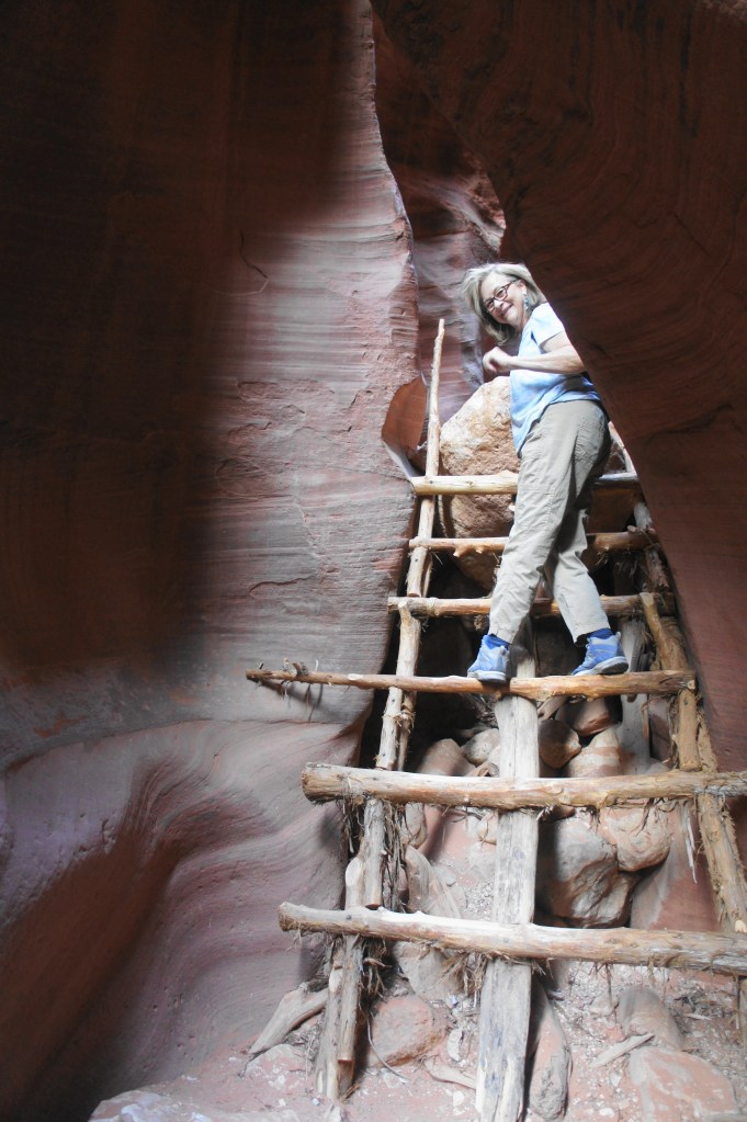
Ladder obstacle in Wire Pass
Within minutes of entering the slot, hikers encounter the hike’s biggest obstacle: a chockstone and 7- to 8-foot drop, littered with twisted branches. This obstacle has frequently evolved, as hikers have developed different methods for surmounting it: stacking rocks and debris, developing crude handholds, installing ropes, or—as it was in May 2021—a well-crafted and durable ladder. In any case, unless visiting right after a flash flood, chances are that somebody before you has developed a way to tackle the descent. (Note: That said, if the ladder is unavailable, this could be tricky—there’s no shame in turning around, although it would certainly be disappointing not to make it to Buckskin Gulch.)
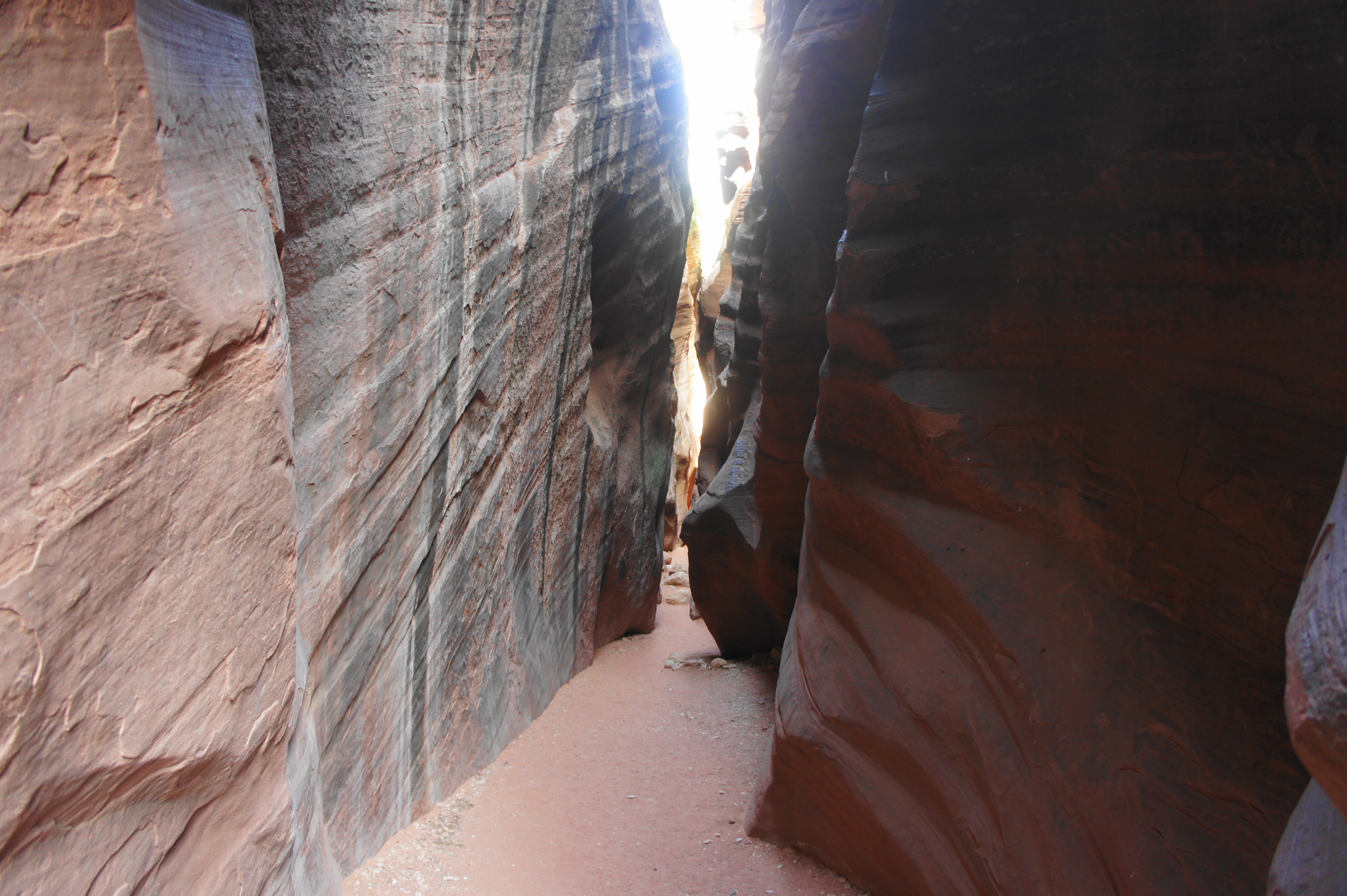
Brief opening in Wire Pass 
End of Wire Pass slot
Beyond the chockstone, the canyon opens up for a brief moment, and the walls are brilliantly streaked with incremental layers. The sunny enclave soon gives way to claustrophobia again as the slot narrows to arm’s length. By 1.7 miles, Wire Pass opens up to high walls and the confluence with the bigger Buckskin Gulch, the highlight of the hike.

On crowded afternoons, the confluence of the drainages is likely to be teeming with people, as it seems to be the turn-around point for many guided hikes and casual day hikers. But the best is yet to come. Even as Buckskin runs both north and south from here, heading right (south) is the better move as it boasts the most impressive views of the fluted and multi-hued canyon walls. (Note: Before entering Buckskin, look off to the right for a large and impressive set of petroglyphs carved into the high wall.)
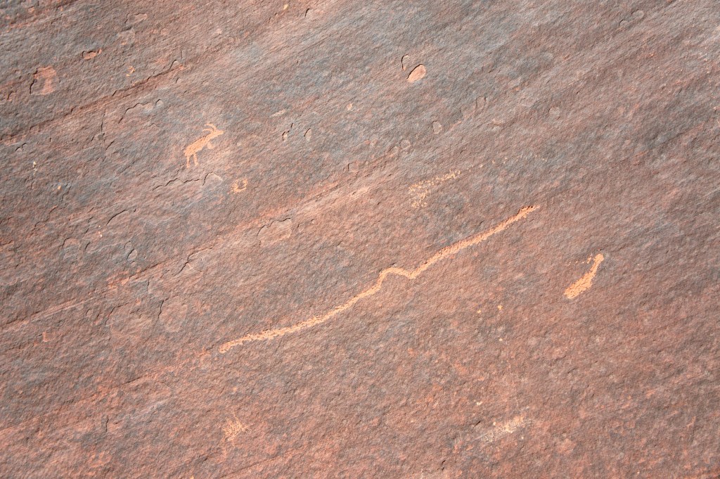
Petroglyphs 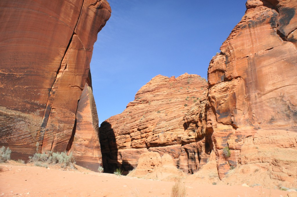
Looking back at Wire Pass entry
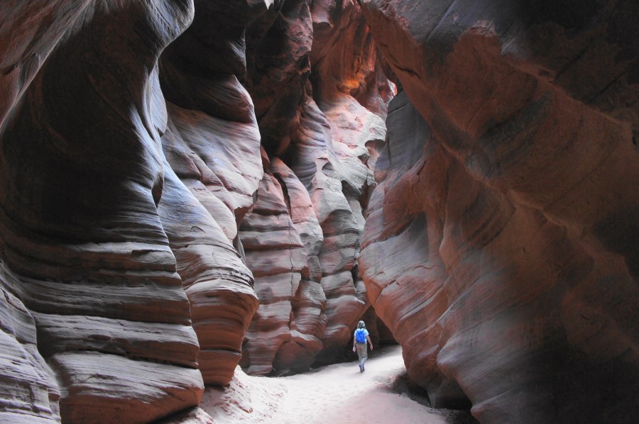
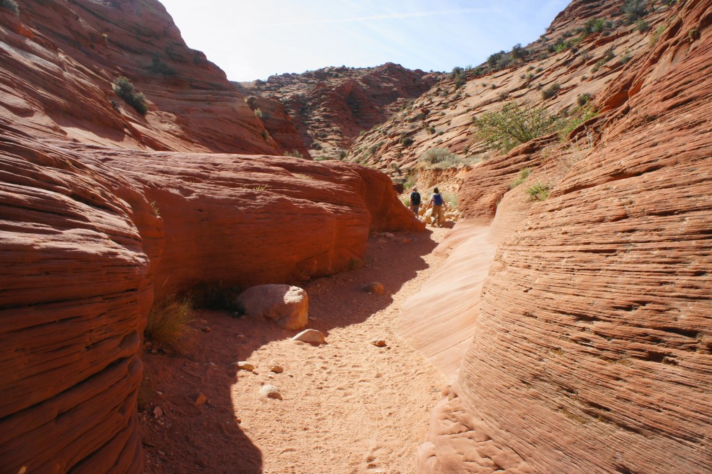
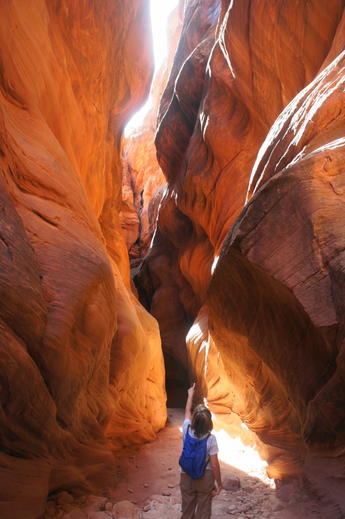
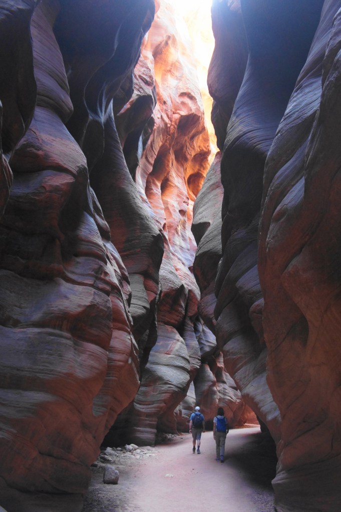
Following a towering wall streaked with desert varnish on the left, Buckskin Gulch narrows quickly to a slender slot. Though slightly wider than Wire Pass, this initial stretch of Buckskin is strikingly beautiful as the drainage gradually cuts deeper and deeper into the Navajo sandstone.
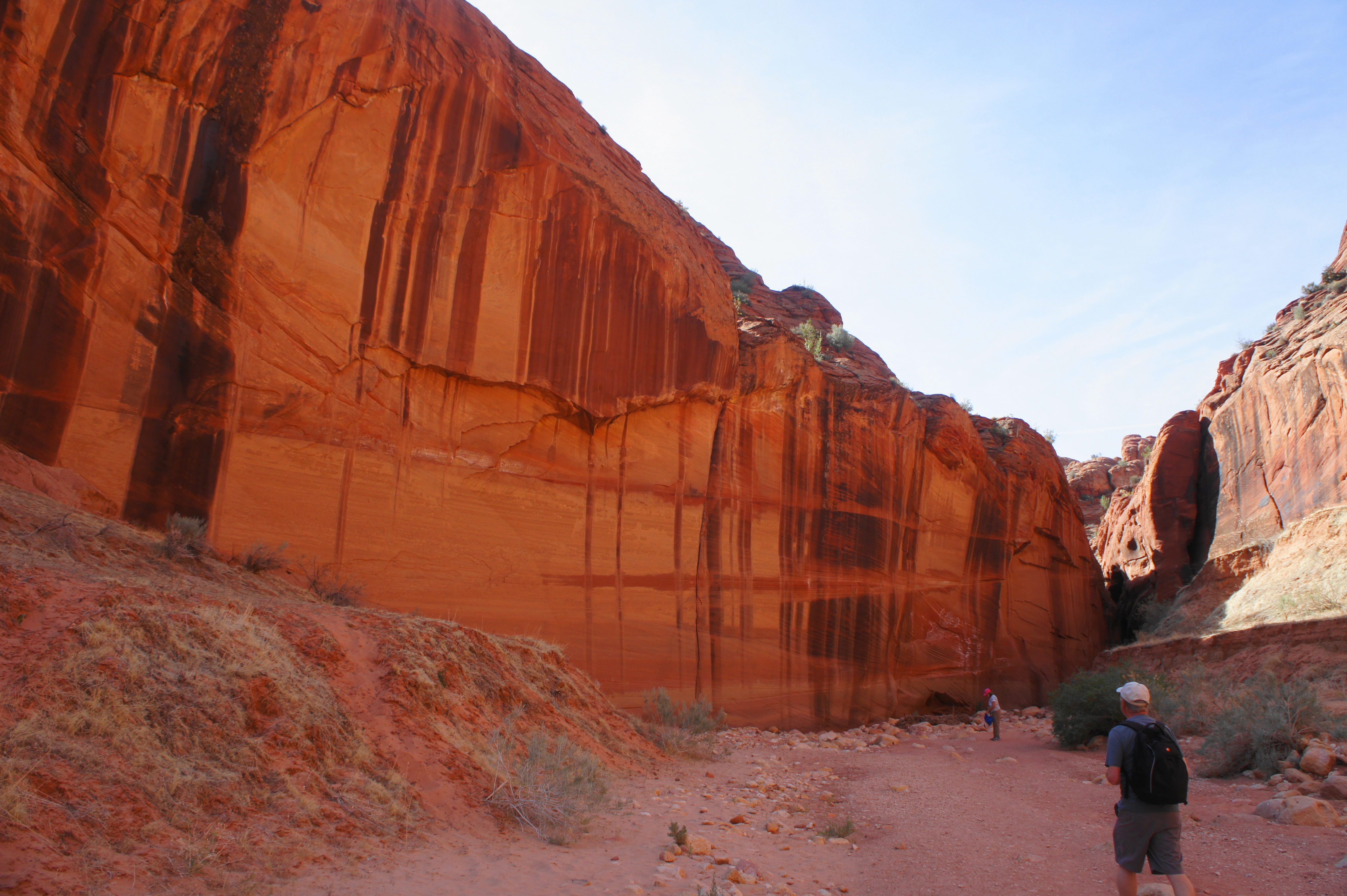
Undulating walls of Buckskin Gulch 
Near the start of Buckskin Gulch
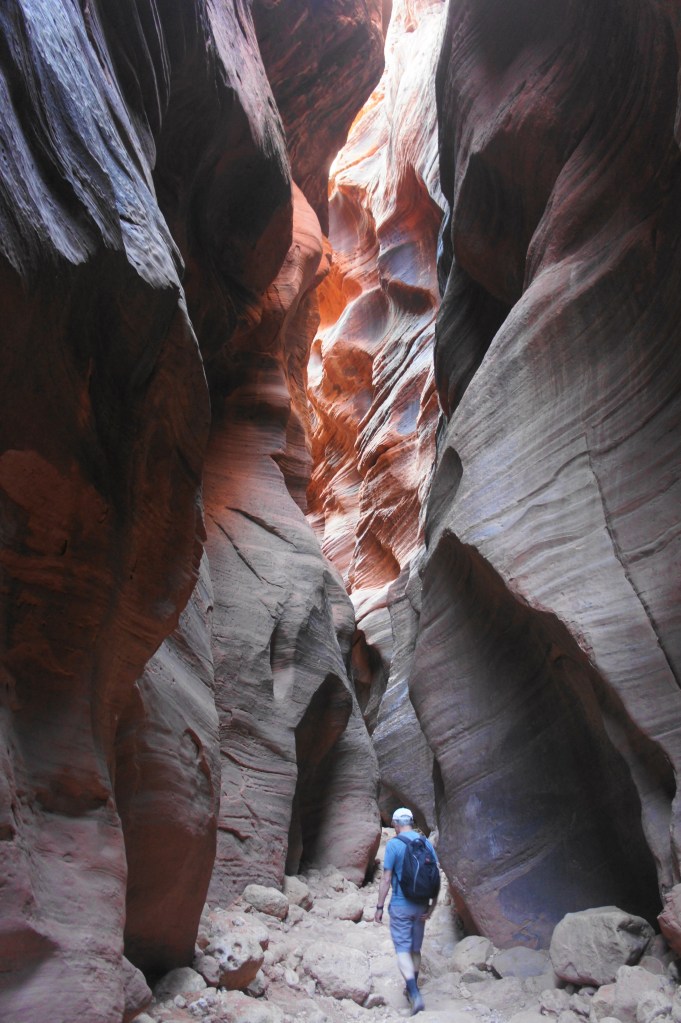
Smooth, sandy traverses are interrupted occasionally by boulder-choked floors, although there are no serious obstacles to speak of in the subsequent mile. The canyon averages less than 10 feet wide for much of this section, with each turn revealing more spectacular and mysterious passages.
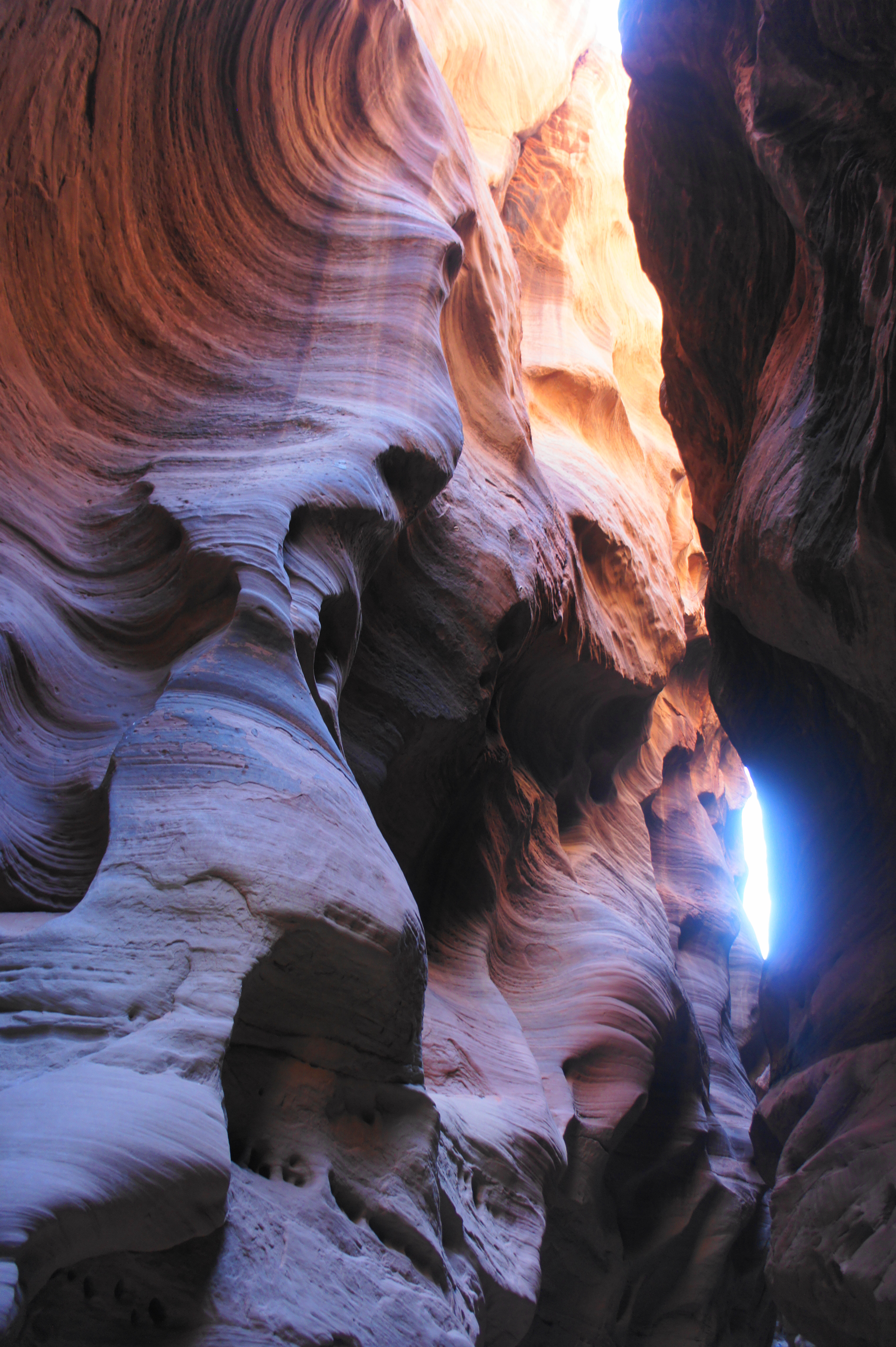

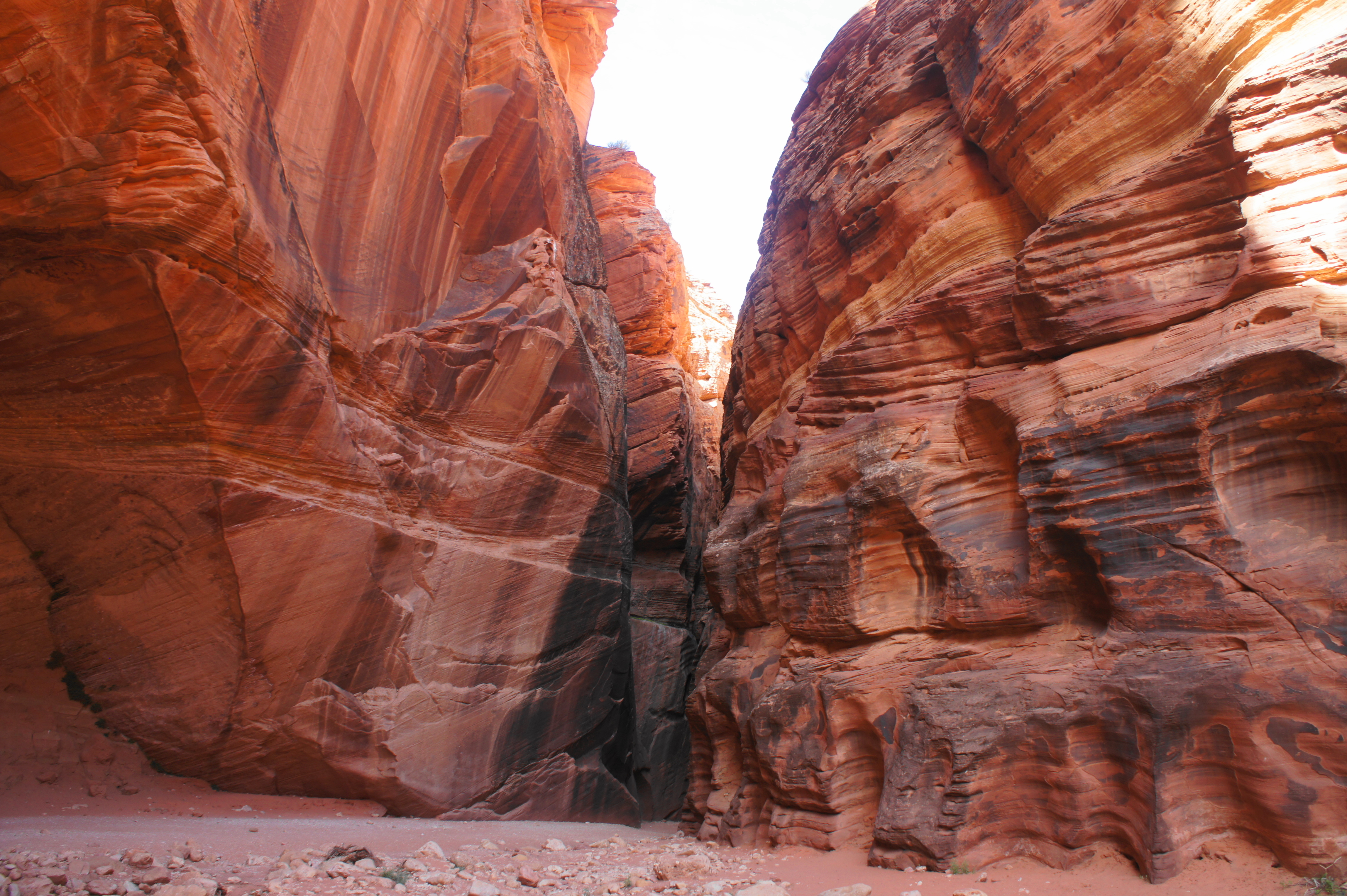
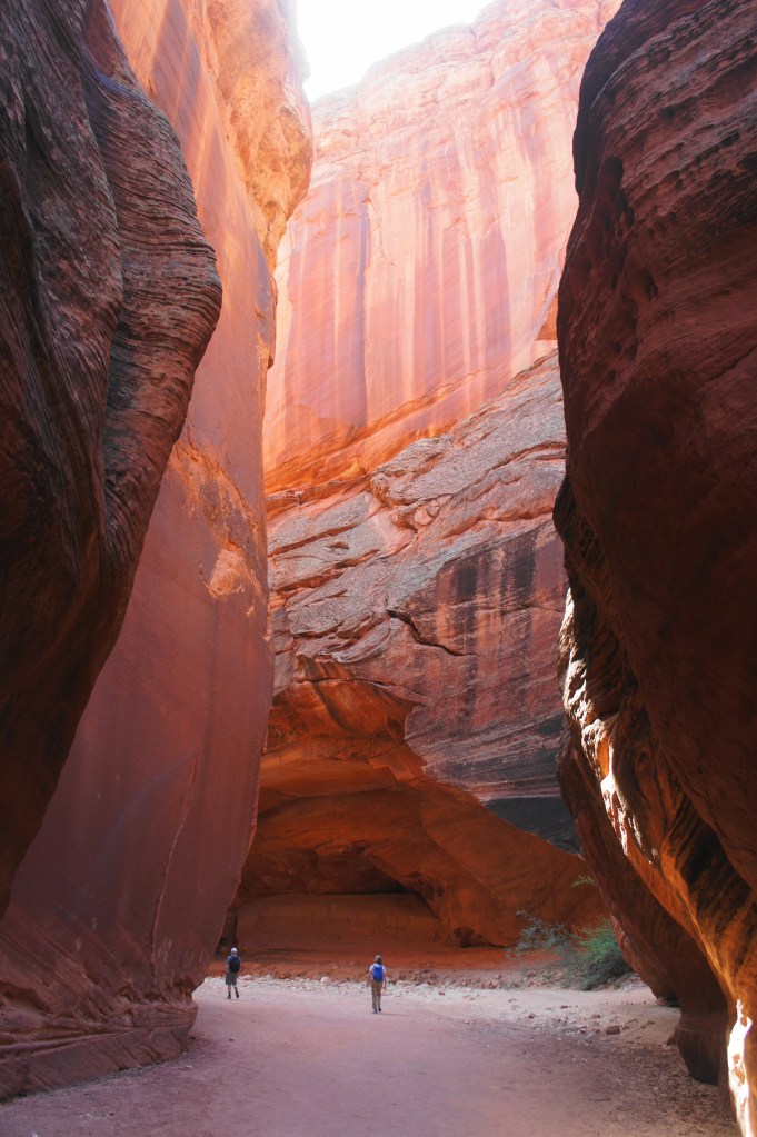
At one point, the undulating walls briefly give way to a sheer vertical face with a blocky alcove. Beyond, the canyon narrows further, making the passage darker and darker. At a point perhaps ¾ mile down Buckskin Gulch, the walls come so close to each other that they nearly touch, trapping a smattering of debris at a point at least 15 feet above hikers in the wash.
Sun shining through the slot 
Darker, narrow section

Blocky alcove in Buckskin Gulch 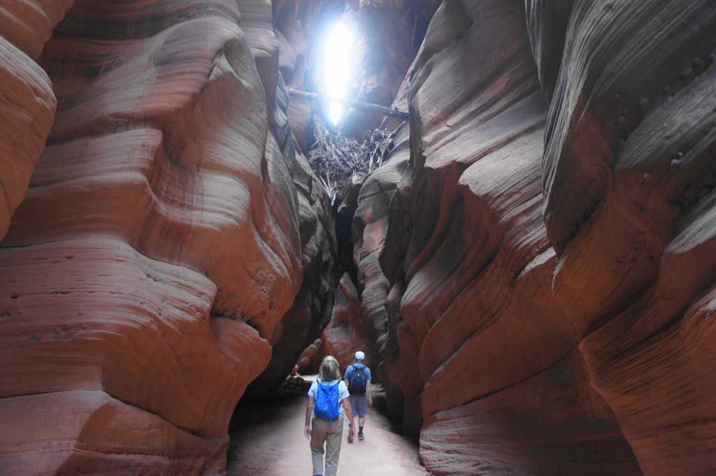
Debris above

Continuing onward 
Near the end of the first mile of narrows
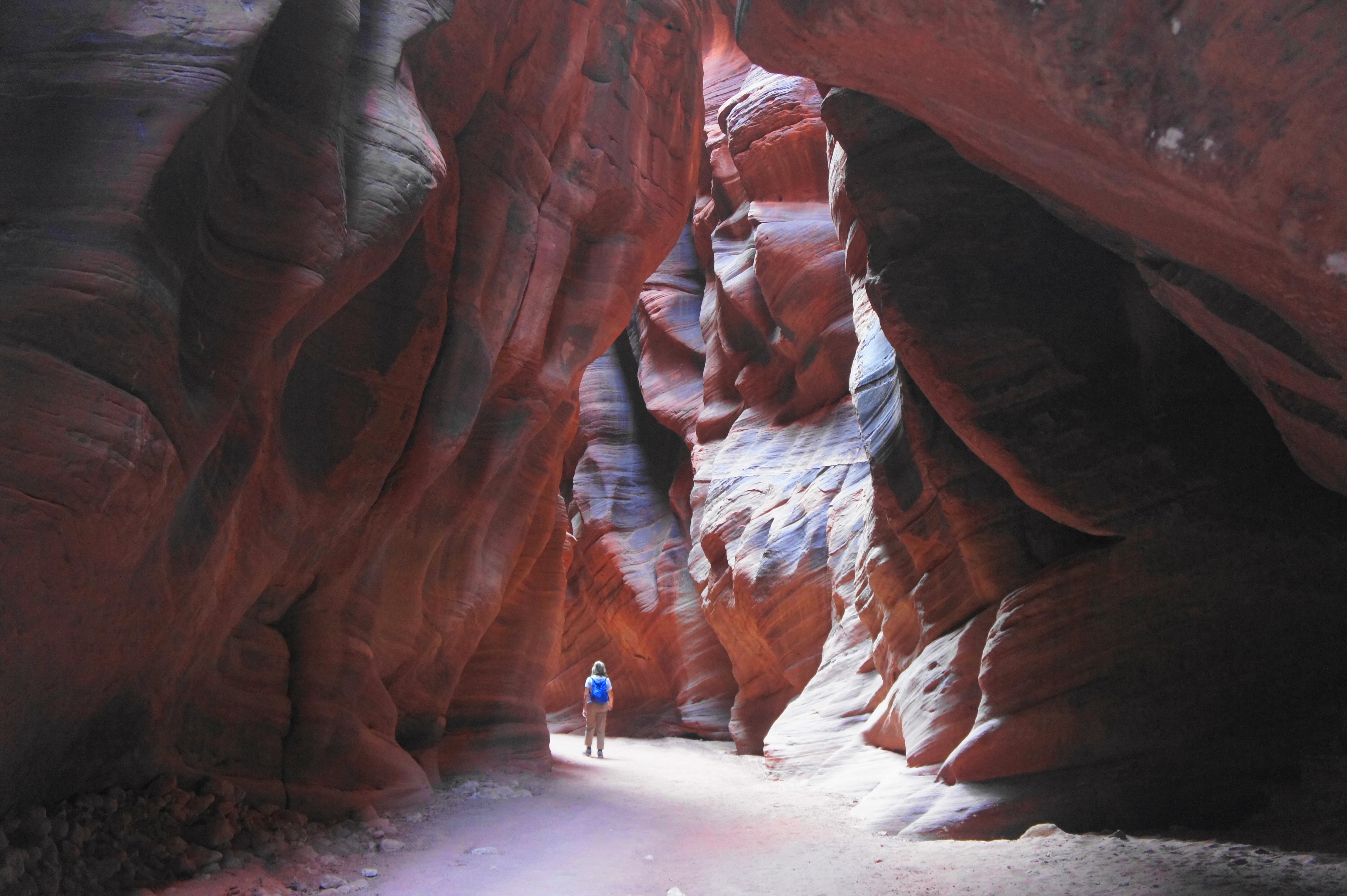
At 2.8 miles, the slot suddenly opens up, revealing the full sun again. This is a common turnaround point for day hikers, but curious travelers can continue farther down-canyon. The subsequent stretch features very high walls but a wider and brushier canyon floor.

Buckskin Gulch as it widens 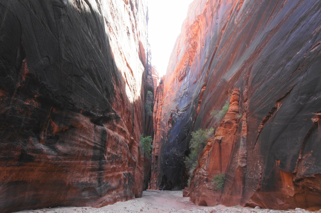
The “wide” section
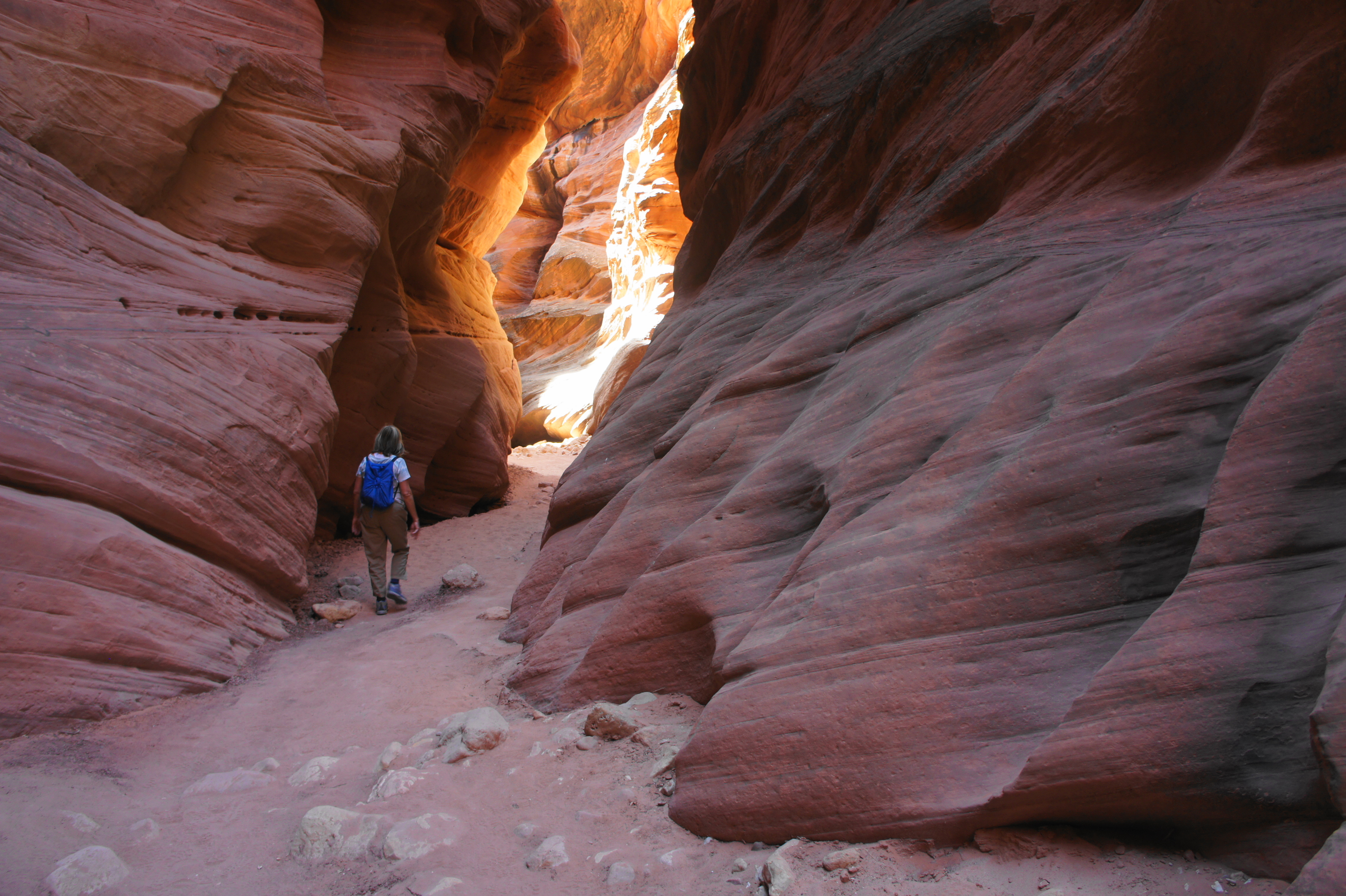
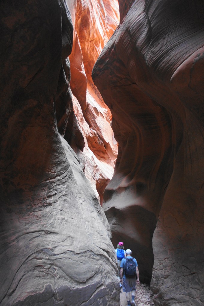
After 1/2 mile or so, Buckskin Gulch does what it does best: it narrows again to a fluted slot, as scenic as the last. These narrows are relatively abbreviated, however, with the canyon opening again (at least by Buckskin standards) a little after mile four.
Entering more narrows 
Narrows

At about 4.5 miles, hikers reach a canyon straightaway interrupted by massive boulders, requiring travelers to scope out a way around the gargantuan blocks. In general, plan to stay to the right—although not too close to the right wall, where the path cliffs out—at one point climbing amid the greenery to find a 5-foot notch that requires careful footing to descend. From here, the boulder obstacles continue but become easier to bypass. After about 2/10 mile, the canyon floor clears, and hikers can get on with admiring the scenery again.
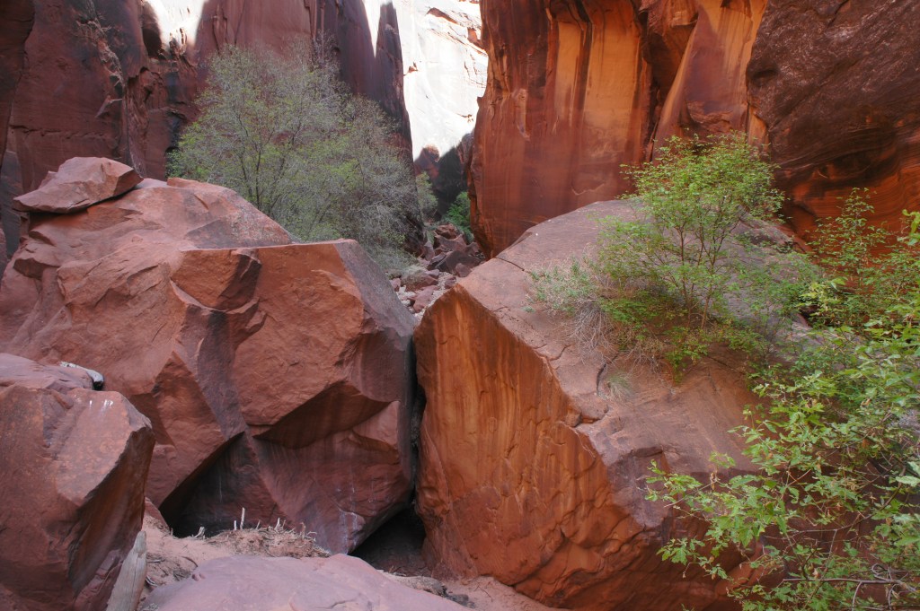
Boulder time 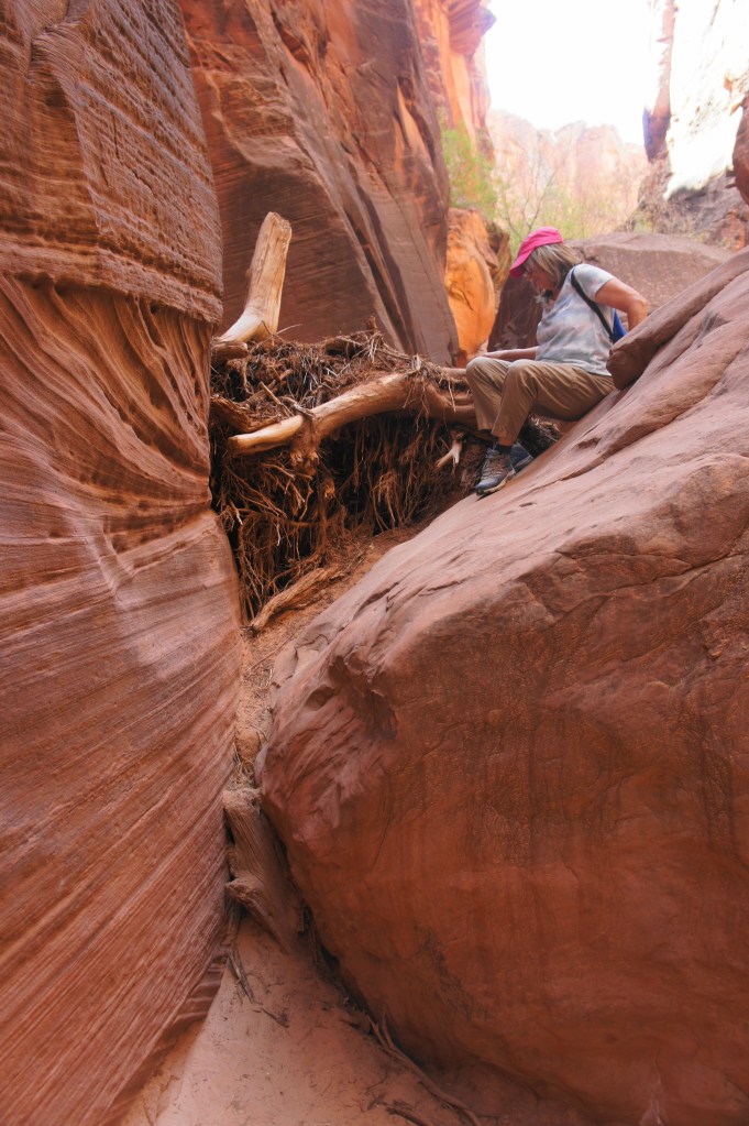
Negotiating an obstacle

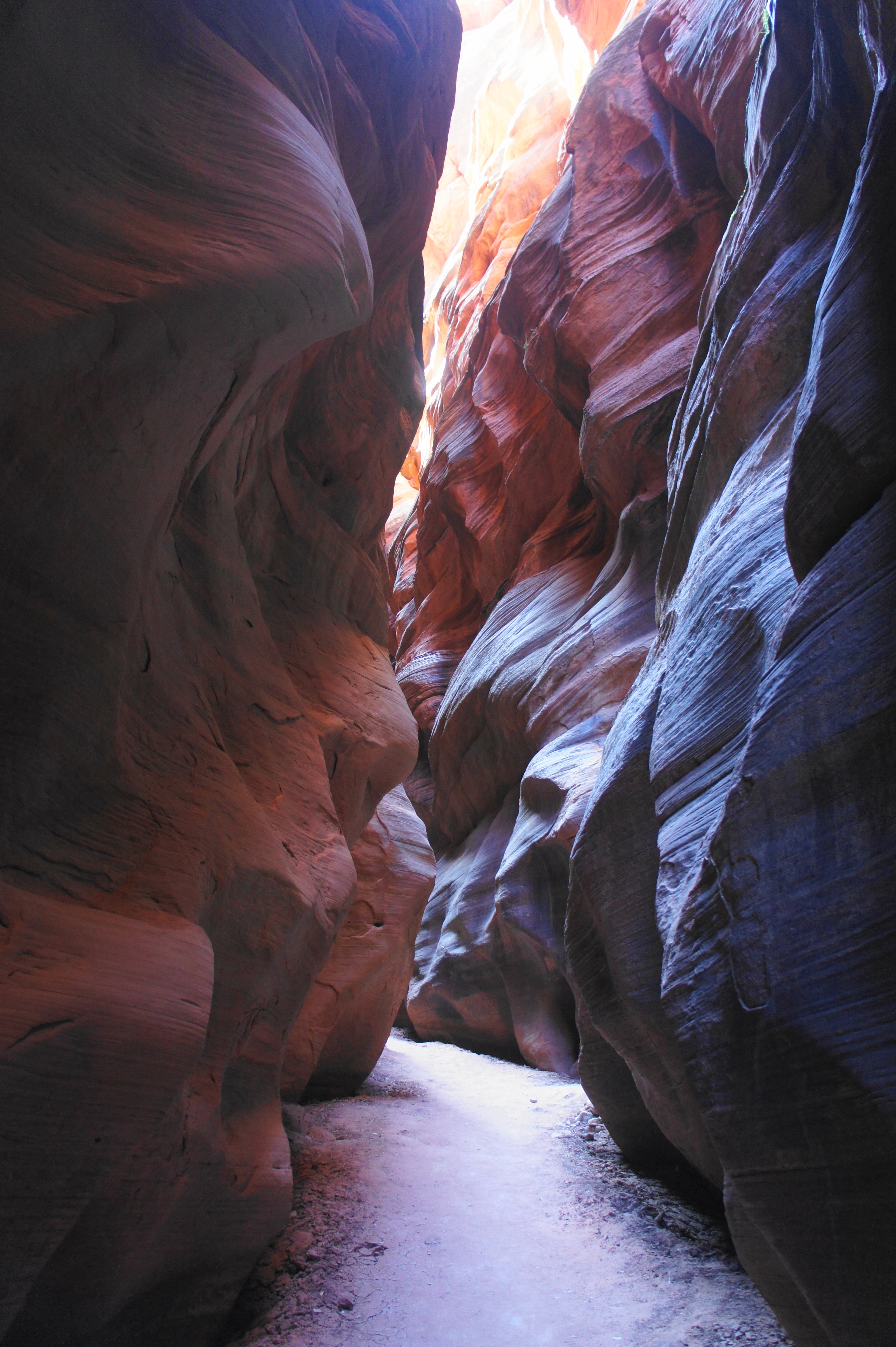
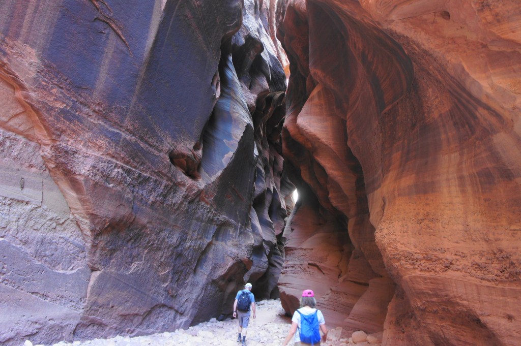
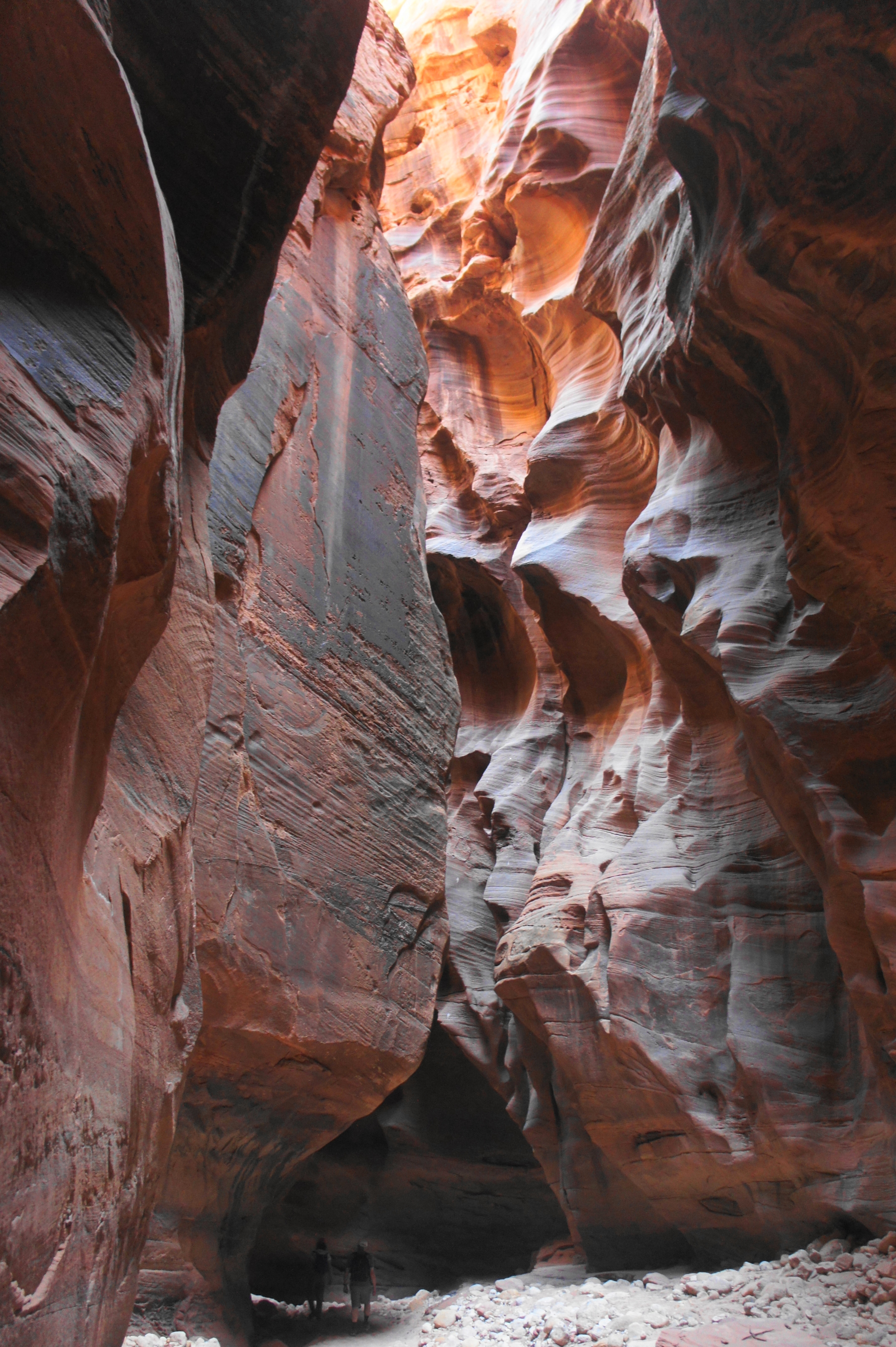
The hike’s darkest and arguably most alluring narrows lie just ahead, with the canyon walls carved with deep pockets of undulating dips and juts. (Note: This section may have deep pools under some conditions.) The endless beauty makes it hard to turn around, but hikers will reach the 5-mile mark amidst these narrows.

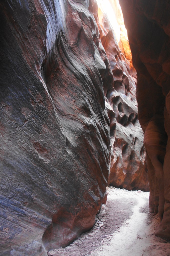
More holey walls 
Beautiful narrows
Spend as much time as desired admiring the beautiful slot, then return the way you came. Doing Buckskin Gulch and Wire Pass in reverse, there are bound to be views in different light and features you did not notice on the way in, making the return journey just as enjoyable as the entry hike.
More of the third narrows 
Near the turn-around point
At the confluence, bear left and return via Wire Pass, exiting the slot past the ladder and finishing the slog back through the open sun. Aside from the dreariness of the final mile in the hot sun, this is, all in all, an unforgettable hike that will leave hikers itching for more slot canyon magic.


This hike is still on our list. You certainly picked the perfect time to hike this with no water. Your photos are spectacular. You even timed it to have a nicely crafted ladder for the choked area.
Yes, it worked out perfectly. I think it’s very rare for there to be no standing water in the gulch.
Wow, what a lovely location and hike! Really nice.
And the sculpted walls of Buckskin Gulch, simply breathtaking. I was not aware of this gorge and your post gave me the chance to get to know new things.
Thanks for sharing.
Kudos to Andrew! I shared it on the “Grand Staircase Escalante National Monument and Adjacent” FB group. Wish I had read this before we visited the area.
Wow, thanks George!
Pingback: Horseshoe Bend Trail (Glen Canyon National Recreation Area, AZ) | Live and Let Hike
Pingback: Wiregrass Canyon (Glen Canyon National Recreation Area, UT) | Live and Let Hike
Pingback: Top 10 Hikes in 2021 | Live and Let Hike
Thank you so much for the detailed story! Nice pictures, lots of very useful information, fun read! Thank you for putting this together!
Pingback: Top 10 Hikes in 2022 | Live and Let Hike