

Each year, for a brief period—after recent rains in winter and early spring—the usually dry and dreary landscape of northern California’s North Table Mountain comes alive with color, flowing streams, and stunning seasonal waterfalls. And these are no run-of-the-mill cascades: as the flattops give way to deep, basalt canyons, dozens of waterfalls—Phantom Falls (164’), Beatson Falls (104’), and Ravine Falls (76’) among them—drop steeply off the cliffs, producing a thunderous roar. Spring also brings a bounty of wildflowers, and the towering basalt walls—in some cases marked by columnar jointing—are a sight to behold in themselves.
Situated in the foothills of the Sierra Nevada near the town of Oroville, North Table Mountain Ecological Preserve has a limited official trail system but an extensive network of unofficial footpaths that crisscross the open pastures and hidden canyons. The most popular destination is Phantom Falls, probably the most impressive free-fall in the park, which can be combined with several other terrific waterfalls in the 7-mile Phantom Falls Loop, a moderately strenuous but diverse and highly scenic adventure. Of course, the fun is largely contingent on being here during the right time of year: summer is brutally hot and dry, with most of the streams completely parched by July or August. Plan to come after recent rains and when the hills are a vibrant green—and be prepared for semi-rugged hiking, including unaided stream crossings, rocky traverses, and patches of mud. A map is also essential, as the trails are unmaintained and sometimes disappear completely—especially after the initial foray to Phantom Falls. (Note: I recommend downloading the excellent map from the Chico Hiking Association here.)


The hike
From the town of Oroville in California’s Central Valley, follow the paved but narrow Cherokee Road north, past the Thermalito Diversion Dam, up into the Table Mountain area. Much of North and South Table Mountain are fenced off as private property, but the California Department of Fish and Wildlife protects a 3,300-acre tract known as the North Table Mountain Ecological Preserve. Stay on Cherokee Road for around six miles; as in crests the largely flat mesa, look for a parking lot (with restrooms) off to the left. This is the primary trailhead for hiking in the park and the start/end location for the Phantom Falls Loop.
Even from the parking lot, the views are already stark. Beyond the verdant plateau, one can see across the Central Valley on a clear day to the Coast Range, including the 7,000-foot peak of Snow Mountain (often capped with its namesake fluff). And, of course, the terrain rises off to the east as well, into the northern portion of the mighty Sierra Nevada. In between lies a topography that resembles parts of Ireland or Scotland: rolling pastures, punctuated by streaks of basalt, the predominant igneous rock layer in the area.
Trailhead to Phantom Falls (1.9 mi.)
The route to Phantom Falls (following the Chico Hiking Association map) takes off westward from the parking area, setting out across a relatively level plateau. At first, the path is wide and well-worn, quickly traversing a seasonal stream. But the route soon begins to fade, generally heading northeast in the direction of a fenced boundary: make your way toward the fence corner that separates the preserve from private lands, staying on the right side.
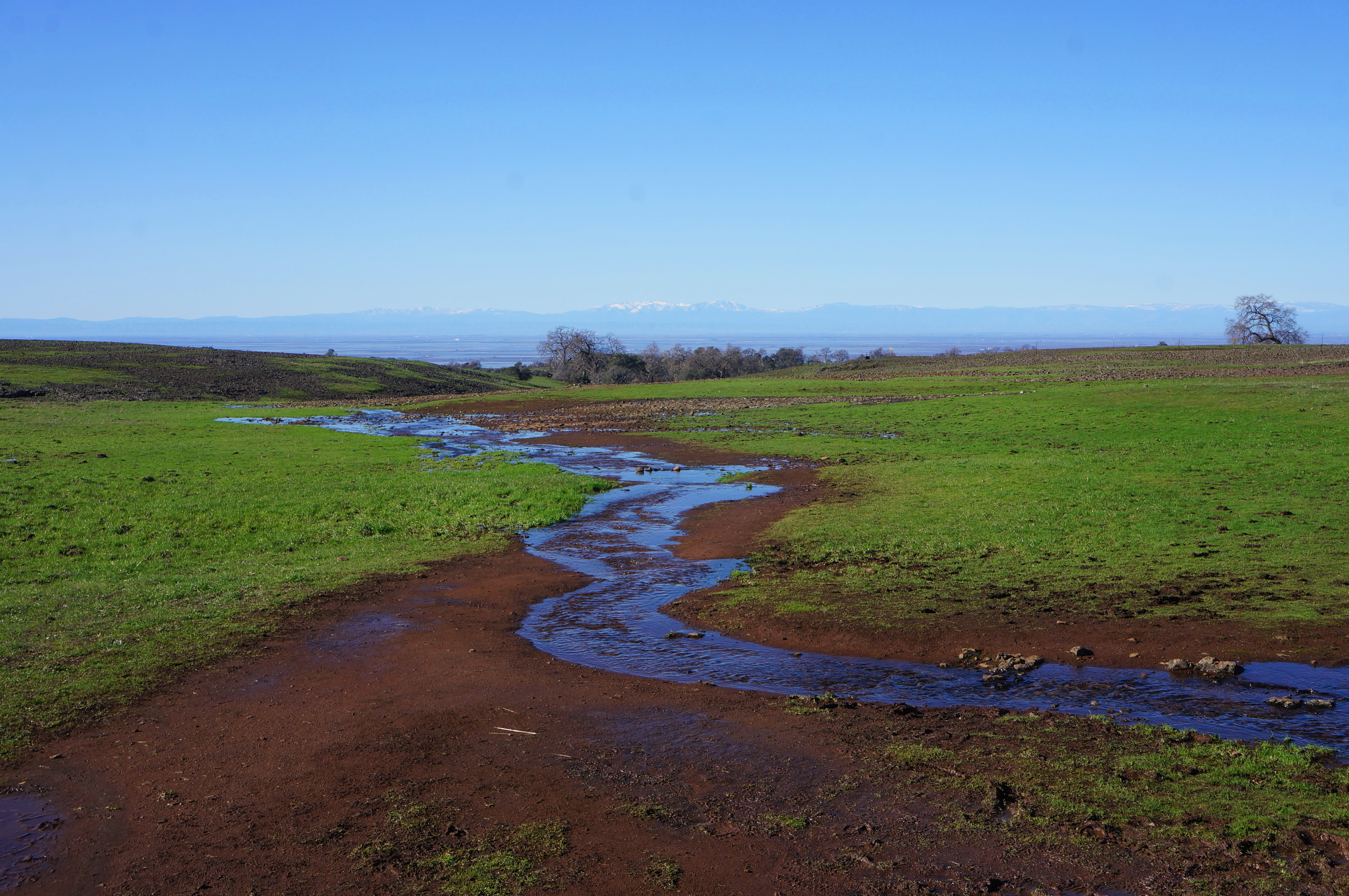
Now, about 2/10 mile from the start, the onward route drops steadily into a sunny ravine carved by Campbell Creek. Cross the stream wherever convenient, but then resist the temptation to follow the fence-line (which most hikers do); instead, cut northeast across trailless terrain. This shortcut avoids unnecessarily steep ups and downs and, despite following no trail, remains manageable as long as one stays the course in a northeasterly direction. There are also occasional metal poles that could more or less act as route markers.
At 6/10 mile, come to an unnamed rivulet, a branch of Campbell Creek, and cross it. Then, minutes later, crest a minor ridge and descend to another tributary, this one featuring a small waterfall on the right. Here the route rejoins the well-trodden path used by the majority of hikers.
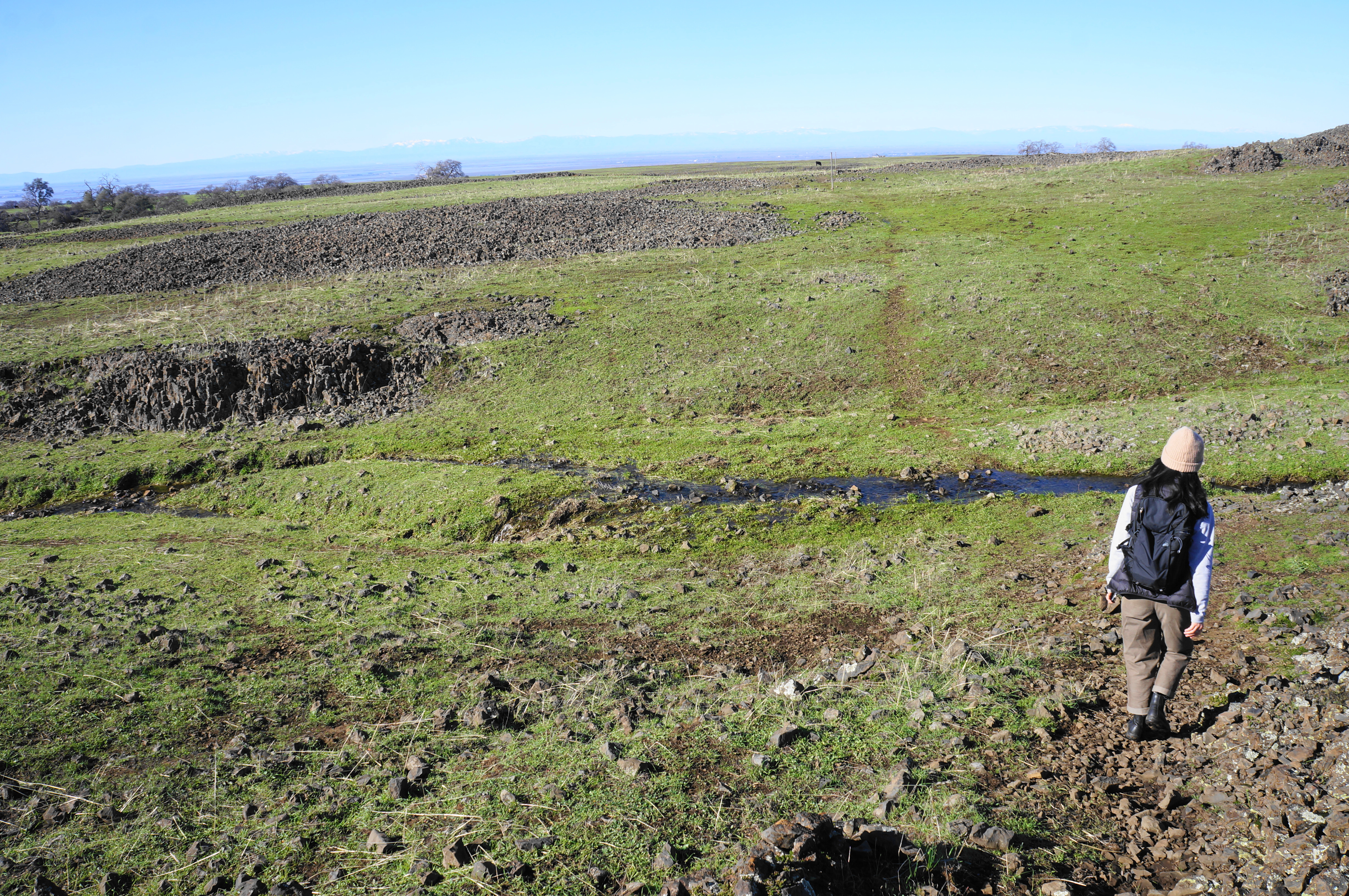
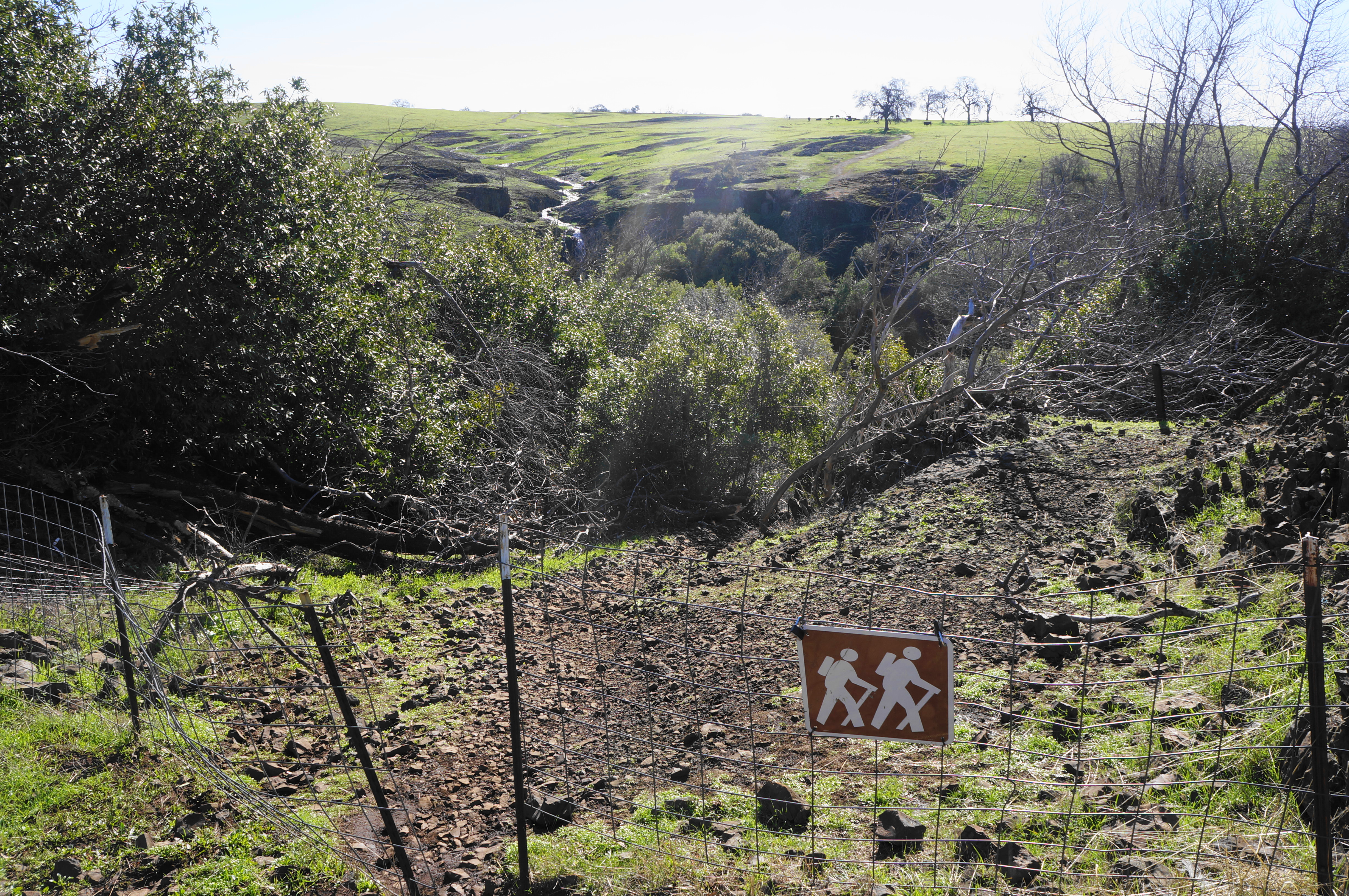
Even as some of the basalt is now exposed in small outcrops, it remains hard to believe at this point that the largely level terrain will eventually give way to deep canyons and hundred-foot waterfalls. But, at 8/10 mile, there is a trail sign that assures one that there are indeed waterfalls ahead, with the route to Ravine and Phantom Falls heading right.
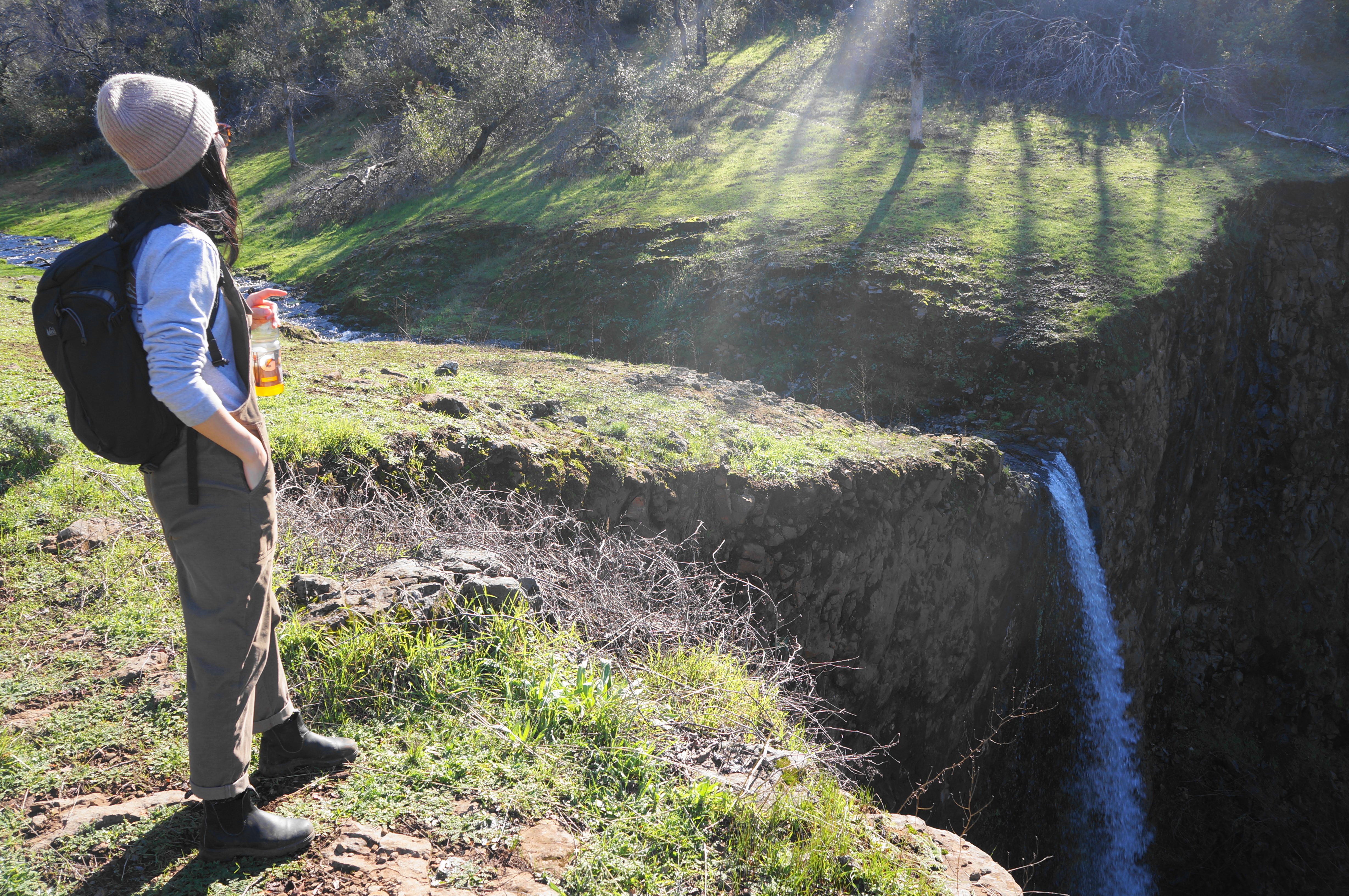
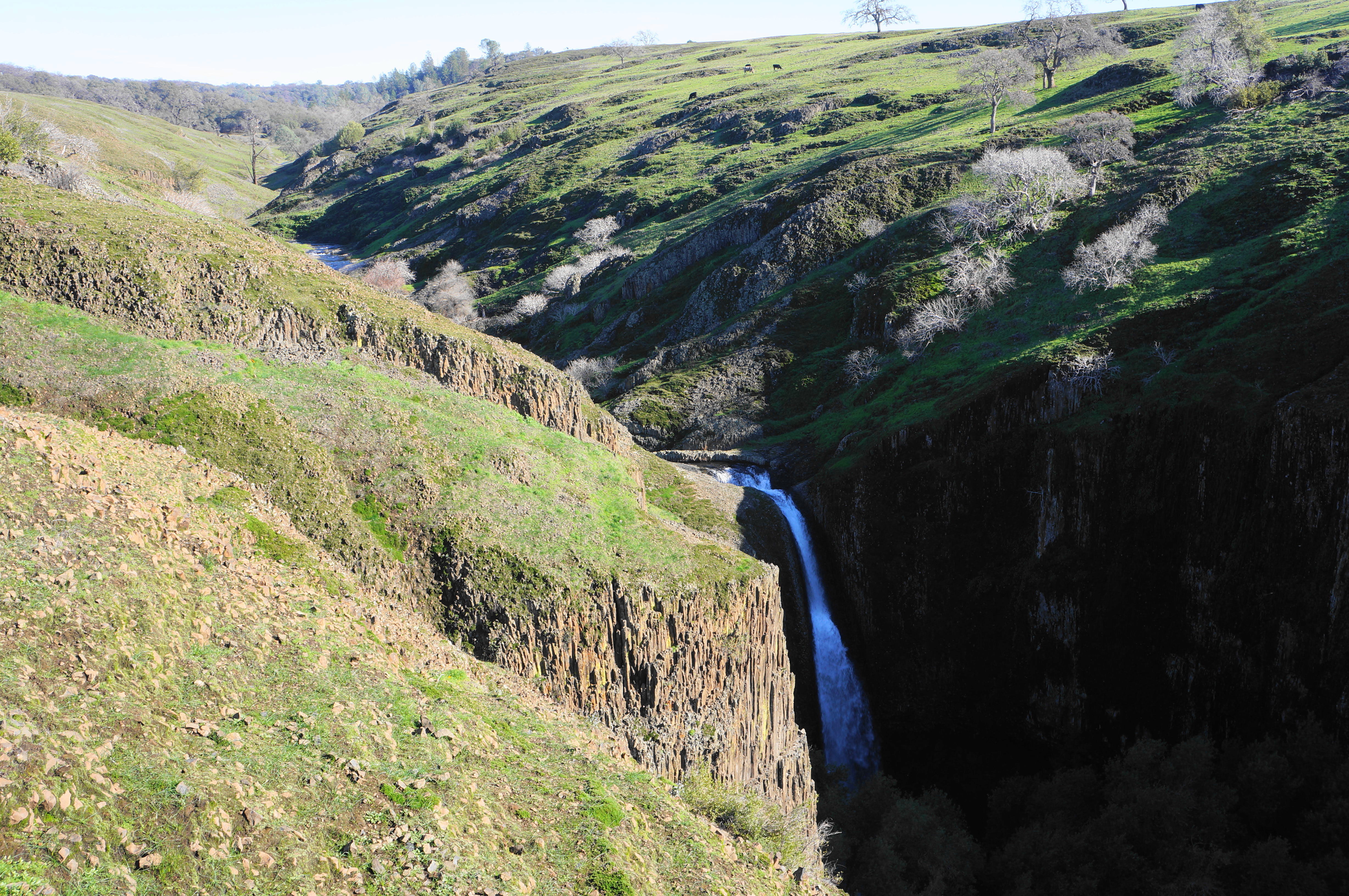
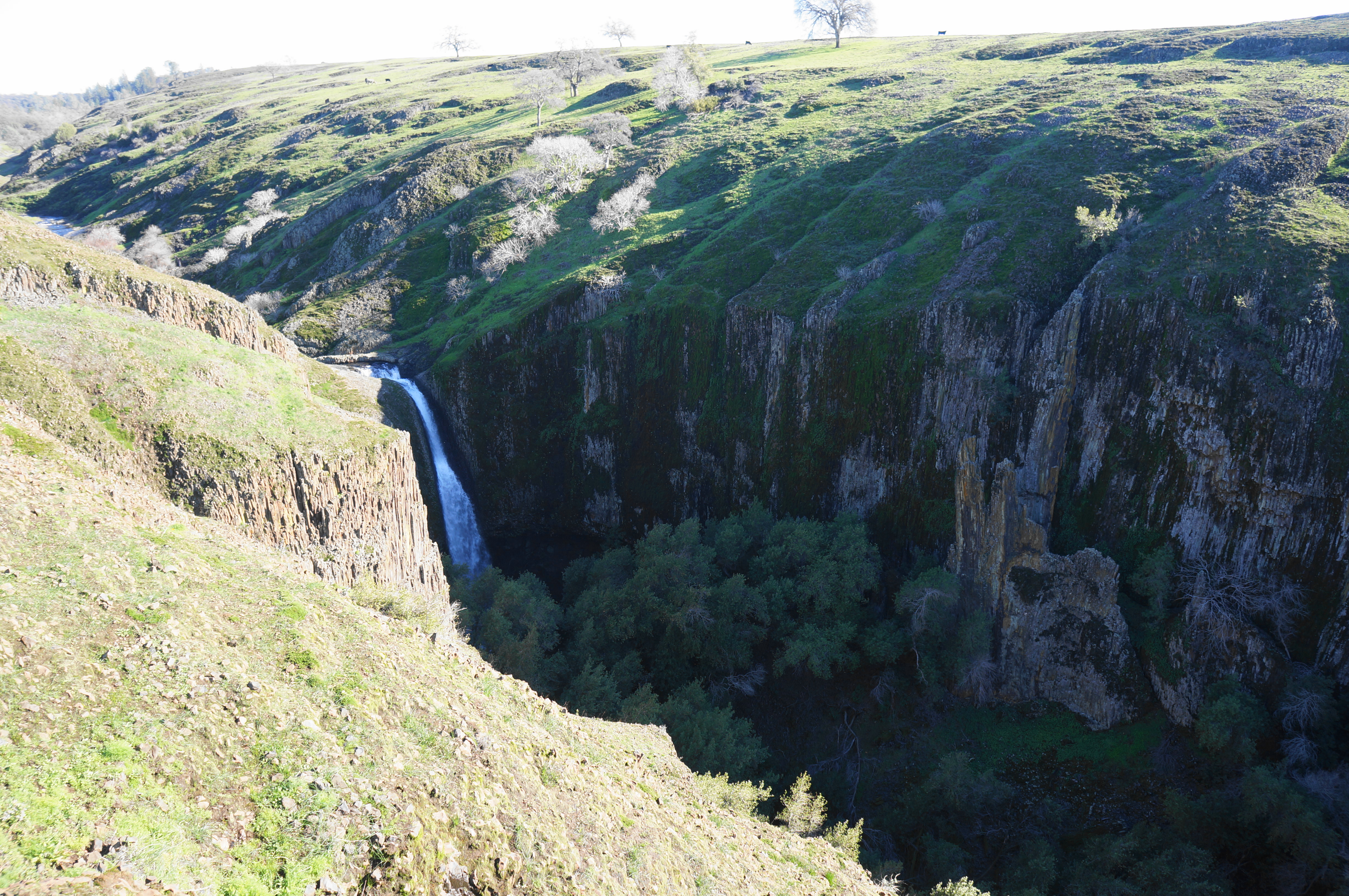
Stay right, starting the loop portion of the hike, continuing on the ruddy track that passes a smattering of oaks on the left. Edge northward toward a new ravine, the largest seen thus far. What begins as a modest hollow quickly turns into a warren of basalt-lined gullies. Approaching the rim of a canyon known simply as “The Ravine,” hikers get their first look at the area waterfalls. In the foreground, a modest rivulet turns into the suddenly powerful Ravine Falls (76’), viewed here from above, and—in the distance—one can see a portion of the shorter Ravine Twin Falls (20’ and 46’).
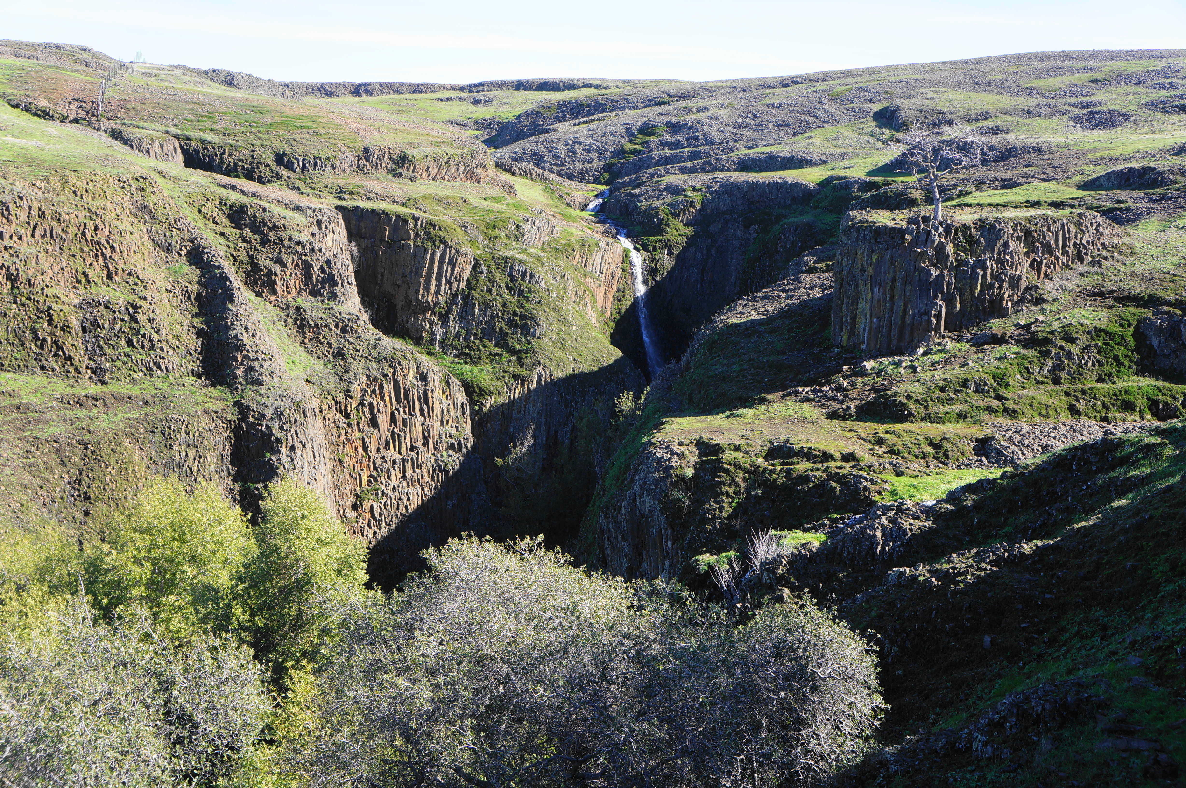
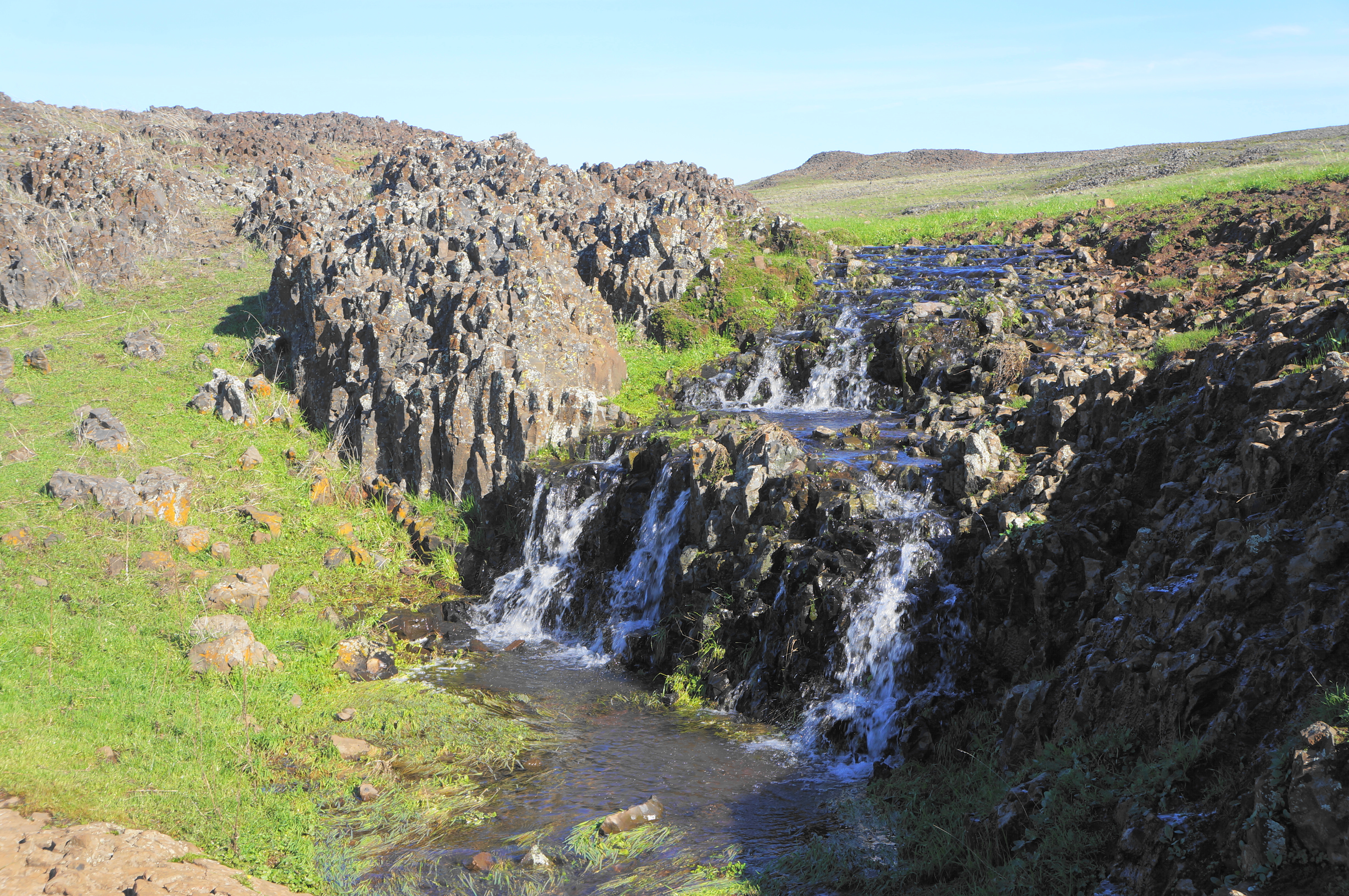
Now thoroughly enticed by the sight of the waterfalls, hikers should continue as the route narrows to a thin singletrack and drops westward into the deep drainage. After a switchback, hikers reach the first solid shade of the hike, where oaks and bay laurel are interspersed with lichen-soaked outcrops, including some up-close exemplars of columnar jointing.


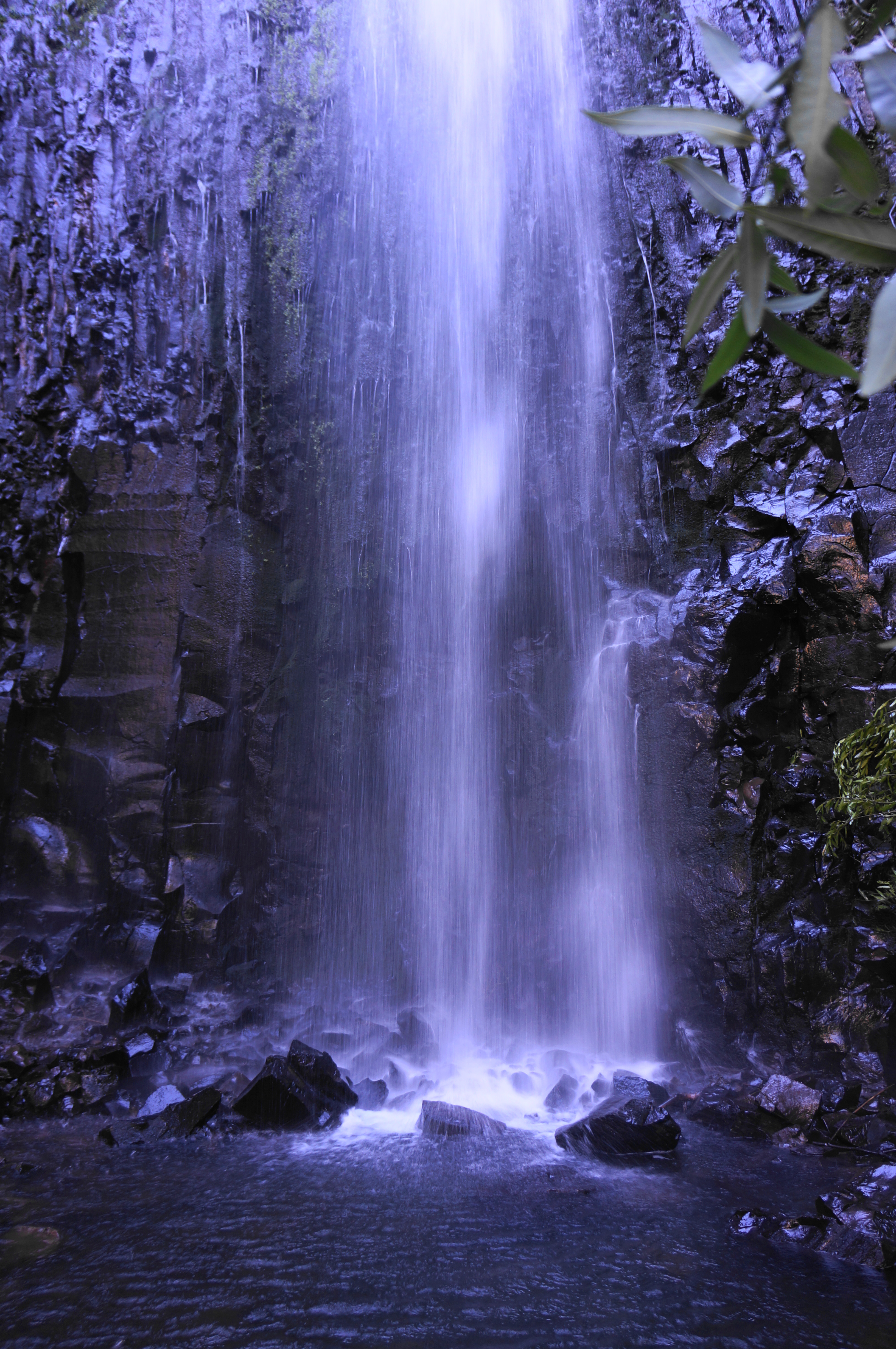
Follow the sounds of falling water until the trail bottoms out at the crossing of Ravine Creek. Turn right and see Ravine Falls, a worthy destination in its own right. Here the stream falls 76 feet in a single drop, flooding a small pool in the shady gully. (Note: This is technically Upper Ravine Falls—the lower falls will be encountered later—and certainly the more impressive of the two.)
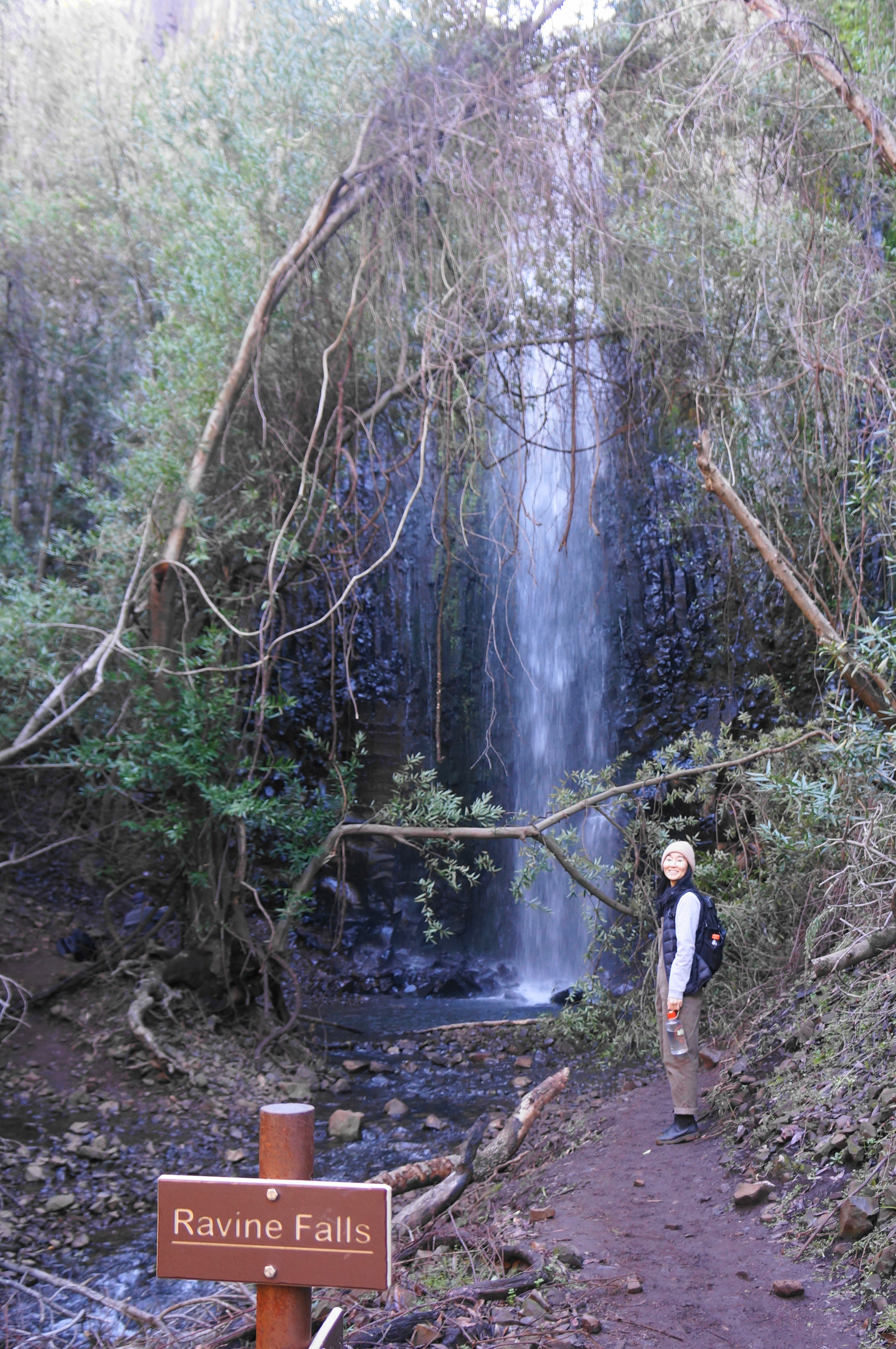


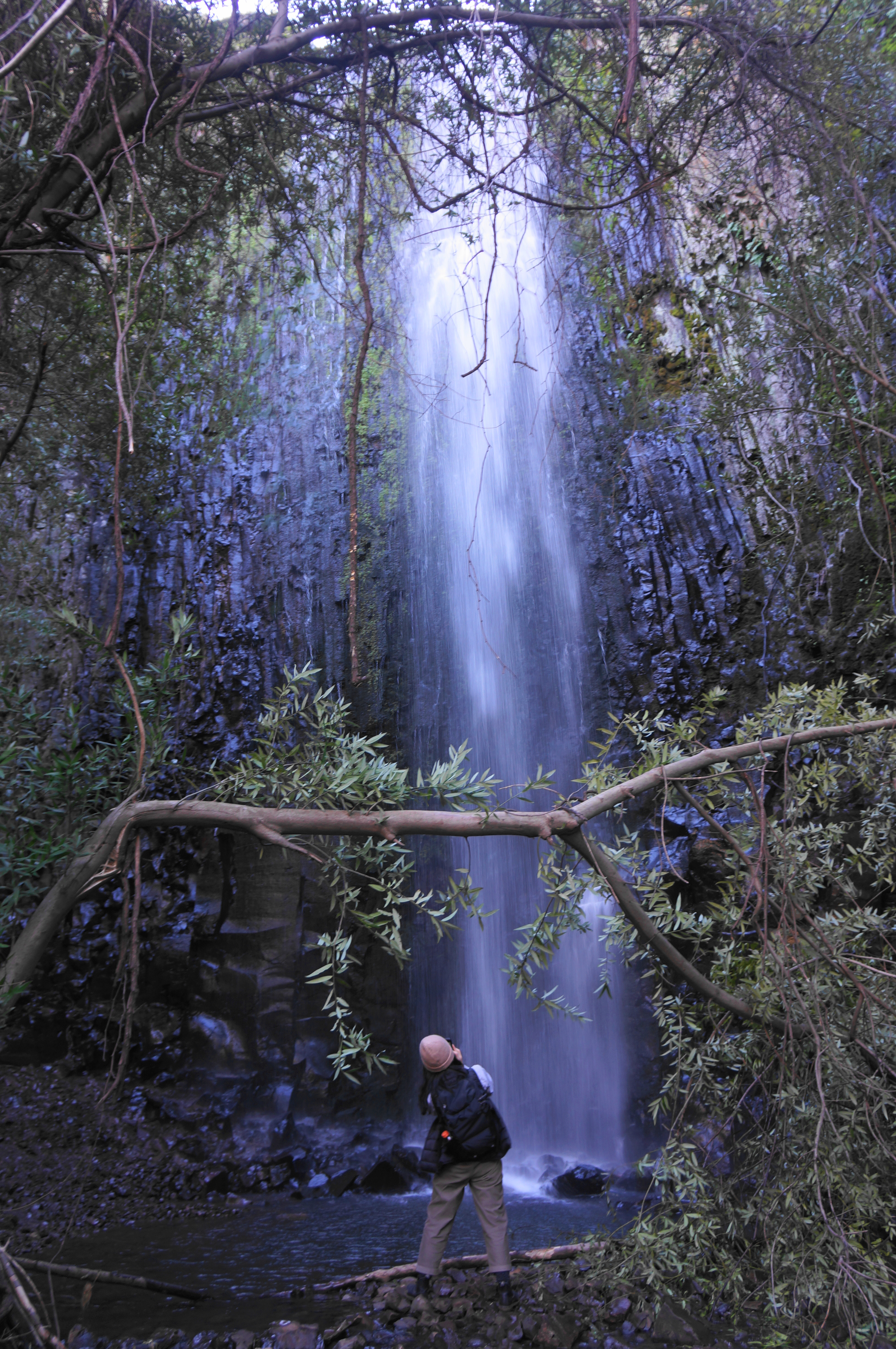
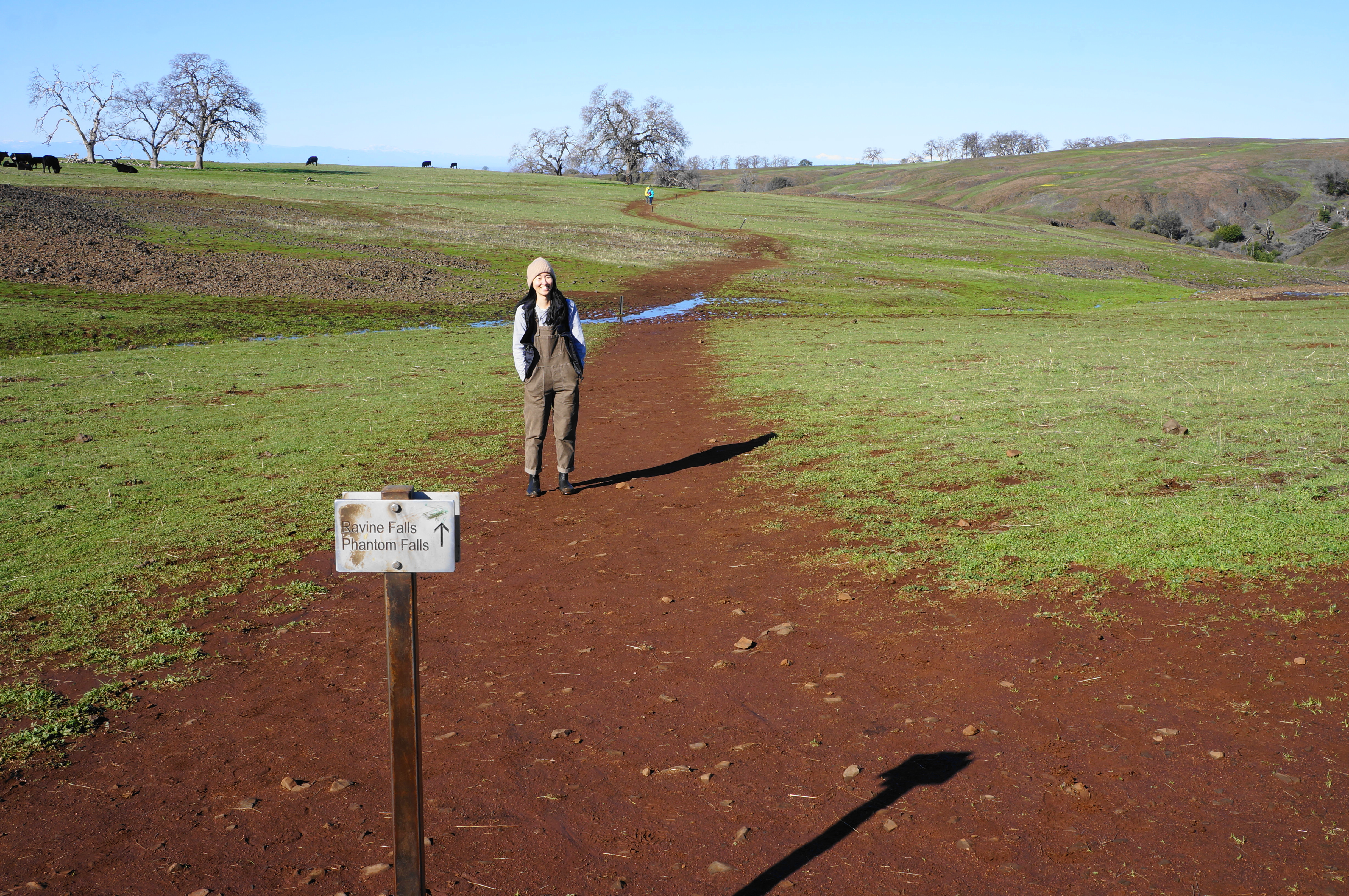
Some hikers will turn around here, content after a 1.3-mile walk. But most will continue on to Phantom Falls, which is more than twice the height of Ravine Falls. The onward trail crosses to the north side of Ravine Creek and then climbs a set of switchbacks to return to the open sun, leaving the drainage behind (for now). Come to a fence with a small crack in it—despite the appearance of being the end of the road, the trail actually continues past the gate, rising up through a grassy gap.

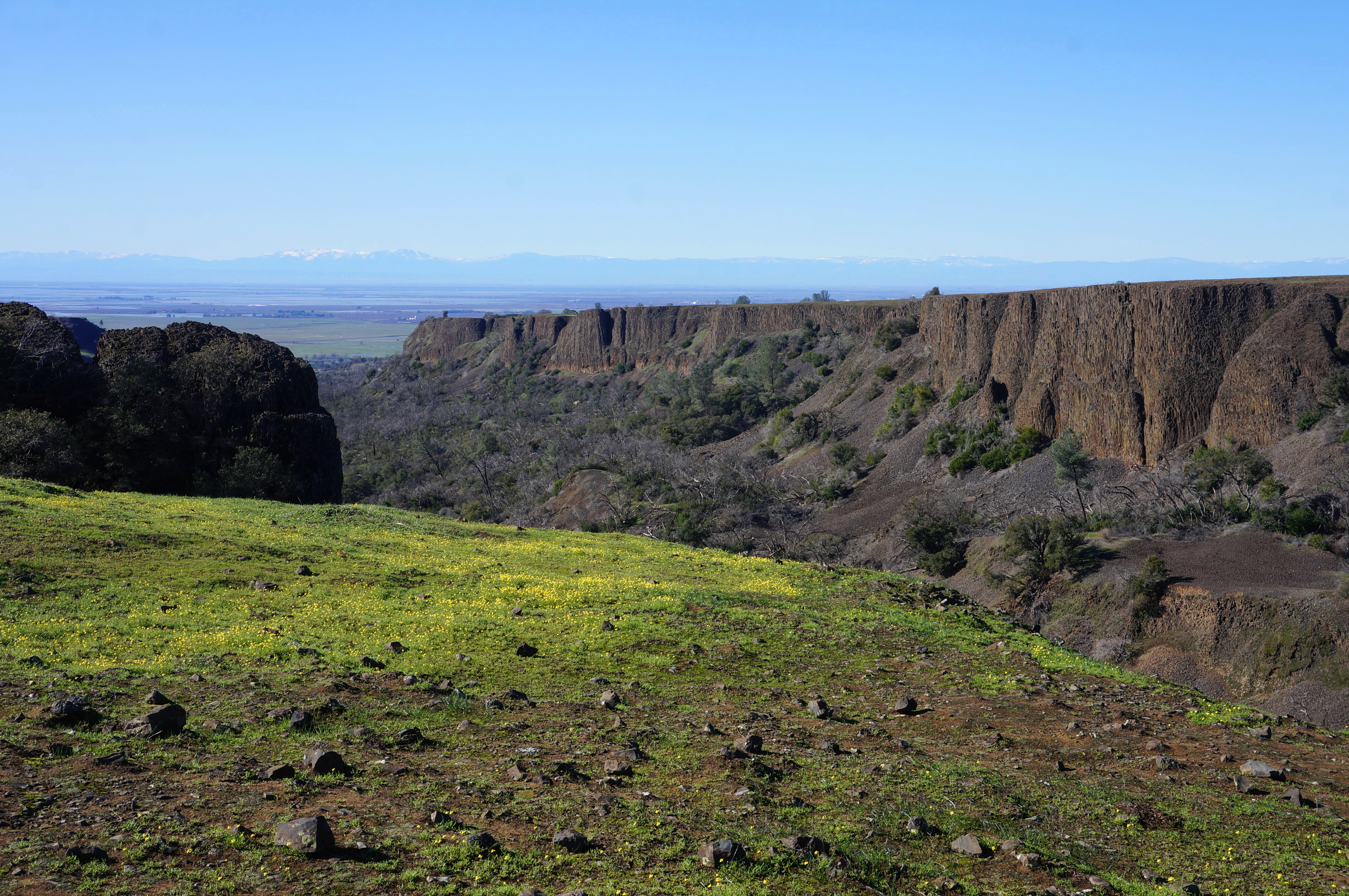
Now with expansive vistas again to the Central Valley and Coast Range, the trail to Phantom Falls continues north and west, skirting a mild hillside between The Ravine and the much-larger Coal Canyon. The latter is the largest incision into North Table Mountain and has the most impressive, multi-hued basalt cliffs, near-vertical for more than 100-200 feet. The basalt is the product of lava flows occurring 30-40 million years ago; uplift and then erosion led to the creation of the deep canyon.
Follow the trail as it comes to the first views of Coal Canyon and splits—stay right at the signed junction, continuing toward Phantom Falls. Before the big prize comes a smaller one—Little Phantom Falls (124’)—which, if you’re careful along the cliff’s edge—can be viewed just as hikers traverse a small creekbed about a minute or two north of the junction. (Note: A better view, from a distance, can be found a little later.)

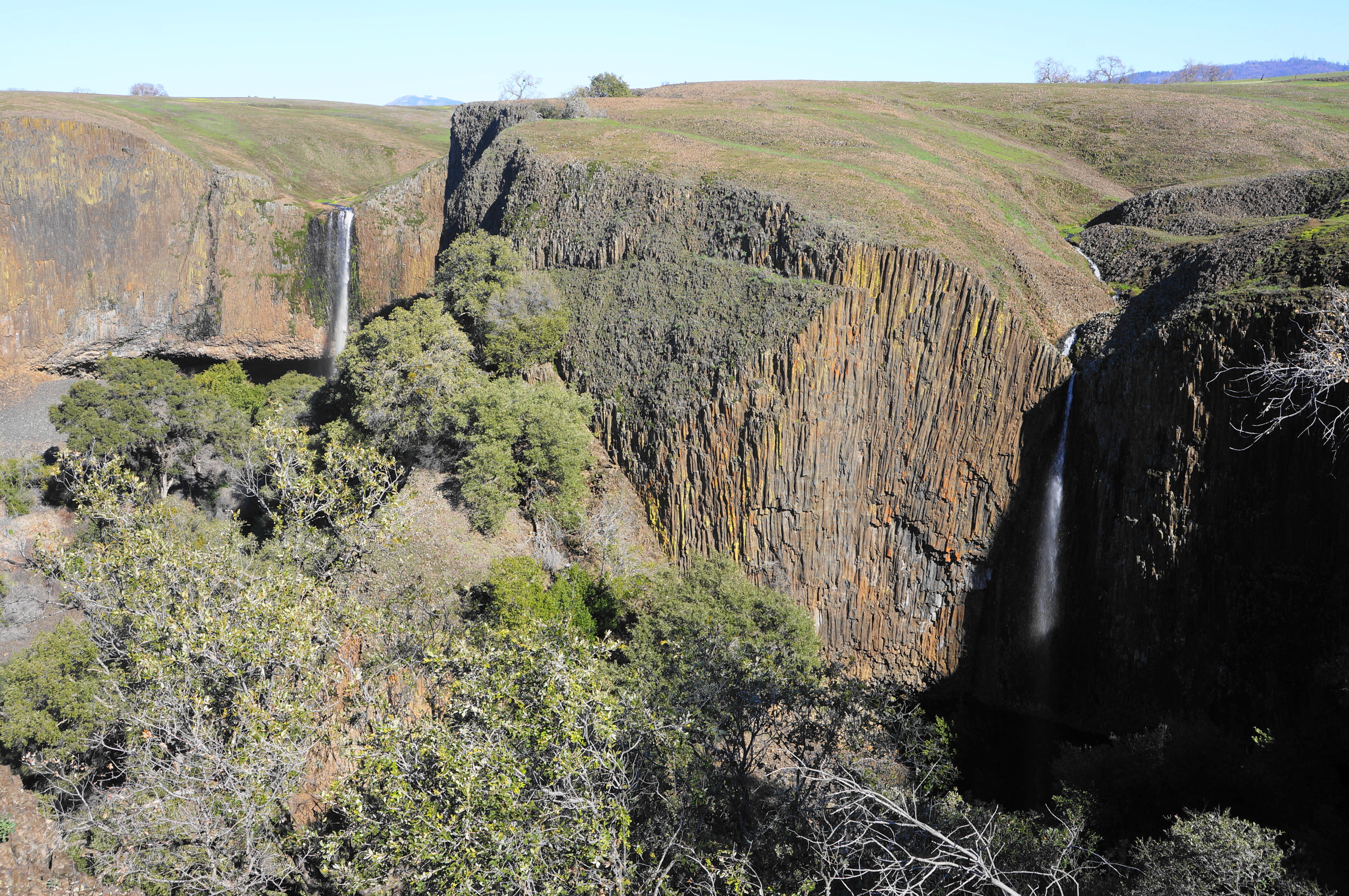
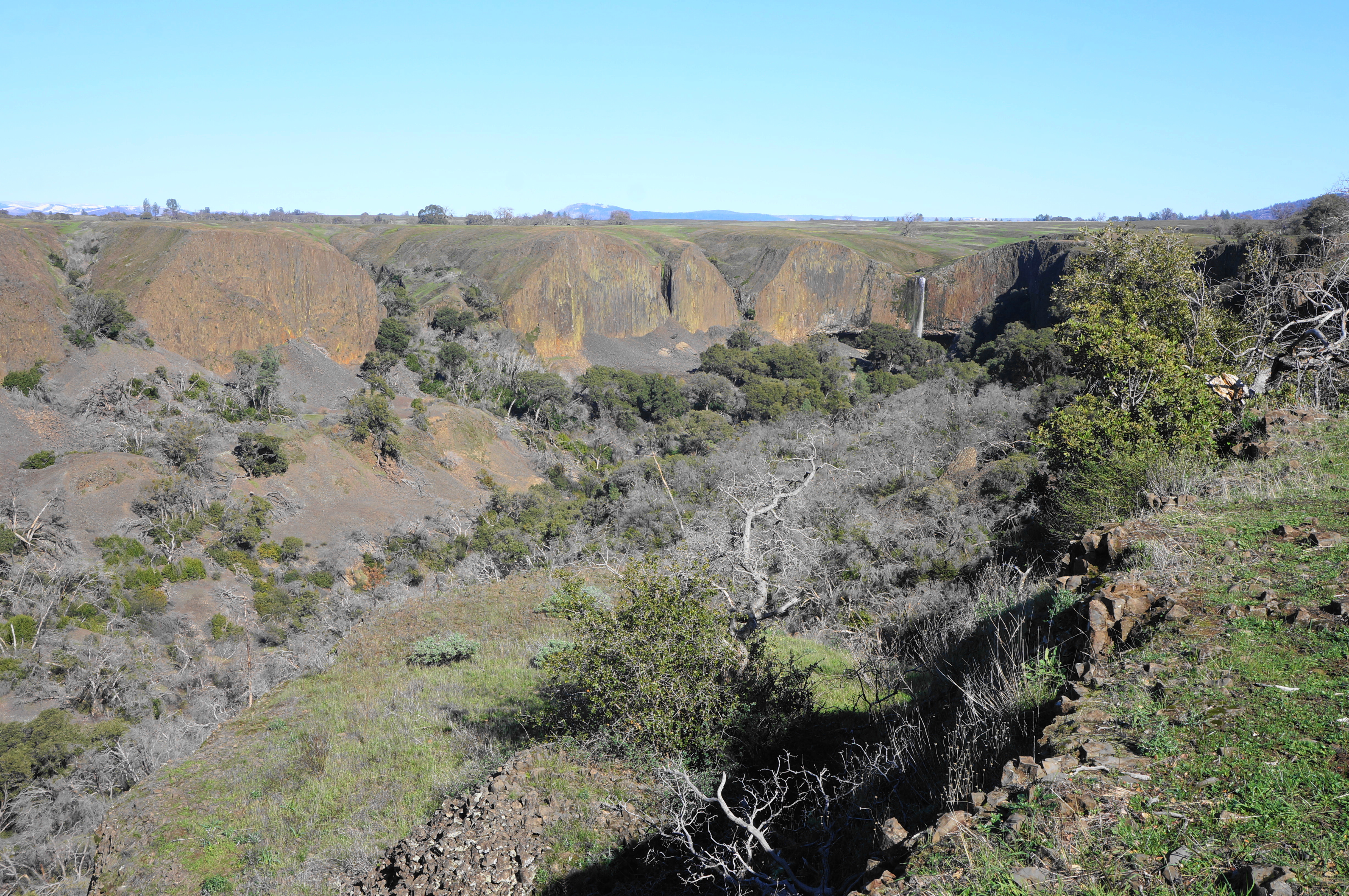
Even with the preview of Coal Canyon, the dramatic vista just beyond Little Phantom Falls still packs a major surprise: suddenly the earth drops 200 feet, and the cliffs form a partly-shaded bowl, punctuated by the stunning display of Phantom Falls (a.k.a. Coal Canyon Falls). Even from a distance, the falls are impressive: they drop 164 feet in a single chute, with the pool obscured by trees. Behind the falls lies a shady cave and overhang. The combination of the falls with the multicolor basalt cliffs makes this spot—known as Phantom View—one of the most picturesque spots in Butte County.


Curious hikers can venture past this viewpoint to the top of the falls—and some very ambitious hikers who are willing to swing way around to the north side of Coal Canyon and descend a dicey chute can reach the base of the cataract. But most will content themselves with admiring the falls from afar at Phantom View before moving on to the remainder of the loop.
Phantom Falls to Beatson Falls (2.2 mi.)
For those just doing the Phantom Falls out-and-back, this is the end of the road: turn around and return the way you came, retracing your steps past Ravine Falls and back over the open pastures to the trailhead. But what’s the fun in an out-and-back when a loop option is available?
To continue the Phantom Falls Loop, make your way back to the nearest signed junction, this time heading right in the direction of Little Ravine Falls. Briefly leave the trail and head right on a thin trace leading back to the canyon edge, where hikers come to a second viewpoint, this one a two-for-one deal: in addition to Phantom Falls, visitors can now also see the bulk of Little Phantom Falls. The two drops—164 feet and 124 feet, respectively—can be captured in a single frame. This vista is known as Phantoms View and is another popular lunch spot for loop hikers.
After this point, the crowds thin considerably, and the route generally becomes fainter and less well-trodden. Making your way back to the westbound track, however, the onward route is occasionally marked and relatively easy to follow, following a smattering of oaks set back slightly from the canyon rim. At 2.4 miles, come to a cut in a fence and a small oak grove, with a sign marking the trail continuation.
Soon the path begins a steady descent, back into The Ravine, a capillary of the main Coal Canyon artery. Follow the toyon-studded north flank of the drainage until the path runs through an old stile—with no fence—and eventually comes out into the open at a spot just above Lower Ravine Falls. Here the gently-flowing stream suddenly drops a level, plunging 40 feet into a rockbound pool, with broader Coal Canyon unfolding beyond. While not as striking as Ravine or Phantom Falls, this smaller waterfall is an impressive feature nonetheless.


Crossing Ravine Creek above the falls can be tricky, especially at high water. But there are a few spots, backtracking a bit from where the trail crosses the stream, where rock-hopping is possible. Thereafter, look for the unmarked but evident singletrack as it climbs back into the woods. The faint trail switchbacks up a brushy slope—sometimes with downed branches that must be negotiated—and rises to a stile through a barbed-wire fence.
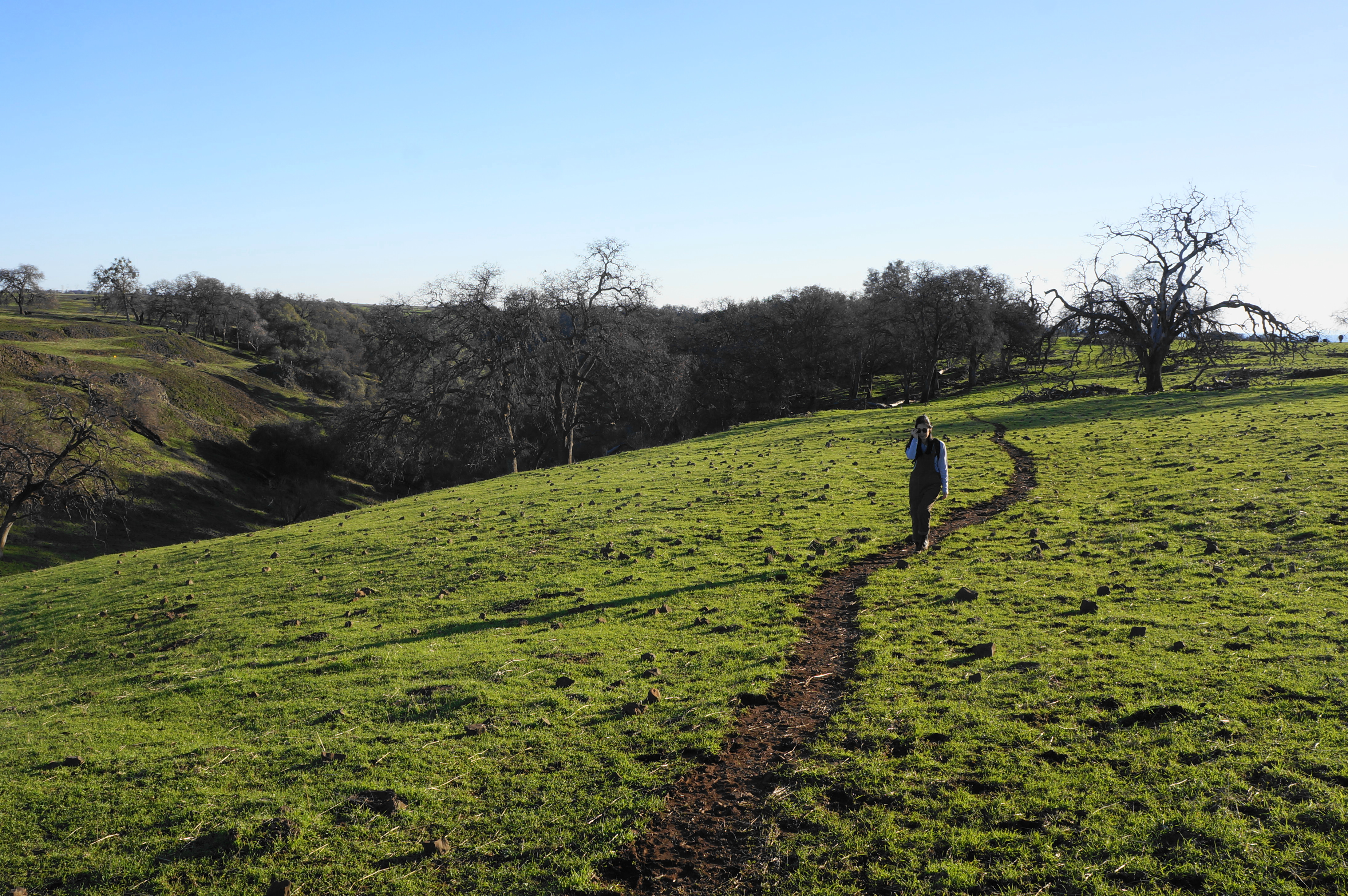
Beyond, the path crests a sunny gap, and the terrain is suddenly flat and devoid of vegetation. The trail follows these flattops, featuring unobstructed views across the Central Valley, for around the next mile.

Traversing the flattops, however, can be tricky, as the trail is hard to distinguish. At the start, the route more or less heads south-southwest on a grassy line between fields of small, basalt rock. Quite often, the area is also marked by cowpies—with the culprits, loving the spring weather, never too far out of sight. (Note: In contrast with the cattle in the Bay Area, which seem very used to hikers, these cows are a bit skittish and a little judgmental—staring down hikers with a confused or faintly menacing look before often running around.)
At 3.5 miles, cross a minor drainage, then rise up to a right-leaning bend, heading toward a reservoir called Western Pond, on private property just beyond the preserve. The trail does not approach the banks of the lake but does encounter the fence-line, where there is another trail sign indicating that it is a mere 0.3 miles to Beatson Falls.


From here, however, the route gets even fainter, at points virtually non-existent. Here some map-reading and general sense of direction is a must. Generally, head straight for 50-75 yards until you reach a cattle watering hole, then take a hard right, following a faint cattle trail. Bearing west, Western Pond comes back into view, but the route keeps well south of it. Just after the pond becomes visible again, begin to cut south, across unmarked terrain, bearing generally in the direction of Sutter Buttes, an island of mountains in the heart of the Central Valley in the distance.

Soon some semblance of a trail returns, and a sign for Beatson Falls is your cue to start looking for the 104-foot waterfall. Head partway downhill into Beatson Hollow, which at this stage is a dramatic canyon with impressively sheer walls. Soon one can see the waterfall nearly in full, dropping through a narrow flume before fanning out into a wider spray. Like Phantom Falls, Beatson is generally viewed from a distance—but the vantage point is dramatic nonetheless.

Beatson Falls to Trailhead (3.2 mi.)
By this point, hikers have been at it for about 4.1 miles, but a little more than three miles remain. This final stretch is not as overtly dramatic as what has been seen thus far, but it has a subtle beauty: gently-flowing creeks weave through shallow gullies pockmarked by oaks and willows.\

As the eastbound trail pushes past Beatson Falls, it passes above and below basalt outcrops, eventually dropping to a spot where an unmarked tributary meets Campbell Creek, the main sculptor of Beatson Hollow. Follow the creek for 1/10 mile to Beatson Ford, where a sign reveals that the route back to the parking area continues left. (Note: A longer route continues right, across the ford, to Crevice Falls and the so-called “Ladder Falls Loop.”)

The next section is peaceful as the path keeps close to the creek before setting out across grassy slopes, crossing a tributary at 5.3 miles. Then the path rises to an open field that continues for a long while, still in Beatson Hollow as it seems to open up. Traverse a pair of shorter, seasonal streams where mud tends to accumulate, then follow the trail as it bends northward, following the Campbell Creek drainage toward its headwaters.

Soon the hollow will split again, and hikers might be able to make out Hollow Falls in the influent off to the east. But the track continues up the westernmost branch heading almost due north. Come to a fence, with private property beyond, at about six miles. Bear left, never crossing the fence but climbing steadily out of the hollow. Eventually the path encounters a willow thicket that can pose some temporary obstacles, and the route twice crosses the thin stream.

Back on the left side, look for a rivulet that branches off from the main creek to the right. Less than 100 yards up this narrow side stream lies the modest but pretty Little Hollow Falls, a mossy chute that is worth a quick look.

Back on the main trail, the incline steepens, and hikers are faced with a choice of a steeper but shorter ascent up and out of the canyon to the left, or a longer but easier track heading straight. Both culminate back on the flattops of North Table Mountain, leaving Beatson Hollow behind.

Soon you will find the initial junction where the loop portion began—hours ago. Bear right, retreading familiar territory as the path drops to the branch of Campbell Creek with the very minor waterfall. After this, follow the cross-country route described earlier, or continue on the longer and harder path that skirts the fence line. Back at the initial fence corner, find the final track heading back, southeast across the open pasture, back to the trailhead. This marks the end of the 7.3-mile stem-and-loop journey.

Pingback: Top 10 Hikes in 2023 | Live and Let Hike
Thanks for your article . It is one of the best on Table Mountain. I have a couple of questions/corrections.
Please review these suggestions and let me know what you think. I was just there this week and would love to hear what you think.
Looking forward to hearing from you. Thanks for your excellent research.
Christie Pittman – pittmanc@comcast.net