

Situated in the Santa Cruz Mountains just south of Silicon Valley in the South Bay, Castle Rock State Park is known primarily for its rock climbing—but the 34 miles of hiking trails are worthwhile as well. To avoid the tech bro crowd, visit on a weekday when the vibe is much more subdued, with quiet walks through forests of oak, bay, pine, and madrone; along high ridgelines and narrow creeks; and atop manzanita-lined ridgelines with views as far as Monterey Bay and the Santa Lucia Range. There are several 1-, 2-, 3-, and 4-hour loop options; the below describes a 2-hour version that combines the Saratoga Gap, Interconnector, and Ridge Trails into a 3-mile jaunt that includes a waterfall, chunky Goat Rock, and terrific ridgetop vistas.


The hike
Castle Rock State Park spans more than 5,000 acres of mostly-wooded terrain in the upper San Lorenzo River watershed of the Santa Cruz Mountains, about a 20-minute drive from Saratoga, a suburb of San Jose, California. There are several trailheads, and many will start at the Main Entrance off Skyline Boulevard, but yours truly started from the Overflow Lot just south of the main parking area. On weekends, the latter might be the only option for latecomers; on weekdays, the lot is often closed, but there is (free) parking along the shoulder of Skyline Blvd (Route 35) (see map here).
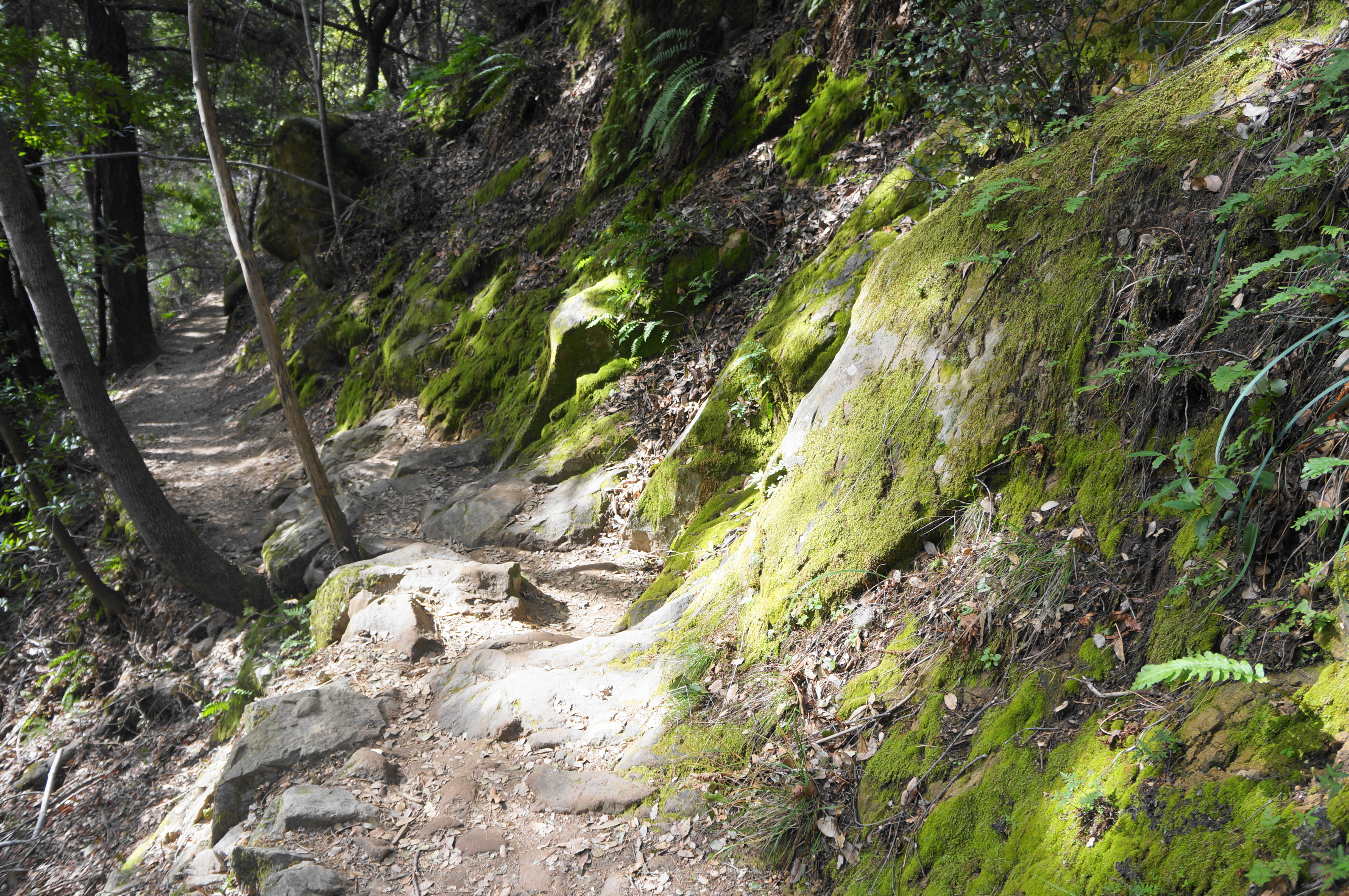
From the overflow lot, there are at least three separate trails fanning out into the woods. Take the path in the center, next to the large trail map kiosk, which offers information on various hikes of all difficulties. The first stretch of the Saratoga Gap Trail follows a very minor ravine, reaching barely more than a trickle even in the wet season. Off to the right is a 25-foot behemoth known to climbers as “Cave Boulder”—aptly named given its many deep cavities. This is the first of many sandstone outcrops that hikers will encounter on the stem-and-loop.
Follow the well-treaded trail as it descends the woody gully and crosses two bridges, coming to a junction with the Castle Rock Trail after about 200 yards. Continuing right, the Saratoga Gap Trail sheds more elevation as it hugs the left bank of the streambed. After 1/3 mile, with a bridge on the right, the path splits again, this time as the Waterfall Connector Trail comes in from the right. Stay left—do not cross the bridge—as the initial ravine merges with a larger drainage: this is Kings Creek, a relatively prominent tributary of the San Lorenzo River.


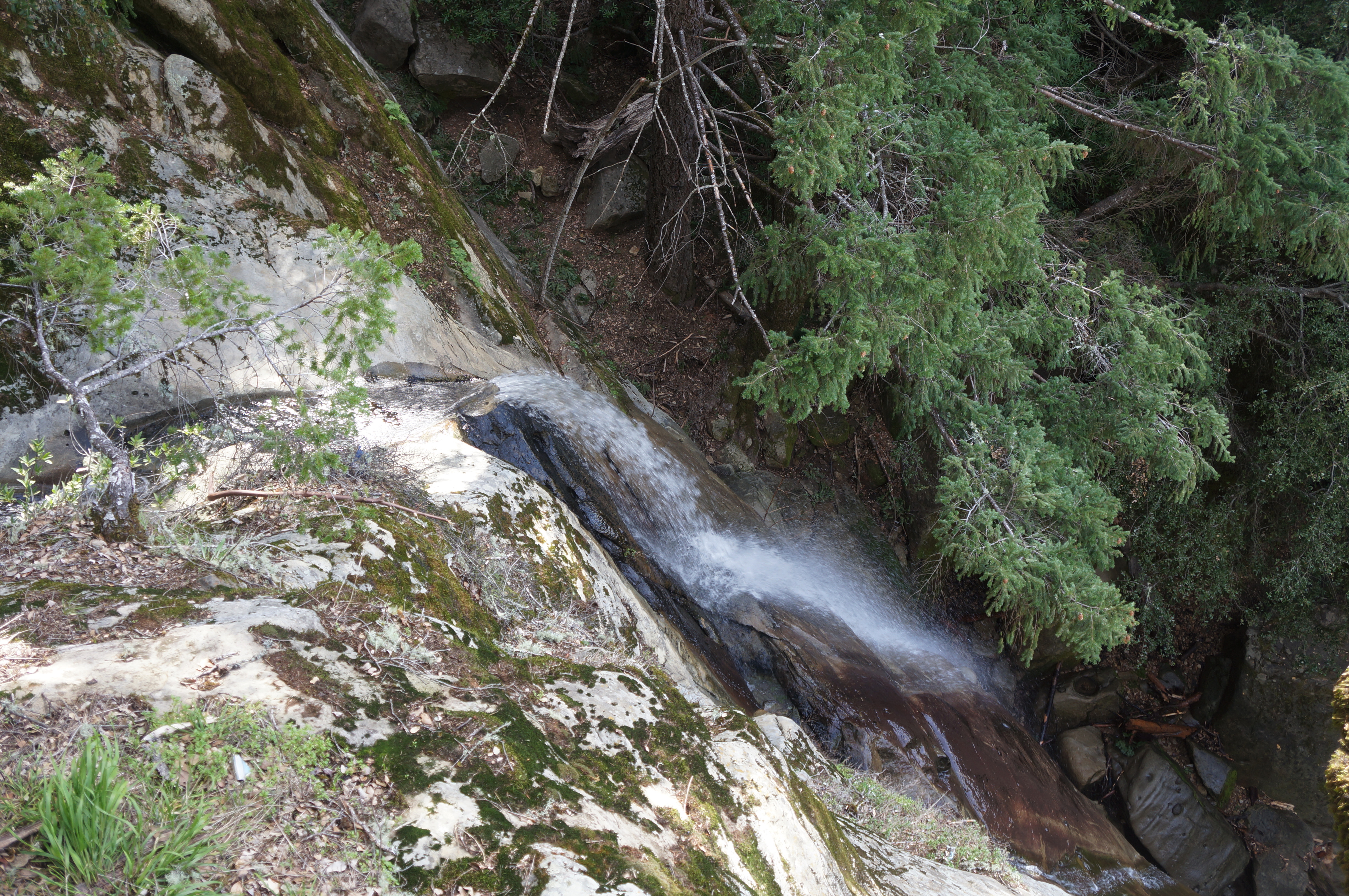
In spring, the creek flows at a pretty good clip, with minor cascades culminating in the much-anticipated Castle Rock Falls. At ½ mile, cross another bridge, then approach another fork: this is the start of the loop portion of the hike. Head left first to reach the falls, continuing on the Saratoga Gap Trail, which takes the low ground (while the right fork begins the Ridge Trail on higher ground).
The Saratoga Gap Trail continues to drop as it keeps Kings Creek on its left, eventually putting a good deal of distance between the singletrack and the streambed. At 6/10-mile, hikers approach Castle Rock Falls from above, with a short spur heading left to a viewing platform. This birds-eye view makes it difficult to view the 70-foot waterfall in full, but the flow in springtime is good, making this one of the most popular destinations in the state park. (Note: There are some social trails leading to the base of the falls, but they are sketchy and unofficial.)
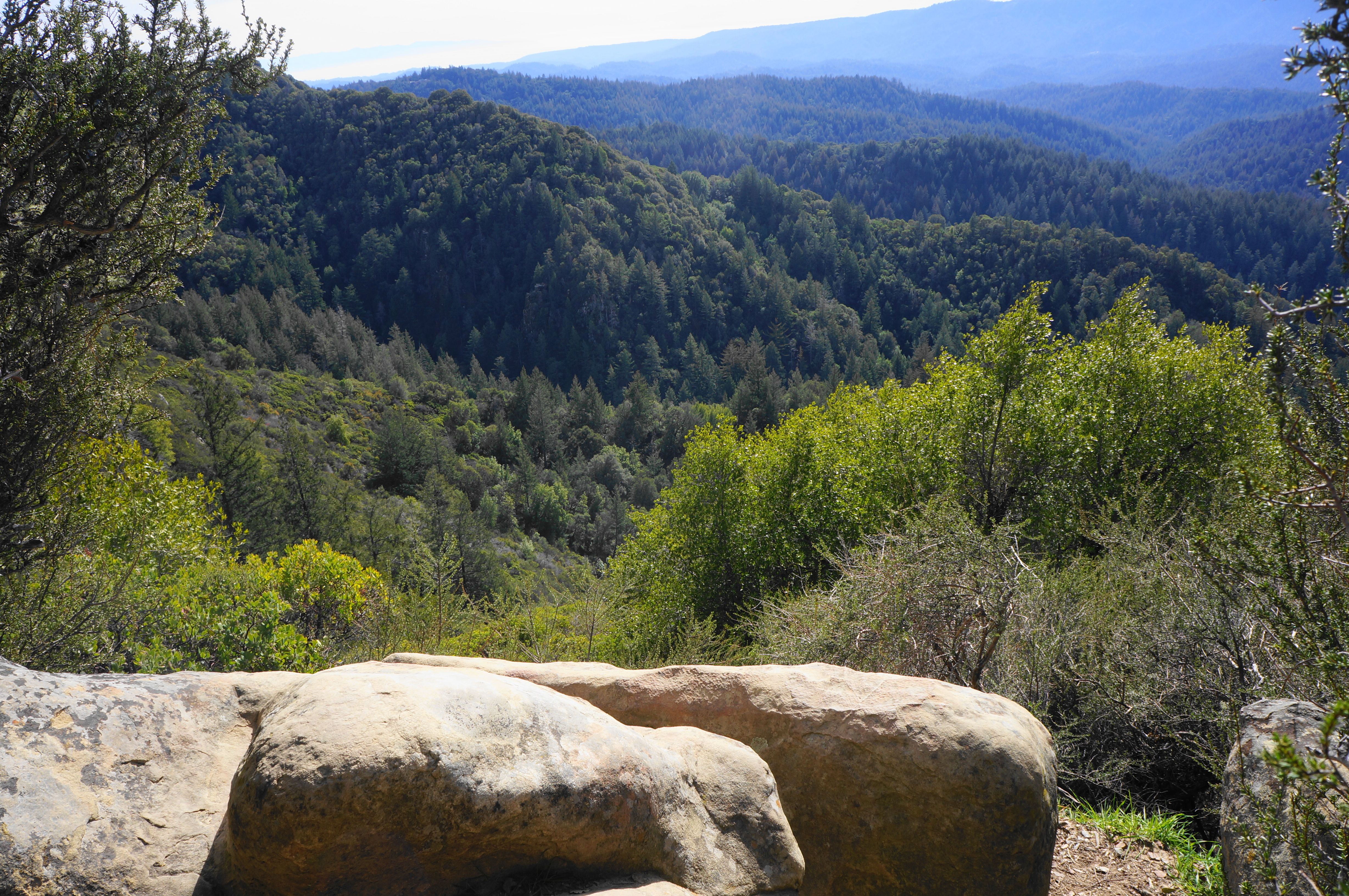
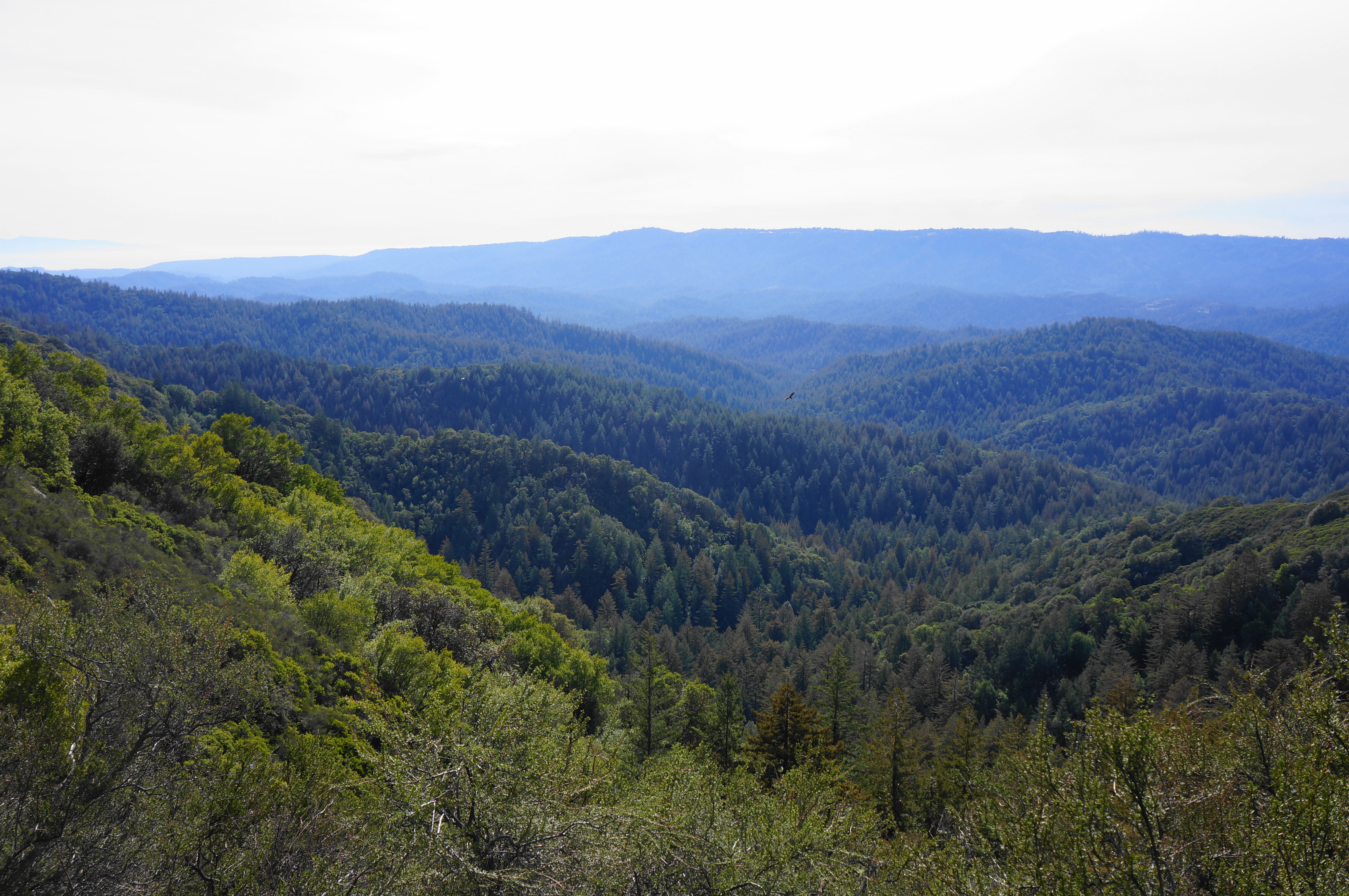
The viewing platform also offers the hike’s first outward views to the skyline beyond, although they are largely obscured by tree cover. Vistas will improve considerably in the next half-mile.
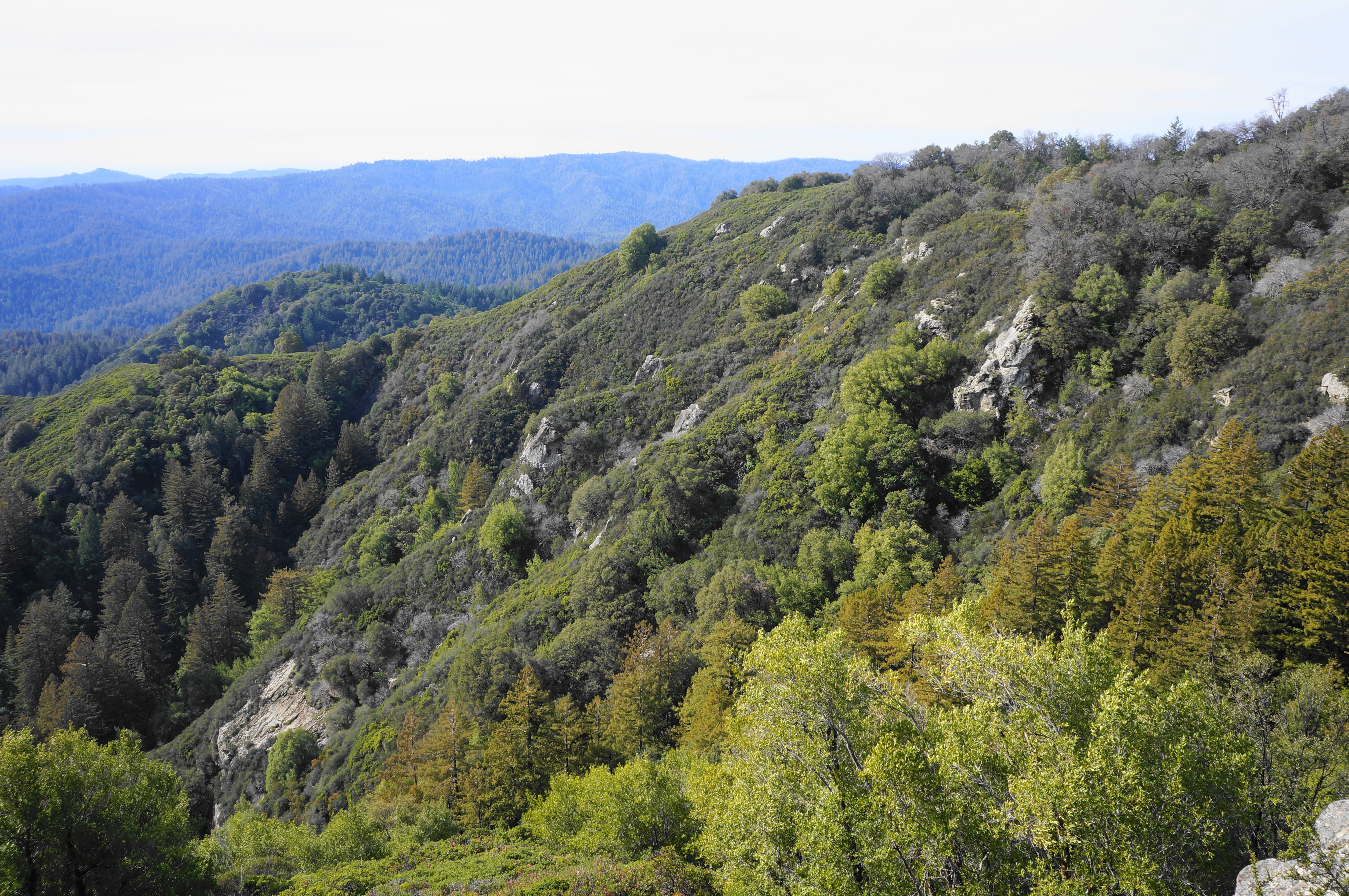
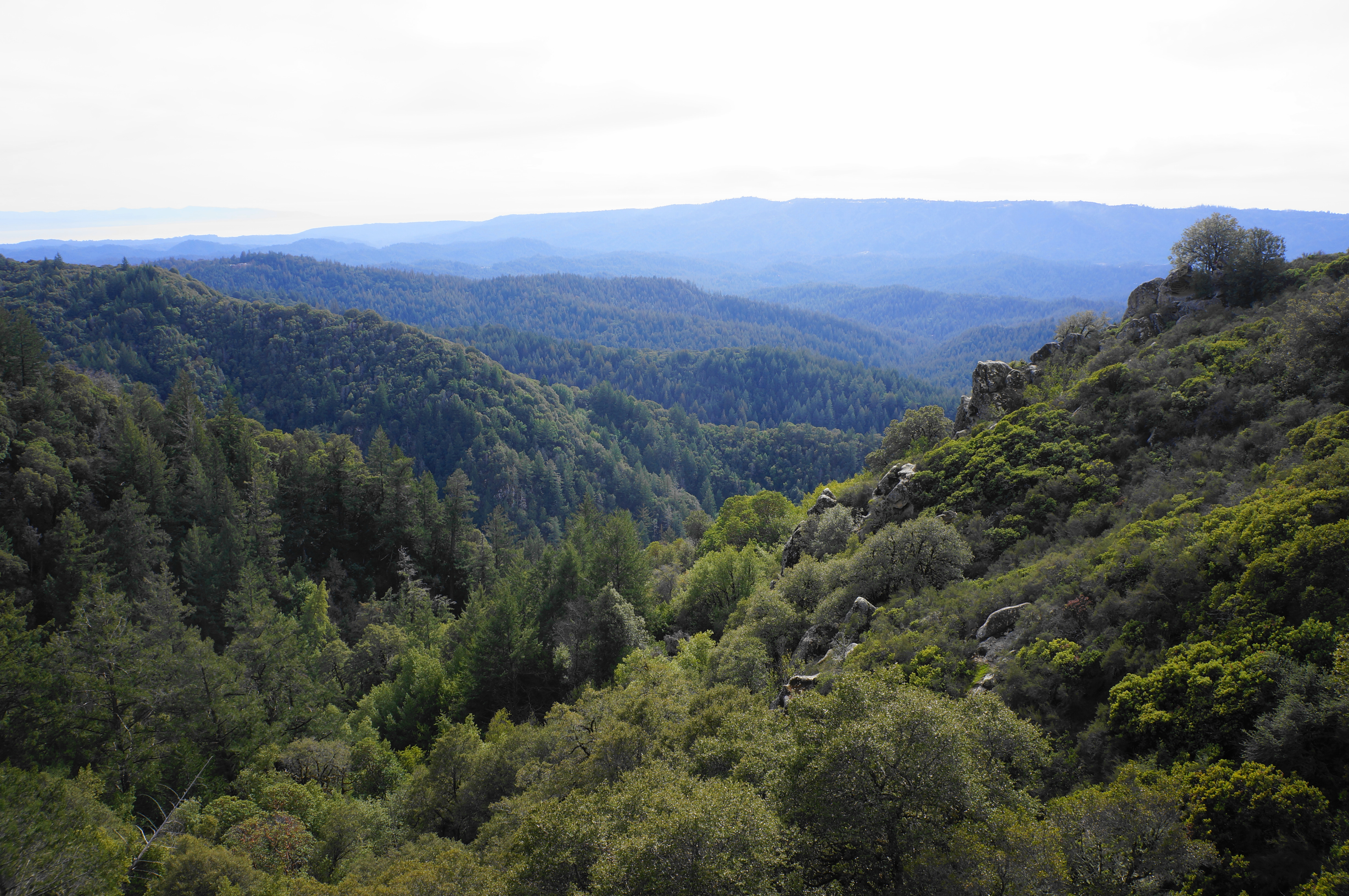
Beyond the waterfall, the trail continues treading westward, rounding another ravine lined with blocky boulder jumbles. At last, at about 9/10 mile, the tall trees recede, replaced by scrubby chaparral and low manzanitas, allowing for wide vistas to the south and west. On clear days, one can see down across the San Lorenzo watershed to Monterey Bay, with the taller Santa Lucia Range rising beyond. Immediately across the wooded watershed, the ridge in the distance is Ben Lomond Mountain, rising to heights almost as high as Castle Ridge, on which one now stands.
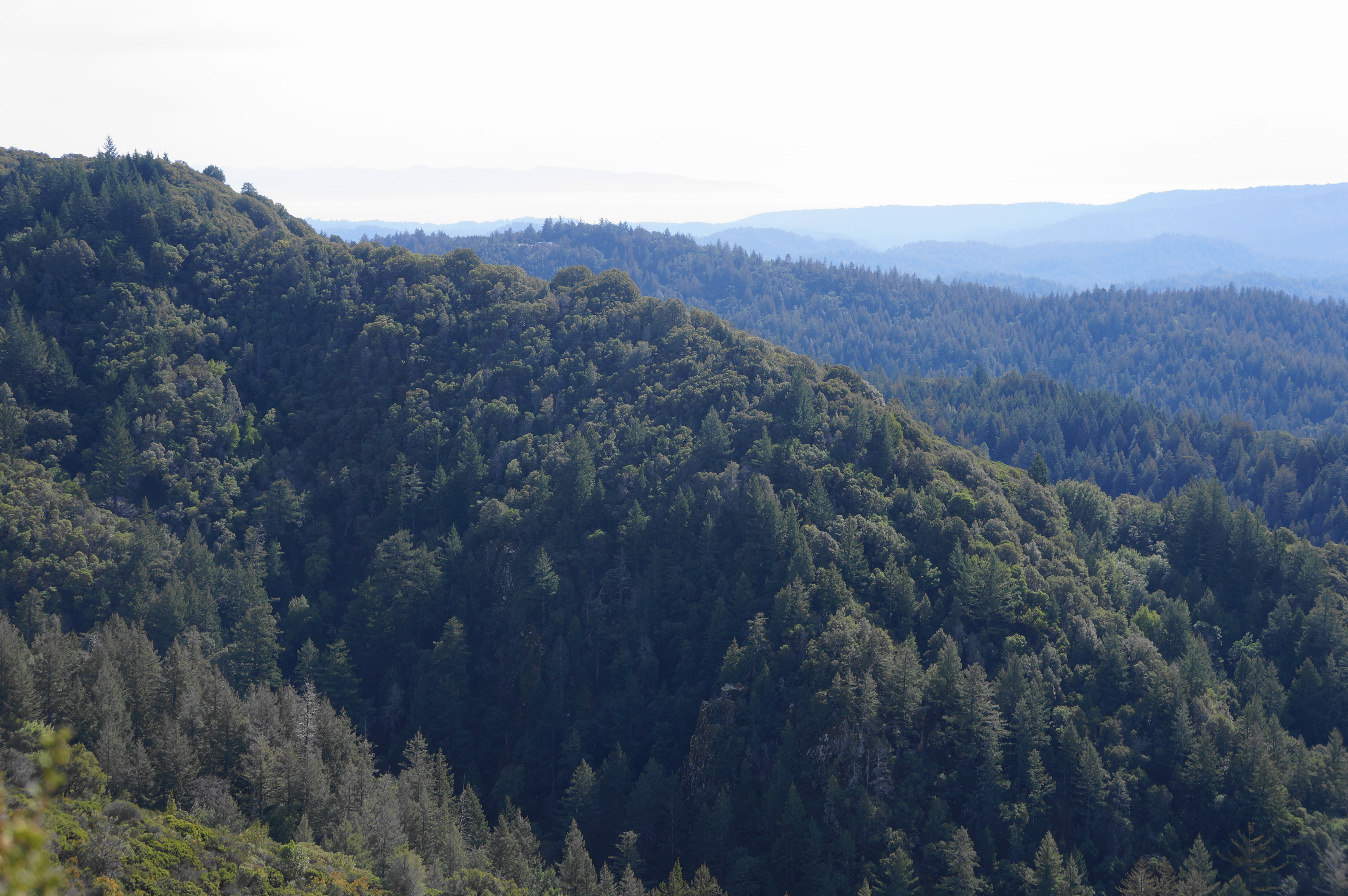
The dramatic views get better as one continues on, rounding a bend below Goat Rock, with the hillside speckled with sandstone outcrops. The tread gets more challenging as occasionally these sandstone slabs protrude onto the trail, requiring some mild scrambling to surmount.
The trail briefly returns to the thick woods again as it rounds to a bridge over another tributary ravine, this one feeding a very small stand of second-growth redwoods known as the Patrick Charles Allen Memorial Grove. Soon, however, the path returns back into the open, with additional views south and west.
The Saratoga Gap Trail continues onward to the Castle Rock Trail Camp, another mile away, but hikers on this 3-mile loop will want to bear right on the Interconnector Trail at 1.4 miles. This relatively uninteresting track involves a short uphill, ending quickly at the wider and more heavily-trafficked Ridge Trail.

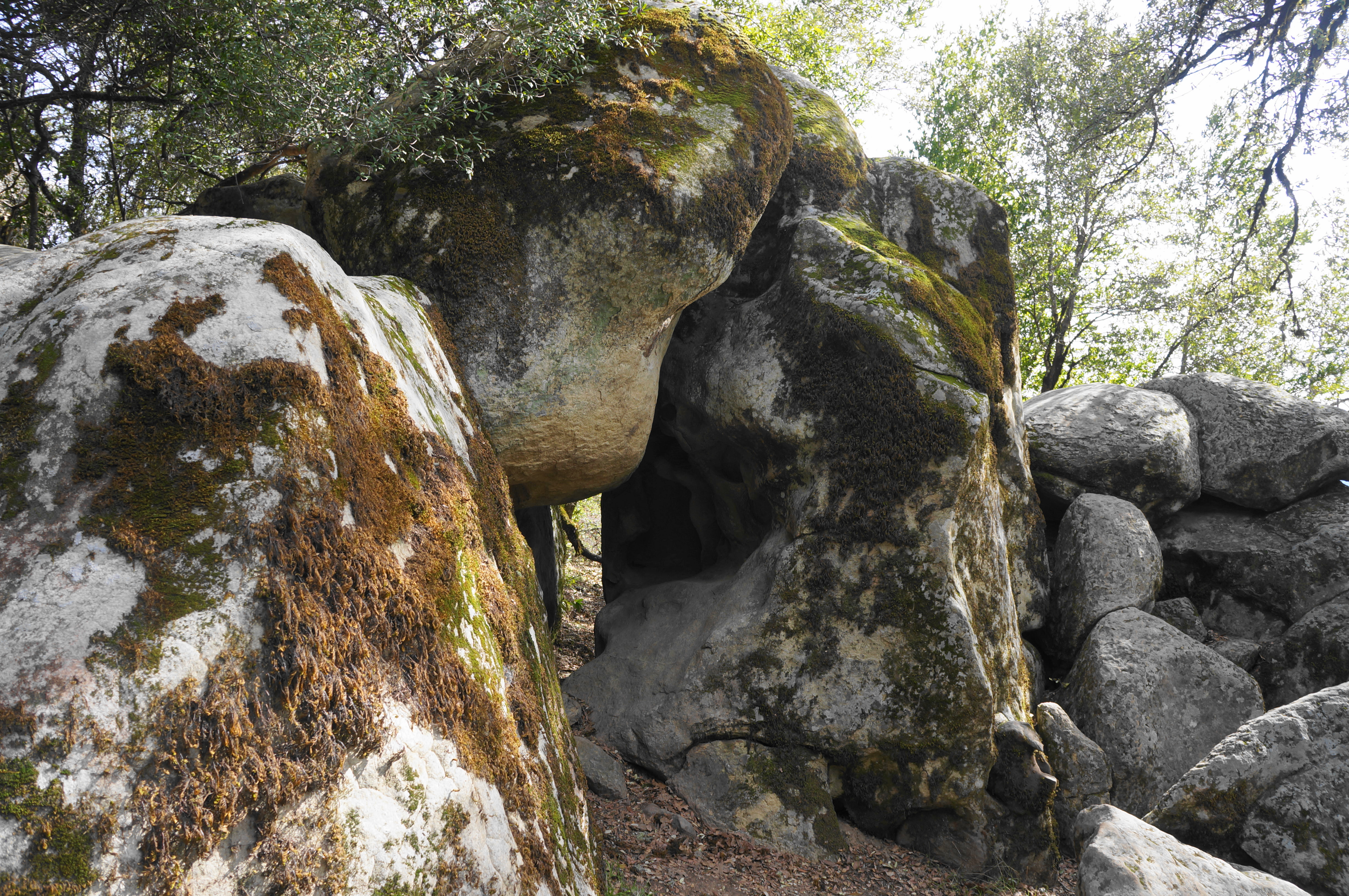
Bear right on this track as it weaves through a black oak forest, quickly coming to another fork, where a short spur leads right to another nice viewpoint labeled the Emily Smith Observation Point. Check out the vista, which is arguably not as great as those on the Saratoga Gap Trail below, then return to the main trail and bear right. Soon hikers will pass a clutch of rocks where two touching, moss-laden boulders form a small archway that is worth a look. From here the Ridge Trail rises to a sign marking “Dan Seldow’s Fraggle Rock Grove,” one of many memorials named for local residents.
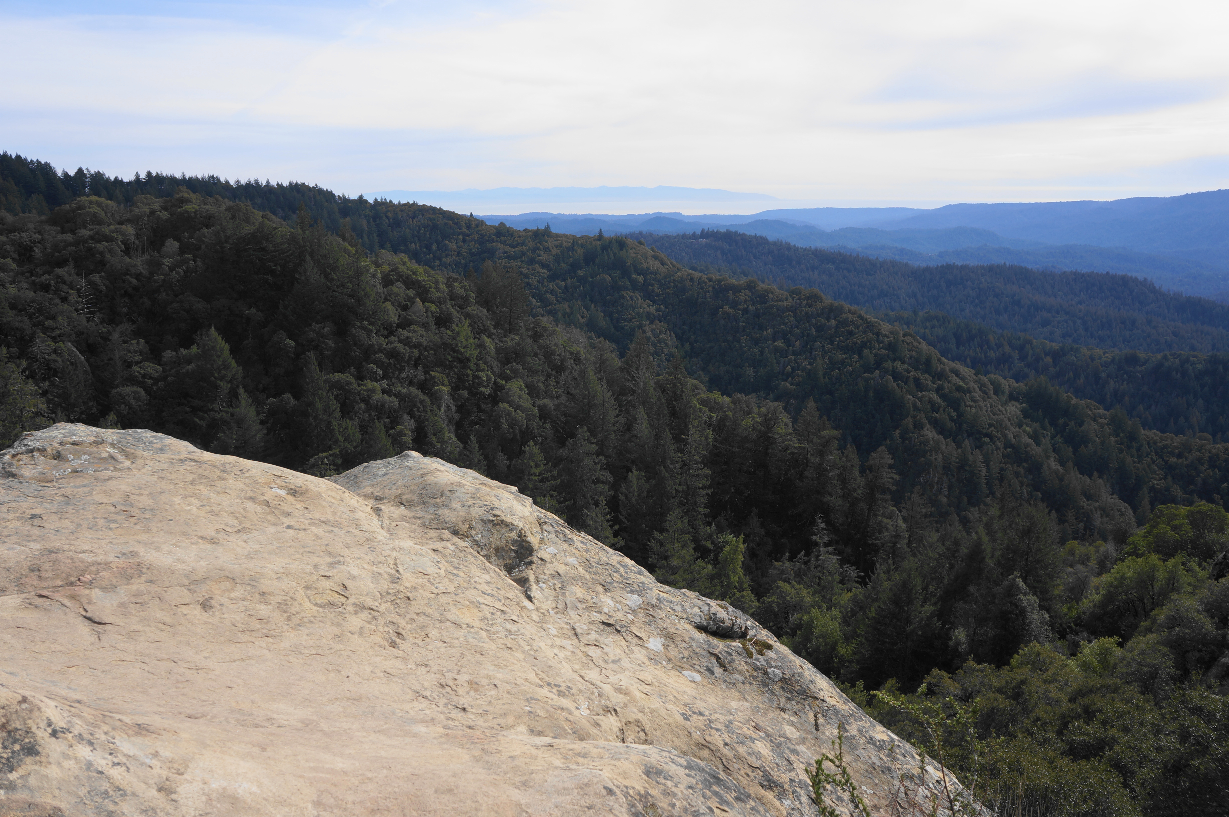
Even as the Ridge Trail traverses the ridgetop, northward views are elusive throughout the 3-mile hike, with hikers proceeding right at the next junction at the 2-mile mark, bringing them back on the south side of Castle Ridge. The trail is now a thin singletrack again, skirting the south-facing flank in the direction of Goat Rock.
After a junction at 2.2 miles (with a dead-end trail heading right to another scenic overlook), the trail comes to the edge of Goat Rock, from this side a seemingly mild climb. (Note: It is a relatively easy and short Class 2+ scramble up the rock from this side.)

But as the trail continues through a narrow gap and down a set of stairs, the full scale of Goat Rock comes into view: the speckled rock face extends 110 feet from top to bottom, with rock climbers seeking to scale it via upwards of 10 different routes. The rock, while not noticeably shaped like a goat head, is notable for its massive cavities, some of which have worn through the rock completely, creating small windows through to the other side.

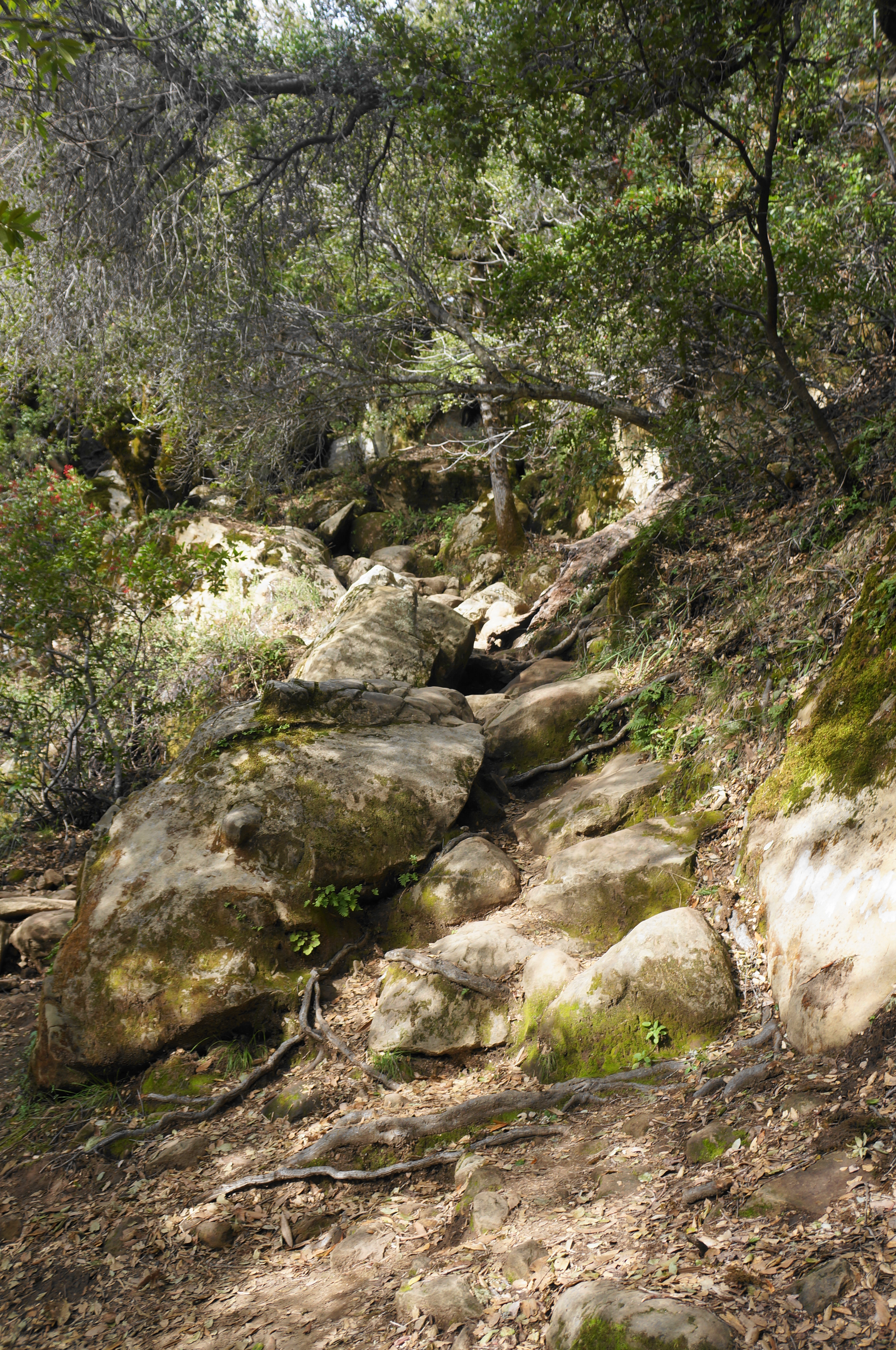
The best viewing spot for Goat Rock is a protruding ledge at the junction of two trails, including one that heads right to the base of the rock face. The main trail, however, heads left, continuing downhill through a steeper boulder section that requires careful footing. Once down the natural staircase, the path engages two short ups-and-downs before levelling and approaching the main drainage canyon of Kings Creek.
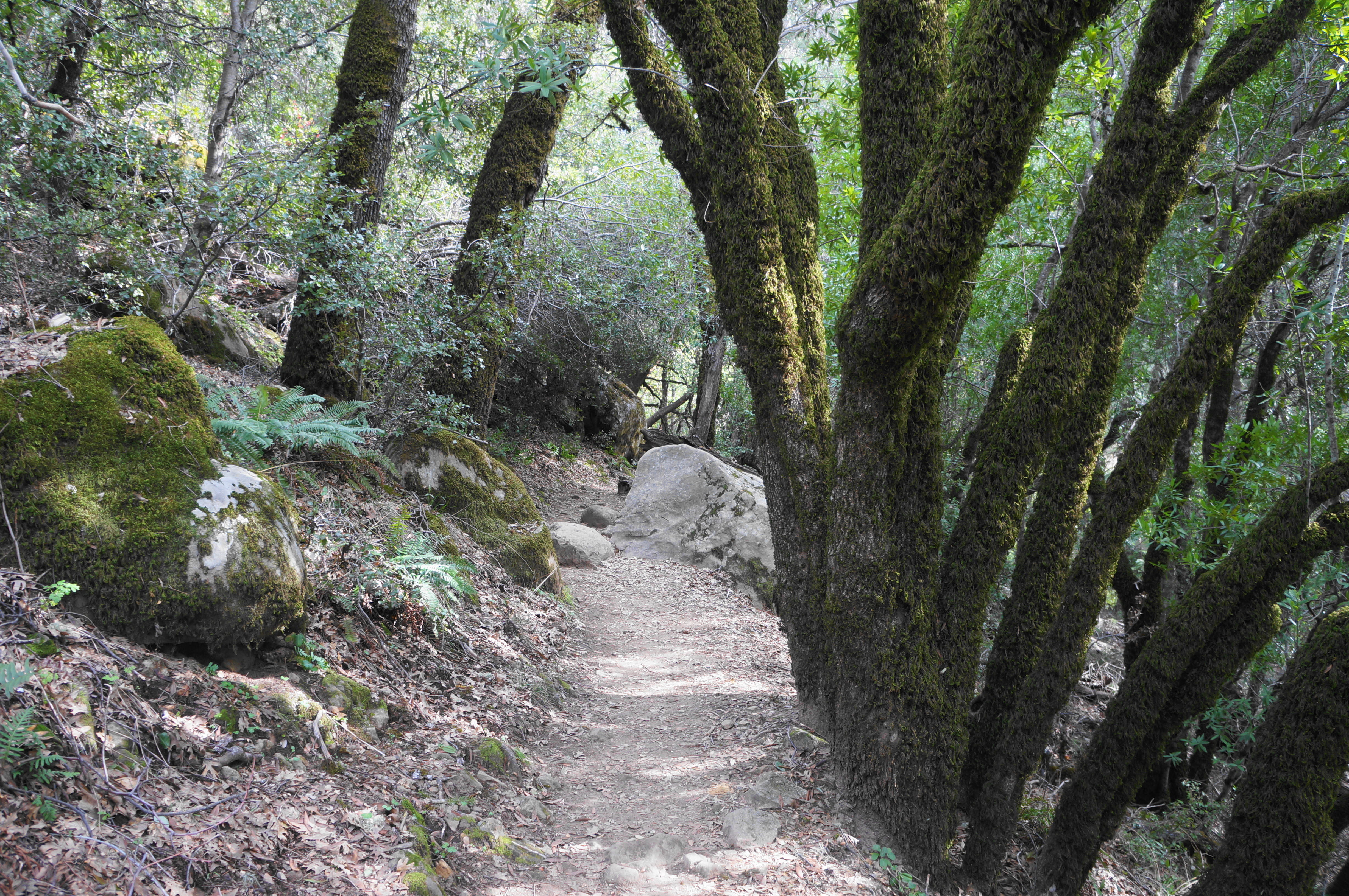
Soon the trail winds back to the start of the loop portion at the bridge over Kings Creek. Cross the bridge and bear left as the Saratoga Gap Trail climbs steadily uphill, returning along familiar territory for ½ mile. After passing the initial junctions with the Waterfall Connector and Castle Rock Trails, the track ends back at the Overflow Parking Area.
All told, this 3-mile hike is one of the easier in the park, although hiking boots and preparedness for some minor scrambling are a must.

Pingback: Top 10 Hikes in 2023 | Live and Let Hike