Most visitors flock to Lake Mead National Recreation Area—straddling the Arizona–Nevada border, a short drive from Las Vegas—for water-related activities on the United States’ largest reservoir by volume. However, adventure-seekers of the land-bound sort are also treated to a fair amount of challenging and rewarding hikes, especially in the Black Canyon area between Lake Mead and the smaller Lake Mohave. This rugged landscape south of Hoover Dam was carved by the Colorado River and its many tributaries, some of which harbor surprising secrets, including waterfalls, narrow slots, and natural hot springs, best visited in the winter/spring months.
One excellent hike, highlighted in a previous post, is the difficult, 5.75-mile White Rock Canyon – Arizona Hot Spring Canyon Trail Loop. Another, just across the Colorado on the Nevada side, is Goldstrike Canyon, which has become quite a popular destination due to its proximity to Las Vegas and numerous, well-kept hot spring pools. The 5.2-mile out-and-back trek passes through scenic narrows and through several boulder chokes, passing at least four distinct soak pools before ending at a landing along the chilly Colorado River. Despite its popularity, this is not an easy hike: ropes are installed throughout the hike to help visitors negotiate the canyon’s many drops and pouroffs, but the hike requires extensive scrambling, some modest climbing skills, and likely some teamwork to complete. (Note: The trail is closed May 15-September 30 each year due to extreme heat, and the route should not be tried when it is raining due to flash flood threats. The hot springs are open for soaking, but avoid putting your head under due to the risk of Naegleria fowleri, or “brain-eating amoeba.”)


The hike
Goldstrike Canyon is one of many branches of the main Black Canyon and is located on the Nevada side of Lake Mead National Recreation Area, between the park’s main Visitor Center and the famed Hoover Fam. Take the exit for Goldstrike Canyon Road off of Interstate 11/U.S. Route 93, passing through a roundabout and parking in a marked parking lot off to the right. As with all popular hikes in the Las Vegas area, getting here early or hiking on a weekday is a must to avoid overcrowding; the parking lot frequently fills by mid-morning on busy weekends.
Not so long ago, one used to be able to drive partway down the canyon – but this is not the case anymore. Instead, after parking, walk partway back up Goldstrike Canyon Road, toward the interstate, and quickly turn right at the signed trailhead, where there is a large information sign with a map and information about the strenuous hike ahead. (Note: The total distance is listed here as 2.6 miles one-way. Many GPS systems are likely to say it is a lot more—and it will feel like a lot more—but note that this is largely because most location services are unable to reliably track you once you’re deep in the narrow canyon. The lack of an accurate reading leads to pinging back and forth that adds considerably to the listed mileage on your GPS even if you have barely moved at all. Also: one drawback of the map at the kiosk is that the number of rope assists is not quite correct—the map shows seven, but we easily counted nine on the total journey. Not all of the ropes are required, as will be noted below, but don’t necessarily peg your distance to the seven ropes noted at the trailhead.)
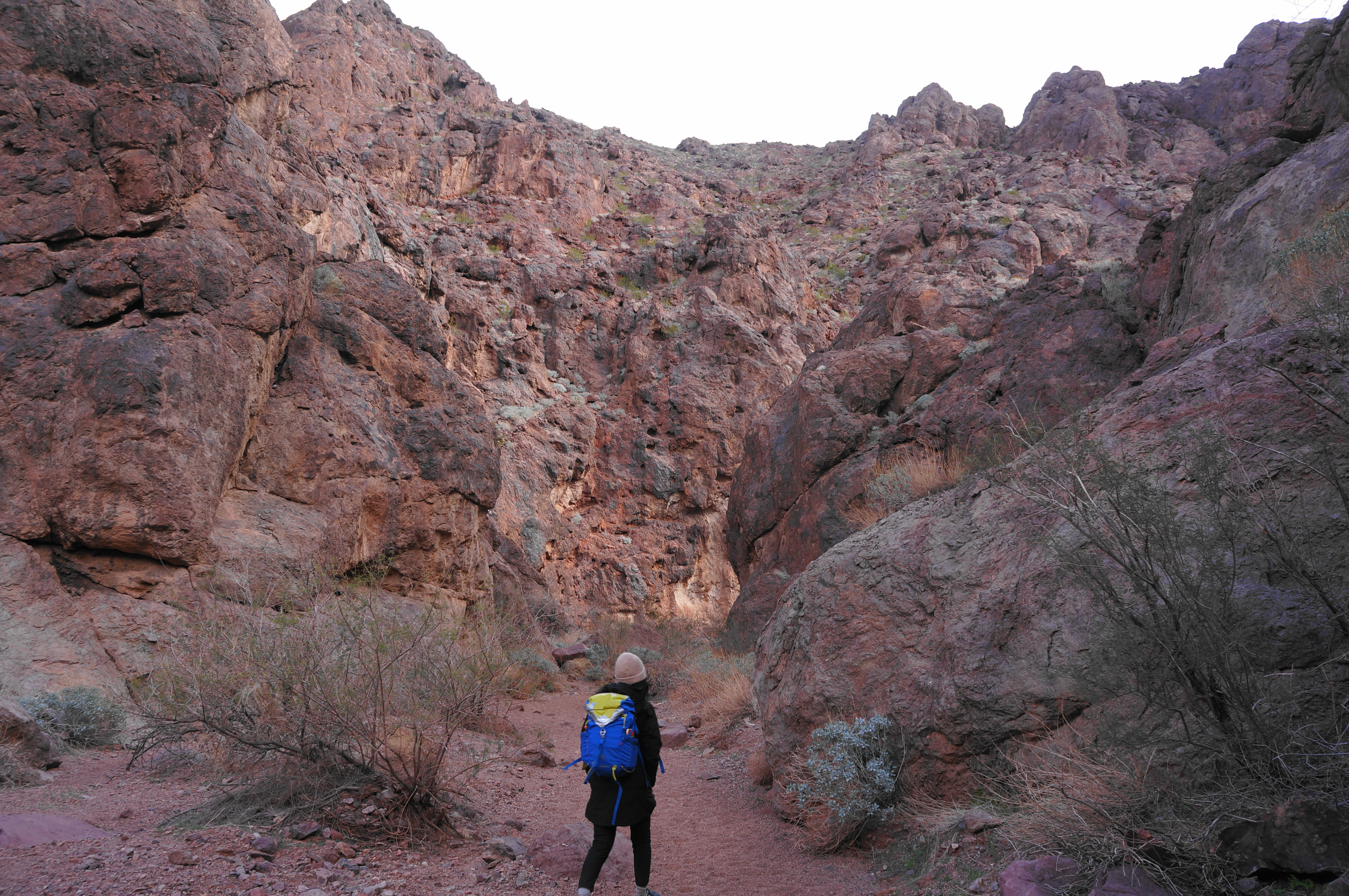
From the Goldstrike Canyon Trailhead, head eastward down the drainage, which begins as a wide and sandy wash. A massive retaining wall dominates the slope to the left, with the whizz of vehicles audible from the interstate above. Like much of the hike, there is little shade in this portion, but the walking starts out easy and obstacle-free—lulling hikers into a false sense of security that will be rudely interrupted within an hour’s time down-canyon.
Make your way down into the wash, then continue straight as the canyon starts to take form. Unlike most narrow gorges in southern Utah, the rock layers in this portion of the Lake Mead area are primarily volcanic, including pluton, dacite, and volcanic tuff.
After about 3/10 mile of walking, hikers reach a constructed barrier that used to mark the old trailhead, back when vehicles were allowed partway down the wash. Continue down the narrowing wash, rounding a left-hand bend and coming into view of an impressively high overpass. Just as the wash approaches the highway bridge, it darts right, thinning further and entering thicker brush.

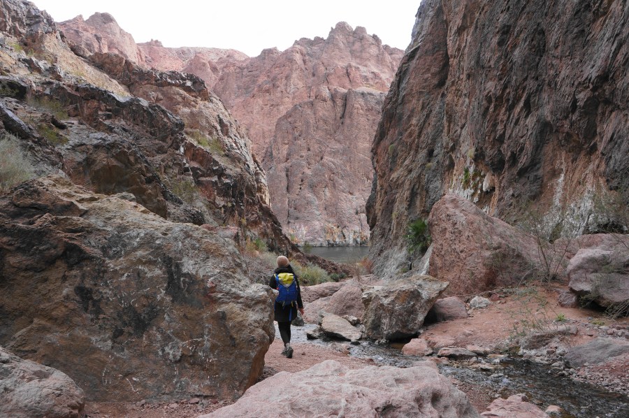
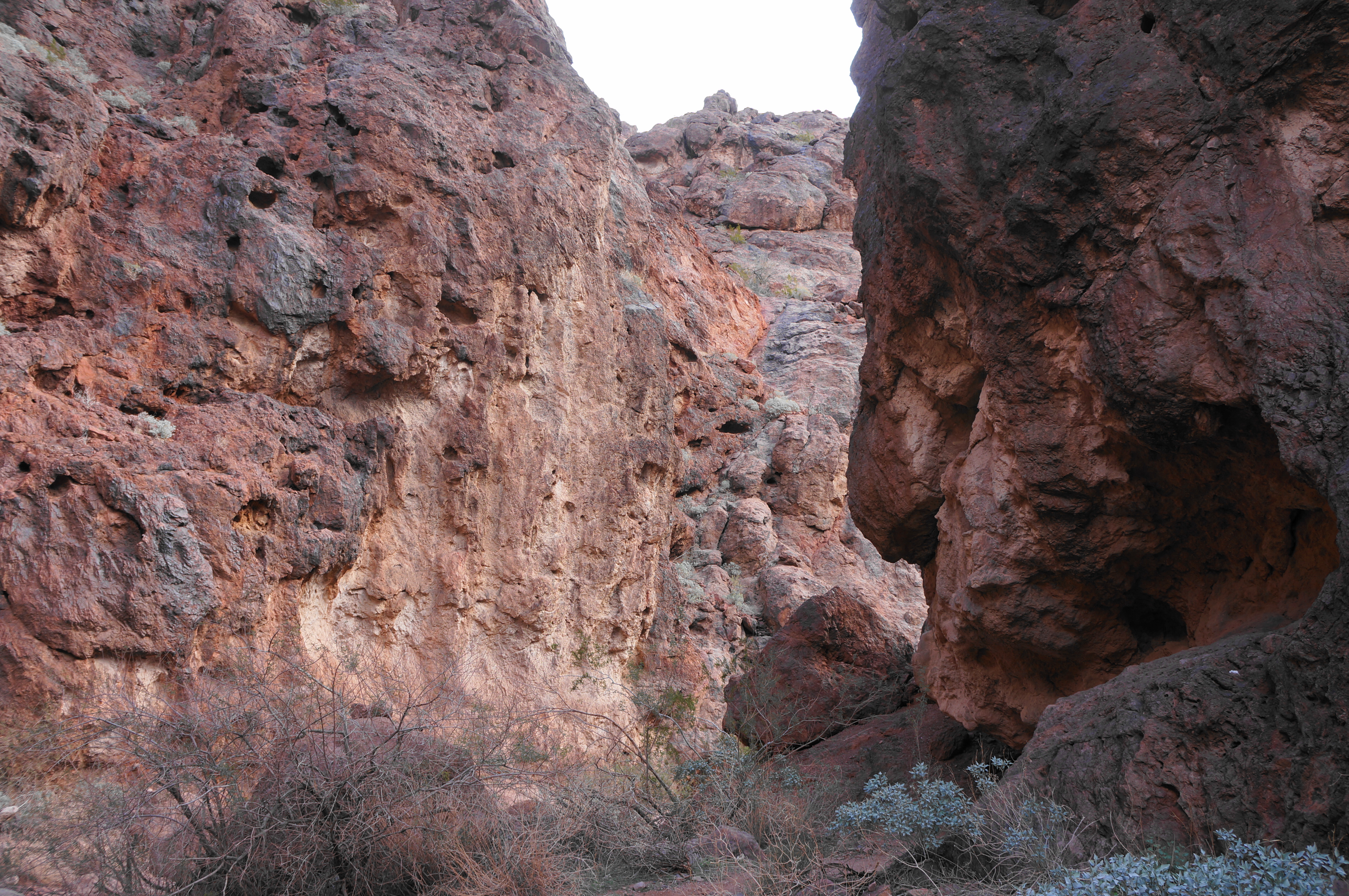
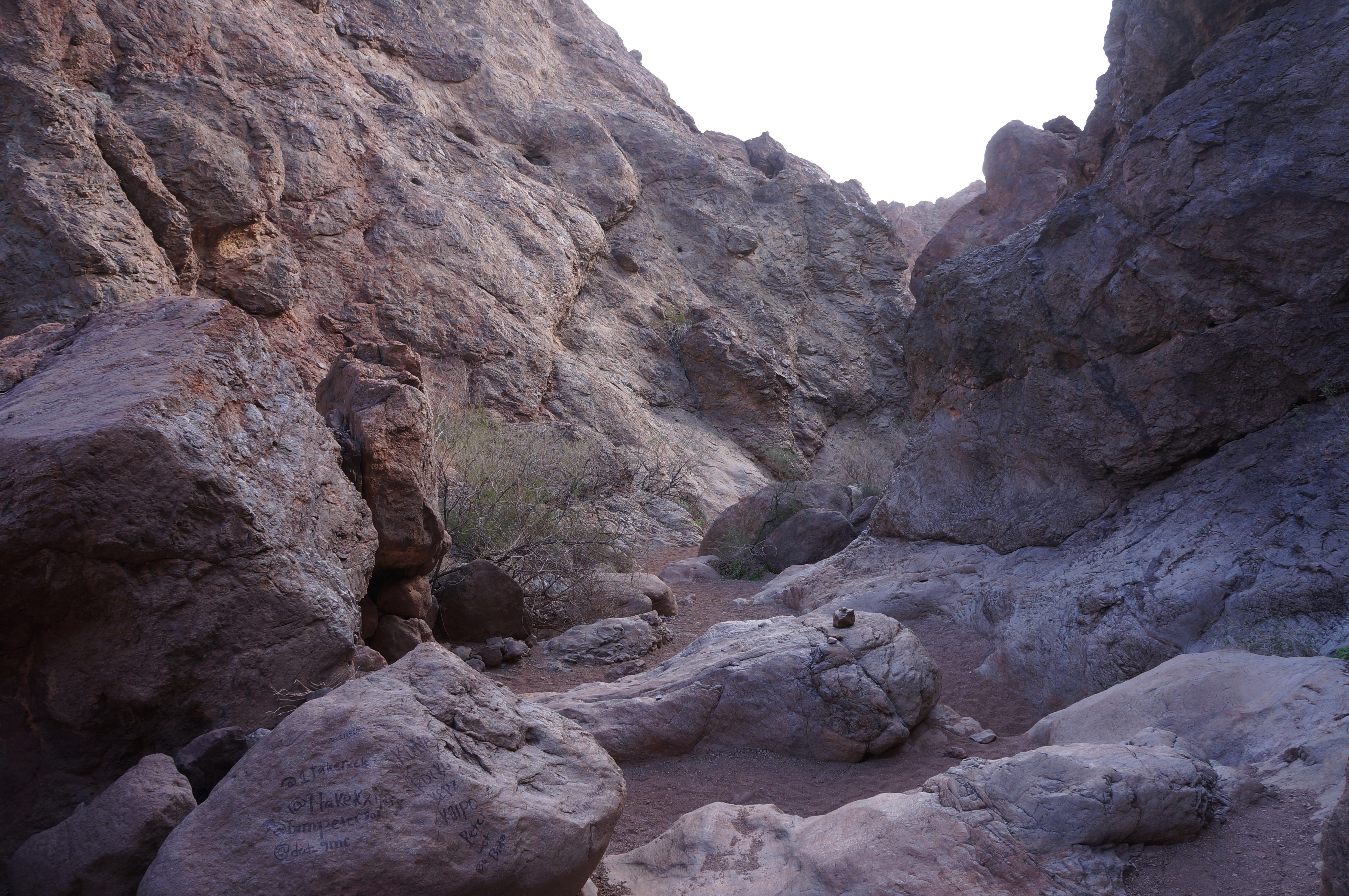
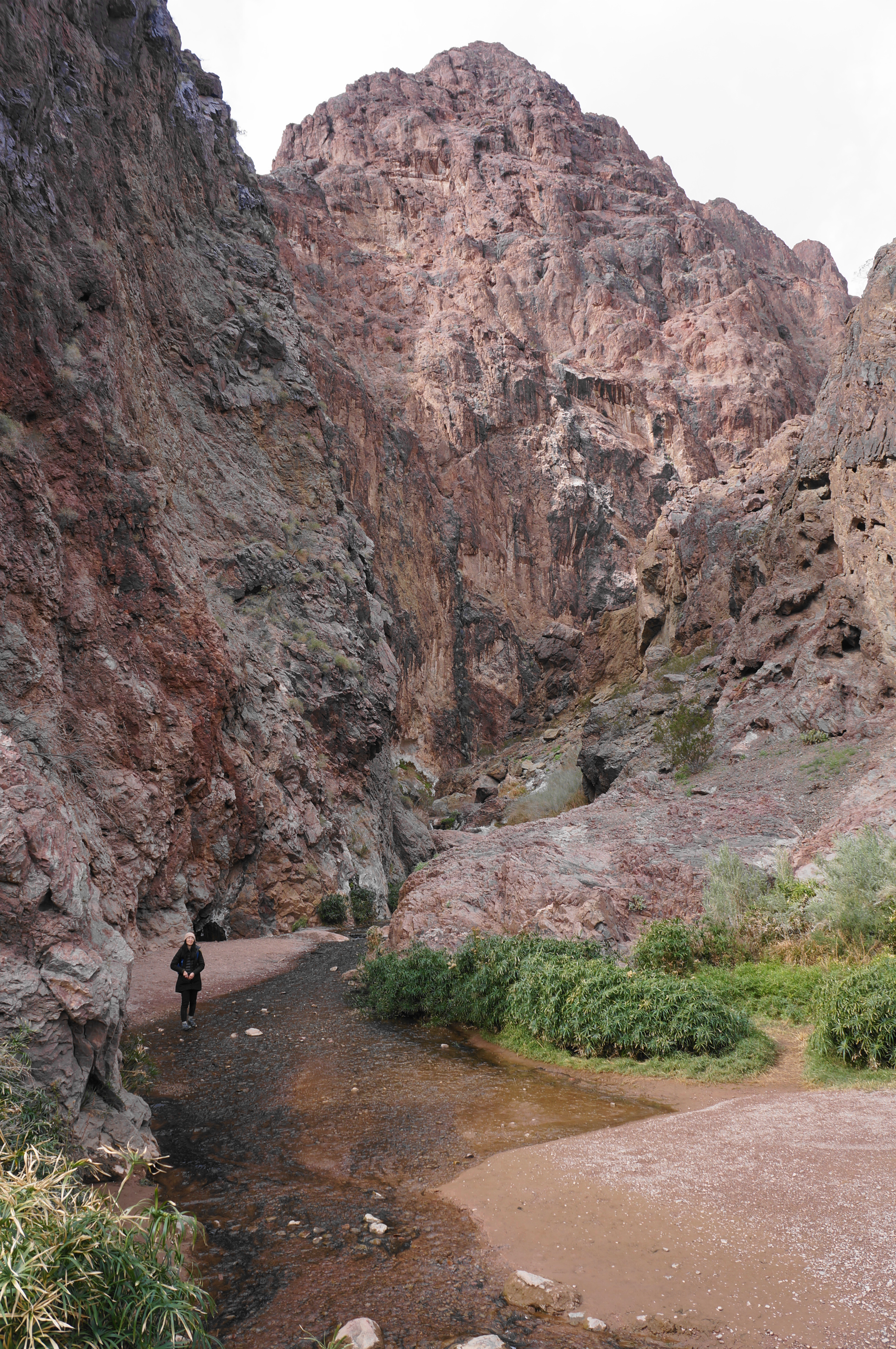
Boulders begin to accumulate at a higher frequency thereafter, although at this stage, a half-mile into the hike, there are no serious obstacles. After twisting and turning for another quarter mile, the canyon veers nearly due south, toward an impressive wall of black-and-white speckled plutonic rock. As you get closer, a bit of fiery red begins to appear, and the canyon veers eastward again, toward the Colorado.

Now having travelled more than a mile, Goldstrike Canyon thins further, and the wash rounds a set of sinuous bends with beautiful views of multihued walls. Catclaw acacias also begin to dot the wash.
After routing through an initial set of narrows, there is a split in the drainage, with a minor side canyon heading up to the right. Stay left, then come to the first significant obstacle of the hike: the once-gentle canyon suddenly drops a level, down a precipitous pouroff that is not easily downclimbed. Instead of taking it head on, take a marked detour off to the left, scrambling up and over a steep but negotiable flank, then return to the wash bottom below the dryfall. (Note: Unfortunately, the boulder jam here is partly graffitied, a problem that gets worse as the canyon continues.)


Beyond the pouroff and boulder choke, hikers encounter a second set of narrows, this one more impressive than the first. Wayfaring continues to be relatively straightforward, and the narrows open up briefly to a spot with a little natural arch visible up to the left. The narrows return thereafter, and there is a view ahead to a much more open area with a set of distant power lines.


This is where, all of a sudden, hikers are greeted by Rope #1, the first of several assisted downclimbs that are required to reach the hot springs and the river. Time for the fun part. Were it not for the large and immensely-helpful steps carved into the rock face, this would be a rather awkward and difficult descent—but with the manmade staircase the downclimb becomes relatively straightforward. Nonetheless, the rope remains handy for balance.


Beyond Rope #1, the canyon opens up considerably, with side drainages coming in from left and right. Pass under the power lines and make your way toward the next narrow section, where one will encounter Rope #2—a newly-installed assist that is curious because it is rather unnecessary. The pouroff itself is quite steep, smooth, and slippery, but there is an obvious and straightforward bypass, where no rope is needed, on the left. Those seeking to test their climbing skills, however, can tackle the rope slide for an additional—if superfluous—challenge.


It is a short walk from here, amid the jumble of fallen rocks, to Rope #3 (Rope #2 on the trailhead map), which—in contrast the second—is quite necessary for negotiating the narrow pouroff. Be sure to keep tension in the rope as you drop down a thin passage to skirt a double chockstone.
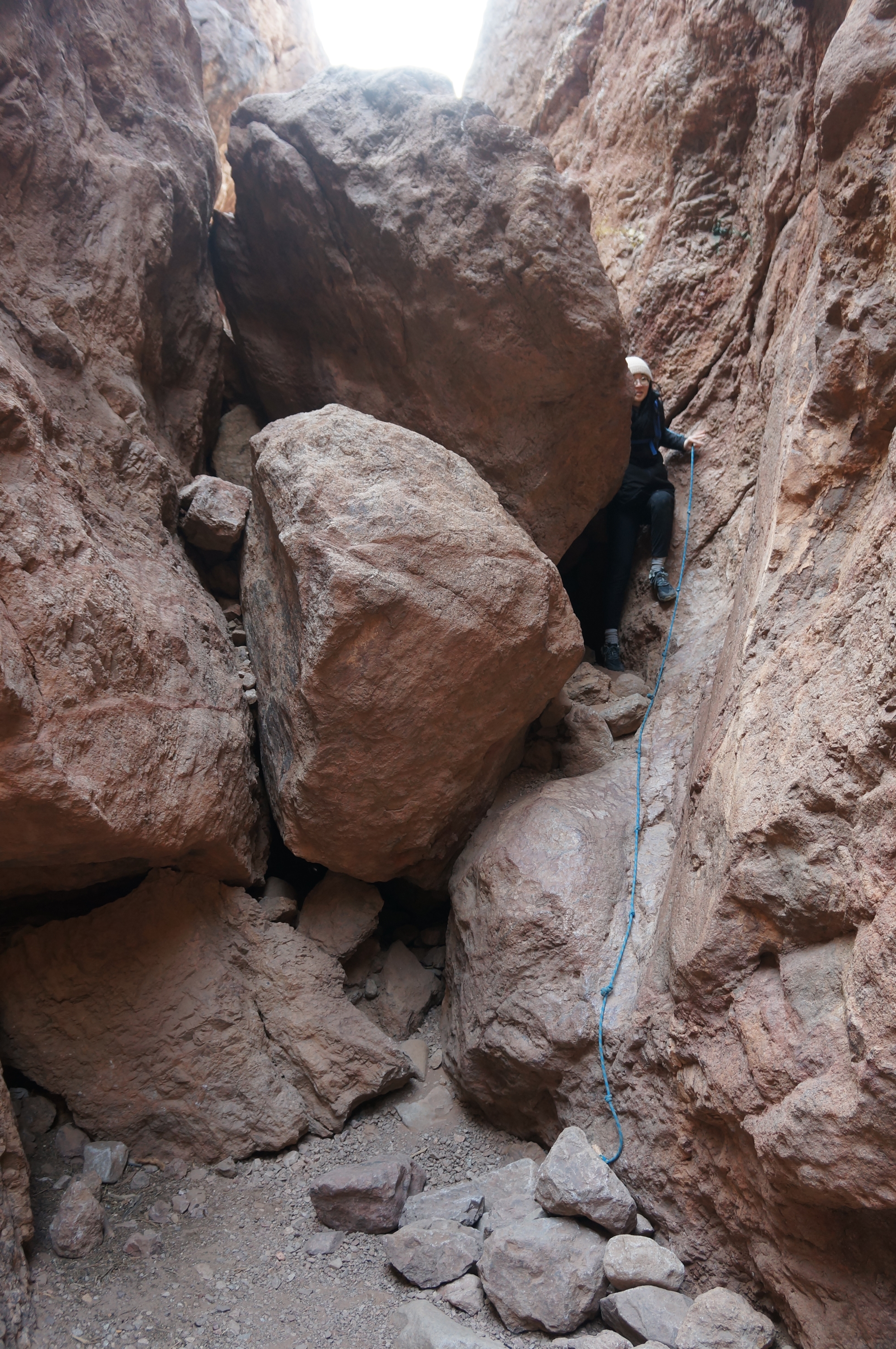

This obstacle is soon followed by Rope #4 (Rope #3 on the trailhead map), a shorter, 7- to 8-foot drop between two boulder faces. From here there are signs of human construction, with a couple obvious retaining walls a couple feet high. Rope #5 is not far beyond but is also not necessary and can be bypassed on the left.

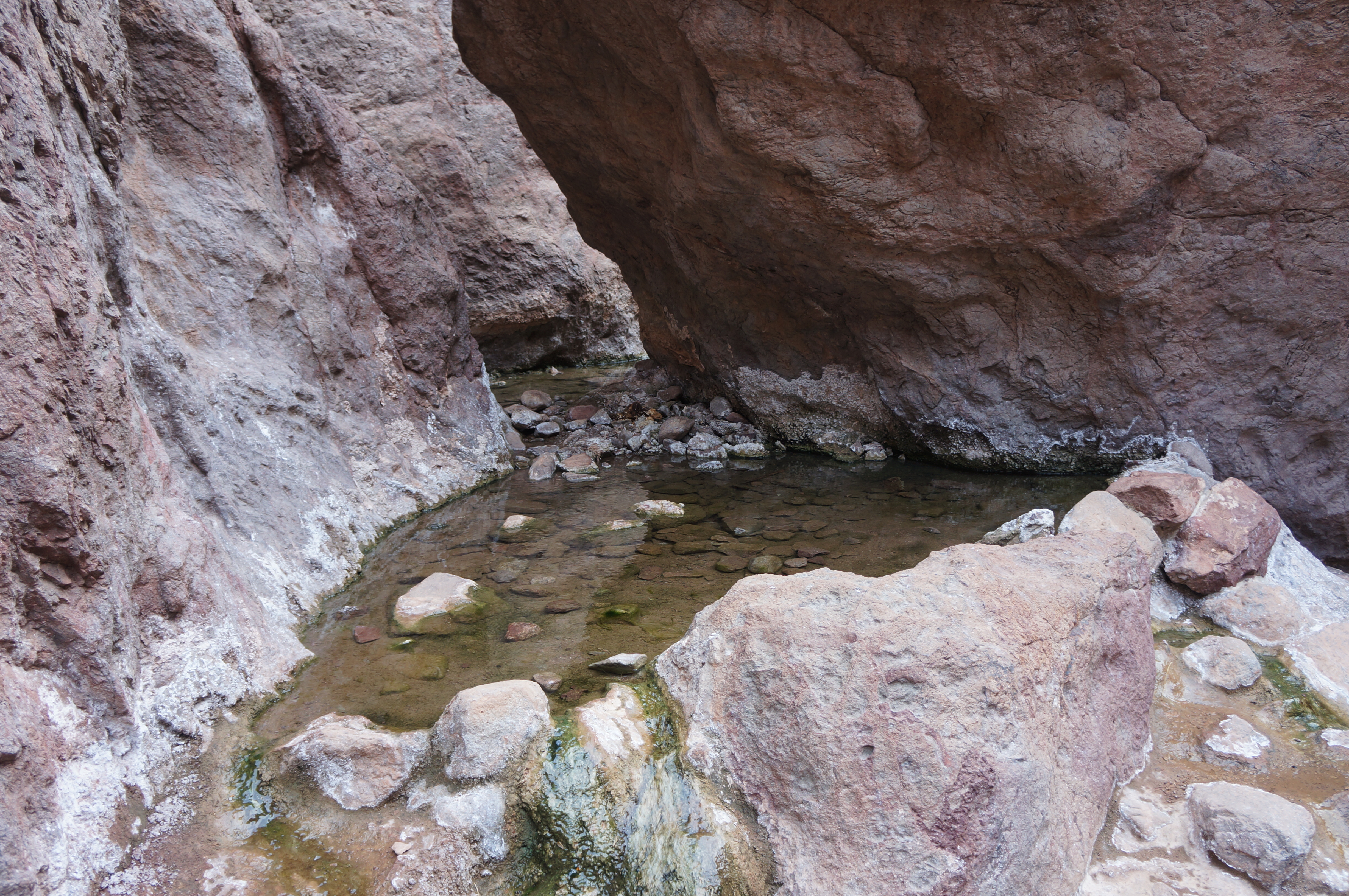
Just below, there is a seep that produces hot water, not enough to form a pool, but the trickling water and mild smell of Sulphur leads visitors down to the first of four hot springs pools—Upper Goldstrike Hot Springs, to be precise. This set of pools is tucked away amid the boulders on the right, with the most visible basin very shallow, but the depth (and heat) grows as one wanders farther in behind the blocky boulders. If you have to skip one of the hot springs, however, this is it—more impressive pools lie beyond. Yet if you are concerned about time or weariness, this is a worthy turnaround point for a roughly 4.2-mile out-and-back hike.

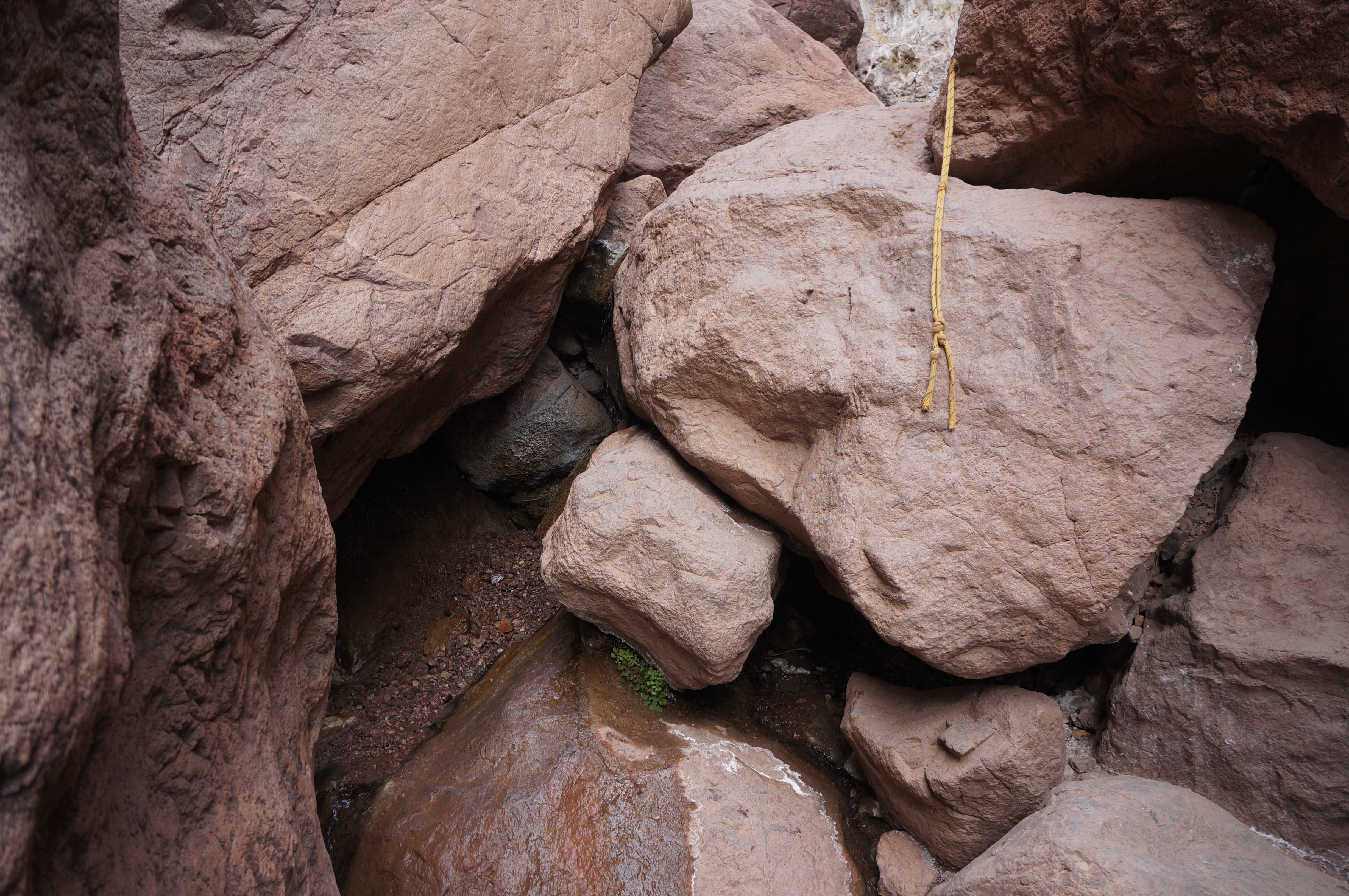
Continuing downstream, a pleasant flat section quickly gives way to another mass boulder choke. There is a short but very helpful rope here at one point—Rope #6—after which hikers engage in a “choose your own adventure” of sorts, with multiple options for tackling the various boulder jams. Rope #7 is also not needed and easily skirted on the right, but Rope #8 is useful and notable for paralleling a trickle of falling water that squeezes under the chockstones on the right. Here there is also a very small pool, with the water disappearing under the rock beyond.


Finally, Rope #9 also skirts a moist section, making the descent trickier due to the presence of slippery boulders at the base of the rope assist. This is arguably the most challenging of all the downclimbs—and probably also the hardest to ascend—due to the greasy base and awkwardly chunky rock that forms the bulk of the drop.
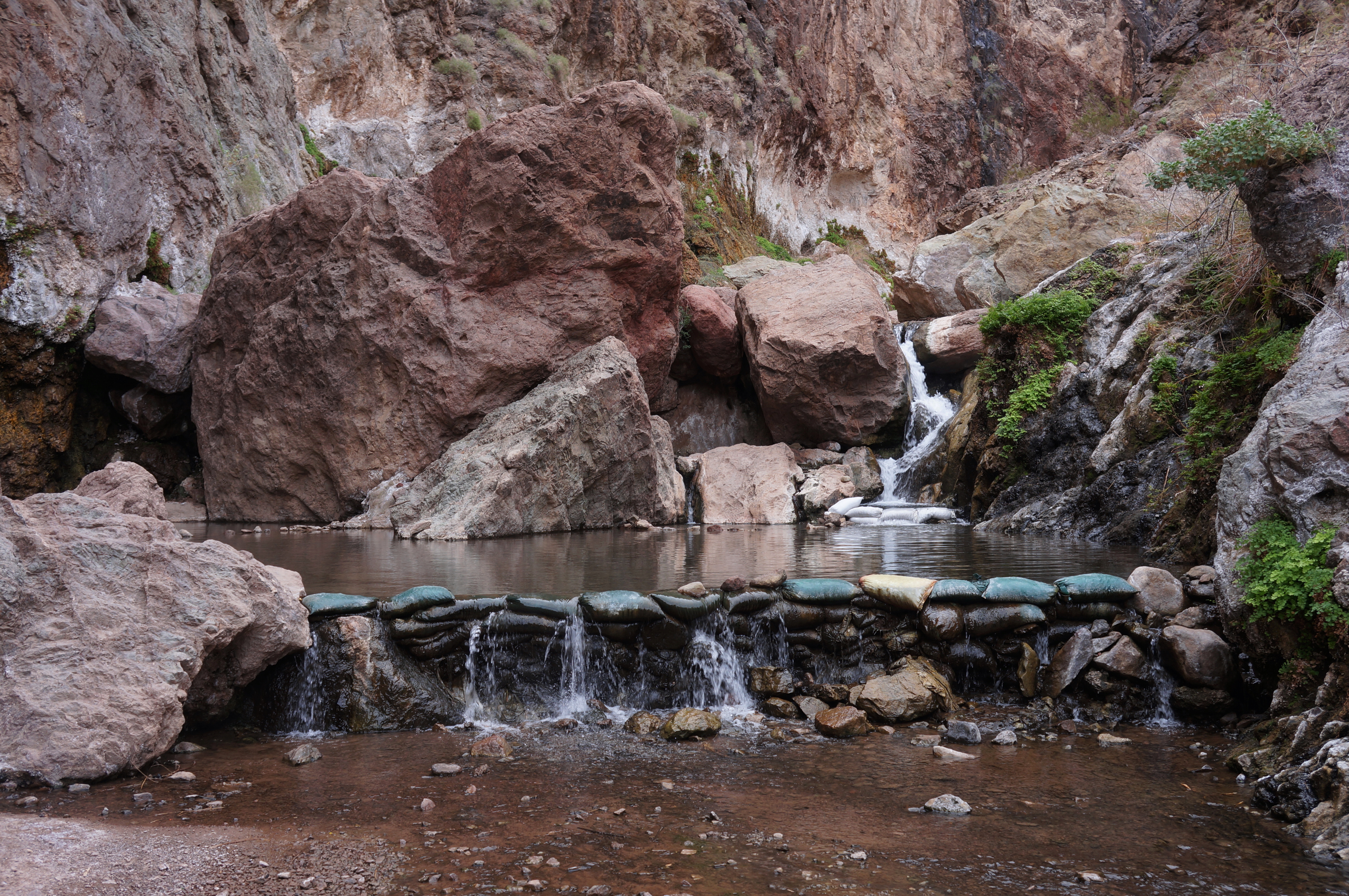
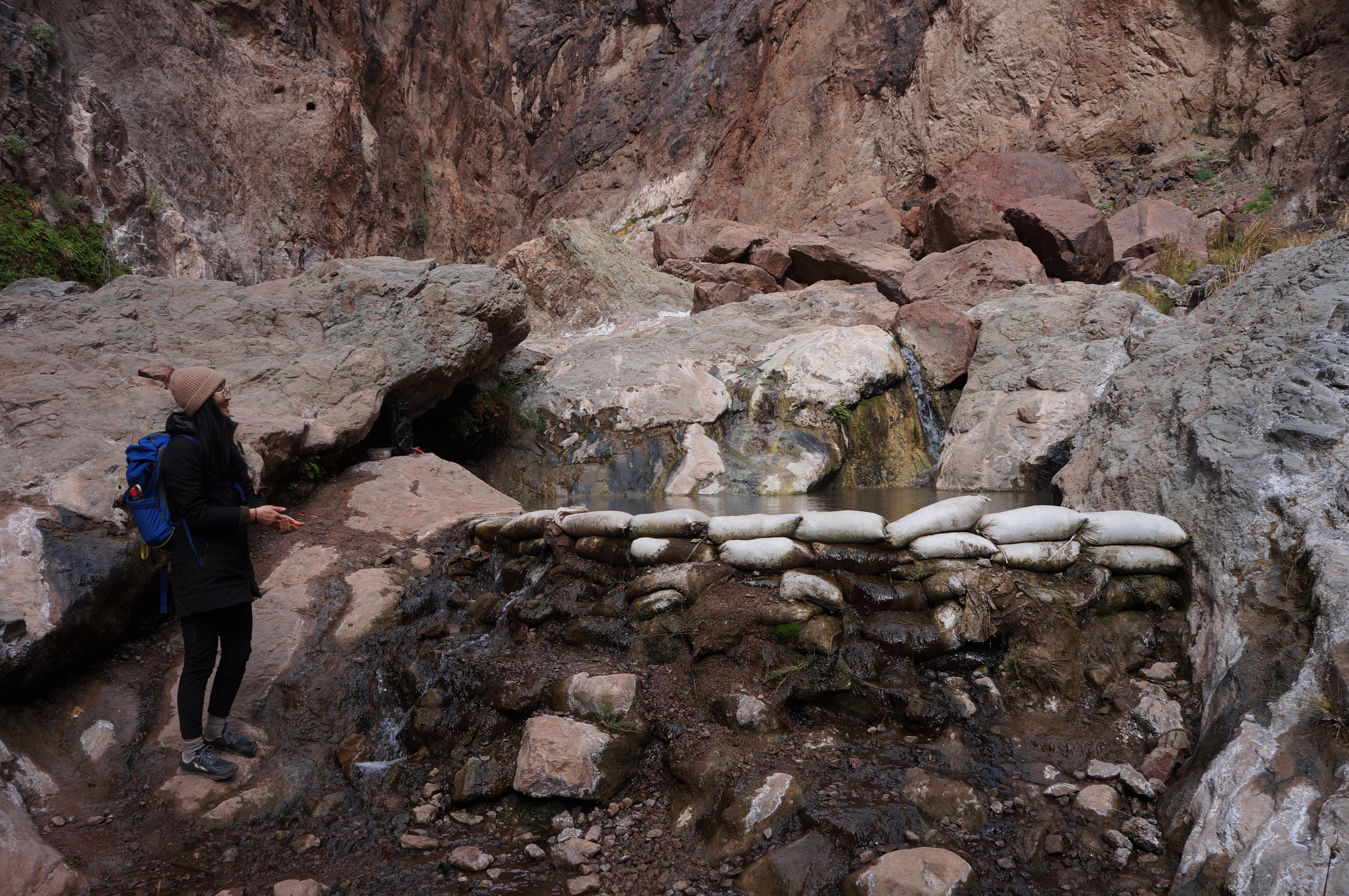
At last, the ropes section is done (until the return journey, of course), and hikers are rewarded with a look at the second hot springs on the right—this one rather small as well but fed by a pretty waterfall of around three to four feet. This (together with springs 3 and 4) is sometimes called Nevada Hot Springs and is usually reinforced with sandbags.

From now on, flowing water is a fixture of the hike, and travellers seeking to save their dry boots for the return ascent may consider switching to water shoes or trying to avoid getting their boots wet. The stream can generally be bypassed on the left as the canyon opens up slightly and hikers pass the third hot springs pool. This is also a nice spot and the deepest pool encountered thus far.


But the highlight of the hike is the fourth and final hot springs, by far the largest and most scenic, situated below a mossy channel and just above the Colorado River. The hot springs are fed by a gently-cascading waterfall and are more or less separated into four sections: a large entry pool that is lukewarm at best, a warmer secondary pool off to the left, a very small (and cool) pool at the base of the falls, and a final inset that is the warmest and nicest of the bunch. Here you can submerge much of your body as you sit comfortably on a rock below the surface, enjoying the balmy temperatures of the natural springs. (Note: This arrangement may be different after storms that flood the area, so be sure to check the latest conditions and be open to changes that may occur after February 2023, when I visited.)
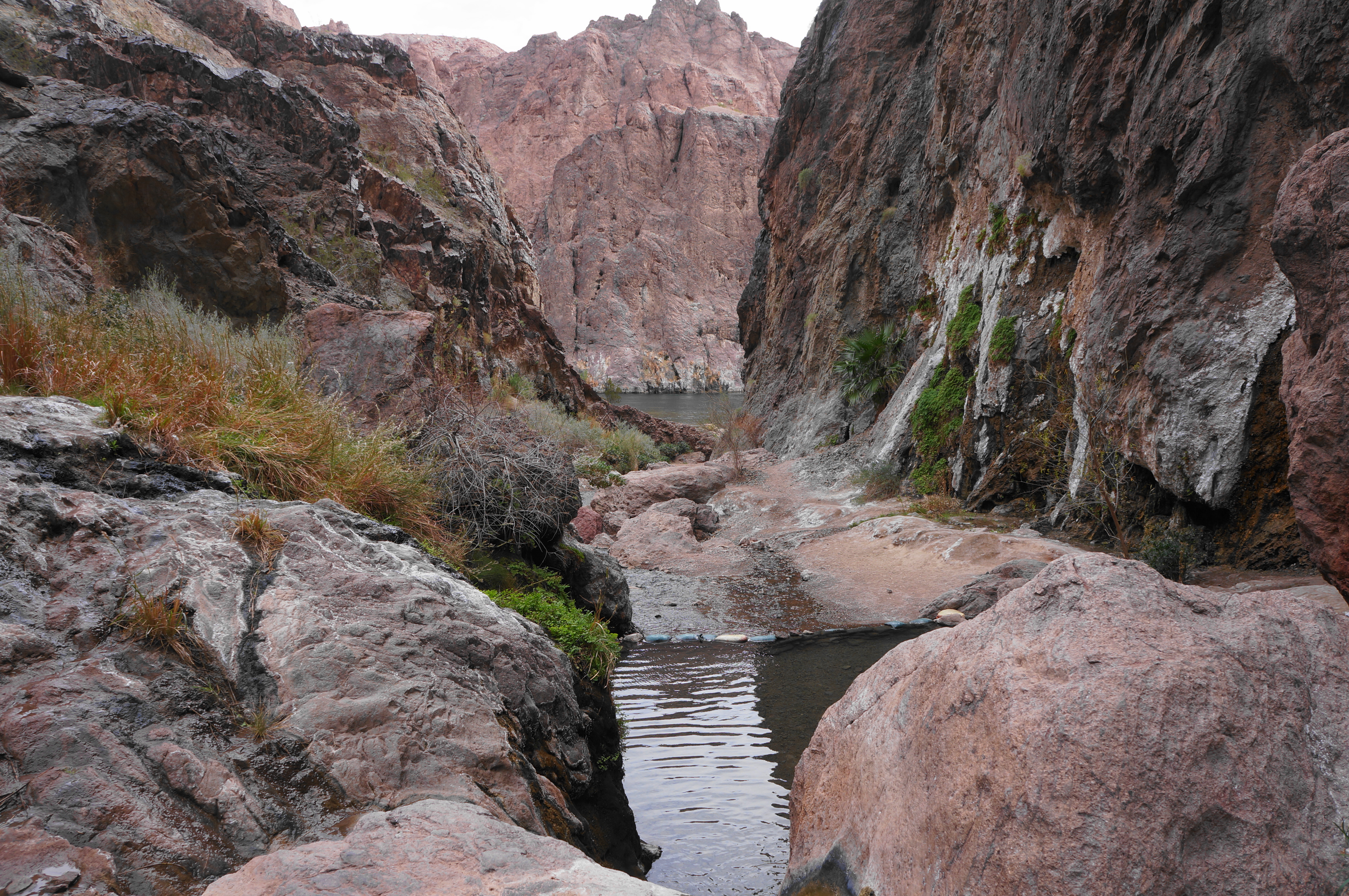

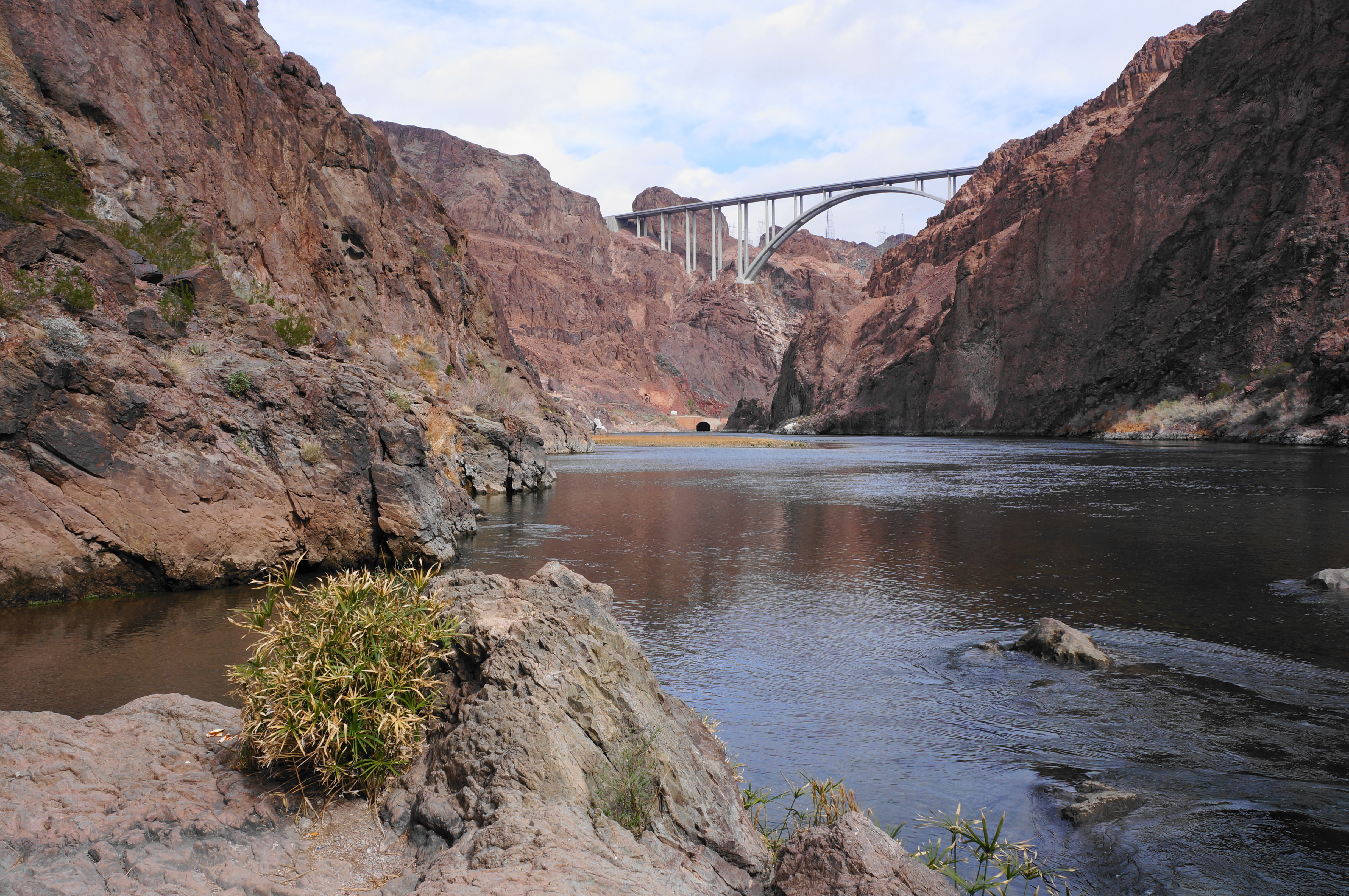
At this point, hikers can either choose to enjoy the hot springs (hope you brought your swimsuit!) or continue down to the end of the hike at the banks of the Colorado River. The river is a short walk of about 1/10 mile, although the flowing hot water can make some of the descents slippery. At last, the warm water of Goldstrike Canyon meets the chilly Colorado in Black Canyon just south of the Mike O’Callaghan-Pat Tillman Memorial Bridge. The Hoover Dam, itself a major tourist attraction, is situated beyond the bridge but just out of view from this spot. Across the river lies the eastern flank of Black Canyon and the state of Arizona.


Although the Colorado River is only 2.6 miles from the trailhead, the numerous fixed ropes and constant negotiation of boulder jams means it will likely take most hikers around 1.5-2 hours to reach this point.

If you haven’t already taken a dip, backtrack to the fourth and best hot springs pool to soak in the warm waters for a bit. Then prepare for the challenging return journey—which can also take a similar amount of time. It is considerably more difficult to climb up the fixed rope assists, and some teamwork may be necessary, especially for Rope #9 and perhaps #8, #4, and #3. Take it slow and steady, and methodically make your way back up the ropes and through the various boulder jams to return to the opening at 1.5 miles and, at last, the return of the easy section just beyond.

Admire the narrows on the way back, and keep an eye out for wildlife: bighorn sheep are known to frequent the canyon, among others. After 5.2 miles, the hike ends back where it started—at the parking lot at the head of Goldstrike Canyon. All told, this feels like a much-of-the-day hike and is rated as strenuous. However, the hot springs and canyon narrows—in addition to the enduring allure of the Colorado River—make this a memorable hike, one of the most beloved in the Las Vegas area.

thank you for the article
Pingback: Top 10 Hikes in 2023 | Live and Let Hike
For a return visit there are three side canyons on the right when going down canyon. The 1st and 3rd are not technical and interesting to explore. Some scrambling necessary, no ropes or other aides present. The 2nd is Motorcycle Canyon which is a technical descent.