
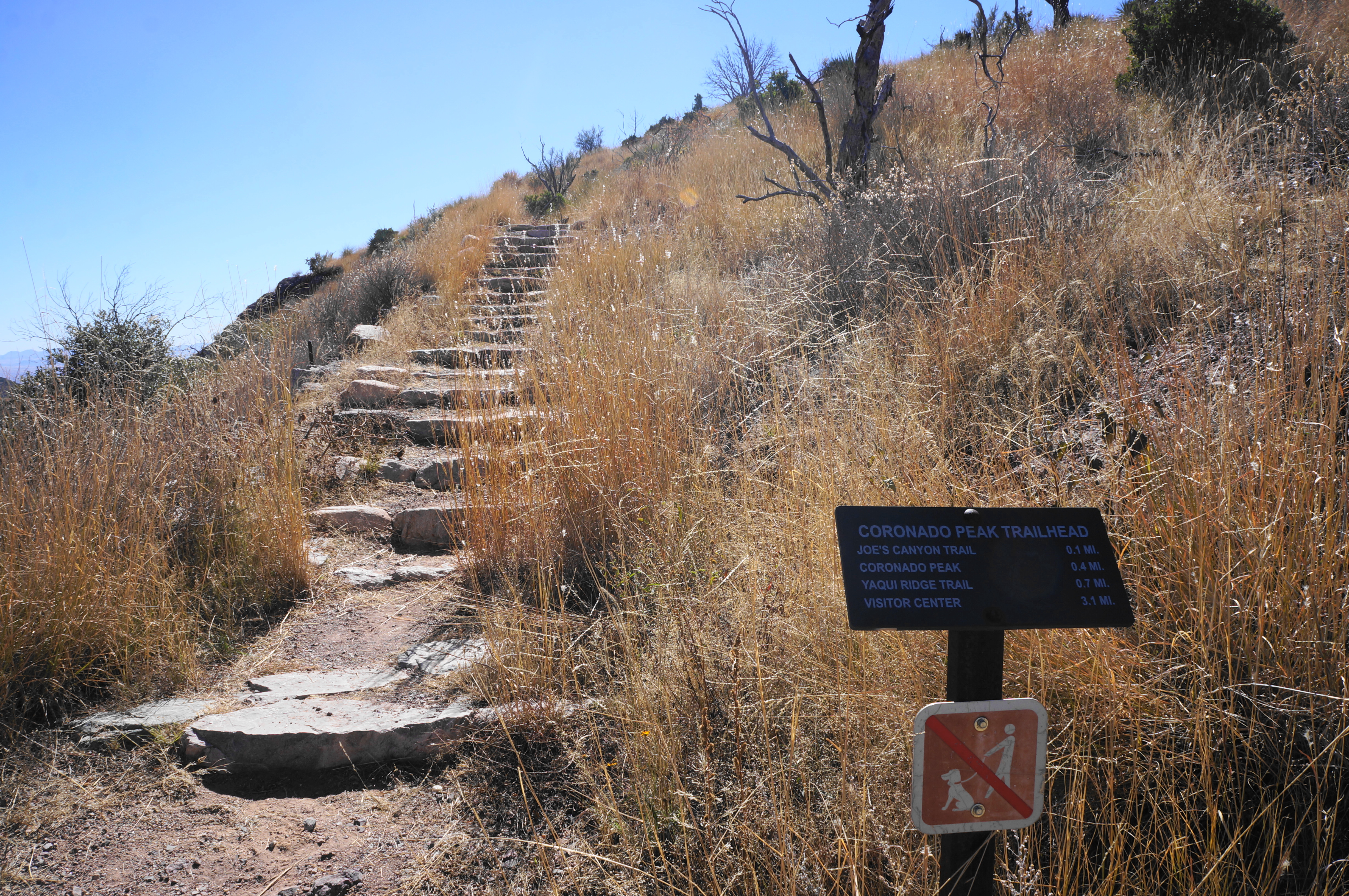
Gaining 300 feet in elevation, the Coronado Peak Trail tackles a summit at the southern end of Arizona’s Huachuca Mountains, one of many “sky islands” in the area. Named for famed Spanish explorer Francisco Vasquez de Coronado, this is the most-visited peak in Coronado National Memorial, offering views of Montezuma Canyon, the San Rafael Valley, and Sonora, Mexico. The climb is short but steep, mostly comprising stone steps in full sun exposure, ending at a shaded viewing platform after 4/10 mile. Hikers can combine this out-and-back with a longer jaunt on the Joe’s Canyon and/or Yaqui Ridge Trails—and Coronado Peak is a prominent landmark near the southern terminus of the 800-mile Arizona Trail, which begins just below the mountain.


The hike
Coronado National Memorial celebrates the 1540-42 Coronado Expedition, which set out from Spanish-run Mexico in search of a fabled “Golden City” of Cibola. The Spanish party passed through this area in mid-1540 before reaching a series of Hopi and ancestral Puebloan villages in present-day Arizona and New Mexico.
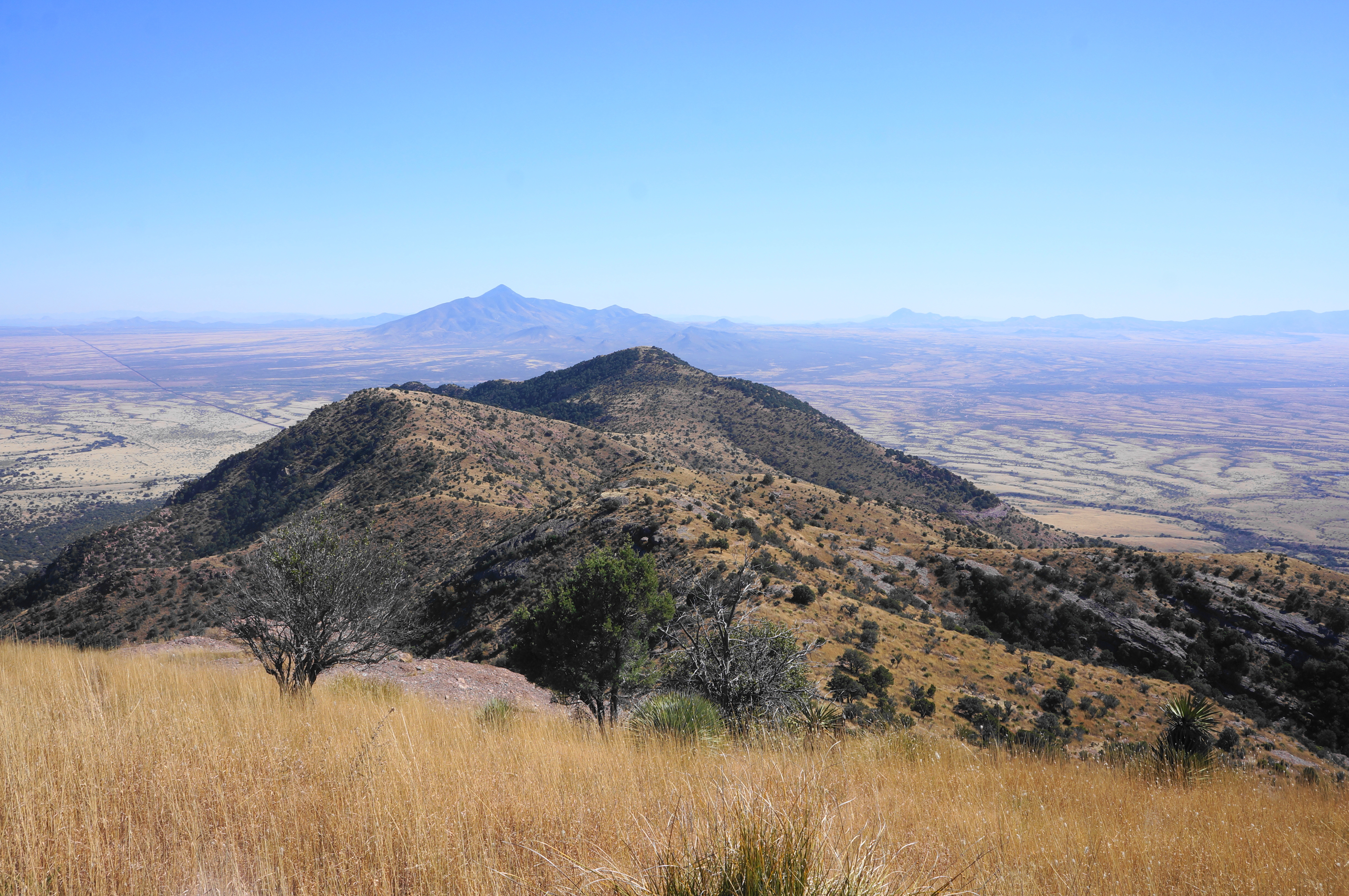
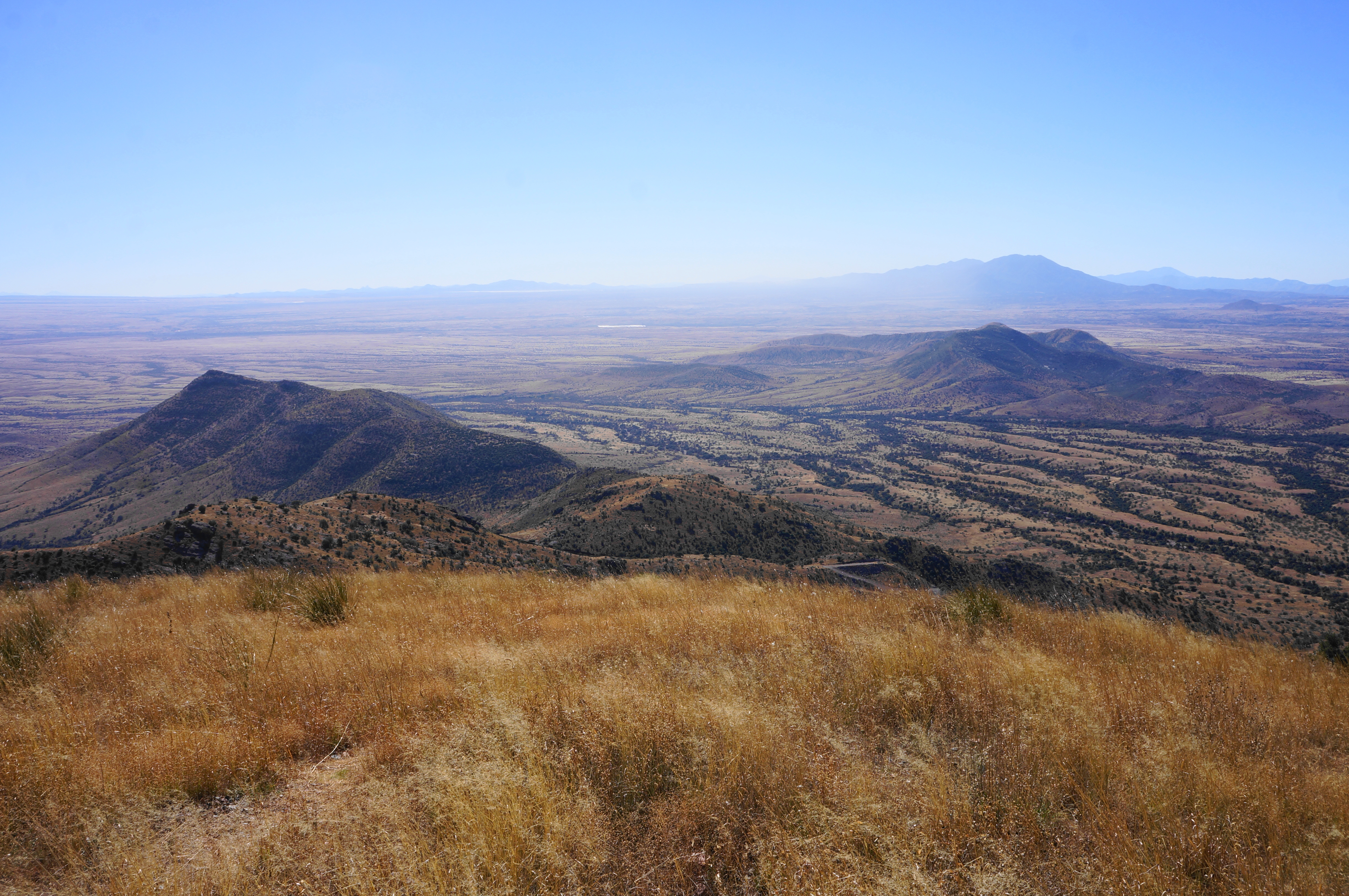
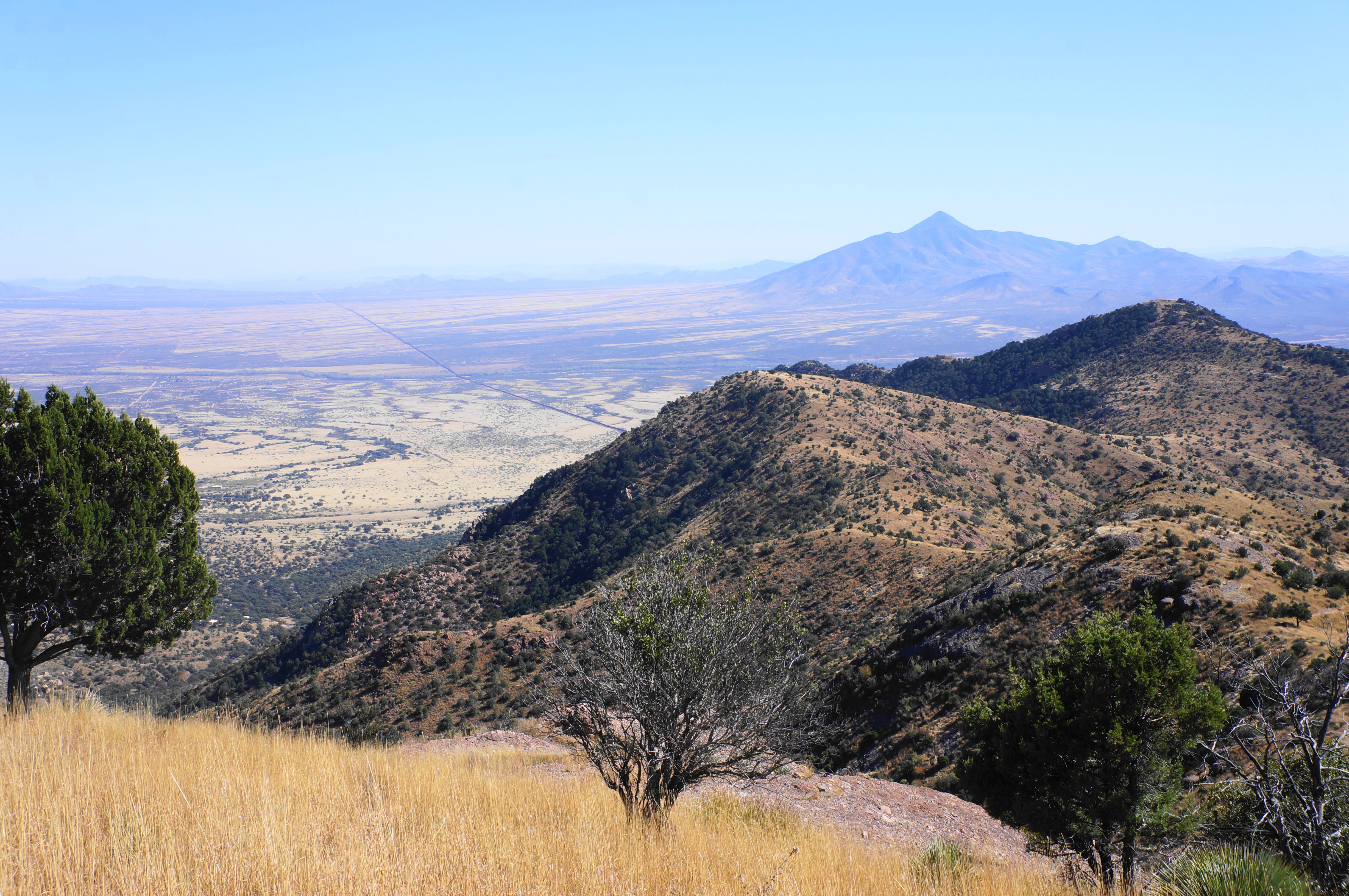
Today, the relatively small park abuts the U.S.-Mexico border and includes a small section of the Huachuca Mountains, one of the larger ranges in the area. Most visitors will enter the memorial from the east (via Sierra Vista or Bisbee), following East Montezuma Canyon Road to the Visitor center and end of the pavement, after which the road continues as a slow but 2-wheel-drive gravel track. Ascend to Montezuma Pass, where there is a relatively large parking area with sweeping views. To the north lies the ridge leading to Miller Peak (9,470’), the highest point in the range. To the east, one can see down Montezuma Canyon to the Visitor Center and vast San Pedro Valley, bisected by the border wall separating the United States and Mexico. To the west, the long flats of the San Rafael Valley eventually give way to the Patagonia Mountains, concealing the border town of Nogales beyond.

The southward view is blocked by a ridgeline and the summit of Coronado Peak, giving visitors an incentive to tackle the 8/10-mile round-trip hike. From the parking area, look for a signed trail heading south, past an initial sign with a trail map. The route begins like it ends: with a series of stone steps, ascending the grassy hillside.

Look for pinyon, juniper, white oak, and yuccas as the Coronado Peak Trail passes a communications tower on the right and rises to a bench and junction. The Joe’s Canyon Trail heads left, while the path to the summit bears right; follow the latter, rising again, with improved views back to Miller Peak and the Huachucas.


Soon the trail swings back and forth between east- and west-facing sides of the main ridge, with open vistas nearly throughout. Catch your breath at various interpretive waysides, then continue south toward the summit.


The final push involves much wider switchbacks and stone staircases, finally culminating at the golden summit, where there is a shade ramada and benches facing southeast. Here the landscape south to Sonora opens up, with views extending as far as Sierra de la Mariquita and the northern ranges of the Sierra Madre Occidental.


Two interpretive signs at the ramada explain the Transatlantic Trade and the legacy of Coronado, whose expedition was deemed a failure but facilitated further Spanish conquest in what would later become the western United States.
When ready, return the way you came—or continue on the Joe’s Canyon Trail to the Yaqui Ridge Trail or as far east as the Visitor Center. Doing just the 8/10-mile out-and-back should occupy hikers for around 45 minutes to an hour, making this one of the shortest and easiest hikes in the park.
