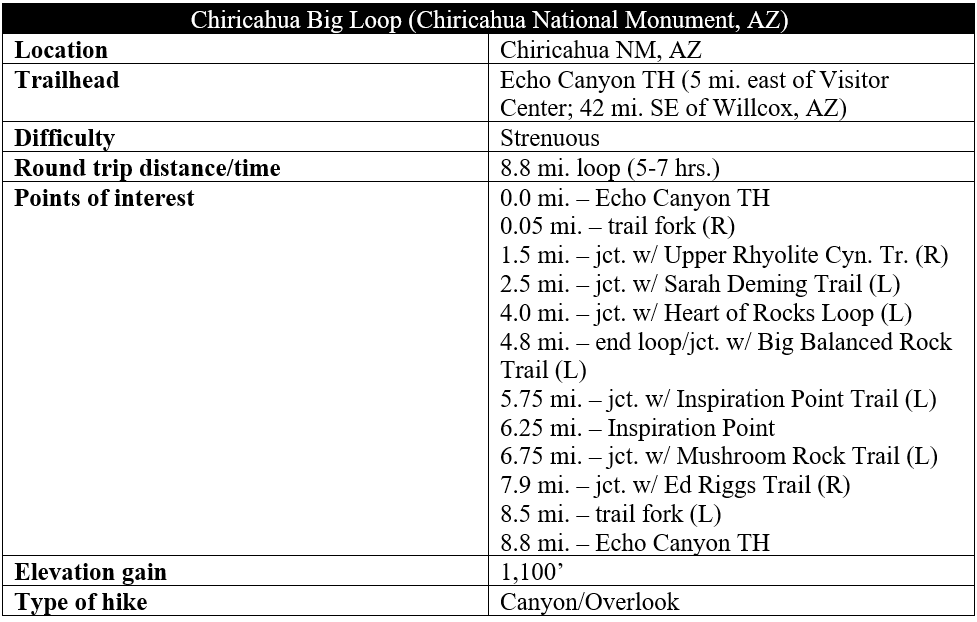
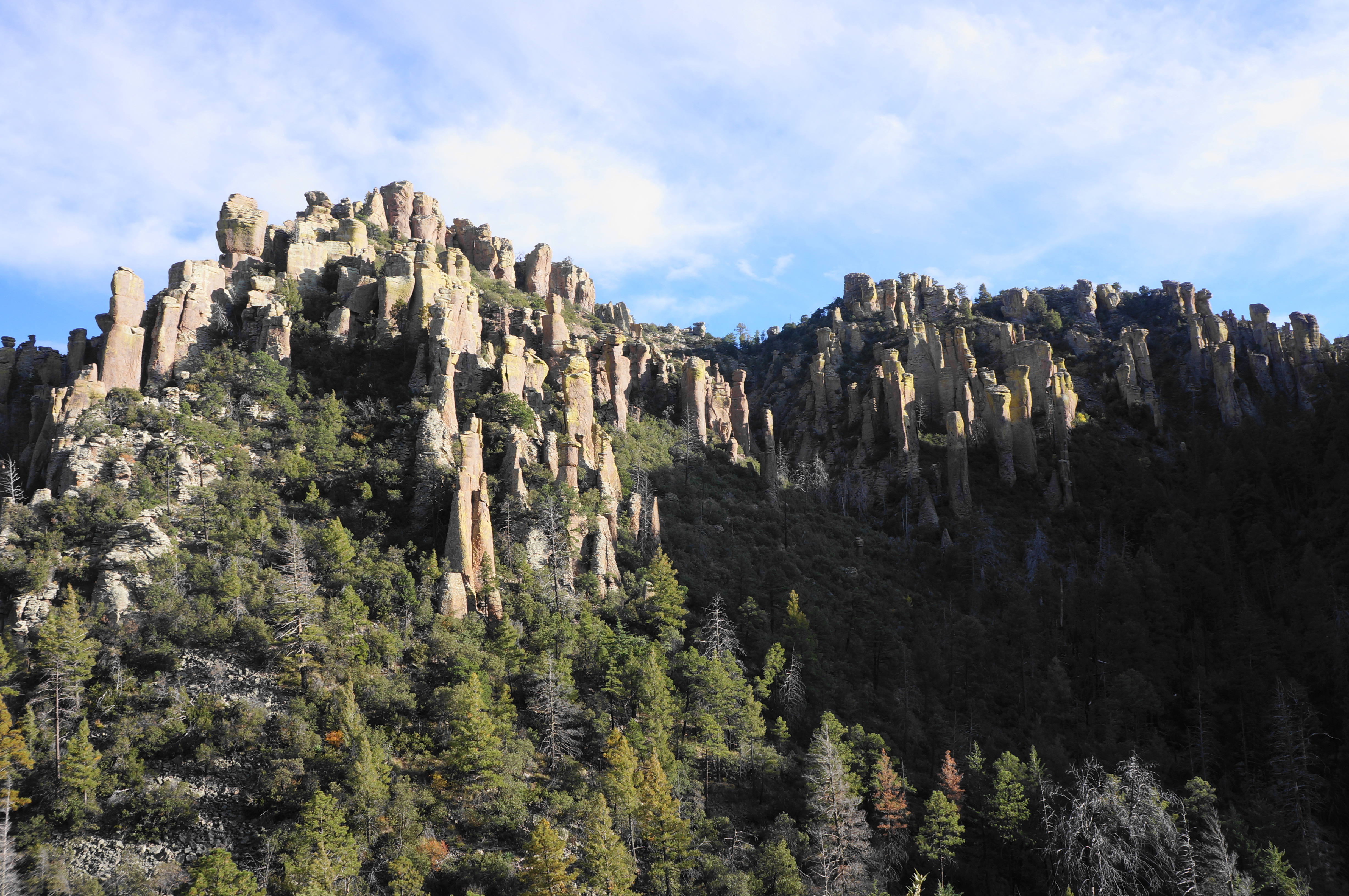
At first glance, the Chiricahua Mountains of southeast Arizona appear little different from the hundreds of other small ranges of the Basin and Range area, which spans from southern Oregon and Idaho down to Mexico: an abrupt north-south range rising from open, scrubby valleys, seemingly the same pattern of dry escarpments with the usual features of rocky peaks and some limited woodlands. But the Chiricahua range harbors a secret that sets it apart from the others: a hidden landscape of thousands of naturally-carved pinnacles composed of yellow-brown rhyolite tuff, evidence of ancient lava flows, uplift, and intense erosion. The result is a “wonderland of rocks” resembling a slightly more subdued version of Bryce Canyon—but spectacular in its own way. Like Bryce, there is an extensive trail network crisscrossing the landscape, with far and away the best option being the Chiricahua Big Loop, an 8.8-mile excursion that combines several trails in Chiricahua National Monument, included the famed “Heart of Rocks” area. The extensive scenery and bounty of spur trails easily make this challenging hike a most-of-the-day affair that visitors are unlikely to forget.

The hike
Chiricahua National Monument spans 12,000 acres in the northern half of the Chiricahua Mountains, with the entrance situated about 35 miles southeast of Willcox, Arizona. The range is located along the boundary of the Sonoran and Chihuahuan Deserts and approximates the northern terminus of the lengthy Sierra Madre Mountains, located primary in neighboring Mexico. The Chiricahua Mountains—named for a group of Apache who once controlled the area—are one of many so-called “sky islands,” or mountain ranges that appear to rise from a surrounding desert “sea.”
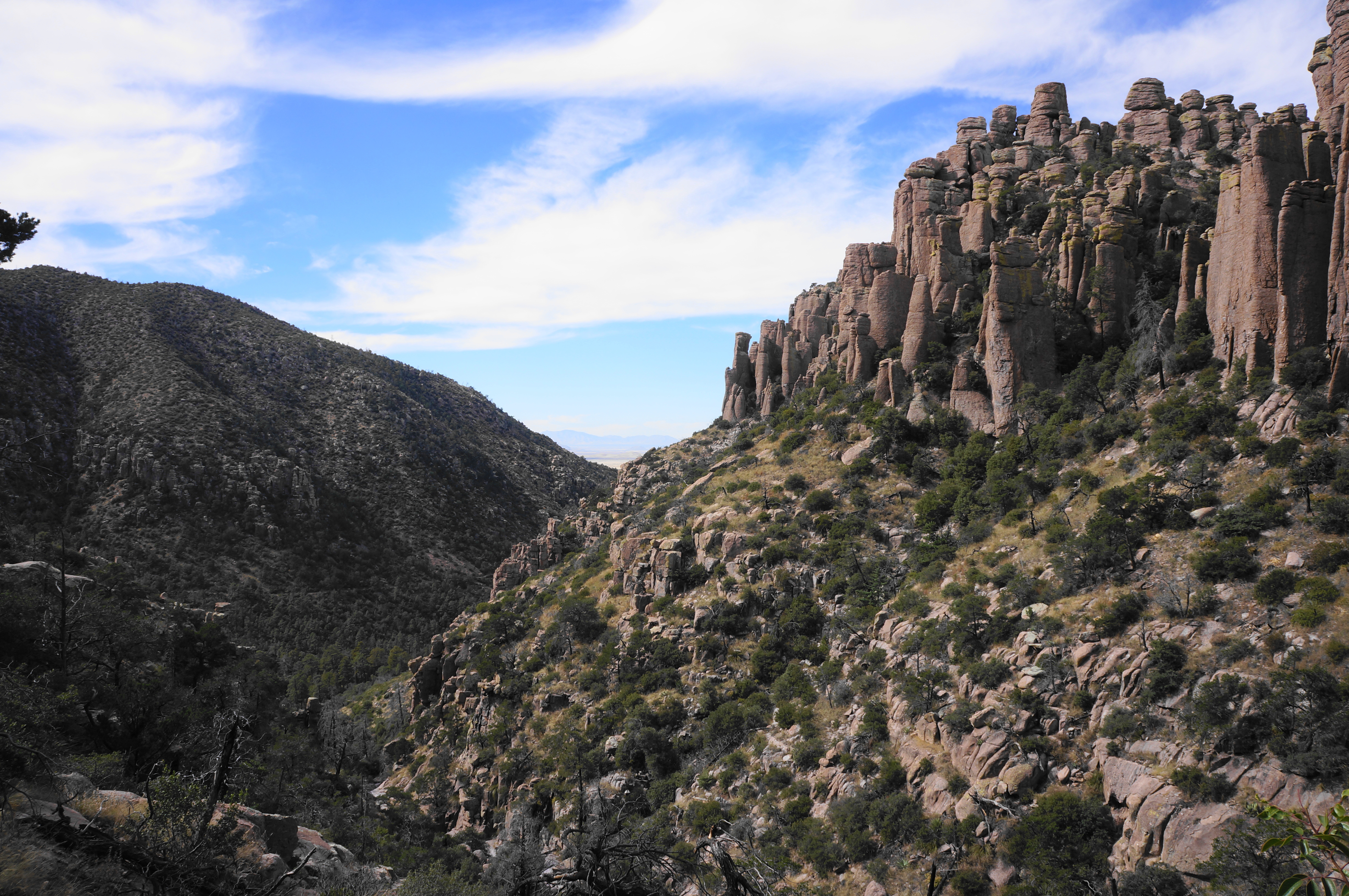
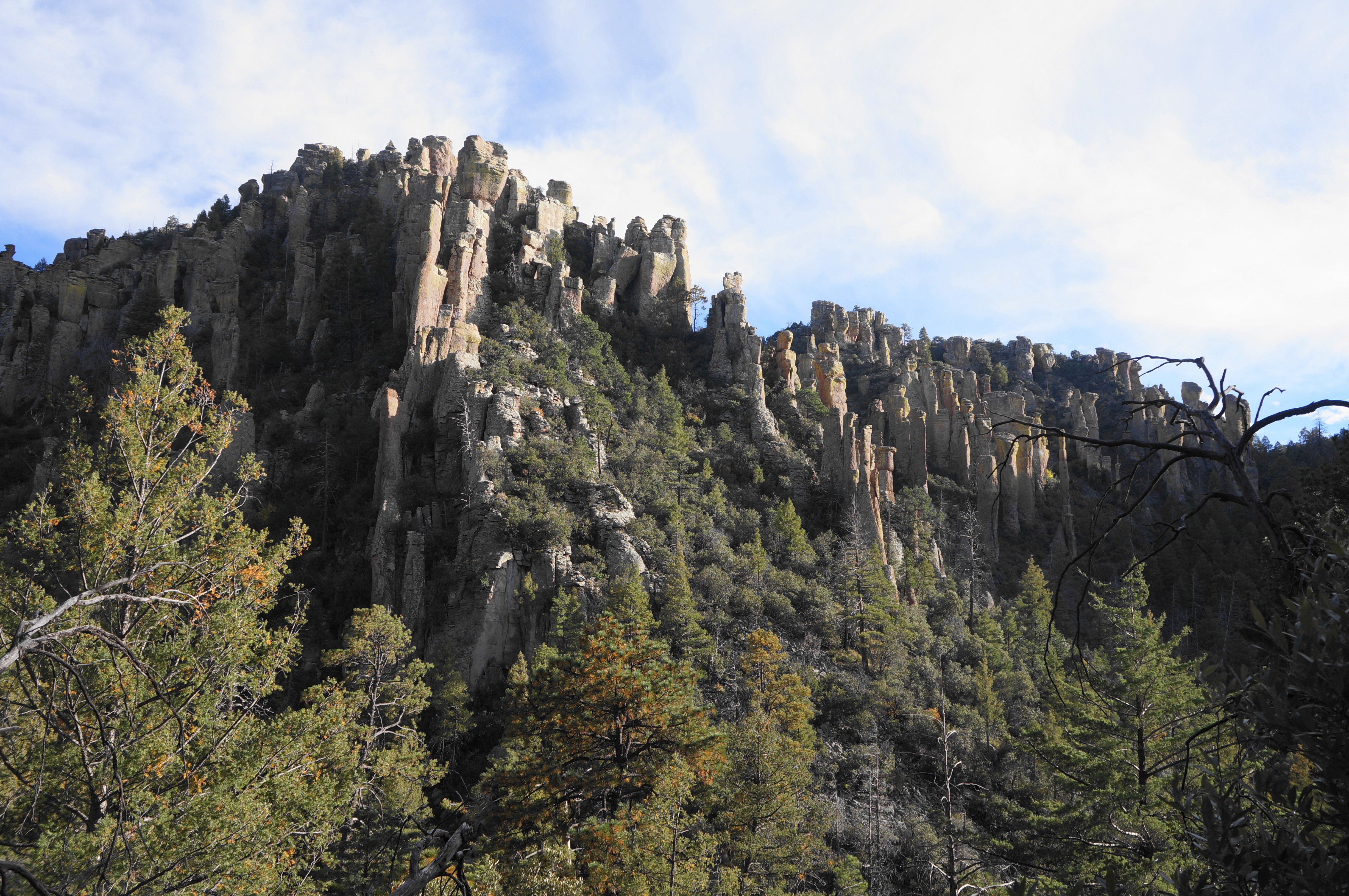
As one approaches the Chiricahuas, however, visitors quickly realize that this is no usual mountain range. Rather, the opening of Bonita Canyon—which offers passage into the park—is lined with tall sides dotted with colorful rhyolite, a volcanic rock layer thought to have been deposited around 27 million years ago. The volcanic eruptions left behind a caldera, and the rhyolite tuff has since eroded into wild shapes, with the largely concentration situated at the heads of Bonita and Rhyolite Canyons.
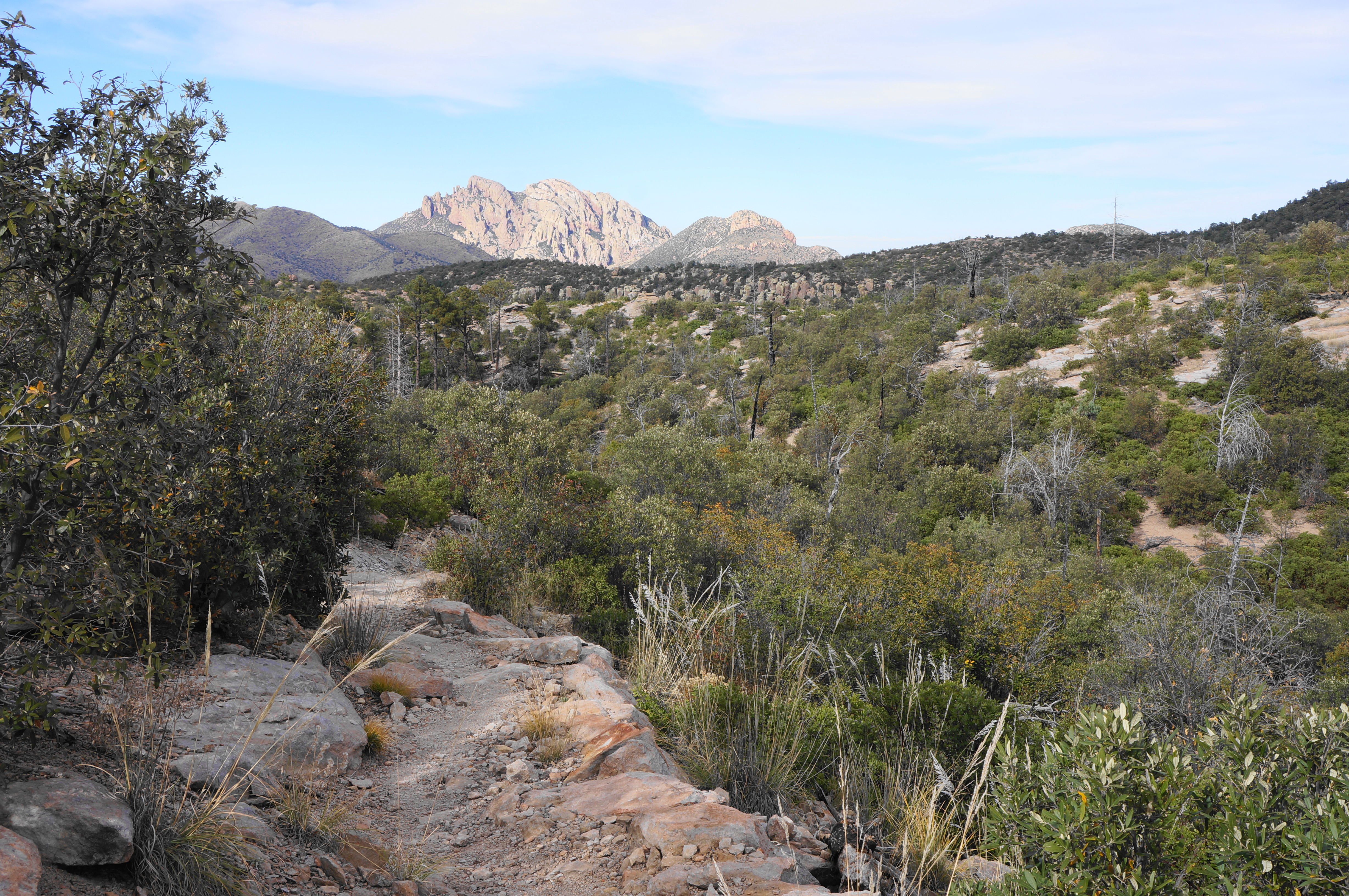
Follow Bonita Canyon Drive—the main road through the park—for 7.5 miles, stopping at the Visitor Center along the way for a map and additional information. The scenery improves as the drive snakes through Bonita Canyon and then hugs an east-facing hillside with views to Cochise Head (8,113’), the highest peak in this northern part of the range. The East Whitetail Creek drainage leads south and east, out of the park, toward the next basin, which straddles the border of Arizona and New Mexico.
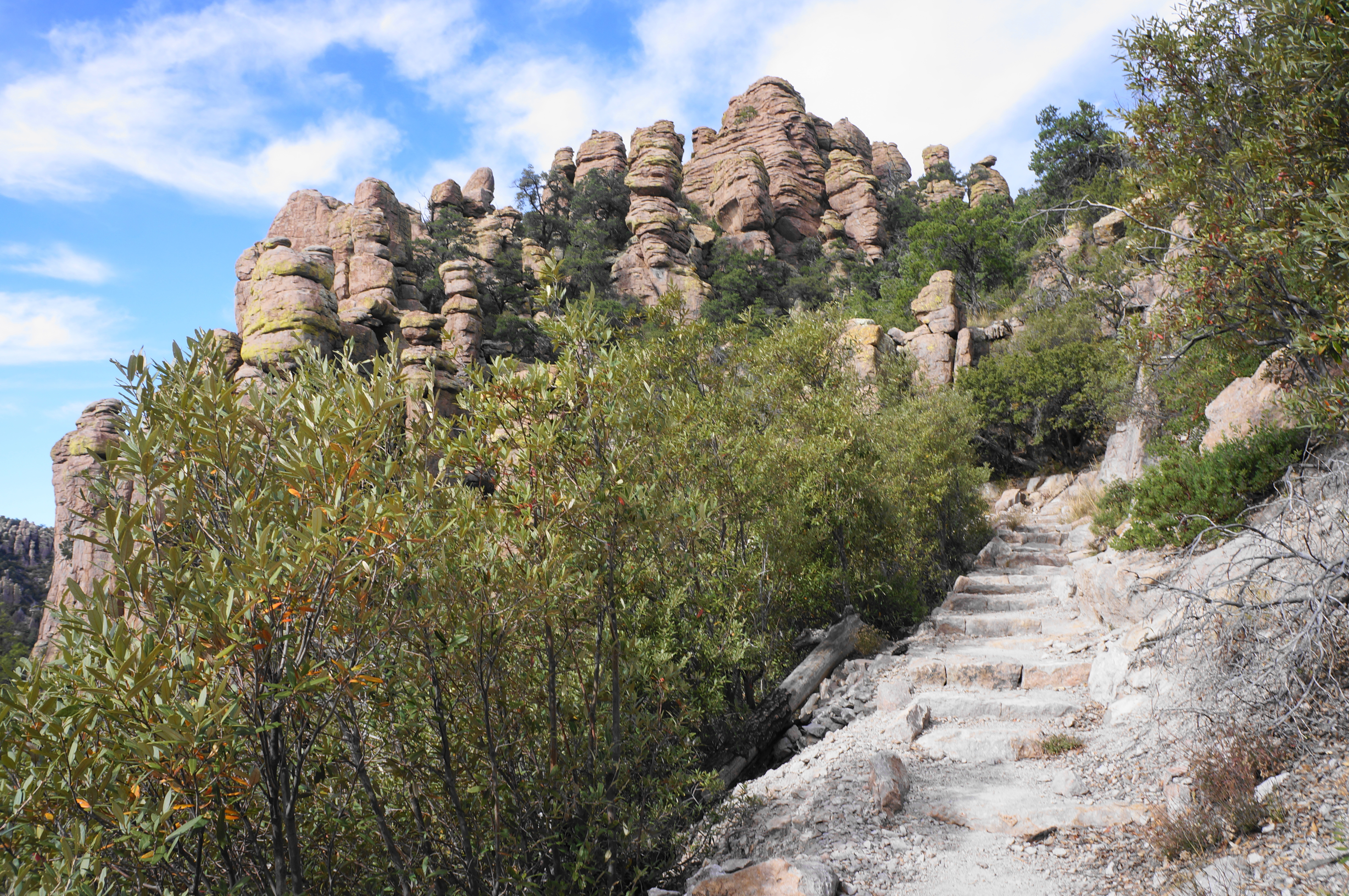
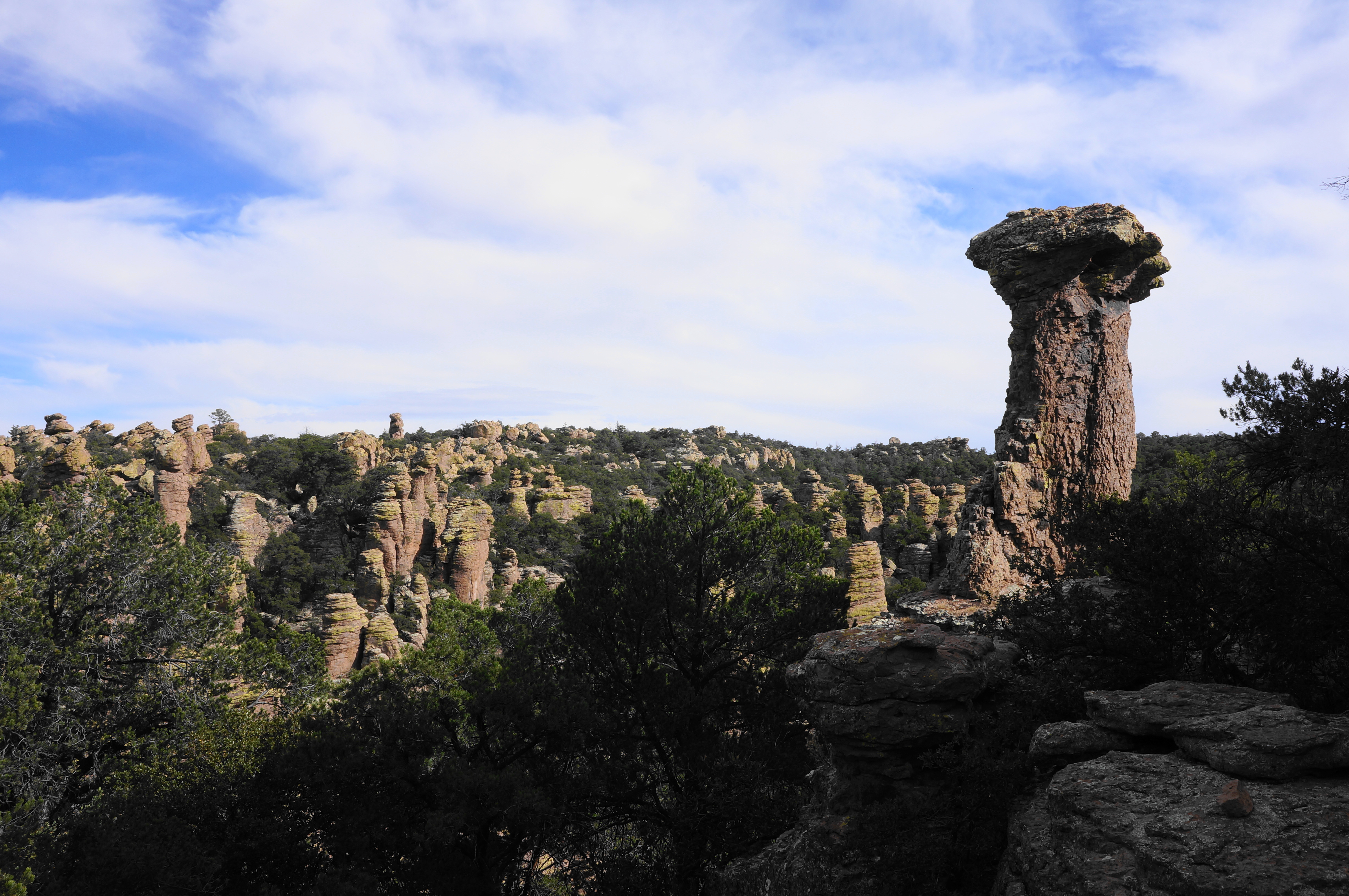
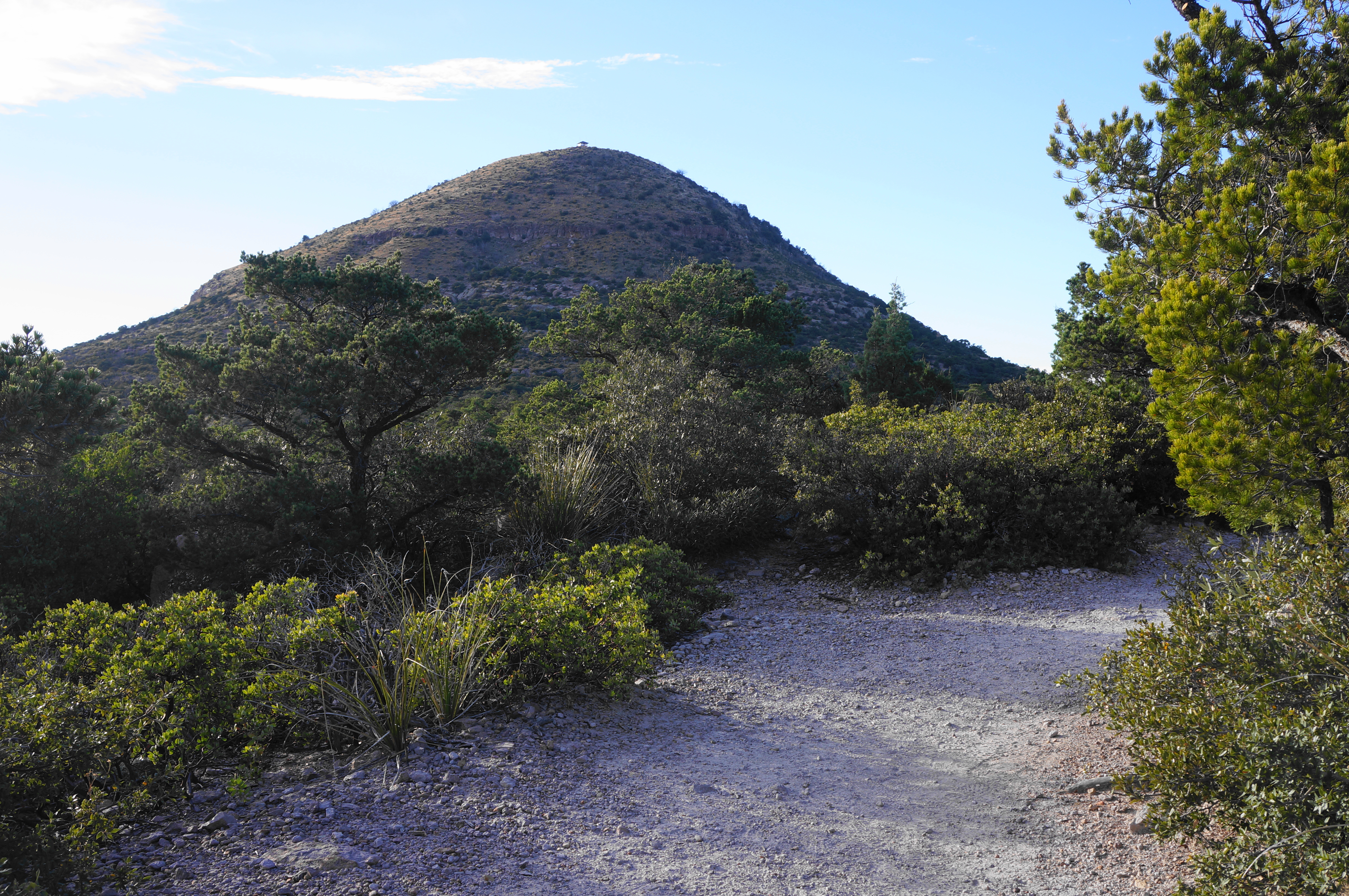
Bear right at the junction for Sugarloaf and Echo Canyon, then pull into the first parking area on the left: this is the Echo Canyon Trailhead, the staging point for several popular hikes in the park. (Note: The lot is relatively small, so arriving on a weekday or early in the morning on a weekend is wise to secure a spot.) While the wonderland of rhyolite is not visible from the parking area, the high hump of Sugarloaf Mountain (7,310’)—composed of volcanic dacite—dominates the vista to the northwest.
There are bathrooms at the trailhead, as well as a trail map and sign with suggestions for some shorter hikes—such as the 3.3-mile Echo Canyon Loop Trail—which will be mostly covered as part of the larger Chiricahua Big Loop.
Echo Canyon Trail to Upper Rhyolite Canyon Trail (1.5 miles)
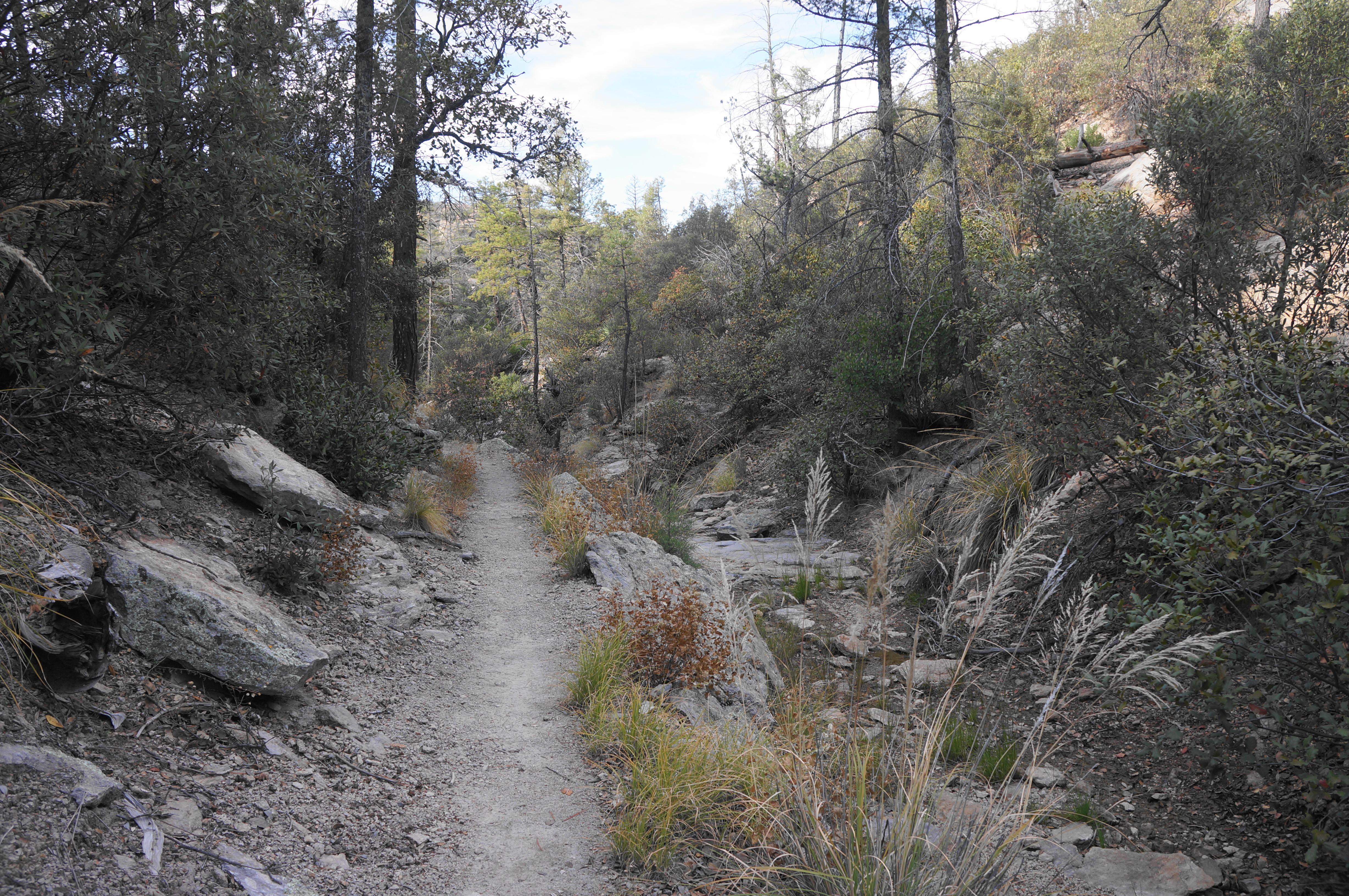
The “Big Loop” begins with an easy and slightly downhill walk across a chalky highland in the scrubby chapparal and pinyon/juniper woodlands, coming quickly to an intersection with the Massai Point Trail. Stay right here, beginning the loop portion of the hike.
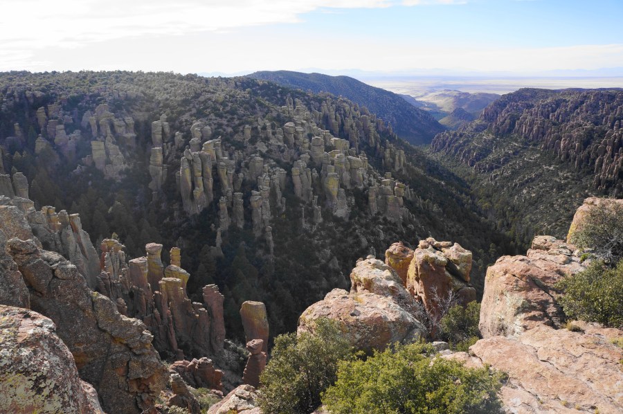
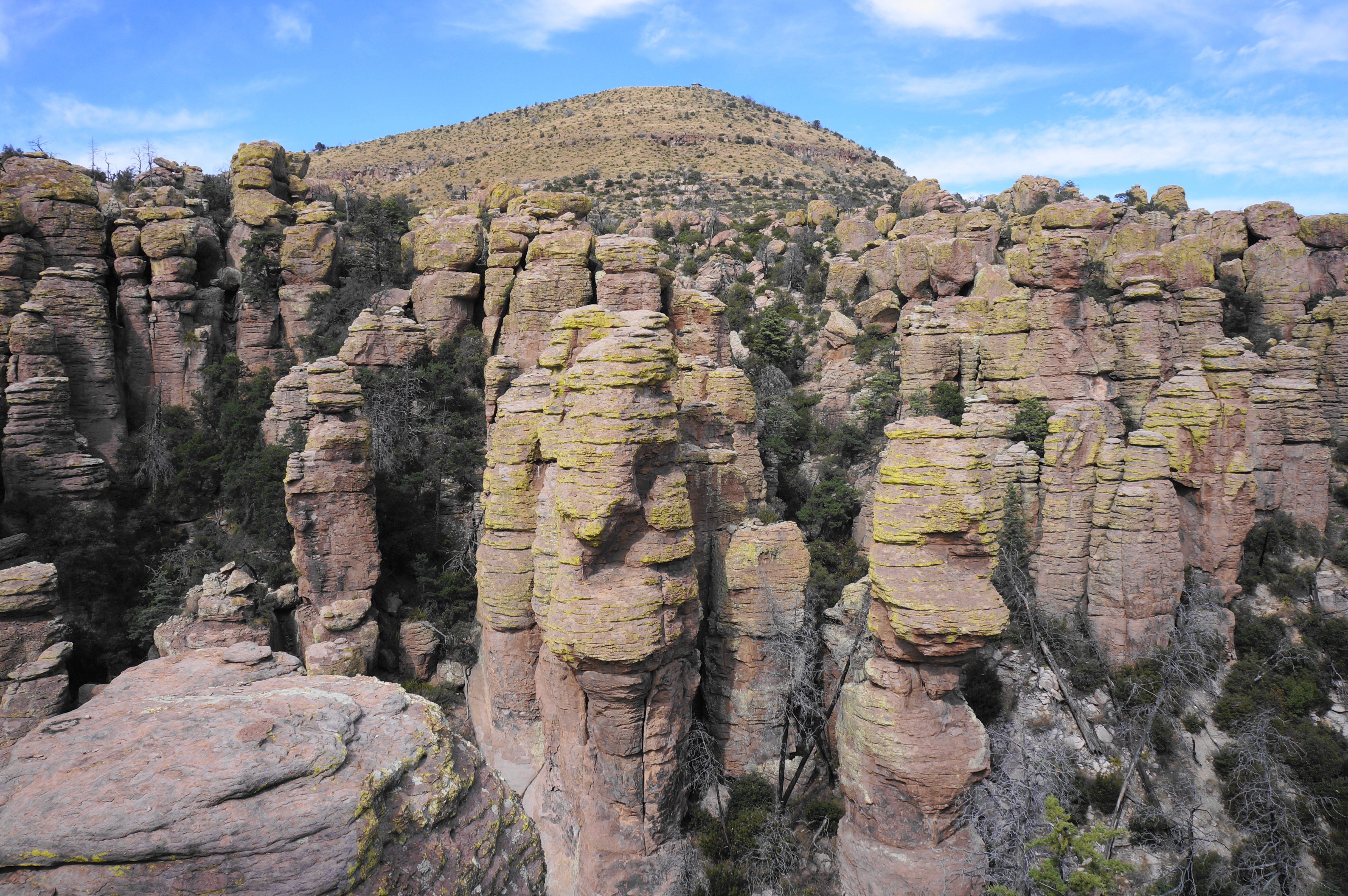
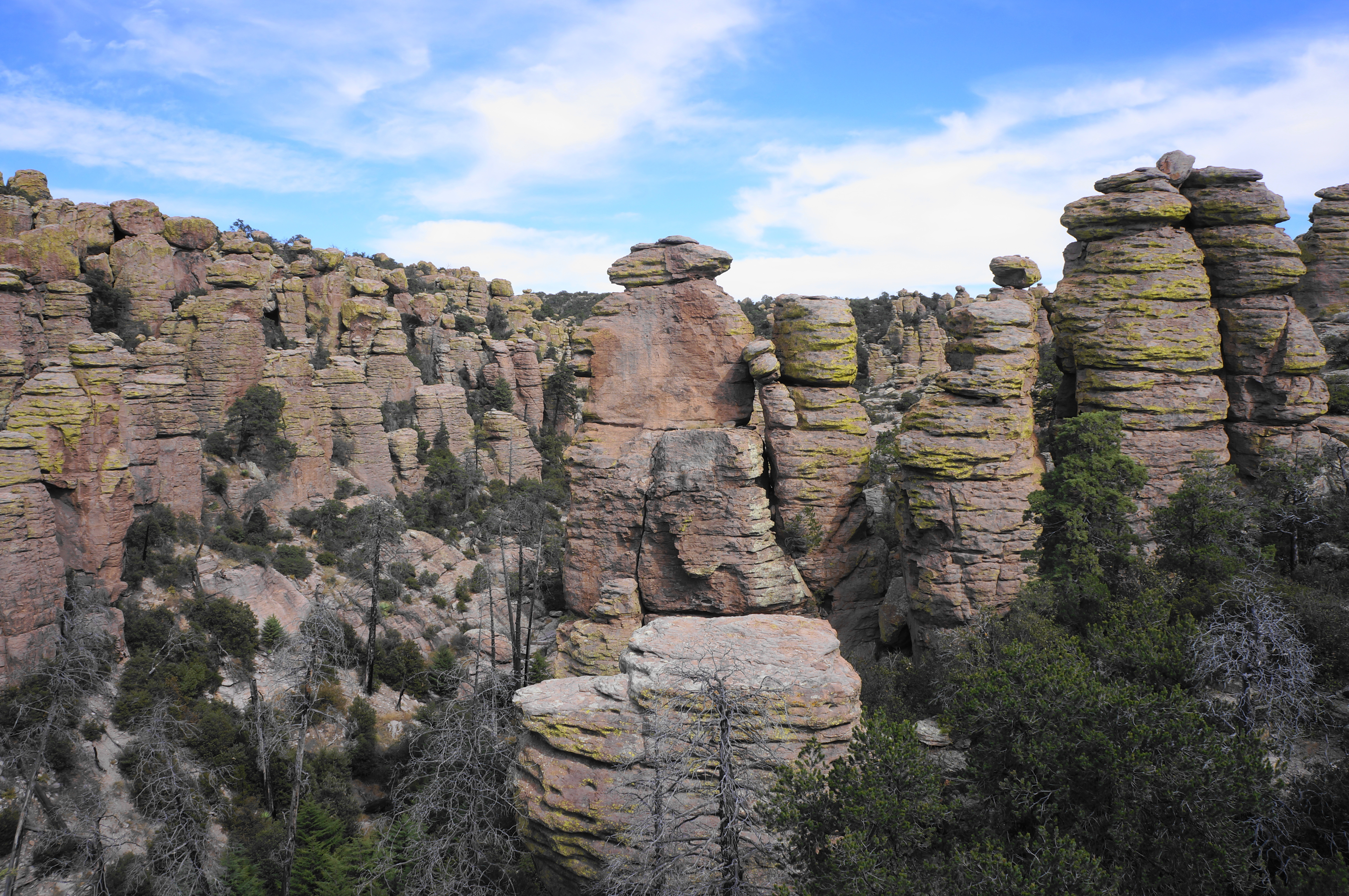
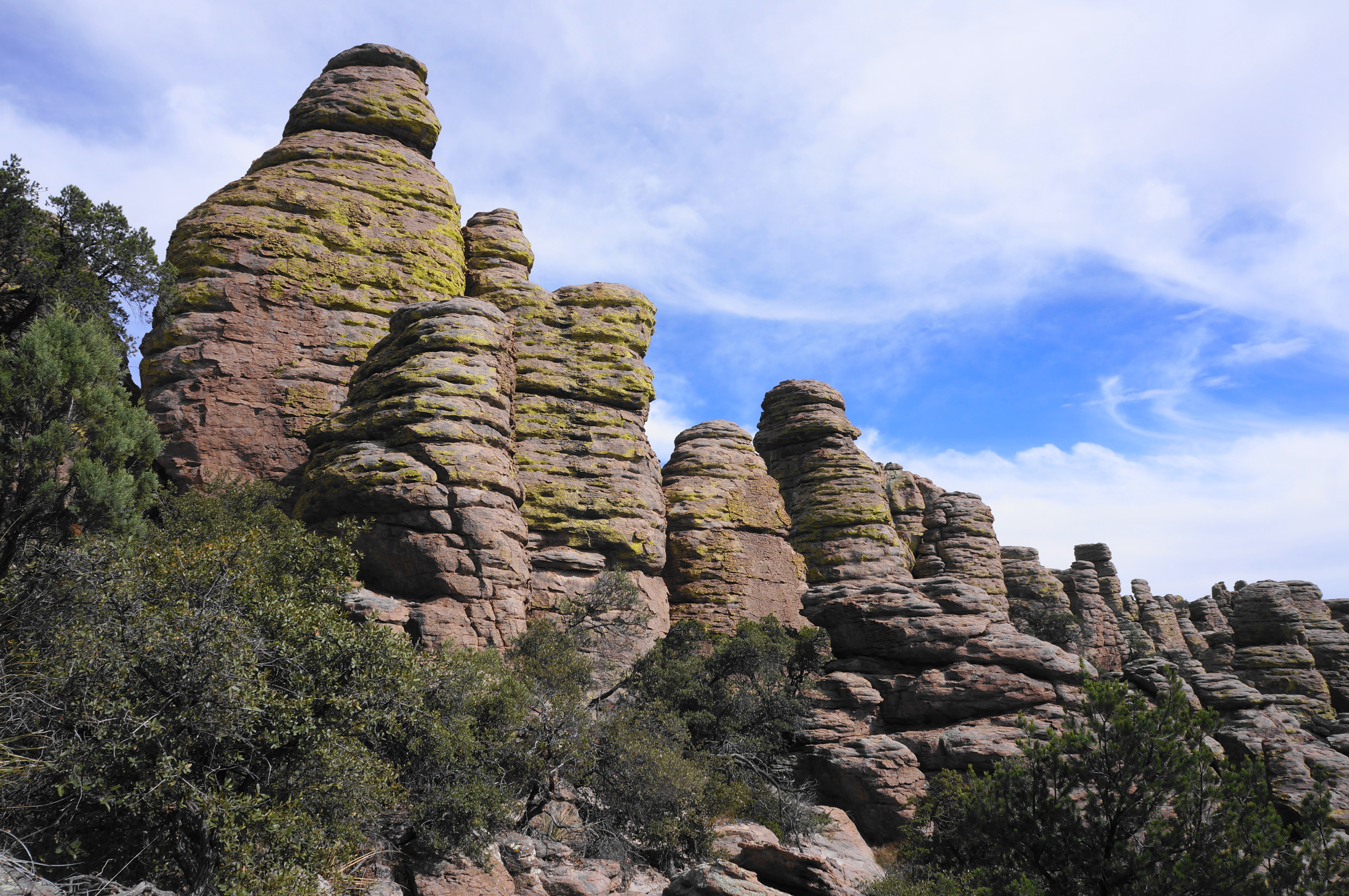
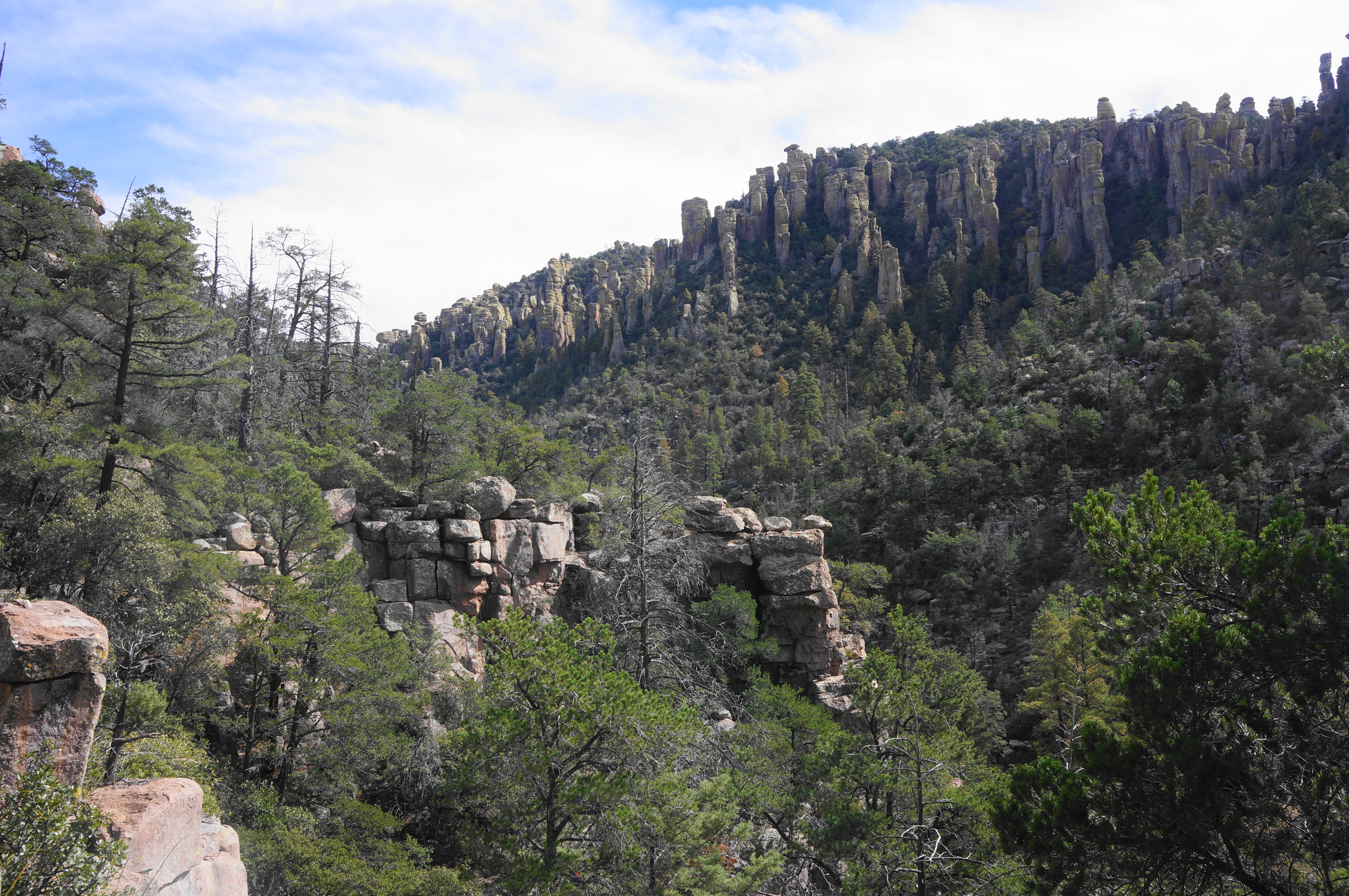
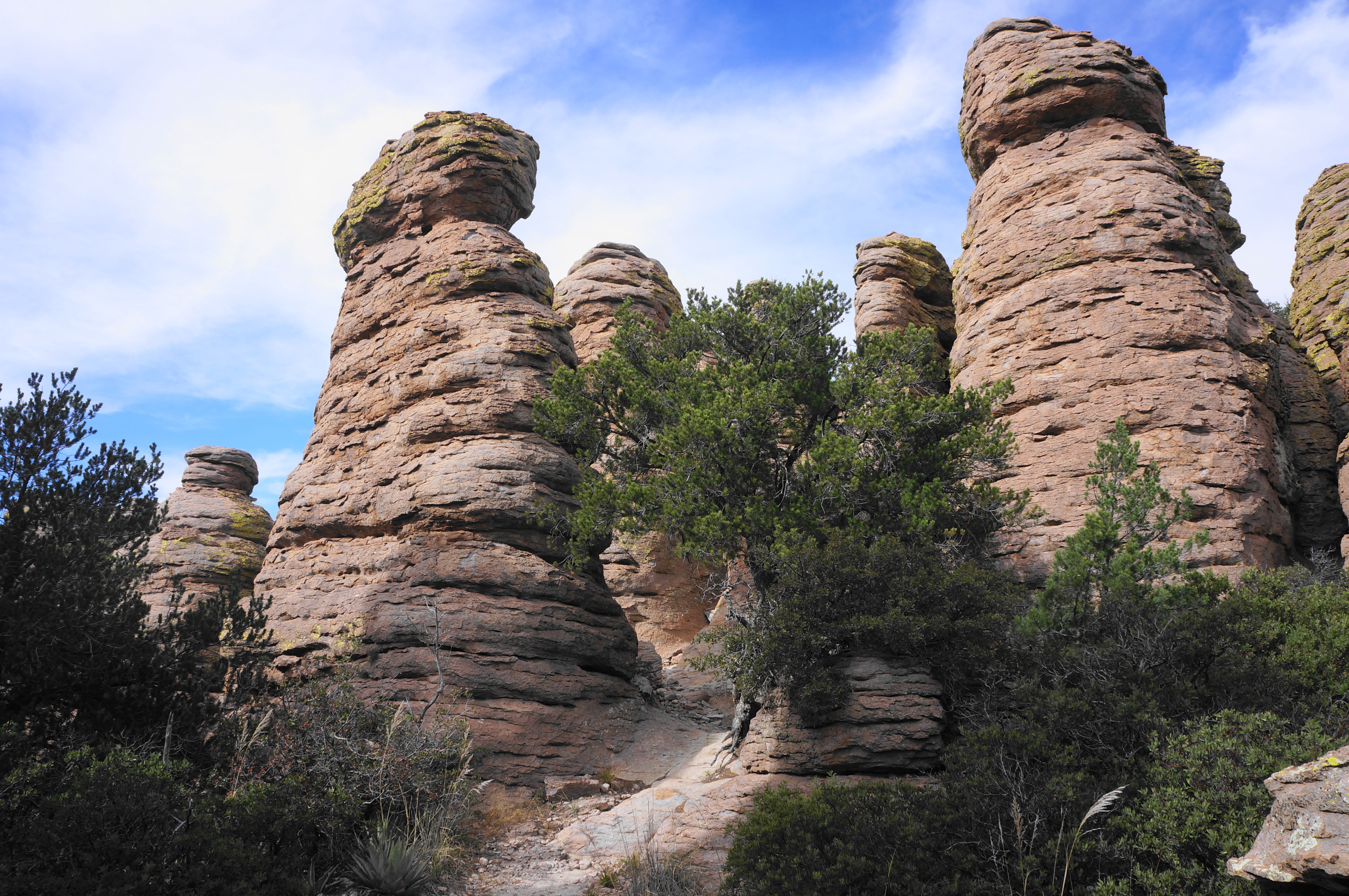
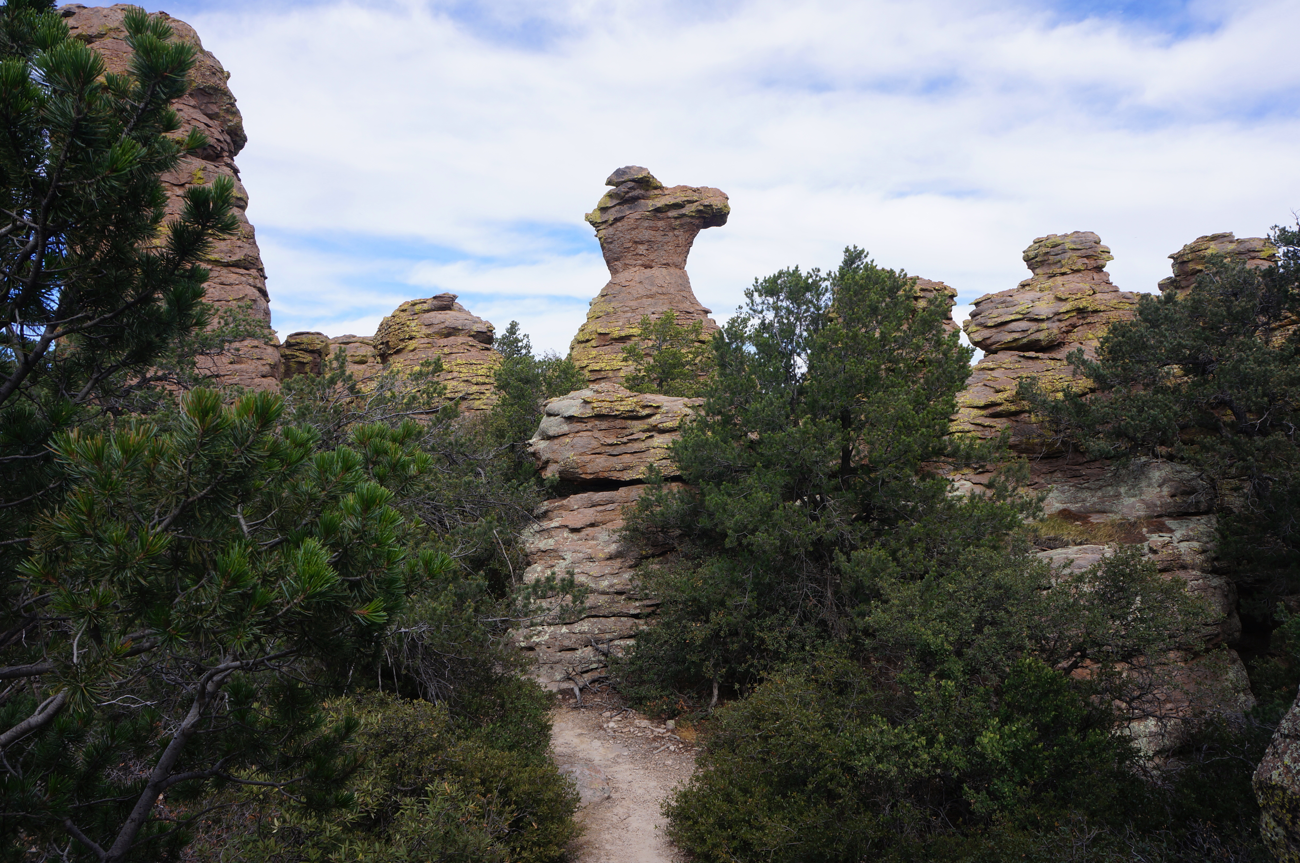
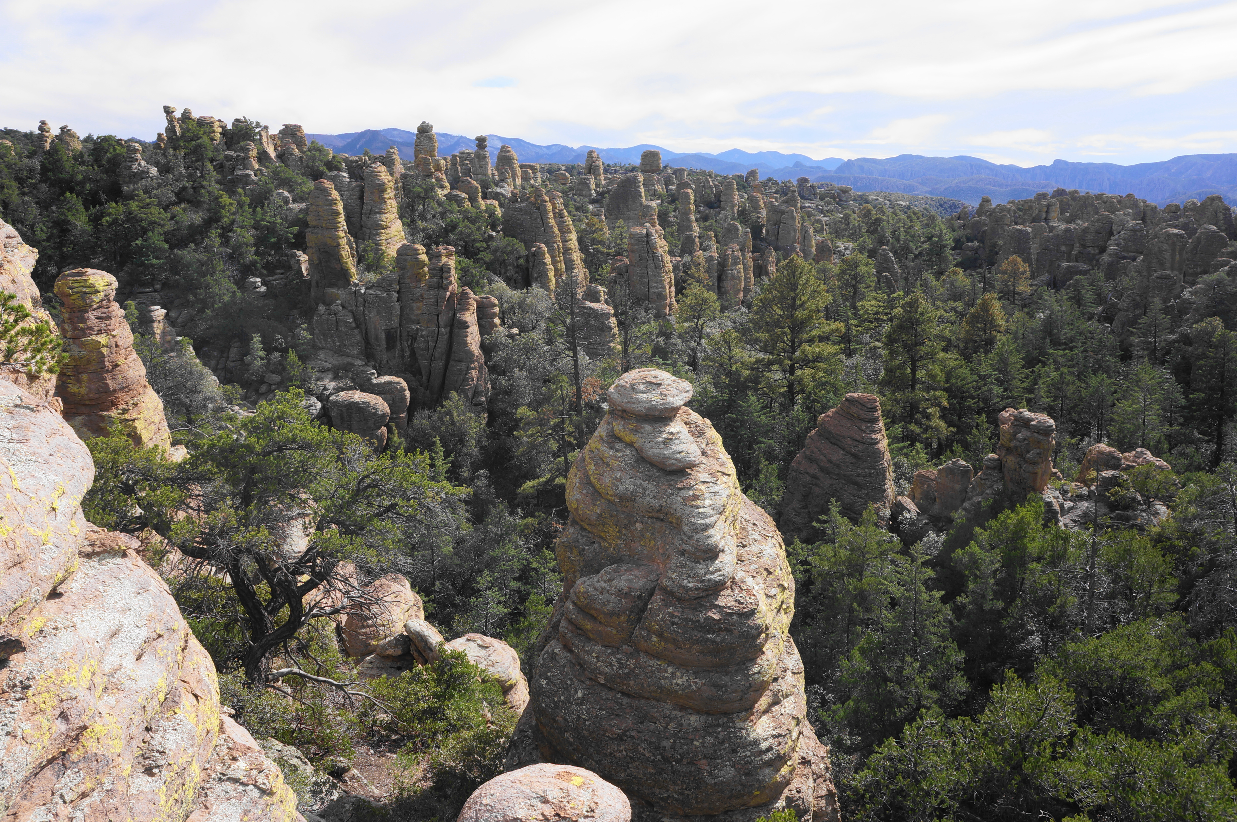
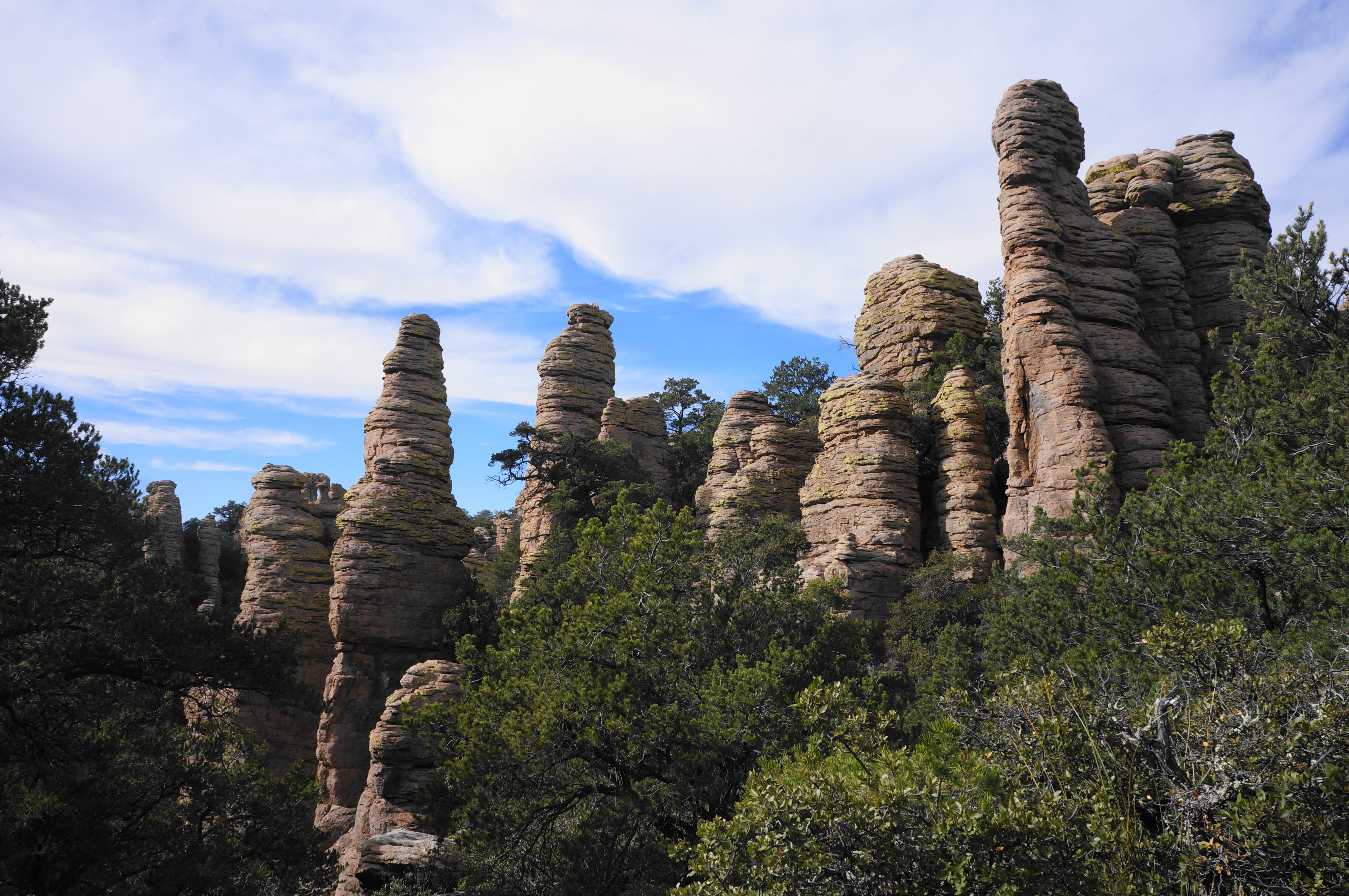
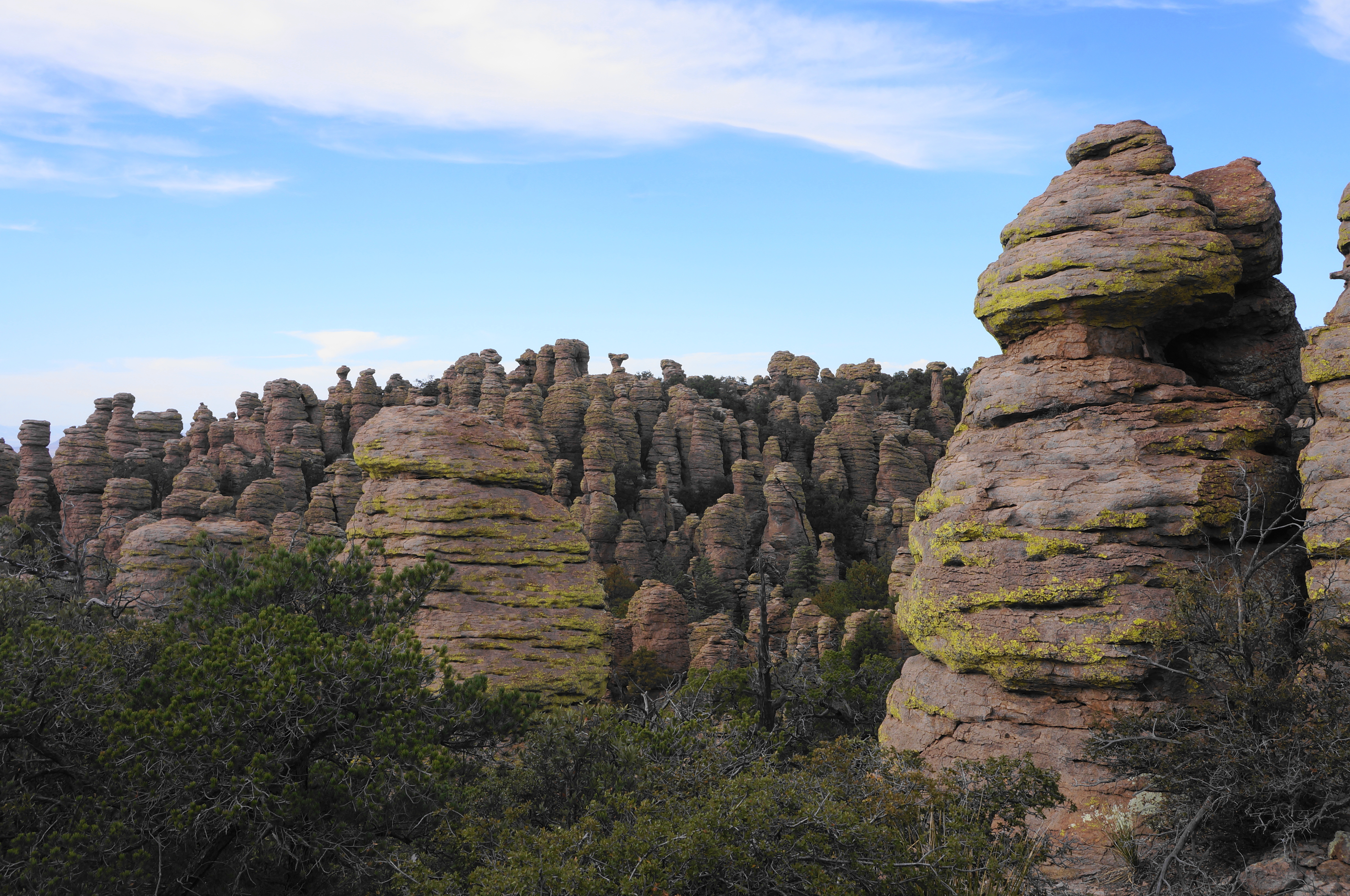
From here the Echo Canyon Trail climbs a short hillock with the first rhyolite outcrops coming into view off to the left. There is a partial view south at around 2/10 mile, but the real action comes about 175 yards later, when hikers get their first good look north into Echo Canyon, a tributary of Rhyolite Canyon that boasts some of the tallest rock pinnacles in the park. The canyon is set just below Sugarloaf Mountain, which is topped by a viewing gazebo, to the north.
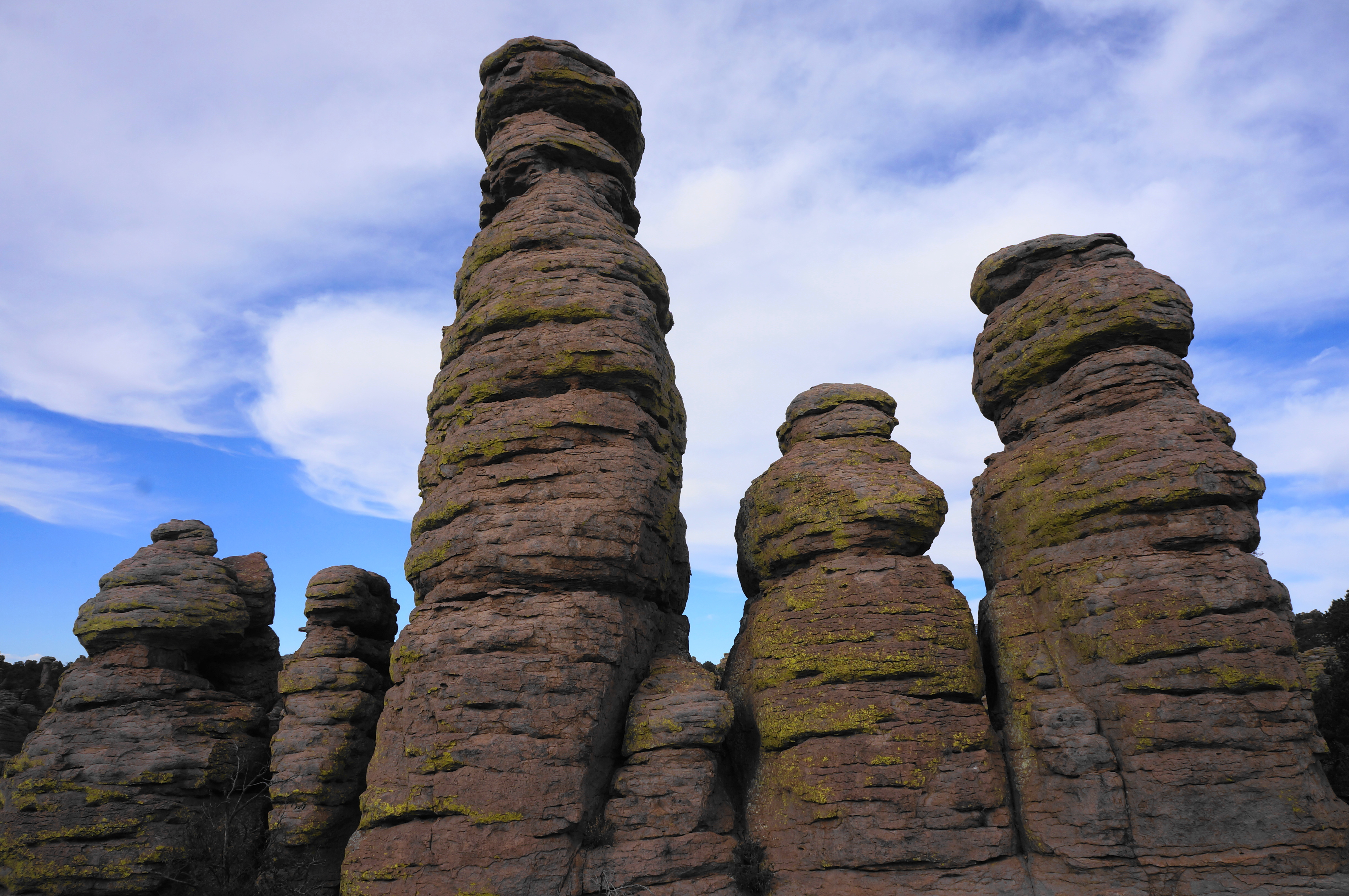
As the trail bounds from one side of the ridgeline to another, hikers soon get their first good views south into the Echo Park area, also boasting a large collection of hoodoos. Mushroom-shaped outcrops become more common alongside the trail, and the coloration and detail of the eroded formations becomes more pronounced as the hike proceeds.

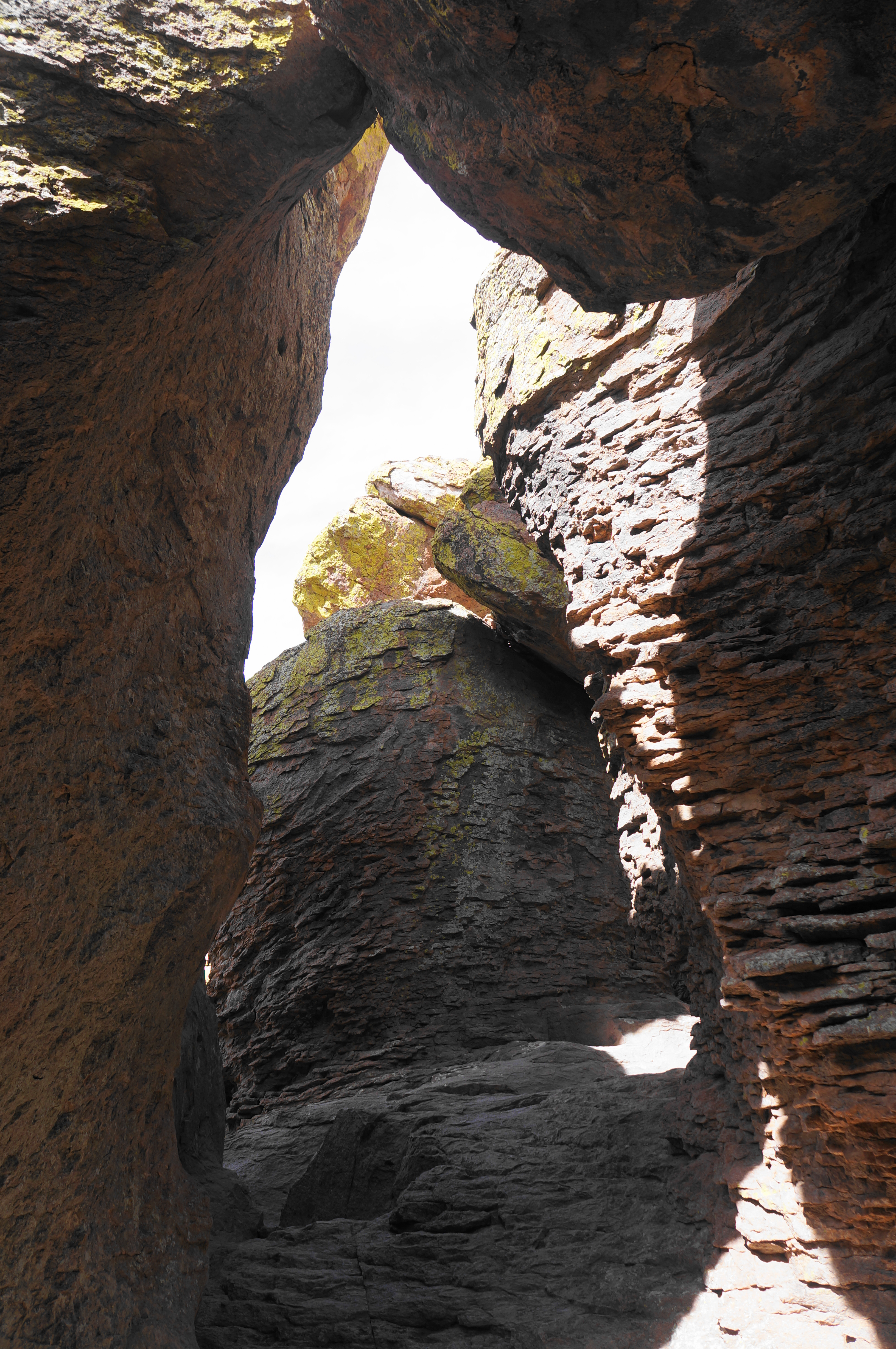
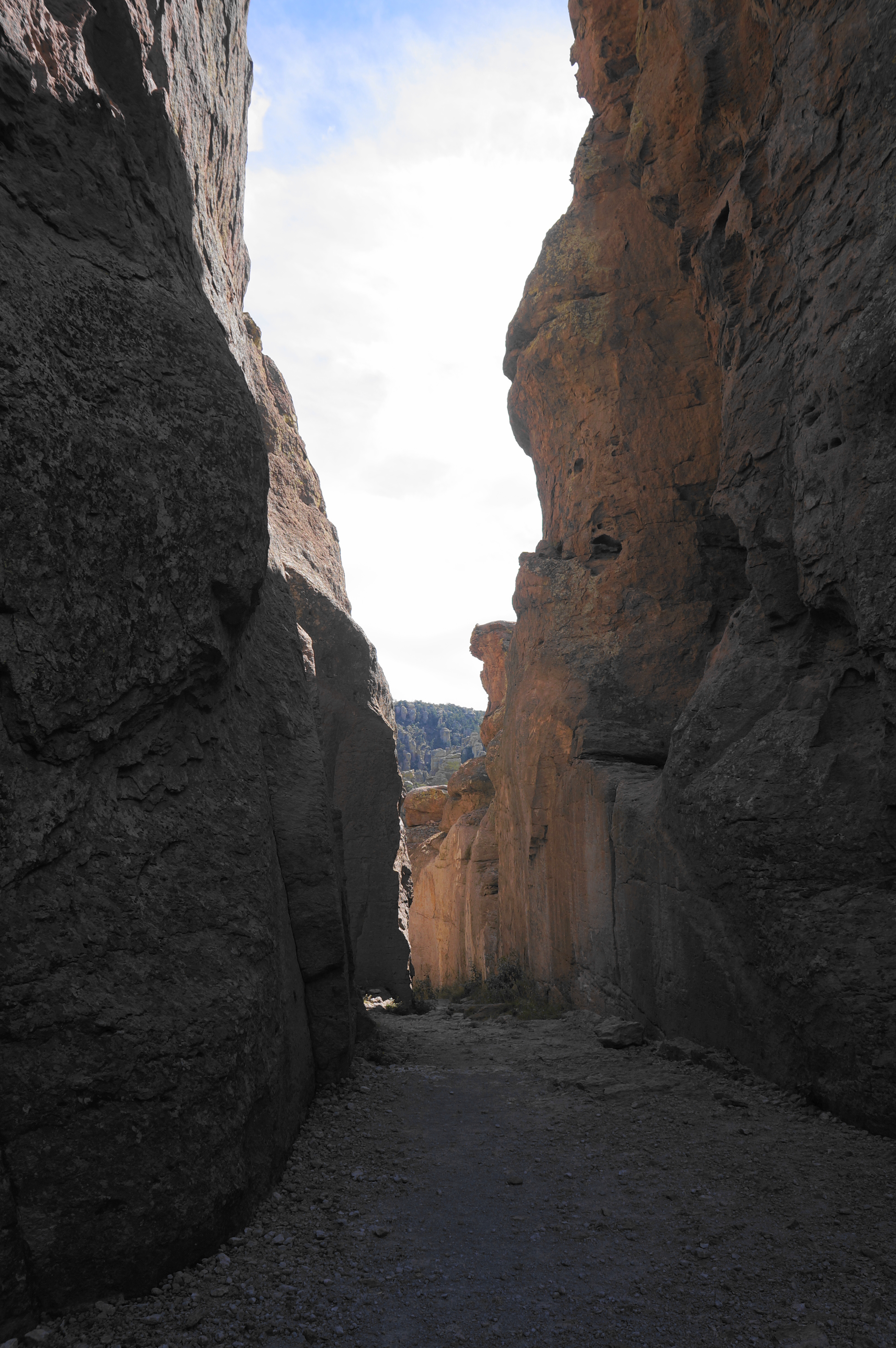
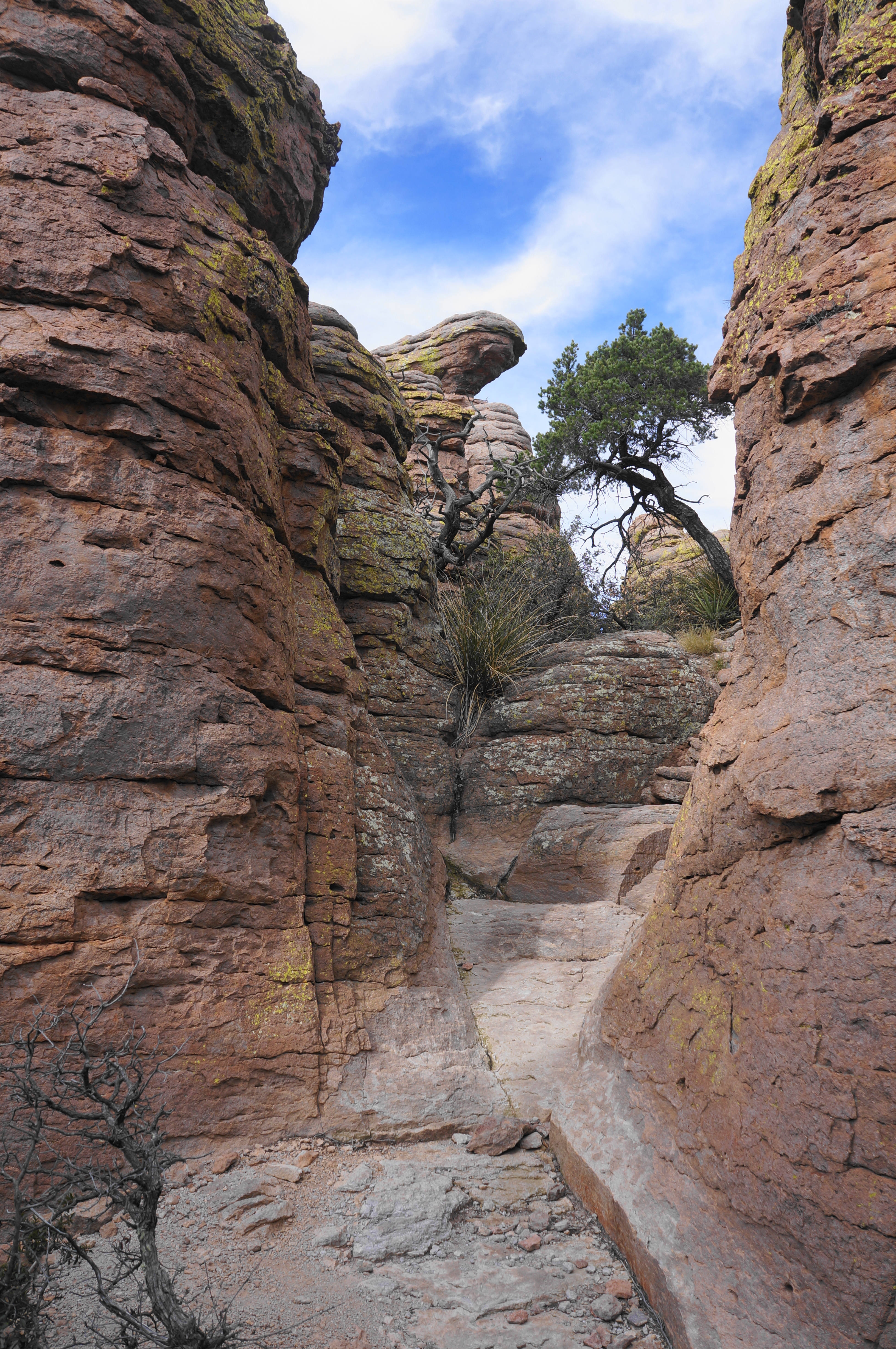
At about ½ mile, the passage noticeably narrows as it squeezes between protruding outcrops, and a sign indicates that one has reached the Echo Canyon Grottoes, which resemble thin cave channels that can be accessed off to the right. Depending on the lighting, this area can make for some spectacular photos (resembling other similar landscapes featured on this blog).


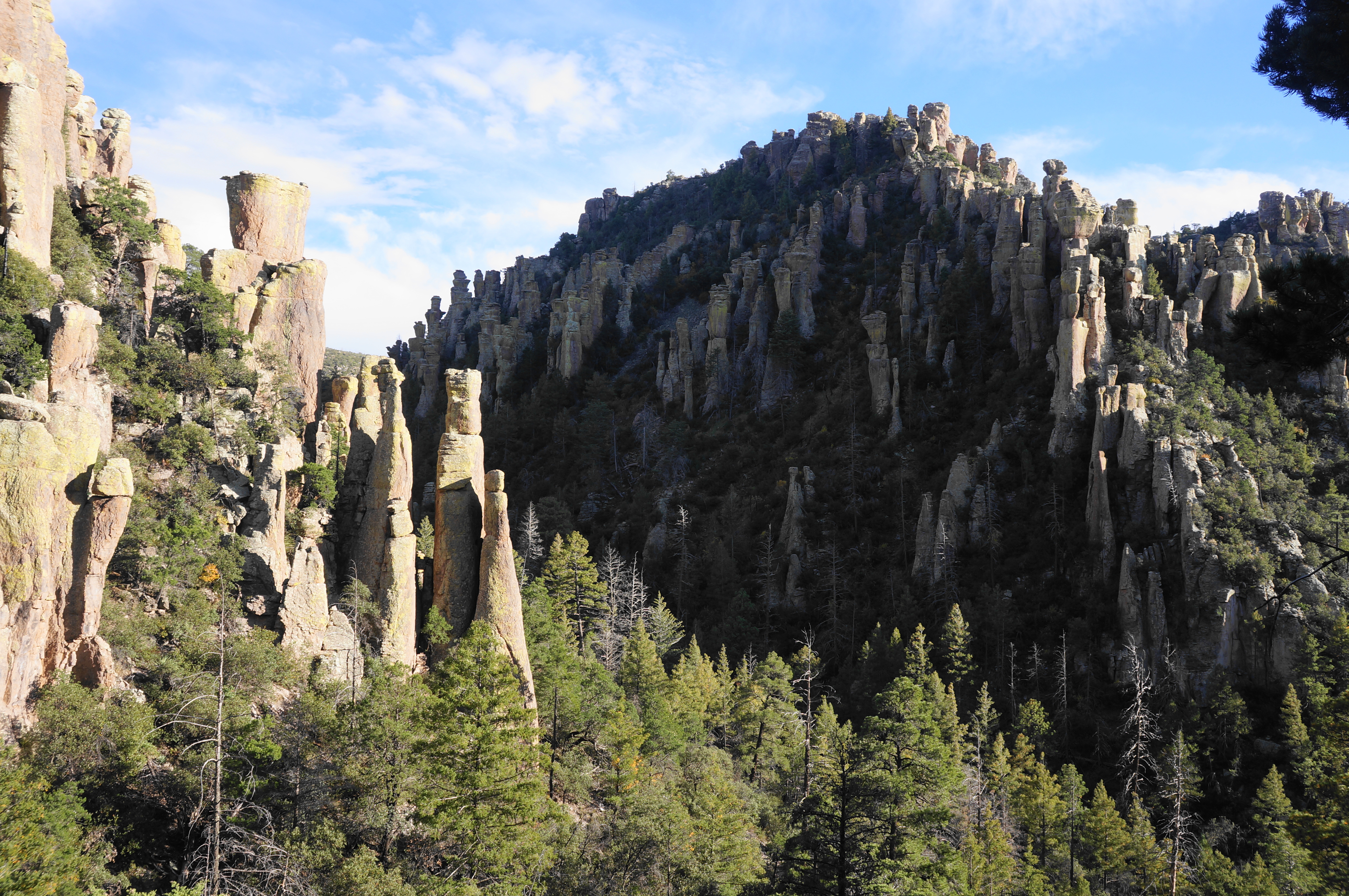
Beyond the grottoes, the Echo Canyon Trail cuts through a few more narrow passages, interspersed with excellent views north and south into the Wonderland of Rocks. One outcrop at about 2/3 mile makes for a nice lunch/snack spot facing north into Echo Canyon, where the rhyolite pillars take on a yellow and almost magenta hue.
Soon a more steady downhill begins, starting with a set of switchbacks where loose rock is aplenty—so go slow and be careful on this track, which is prone to causing ankle sprains. Pass through another thin notch, then continue down more switchbacks, shedding elevation quickly.

At about 1.1 miles, hikers reach a sign for Echo Park. By now hikers are largely below the pinnacles, which rise dramatically in columns above.

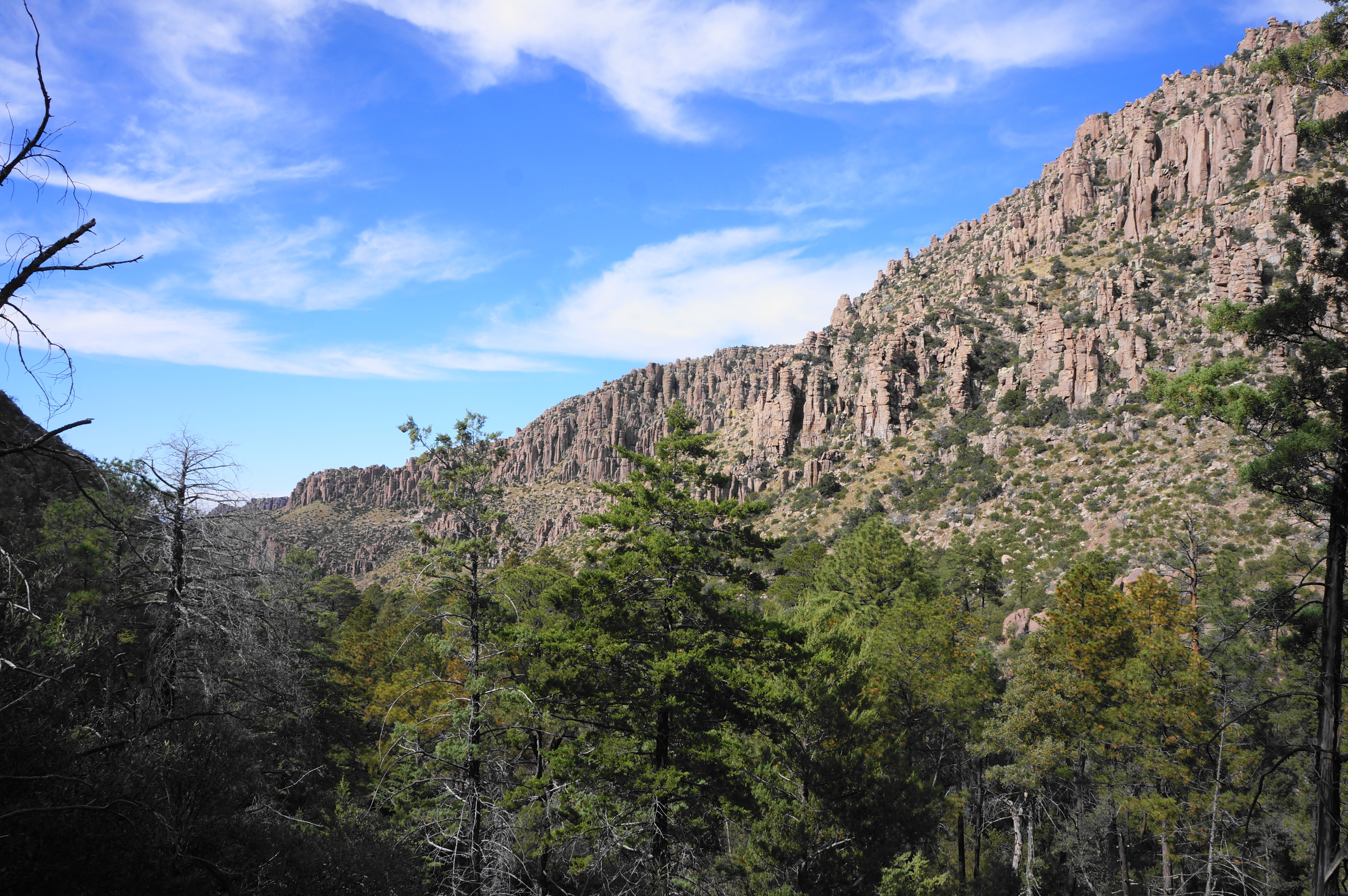
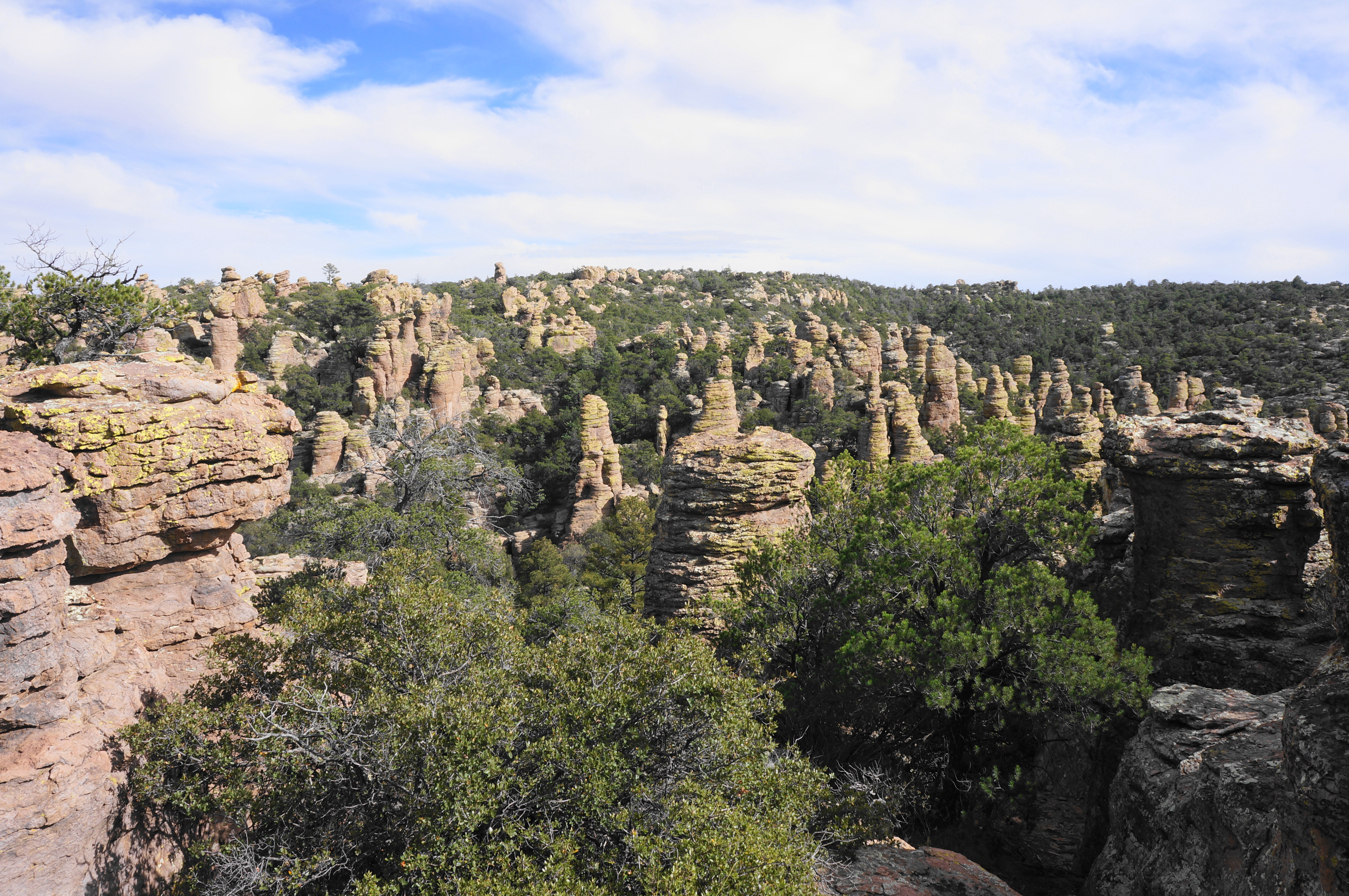
Cross the main Echo Canyon drainage at 1.2 miles, then follow the now-relatively level trail as it hugs the southern flank. Views open up to the broader Rhyolite Canyon, which connects this area with Bonita Canyon and the Visitor Center area. Lining the canyon, especially on the north, is a long line of rhyolite pinnacles.
At 1.4 miles, the Echo Canyon Trail winds around a left-hand turn, curving around to the north side of the main Rhyolite Canyon drainage, leaving Echo behind. This gorge harbors similar formations to the east.

The trail continues for another 50 yards until it reaches an intersection with the Hailstone Trail and Upper Rhyolite Canyon Trail. Most hikers, doing the 3.3-mile Echo Canyon Loop, will stay left, but the adventurous and hearty explorers of the Big Loop will want to stay right on the Upper Rhyolite Canyon Trail.
Upper Rhyolite Canyon Trail to Sarah Deming Trail (1.0 miles)
The next section, more distant from the stone formations, has a distinctively different feel as it dips into a riparian woodland with more shade and fewer vistas. A steady downhill takes one eastward into Upper Rhyolite Canyon, then bends south and crosses the main wash at 1.75 miles. Follow the streambed on the right, now skirting the north-facing slope. Cross back over to the right side of the drainage at 1.9 miles, then back again minutes later. Repeat the crisscross three more times, ending up back on the right side of the canyon.

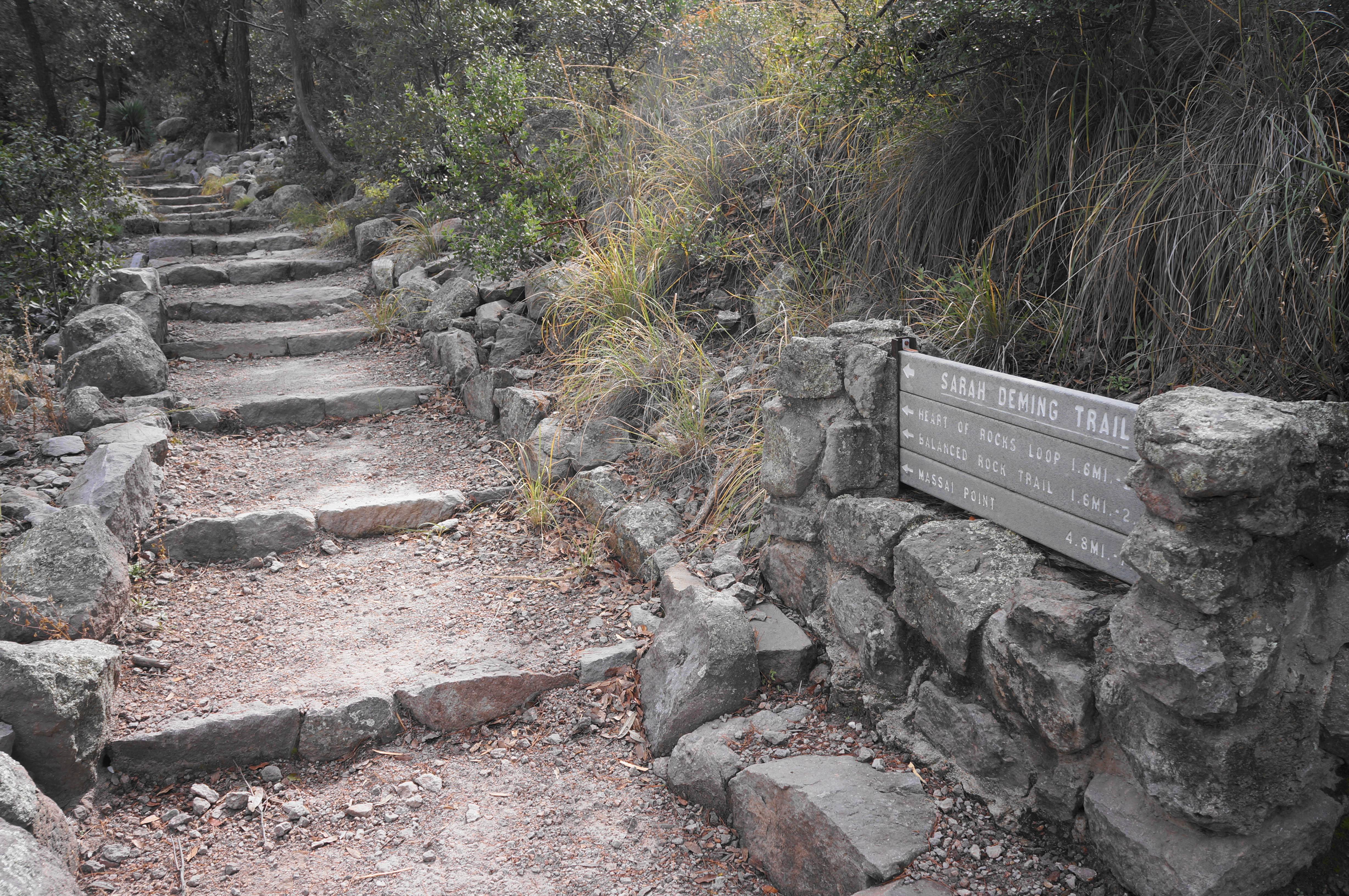
After rounding a bend, the trail descends to clear the wash bottom a final time, then ascends, surprisingly steeply, to a point where the path rises again above the dense tree cover. Enjoy the extended vistas down-canyon, passing the mouth of Sarah Deming Canyon and coming to a junction again at 2.5 miles. This is the intersection with the Sarah Deming Trail, the next leg of the journey.
Sarah Deming Trail to Heart of Rocks Loop (1.5 miles)
The initial climb to the junction was just a preview of what is to come on the Sarah Deming Trail, by far the most difficult part of the loop. Here hikers will gain around 850 feet in elevation over the course of 1.5 miles, with the hardest part coming in the final ½ mile.

Like the other forks, Sarah Deming Canyon too is lined with rock formations, although the denser woodland cover blocks much of it from view for at least the first half of the climb. Edge eastward, then south, as the trail stays well above the canyon floor, climbing through a mix of deciduous and coniferous tree cover.
Climb steadily for nearly a mile before the path briefly levels and crosses to the east side of the drainage through Sarah Deming Canyon, initiating the final ½-mile ascent out of the canyon and into the Heart of Rocks area.
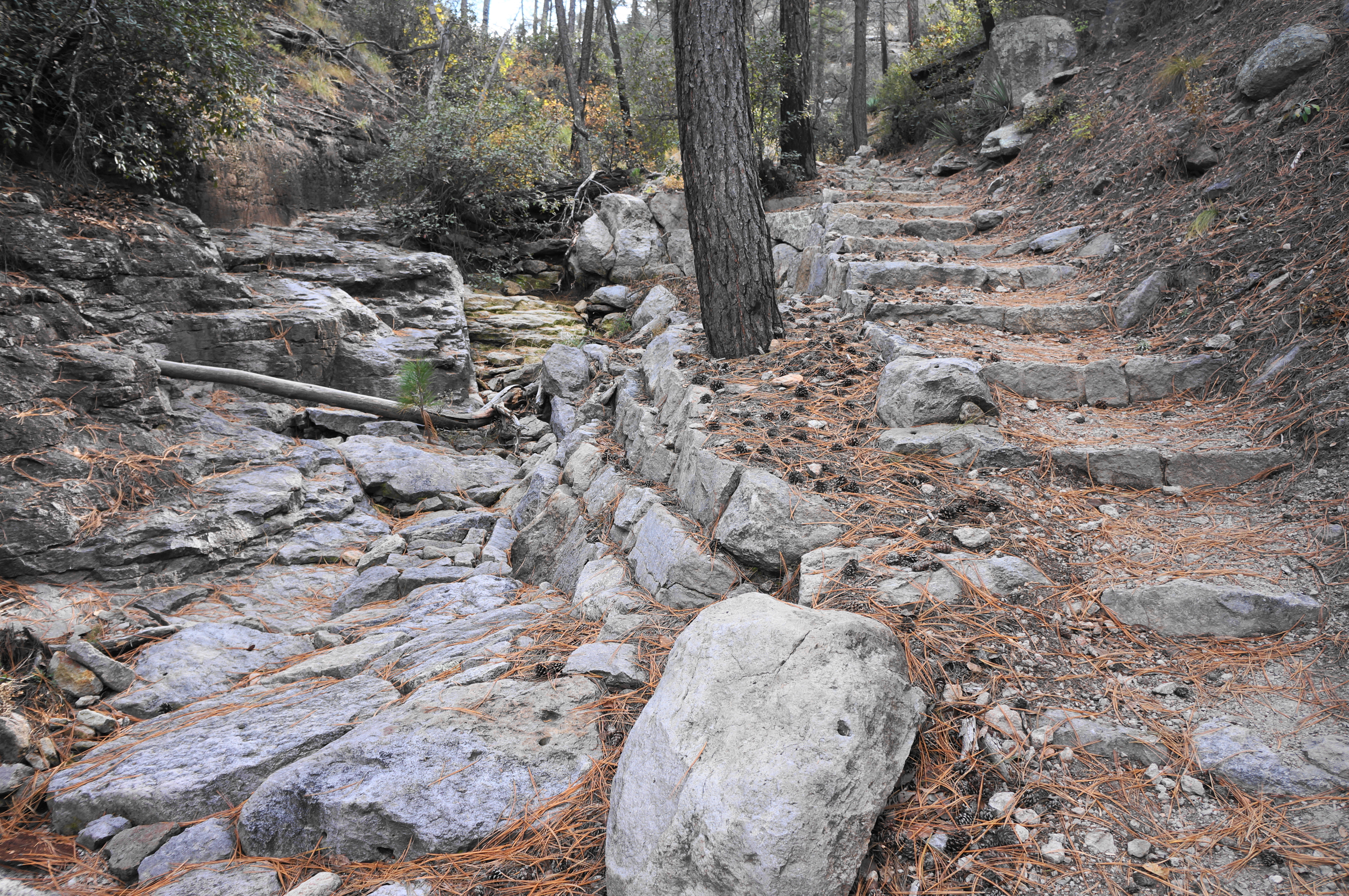
The incline steepens and vegetation lessens as hikers slog up the hill and are at least rewarded with better views as the ascent proceeds. The trail more or less makes for an easement in the rhyolite rim, some 300 feet above the canyon. Expect many stone steps in this section—a testament to decades of trail work and maintenance.
At last, about four miles into the Big Loop, the incline eases and the Sarah Deming Trail ends at an intersection with the Big Balanced Rock Trail and the Heart of Rocks Loop. The latter is what makes the lengthy slog worthwhile, and constitutes a “loop-within-a-loop” that occupies hikers for the next 8/10 mile.
Heart of Rocks Loop (0.8 miles)
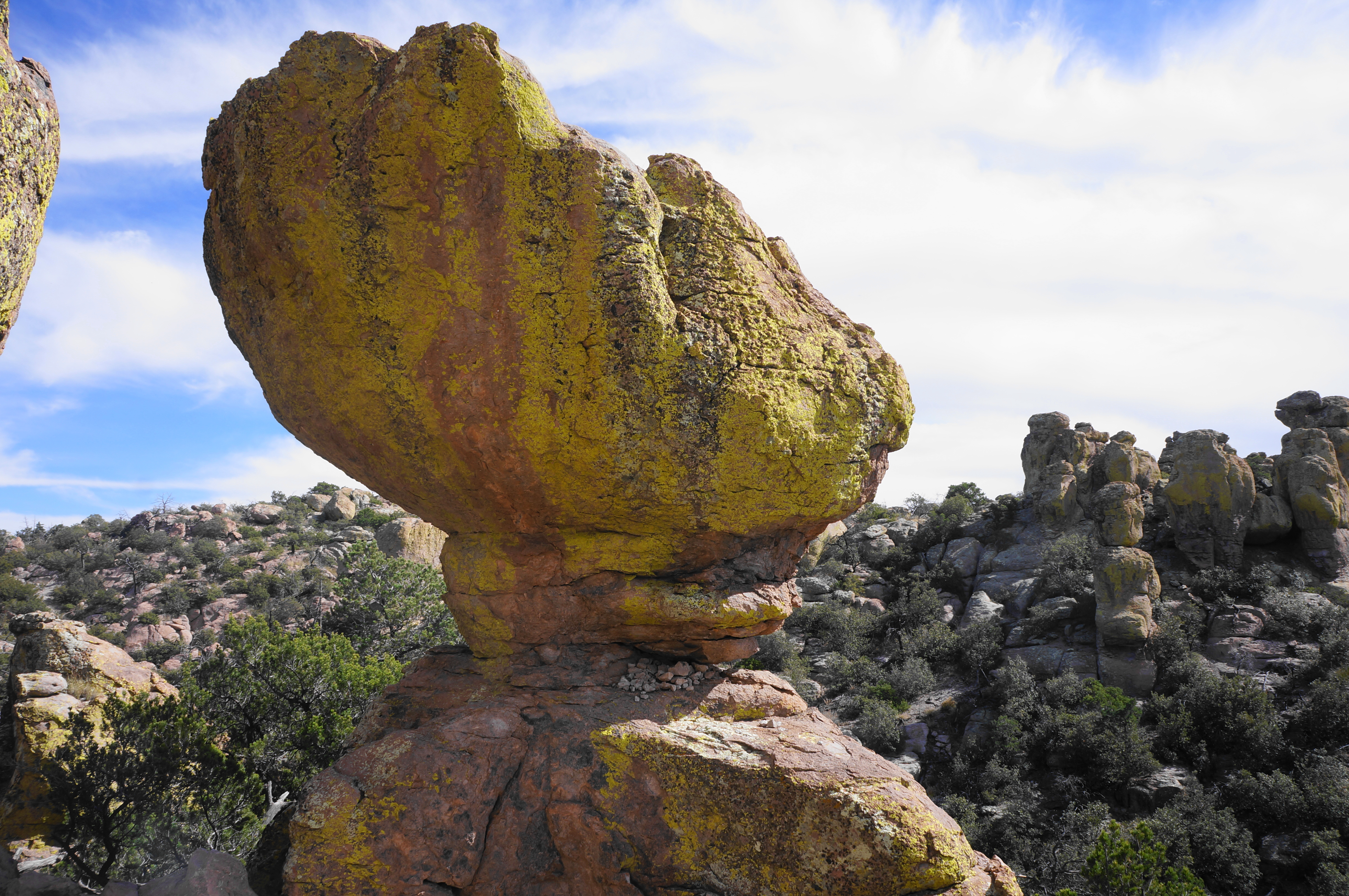
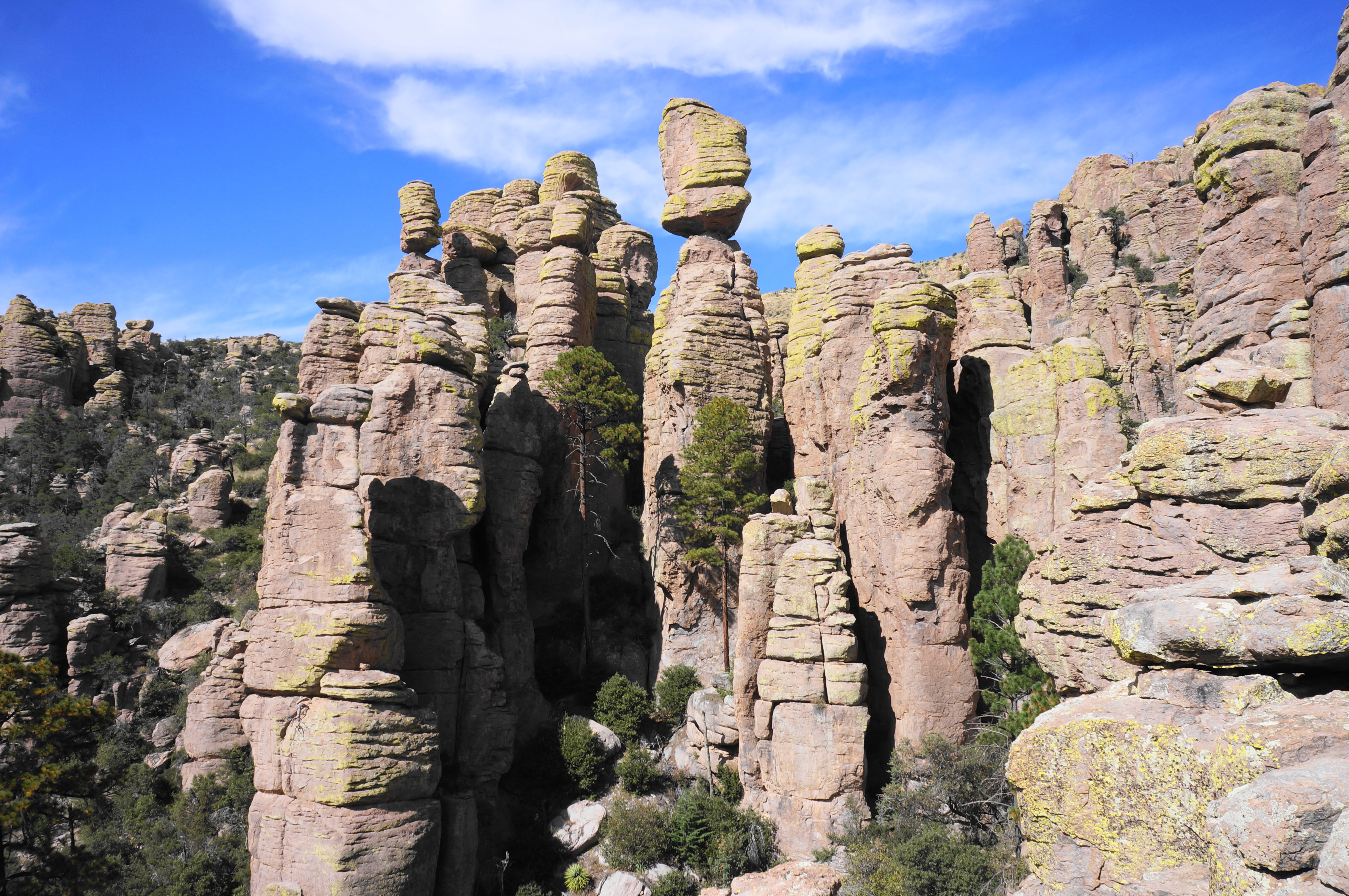
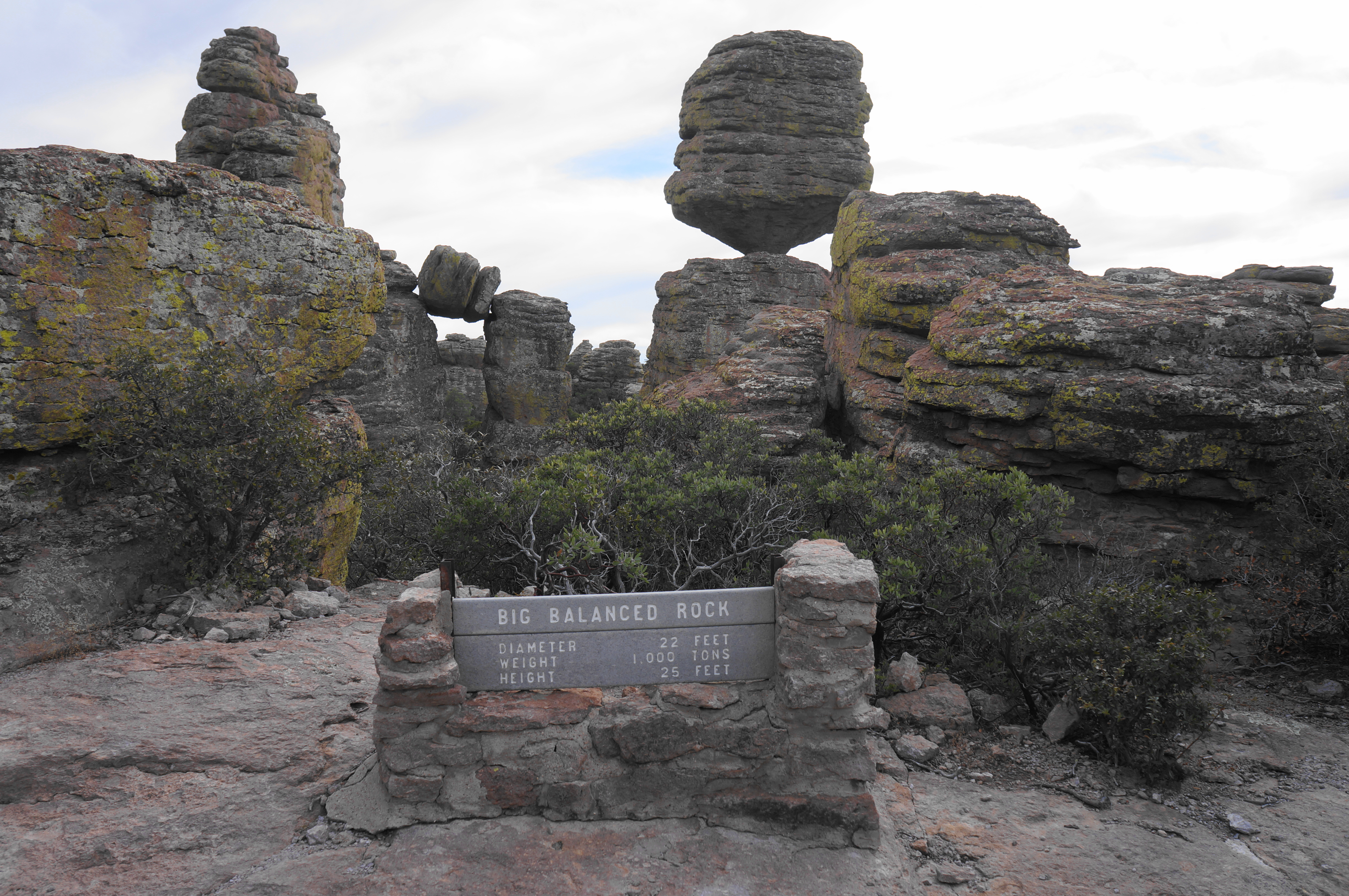
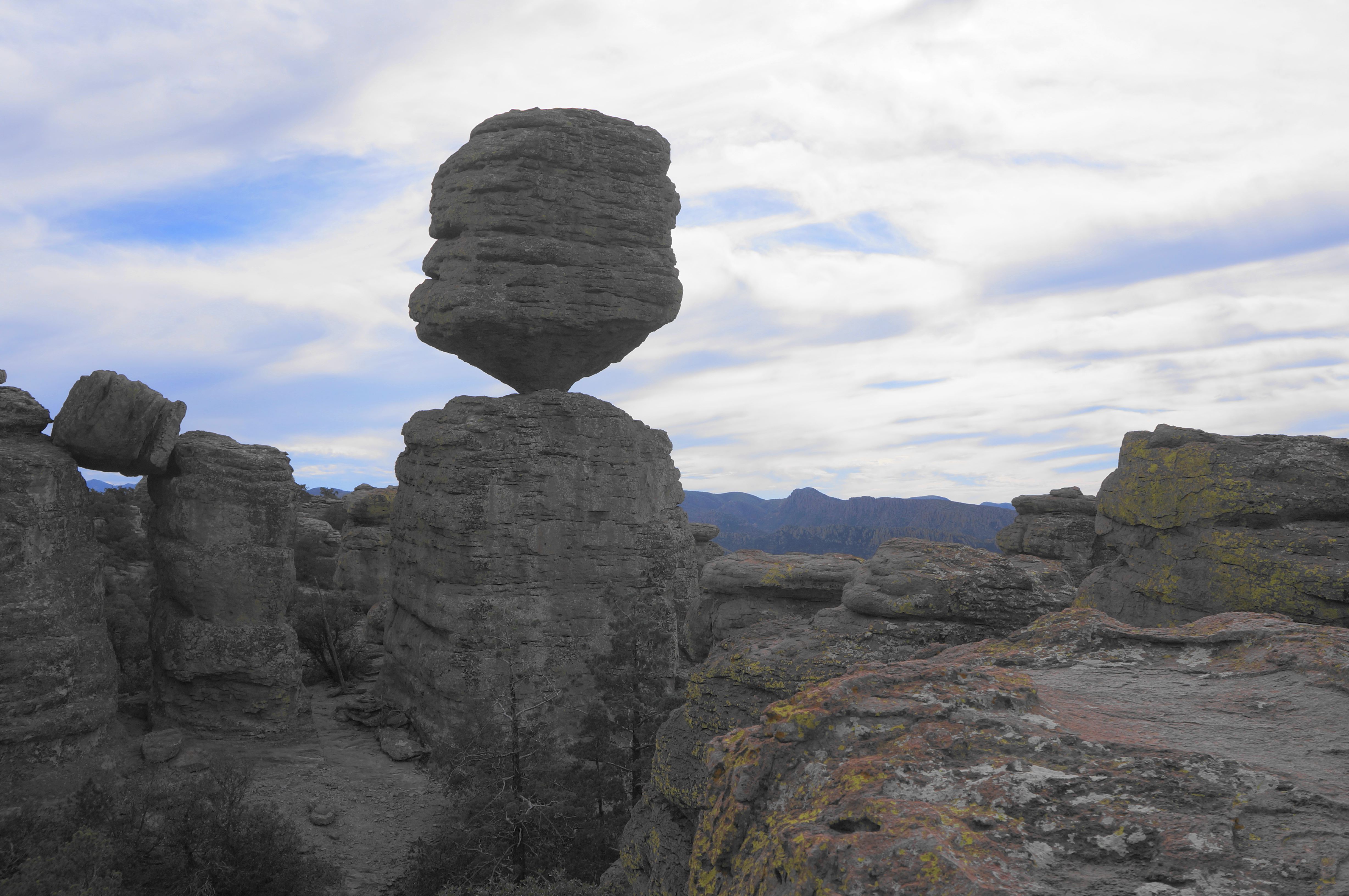
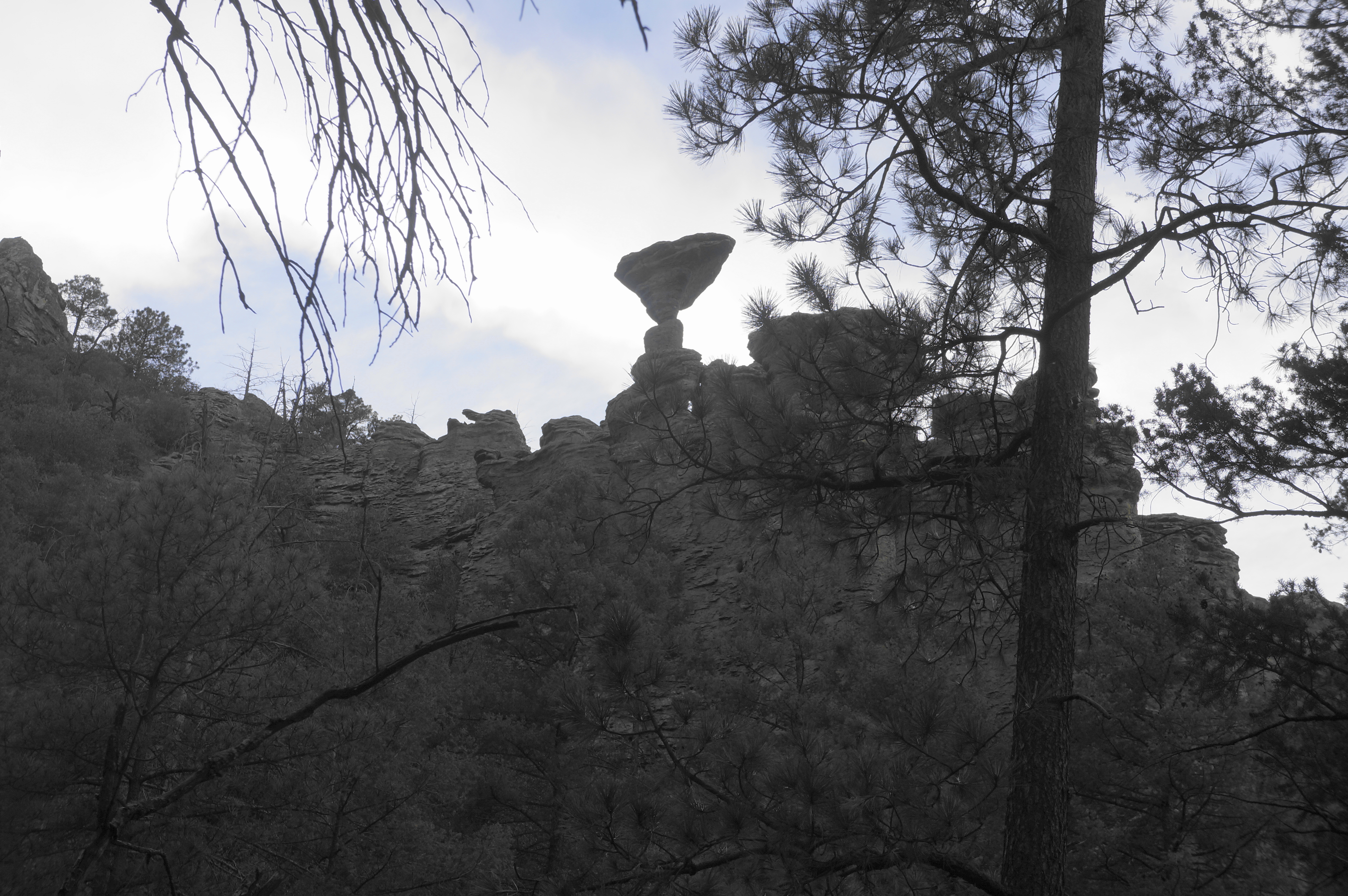
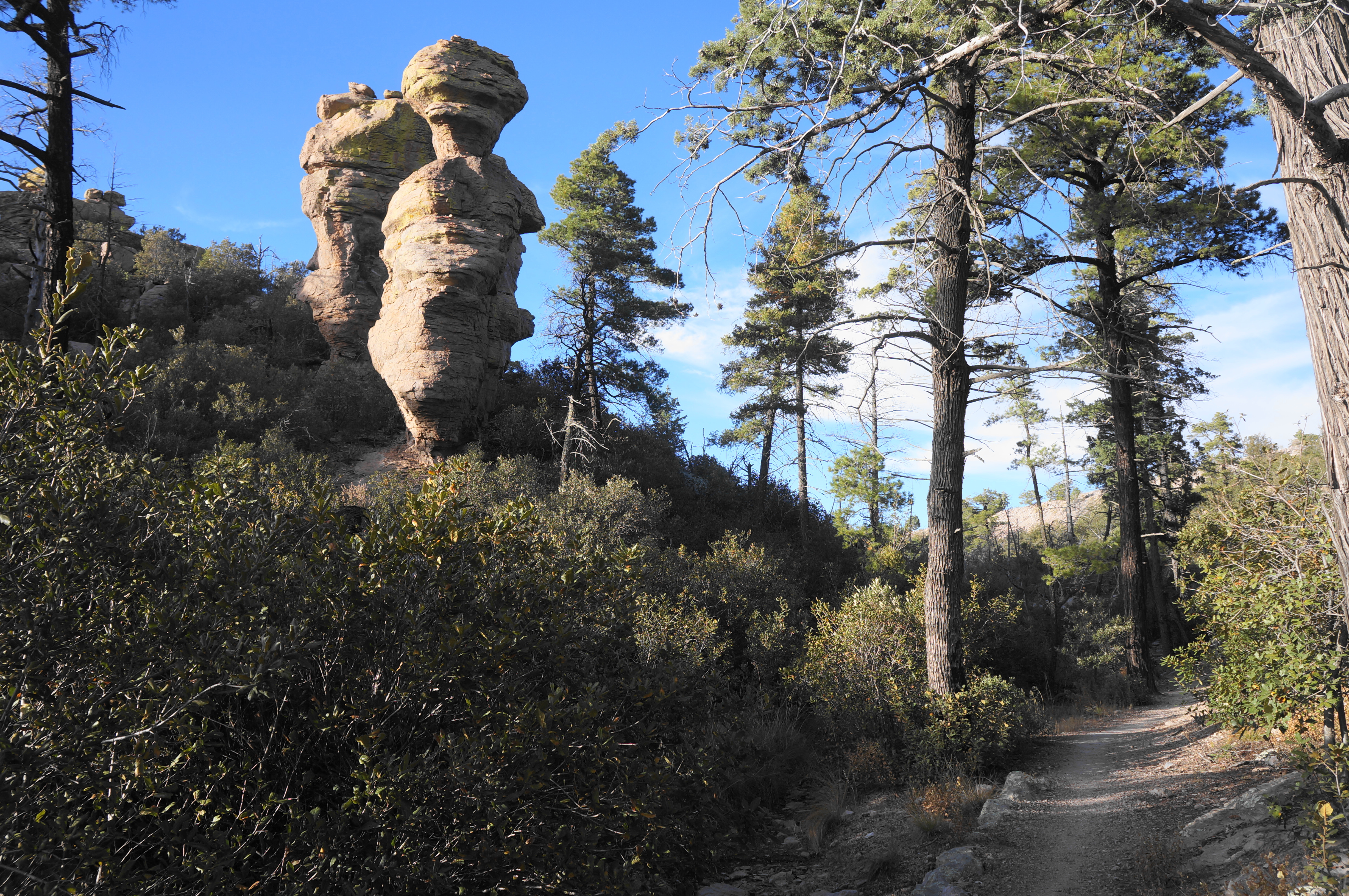
Before heading onward, look right for a preview of Big Balanced Rock, an imposing, hourglass-shaped spire that is one of the most well-known formations in the park. Hikers will return to get a better look, but for now, bear left on the short connecting spur to the Heart of Rocks Loop.

The next section is actually downhill, clearing a dry drainage with plenty of shade and neat narrow passages. Look for a sign for the Heart of Rocks Loop heading left, however, after which the trail climbs again.


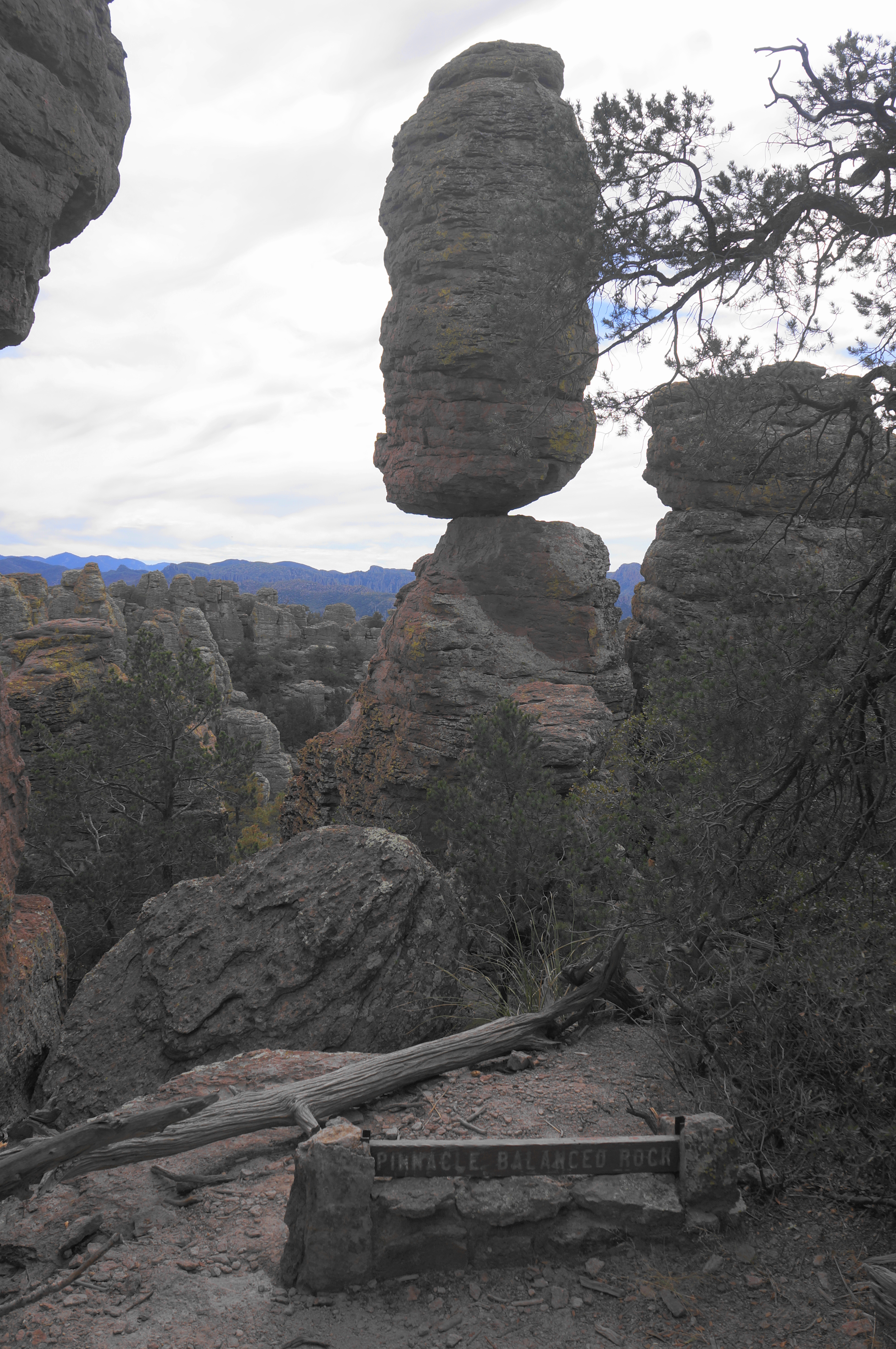
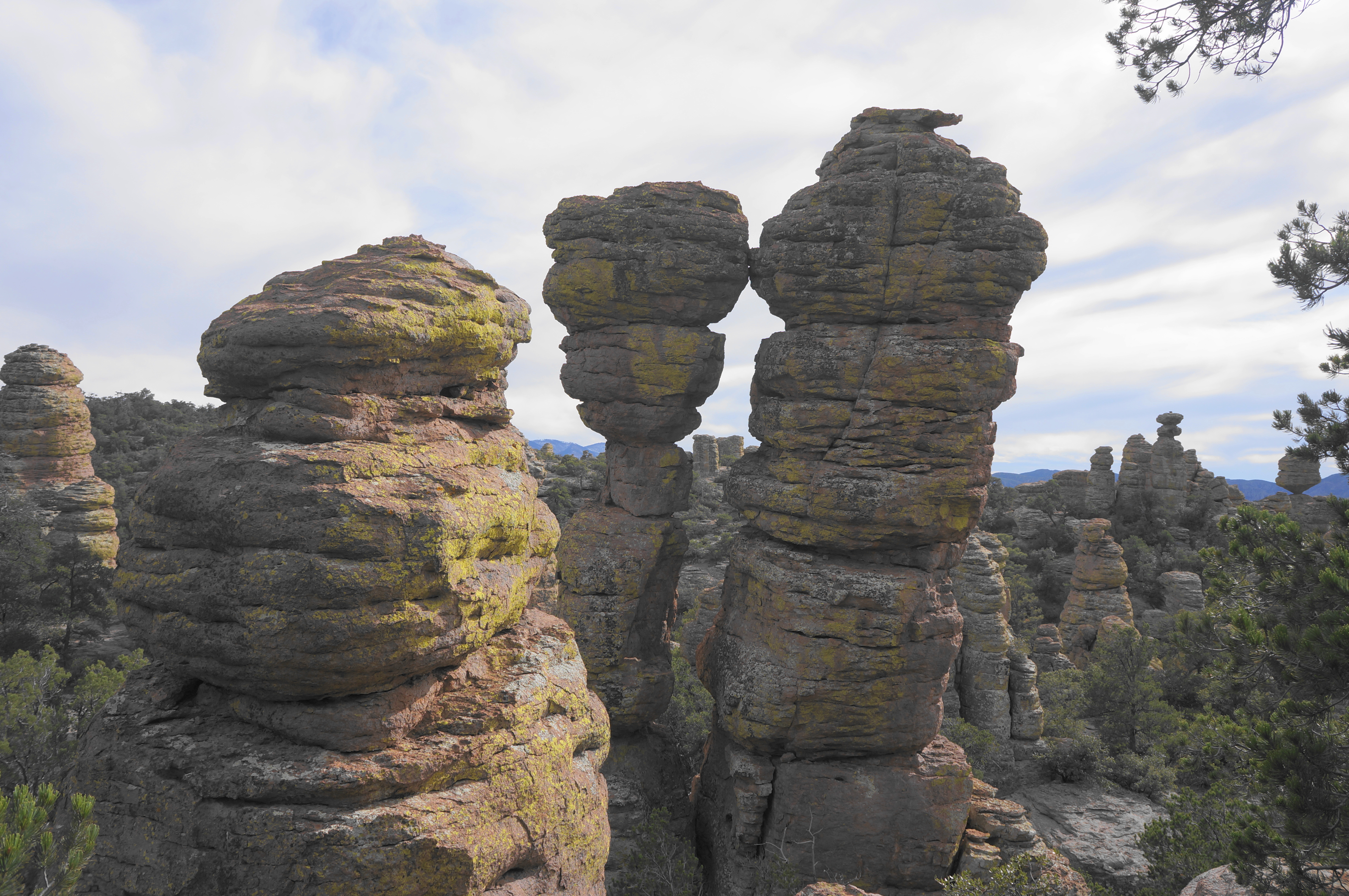
Proceed through a slender channel between rhyolite fins, then climb to a view of Pinnacle Balanced Rock—a smaller but also impressive version of Balanced Rock—on the left. Surely erosion will not let this precariously-balanced stone stay as it is for long…
After Pinnacle Balanced Rock, ascend through two thin slots and up to a view of a formation called Old Maid on the right. Now proceed downhill in the direction of Camel’s Head, a distinct hoodoo that remains visible throughout much of the loop.

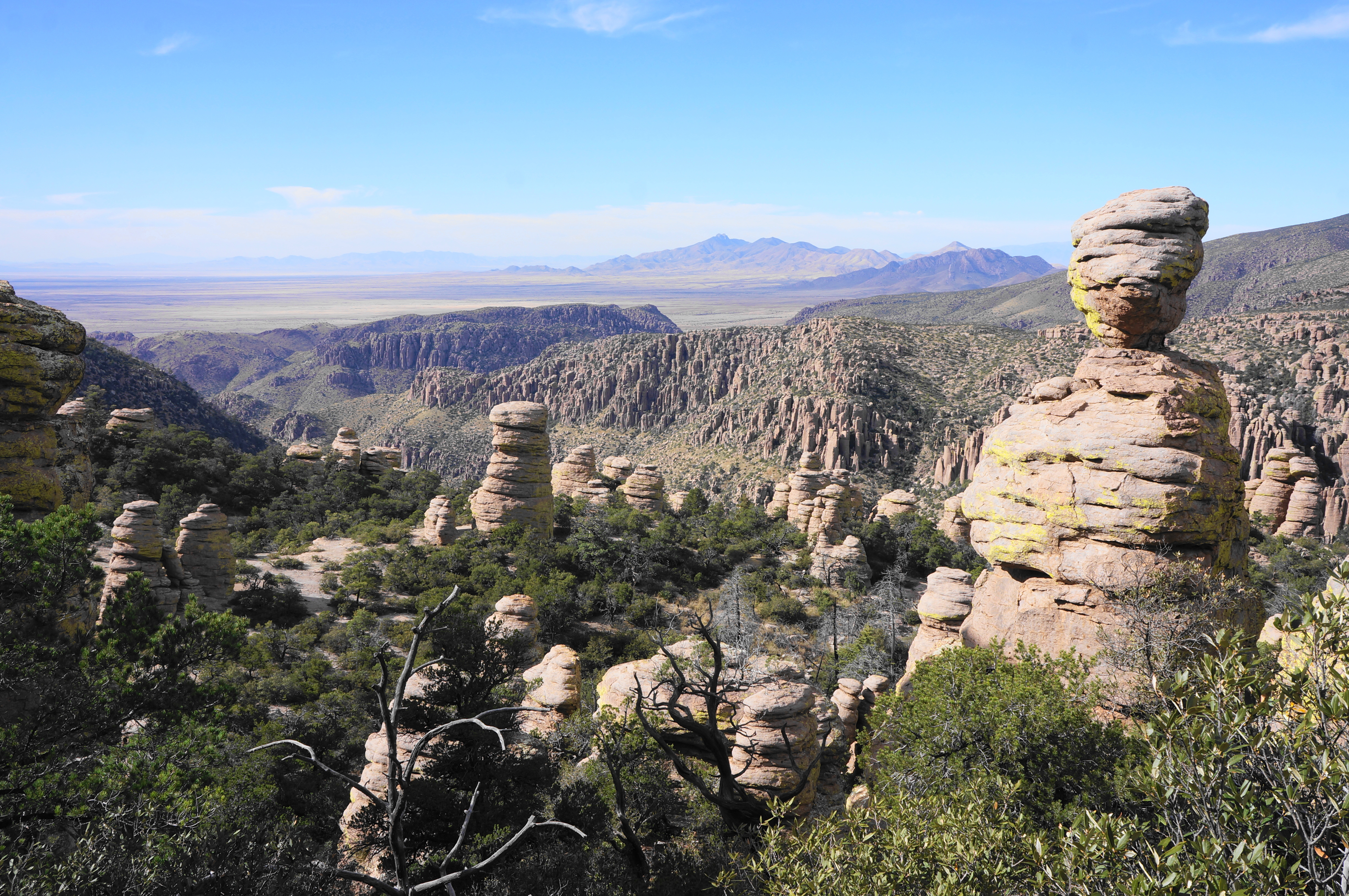
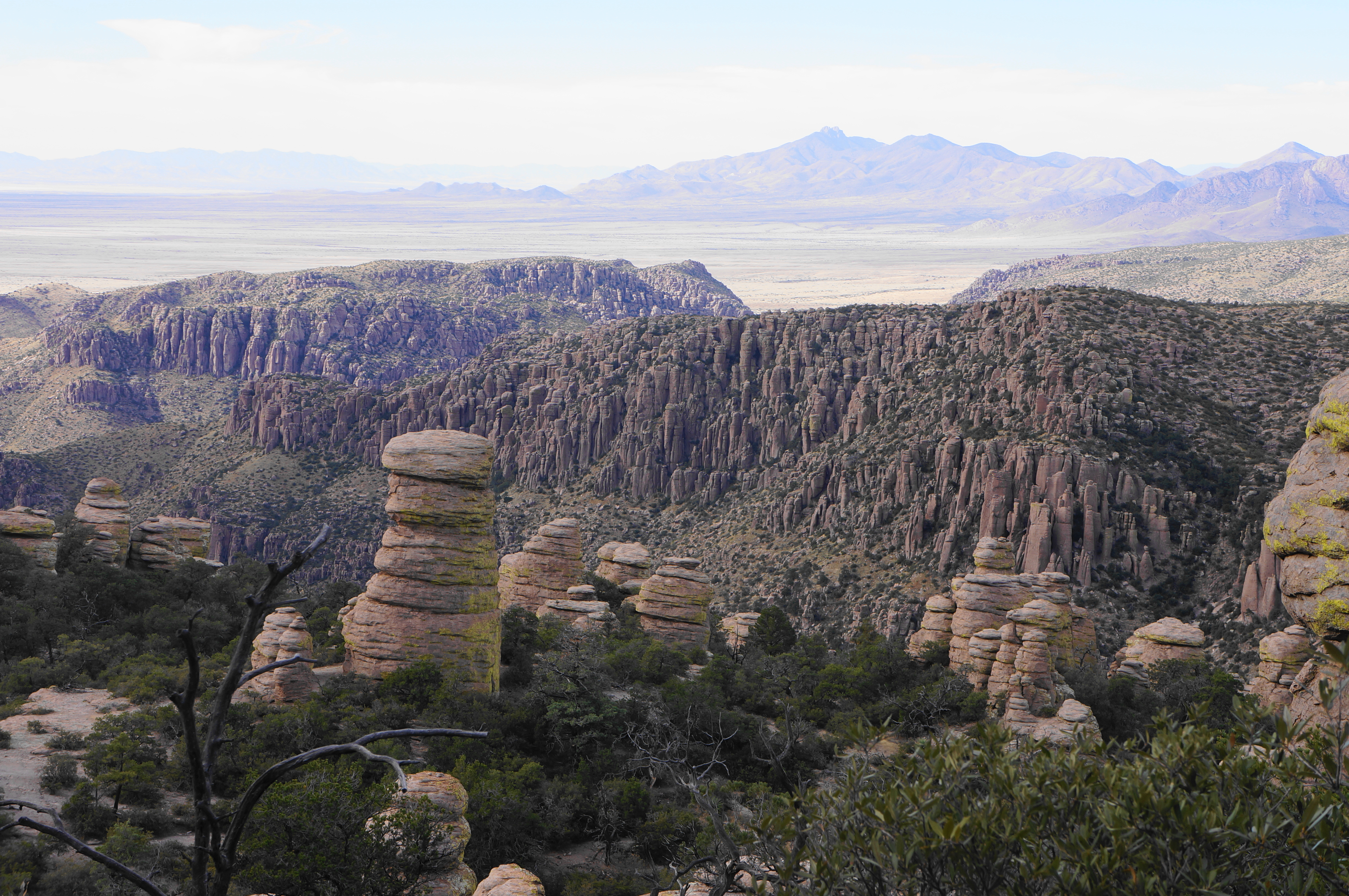
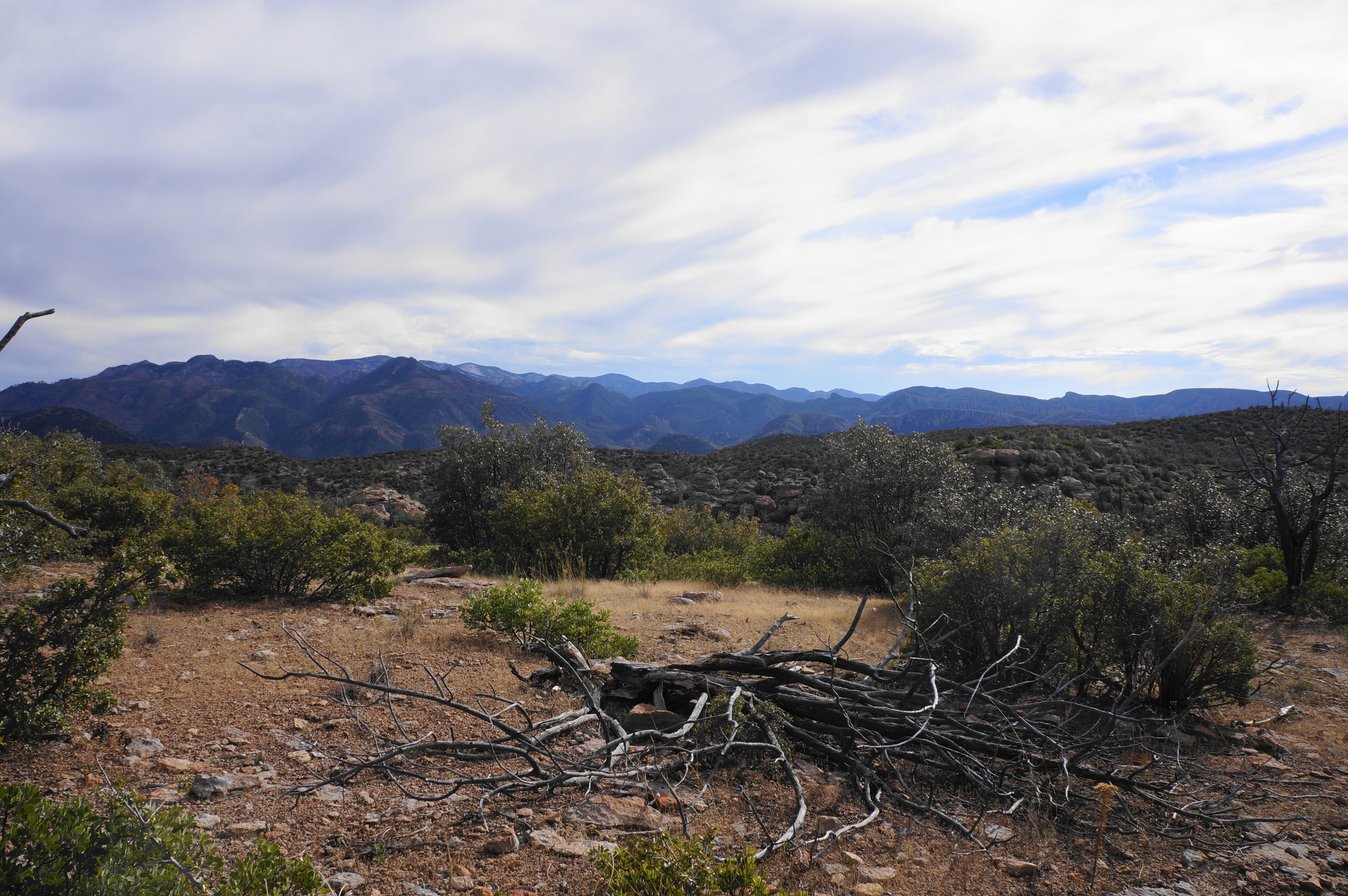
After clearing another notch, the trail levels off, and spurs off to the left offer vista points overlooking Rhyolite Canyon and the vast valley to the northwest, with the Dos Cabezas, Winchester, Galiuro, and Pinaleño Mountains beyond. This is one of the best overlooks in the park.
Pass Thor’s Hammer on the right and slip through a notch with a small rock arch on the left, with additional options for views down Rhyolite Canyon beyond. Soon the trail makes a right turn and proceeds eastward, leaving the densest jungle of rocks behind but proceeding into another set of formations on the other side of an unnamed drainage.


Follow the high shelf as it passes a view, through a narrow window, to a pair of formations humorously named Punch and Judy. There are also views north to Echo Canyon, Sugarloaf Mountain, and Cochise Head, with the highlands dotted with thousands of rhyolite pinnacles in between.
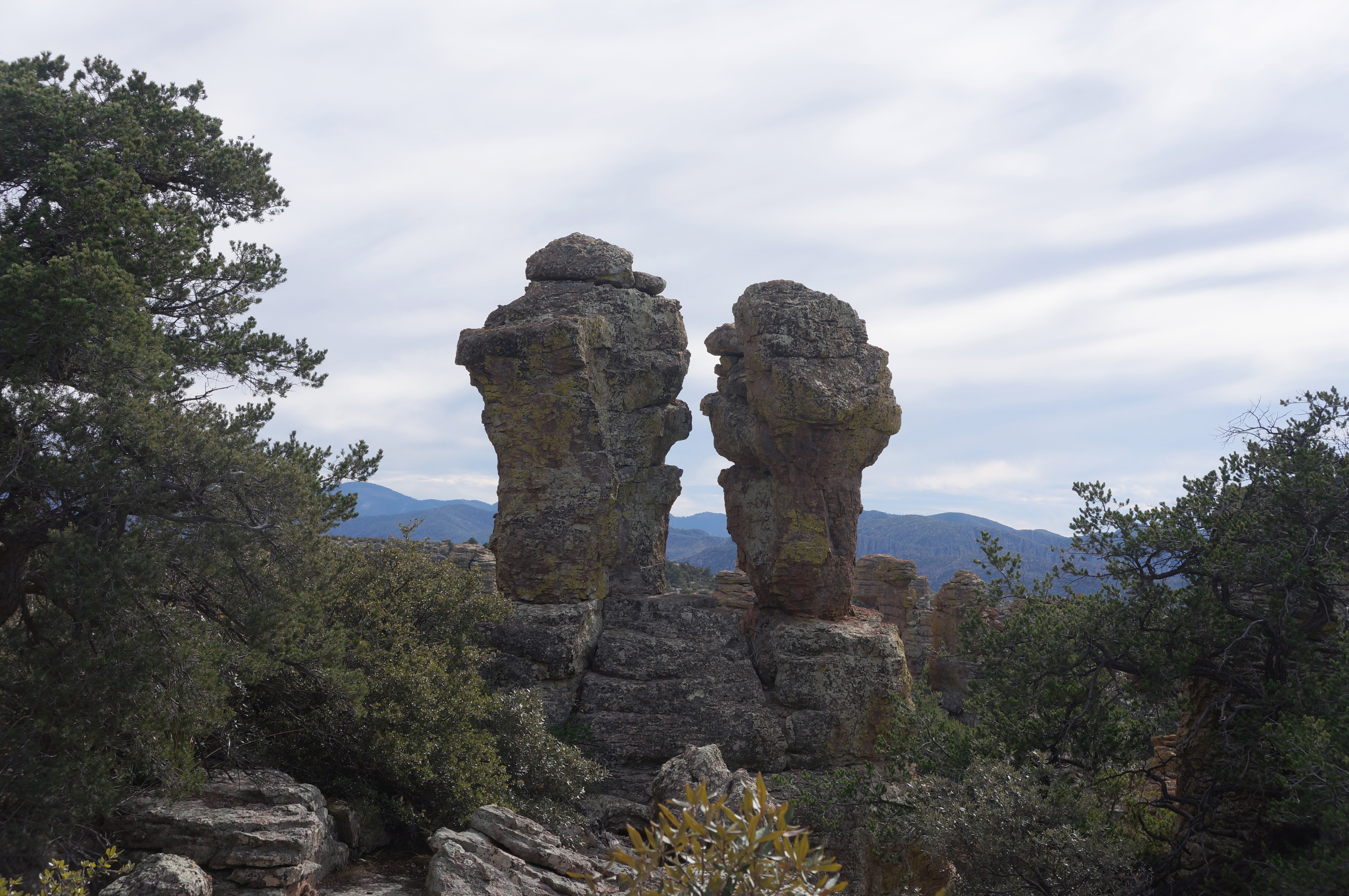
There is one curiously-perched outcrop known as Duck on a Rock (although I missed it), as well as two tall slender pinnacles known as the Kissing Rocks—after which the trail heads southward to close the loop. Proceed downhill and find a west-east ravine that hikers will follow to the drainage that splits through the Heart of Rocks, reaching the initial junction that started the circuit at 4.7 miles.
Bear left, traversing familiar territory as one climbs back to the junction at the pass below Balanced Rock. This time head left, setting off east and leaving the Heart of Rocks behind.
Big Balanced Rock Trail and Inspiration Point Trail (2.0 miles)
Aside from Big Balanced Rock, which is visible off to the right immediately after the trail fork, the scenery in the subsequent section is more subdued, with the rhyolite formations eventually receding. After an open stretch of chapparal, the denser tree cover returns, and hikers generally follow a high ridgeline with occasional dips and bends.
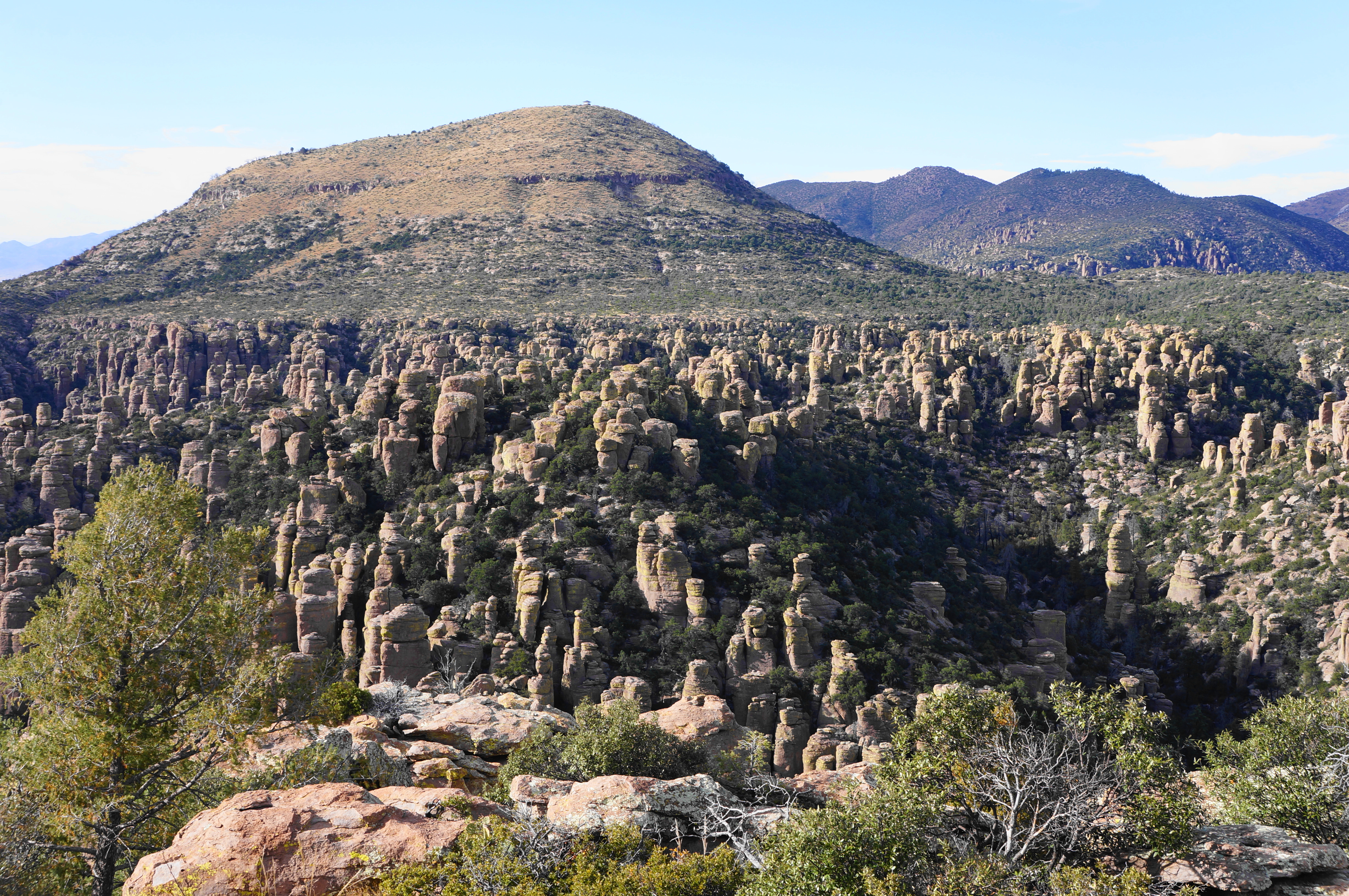
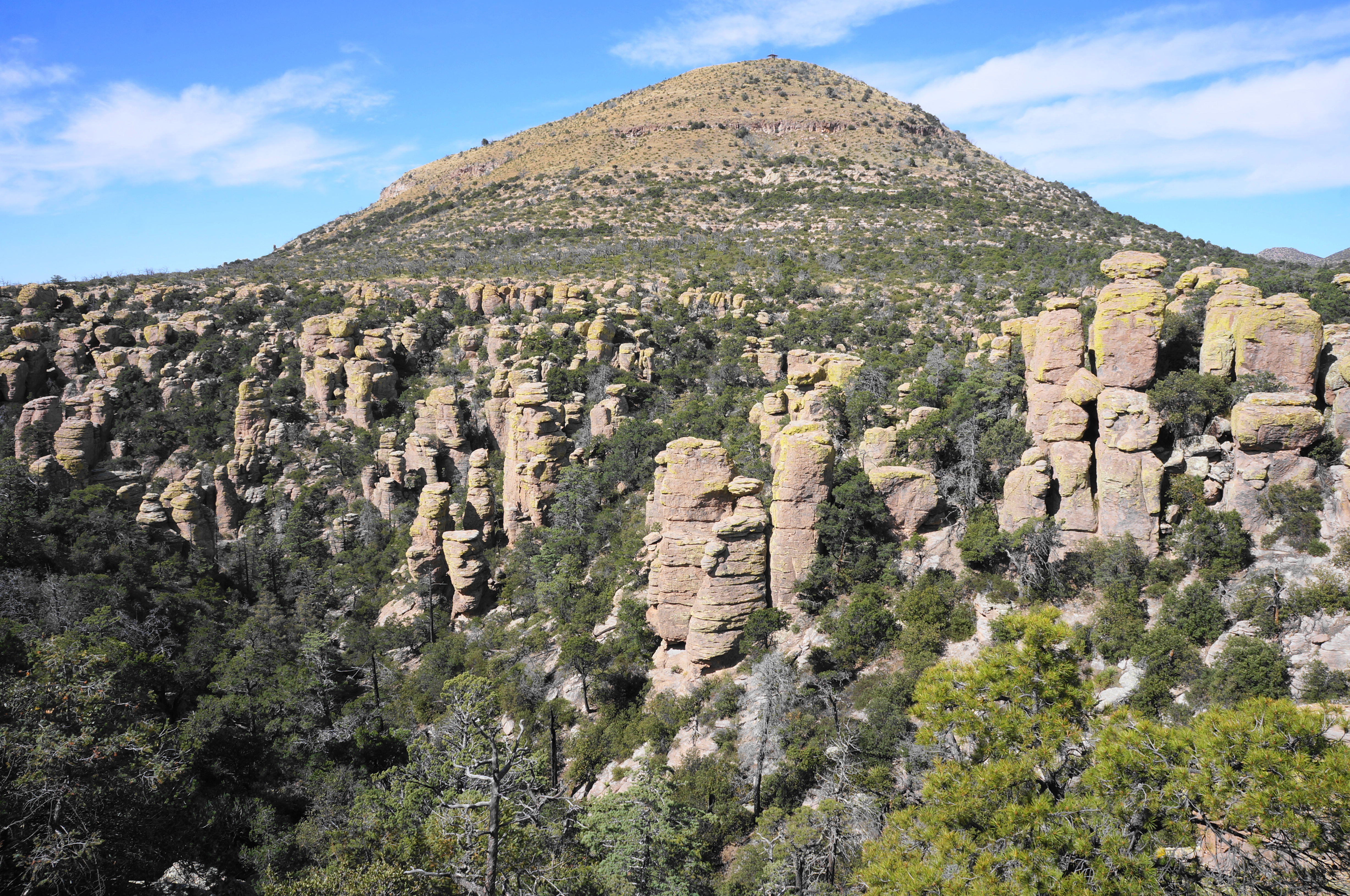
The Big Balanced Rock Trail offers the loop’s best southward views, however, to the higher peaks of the central Chiricahuas—much of this landscape is protected as part of the Chiricahua Wilderness. There are also distant views to Cochise Head and the Dos Cabezas Mountains to the north.
For the most part, this mostly-level section is an opportunity to gain time possibly lost while wandering the Heart of Rocks, with hikers allured by the prospect of seeing Inspiration Point, where the rhyolite wonderland of rocks returns in a spectacular, sweeping vista.
At 5.75 miles, a mile from the Heart of Rocks Loop, come to the junction with the Inspiration Point Trail, a one-mile out-and-back that is well worth the extra effort. Head left on the mostly level track as it follows a ridgeline between Totem and Hunt Canyons, dotted with junipers, yuccas, cacti, and scrub.

While there are few views along the way, they come suddenly and astonishingly at the end of the ½-mile trail, where hikers can peer out from Inspiration Point to the myriad pinnacles below. The views north to Echo Canyon, Sugarloaf Mountain, and Cochise Head are retained, but perhaps the most dramatic is the look west into Totem Canyon, named for the high totem-pole-shaped spires that rise to form the canyon walls. Visitors can also see north and west across the valley toward Willcox and the Dragoon Mountains.
Inspiration Point, due to its remote location, is often not very crowded—indeed, I had it all to myself. But when you’re ready, continue back along the ½-mile trail to the junction with the Big Balanced Rock and Mushroom Rock Trails, heading left.
Mushroom Rock Trail to Ed Riggs Trail (1.2 miles)
By now, hikers are likely to be rather tired and ready to wrap up the hike. But there is still about two miles remaining. The Mushroom Rock Trail leads east from the junction and descends into a shallow section of Hunt Canyon, a relatively featureless tributary of Rhyolite Canyon.
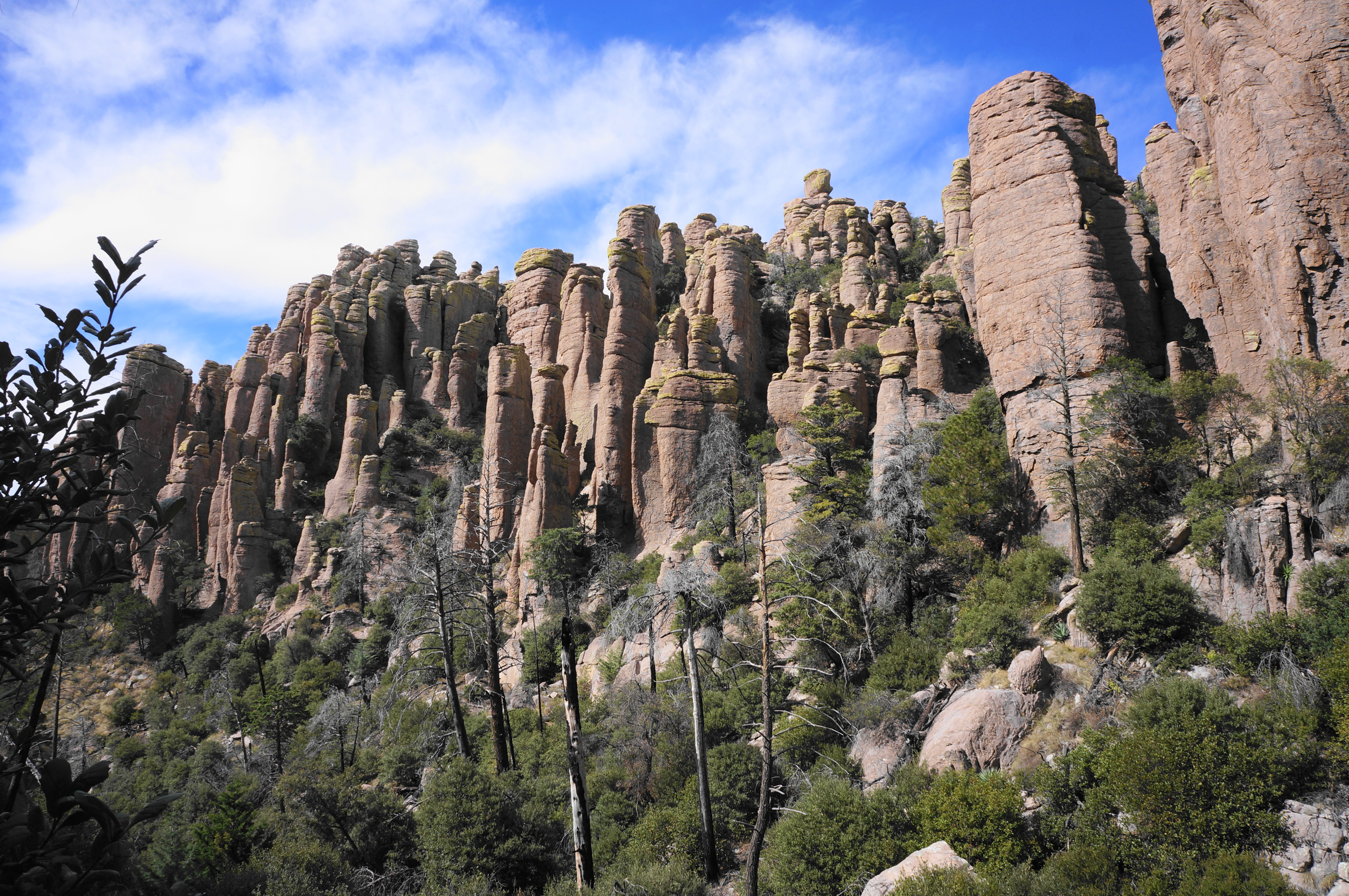
Clear the canyon drainage at 6.8 miles, then follow the east flank northward to a brief set of switchbacks, after which the trail closely hugs the canyon bottom. Trace Hunt Canyon to its end, now returning to Upper Rhyolite Canyon, where the rhyolite spires become more prominent again. The sole named feature in this area is Mushroom Rock, which rises high above the drainage off to the left and is pointed out by a small sign along the trail.
Continue along the Mushroom Rock Trail as it heads west and clears a drainage and boulder choke at around 7.8 miles. The views of the surrounding spires here are impressive, especially as one gets another look at Totem Canyon from its base. At 7.9 miles, the trail comes to a junction with the Hailstone and Ed Riggs Trails, both part of the shorter Echo Canyon Loop.
Ed Riggs Trail and Massai Point Trail to Echo Canyon Trailhead (0.9 miles)
The final mile is now upon you; make a right turn on the Ed Riggs Trail, which offers a much milder return to the trailhead than the nearby Echo Canyon Trail. Follow a side drainage north, back toward the rim at Massai Point, staying left as the side canyon forks shortly upstream from Rhyolite Canyon.
Hikers are back in a position where they can get up-close looks at the rhyolite pillars, which take on a multitude of shapes, from plump outcrops to tall, slender spires. Continue to trace the path uphill, flirting several times with the (usually dry) drainage and cutting through gap below Massai Point.

After a brief level period, climb again to the junction of the Ed Riggs Trail and Massai Point Trail, bearing left toward Echo Canyon Trailhead. The final ¼ mile follows the Massai Point Trail within striking distance of Bonita Canyon Drive, with the sounds of traffic heard for the first time in hours.
A final uphill stretch leads back to the chalky ridgeline where the hike began—and the initial trail split. This time head right and follow the short path back to the trailhead, ending the 8.8-mile journey.
The Chiricahua Big Loop is a satisfying but relatively strenuous hike that should not be taken lightly: the elevation gain and loss is significant and the trail rocky and circuitous. Hikers should budget around 5-7 hours to complete the circuit, including stops to take in the beauty of the “wonderland of rocks” along the way.

I’m a big fan of Chiricahua NM. I feel like I’ve done the Big Loop. (In fact, my blog suggests that I have. It mentions 9 miles: https://daringdayhikes.home.blog/2018/12/30/chiricahua-heart-of-rocks/ .) However, I don’t remember the Echo Canyon Grottoes. Guess it’s time to go back. Thanks!
On my last visit to the Sulphur Springs Valley was in the summertime, and I got a chance to hike the Dragoons on the West side, at Cochise Stronghold, but never made it to the Chiricahuas. Your descriptions here make me want to go this spring before the heat really takes over, Andrew. Another big plus in those mountains is the birding, with an enormous number of species that come up from Mexico.
Wow, this place is so cool! It’s been on my list to visit but I’ve never actually researched it closely. Now I really want to go asap!
We completed this hike a few years back but in the opposite direction. We were so tried by the time we got to the grotto that we couldn’t enjoy it. We returned the next day to complete the shorter loop and started at the grotto. Much nicer. We are headed back next month.
Great! Yes, coming up the Echo Canyon Trail last, after doing most of the rest of the loop, would be quite exhausting. Hope your upcoming visit is nice.