
– Civil War Series –
At a time when most eyes were on the major battlefields of the Civil War out east, the Union Army was engaged in 1962 in a series of smaller skirmishes in the American Southwest with Confederate cavalry and an ongoing conflict with various bands of the native Apache. As Confederate forces made designs on New Mexico Territory, which included what would become Arizona, the U.S. Army sent a column of the 5th California Volunteers to head off the threat, but they were drawn into the wider Apache War in the Battle of Apache Pass (15-16 July 1862). As the contingent moved through the Chiricahua Mountains in southwest Arizona, they were ambushed by a group of native Americans led by Cochise (1805-1874), for whom present-day Cochise County is named. The battle, which ended in a defeat for the Chiricahua Apache, nonetheless prompted the Union Army to fortify the area, establishing Fort Bowie later that year.
Today, visitors can tour the remains of Fort Bowie and trace the steps of the Chiricahua Apache and California soldiers who engaged in the battle. But there is a catch: unlike nearly every other Civil War fort in the National Park Service, this one is only accessible by way of a 3-mile out-and-back—or slightly longer loop—hike from Apache Pass Road. Along the way, hikers will pass several historic ruins, a cemetery, and Apache Spring—the latter a key source of water for the Apache Indians and Union soldiers who occupied the area. The below description covers a roughly 4.4-mile stem-and-loop, including a short spur to the original fort site, a loop around the larger “second” fort, and an alternative return route via Overlook Ridge, which offers nice views to Siphon Canyon, Fort Bowie, Bowie Peak, and Apache Pass.


The hike
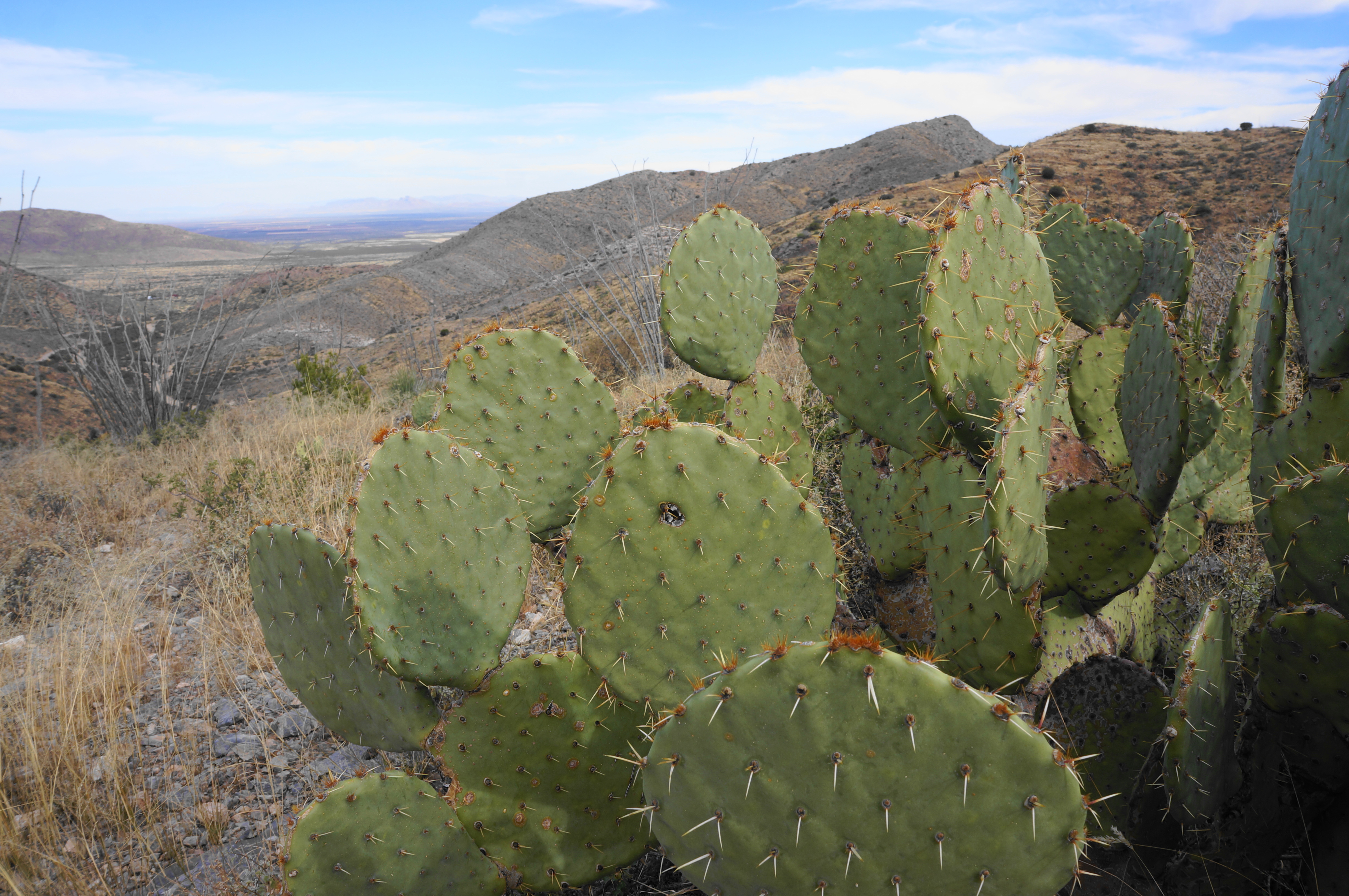
Fort Bowie National Historic Site is situated in southwest Arizona, about 13 miles south of the town of Bowie on Interstate 10. Visits are often combined with trips to nearby Chiricahua National Monument. Reaching the Fort Bowie Trailhead requires traversing a usually well-graded gravel road that follows an easement between the Chiricahua and Dos Cabezas Mountains, cutting through a classic Sonoran Desert landscape before rising to a scrubby savanna with several seasonal drainages that support larger tree life.
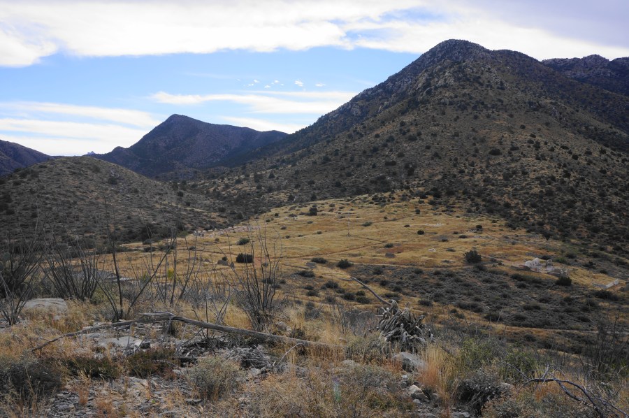
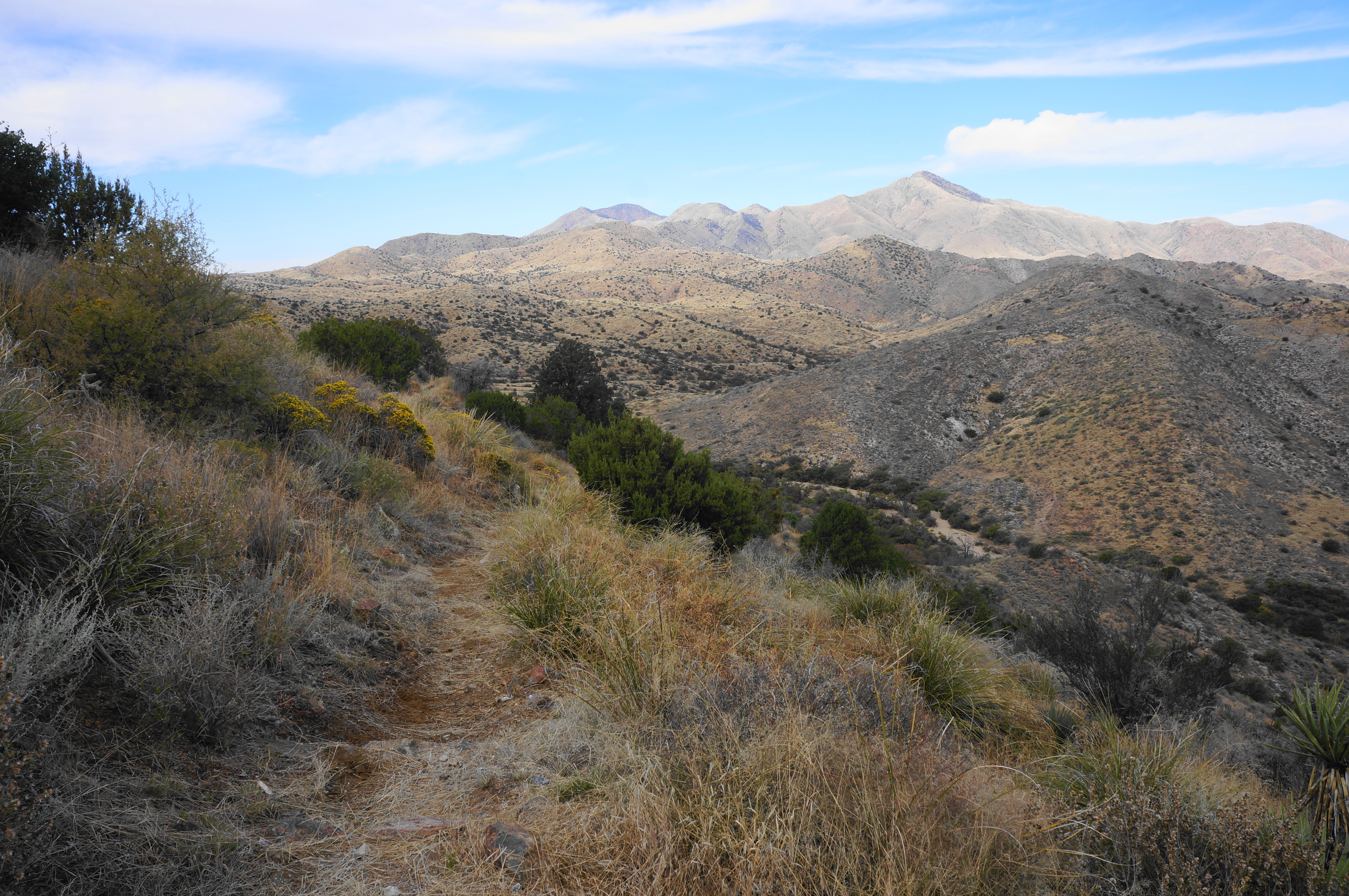
Just east of the crest of the pass, look for a reasonably large parking area on the north side. Across to the south is the start of the Fort Bowie Trail, accompanied by a picnic gazebo, information boards, and a map of the park. Off in the distance to the southeast, one can see the hulking heights of Bowie Peak (6,982’) and the protruding head of Helen’s Dome (6,376’).
The hike begins with a mild descent, dropping to clear the main drainage through Cutoff Canyon. Just beyond lies the stone foundation of an old mining cabin, built by a local prospector well after the closure of Fort Bowie in 1894. The builder, Jesse L. Millsap, was killed while digging a well in 1929 and is buried at nearby Bowie Cemetery, 15 miles to the north.

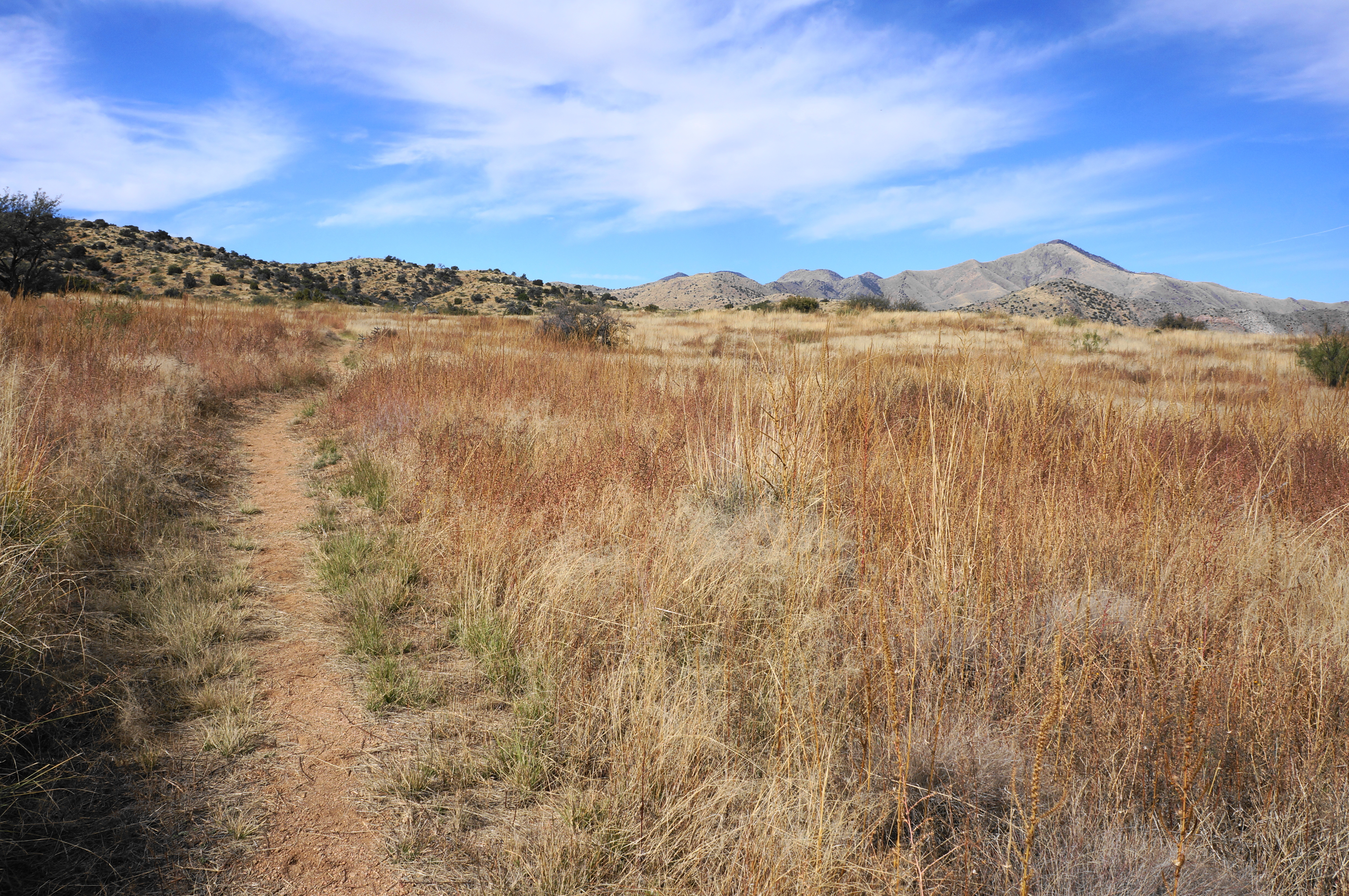
Stepping past the cabin ruins, the trail climbs back out into the open before dropping again to cross another drainage. After this comes a third, short wash traverse, after which the path rises to a golden, grassy, and sun-soaked plain. Looking back, one can see Government Peak (7,580’), one of the highest promontories in the Dos Cabezas Mountains. The windswept hillsides to the north are noticeably less vegetated than the landscape ahead to the east; this is in part due to the soil transitions of the area and presence of Apache Spring just below Fort Bowie.

Head toward the spring and fort, coming to a sign for the Parke Camp Site at around ½ mile. A full eight years before the Battle of Apache Pass, U.S. Army Lieutenant John Parke led a surveying trip to this area, camping at this spot in March 1854. The objective was to identify a route through the mountains for a long-distance railroad line: Apache Pass, while passable, was far more tedious than the flats to the north, which Parke settled on as a better alternative a year later; by 1880, the railroad through Willcox and Bowie was complete.

The field on which you walk, however, was not just notable for hosting the Parke expedition. More famously, it was the locus of the 1861 “Bascom Affair”—the event that triggered years of hostilities between the U.S. Army and Cochise’s band of Chiricahua Apache. In January 1861, at nearby Sonoita Creek, a Tonto Apache group kidnapped the 12-year-old stepson of local rancher John Ward, prompting the army to send a contingent led by Lt. George Bascom to try to locate and recover the boy. False intelligence led Bascom to pin the blame for the kidnapping on Cochise, whom Bascom tracked to this location in February 1861. Here Bascom set up a meeting with the Chiricahua leader and attempted to imprison him and his family; Cochise, however, escaped, fleeing up and over the modest hill visible off to the left.

An interpretive sign—located just past an ensuing trail junction—tells the story of this encounter, which triggered a series of tit-for-tat attacks. In the weeks following the initial incident, Cochise took several white Americans hostage, and Bascom’s party killed the Chiricahua in their custody. This set off decades of bad blood between the longtime natives and the encroaching settlers, prompting the U.S. Army to hastily construct Fort Bowie in late 1862.
The aforementioned trail fork marks the start of the loop portion of the hike. Head right first, passing the Bascom Affair sign on the left and beginning a counter-clockwise circuit around the valley. Soon hikers come to the Stage Station Ruin, once an active outpost used by soldiers and travelers on the Butterfield Trail, an overland stagecoach line used by commercial passengers and the U.S. Mail service for a brief period from 1858 until 1861. Take the short spur here to see the full stone ruins and read a second sign on the Bascom Affair.

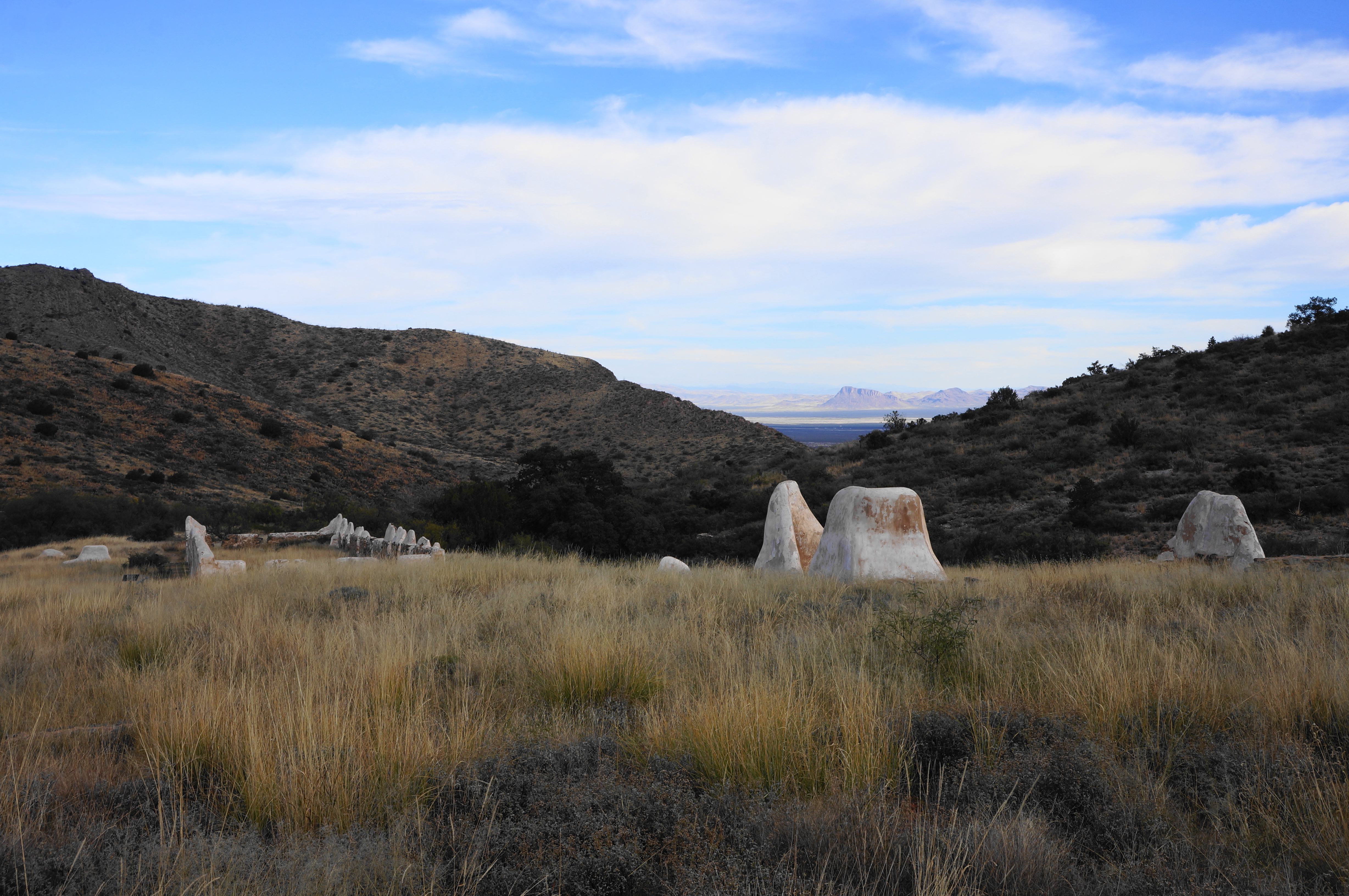
Less than a minute’s walk from Stage Station, the trail stays straight through a four-way junction with a hiking trail that follows the old Butterfield stagecoach line. (Note: This trail, however, was closed as of November 2022.) Just ahead, with a wider, sandy drainage shaping up to the left, hikers reach the neatly-fenced Post Cemetery, which was constructed before Fort Bowie but came to be the resting place for many who served there. The military personnel and their dependents who were buried at the cemetery were later moved, leaving only civilians behind. (Note: See a listing of all those identified who are interred at the cemetery here.)

The onward path continues by rounding the northeast corner of the cemetery and then crosses the wide wash. Despite being downstream from Apache Spring, this basin is dry for most of the year. Now on the north side of the drainage, the Fort Bowie Trail approaches a partly-rehabilitated ruin on the left: the contours of the Chiricahua Apache Indian Agency, once the office of U.S. Indian Agent Thomas Jeffords, who “governed” the Chiricahua Apache in the area from 1875 to 1876.


Moving on, the shade grows denser—welcome on a hot day—and the trail passes a small interpretive sign marking the site of the Battle of Apache Pass: it was here, along the Butterfield Road, that 96 California Volunteers were ambushed on 15 July 1862; the U.S. soldiers endured five casualties (two killed, three wounded) but were able to repulse the Apache in a counter-attack at the nearby spring.
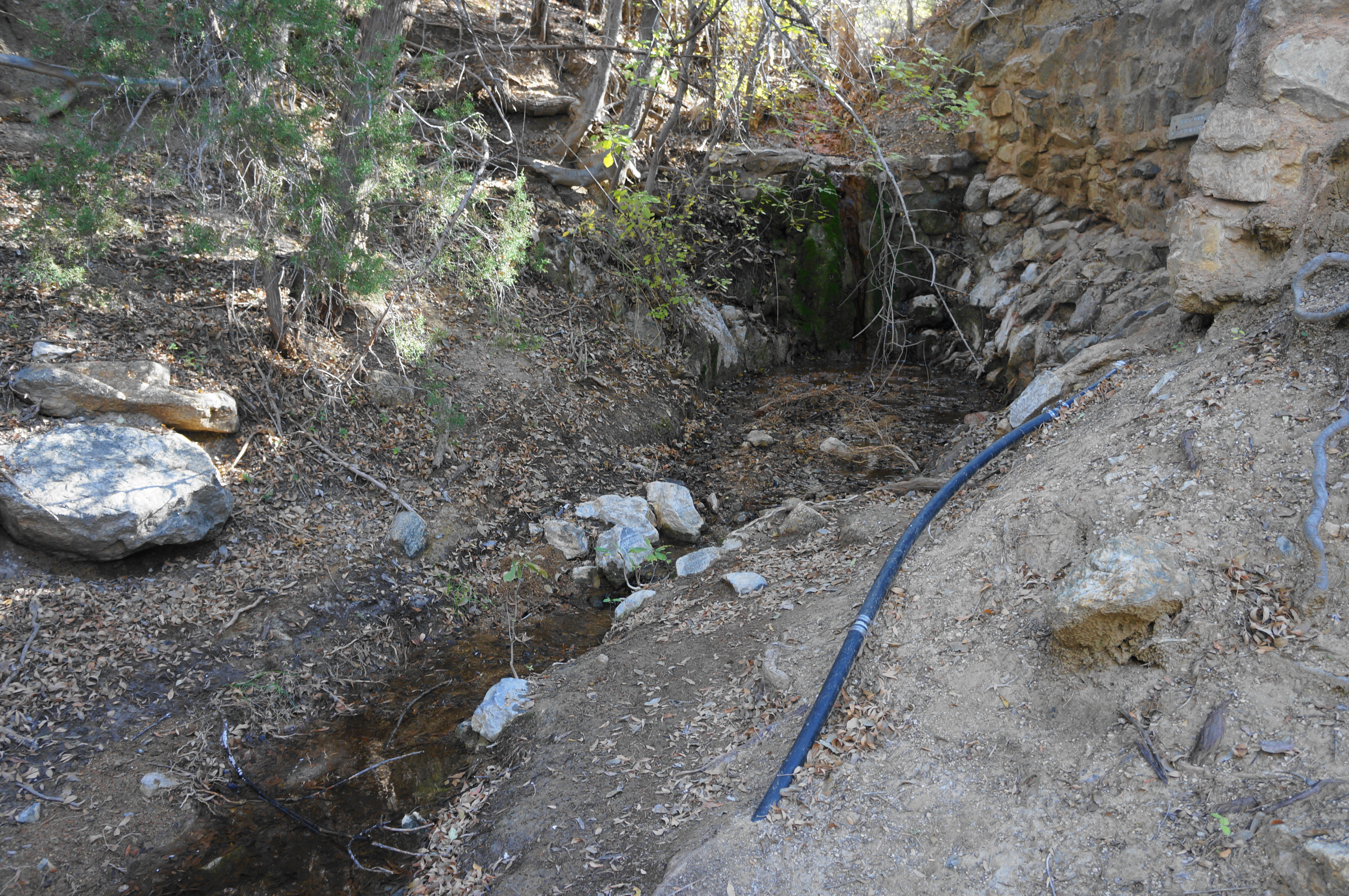
Steps later, hikers come to a reconstructed representation of a thatched hut used by the local Chiricahua Apache. From here the trail crosses the streambed and enters a lovely, well shaded gully with taller trees. Flowing water means Apache Spring is near, and indeed hikers pass it minutes later: the site is protected by a stone retaining wall, seemingly kept up by the Park Service. The trail suddenly climbs a steep staircase to clear the spring and rises back into the open after the brief foray under the lovely tree canopy.

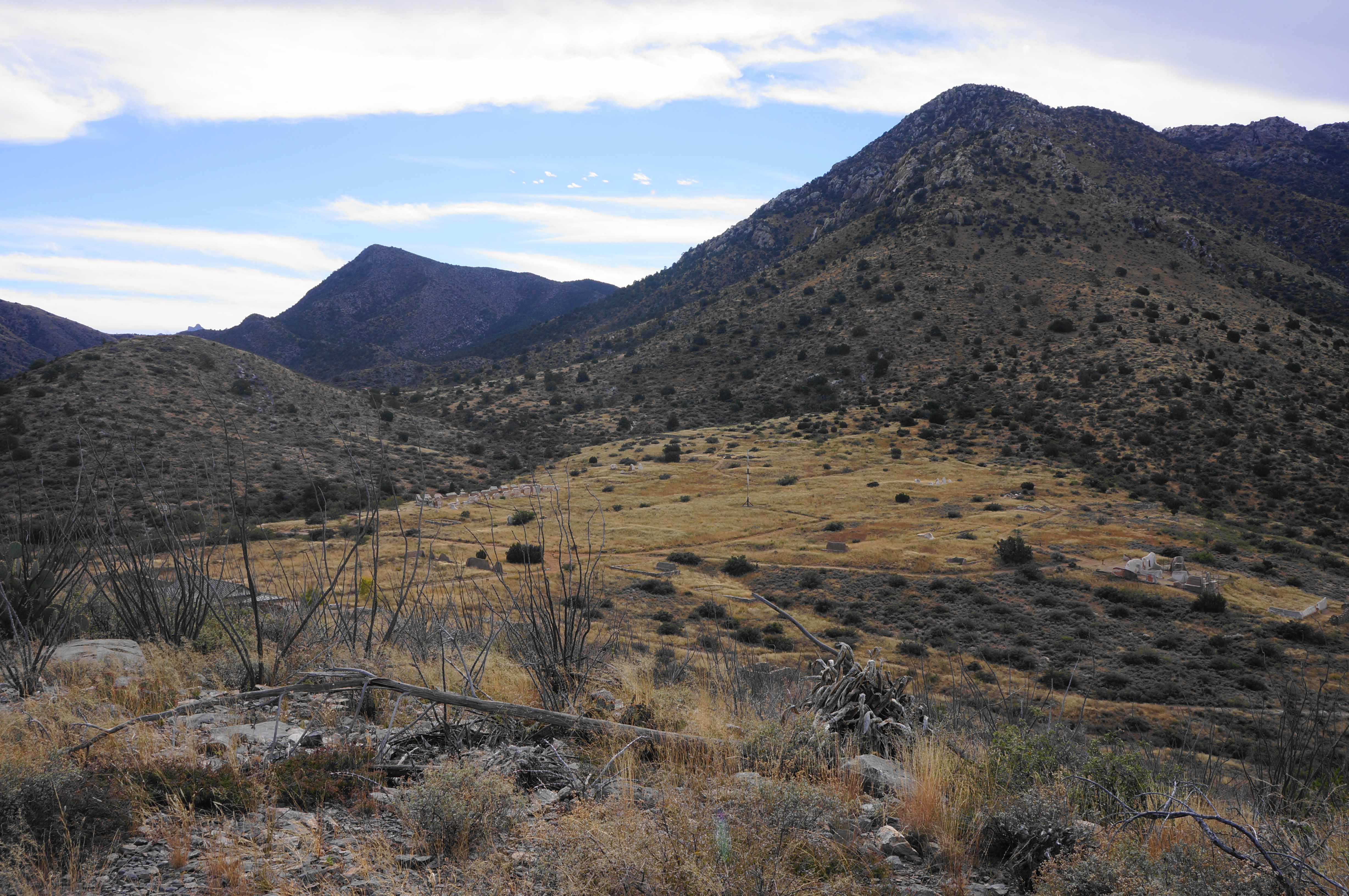
By now one can begin to make out parts of Fort Bowie ahead, as well as the official Visitor Center, open daily from 8:30am-4:00pm. But it’s worth first taking a minor detour, with a spur trail heading off to the right for 300 yards to the ruins of the O.G. Fort Bowie, a much smaller outpost that was built on a hill overlooking the spring and Siphon Canyon. Construction began less than two weeks after the Battle of Apache Pass, and the original fort was abandoned in favor of the new, larger installation constructed just to the east in 1868.

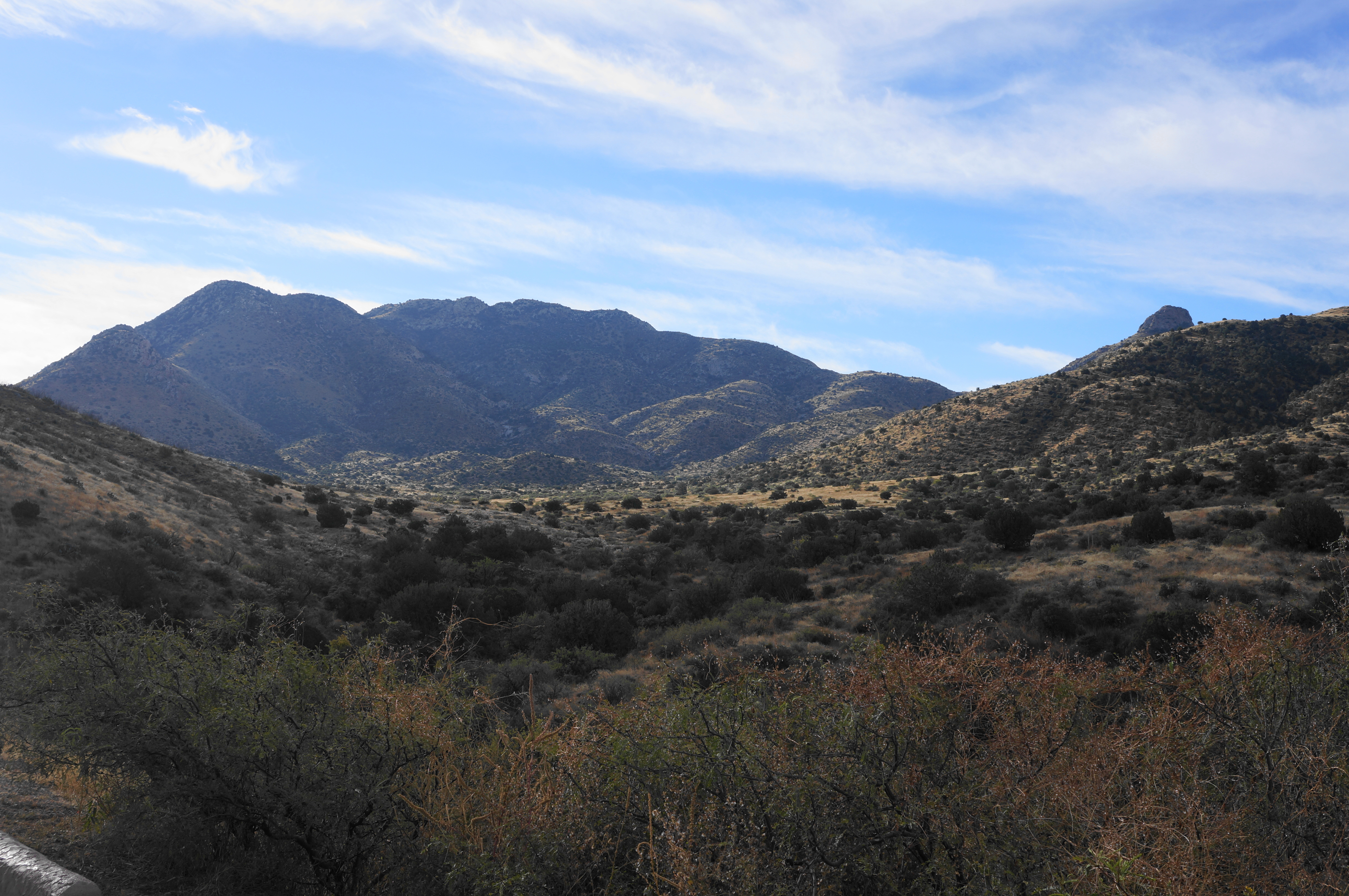
This spur trail is much thinner, with grasses encroaching onto the path, but the route is reasonably easy to follow—first past an initial ruin, then up a side gully, culminating with a short loop around the hilltop. The remains of the fort here are modest, but the views are excellent, with a clear look across the valley to Post Cemetery, Cutoff Canyon, and Government Peak. One also gets a good shot of Helen’s Dome, a granite knob frequented by local climbers.

After rounding the loop, return the way you came on the spur path, coming back to the main track. By now hikers have travelled around 1.8 miles, and a persistent climb brings hikers up to the plateau with the “new” Fort Bowie and the modern Visitor Center.

Fort Bowie is notable for being one of the few (only?) places in the National Park Service system where one has to walk more than a mile to reach the main visitor center. And yet this perhaps part of the appeal – the lack of a visitor center means only prepared and determined visitors are likely to make the journey. On many days, hikers will have the Visitor Center to themselves – except for one or two hearty park rangers, of course, who, to be fair, tend to use the road (also open to vehicles with disabled placards) to access this point.
After exploring the Visitor Center and bookstore, head back outside toward Fort Bowie. Just past the howitzer cannon, head south on a wide, dirt track into “Second Fort Bowie,” which became the epicenter of local U.S. Army operations after construction in 1868. The fort was never attacked, but many of the soldiers sent out from here on patrols certainly were, as the famed Geronimo took up the fight against the encroaching settlers after Cochise died in 1972.

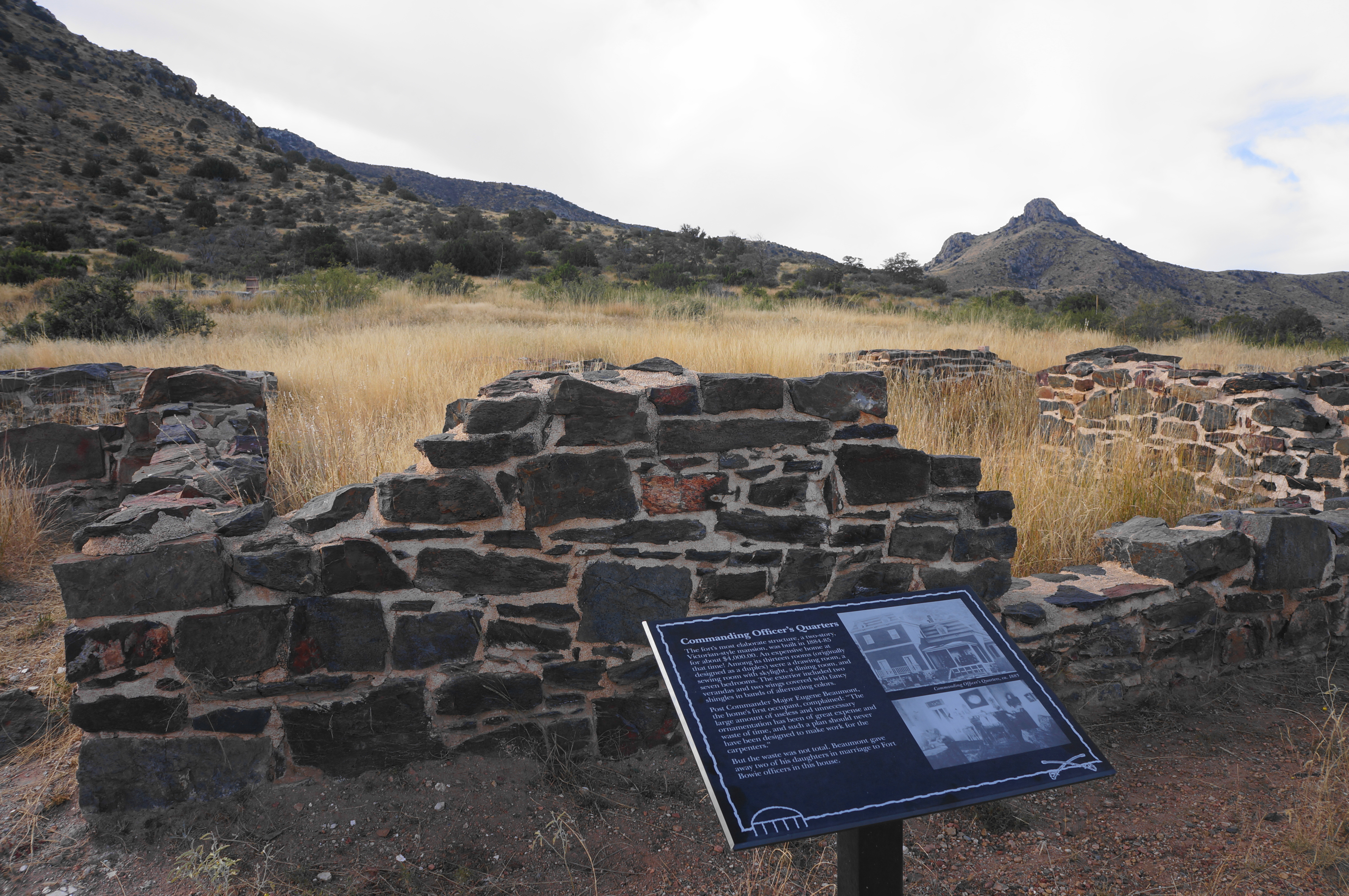
The ruins of the fort are modest, with crumbled adobe and low, overgrown stone foundations. Among the stone ruins lie the officer quarters, trading post, and mess hall, scattered atop the plateau, with another gap in the mountains visible off to the east. Make a clockwise loop around the fort remains, including a short spur in the southeast corner that ends at the “new hospital.” The trading post—Sutler’s Store—offers the best views down to the valley from which you came, and each structure has a small interpretive sign offering a short historical description.

It is somewhat easy to stray from the rectangular loop around the fort, but the Visitor Center off to the north remains in view much of time, making navigation back to the start relatively straightforward. All told, the circuit and various spurs cover around a half-mile.
After exploring Fort Bowie, stop by the bathroom at the Visitor Center and then prepare for the return journey, with hikers having two options. The first is to return the way you came, past Apache Spring. The second and preferred choice, however, is to follow Overlook Ridge back to the start of the loop, offering a more strenuous but considerably more scenic return.
The climb up Overlook Ridge begins immediately behind the Visitor Center on the northwest side, with the thinner and rockier path ascending an ocotillo-dotted slope. The climb lasts around a quarter mile before easing, with hikers gaining grand views down to Fort Bowie and across the valley to Bowie Peak and Helen’s Dome.
A stone marker with a short inscription tells the story of the closing of Fort Bowie, which was abandoned in 1894. By then the threat from the Chiricahua Indians had largely subsided, and the remaining native population was moved into reservations, marking the end of the so-called Apache Wars.
Enjoy the classic Sonoran landscape as one traverses Overlook Ridge, with yuccas and small cacti scattered among the ocotillos and brush. Reaching the summit at around 2.9 miles, there are excellent views north—down Siphon Canyon—and south and west, across the main valley.
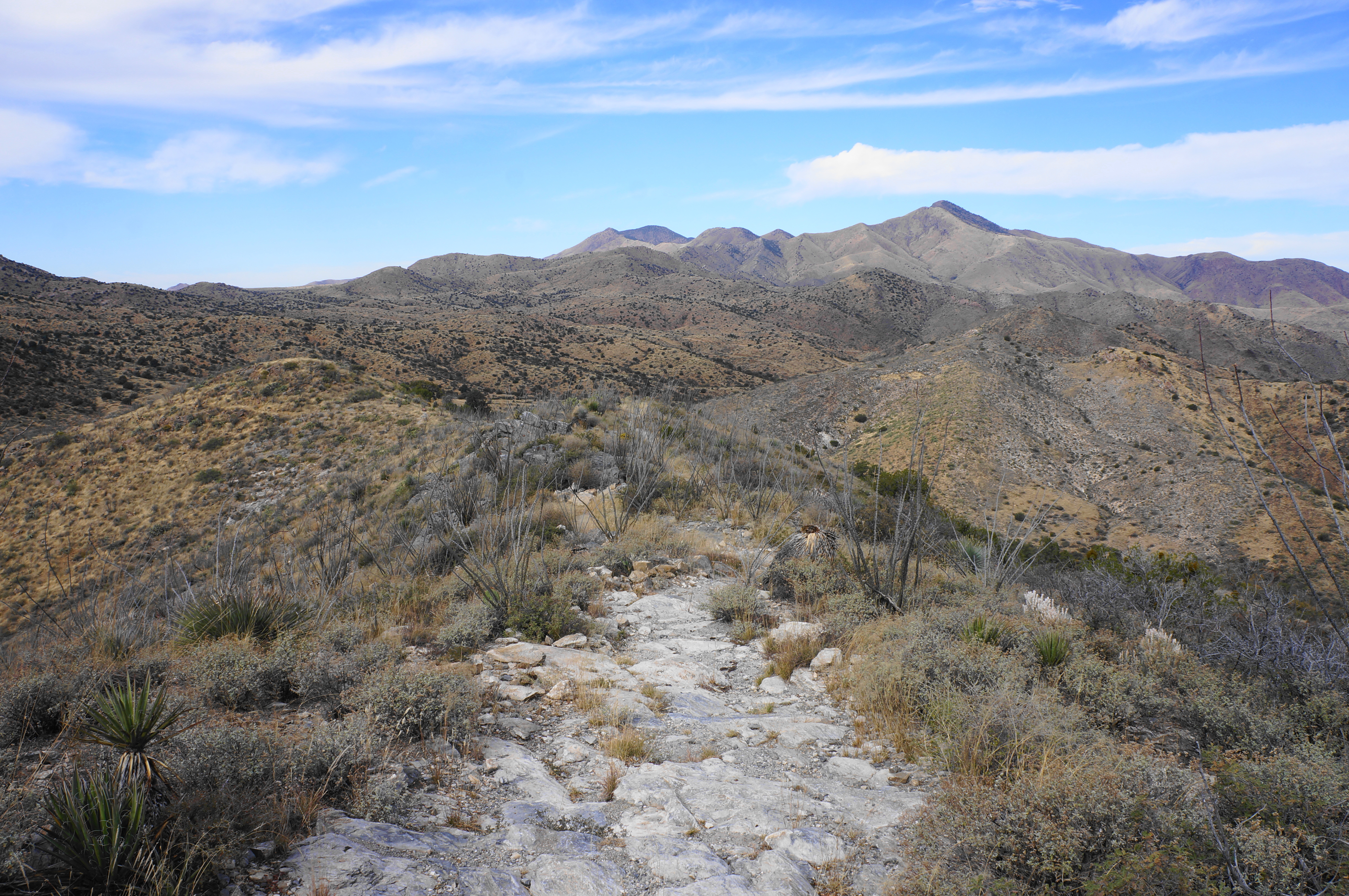
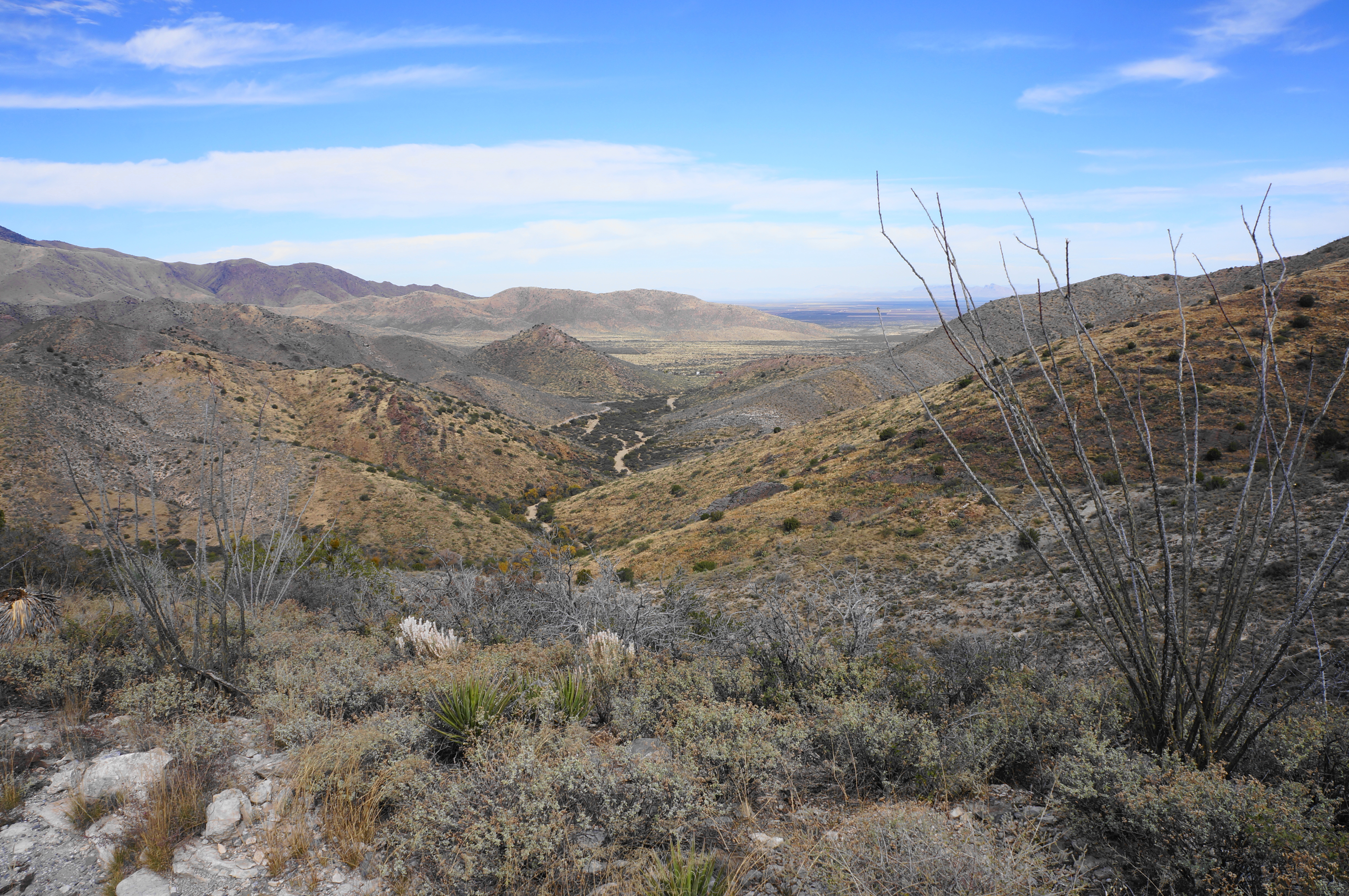
About ¼ mile later, there is a short spur left that ends at a vista point and another explanation of the Battle of Apache Pass—this spot offers a bird’s eye view of the former battlefield. After returning to the main path, continue west as the trail descends the wavy limestone ridge to a series of additional overlooks. From here the descent steepens as the trail engages a set of switchbacks that brings hikers back down into Siphon Canyon.

Working back across the floodplain, come to a junction again with the Butterfield Trail, then make your way across the wide and sandy drainage. On the west side, the larger vegetation recedes, and hikers enter familiar territory, edging across the grassy plain encountered early in the hike.
From here it is a short walk back to the start of the loop section, with more than 3.8 miles of walking (including all the spur trails mentioned) now behind you. Take a look back toward Fort Bowie and Bowie Peak, then proceed northward, retracing the initial ½-mile stretch to return to the trailhead at Apache Pass.
This historic hiking trail clocks in at around 4.4 miles—including the several spurs and circuit around the main fort complex—and is a pleasant half-day outing in a scenic corner of southern Arizona.

Thank You, Andrew.
We did this hike in May 2022. Reading your trail description brings back nice memories.
Thanks!
Pingback: Fort Bowie National Historic Site: Ranger PamPaw’s Companion Guide - Tezels on the Road