

Southwest Oregon’s Samuel H. Boardman State Scenic Corridor features some of the finest stretches of shoreline on the Pacific coast of the United States, and the short-but-spectacular Thunder Rock Cove Loop traverses one of its most picturesque pockets. The brief circuit skirts towering bluffs that plunge into Thunder Rock Cove (a.k.a., Seal Cove), approaches a seaside natural bridge, and features open views of the swirling Pacific Ocean. Along with nearby Natural Bridges, this is a must-see destination between Brookings and Gold Beach, Oregon and is best viewed in the morning or midday sun.

The hike
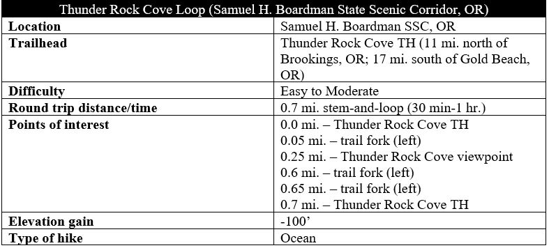
Start and end the brief Thunder Rock Cove Loop at the Thunder Rock Cove Trailhead, an unmarked but popular parking area along Highway 101 (Oregon Coast Highway) (mile marker 347.8), roughly 11 miles north of Brookings and 17 miles south of Gold Beach. The graveled turnoff is situated just north of the signed pullout for Natural Bridges and features a large trail marker that indicates you are in the right place.
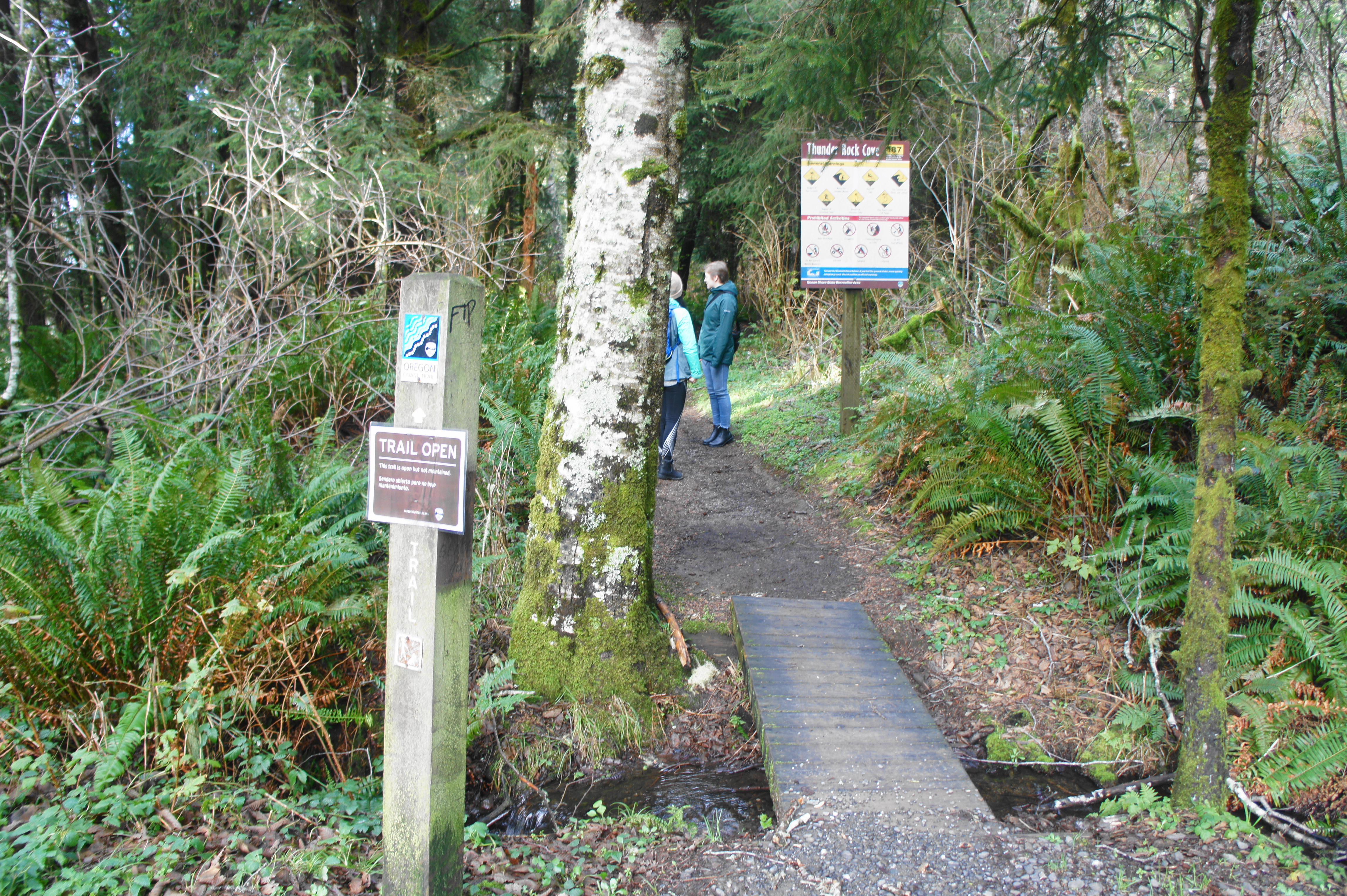
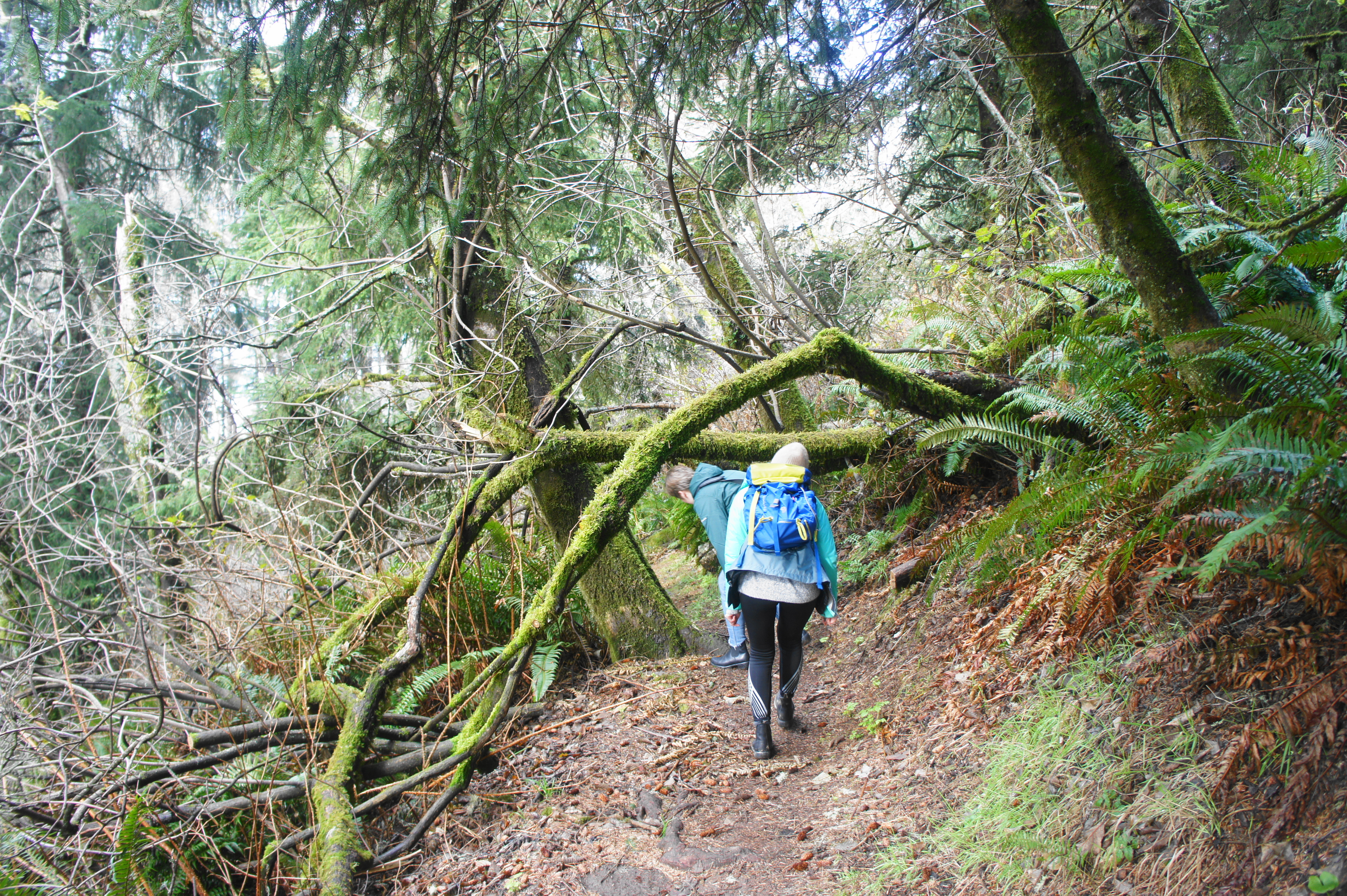
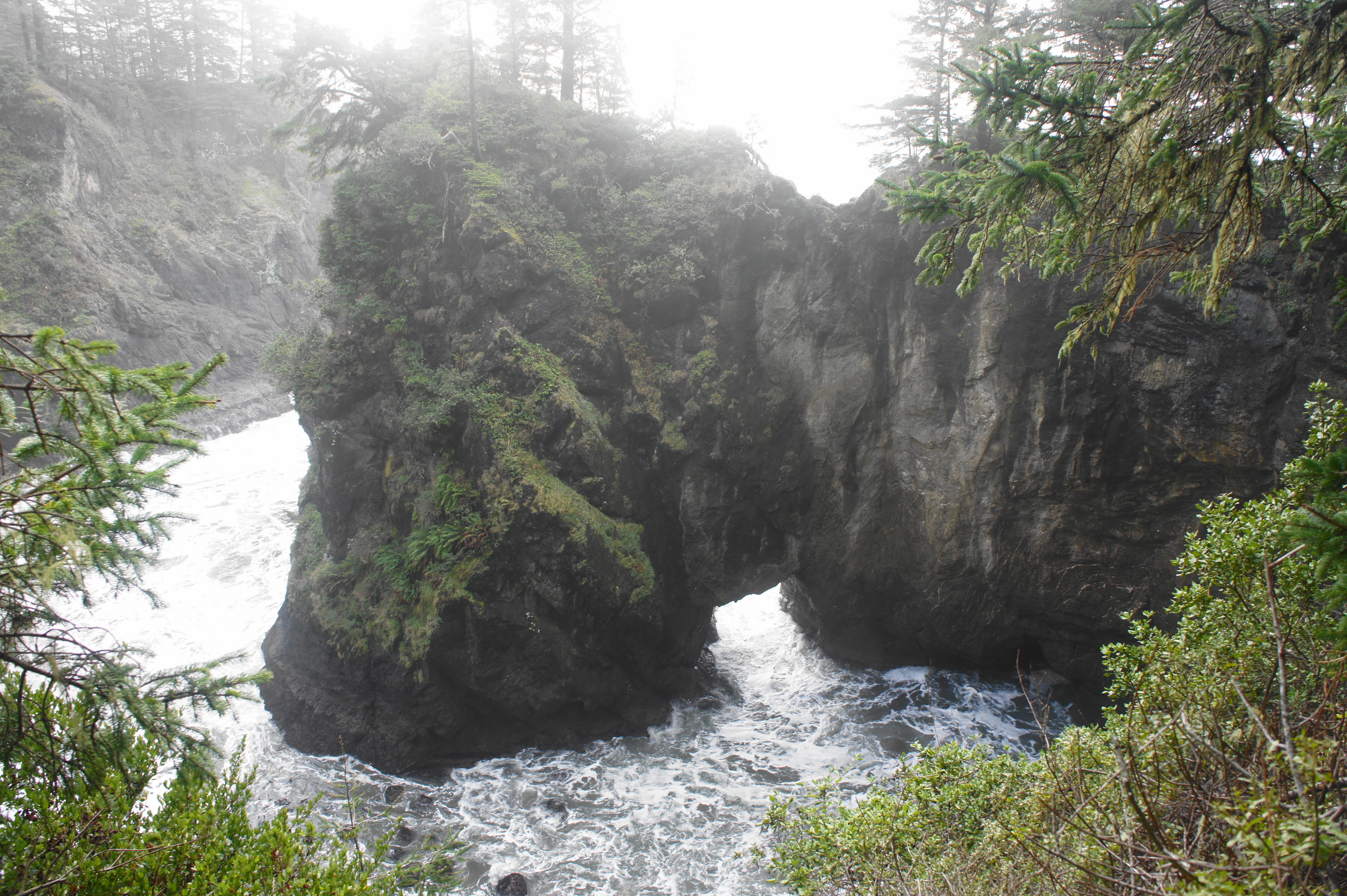
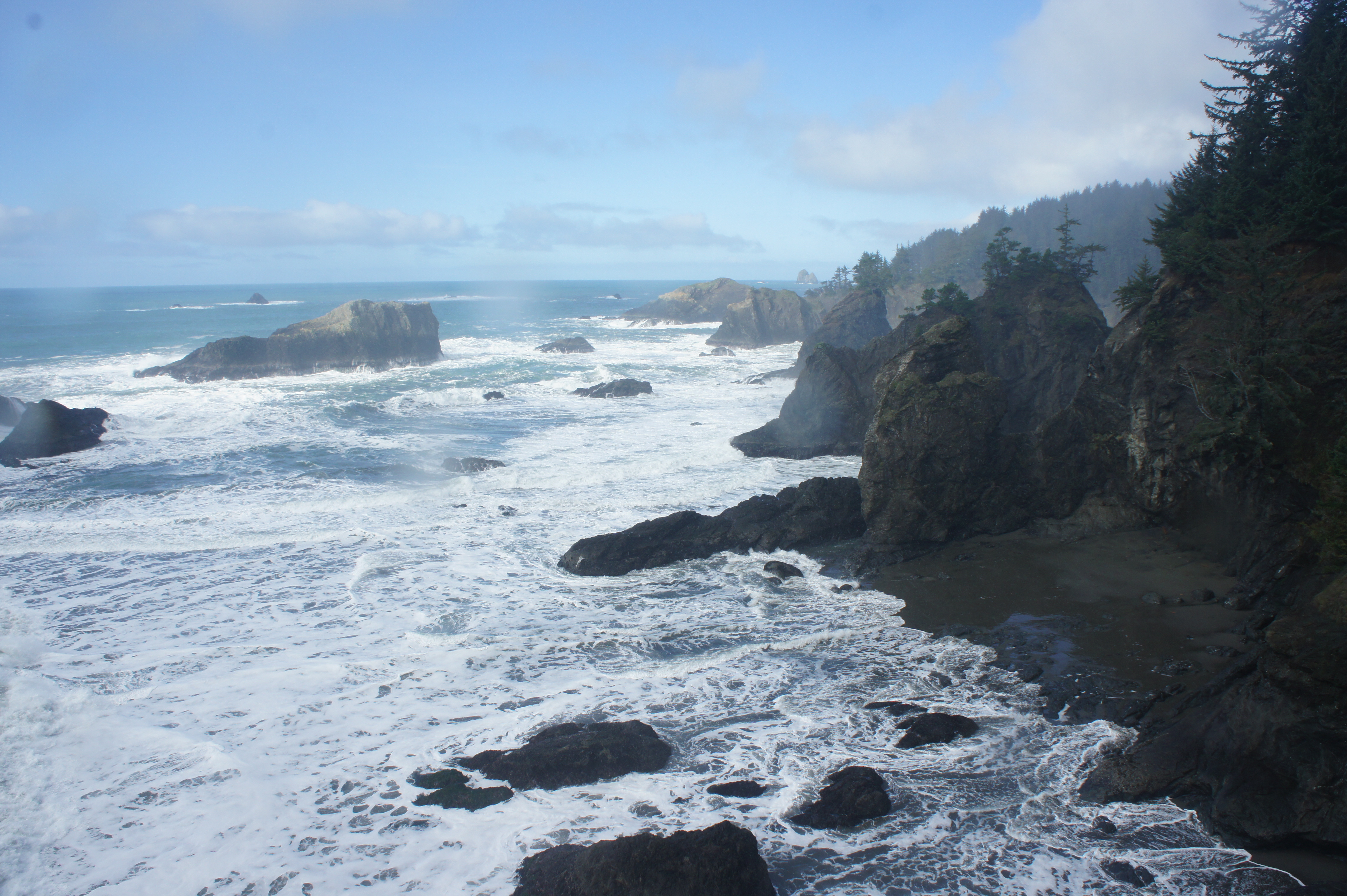
Take the path heading north from the parking lot: this is part of the lengthy Oregon Coast Trail, which transits the entire length of the Oregon shoreline. After traversing a short bridge and entering the spruce-and-fern-lined forest, bear left at the initial junction. (Note: Many hikers head right to reach nearby Secret Beach, a longer and more arduous hike.) Beyond, there are several spurs off to the left, leading to vistas of Thunder Rock Cove (a.k.a. Seal Cove), where the swirling sea cuts through a natural bridge carved in the ancient rock below. This picturesque spot is tantalizingly beautiful, with the turquoise waters lapping up against sheer vertical rock faces.

Trail around Thunder Rock Cove 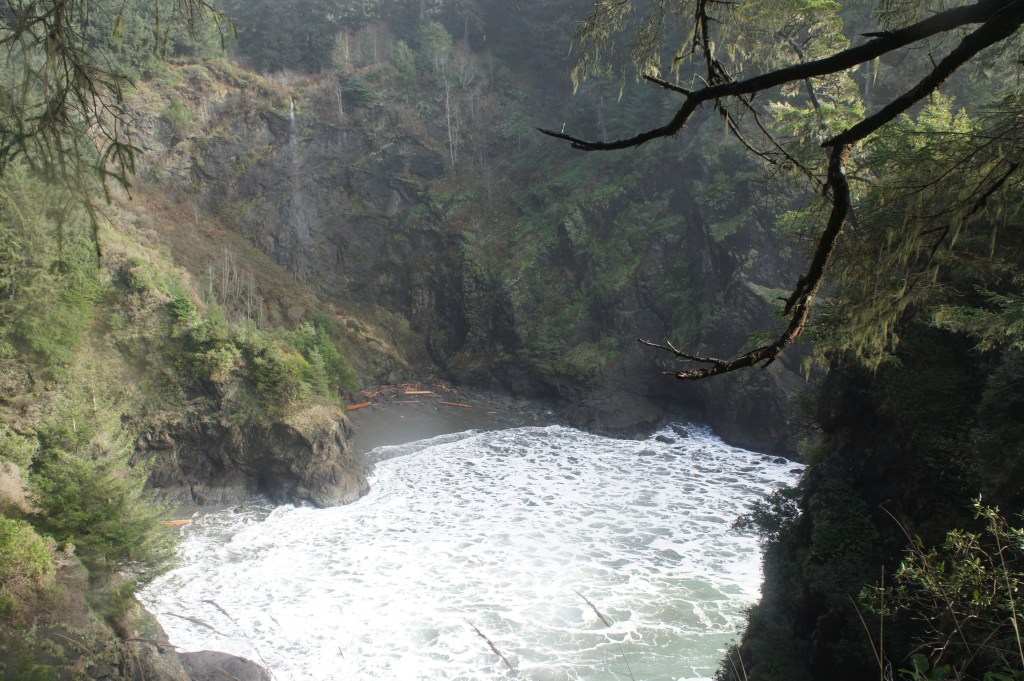
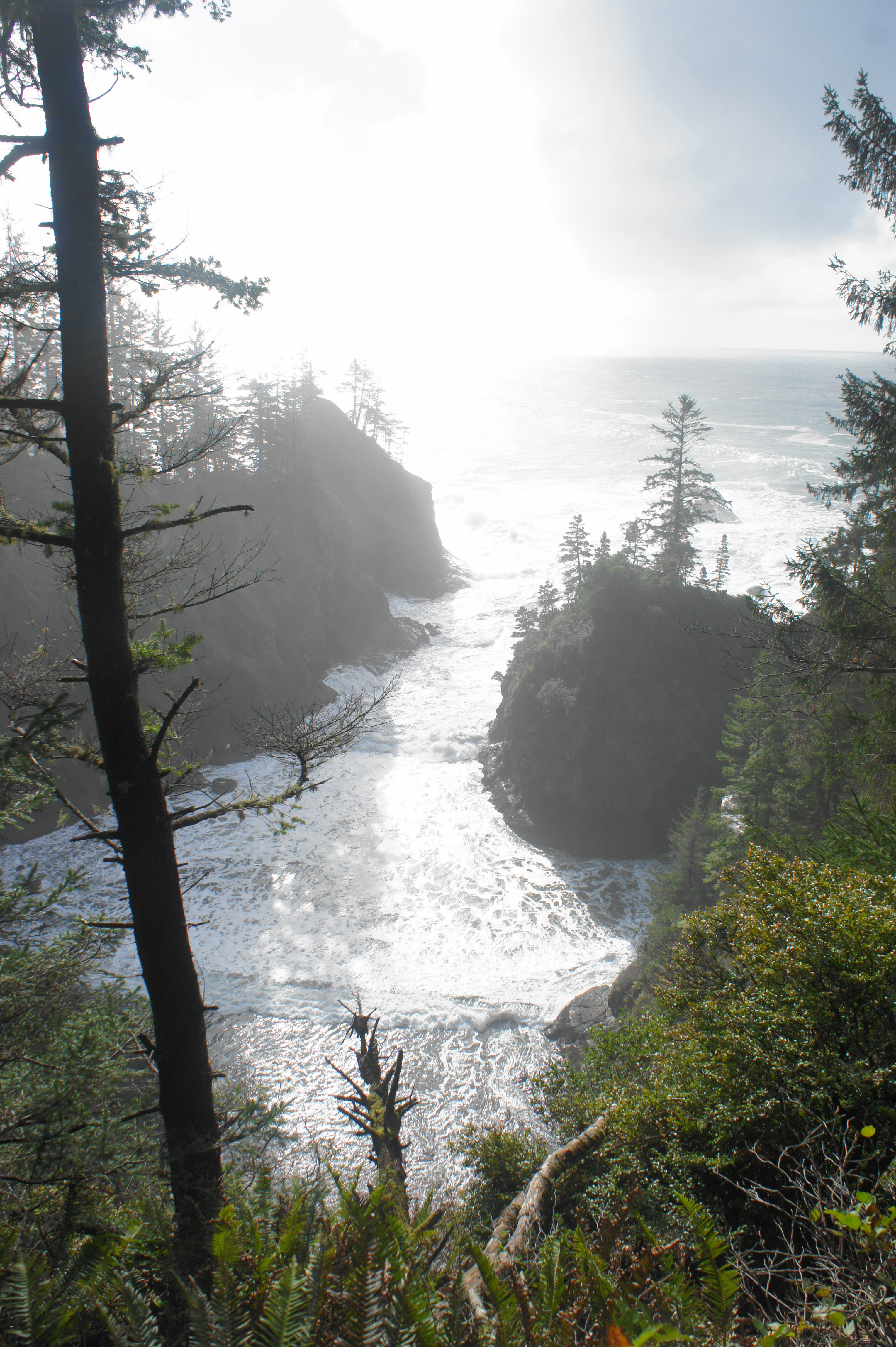
Small waterfall dropping into Thunder Rock Cove

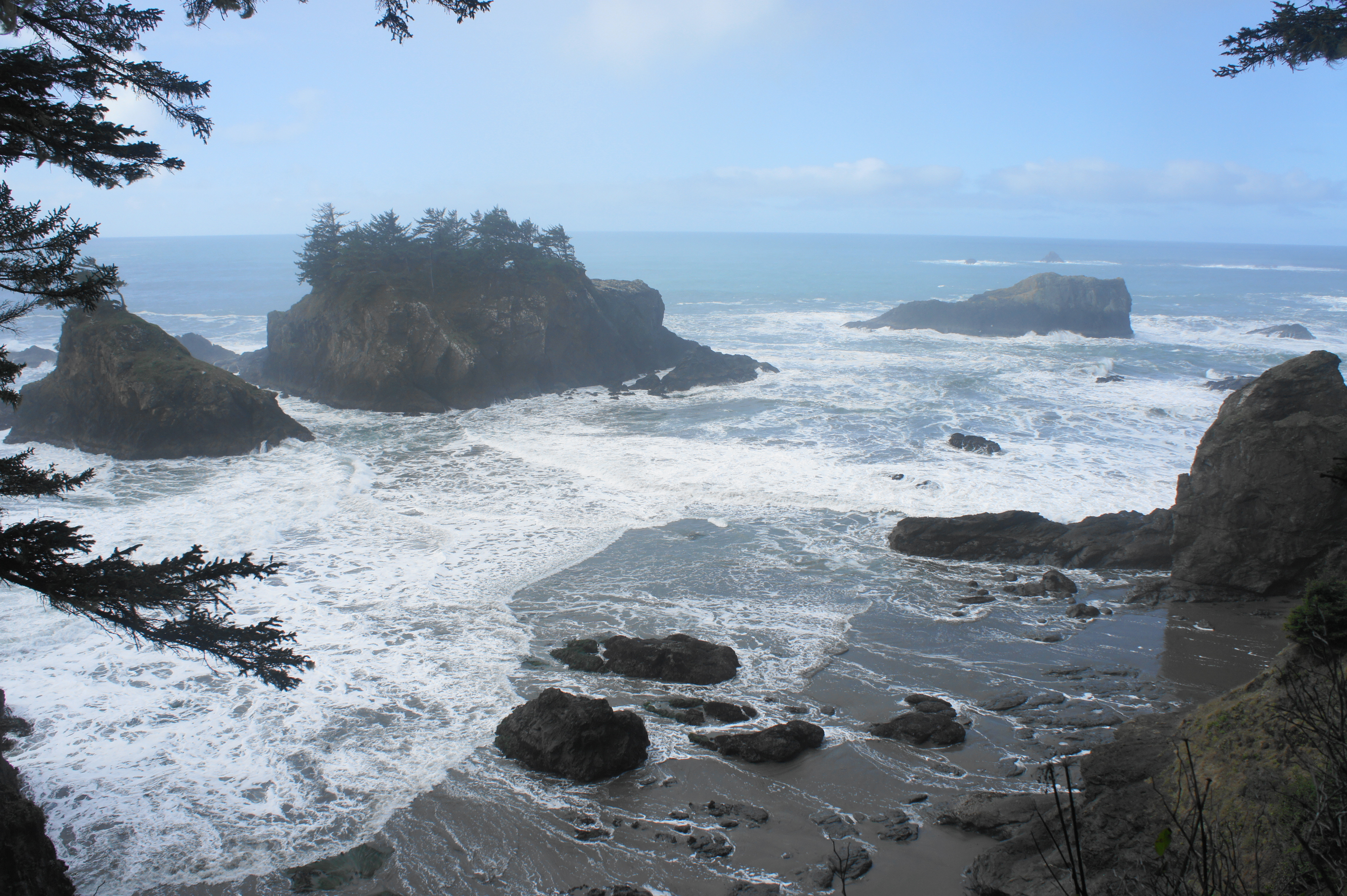
The views of the cove and archway improve as the trail continues, especially after the loop path descends a set of switchbacks along a fern-clad slope. Minutes later, the path leads out to a small, spruce-clad peninsula with magnificent views, especially to the west, where the sea seems to converge from all directions on a shallow basin, protected by sea stacks several hundred yards distant from the coast. Hikers can also see northward in the direction of Miners Gulch, Secret Beach, and Spruce Island, although none are quite visible due to the angle of the coastline.

View north from Thunder Rock Cove Loop 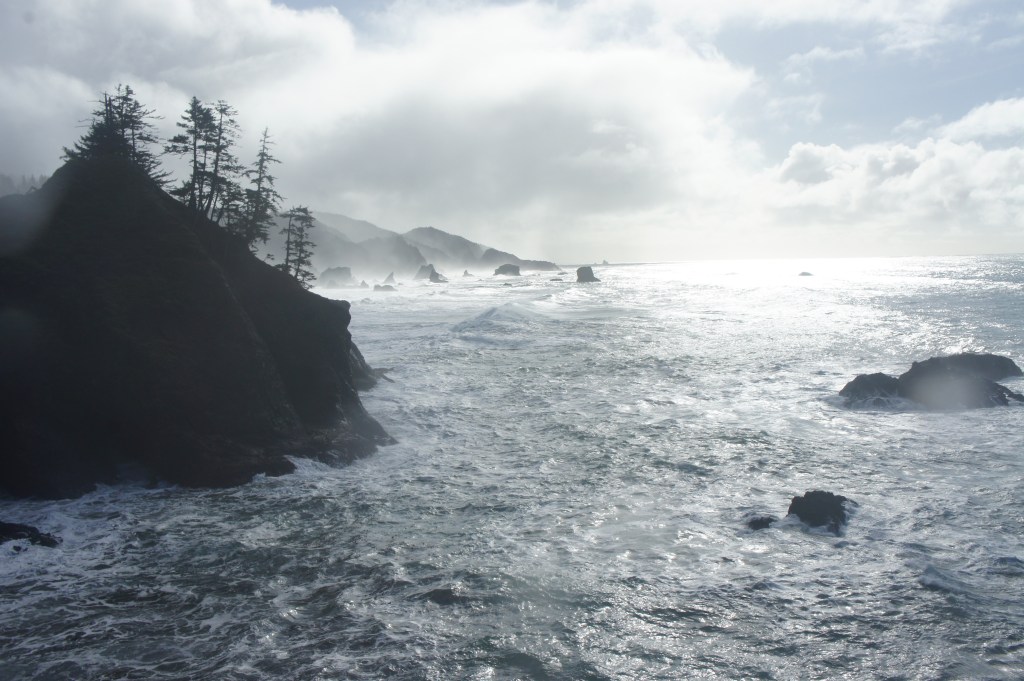
View south from Thunder Rock Cove
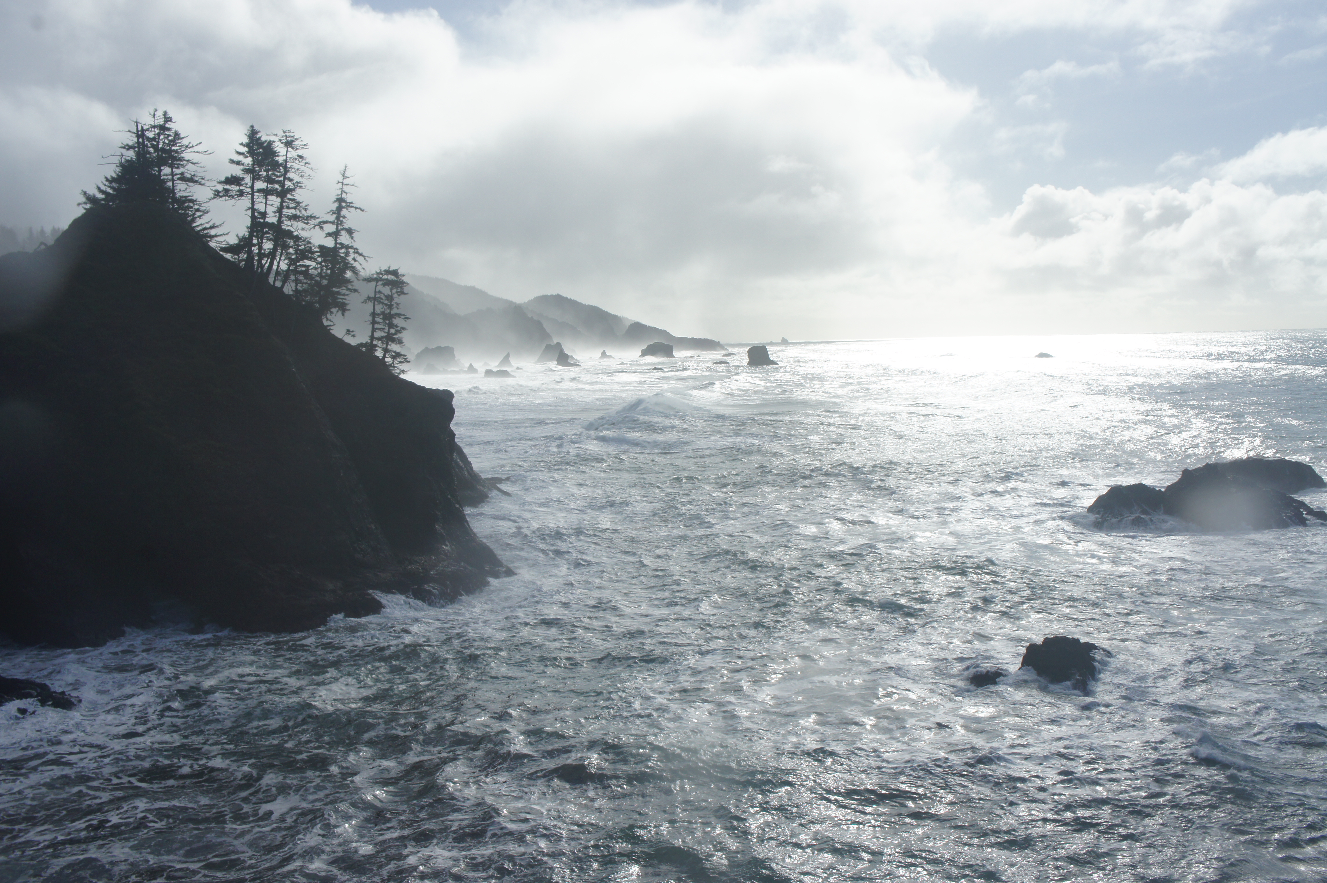
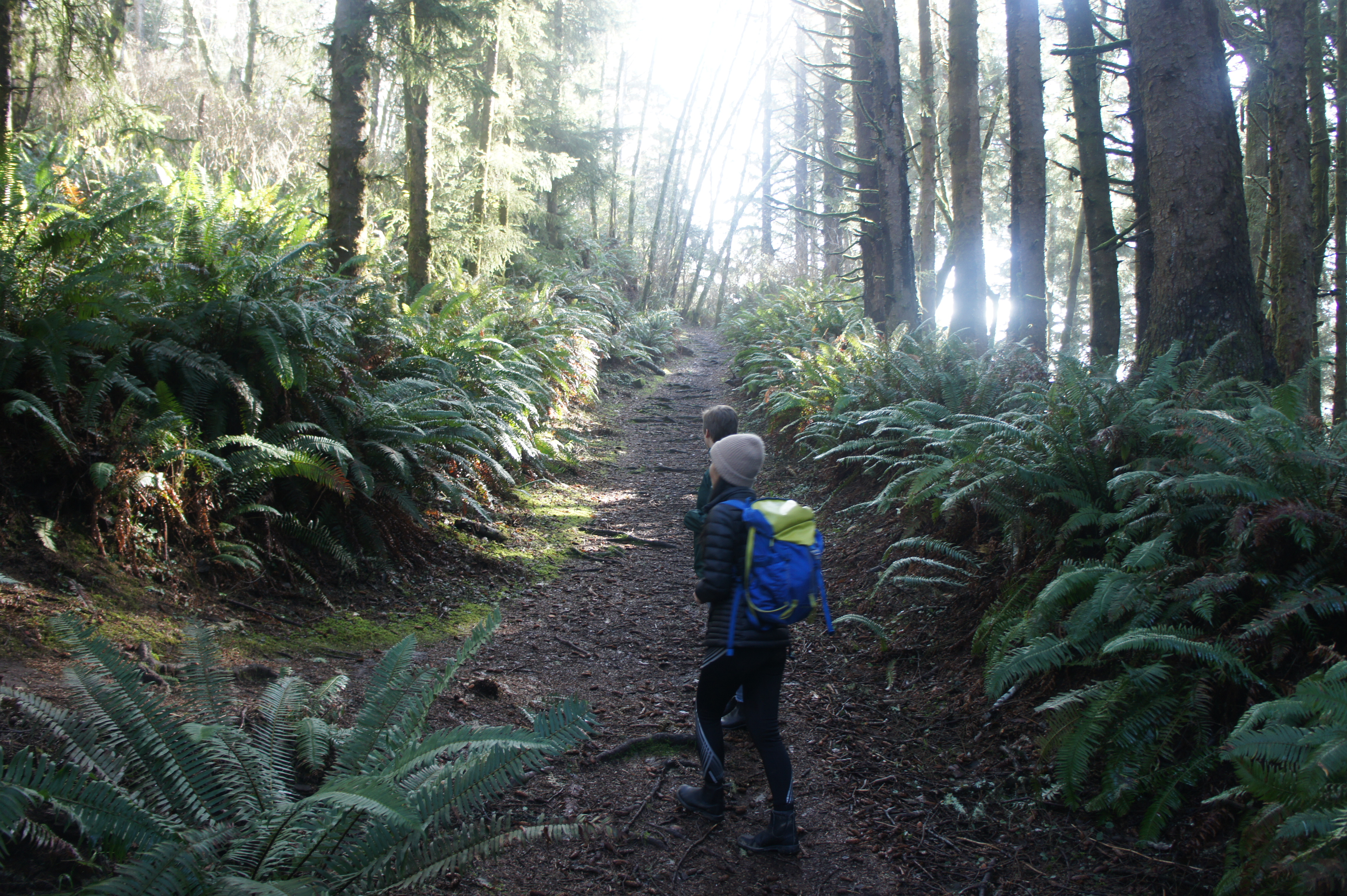
Intrepid hikers can continue out—sharply downhill—to the natural bridge, but most hikers will want to continue northward from the peninsula, following a narrow but discernable trail that hugs the cliffsides. The rest of the hike has no real ocean views but cuts through a dense forest of Sitka spruces and other conifers, with the understory lined by sword ferns.
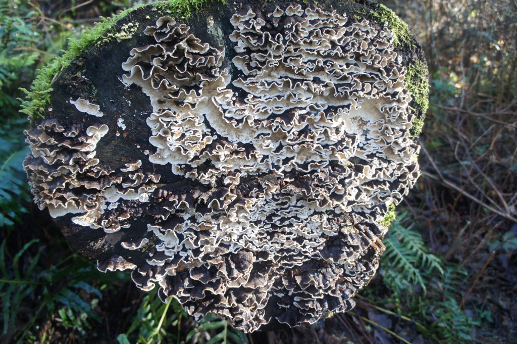
Fungi along the trail 
Fern-lined trail leading back to the start

At ½ mile, the loop trail climbs steeply back toward the start, then bears southeast through a sea of ferns to a trail junction at 6/10 mile. While heading left leads to Secret Beach, the loop trail continues right, quickly reconnecting with the initial junction. From here, bear left and, within a minute, return to the parking area, having completed the short but scenic hike.

Pingback: Indian Sands Loop (Samuel H. Boardman State Scenic Corridor, OR) | Live and Let Hike
Pingback: Easy Guide to Samuel H Boardman Scenic Corridor - Pechluck's Food Adventures
Pingback: Humbug Mountain Trail (Humbug Mountain State Park, OR) – Live and Let Hike