For a change of pace, let’s take a break from the Rockies and explore a new favorite trail of mine out East…just minutes from Boston’s Orange Line in the eastern district of Middlesex Fells Reservation. Don’t let this trail’s relative height (just around 300’ at its peak) and proximity to a major city fool you: this 4.7 mile circuit (4.2 mi. loop + 0.25 connector) is no easy walk in the park. In fact, this mostly-forested Rock Circuit Trail is purposely designed—or so it seems—to seek out and conquer every single steep, rocky crag in Middlesex Fells. Unlike its western cousin, don’t expect to find switchbacks or gentle sloping inclines in the eastern district. In some places, the white blazes marking the route simply lead directly up the jagged fells.

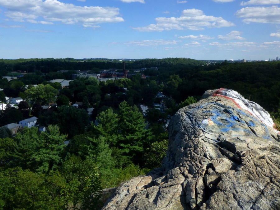
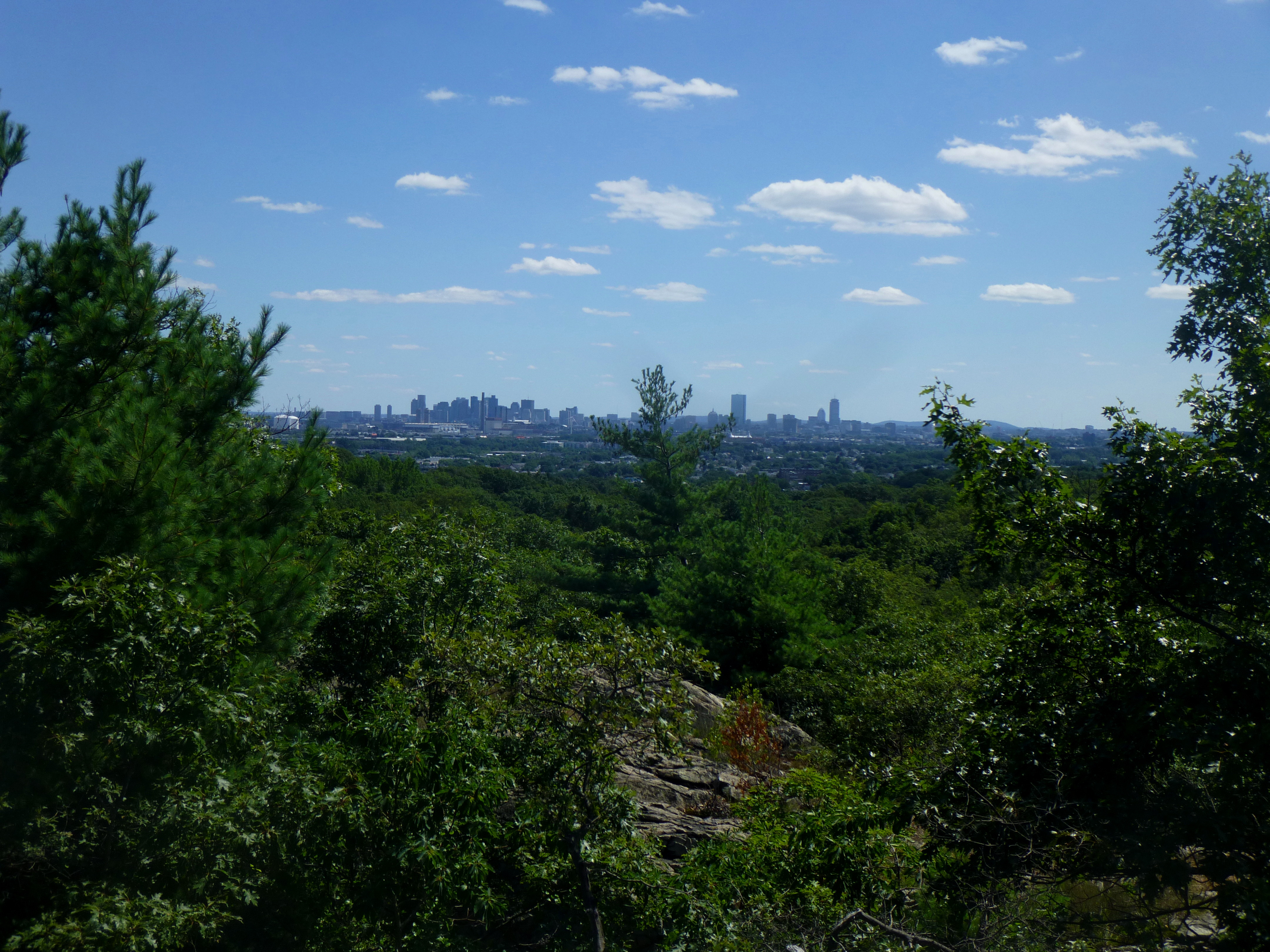
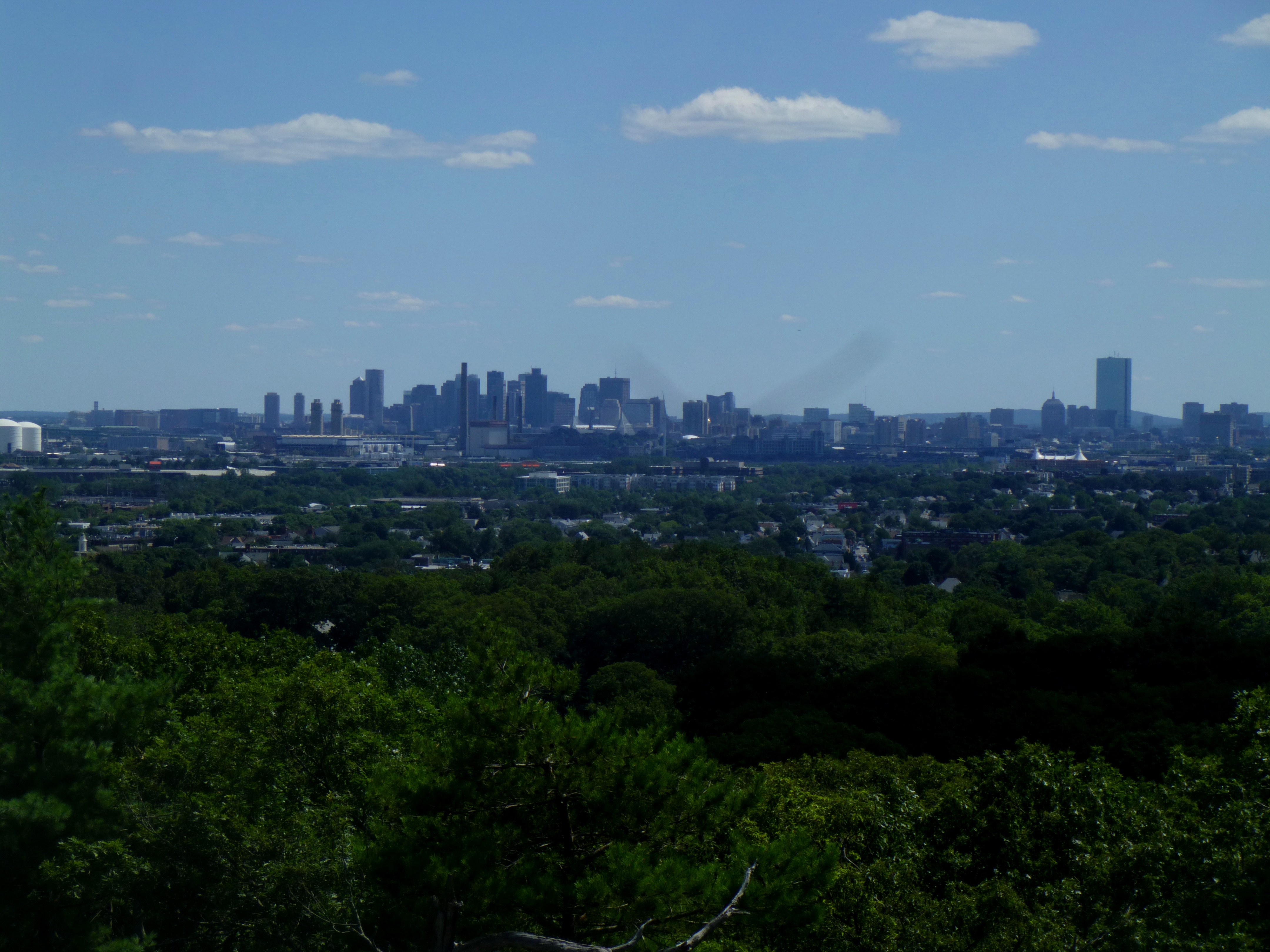
Fortunately, however, weary hikers are rewarded with excellent views at several points—of downtown Boston to the south, Revere and Revere Beach to the east, Melrose directly to the northeast, and Middlesex Fells’ western district to the west. For a local Bostonian looking for a challenge close to home, there is perhaps no better trail.

The hike
(First, a cautionary note: I began this hike determined to finish the 4.7-mile route in around two hours. But it did not take long to discern that typical hiking pace (about two miles per hour) does not apply here. All in all, it took me around 3 hours, even at a reasonably brisk pace, to finish; the Middlesex Fells hiking page calls for even more—4.5 hours on average.
Why the slow pace? Two reasons. First, this trail is truly strenuous, for the reasons noted above. Second, Middlesex Fells is a maze—a labyrinth of zigzagging trails, roads, and other paths, most of which are not well marked, if at all. While the Rock Circuit’s white blazes (found generally on trees and rocks) are a godsend, hikers should not rely on them alone. Experienced map-reading is almost essential, as well as an acute awareness of where you are on that map. Newbies may even want to consider hiking with someone else who knows the area.)

Caveats aside, for a trail within striking distance of a bustling metropolis, this is really the cream of the crop. It is easy to understand from the scenic trail why American pioneers in the 18th and 19th century sought to leave New England: the wretched rocks that made farming and ranching next to impossible. A day at Middlesex Fells will expose just how stony New England is.
So: bad for farming. But great for sightseeing.
The other beauty of the Rock Circuit Trail is its accessibility. If you are like me—vehicle-less—Middlesex Fells is appealing due to its location just off well-trafficked subway and bus routes. Without further ado, my best stab at a comprehensive trail description below…
Getting there: Goodyear Avenue, Cross Fells Path, and the “Cascade”
If you are like me and do not have a car, the best course of action is to start by taking the Orange Line T to its northern terminus at Oak Grove in Malden, MA. Exit the station to the west and turn right on Washington Street, a north-south road that leads north into Melrose. Follow Washington for around ½ mile to Goodyear Avenue, on your left. A short dead-end road notable for its rather steep incline, Goodyear leads some 100 yards to the edge of Middlesex Fells…and the trailhead for the route described.
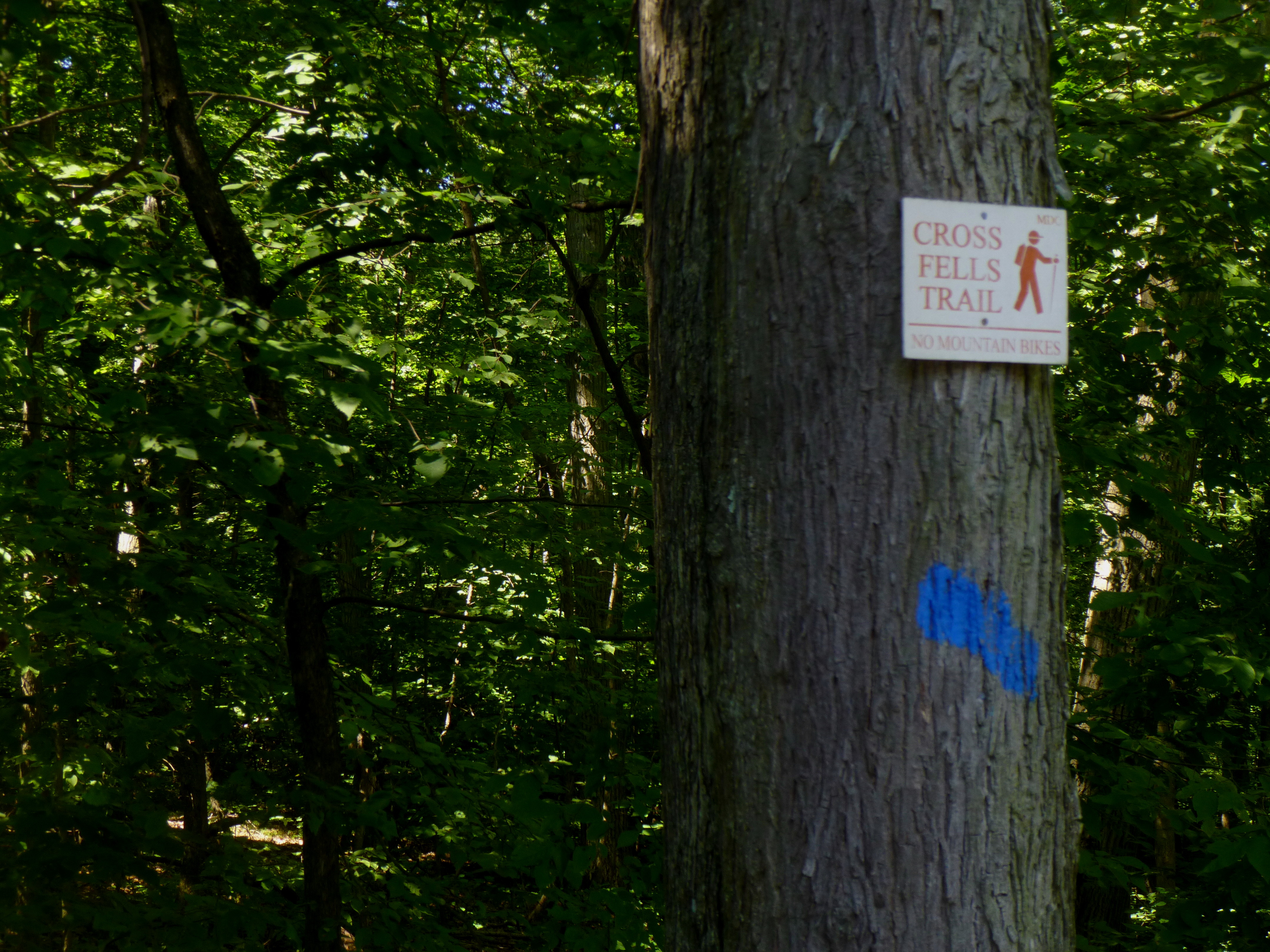
It is important to note that the Rock Circuit Trail does not start here precisely. Rather, the best (and least confusing) route from Goodyear involves following the wide and well-marked Cross Fells Path for around ¼ mile.
Before proceeding, however, consider a short detour at the Cascade Trail turnoff, located just around 25 yards up the Cross Fells Path.
For this detour, follow the Cascade Trail for 0.2 miles to the “Cascade”—a significant rock protrusion known for, of course, its small, 10- to 15-foot waterfall. Unfortunately, on the Sunday afternoon in August when yours truly visited, the cascade was little more than a trickle. Perhaps visit in the spring to make the short trip worthwhile.

Return the way you came. Back at the Cross Fells Path, continue right as the trail gently climbs up into the fells. At 0.1 mile, the Cross Fells merges with East Path, after which the trail cuts west and climbs more steeply toward the Rock Circuit Trail.
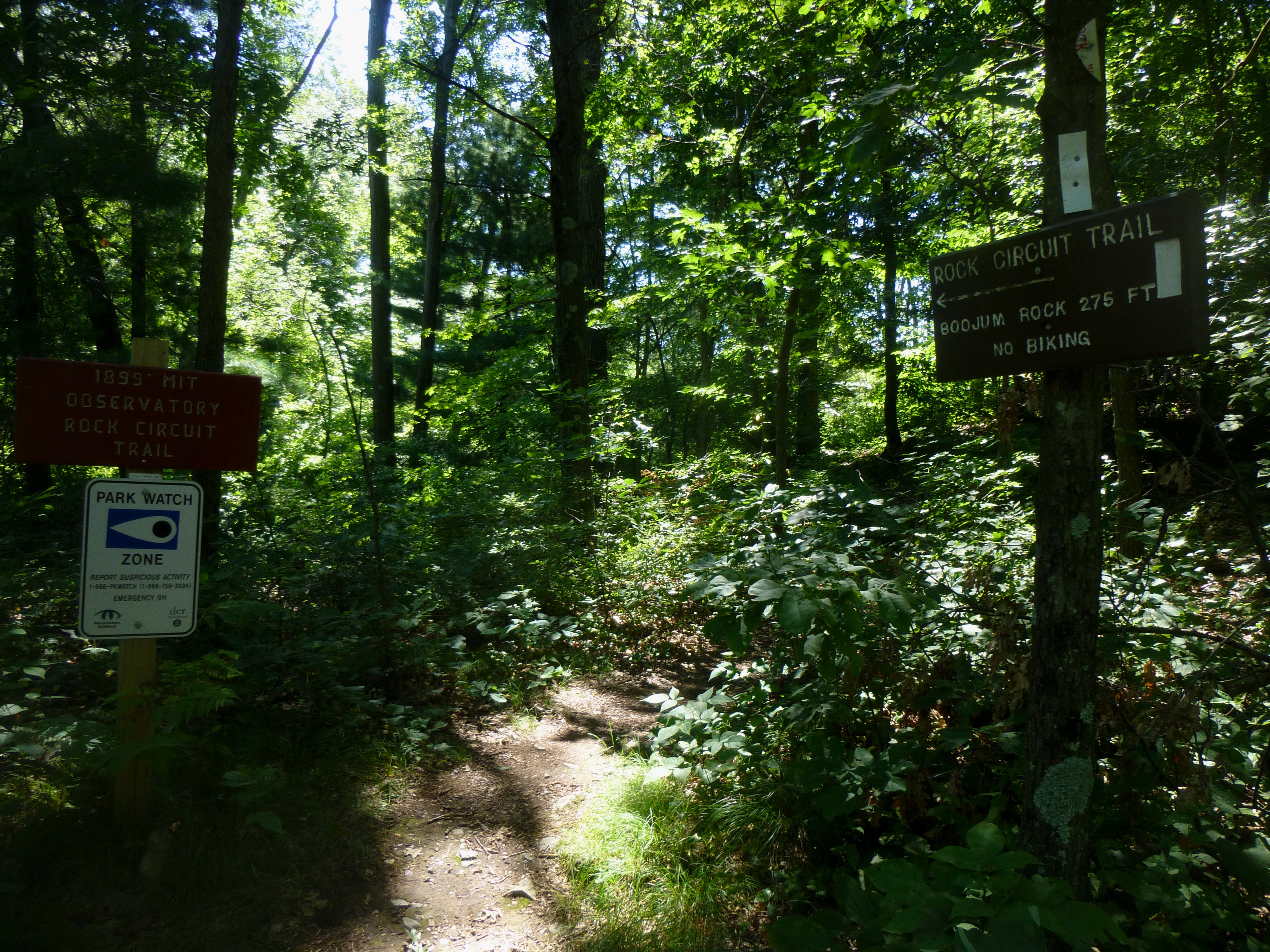
The Rock Circuit junction can be easy to miss. A helpful reminder, however, is to note that the Rock Circuit Trail is located at the top of a hill (not unusual for the 4.2-mile loop). It is marked by two small signs—one marking the route north toward Black Rock, one marking the route south toward Pinnacle Rock. For now, take the southern route (to the left).

Section I: Cross Fells Path to Pinnacle Rock (~0.35 mi.)
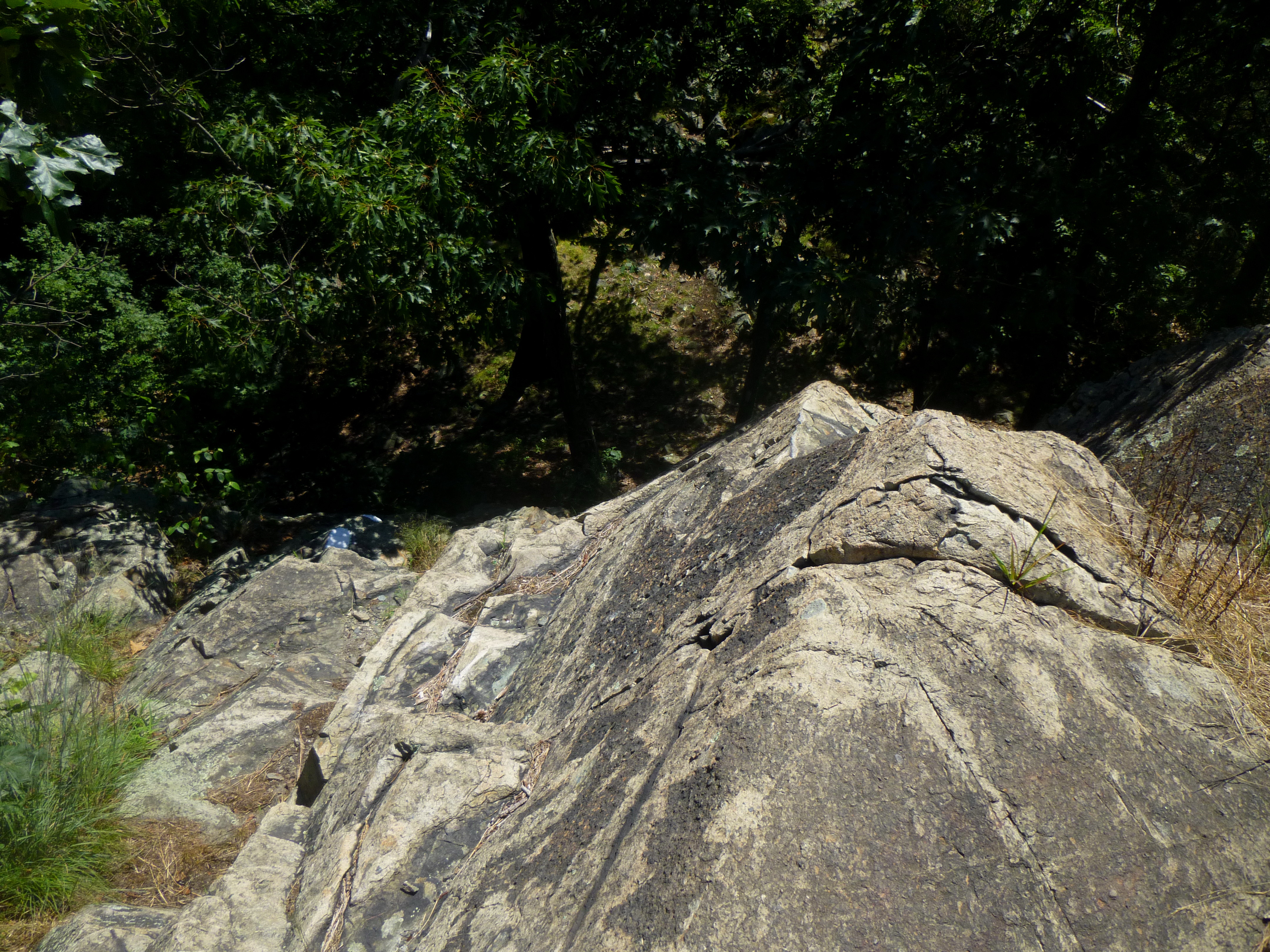
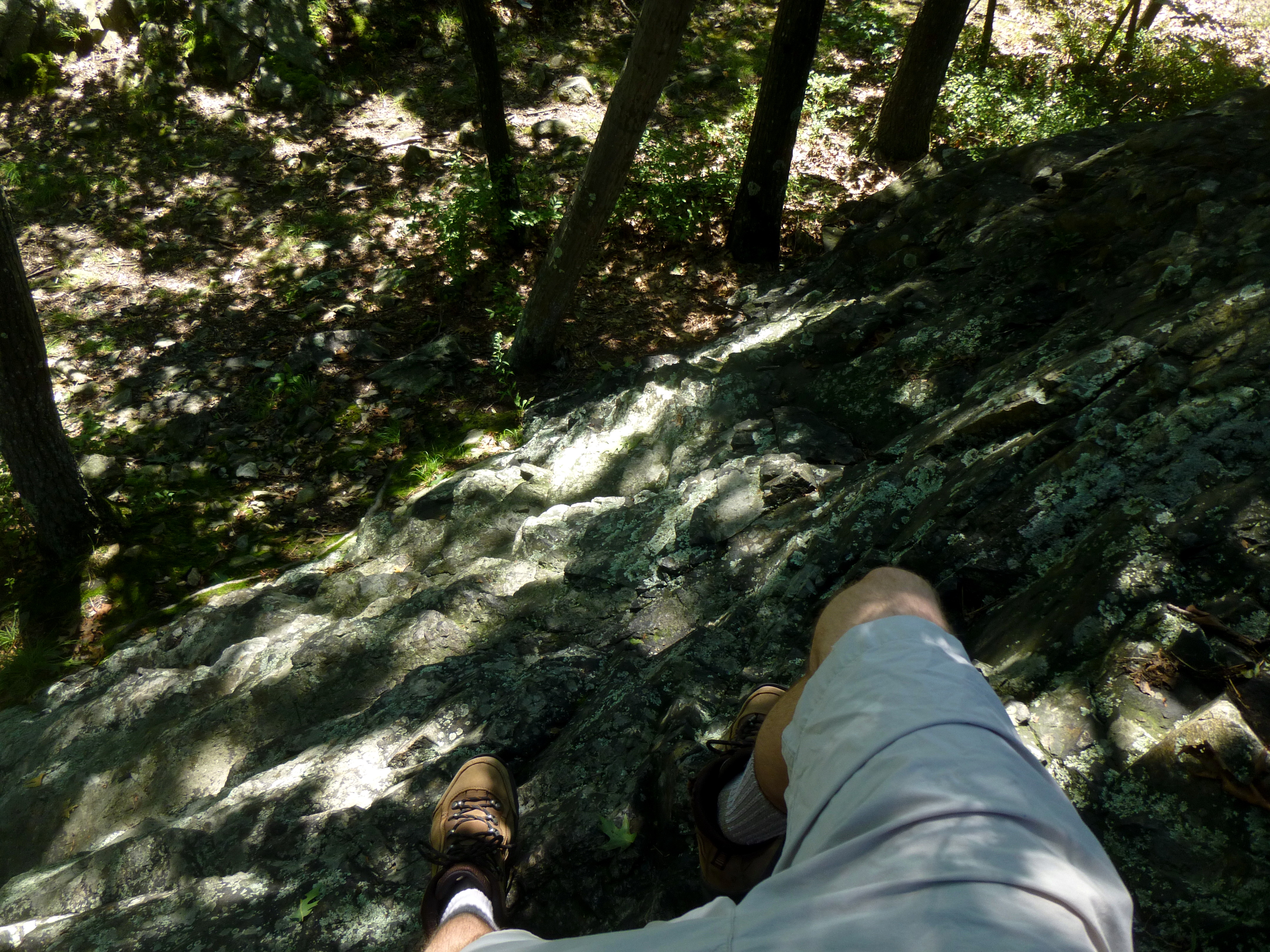
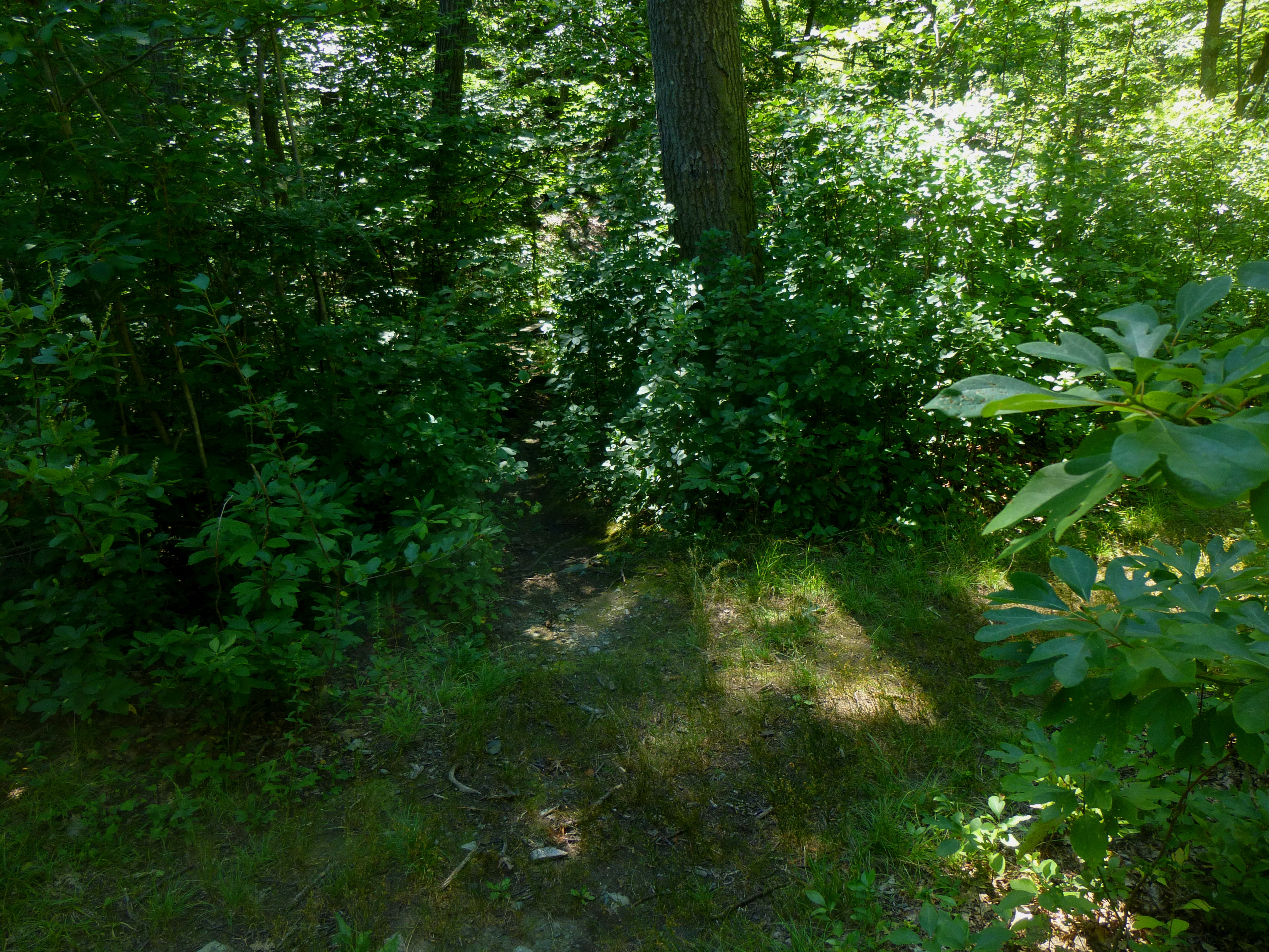
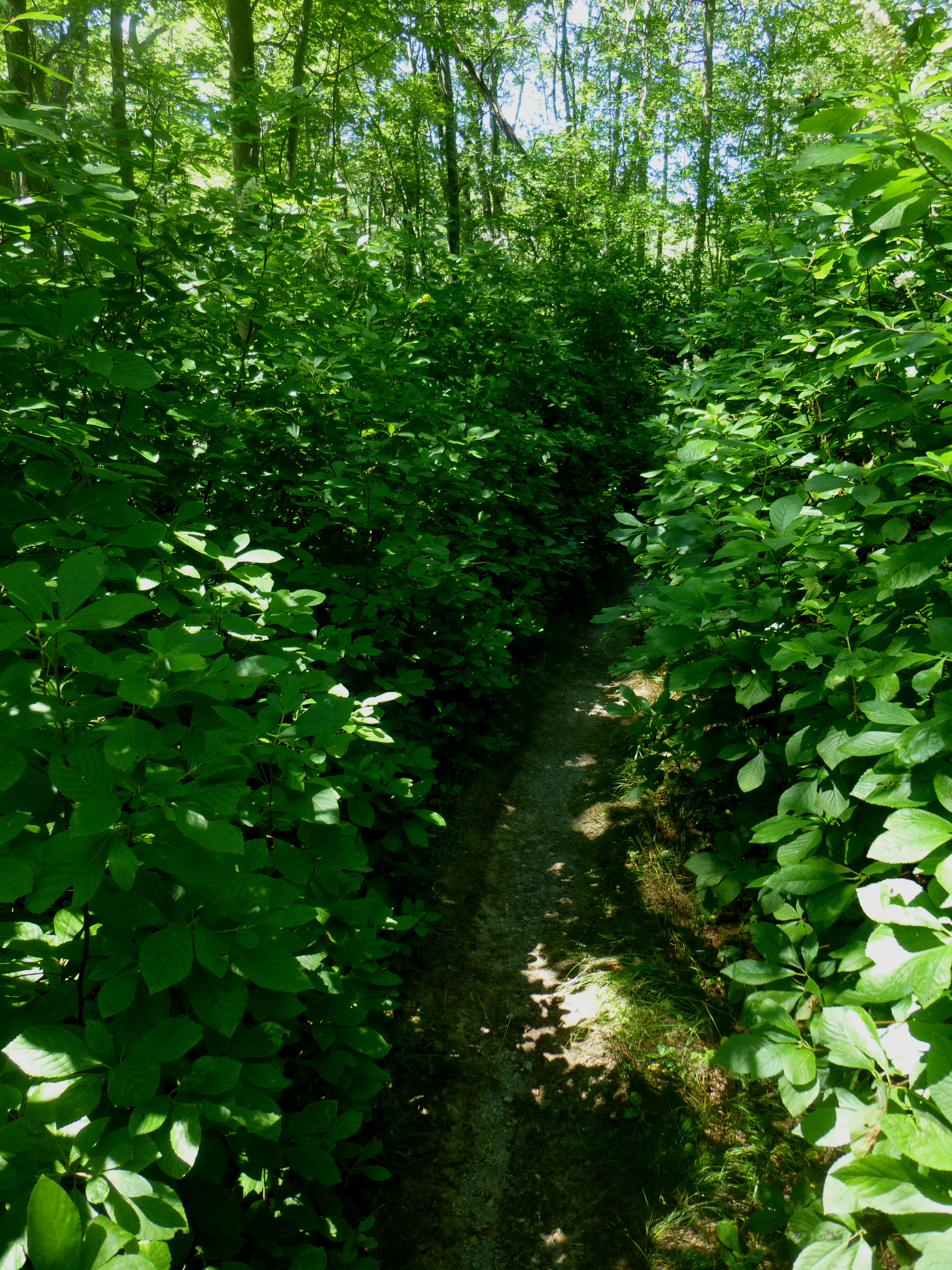
Once officially on the Rock Circuit Trail, two features quickly become apparent. First, the route is often narrow, winding, and not easy to follow. Second, when in doubt where the trail is heading, it is probably a safe bet to assume that it is heading for the nearest granite outcropping.
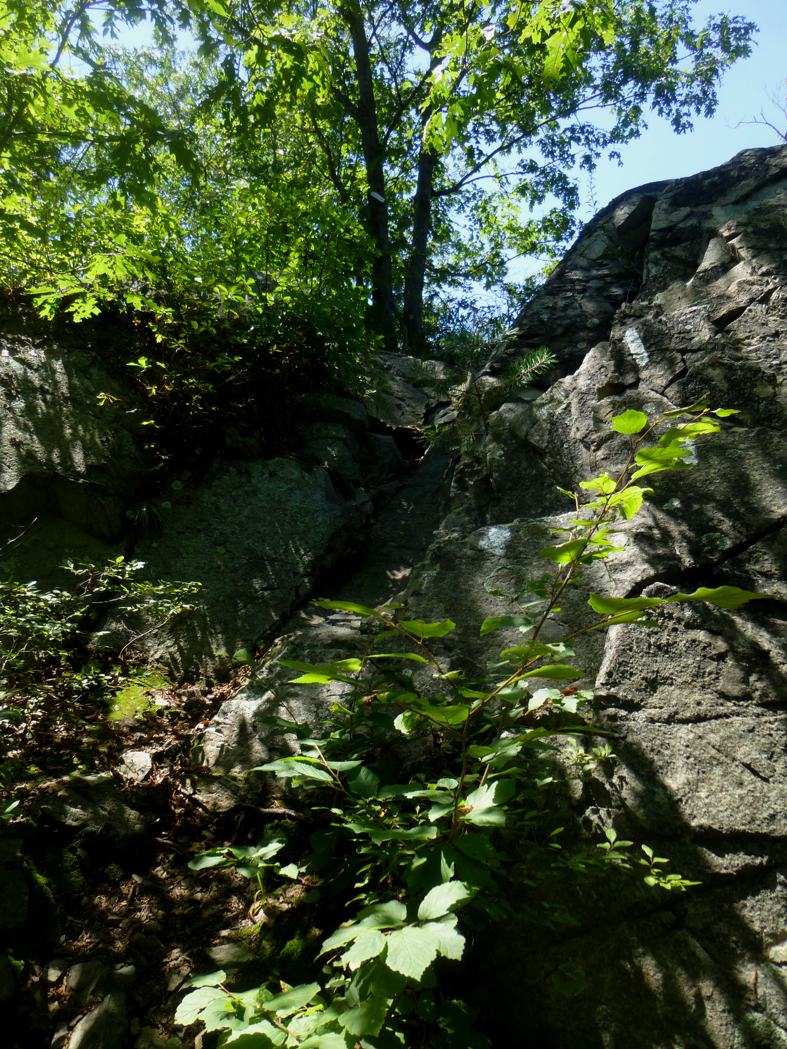
The formula goes like this: scramble up a steep rock crag (sometimes even requiring the use of your hands), crest briefly at the top, then climb steeply down the opposite side. After a short stretch of “traditional” trail weaving through a forested ravine, repeat.

In the first section alone (just 0.2 mile from Cross Fells Path to the East Path junction), expect to scramble up and down four or five rocky crags. One rock in particular involves a somewhat tricky maneuver over (or under) a fallen tree.
Of course, a normal hike would have simply skirted these mighty granite bulges to get from point A to point B. But the original trailblazers, with white spray paint at hand, clearly had a twisted sense of humor…
With this opening adventure behind you, the trail abruptly emerges from the foliage to cross East Path, a grassy but wide route running roughly east-west. The spur trail to Pinnacle Rock is not marked—but an observant hiker can pretty easily spot a narrow path through the trees just across the way.
The short jaunt to Pinnacle Rock is somewhat kinder than the previous section. Approaching the rock from its shady “backside,” the trail actually skirts the edge of the rocky section to the west before ascending south under tree cover.

Within 50 yards, hikers will emerge out from under the trees…at Pinnacle Rock’s scenic summit.
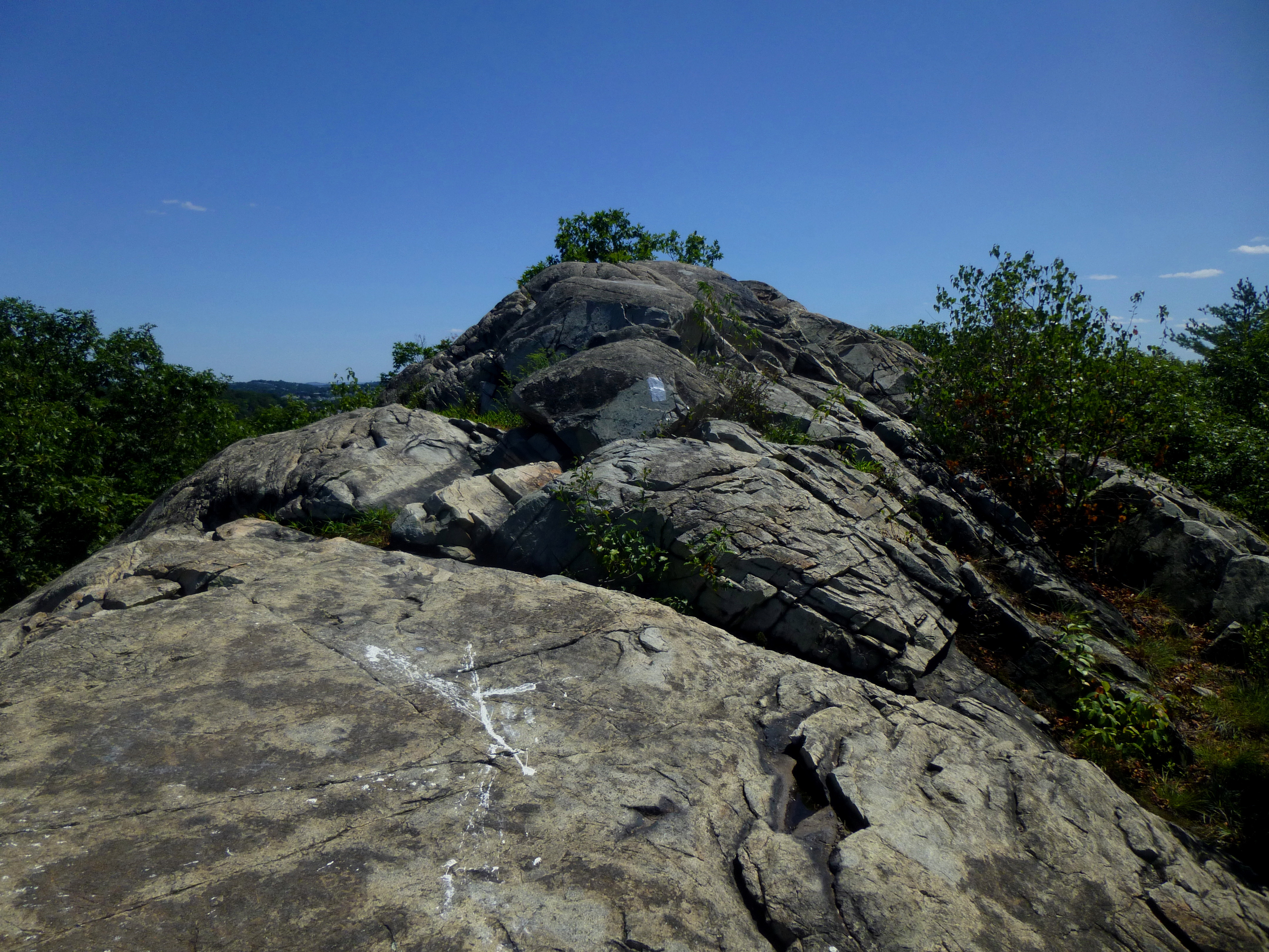
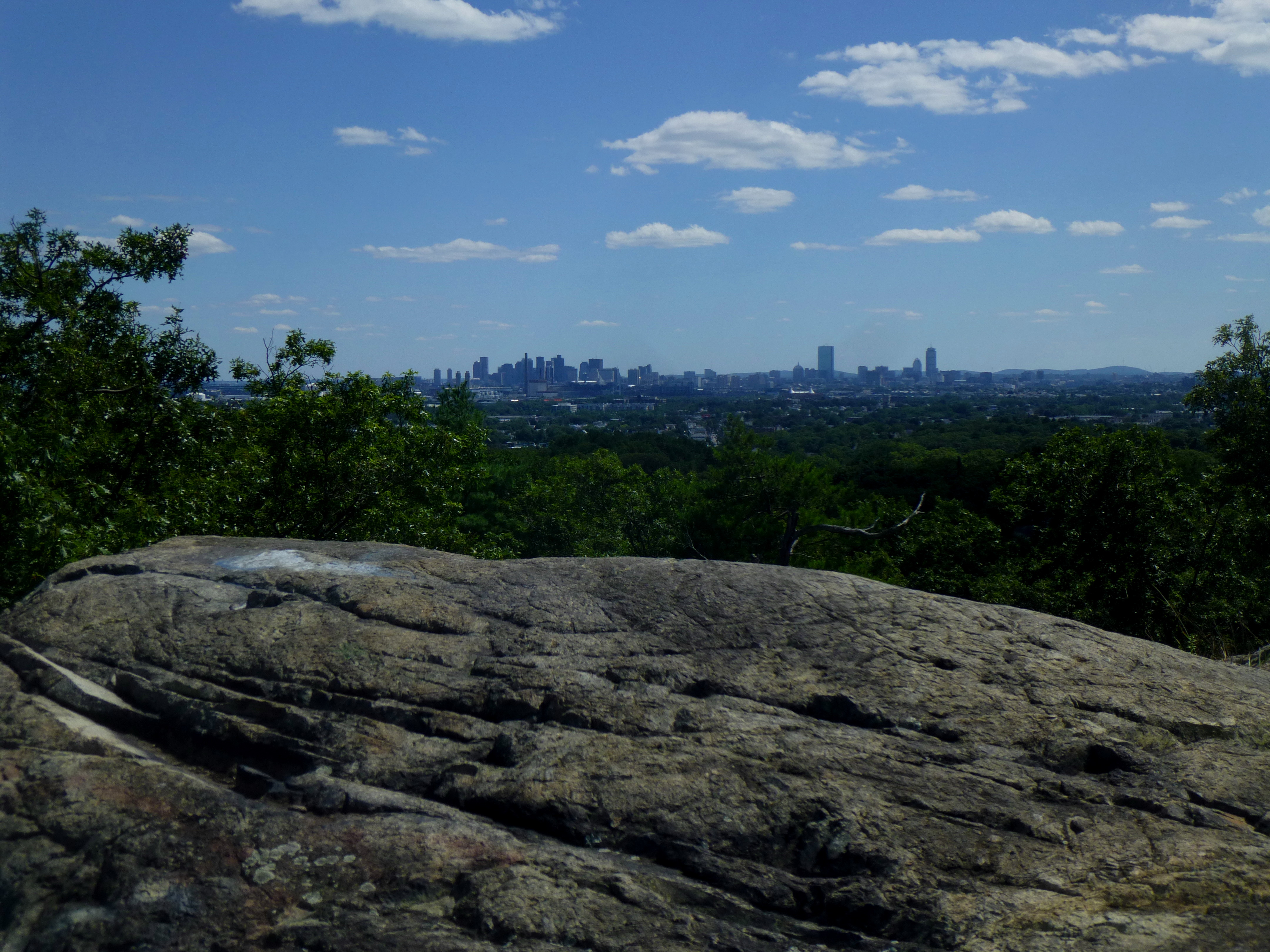
The views from Pinnacle Rock (250’) are stupendous. On a clear day, expect to see downtown Boston to the south and Revere Beach to east. This is a prime spot to take a break for lunch or a snack.

On the beautiful Sunday afternoon that I visited, I had the entire rock to myself. Including the Cascade Trail detour, I reached Pinnacle in around 45 minutes.

Section II: Pinnacle Rock to Boojum Rock (~0.85 mi.)
Returning to the East Path junction, the path from here can be frustratingly difficult to spot.
Emerging from the Pinnacle Rock spur trail, turn left onto East Path and follow the suddenly narrow route through a thicket of greenery. At the first junction, turn left. Although a nearby tree denotes “Pinnacle Path”—which, according to the map, appears to be past the turnoff for the Rock Circuit—continue some 25 yards along the wide, grassy track. A sign marking the Rock Circuit Trail will then come into view off to the right.
Once back on the narrow trail, it is relatively smooth sailing (only a couple steep rocks to tackle) for almost a quarter mile to the Fellsway East road crossing.
At the road, Rock Circuit temporarily meets up with the Cross Fells Path again. After crossing the Fellsway, turn left at the sign denoting “Boojum Rock” thataway.
The trail in this section is almost entirely forested, running through a series of small ravines, but it gradually climbs to an unnamed high point (around 200’) with another nice view of Boston.
The descent from this rock is characteristically steep, but before you know it, you arrive at the next landmark—Jerry Jingle Road, a dirt path that is hard to miss.
Despite being the highest point on the hike (275’), Boojum Rock is noticeably easier to climb than many of the others. Of course, a bit of scrambling is required, but within 0.2 miles of Jerry Jingle, you are at the top. More fine views of Boston and beyond.

With the detour to the Cascade, and a 10-minute lunch at Pinnacle Rock, I reached Boojum within an hour and a half. At a more leisurely pace, expect perhaps 2-2 ½ hours.
Section III: Boojum Rock to Fellsway East (~2.3 mi.)
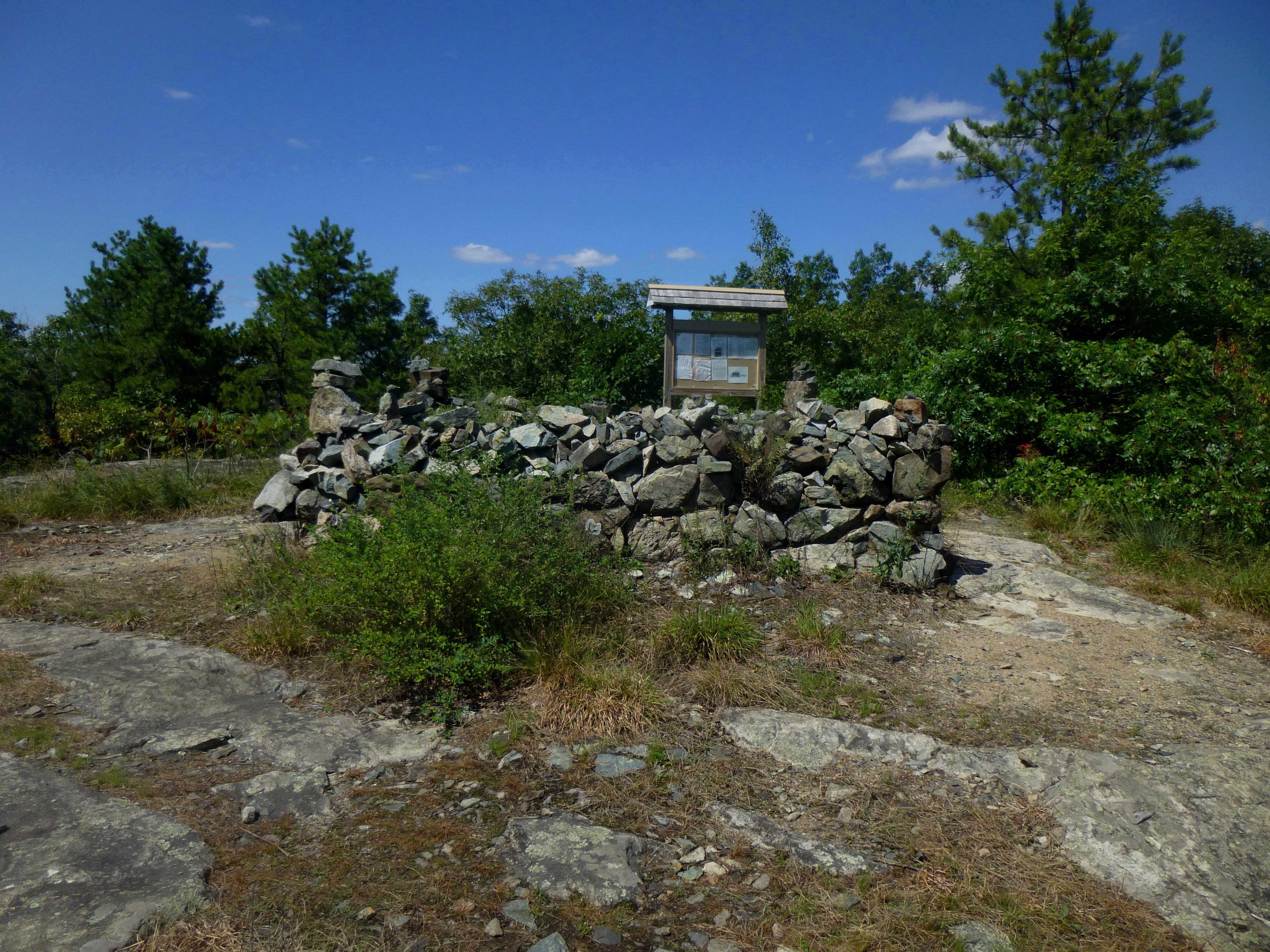
Beyond Boojum Rock, the gradient becomes noticeably milder. Expect to make up for lost time over this 1.5-mile section. The first ¼ mile or so climbs gradually—in mostly exposed sun—to the odd, man-made rock enclosure that is the MIT Observatory, built in 1899. This marks the highest point on the route (around 300’).
Descending from the observatory, the trail dips in and out of a few small, forested ravines. In this section, I saw a beautiful young fawn trotting through the woods. I also spotted my first fellow hiker—almost two miles and 1 ½ hours into the hike.

Soon the trail edges within striking distance of Hemlock Pool Road, which is visible off to the right on two occasions but does not directly intersect the trail. Be sure to keep following the white blazes—in a few spots, it is easy to find oneself wandering off along one of the route’s many deceptive offshoots.
After crossing Hemlock Pool Path (distinct from Hemlock Pool Road, but just as wide), the trail again returns to its signature feature…rock scrambling. At one of the several granite slabs, enjoy a sneak peek of Wright’s Park (owned by the city of Medford) down below—where one can make out, with a bit of effort, Wright’s Pond. This vista marks about the halfway point along the 4.7-mile hike.

2.5 miles into the hike, the trail intersects Woodland Path. A short jaunt west along this track (which doubles as the Cross Fells Path) will lead hikers to the parking area at Parcourse Fitcenter, as well as to Molyneaux Circle (and the 710 and 99 buses). This is, in fact, a more popular alternative trailhead than Goodyear Avenue—but harder to get to on a weekend without a car (as buses run less frequently).
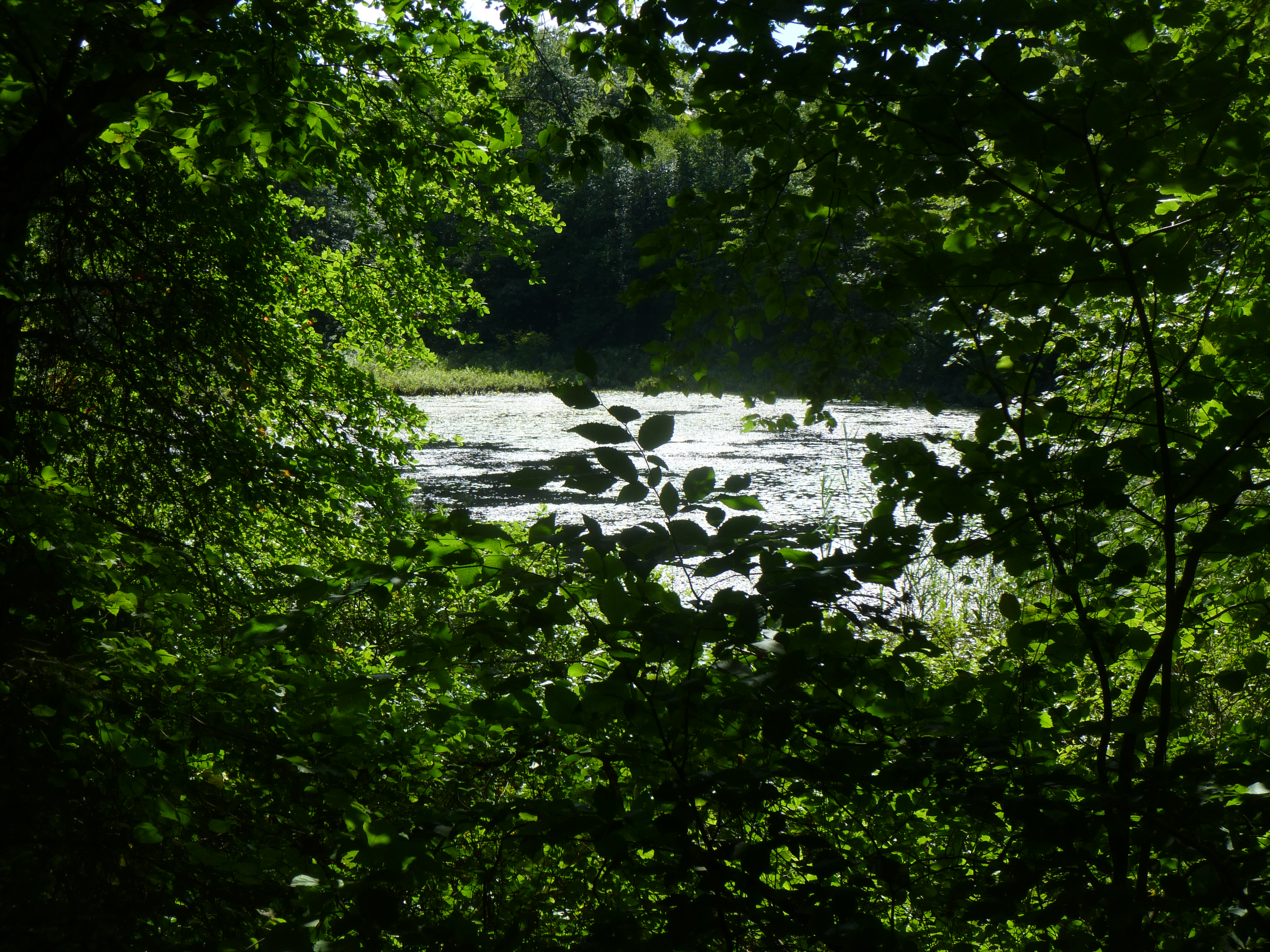
Woodland Path roughly bisects the eastern section between Woodland Road and Fellsway East between its rocky south and smoother (and kinder on the legs) north. Continuing on, the Rock Circuit route to Shiner Pool (a still, lilypad-filled pond) is wide and relatively flat.
At Shiner Pool, the trail finally crosses Hemlock Pool Road. At the gravel road, turn right, then a quick left to again catch the narrow but signposted Rock Circuit path.

Follow the trail for a quarter mile to Reservation Path, where a fence marked “Fells Reservoir MWRA” (or something to that effect) signals that the man-made lake is just beyond. Follow the road to the right for 25 yards for a quick peek. It’s nothing special—but pleasant enough for a photo or two.

Finding the Rock Circuit Trail again from here can be a bit a tricky. Doing so requires following the Wyoming Path, then Pipe Line Road (to the left) for about 150 yards. Subtle white blazes on the trees to the left serve to direct traffic. The marked Rock Circuit Trail starts up again off to the right along Pipe Line Road.
From here, it is about 0.6-0.7 miles to Fellsway East, again ascending and descending a series of granite obstacles. At one point in my hike, I found myself off the trail—having veered onto what in hindsight I discerned to be Wyoming Path—but fortunately the “new” trail wounds its way meeting back up with Rock Circuit after about ¼ mile.

(Note the orange blazes just before reaching Fellsway East road: this is the Rock Circuit “Connector” Trail, a shortcut back to the MIT Observatory.)
Section IV: Fellsway East to Cross Fells Path (~0.7 mi.)
Crossing Fellsway East, of course, means one is back in rock city. The trail almost immediately heads uphill to an outcropping unique for its views of the road, some 20 feet below.

Hikers reach the next named destination—White Rock (256’)—after about four steep ascents, but the rock itself is not quite as scenic as Boojum or Pinnacle. Walk a little farther beyond the summit, however, to catch a nice view of the sleepy town of Melrose from a small ledge protruding out over the town.
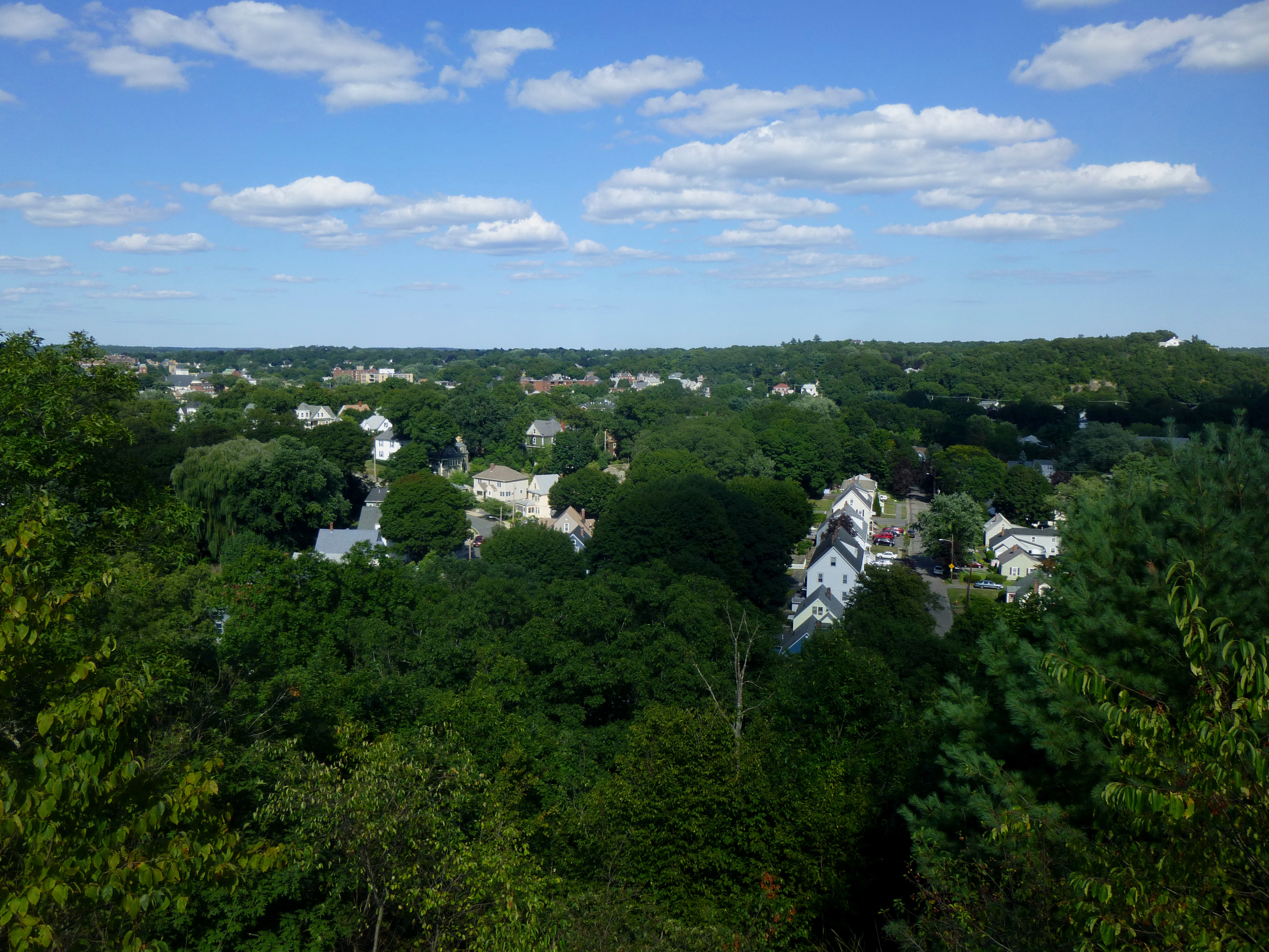
Speaking of Melrose, it is really Melrose Rock that offers the better vista—visible from White Rock and located about 0.1 mile farther down the trail. Another great place to stop for a snack break; by now, your legs—and maybe stomach—are likely to be getting impatient.

Peering south from Melrose Rock, it is easy to spot the next destination. It is the yin to White Rock’s yang—Black Rock.

Accessing Black Rock, of course, involves slogging another ¼ mile, but by this time the weariness is accompanied by a comforting sense that the end is near.

And the views north and east from Black Rock are quite pleasant. Melrose is perhaps much prettier from above than from down at surface level…

From Black Rock, the trail has one or two rocky crags left in store before meeting up again with the Cross Fells Path—the start and end point for the loop. Right around here, I ran across a particularly aggressive woodpecker!
Getting back: Cross Fells Path and Goodyear Avenue
Cross Fells Path—a wide and well-marked route—is a likely to be a welcome sight. Simply follow the path for ¼ mile, all downhill, back to Goodyear Avenue. From here, retrace your steps from a few hours before—right on Washington Street, then a straight shot to Oak Grove T stop.

For the entire 4.7-mile route—because of its confusing and heart-pounding nature—allot around 4-5 hours; less if you already know the area and/or have considerable experience with rock scrambling or bouldering. Including the trip to and from Oak Grove, tack on an extra half-hour.

Hi Andrew. Great blog! I stumbled on it after googling “Middlesex Fells MIT observatory” (after stumbling upon that strange site (?) on my run this morning). Lots and lots of stumbling all around – certainly on the Rock Circuit Trail! Thank you for confirming my suspicion that the trail run was in fact “strenuous” by standard measurements. Ha! I only completed half of the full circuit in about 45 minutes. It certainly is a hidden treasure if you don’t mind climbing and getting a little bit dirty. Also, happy coincidence: I am a fellow Hoya! COL ’02! Spend several years living on Cap Hill after graduating, too. Love it there. I do take issue with your comment about Melrose, however. Melrose is a BEAUTIFUL city from every angle, hi or low, with gracious Victorian homes, tree lined streets, and a bustling downtown. So there. Next time you’re in this neck of the woods (literally) you should give it a second look. 😉 And if you’re curious about other trails and runs in the area, check me out at creakyjointsrunning.wordress.com HoyaSaxa!
Hi there! Glad you enjoyed the post. Being almost 3 years since I wrote this post, I blame my youthful ignorance for mischaracterizing Melrose! I’ll definitely check out your blog. Hoya Saxa!
We did this hike on a beautiful but hot Saturday afternoon in August. We stopped at the New England Sanatorium because it took us 2-1/4 to 2-1/2 hours to get there and the kids were done. It was a fun and challenging hike. There are often ways to get around the big rocks instead of over and this was good because the dog had a hard time scrambling down some of them. We would not recommend bringing a dog.
Pingback: Top 10 Hikes of 2016 | Live and Let Hike
Pingback: Top 10 Hikes in 2017 | Live and Let Hike
Pingback: Top 10 Hikes in 2020 | Live and Let Hike