
For 296 miles, the restless Pacific Ocean laps up against the Oregon Coast, producing chilly beaches, windswept rock outcrops, and imposing sea stacks. While some more peaceful, wide-open beaches may be found further south in California, the word that best describes the Oregon seashore is rugged. What Maine’s Acadia National Park is to the eastern seaboard, the coastline of the Beaver State is to the west: picturesque and mysterious, the jagged bluffs and craggy capes of the Oregon Coast are an excellent hiking destination.
The stretch of coast in southwestern Oregon is particularly spectacular, highlighted by the Samuel H. Boardman State Scenic Corridor, which covers 12 miles of coastline between the towns of Brookings and Gold Beach. The park’s closest circuit hike to Brookings is the Cape Ferrelo Loop, which covers a little over a mile and is a relatively easy jaunt. From the headland, hikers get panoramic, unobstructed views of the Pacific Ocean and the surrounding shoreline to the north and south, making this a must-see destination along the Oregon Coast Highway.

The hike
There are more than a dozen trailheads in southwest Oregon’s Samuel H. Boardman State Scenic Corridor, and Cape Ferrelo Viewpoint is the second southernmost of the bunch. From central Brookings, follow Highway 101 (Oregon Coast Highway) northward for roughly five miles; after passing the turnoff for the Lone Ranch Picnic Area, look for the marked spur road to Cape Ferrelo Viewpoint. Follow the paved track to its end, culminating in a circle with parking along the curb. (Note: If coming from Gold Beach or the north, follow Highway 101 to mile marker 351.9.)
At the parking area, visitors will observe the Oregon Coast Trail (which spans the entire coast of Oregon) heading both north and south. Follow the southbound track, which immediately cuts through a thicket of dense hedges—this is salal, a waxy shrub that is ubiquitous along the Oregon coast. Towering above is a stand of Sitka spruce, the most common conifer in the area.

After about 200 yards, the trail splits at an unmarked junction. Heading left is a short spur that leads to a bench overlooking Lone Ranch Beach, with numerous sea stacks beyond. On clear days, one can see as far as Crescent City and the northern California coast.

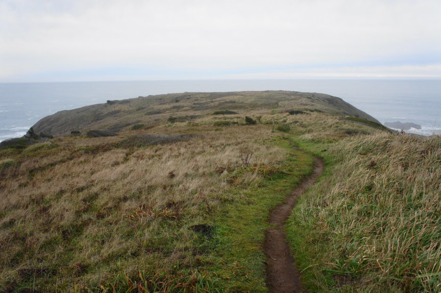
Yet this is only a teaser for the viewpoints to come, so backtrack to the junction and turn left on the other fork, continuing toward Cape Ferrelo. From here the onward trail enters a dark passage—a tunnel in the trees formed by a thicket of Sitka spruce—producing a brief spooky feeling as hikers continue. Beyond the tunnel, the landscape opens up, revealing views both southward and to the north. Here there is another junction, with the main trail heading straight while a grassy path comes in from the left. This is the start of the loop section.

Bear right first, climbing up and over a small hillock, then descending to an open plain. One can begin to see the edge of the cape by now, and the well-trodden track continues westward toward the ocean. At ¼ mile (not including the initial spur), there is a lean sign for the Coast Trail; continue straight as the path treads closer to Cape Ferrelo.

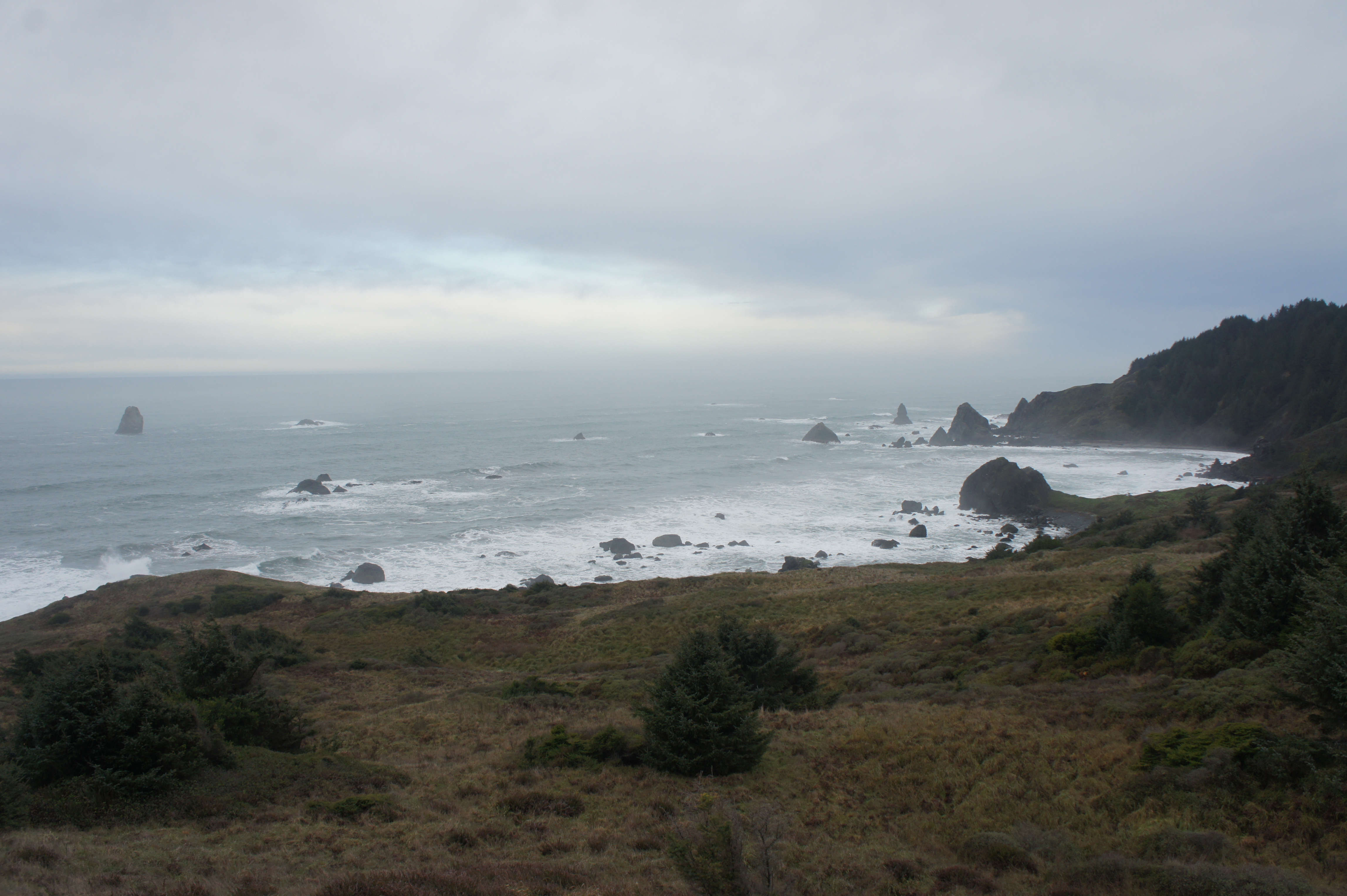
About 2/10 mile later, the trail reaches the tip of Cape Ferrelo, where the flat grasslands of the headland give way to near-vertical cliffs, dropping several hundred feet to the turbulent ocean below. While the views due west are of endless sea, one can see more sea stacks to the north and south.

Up the coast, the shoreline juts out briefly at House Rock, with the onward shore obscured by the spruce-lined bluffs. The continuing trail wraps around to the south, providing even better vistas of the Brookings area, with Twin Rocks and Goat Island visible in the distance.

From this southward view, the trail begins to fade, and multiple paths bear off in different directions. It is thus a bit of a choose-your-own-adventure to complete the loop; generally hugging the hillside, descending briefly (but not too much), is a good move. This eventually connects back with the grassy path that reconnects with the second junction near the start of the hike. From here, pass again through the spruce tunnel and pass the initial fork to return to the trailhead.
All told, the Cape Ferrelo Loop is a relatively easy, one-mile stem-and-loop with magnificent seaside views and offers a nice introduction to the extensive trail system of Samuel H. Boardman State Scenic Corridor.

Pingback: Humbug Mountain Trail (Humbug Mountain State Park, OR) – Live and Let Hike
Pingback: How to Elope Along the Samuel H. Boardman Scenic Corridor