At 12,013 feet, Medicine Bow Peak is the highest mountain in southern Wyoming’s Snowy Range, a small but exceptionally scenic slice of the broader Medicine Bow Mountains, which extend into northern Colorado. The peak is accessible via a relatively straightforward climb, with some decent elevation gain but no scrambling or technical climbing, making this a popular favorite of residents in nearby Laramie or Cheyenne, Wyoming. In addition to 360-panoramic views from the summit, the Medicine Bow Peak Loop passes through spectacular meadows and skirts glimmering alpine lakes, making this roughly 7-mile day hike easily one of the most memorable jaunts in southern Wyoming and beyond.


The hike
The downside of relative proximity to Laramie and other prominent towns is that the Snowy Range is often overrun with visitors, with the vast majority concentrated in the handful of square miles surrounding Medicine Bow Peak. Campers, anglers, hikers, and bikers easily fill in the campgrounds and picnic areas around Mirror Lake, just west of Snowy Range Pass (10,847’) and the highest point on the 29-mile Snowy Range Scenic Byway. Plan to arrive early in the day to secure a parking spot at one of the multiple trailheads, a strategy that also helps to avoid the late afternoon thunderstorms that frequent the area in summertime.
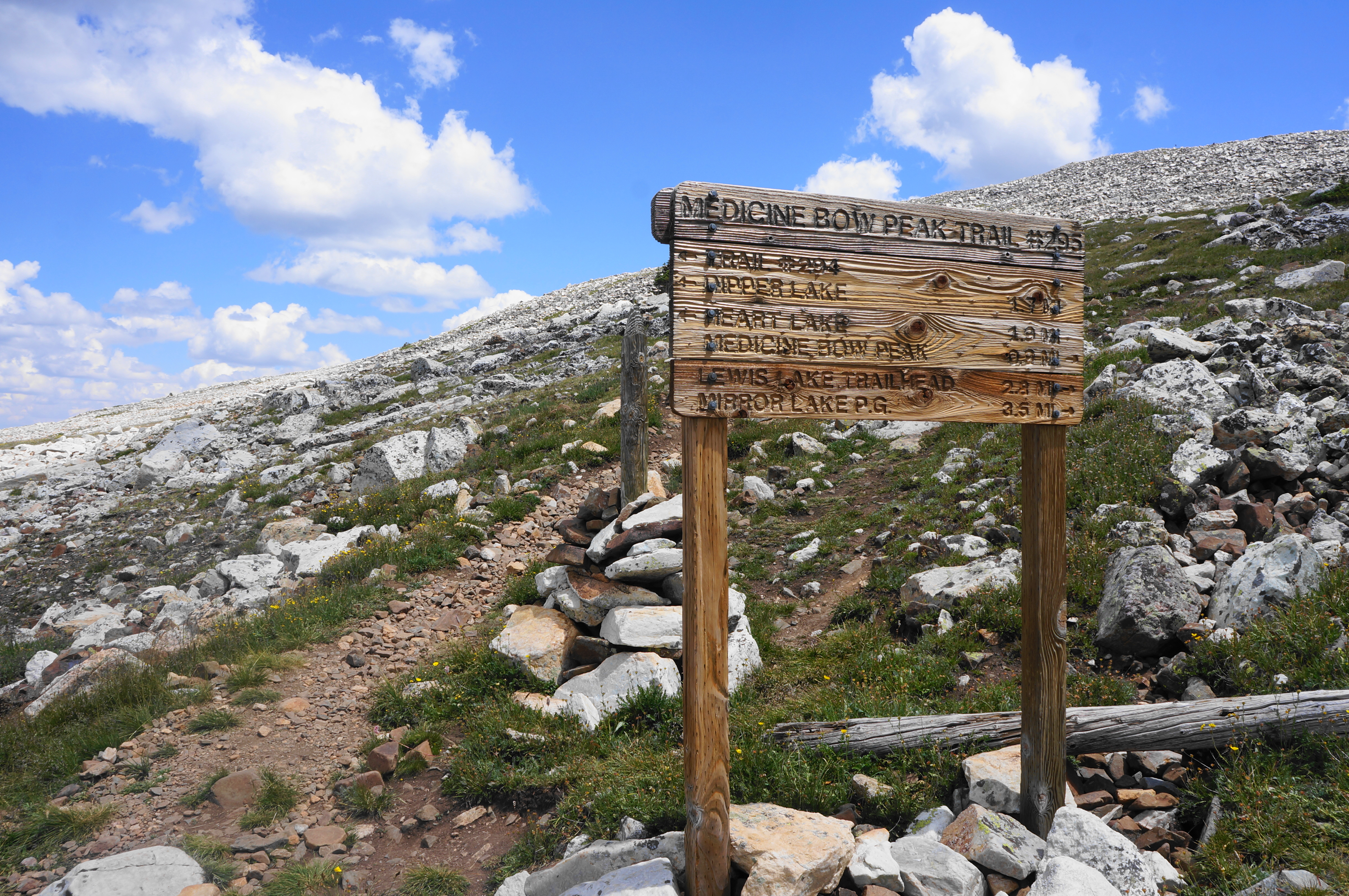
There are several options for accessing the 6.9-mile Medicine Bow Peak Loop, which combines the Medicine Bow Peak and Lakes Trails. One is to start at popular Mirror Lake, although the parking is very limited; the other—and preferred—option is to begin and end at the West Lake Marie Trailhead, located just over a half-mile south of Mirror Lake. Here there is parking for perhaps a couple dozen vehicles, with late-comers tending to park along the shoulder in both directions.
West Marie Lakes Trailhead to summit via Medicine Bow Peak Trail (3.6 miles)
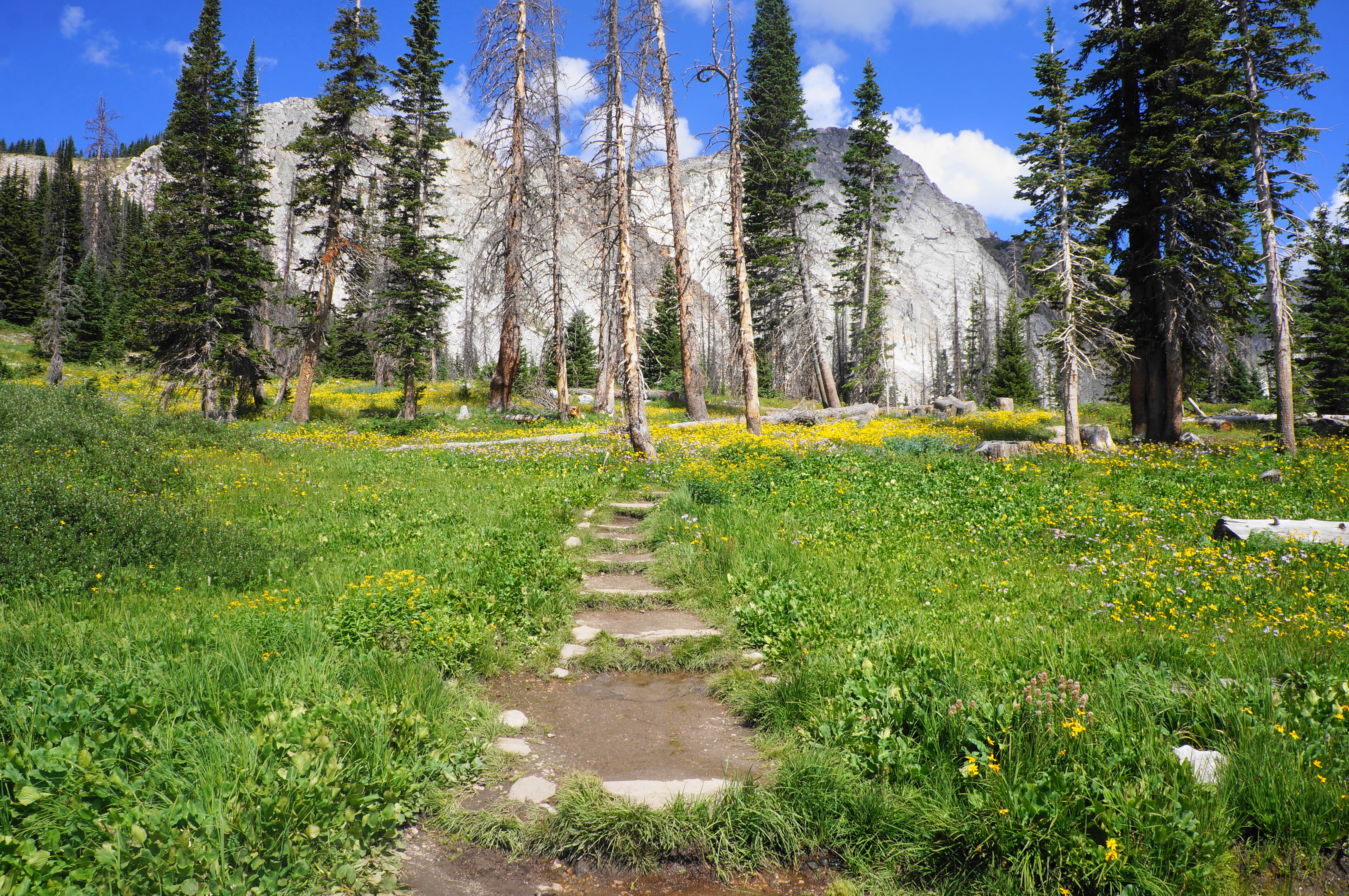
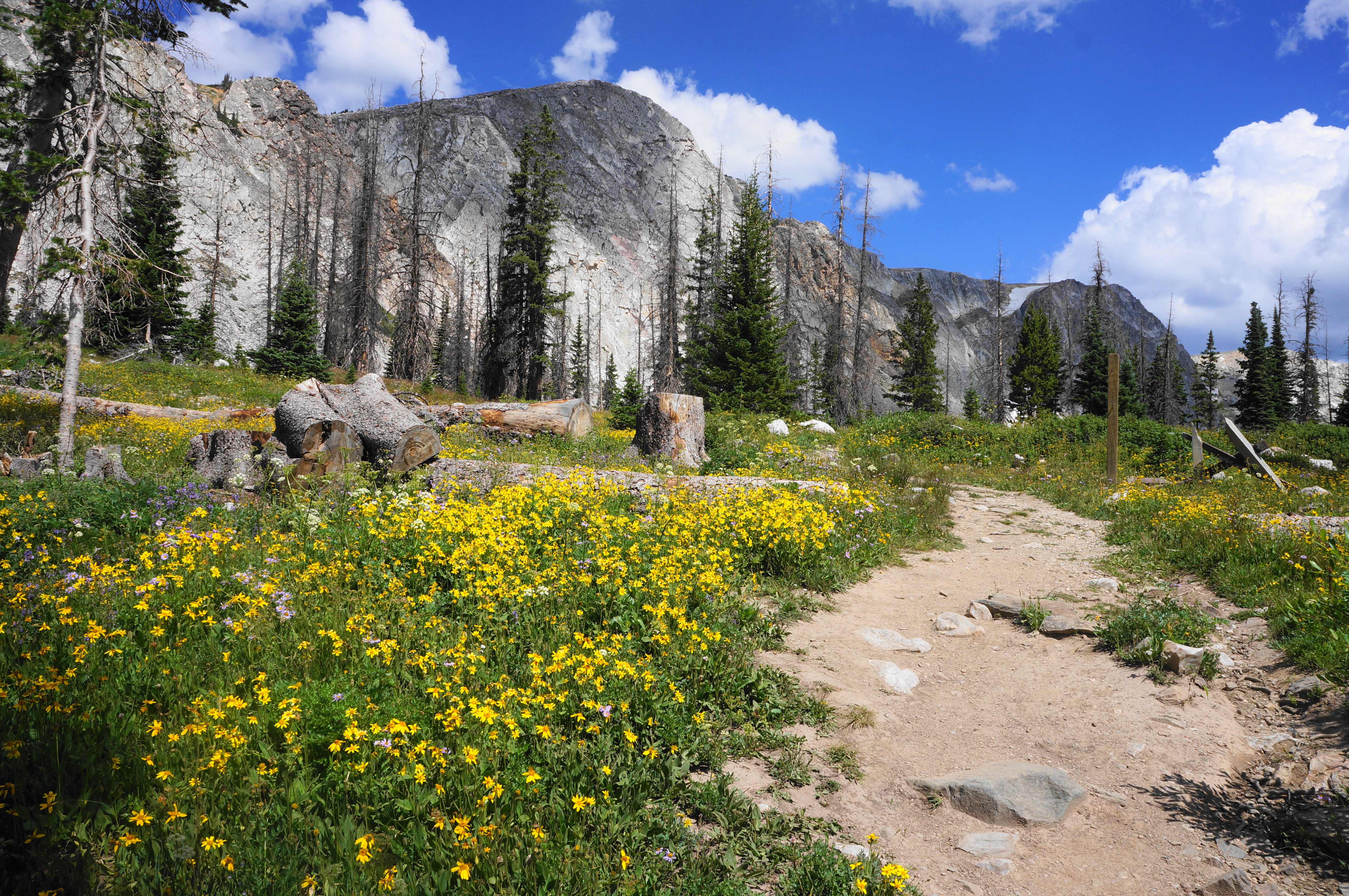
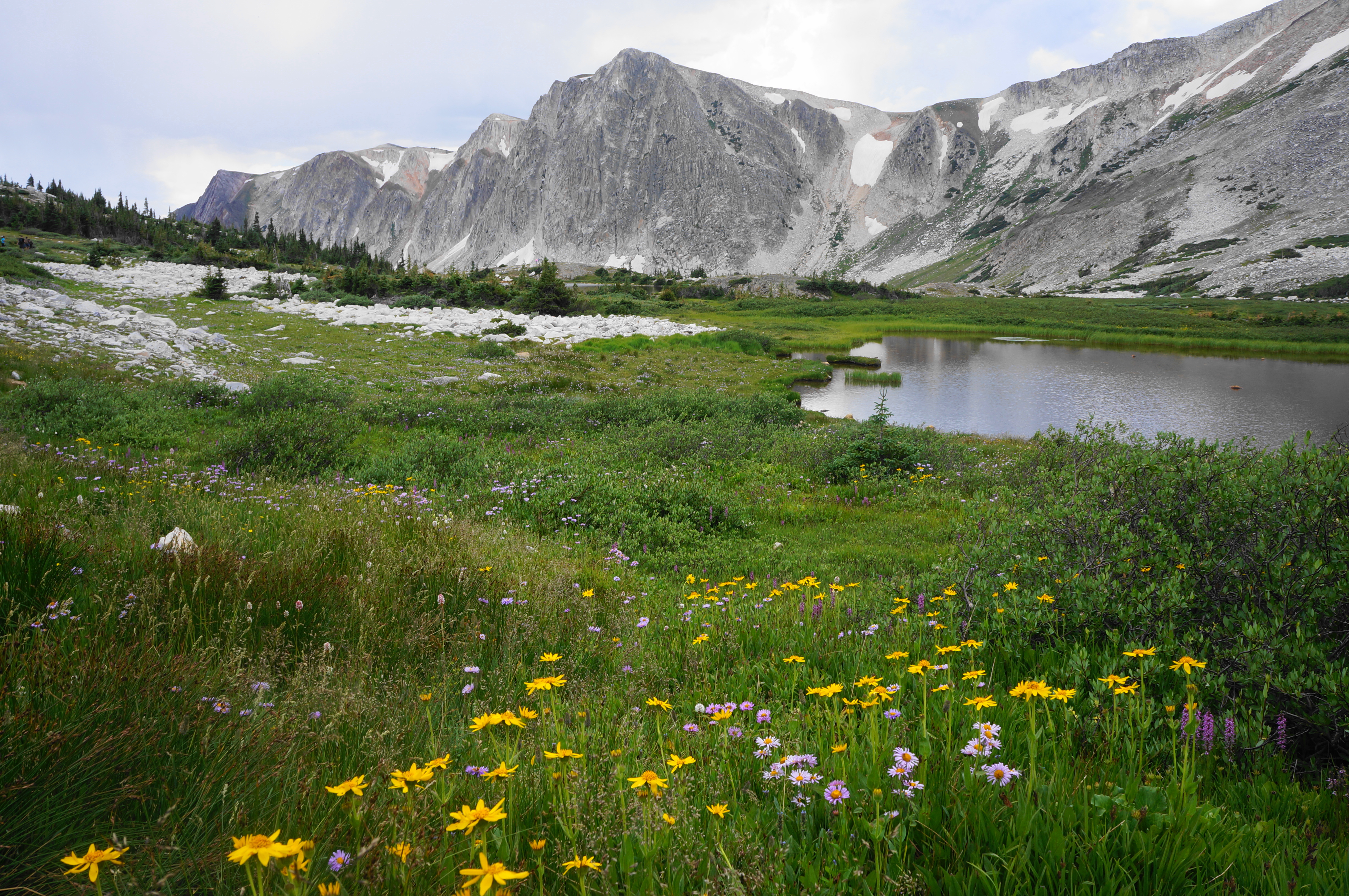
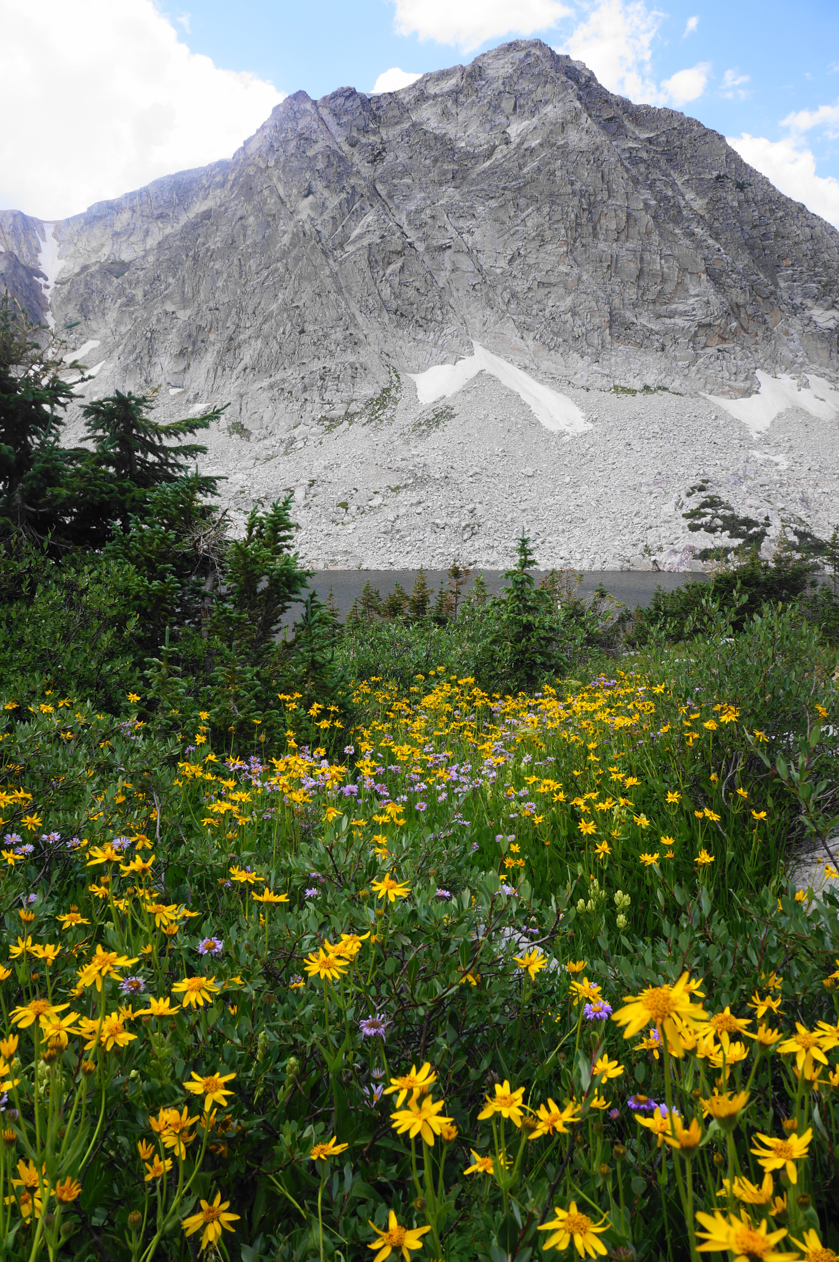
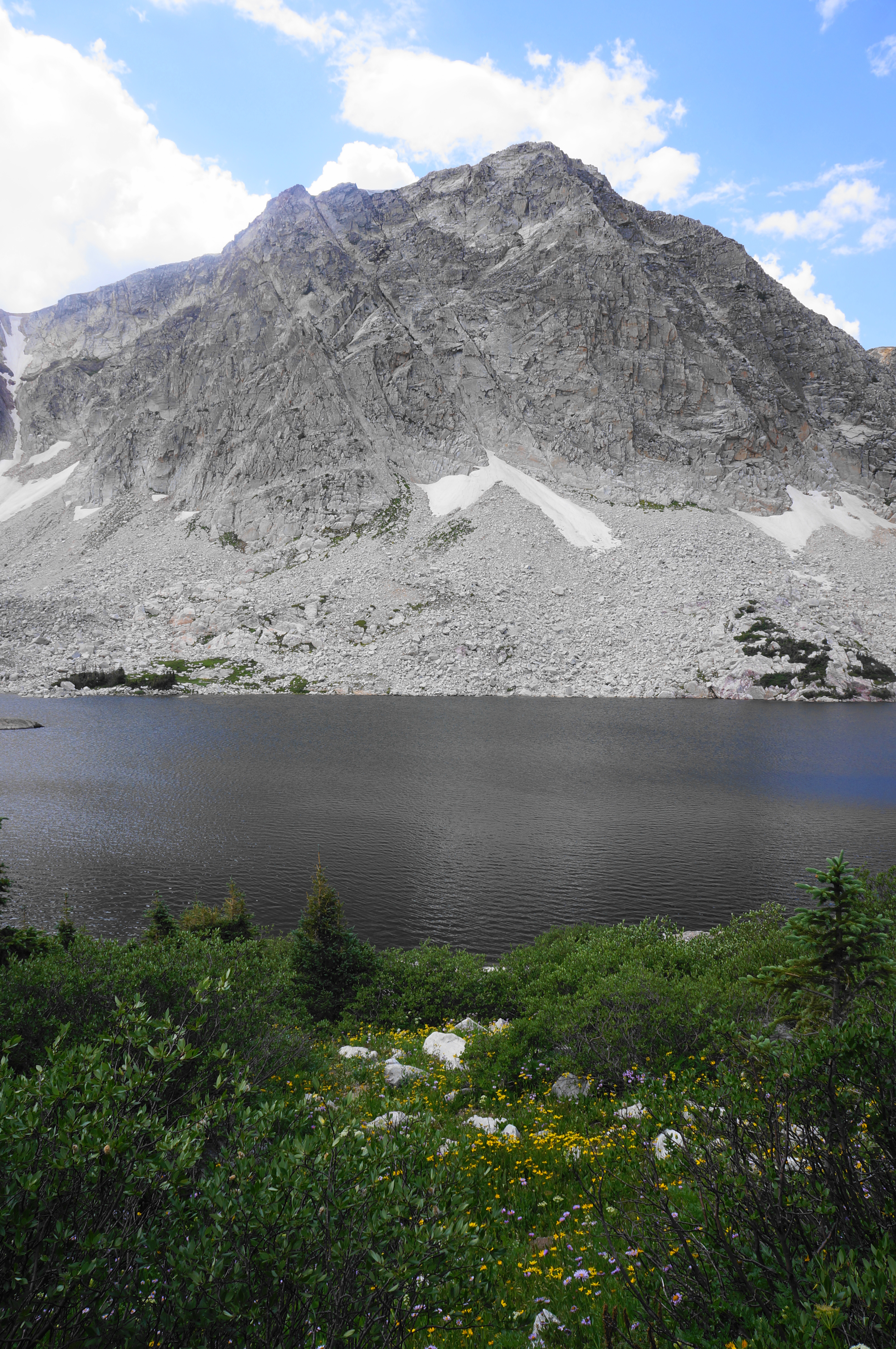
Three distinct trails take off from this starting point: the Lakes Trail, the Lake Marie Falls Trail, and the Medicine Bow Peak Trail. The latter begins by climbing a modest staircase through a clutch of lifeless pines, seemingly marred by weather or beetles. However, the verdant meadow, teeming with wildflowers and beaming with color, more than makes up for the struggling forest. One can also begin to make out the range of precipitous mountains ahead, beginning with The Diamond (11,720’), then Old Main (11,755’), and—in the distance—Medicine Bow Peak (12,013’). The Medicine Bow Peak Trail will eventually tuck behind these peaks to the west and north before summitting Medicine Bow.
After around 75 yards, the trail splits, with a spur heading right to a shelter and picnic area overlooking Lake Marie. The main track bears left, beginning a steady alpine climb. Soon the Medicine Bow Peak Trail treads uphill and southward, away from the lakes and peaks before rounding a right-hand switchback that carries hikers up a pine-studded ridge.
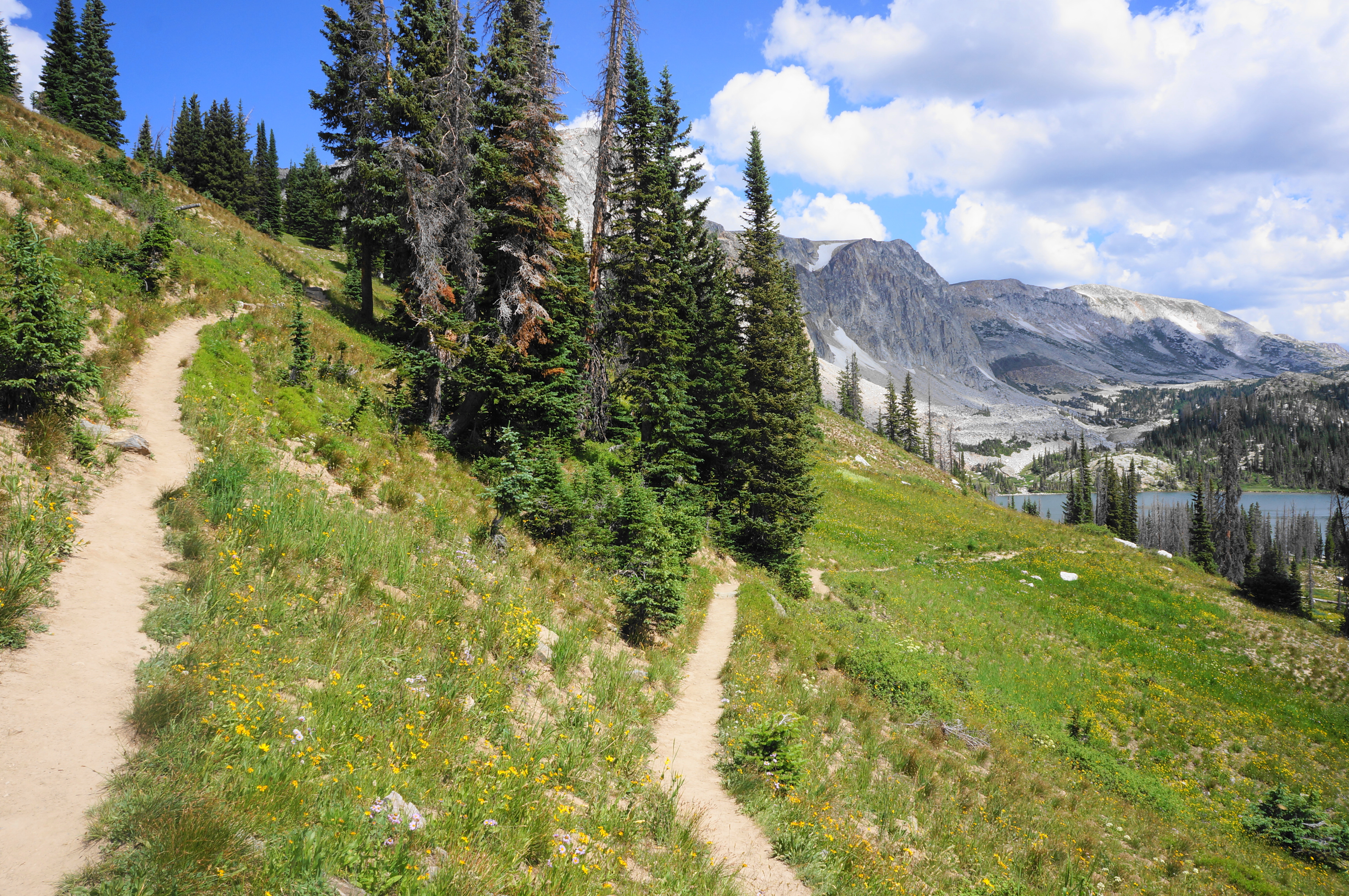
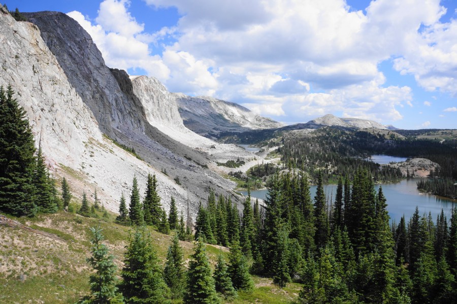
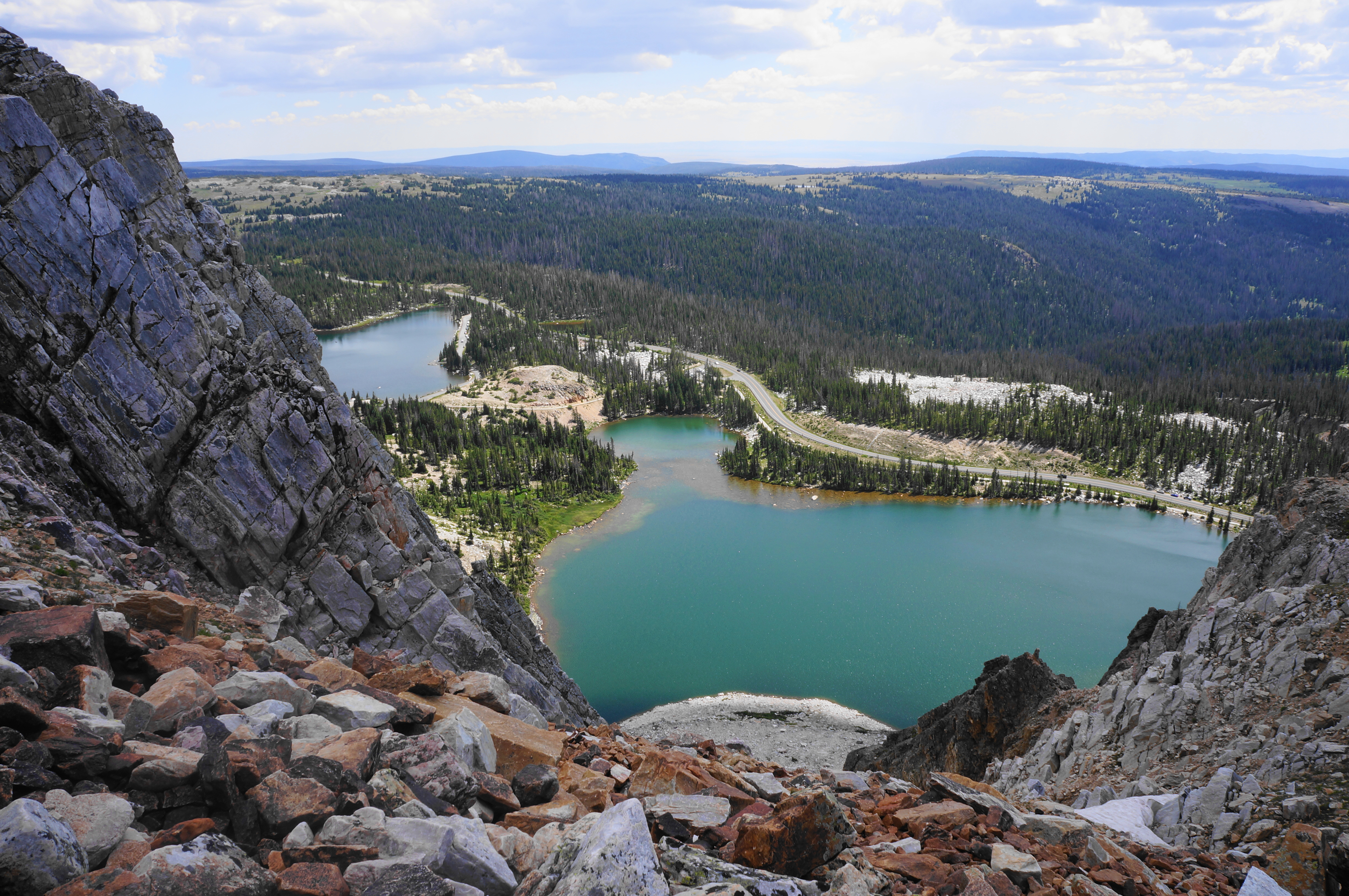
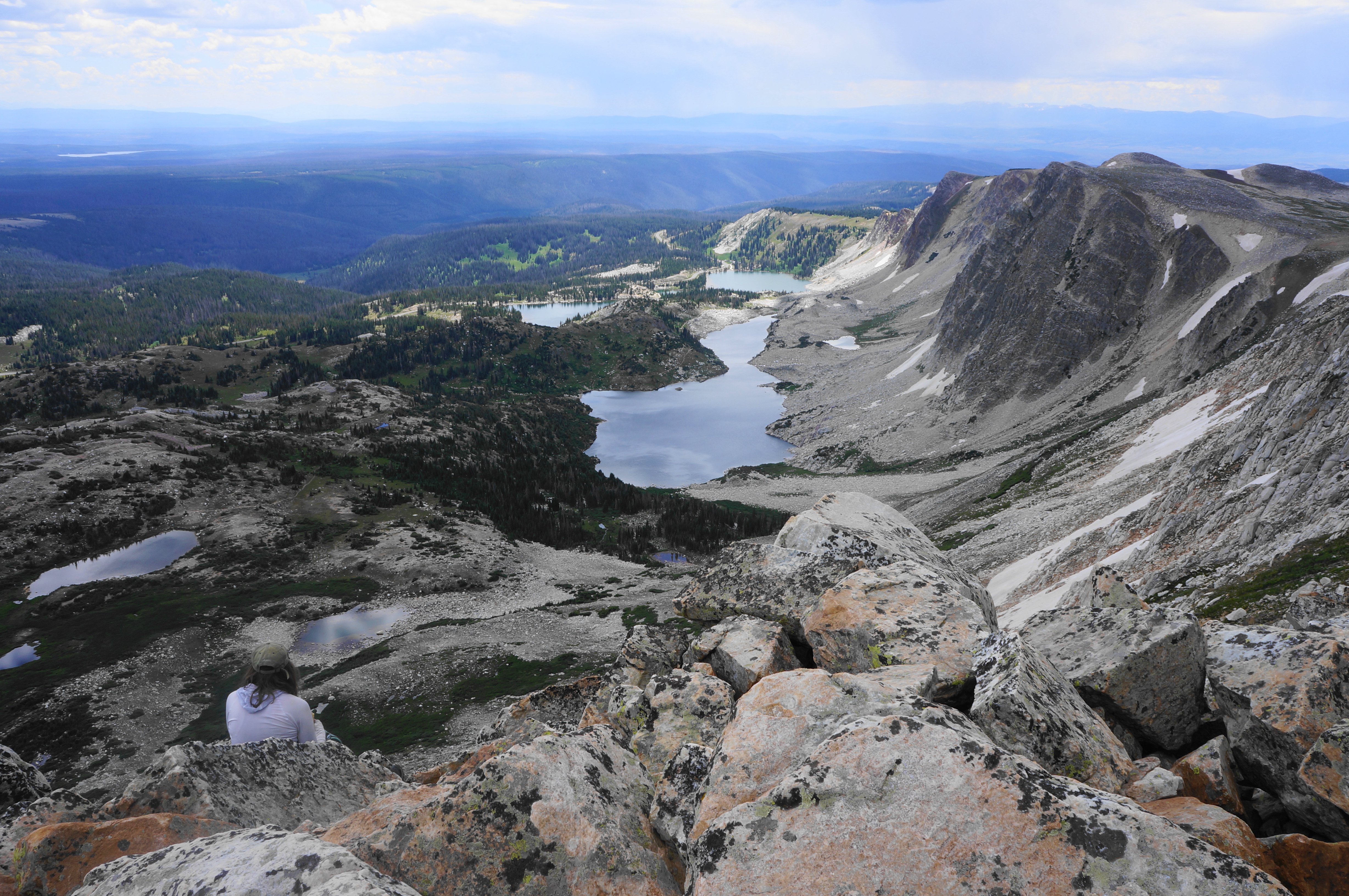
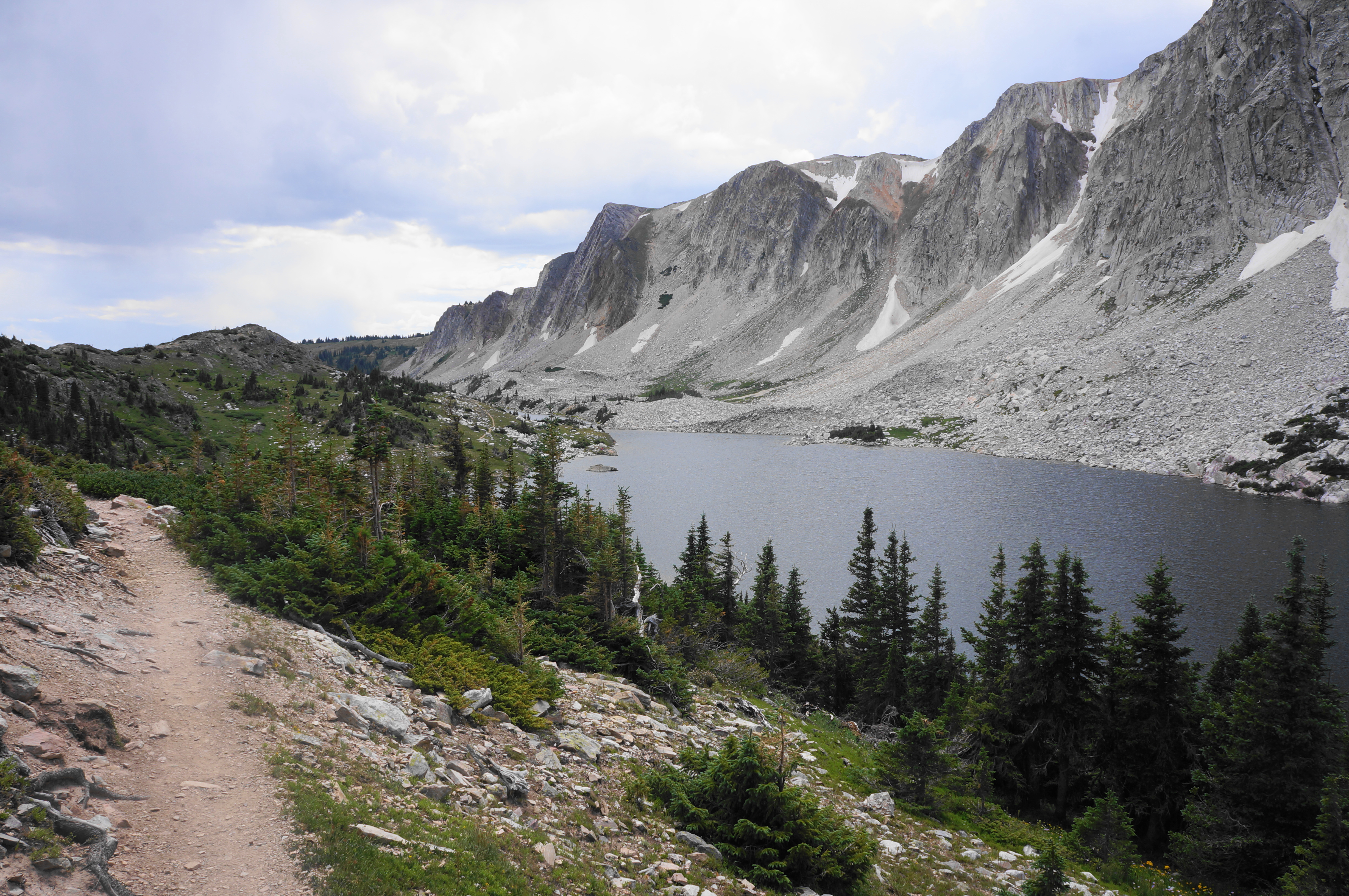
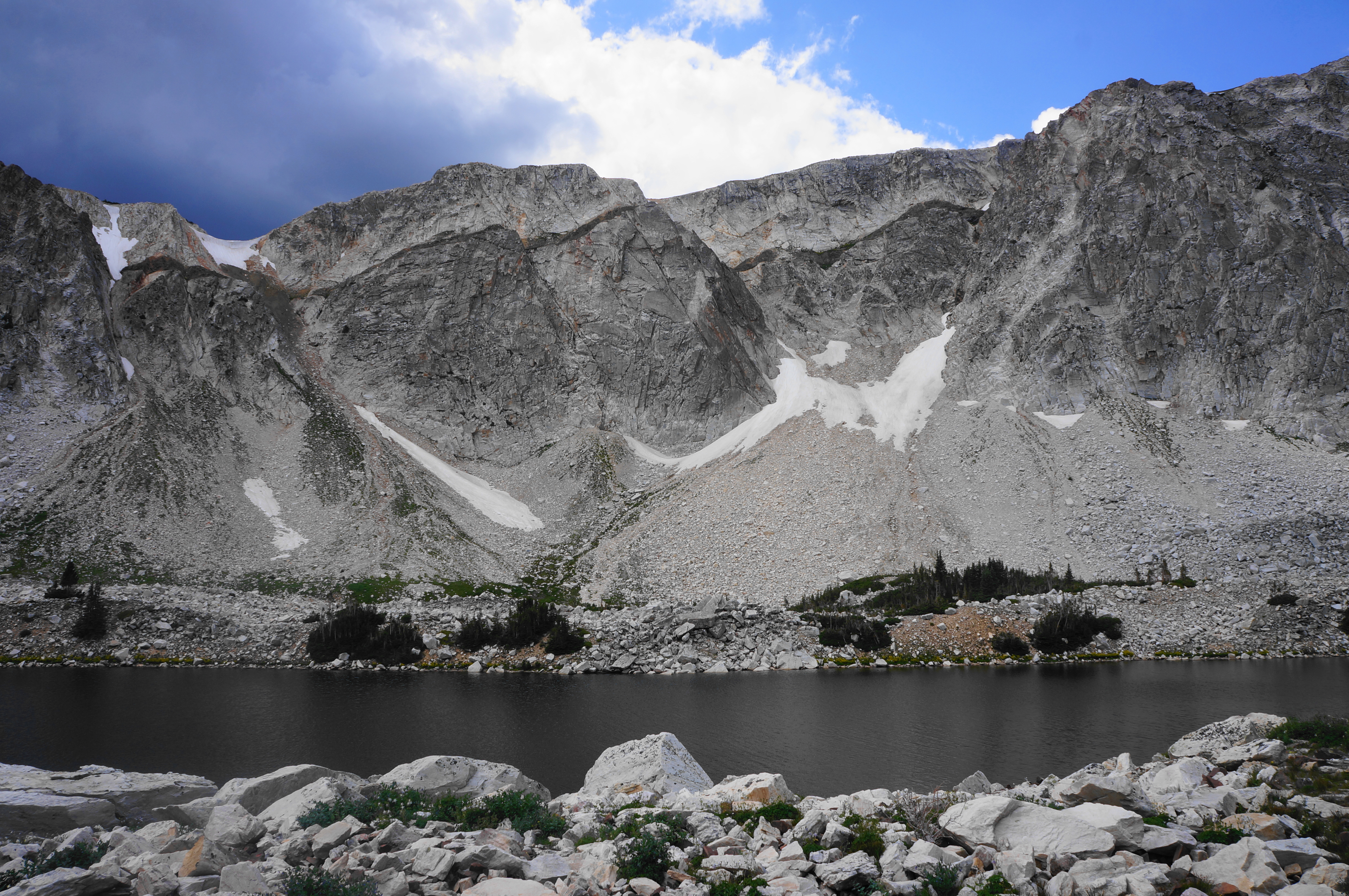
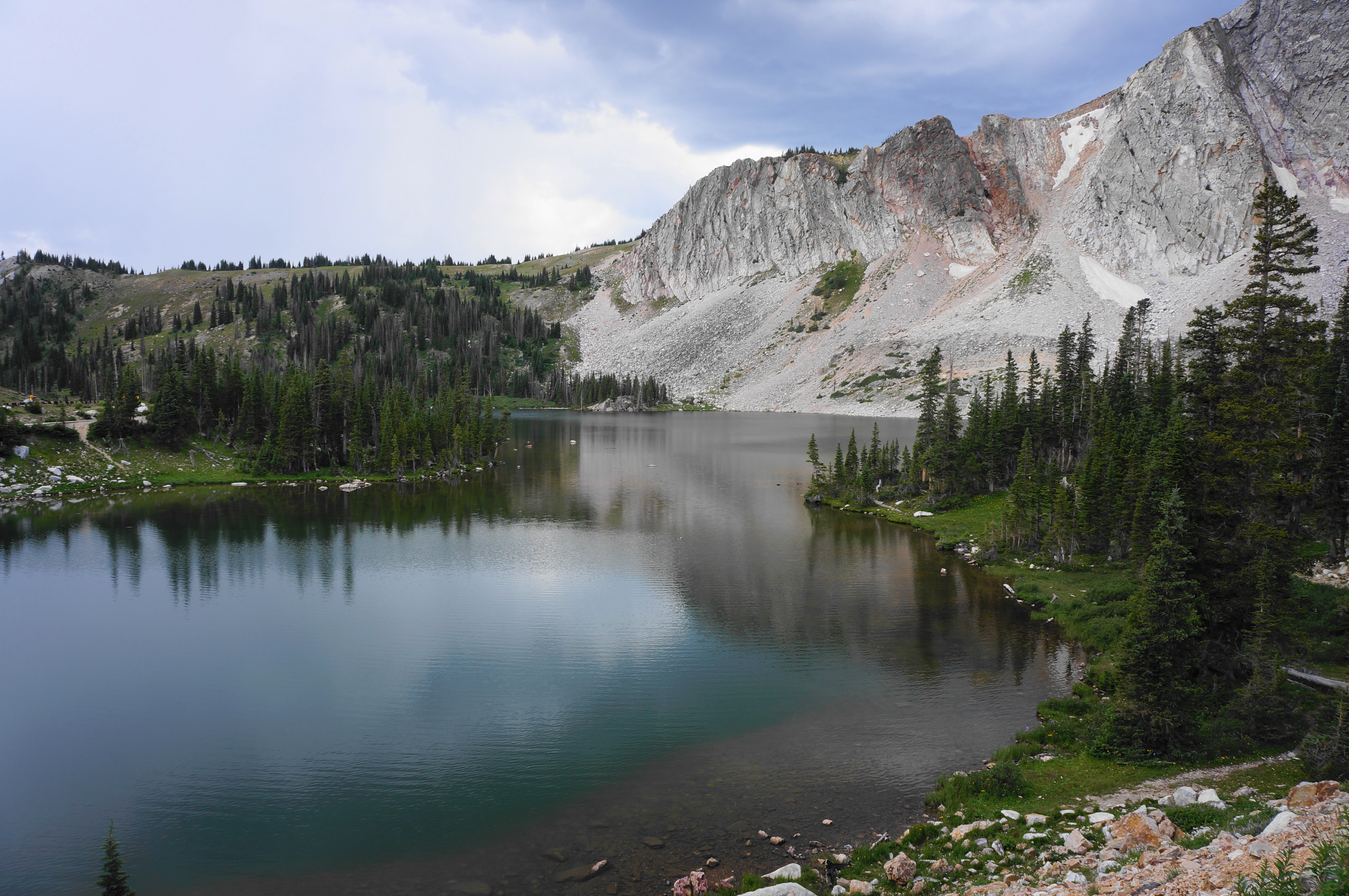
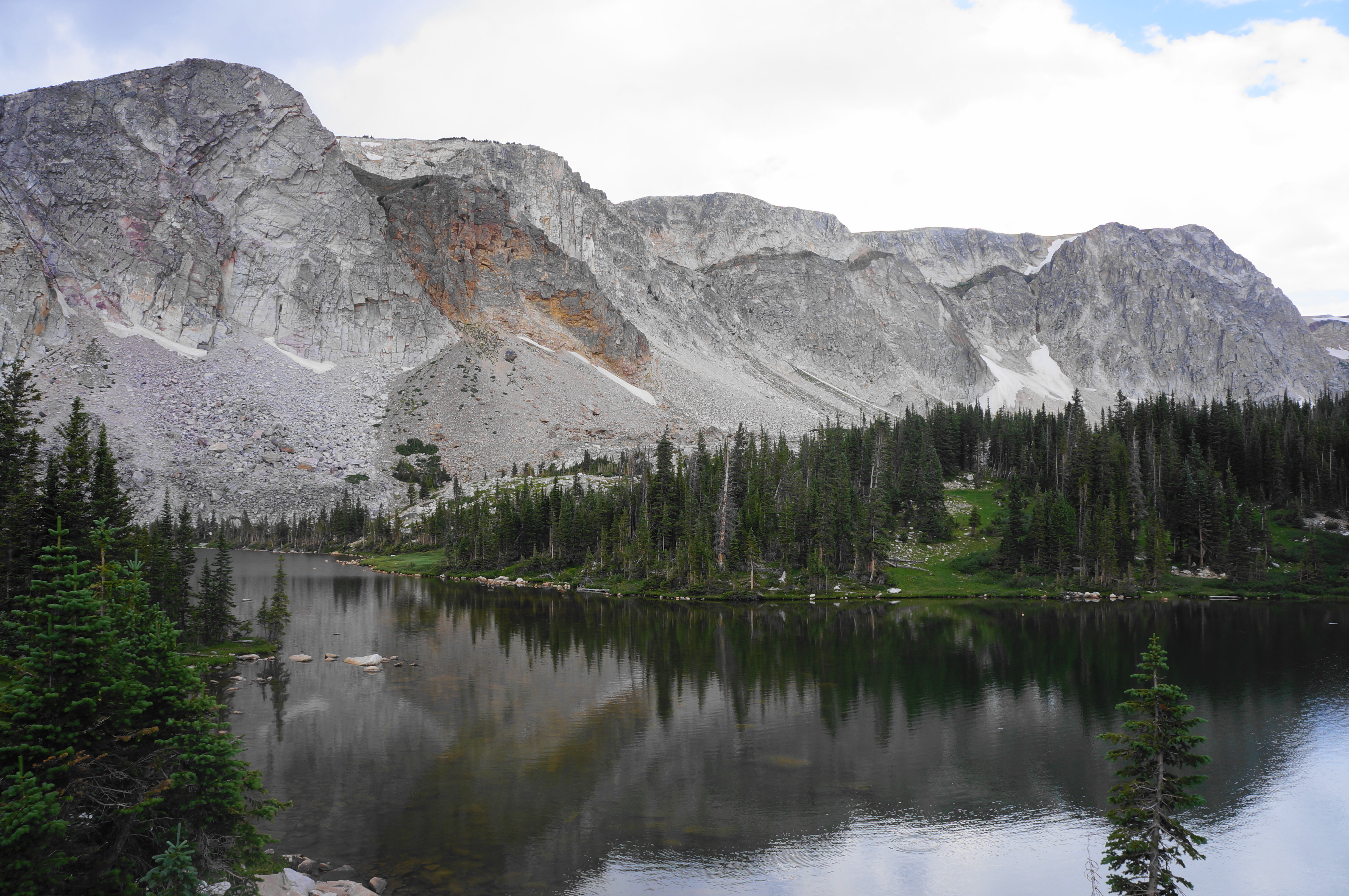
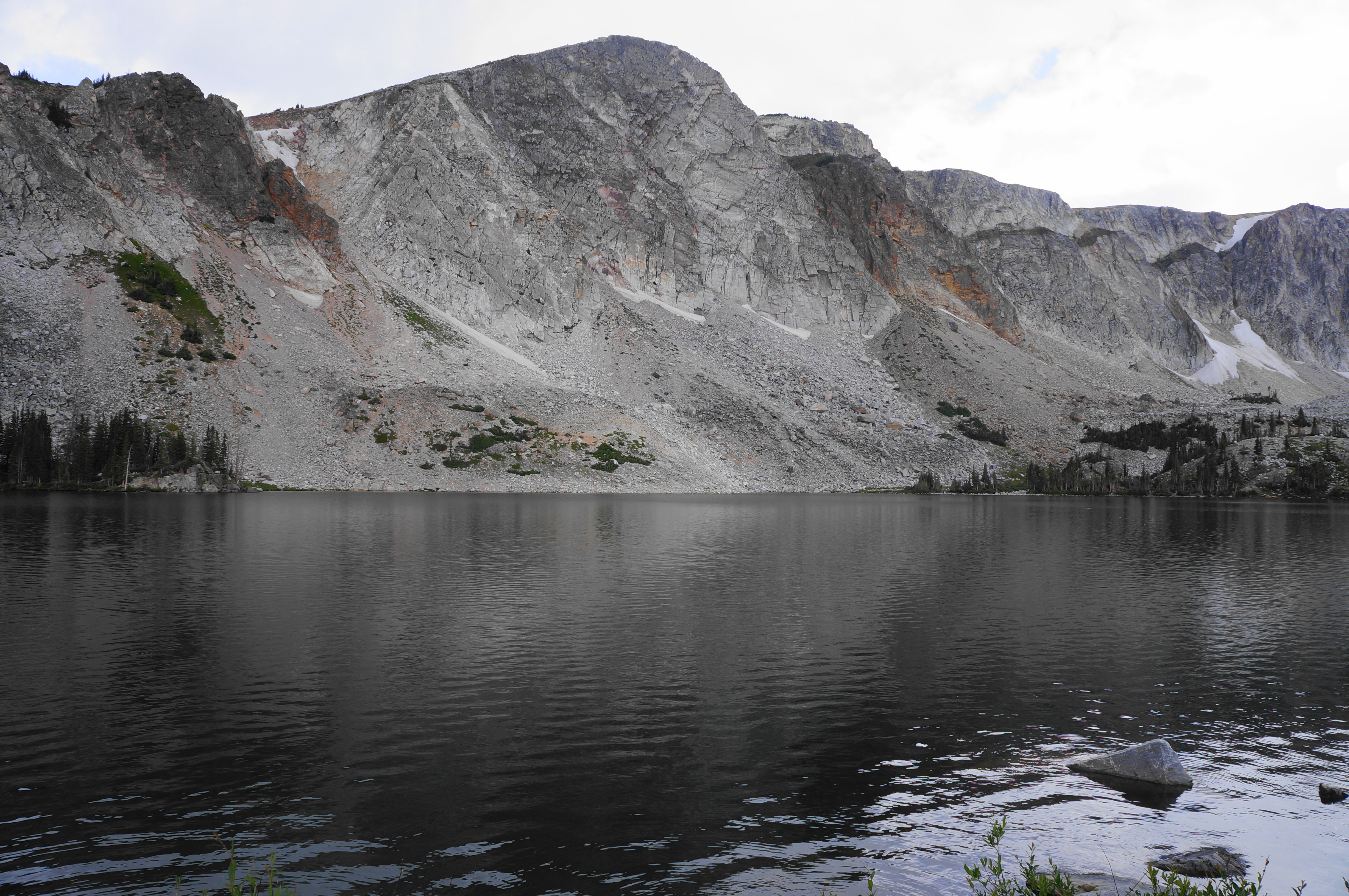
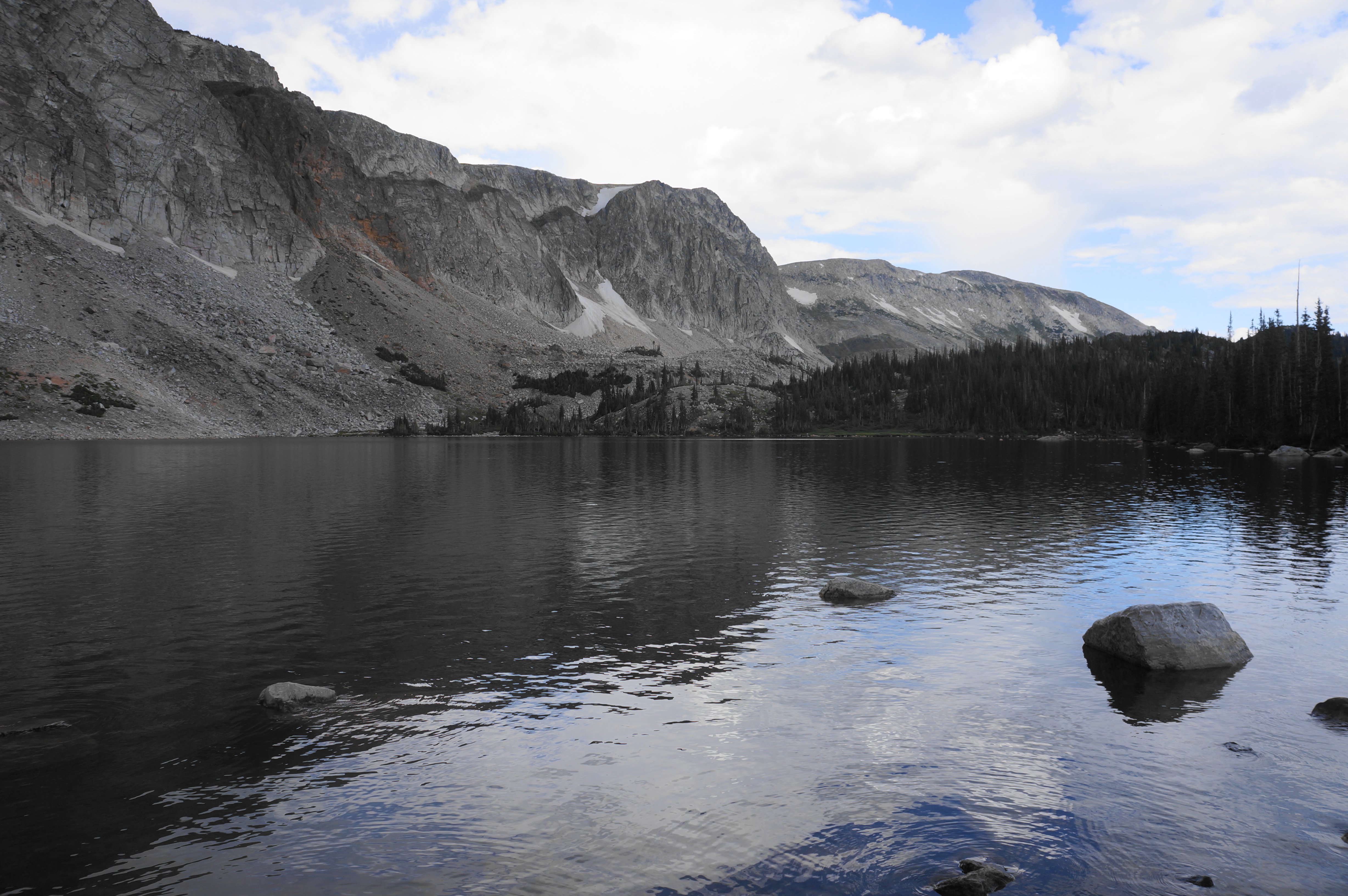
The open moraine gives way to terrific views across Lake Marie to Mirror Lake and Sugarloaf Mountain (11,398’). While the rest of the surrounding Medicine Bow Mountains resembles a lower, forested, and mild-sloping plateau, the Snowy Range rises precipitously—a case of a mountain range on top of a mountain range. The peaks, affectionately known as “The Snowys,” are composed primarily of quartzite, evidence of ancient sand deposits that were thrusted upward with the Rocky Mountains; centuries of erosion then left behind the jagged and magnificent mountains seen today.

As the hike continues, the distant summit of Medicine Bow Peak becomes obscured behind The Diamond and Old Main, but the vista now extends as far as Lookout Lake, which will be encountered later in the hike. At around ½ mile, the trail begins edging away from the peaks again, treading south and west to an open slope with westward views. Hikers can see a higher ridgeline ahead.

Minutes later, the Medicine Bow Peak Trail starts moving north again toward the three summits along a relentless uphill. After a welcome patch of spruce trees that provide rare shade on the largely exposed hike, the onward route begins the toughest climb of the entire loop.
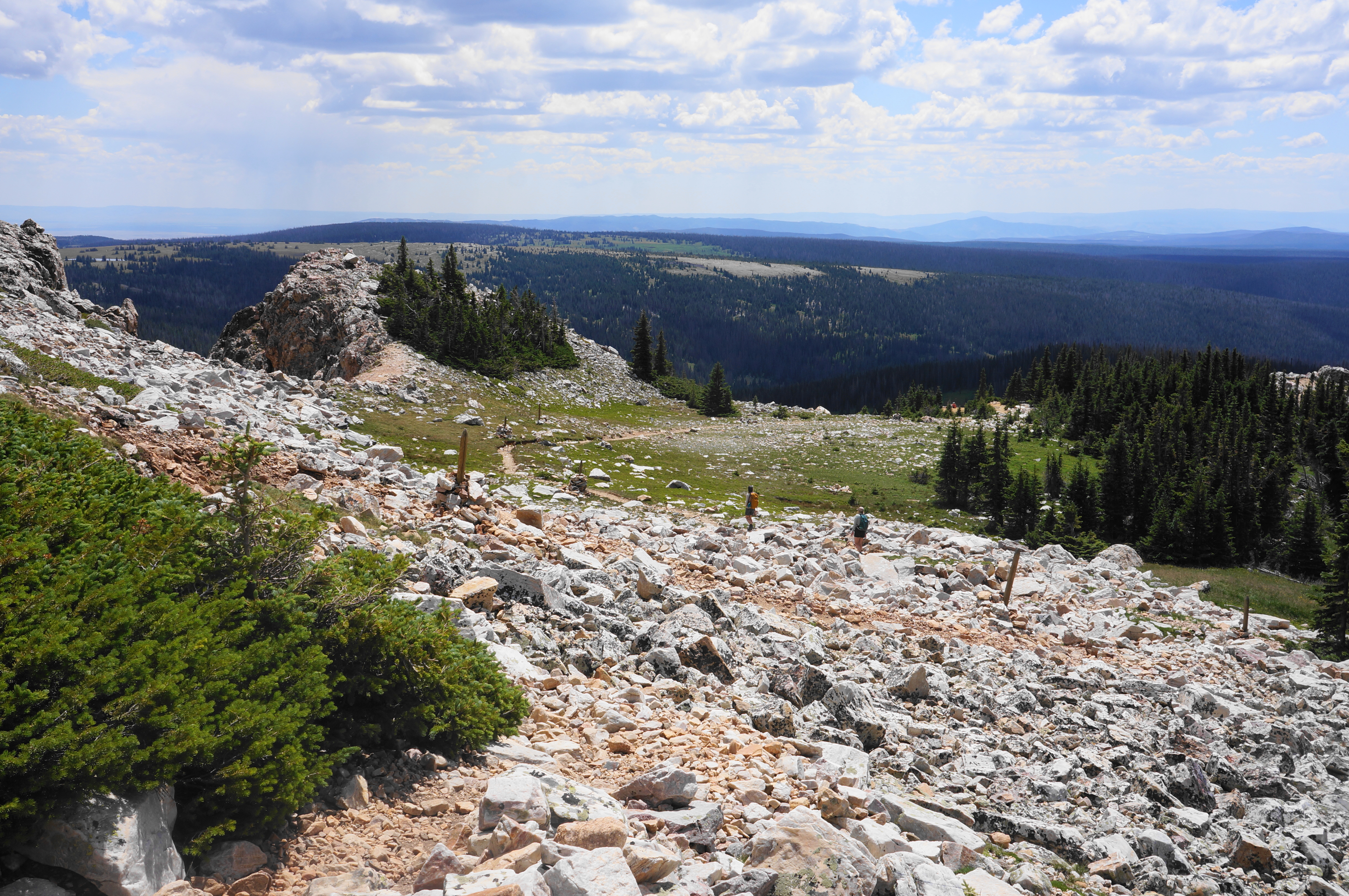
Climb through two patches of boulder rubble, enjoying expansive views between huffs and puffs. The large mountain range in the distance—to the southwest—is the Sierra Madre, another snow-capped range, positioned on the Continental Divide, that extends into northern Colorado.
The uphill boulder slide section—the scree more of a nuisance than an obstacle—is interrupted briefly by an ease in the incline. But the climb continues again as the trail wraps around to the west flank of the mountain range. At 9/10 mile—still in the rock scree—tackle a right-hand switchback, bearing east again. After a brief time away, the path returns to a spot overlooking the lakes to the east, now with a bird’s eye view down to Mirror Lake and Lake Marie.
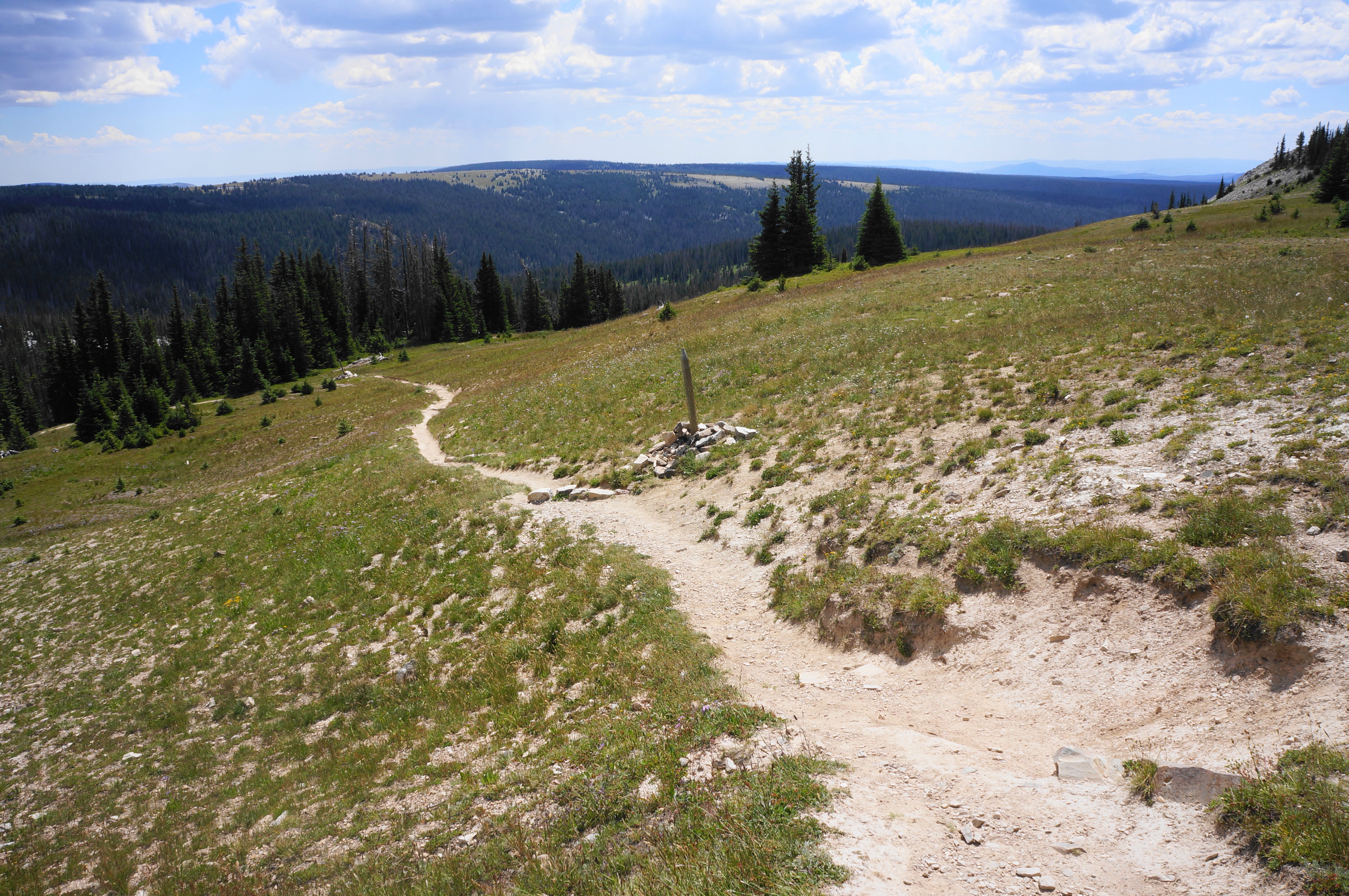
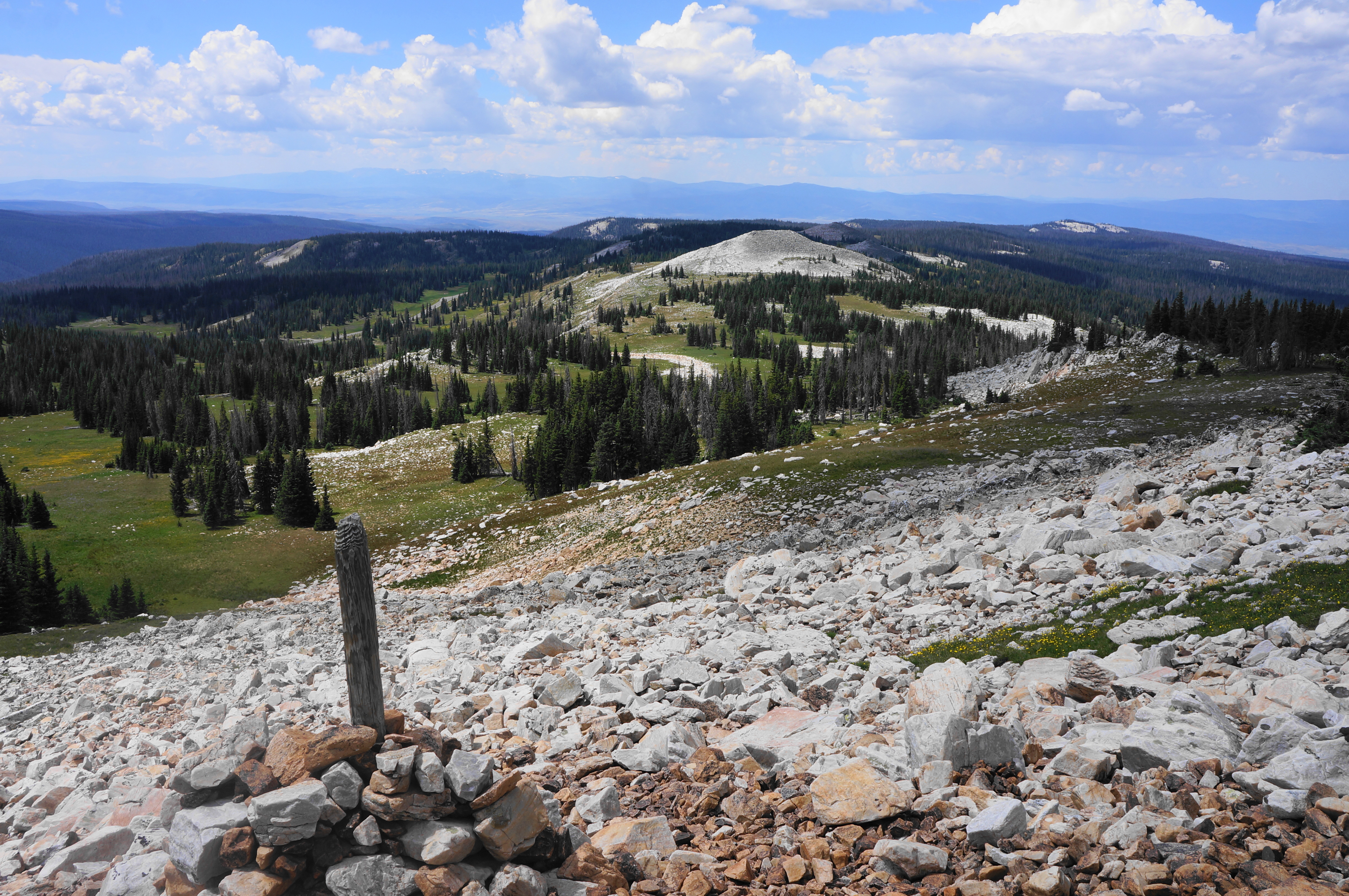
Take a left-hand switchback, then traverse an open and very steep incline that lasts perhaps 1/10 mile before finally easing. Follow the trail—marked with wooden stakes—as it offers its first views northwest, toward Pennock Mountain (10,043’) and an extension of the Medicine Bow Mountains. Hikers also get a look at the terrain ahead—still dotted with quartzite but much milder and flatter than the previous half-mile.

Thus begins a long, easy section with unobscured views westward toward Saratoga and the Sierra Madre. Mild ups and downs are interrupted briefly by a longer climb at around 1.6 miles, but this too gives way soon enough to easier tread. At 1.8 miles, the route passes a gap between two peaks on the right: this is the modest division between The Diamond and Old Main, both of which are not summited on the trail.
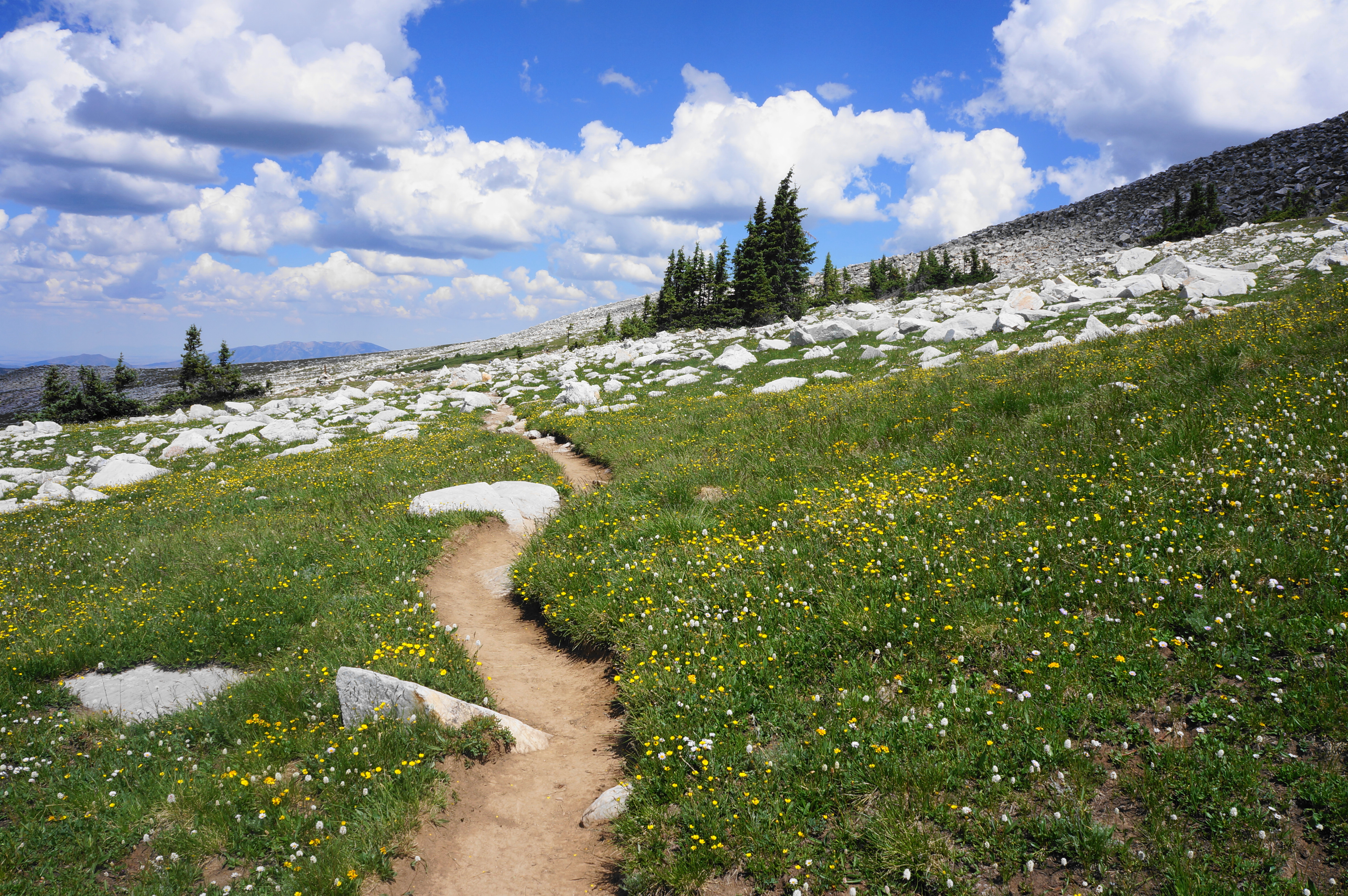

Traversing the tundra leads to a minor crest and another open basin walk with the first views of Medicine Bow Peak since the start of the hike. Here the peak appears imposing but much less difficult than before.
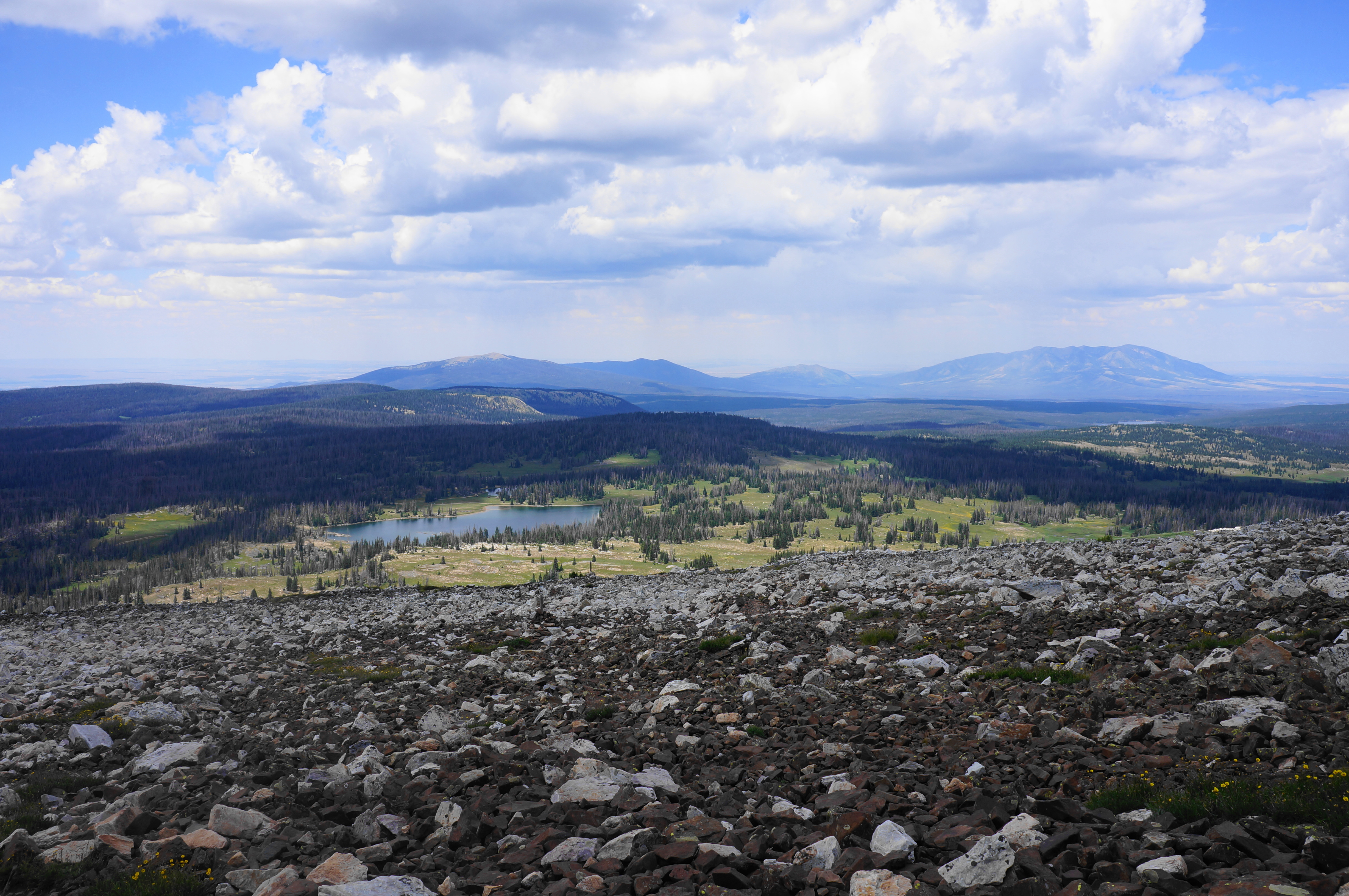
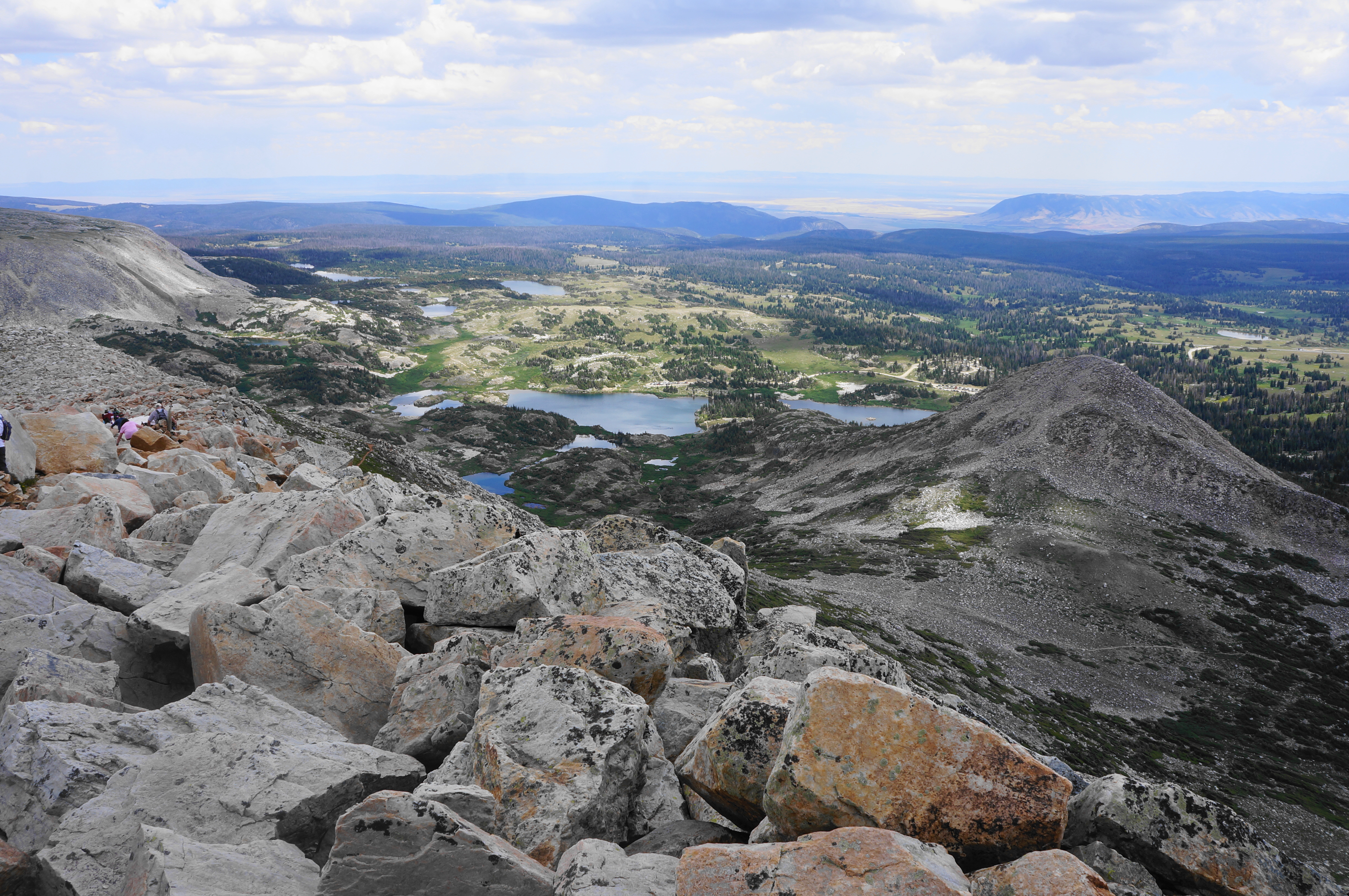
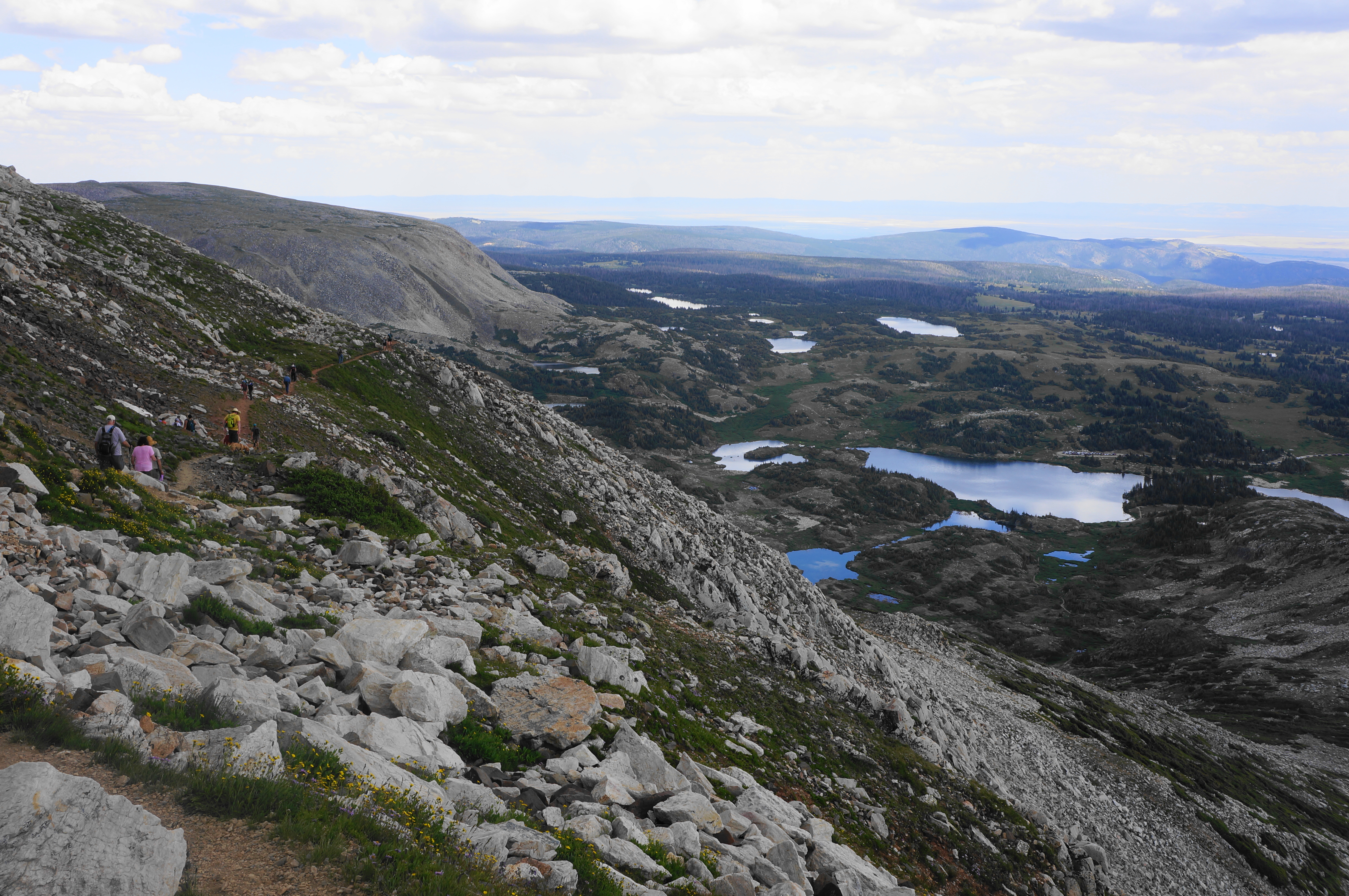
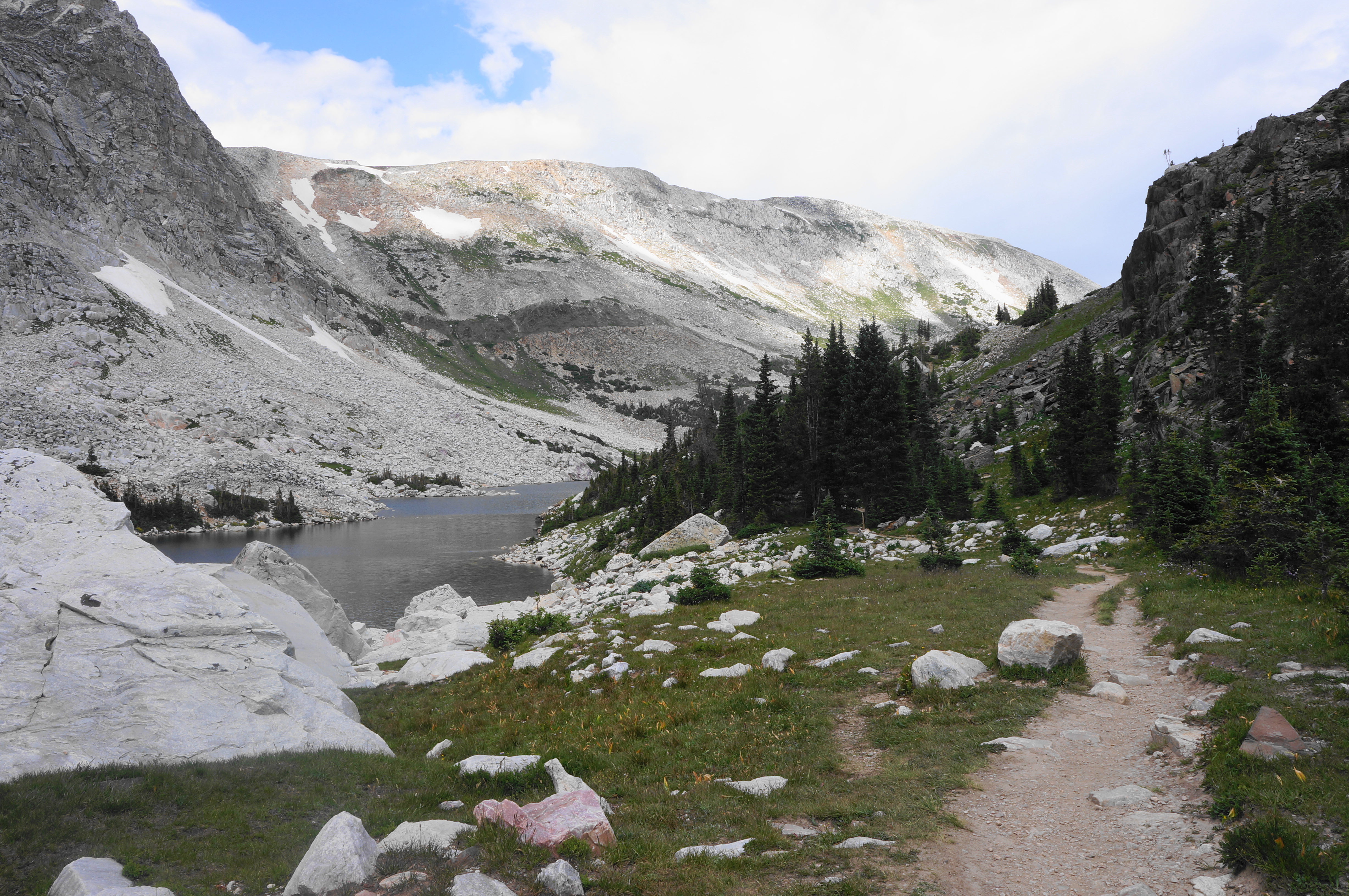
At 2.25 miles, approach a sign for the “Old Lookout Cabin,” where a spur leads to the namesake, situated in the gap between Old Main and Medicine Bow Peak. A rise to the saddle offers more eastward views, and a smattering of subalpine lakes to the west are also now visible, including Dipper Lake and Turpin Reservoir. Pass a sign at 2.4 miles for “Medicine Bow Peak,” then—after mounting a boulder pile—the trail actually descends for a brief period. A nice grassy section skirts scree fields on the right.
Upon approaching a trail junction at 2.8 miles, the 1.5-mile level section comes to an end. The Dipper Lake Trail bears left for 1.7 miles, ending at its namesake, but the Medicine Bow Peak Trail continues right, immediately beginning an intense uphill.
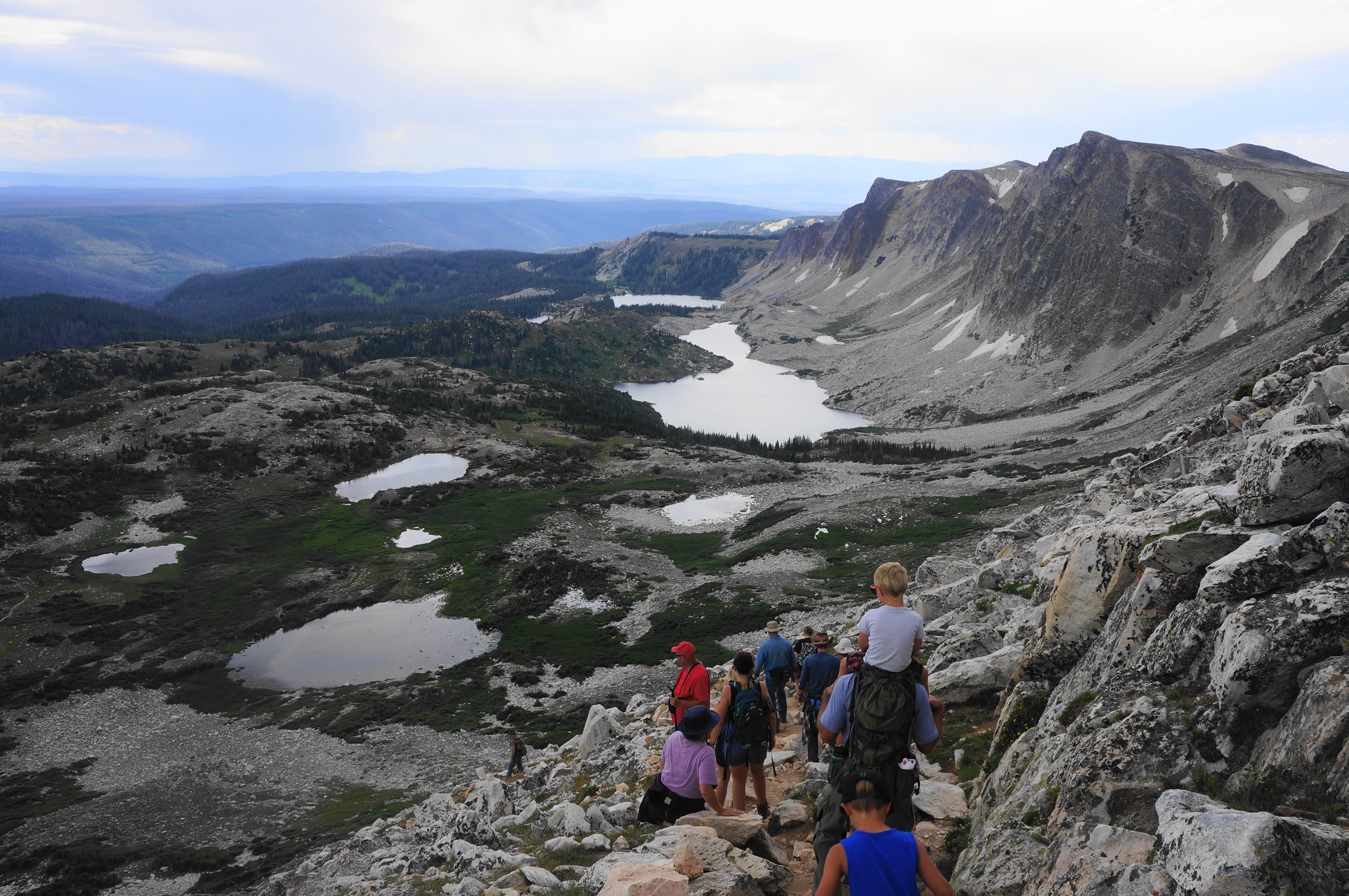
The demanding climb is made more difficult by the altitude, as hikers have now crested 11,500 feet. Some level stretches at 3.1 and 3.3 miles offer some respite, but overall, the path ascends relentlessly, in a final push for the summit of Medicine Bow Peak. As with many peak-bagging hikes, there are false summits, one of which is passed on the right at around 3.3 miles. Here visitors can see the true summit ahead, however, with less than 100 feet in elevation gain to go.
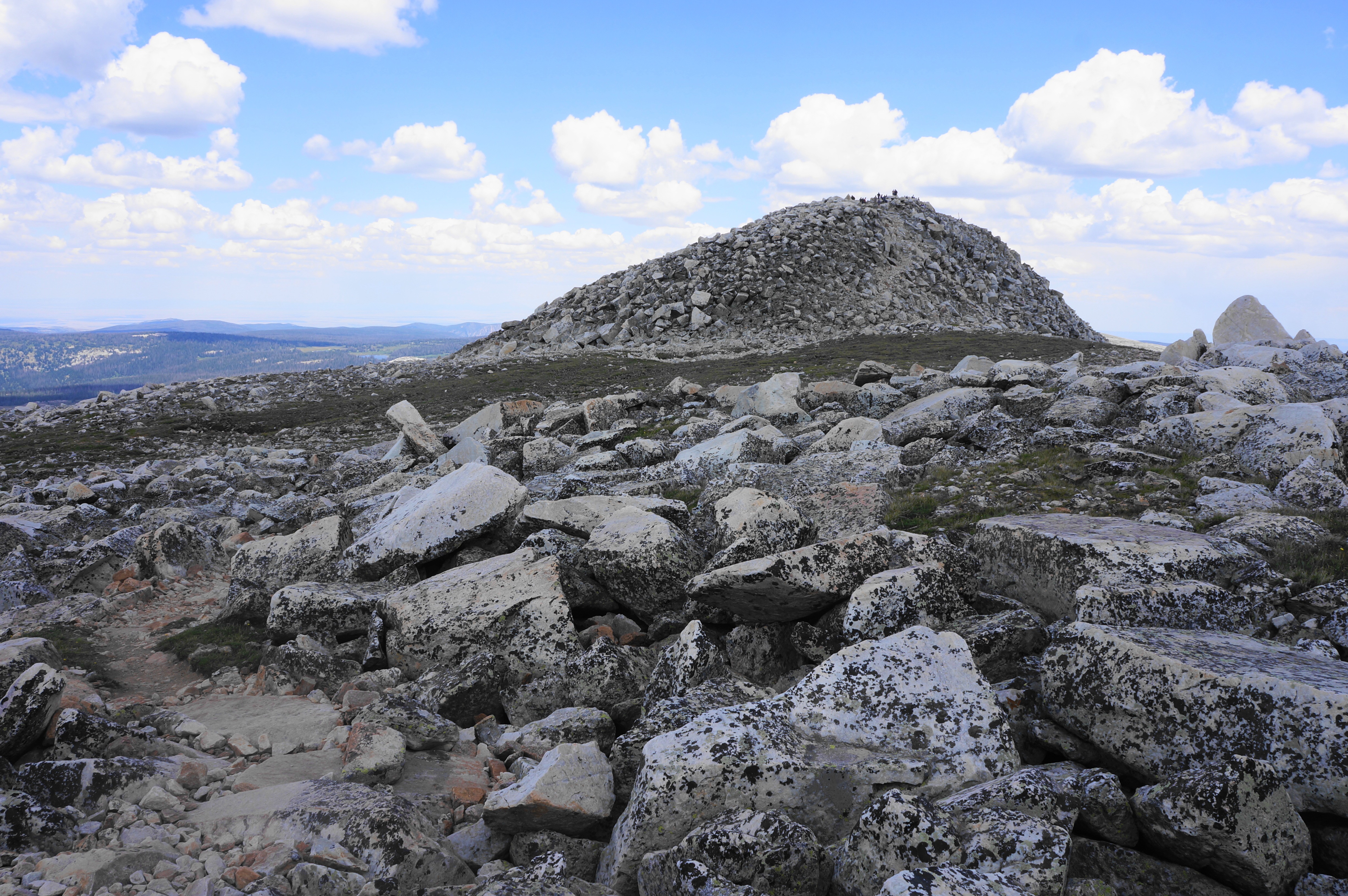
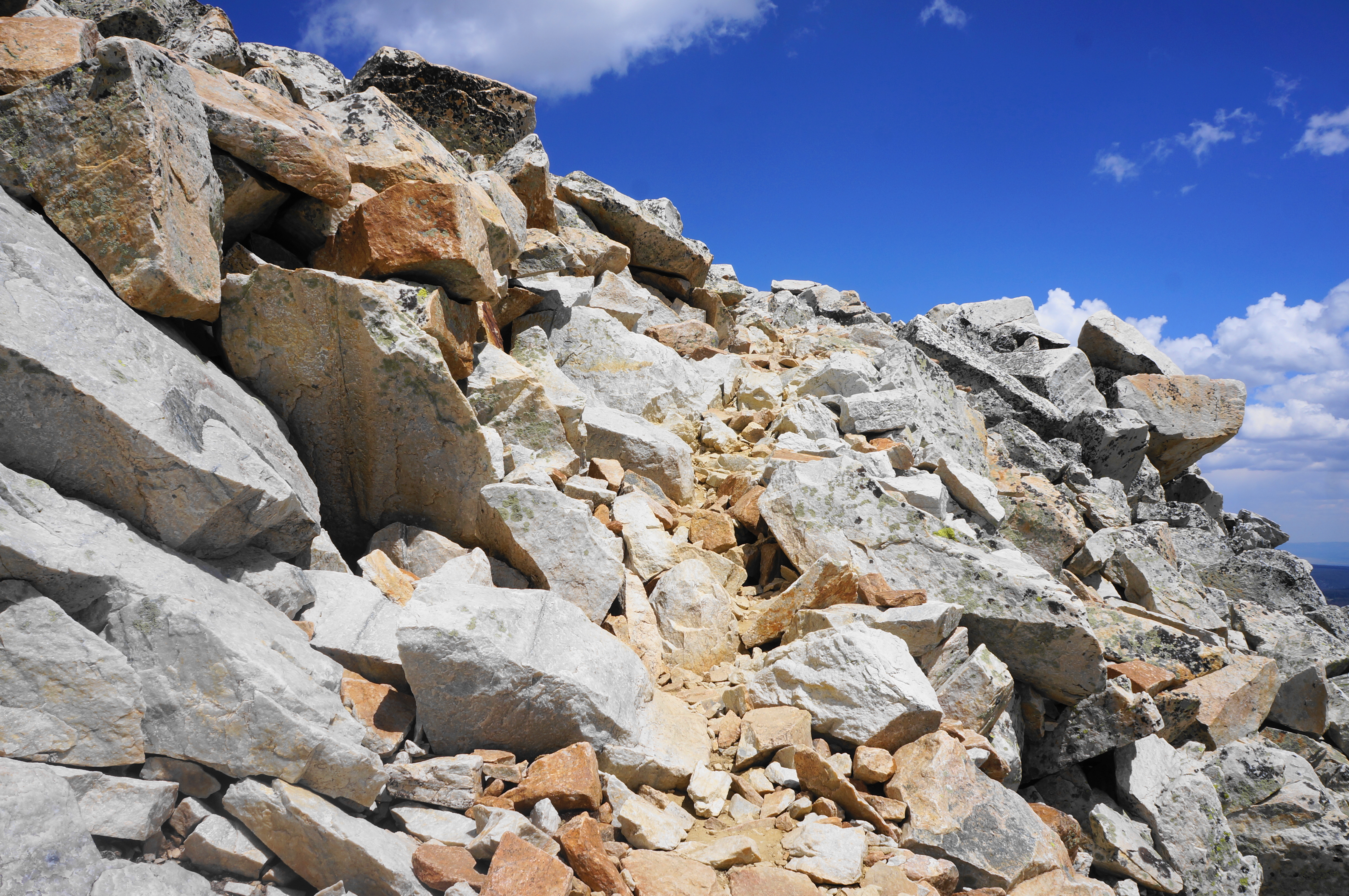
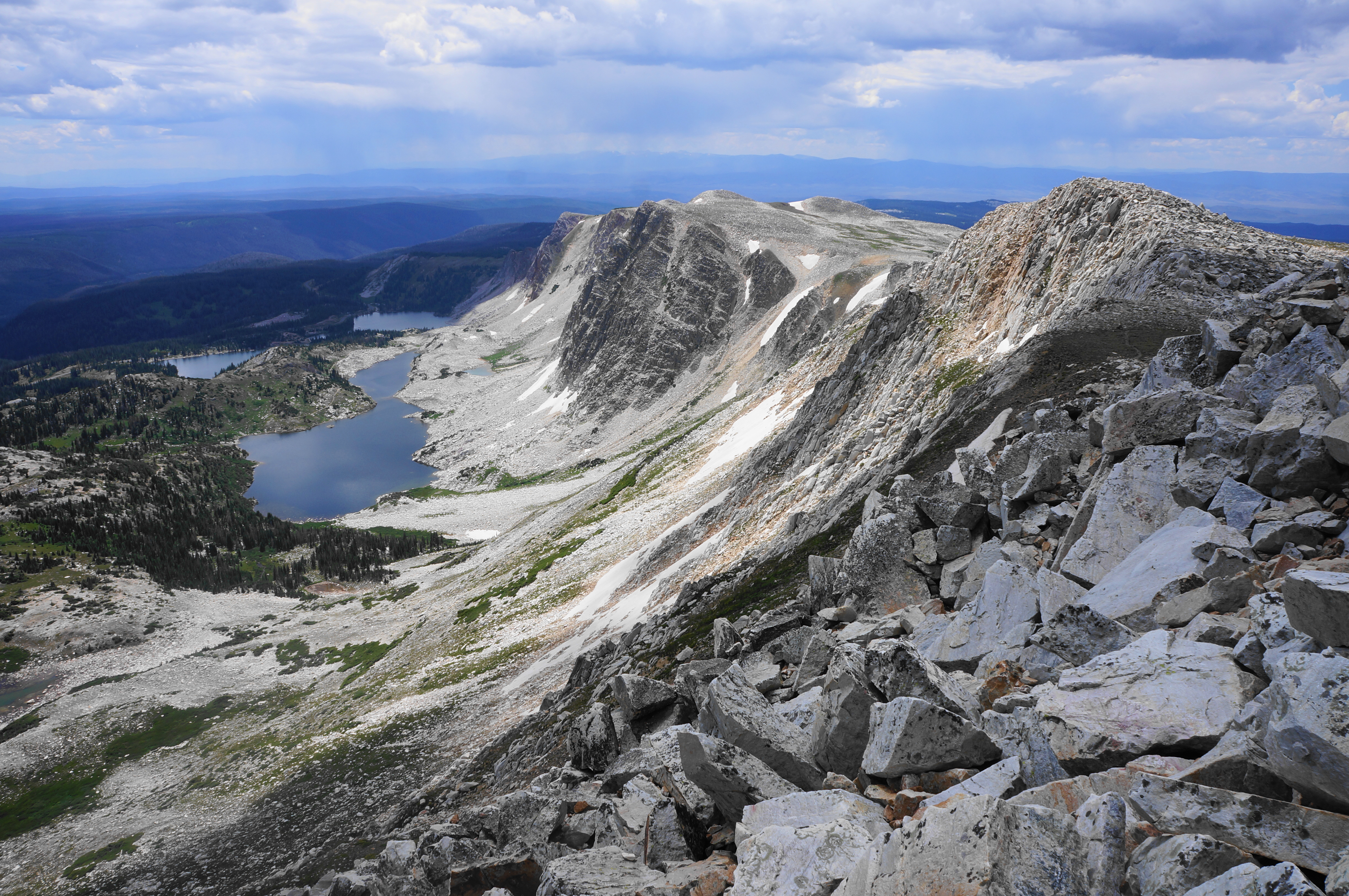
Come to the base of the summit hump, with views from the ridge looking down more than 1,000 feet to the lakes below. The final ascent is the hike’s closest analogue to a true rock scramble, with hikers having to contend with loose and bulky quartzite rocks. But the trail is evident and ascent mild, culminating at the 12,013-foot summit.
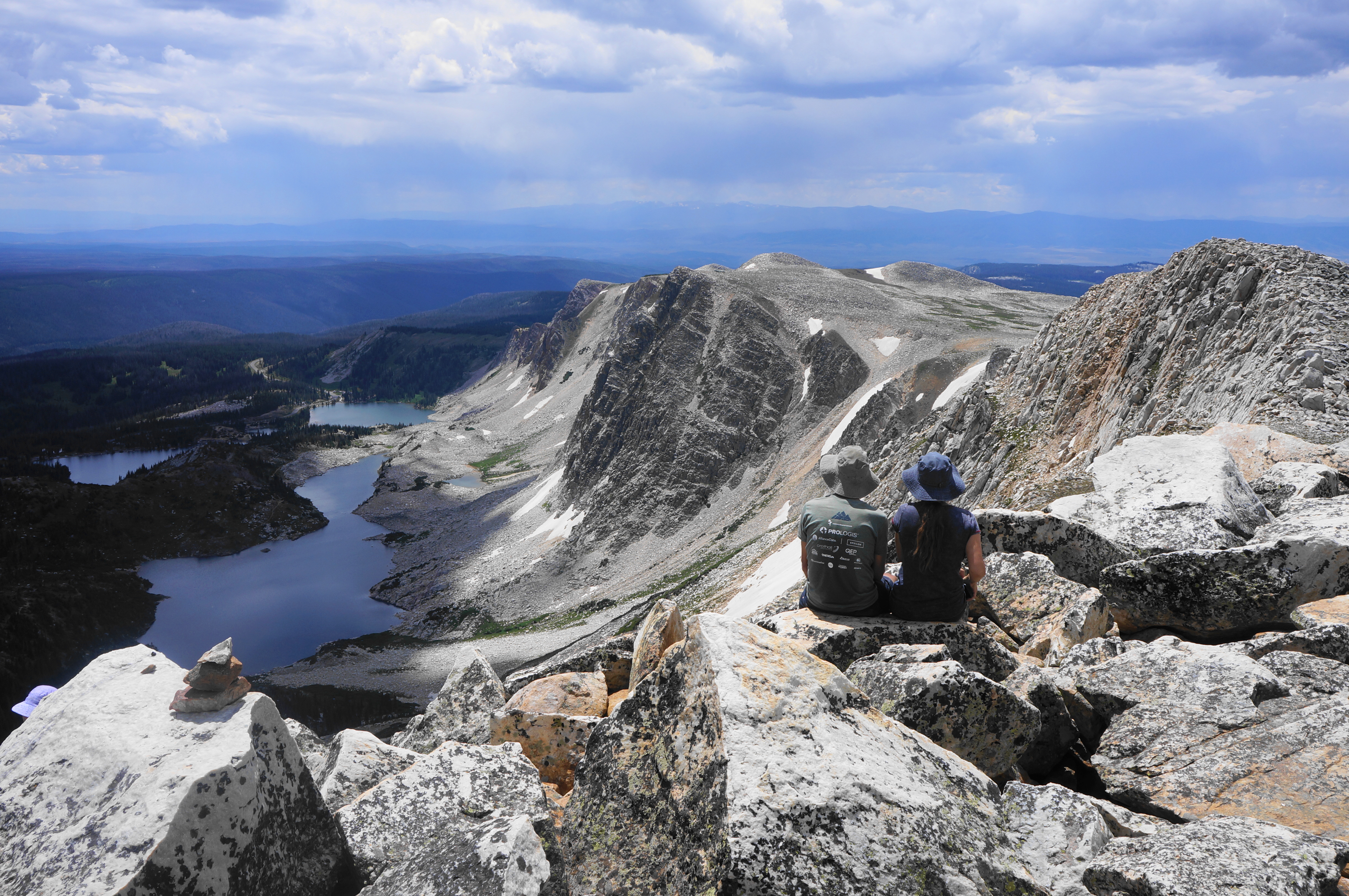
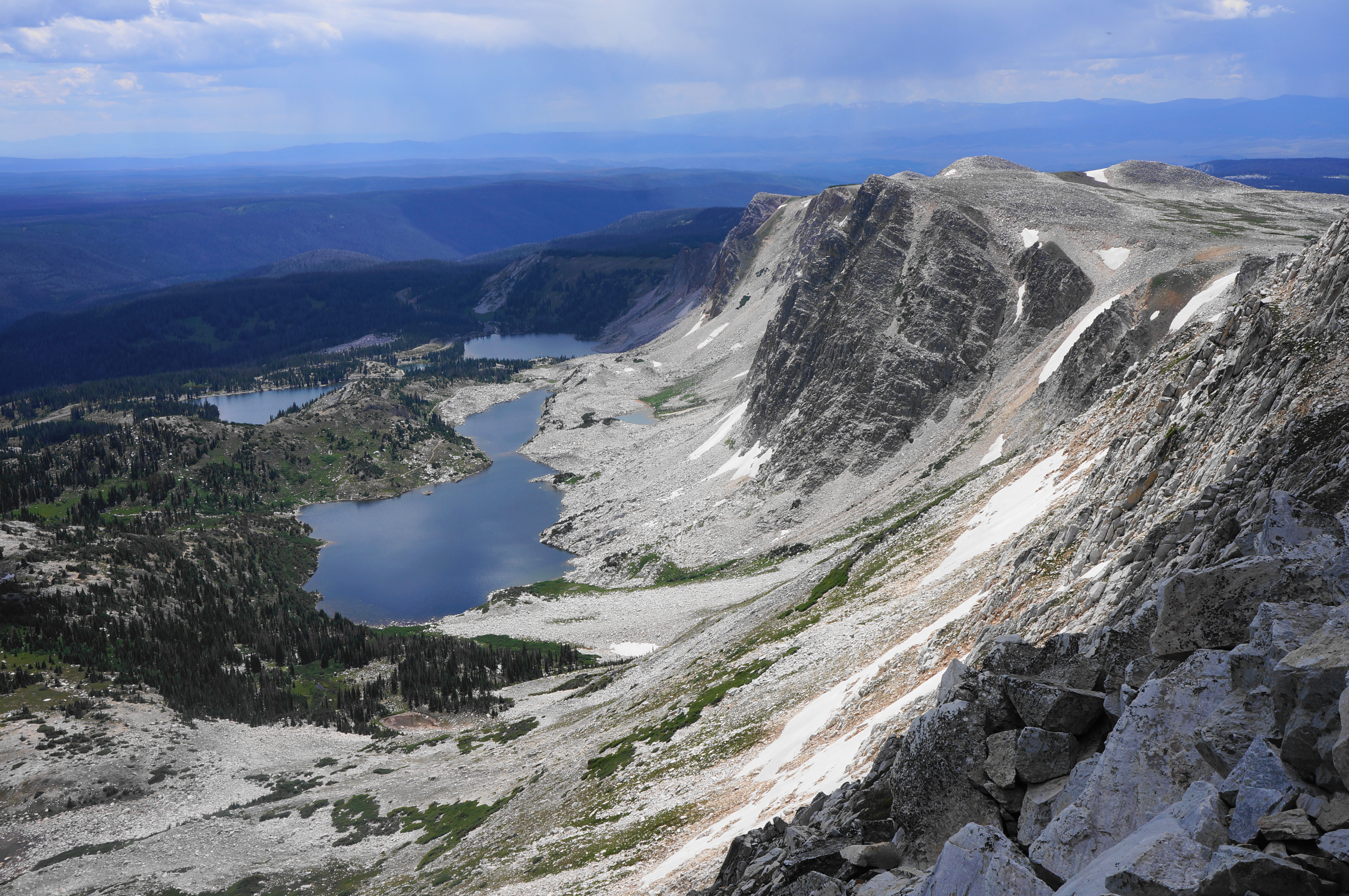
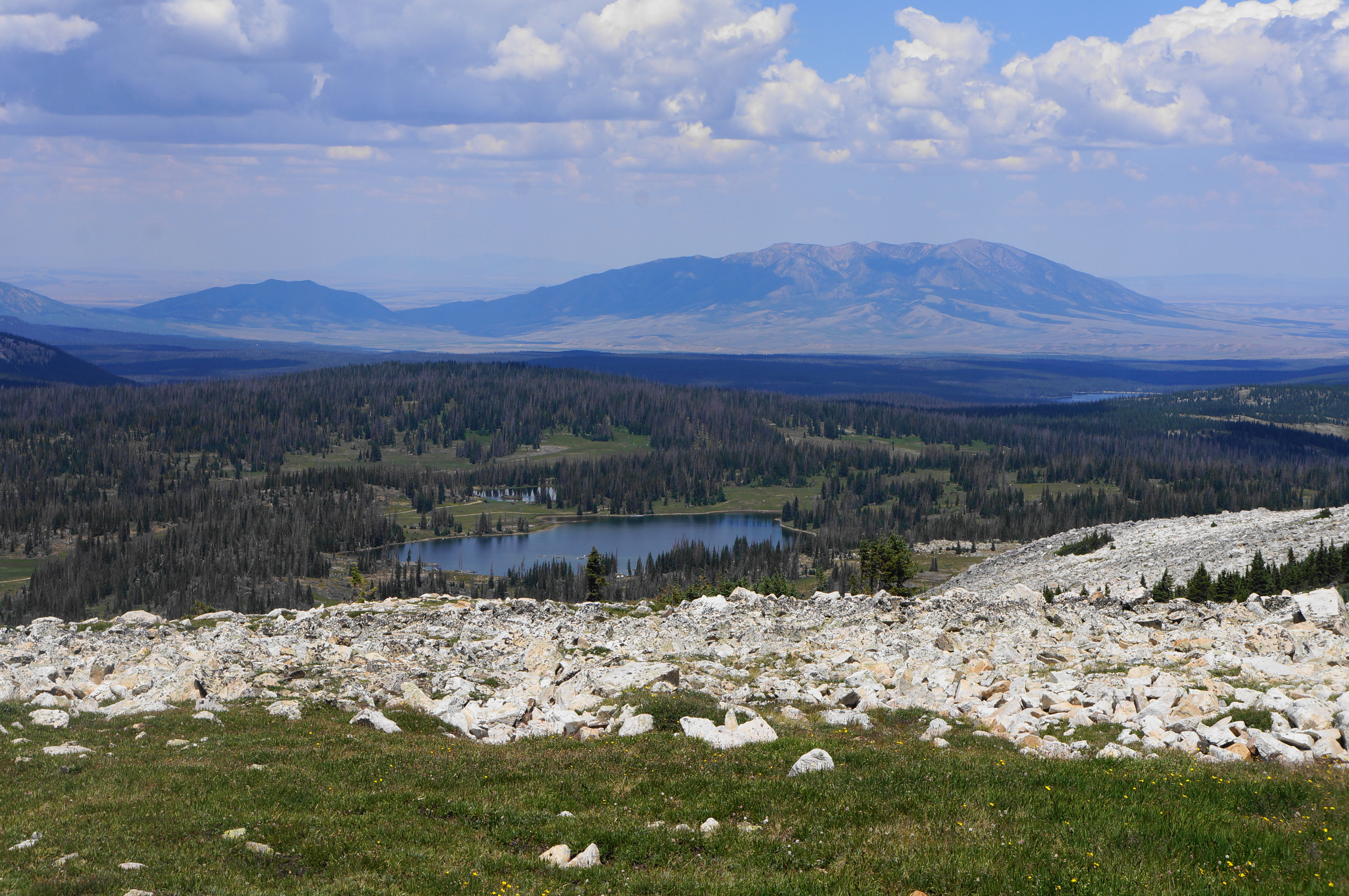
The views from Medicine Bow Peak, as expected, are simply splendid. In addition to the westward views, hikers can now look south to the parade of alpine lakes—Lookout, Mirror, and Lake Marie—guarded on the right by the near-vertical cliffs of The Diamond and Old Main. One can also see east to a clutch of other lakes, including Lewis, Libby, and Klondyke Lakes. Eventually the Snowy Range fades away, with the Laramie Valley beyond.
Space is at a premium at the summit, which can get crowded on summer weekends, but there are enough spots to sit and enjoy the views over lunch or a snack. Better yet, at 3.6 miles, the hike is only around half-way complete, with more scenic terrain ahead to complete the loop.
Summit to West Marie Lake Trailhead via Lakes Trail (3.3 miles)
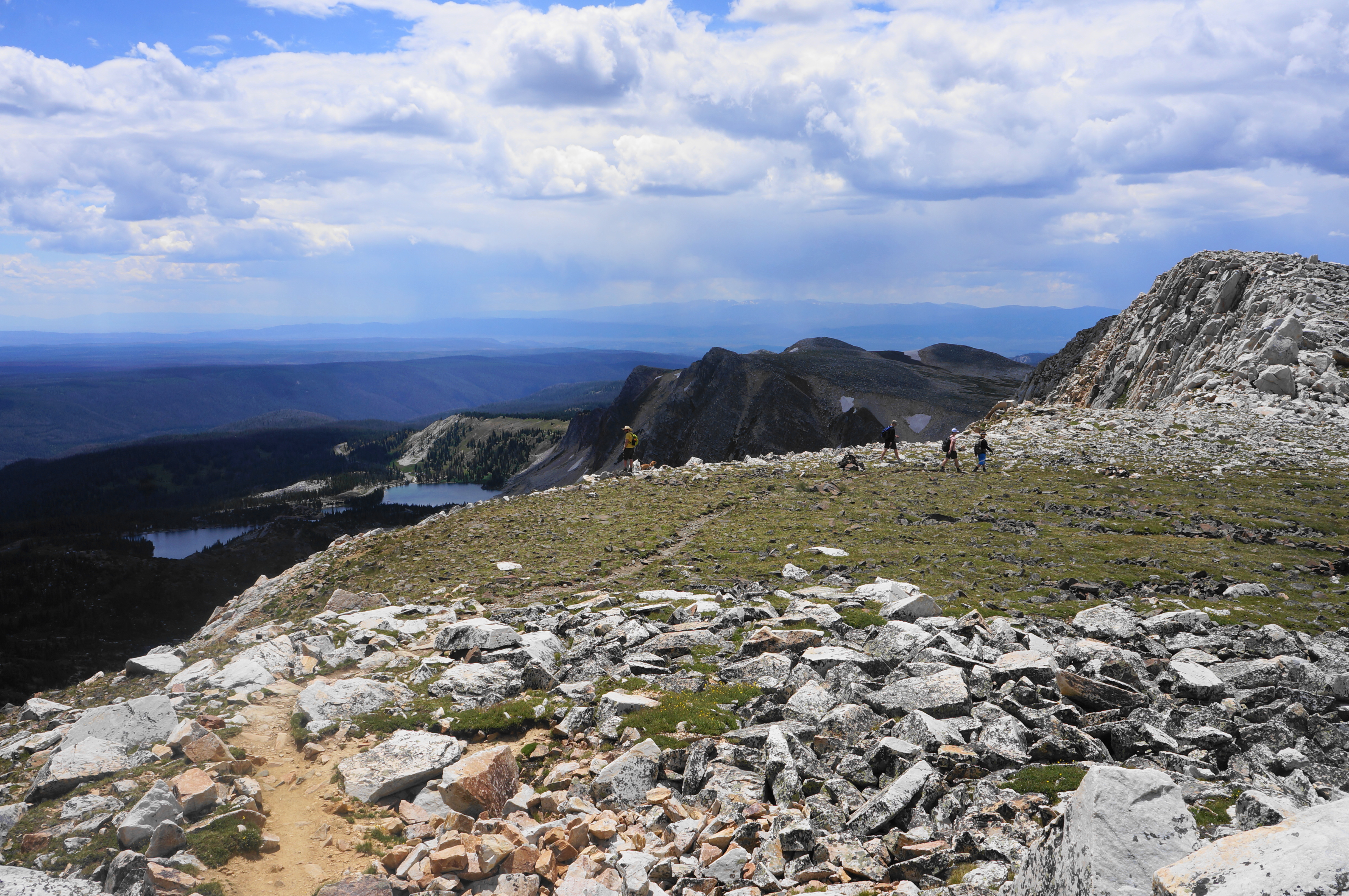
Here at the summit, loop trekkers will mix with day hikers who opted to take on the summit as an out-and-back from the Lewis Lake Trailhead—a shorter but less rewarding walk. The two groups will combine for the next section, a long and steady descent to a low saddle between Medicine Bow and Sugarloaf Mountain.

The descent begins by heading straight down an east-west ridge, then four switchbacks and a straightaway that can be snow-covered through much of the year. Follow signs and the scores of hikers bounding down stairstep switches, with near-constant views of the lakes to the east and south. For a while, the shade-less tread heads south toward Lookout Lake and the rest of the massif, but soon the wiggles extend back and forth, with careful footing required on the rocky and often slippery surface. (Note: On the summer afternoon in July when I did this hike, it started hailing around this point.)
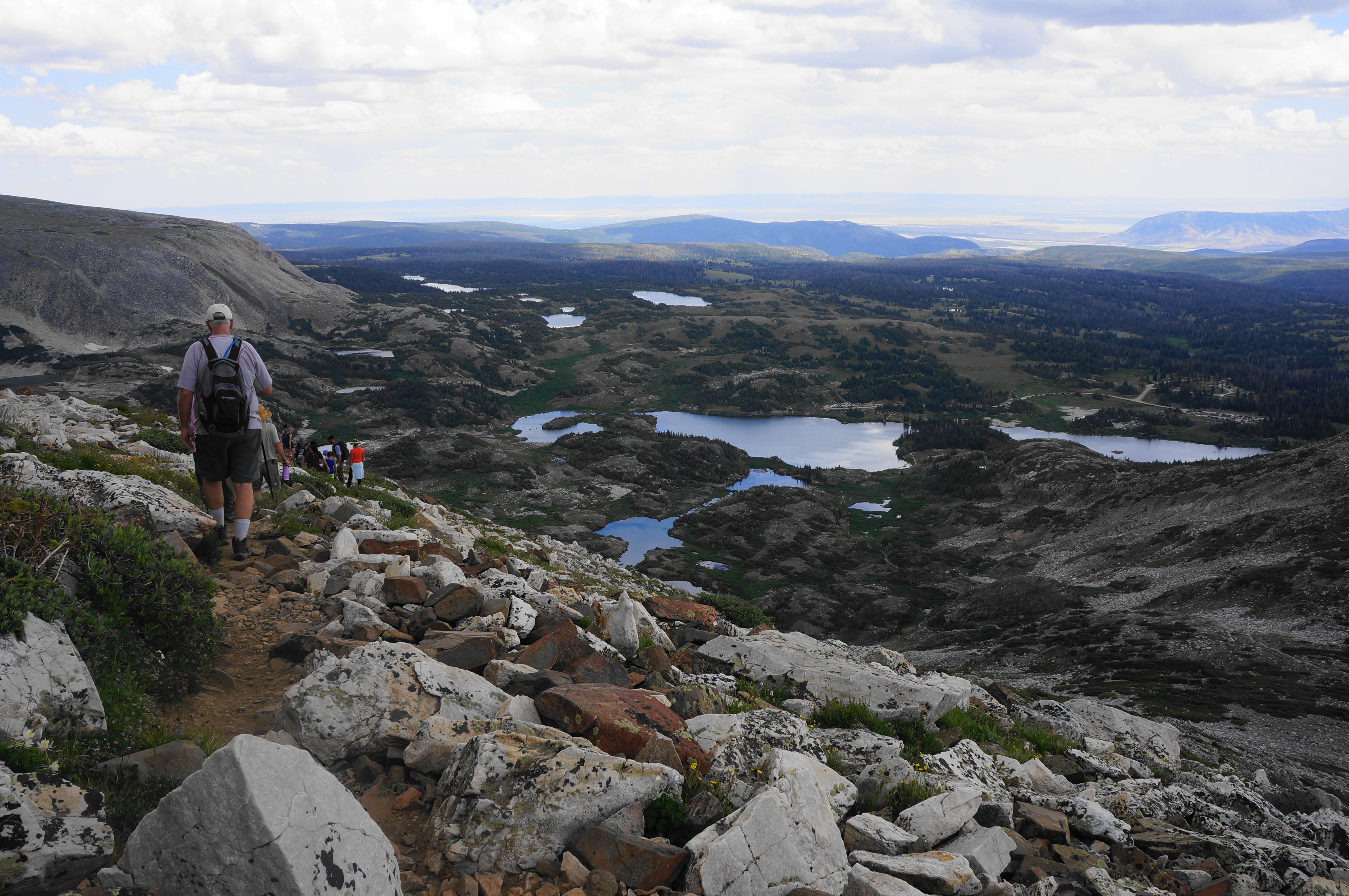

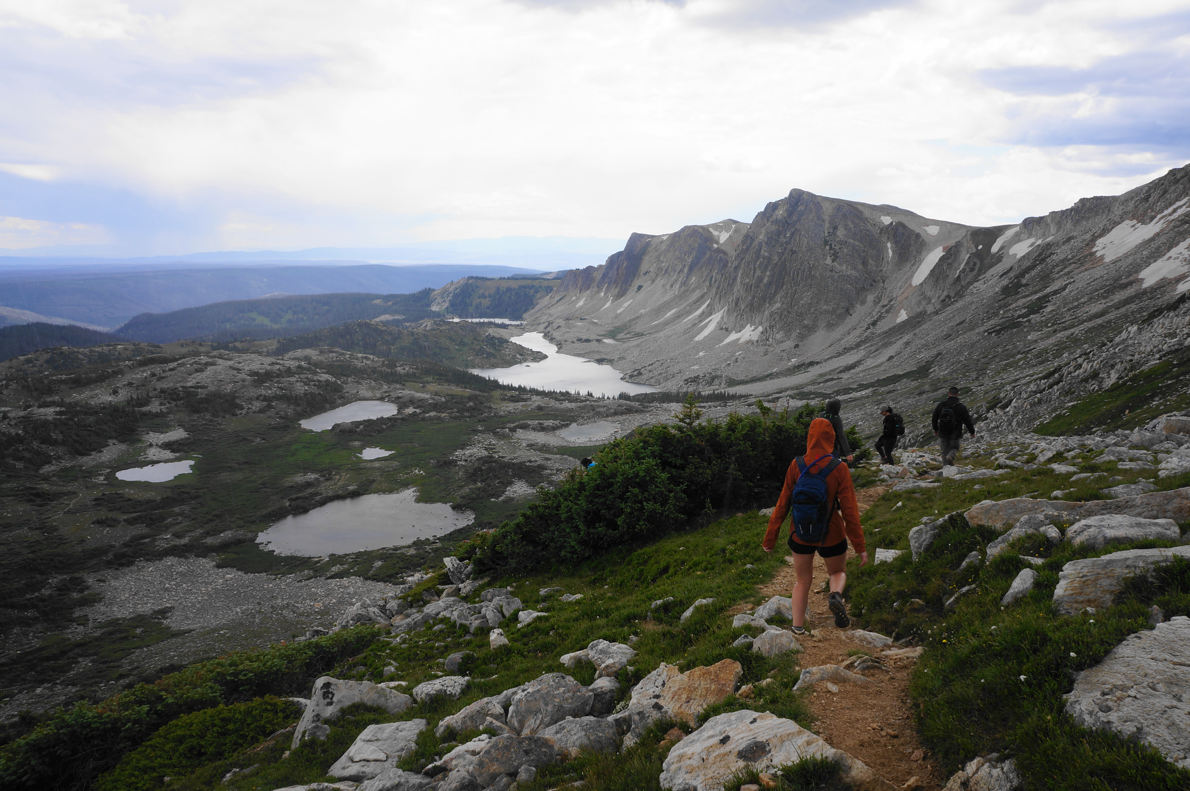
At last, almost a mile from the summit, the trail reaches the saddle and junction with the Lakes Trail. With the out-and-back hikers heading left to Lewis Lake, the crowds thin again along the Lakes Trail, another beautiful section of this star-studded hike.
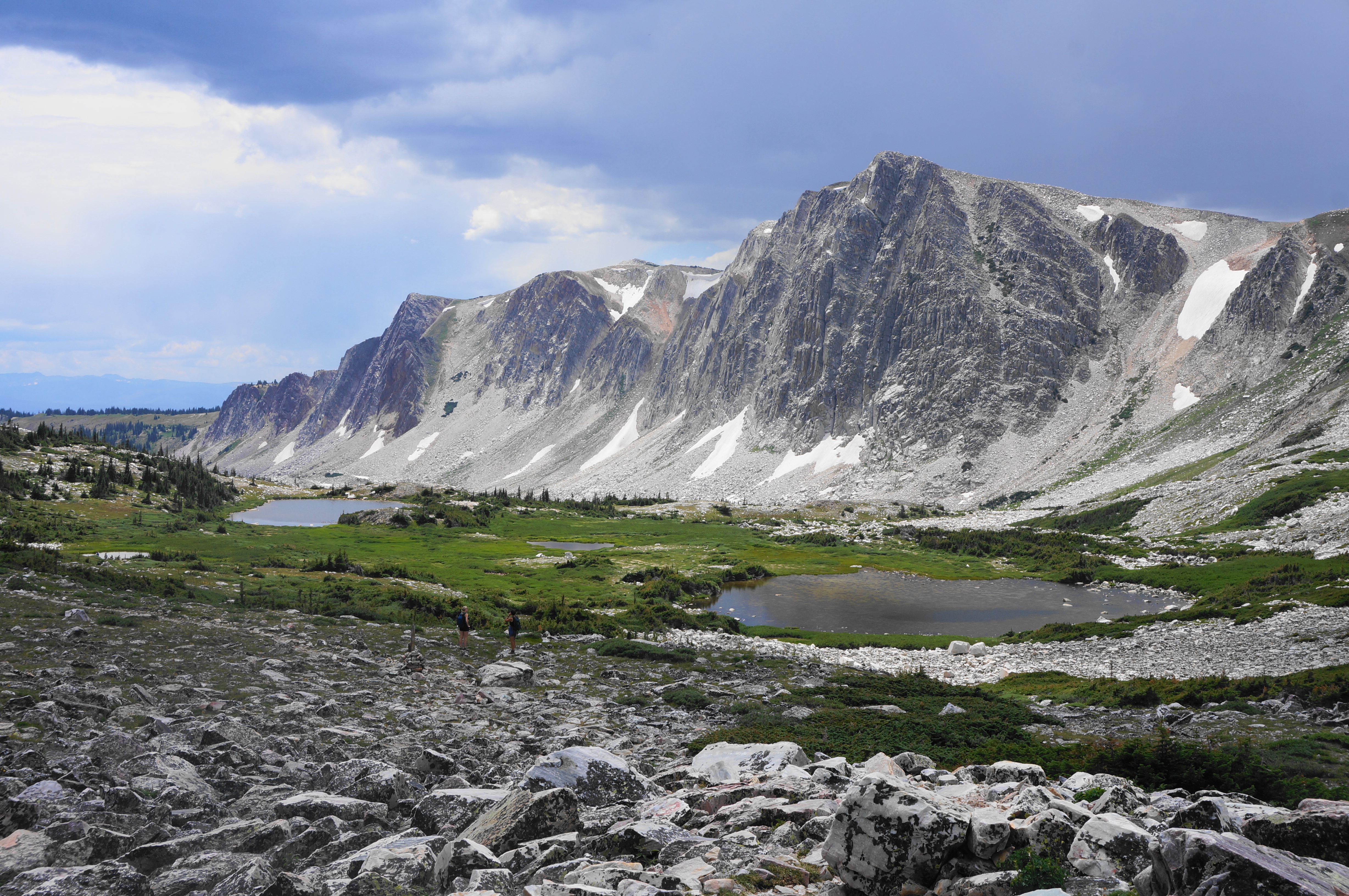
After traversing an alpine meadow, the path briefly cuts through a stunted conifer section, then passes the first of several small, unnamed pools on the right. From here the mild track weaves within reach of a second, smaller pond, then skirts a low ridgeline on the left. Pass a small boulder field, then a third pool, at around 4.9 miles. All the while, the towering façade of Old Main dominates the landscape.
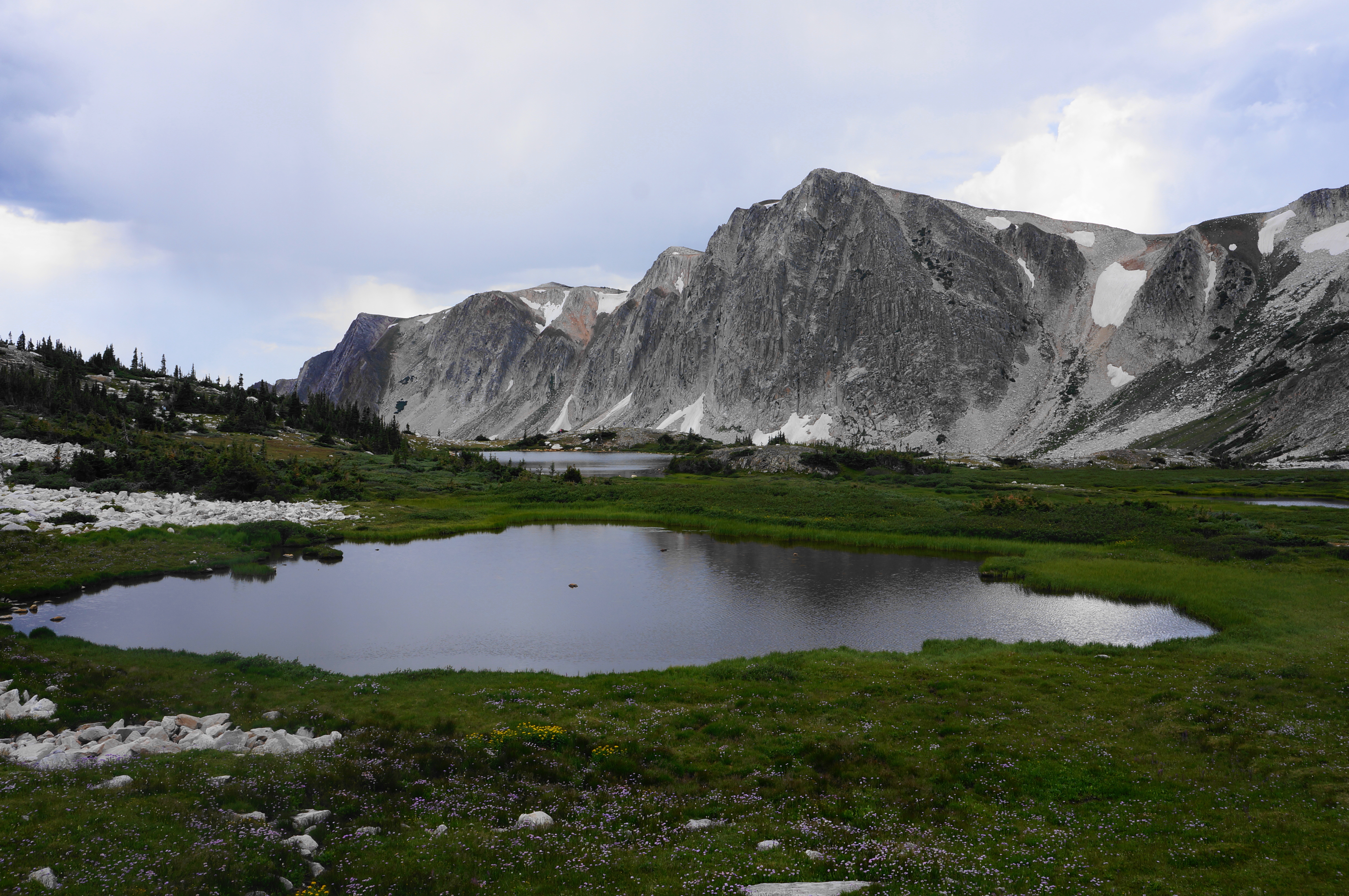
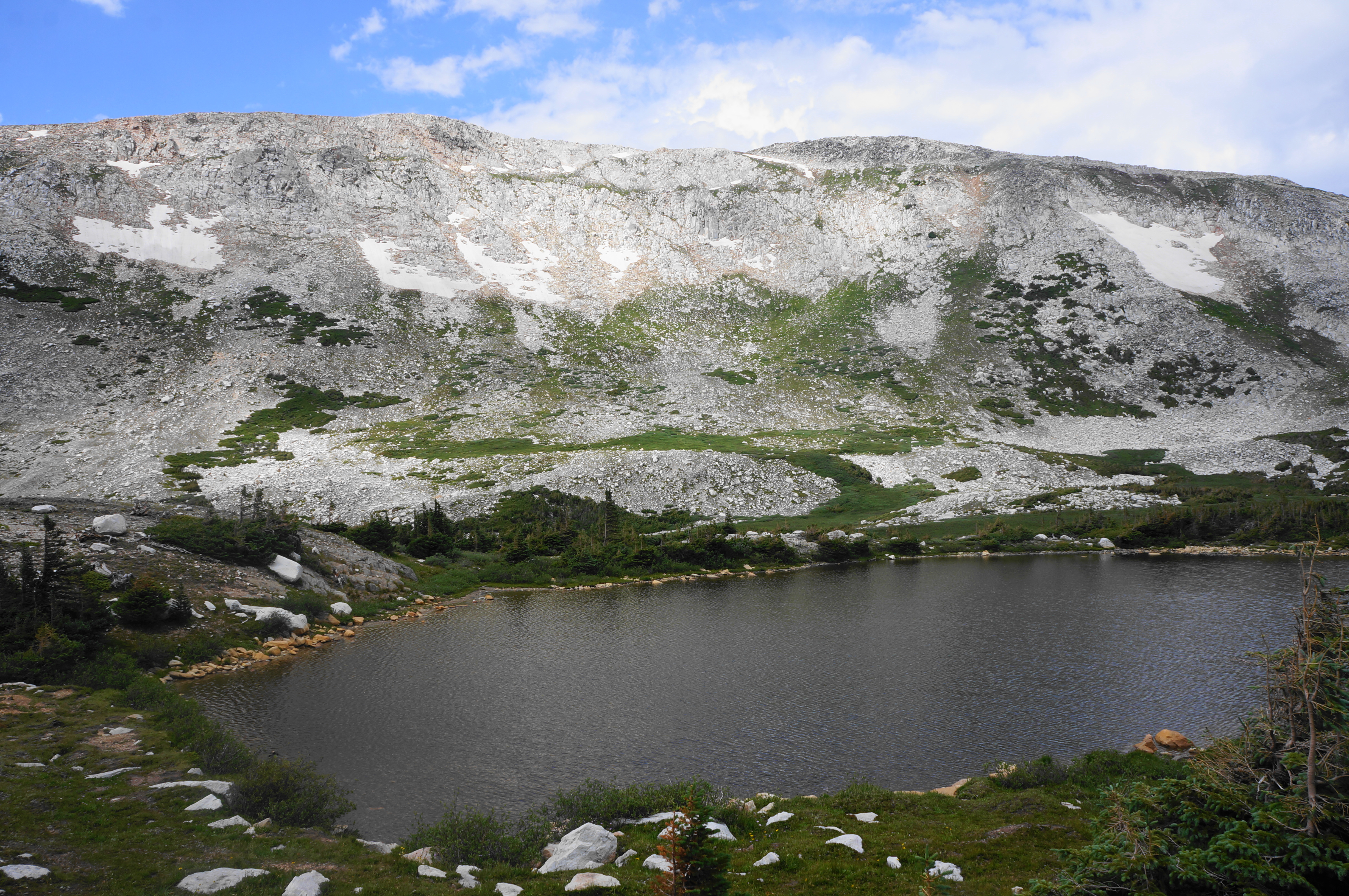
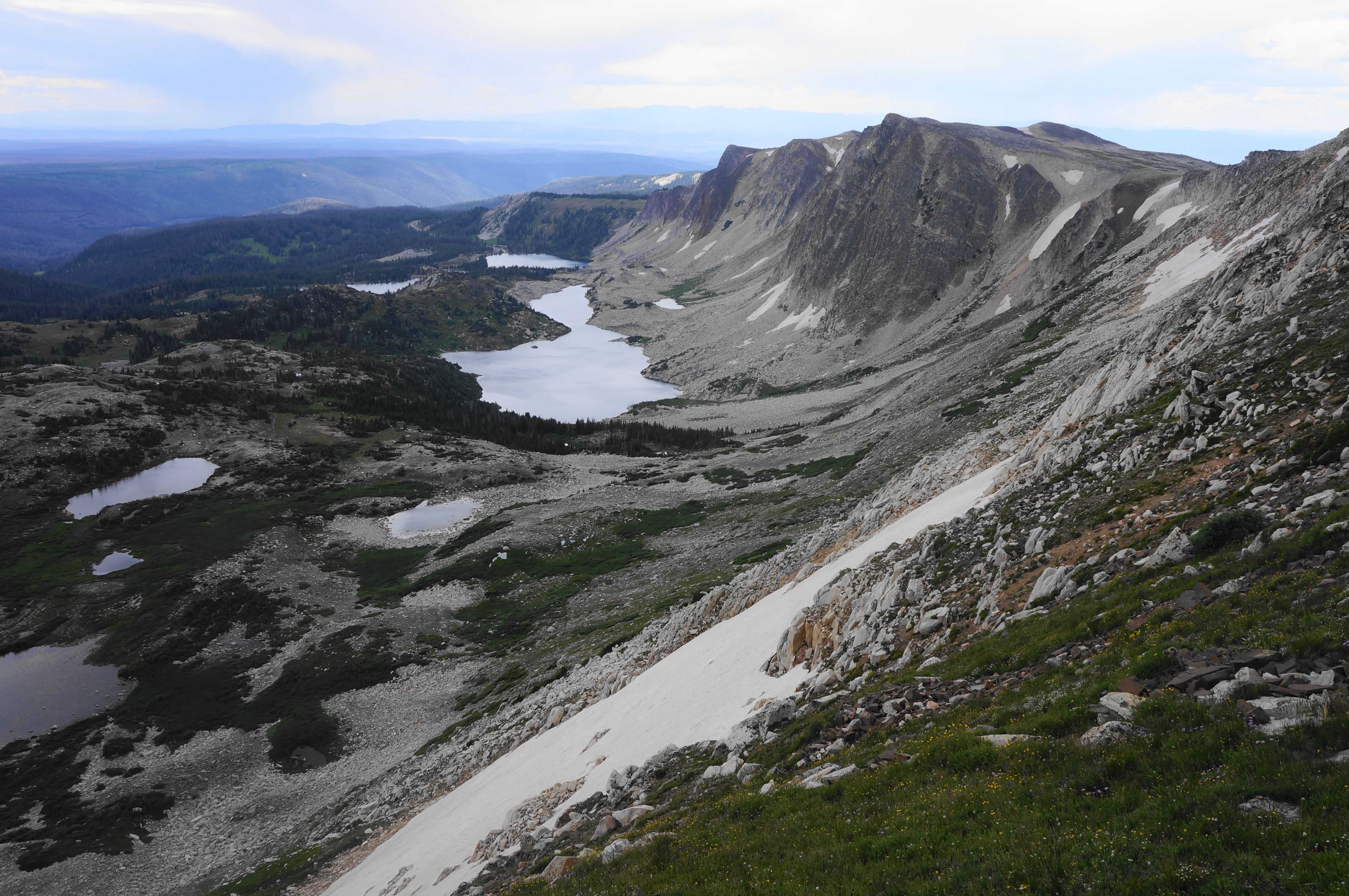
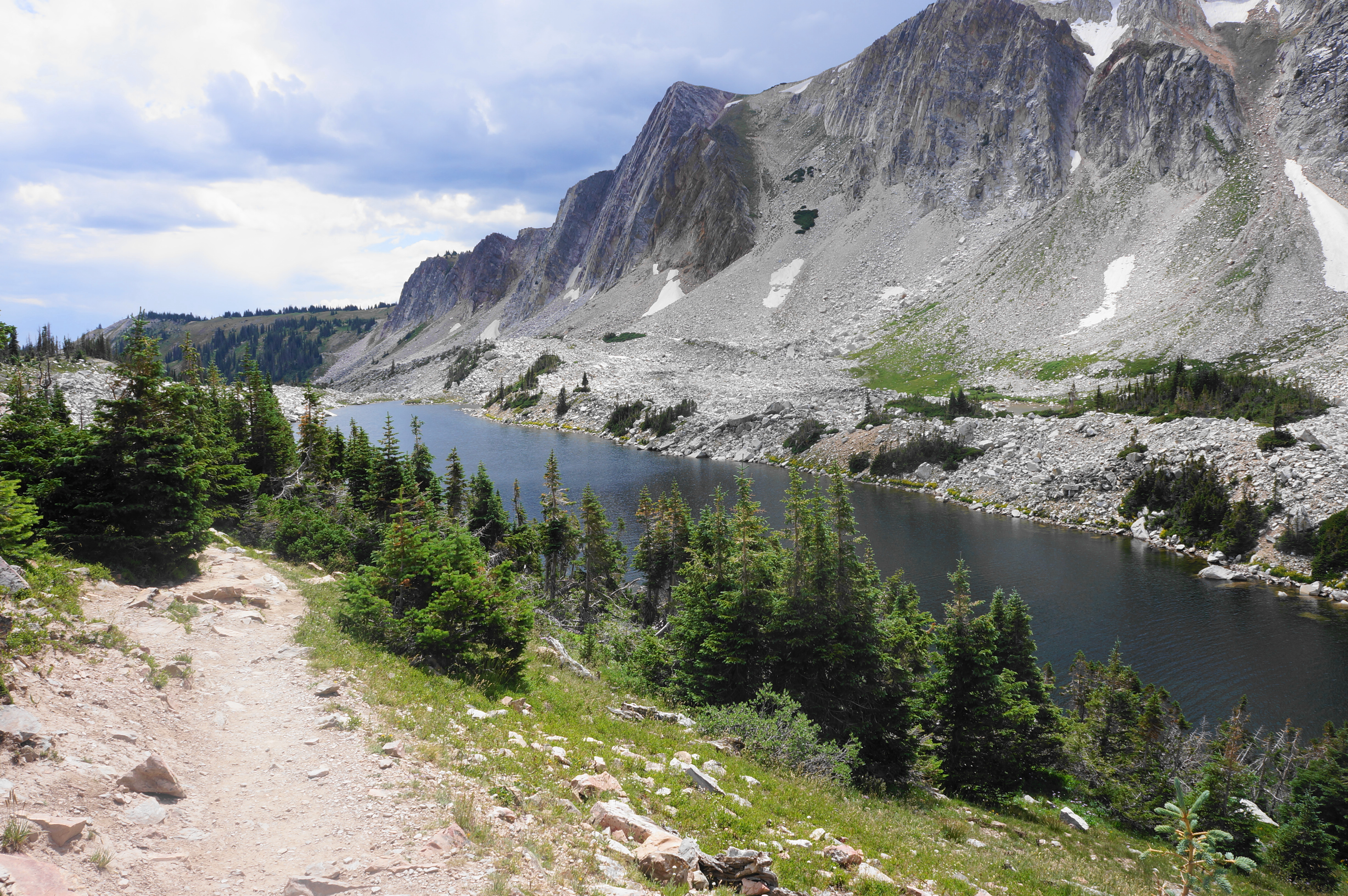
From here the Lakes Trail rises slightly to a beautiful moraine with wildflowers and patches of pines. Pass through a gap, descending next to Lookout Lake—the largest lake encountered on the hike—which is surrounded by pines on the east bank but flanked by scree and rubble on the west side.
A very steep downhill at 5.3 miles leads to a curious, unmarked junction. Bear left, with the path moving southward in the direction of the Mirror Lake and Lake Marie Trailheads. With Lookout Lake still down to the right, cross over a small stream, then climb a mild slope with open views as the lake thins to a narrow channel. (Note: In dry years, this narrower strip is actually a separate lake.)

Soon the path settles into a downhill wooded section, then an up and down in the open with the lake reaching its terminus on the right. It is a short walk from here to the Mirror Lake Picnic Area, where there is limited trailhead parking.
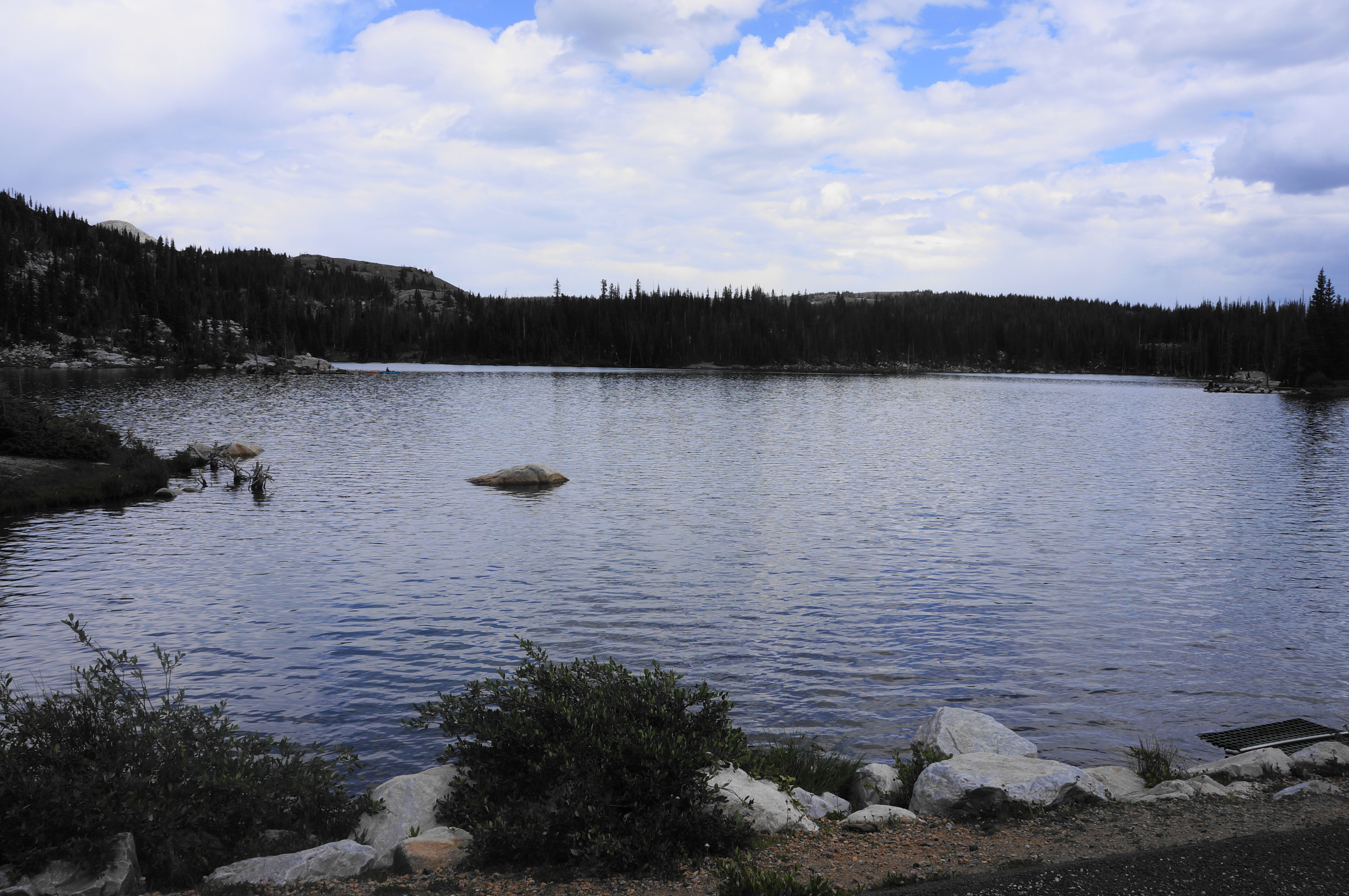
At the first sight of the road, take a left, finding your way out of the parking area and to the shores of Mirror Lake. With the lake on the left, continue along the entry road until a wide and marked path bears right. (Note: There is a sign here that reads “No Parking – Trail to Marie Lake.”) The paved route is a pleasant stroll that first skirts an inlet of Lake Marie before coming to another small parking area.
Stay on the path as its parallels the road, with the rest of Lake Marie now coming back into view. A sign indicates that hikers have entered Carbon County. With the parking area now in sight, the trail crosses a final bridge; turn left and return to the trailhead, ending the 6.9-mile loop hike.
Although one of the easier 12,000-foot summits in Wyoming to reach, this hike is considered strenuous due to its length, considerable elevation gain, and high altitude conditions. Hikers should expect to take at least 4-6 hours to complete the loop.

Excellent photos and trail report. THANKS for sharing!
You do such a great job documenting these hikes, please keep up the great work… Thanks!
Pingback: Top 10 Hikes in 2022 | Live and Let Hike
We did this hike and I have to say your description and photos are spot on.