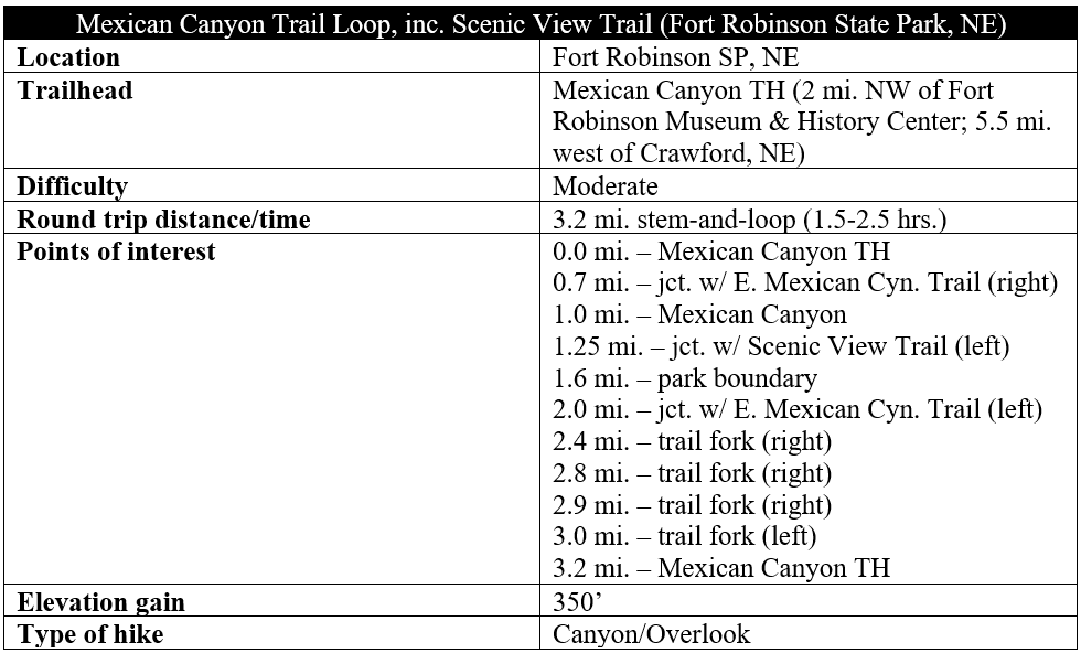
Fort Robinson, a former U.S. Army base dating to the late 19th century, may be the most popular destination in the state park that bears its name—but the natural highlights lie beyond to the north and west in the sedimentary rock canyons and high bluffs that form part of northwest Nebraska’s Pine Ridge. This 22,000-acre state park features an extensive—if underdeveloped—trail network for hiking, biking, and horseback riding, and the Mexican Canyon Trail Loop covers some of the most spectacular terrain. Expect on this 3.2-mile journey to see towering chalk cliffs, photogenic box canyons, and a diversity of flora and fauna.

The hike
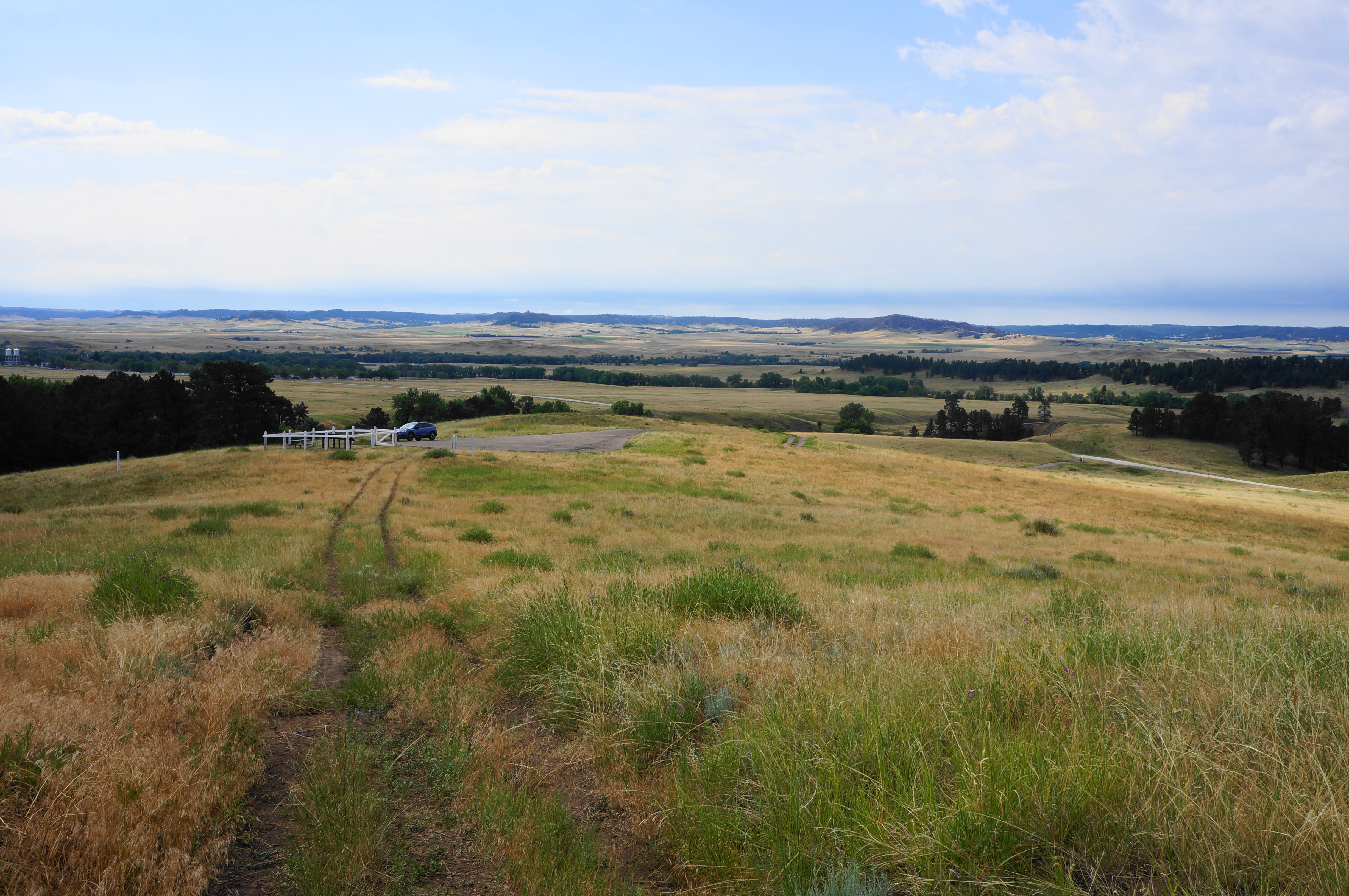
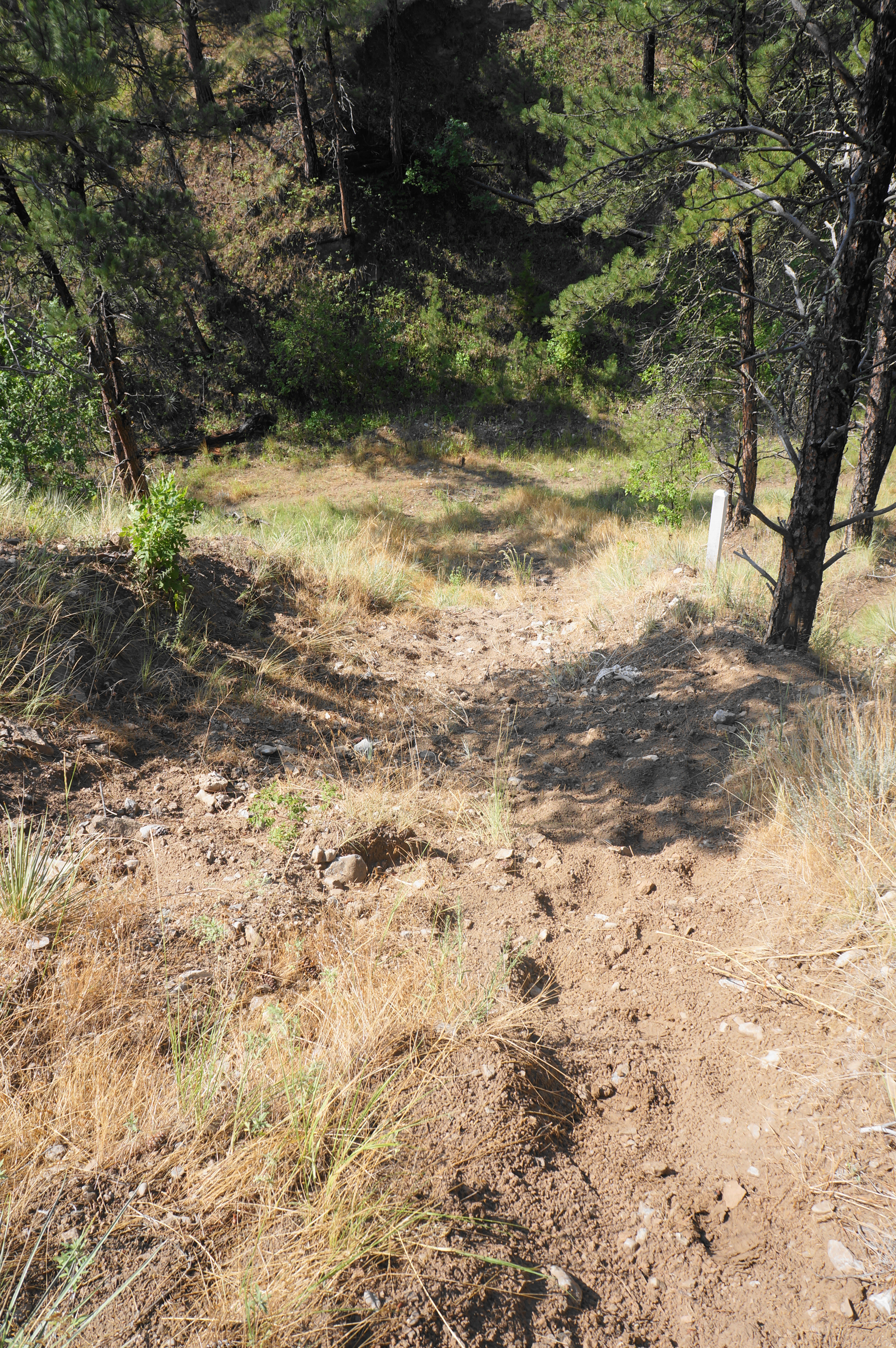
To reach the trailhead, head northwest on Soldier Creek Road from Fort Robinson, bearing in the direction of remote Soldier Creek Wilderness. Here the road traverses a broad plain that bisects the state park, with the main complex of buttes, ridges, and plateaus dominating the skyline to the north. Drive on Soldier Creek Road for 1.6 miles, bearing right at the sign indicating the Mexican Canyon Trailhead. A dirt, steep doubletrack—likely accessible with any vehicle unless conditions are wet and muddy—leads uphill to a mound south of the cliff-line with early views.
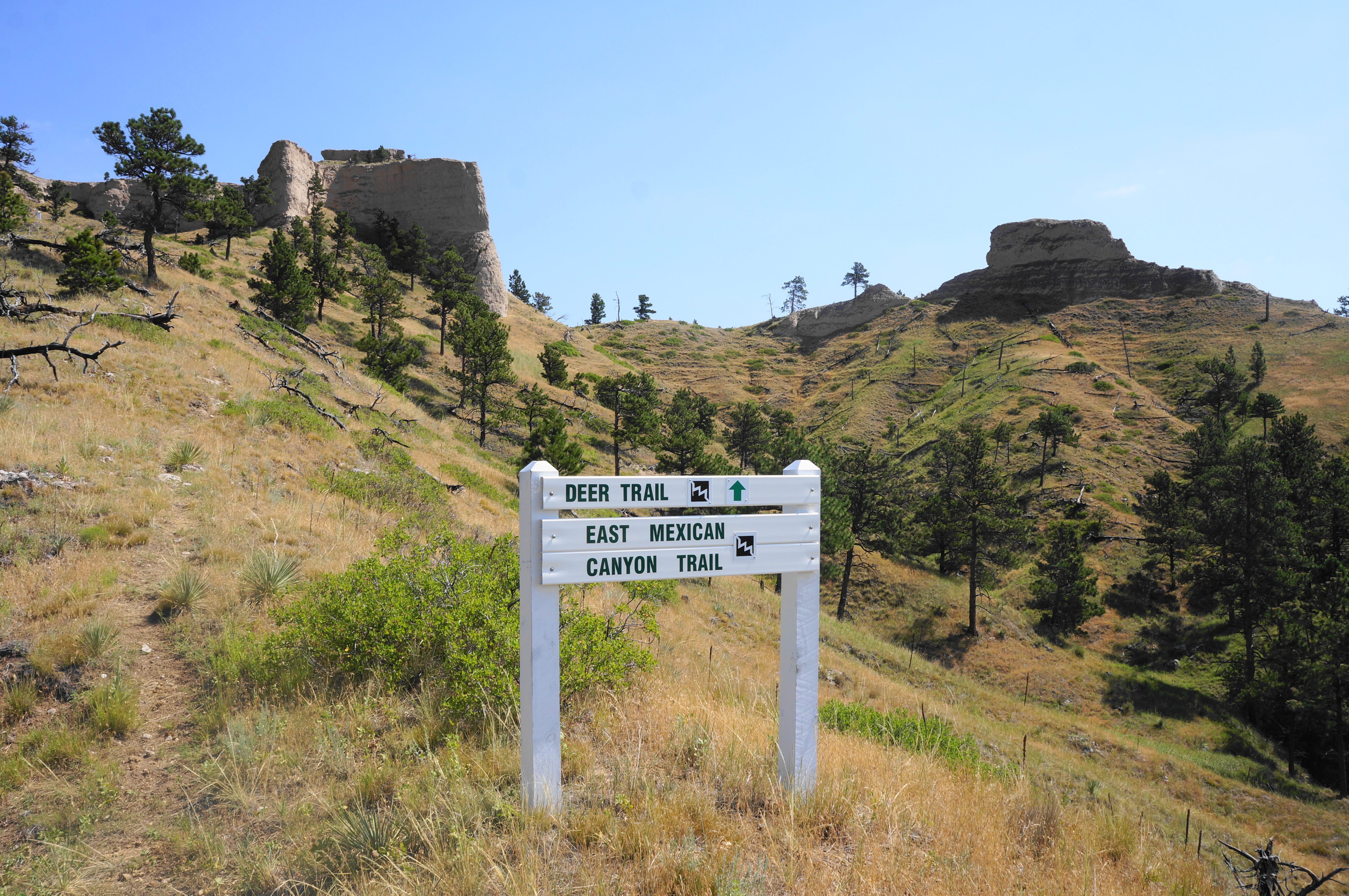
At the trailhead, there is a small white picket fence enclosure, as well as a picnic table and information on the resident bighorn sheep—which you have a decent chance of seeing on the hike. The loop hike described combines the Mexican Canyon Trail, East Mexican Canyon Trail, and a ¾-mile spur to the park boundary on the Scenic View Trail, heading in a clockwise direction.
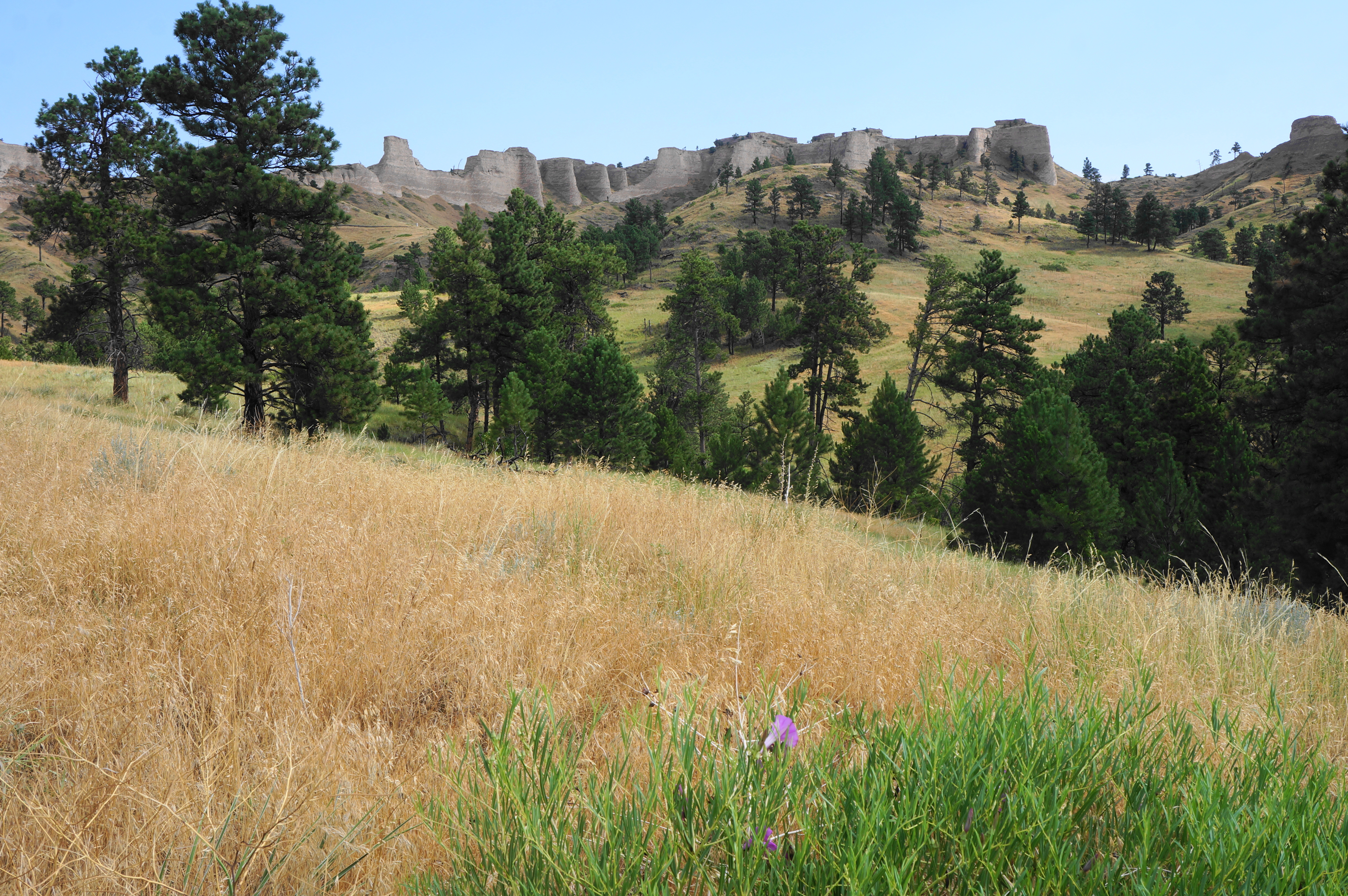
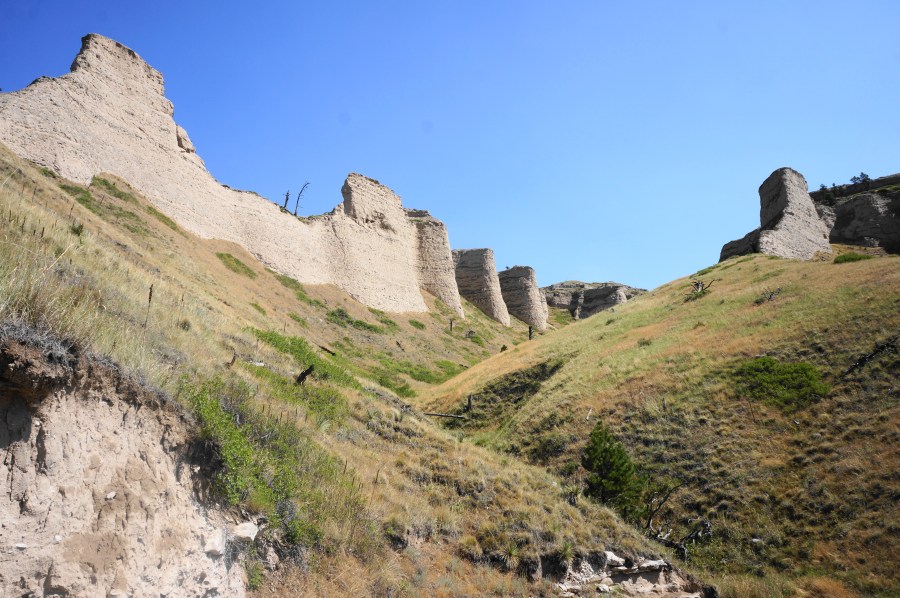
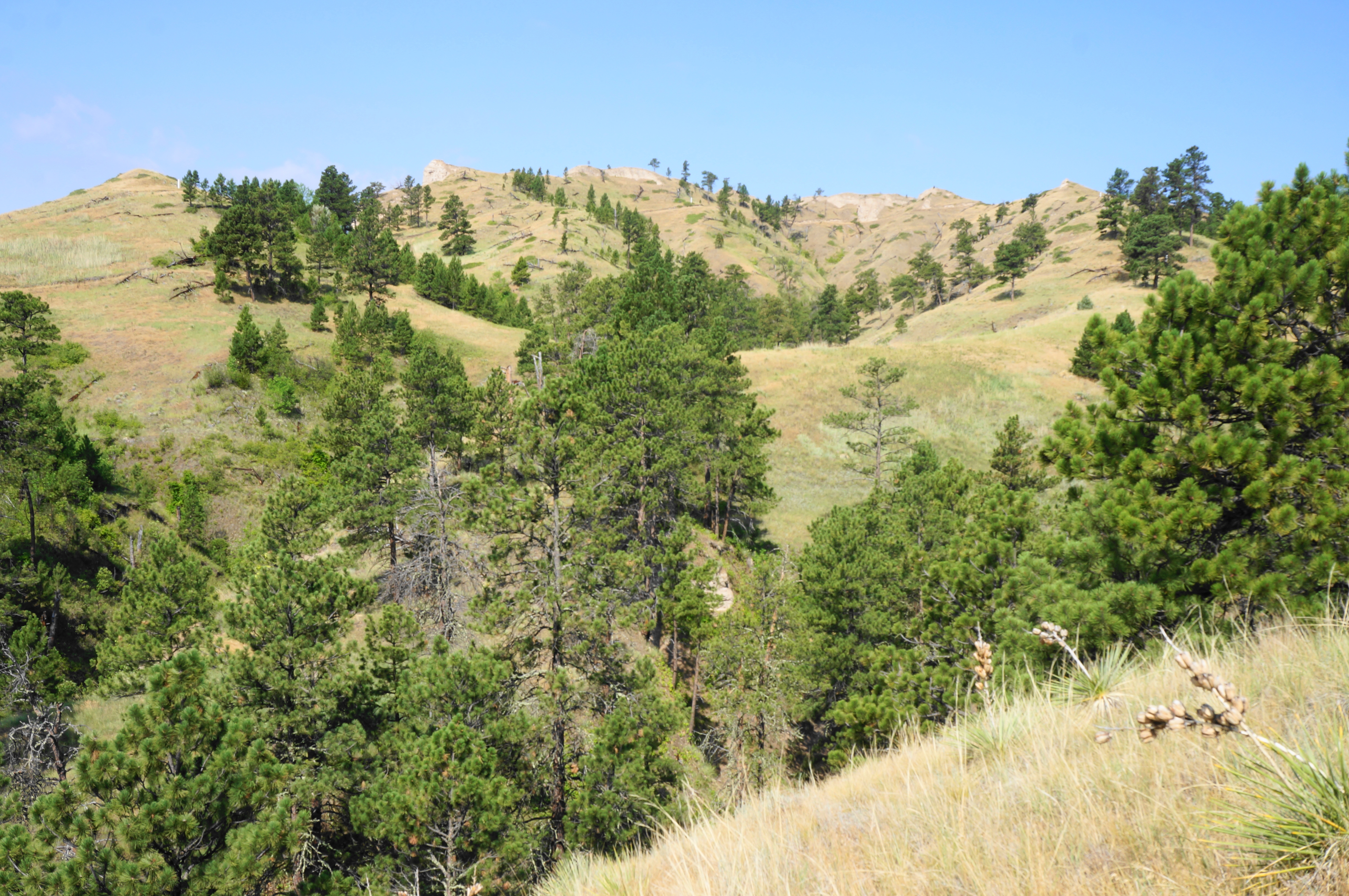
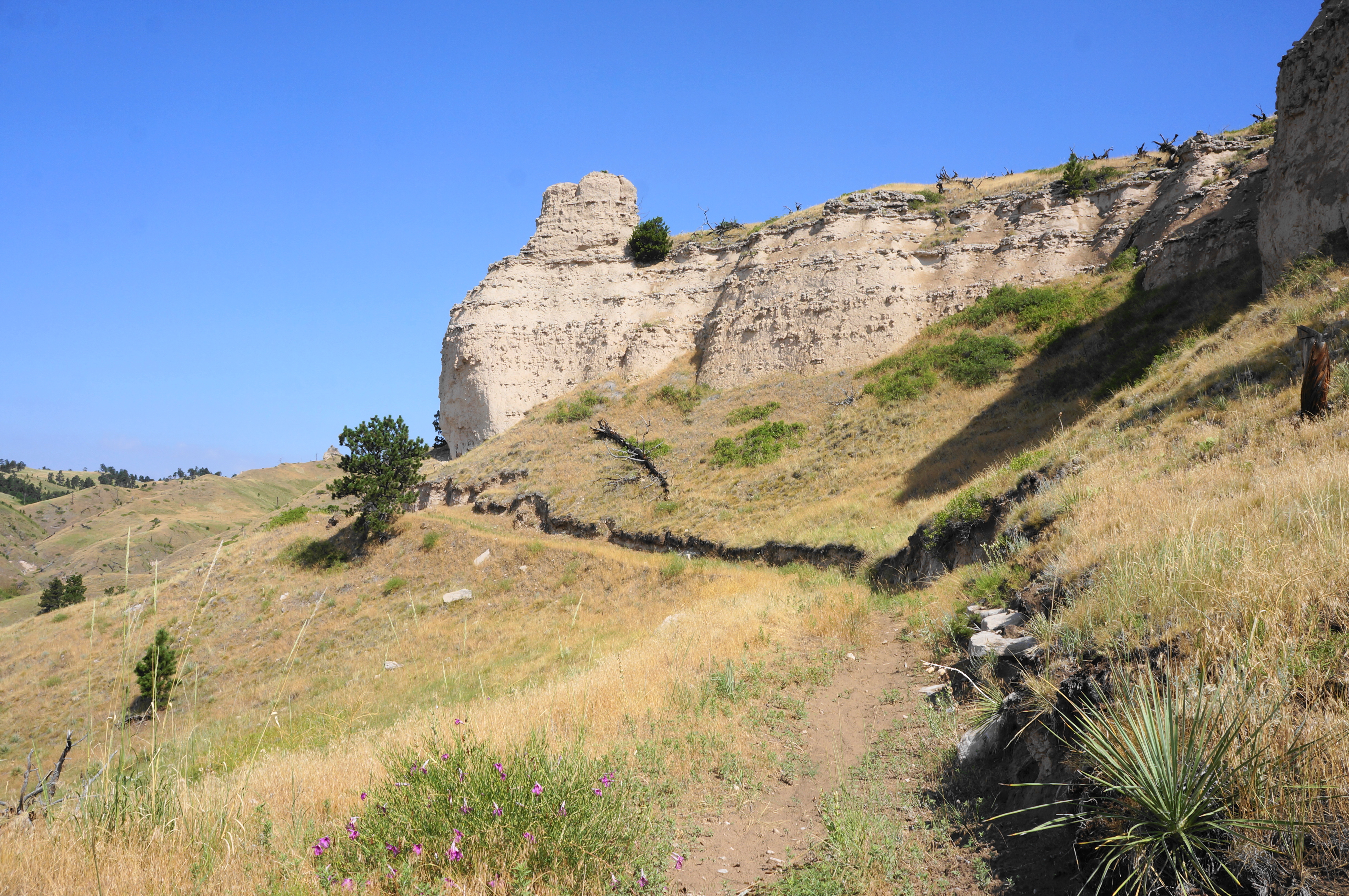
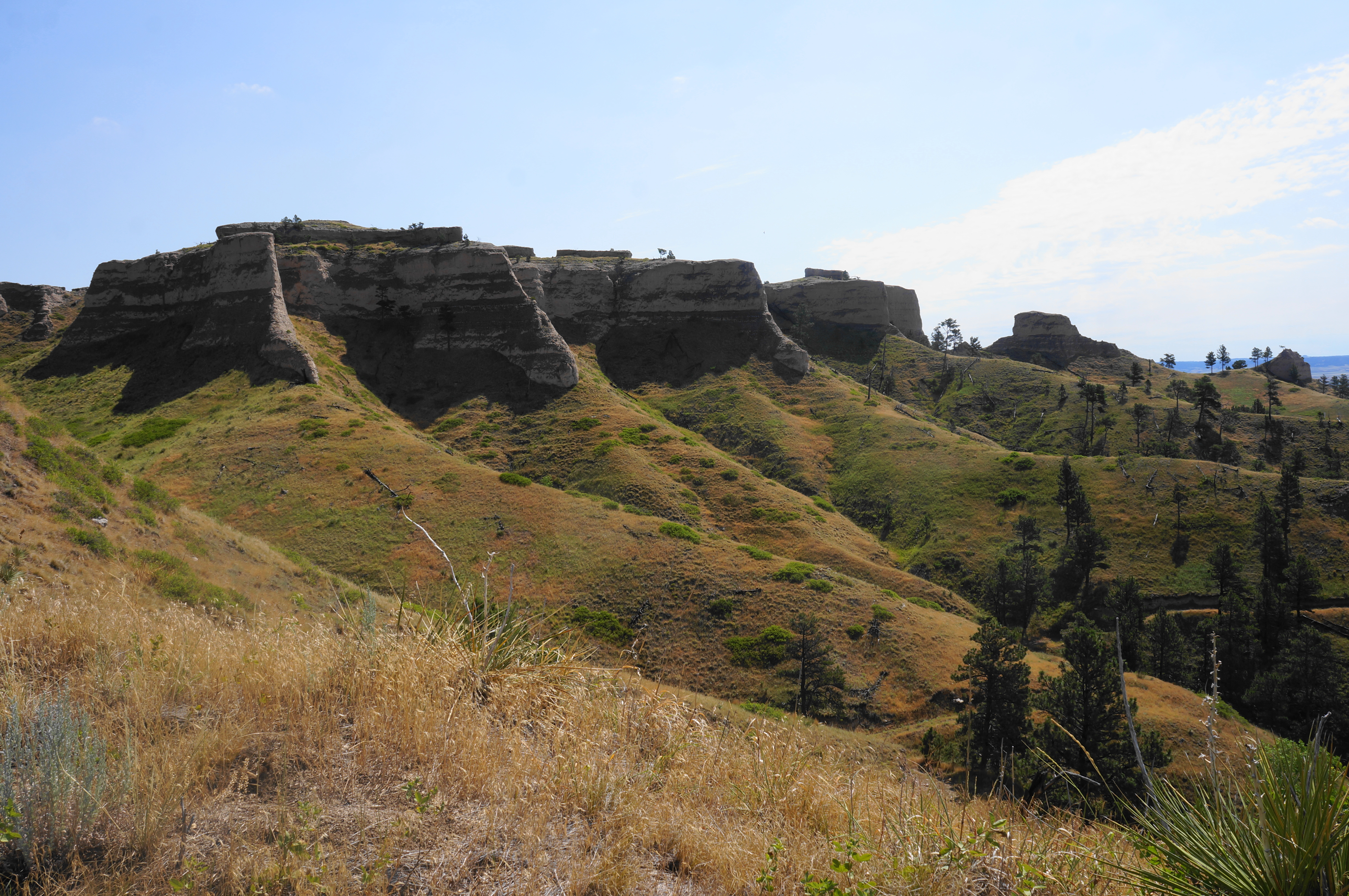
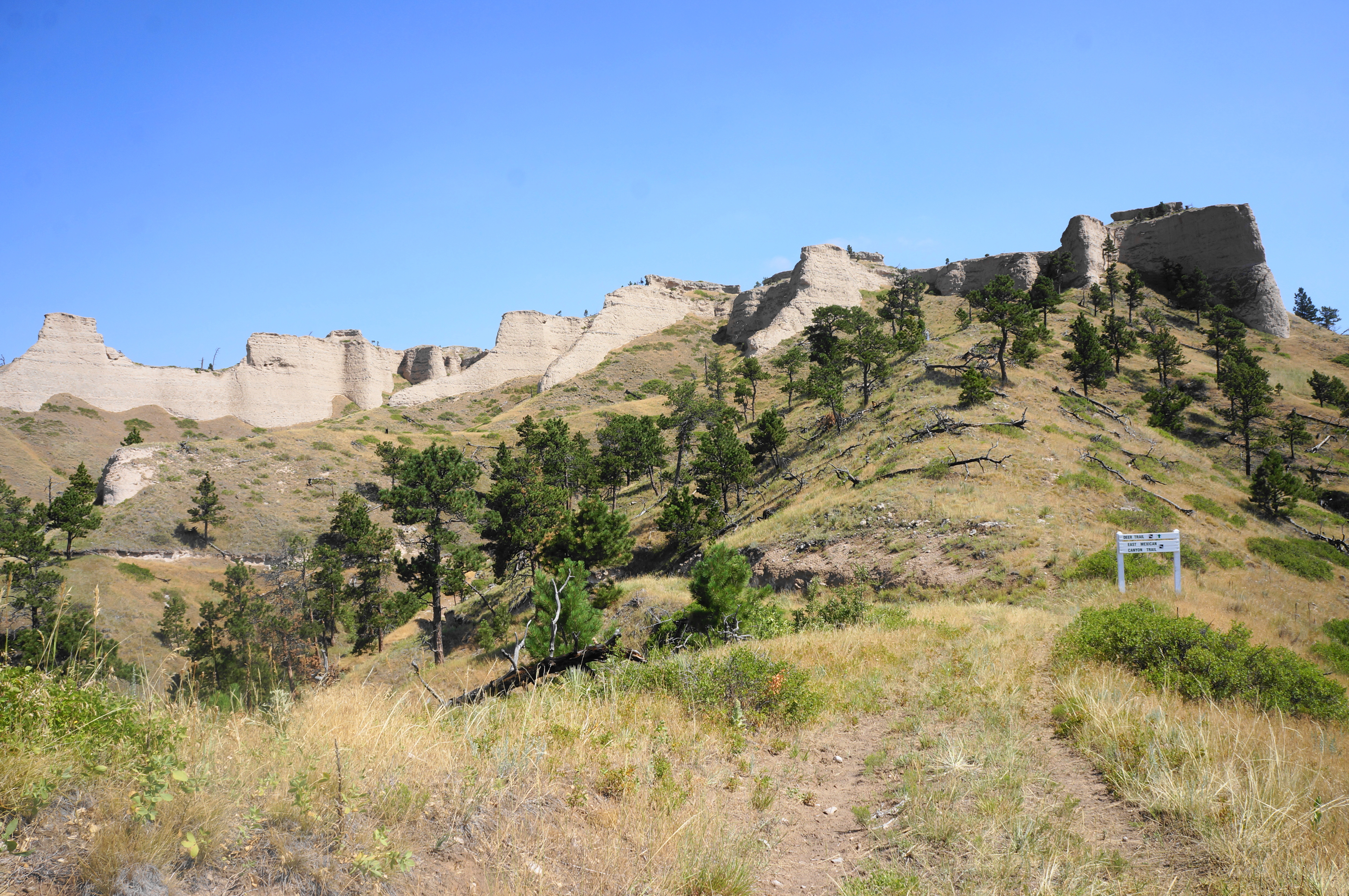
Begin the hike by finding the grassy doubletrack path heading up the ridge to the northwest, quickly putting the small trailhead in the rear-view mirror. Views of the crumbly cliffs are immediate—although they improve significantly as the journey continues. Between the Mexican Canyon Trail and the bluffs lies Mexican Canyon, one of the longest incisions in the park’s highlands. The usually dry canyon nonetheless bears significant life, including a diversity of conifers characteristic of the broader Pine Ridge.

The Mexican Canyon Trail keeps its distance from the bluffs visible to the north, but another high ridge begins to take shape on the left—this is the long arm of Walter Reed Butte (4,401’), named for the Army doctor who also became the namesake for the famous veterans’ hospital in Washington, DC. (Note: The trail never quite summits the butte but comes close.)
At about 0.35 miles, the trail splits—marked by white stakes—with an incredibly steep slope heading left. Given the two forks meet up again soon, it is best to go right, where the tread is easier and incline more gradual. There is a short steep section, but soon the trail levels again, and the two alternatives weave back together.
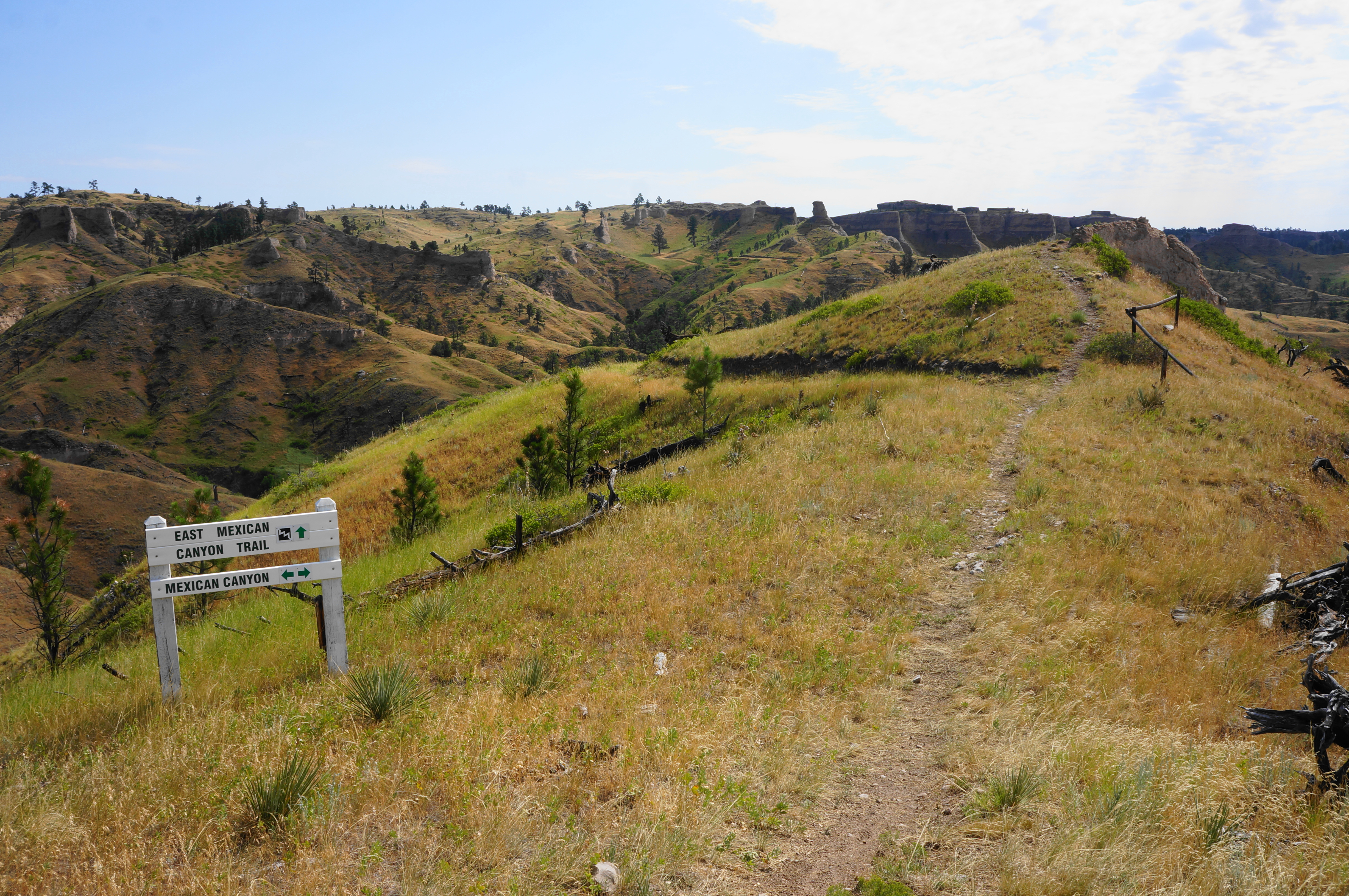
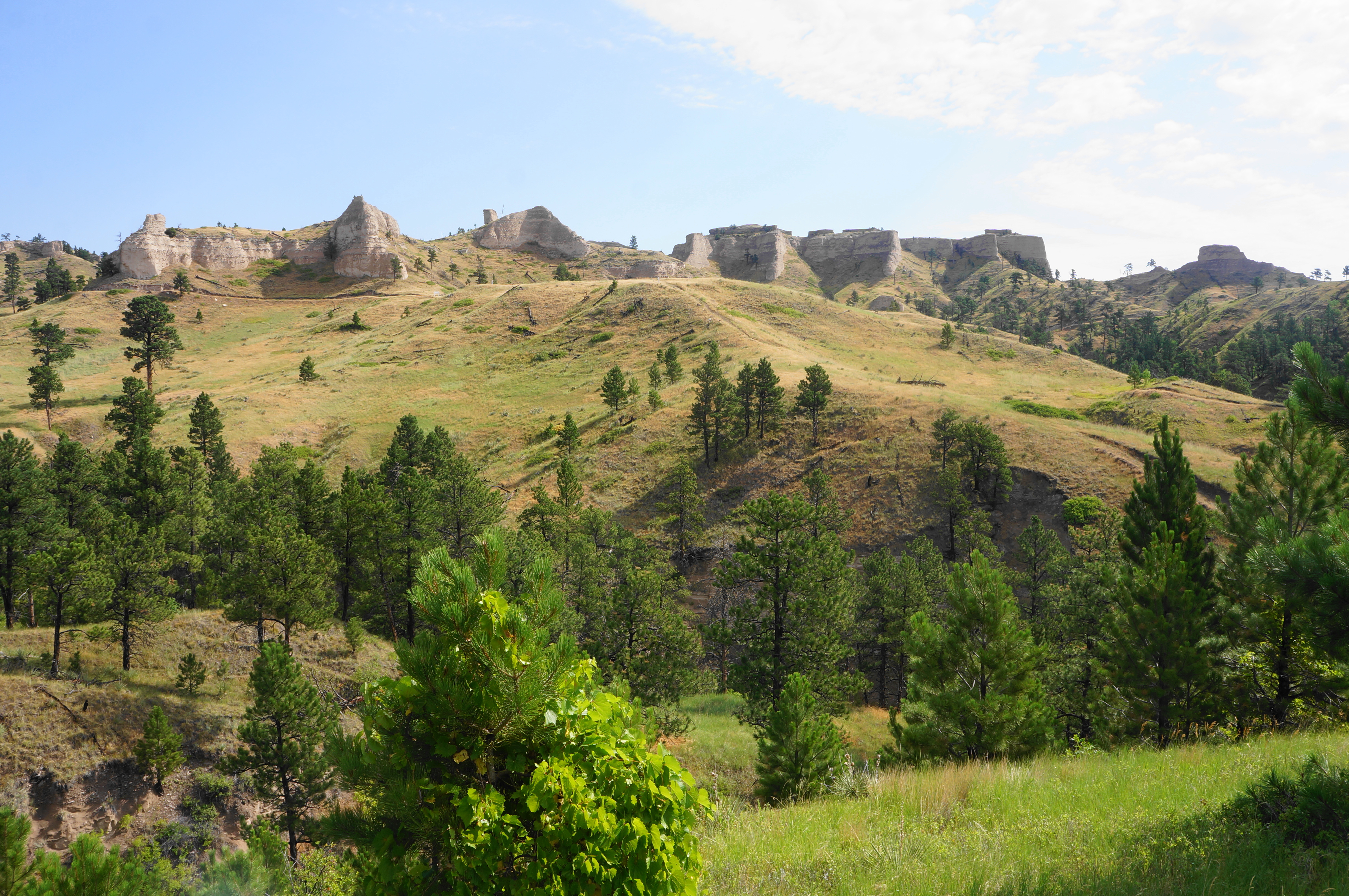
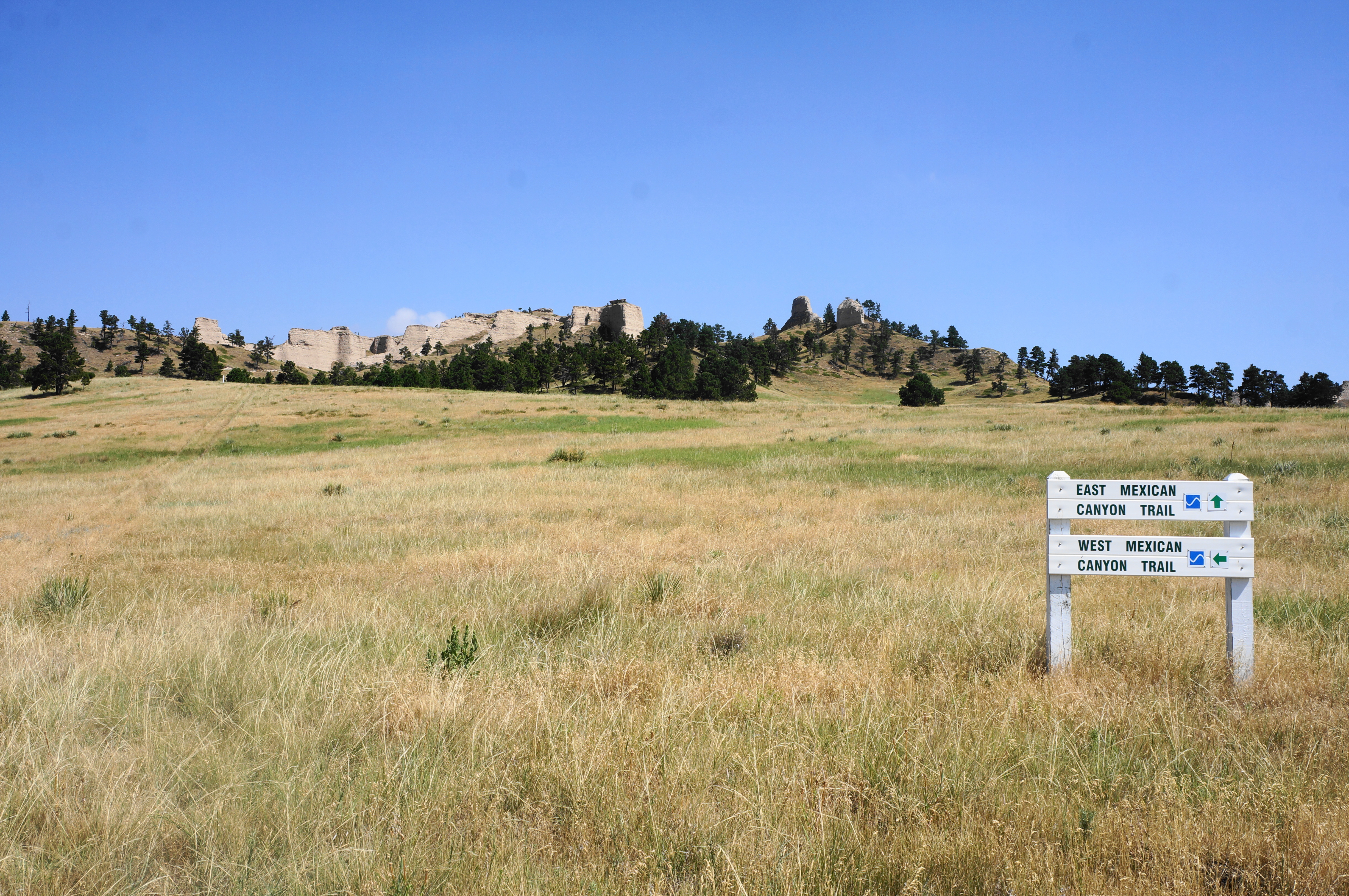
It is not long until the stiff climb returns, with hikers now getting a workout as they continue to skirt the fringes of Walter Reed Butte. The trail approaches some small chalk outcrops on the left, and there are excellent views down-canyon to the south and east. Upon cresting a moderately high saddle, hikers are greeted with a junction: the intersection of the Mexican Canyon Trail—which continues northwest—and the East Mexican Canyon Trail, a more scenic alternative. Head right, beginning a pleasant downhill section.
Immediately after turning right, there is a short spur to an outcrop with canyon views, with the main track gradually dropping left down a windy ridgeline. More or less follow the white stakes as the singletrack skirts tall grasses and yucca plants, with distant views of the trail network snaking below the stony cliffs to the east.
Eventually the trail starts to descend more steeply into Mexican Canyon, a shady gulch that feels a world away from the open desert pitches above. Here the landscape is teeming with shrubs and tall pine trees, with water running seasonally through the channel.
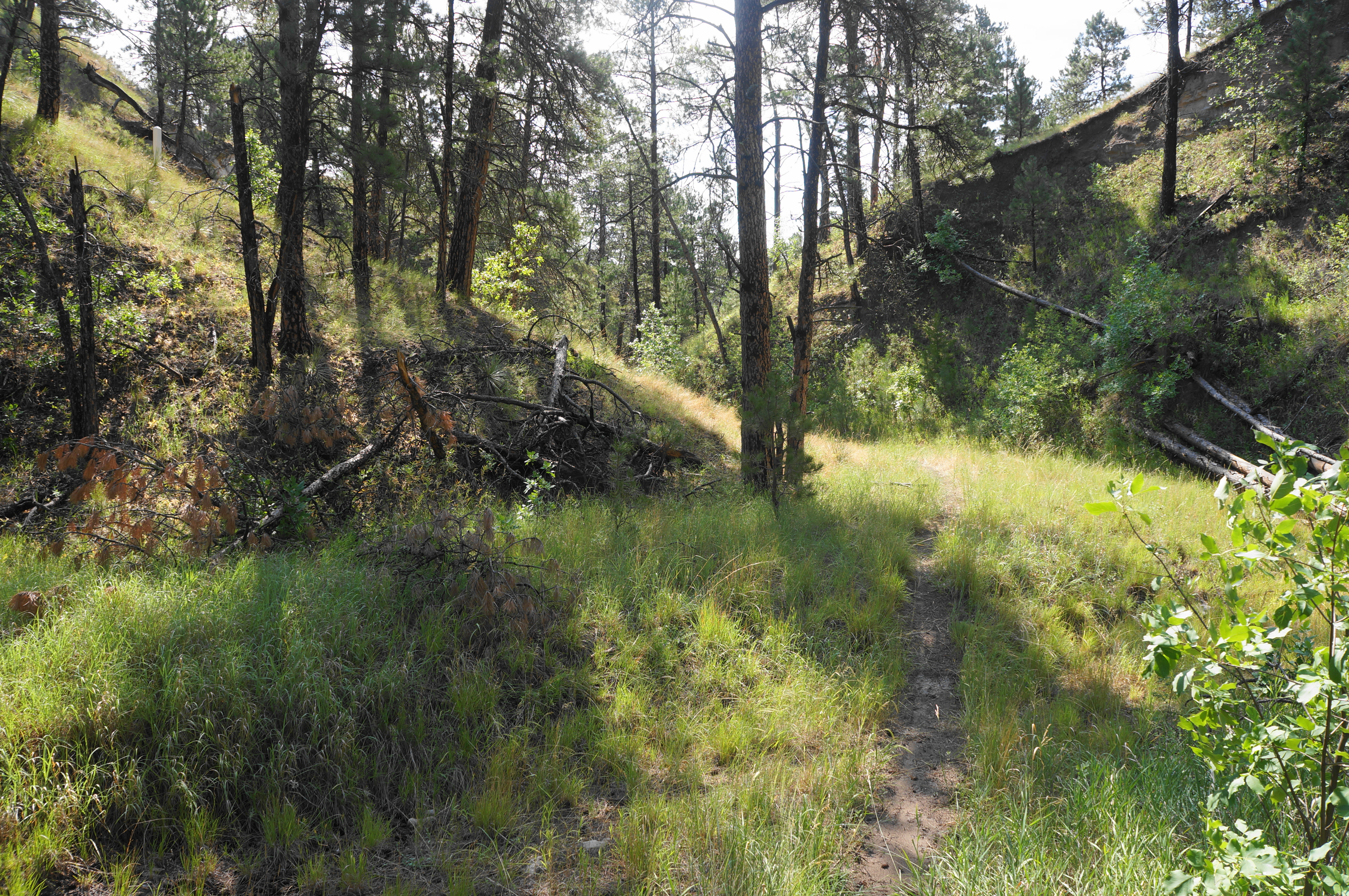
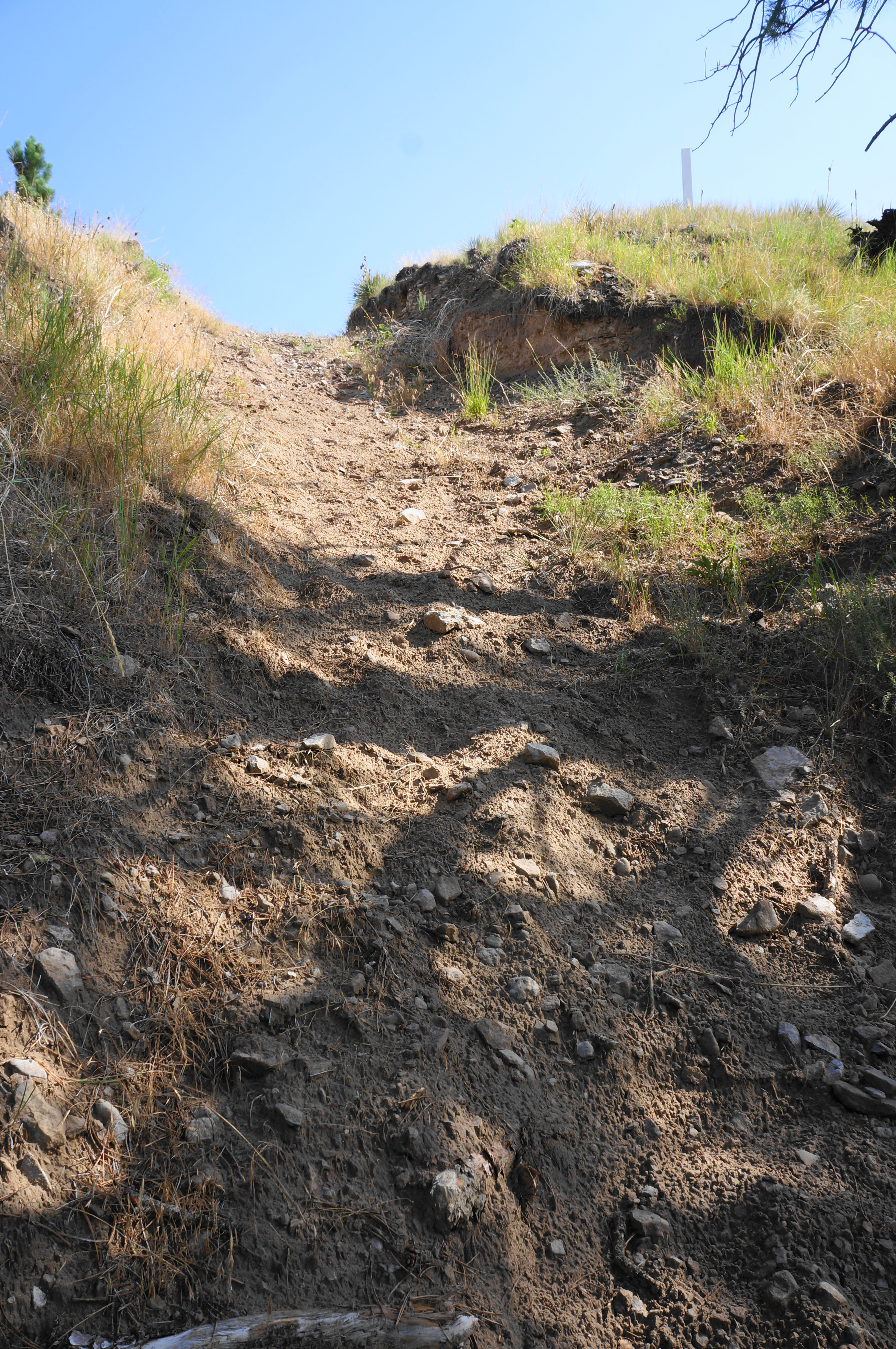
Hikers’ time in the canyon, however, is abbreviated, as the trail quickly climbs out again to the left (see the white trail marker), by way of an incredibly steep pitch that should be taken with care. This brutal but brief uphill brings hikers back up into the open prairie, with continued views.
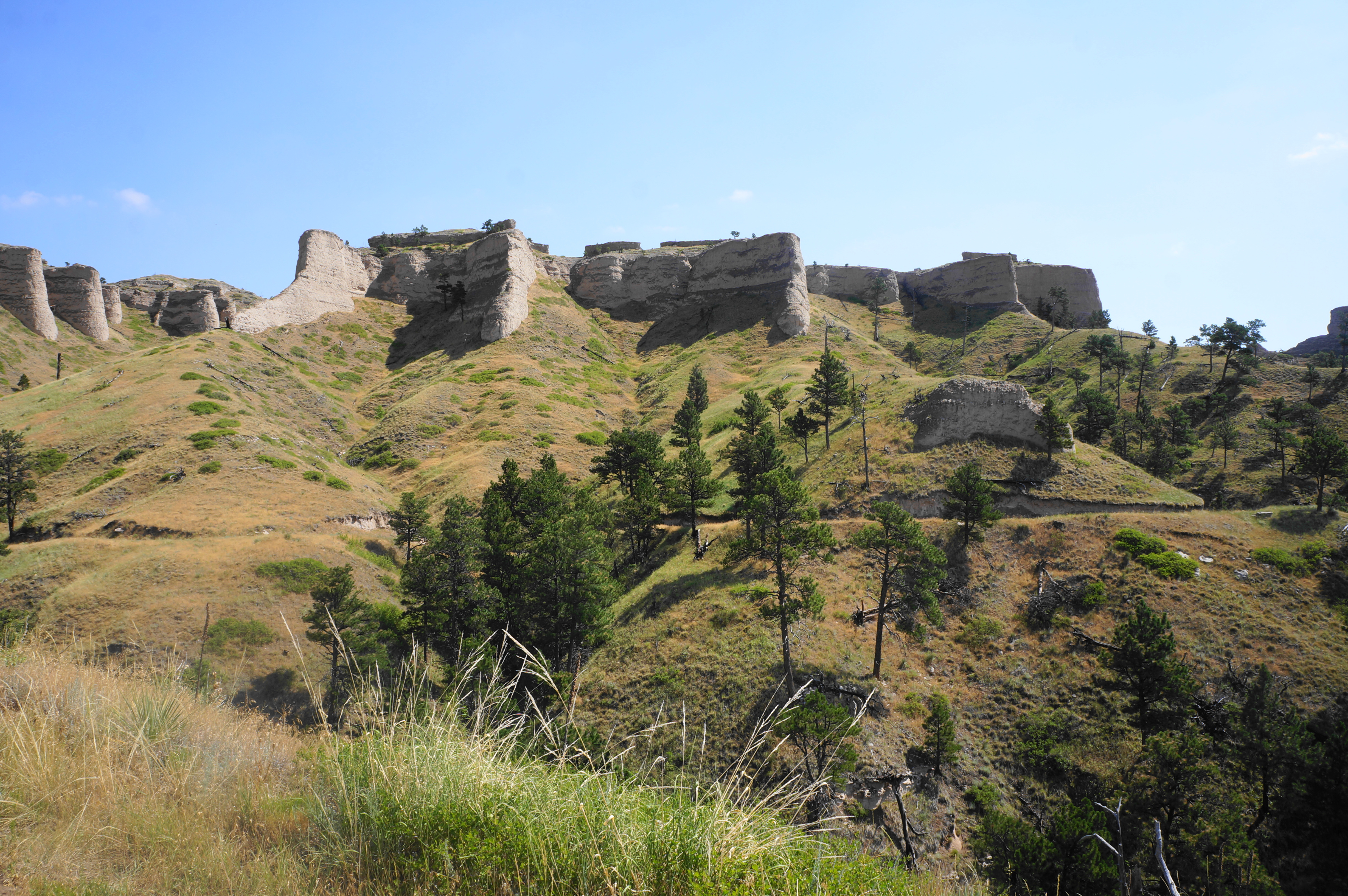
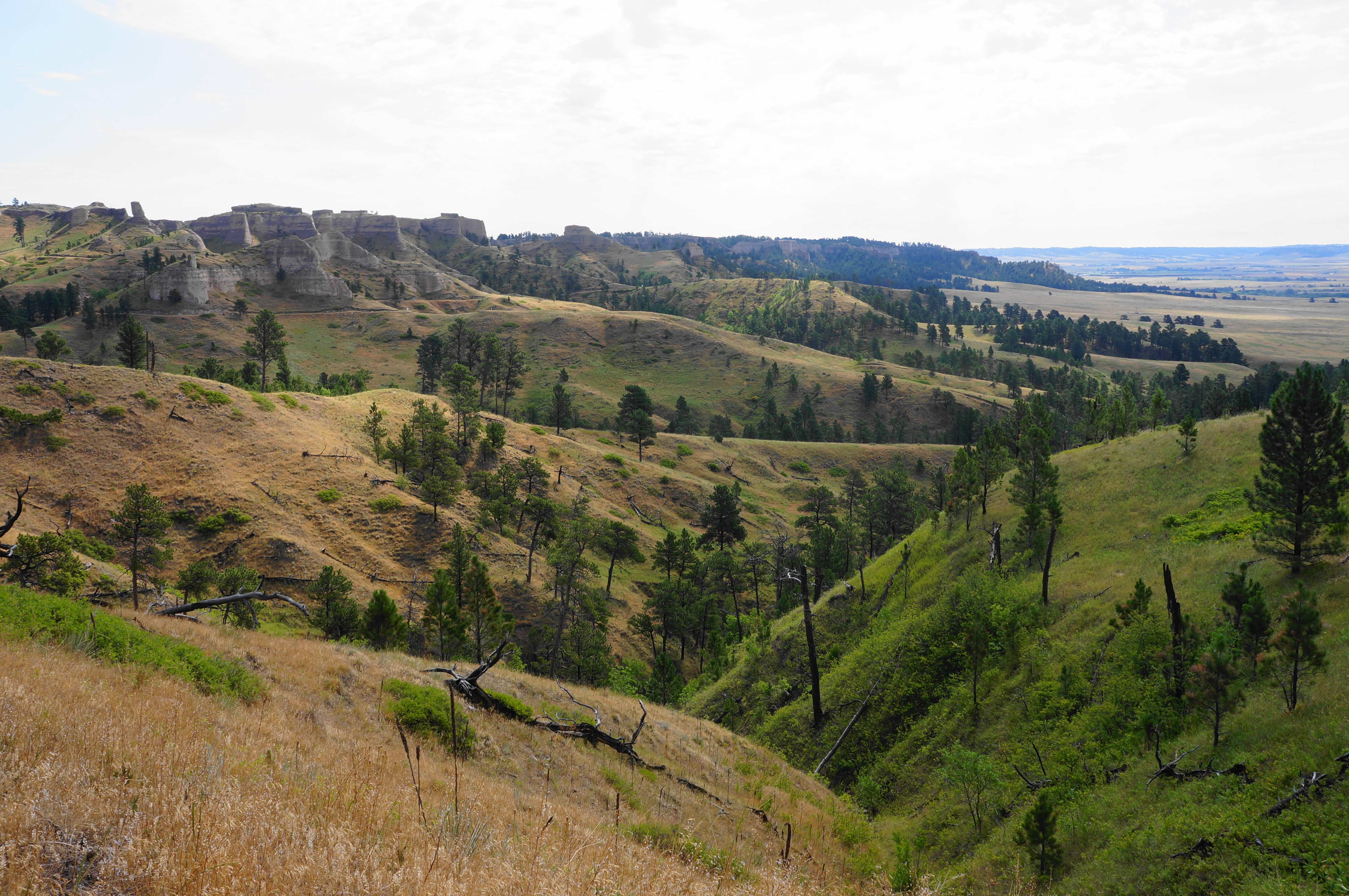
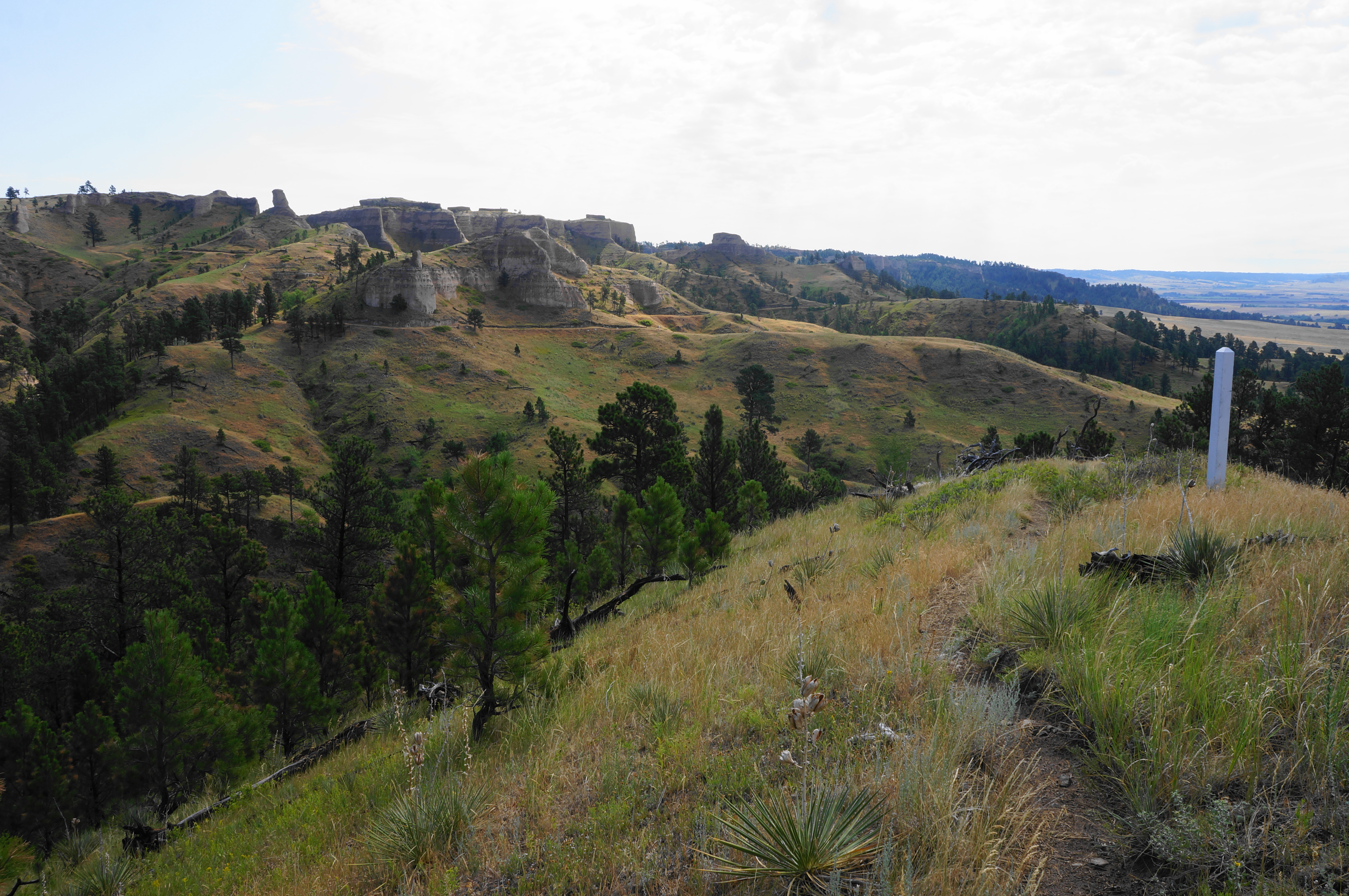
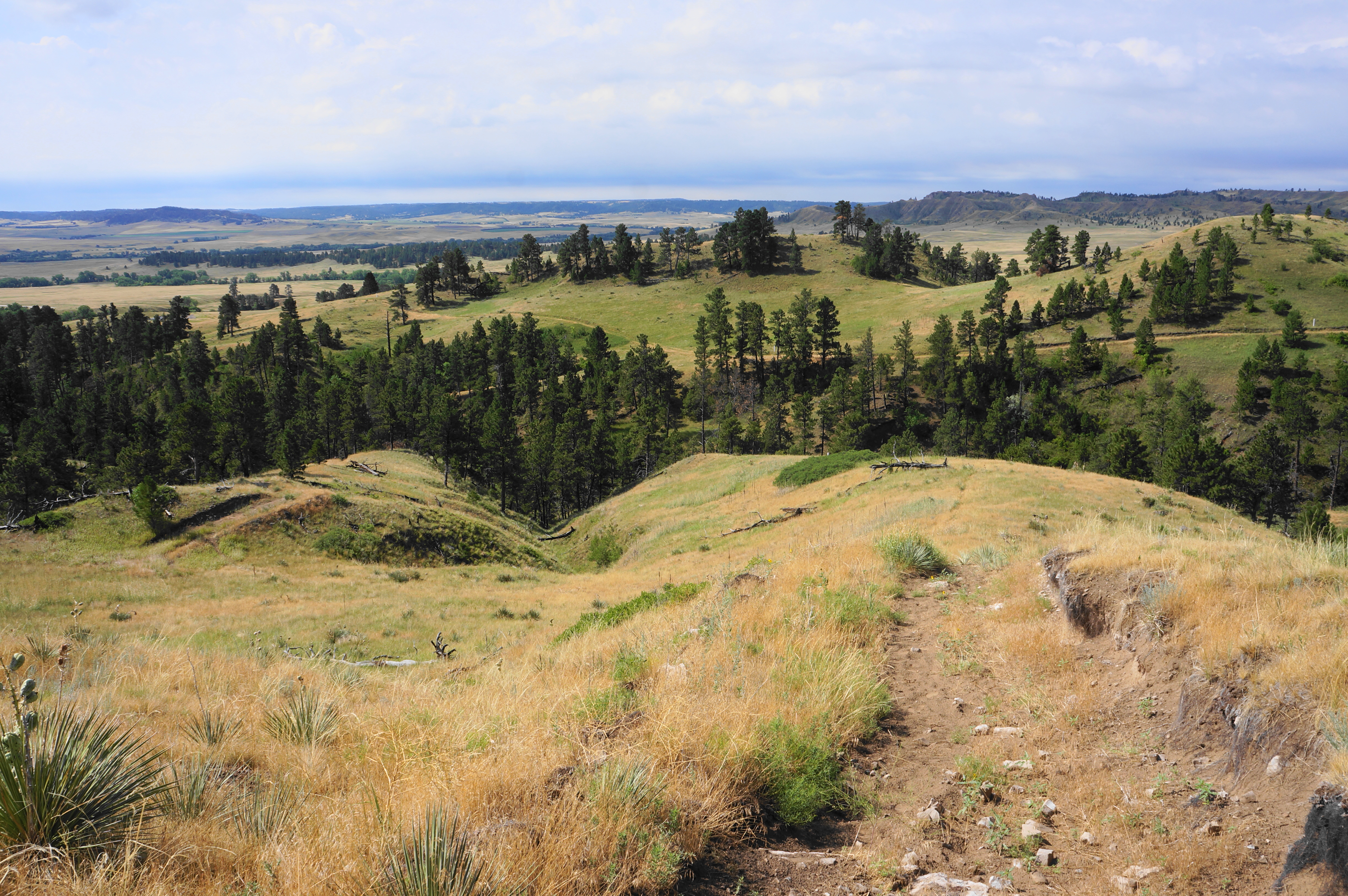
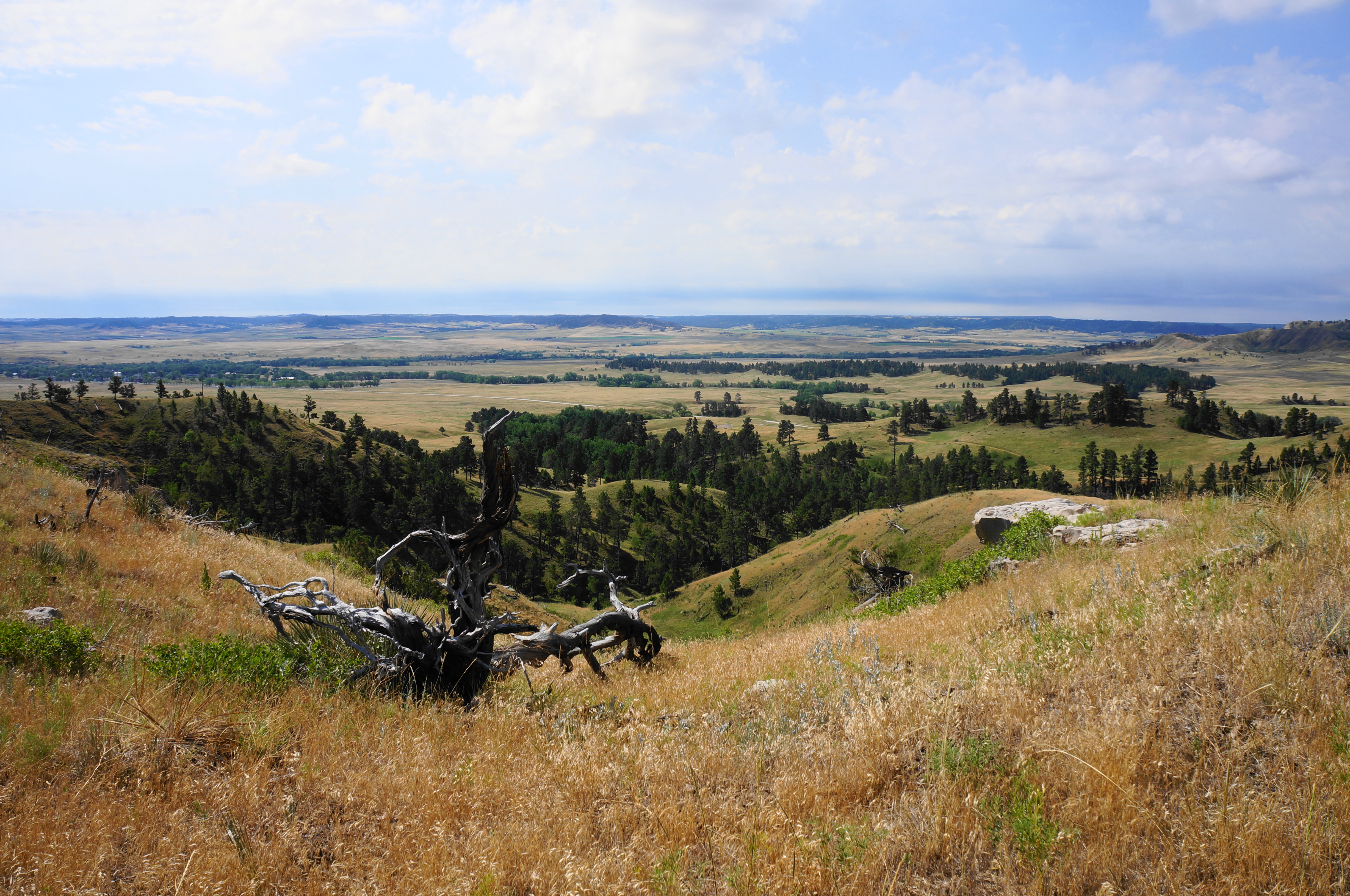
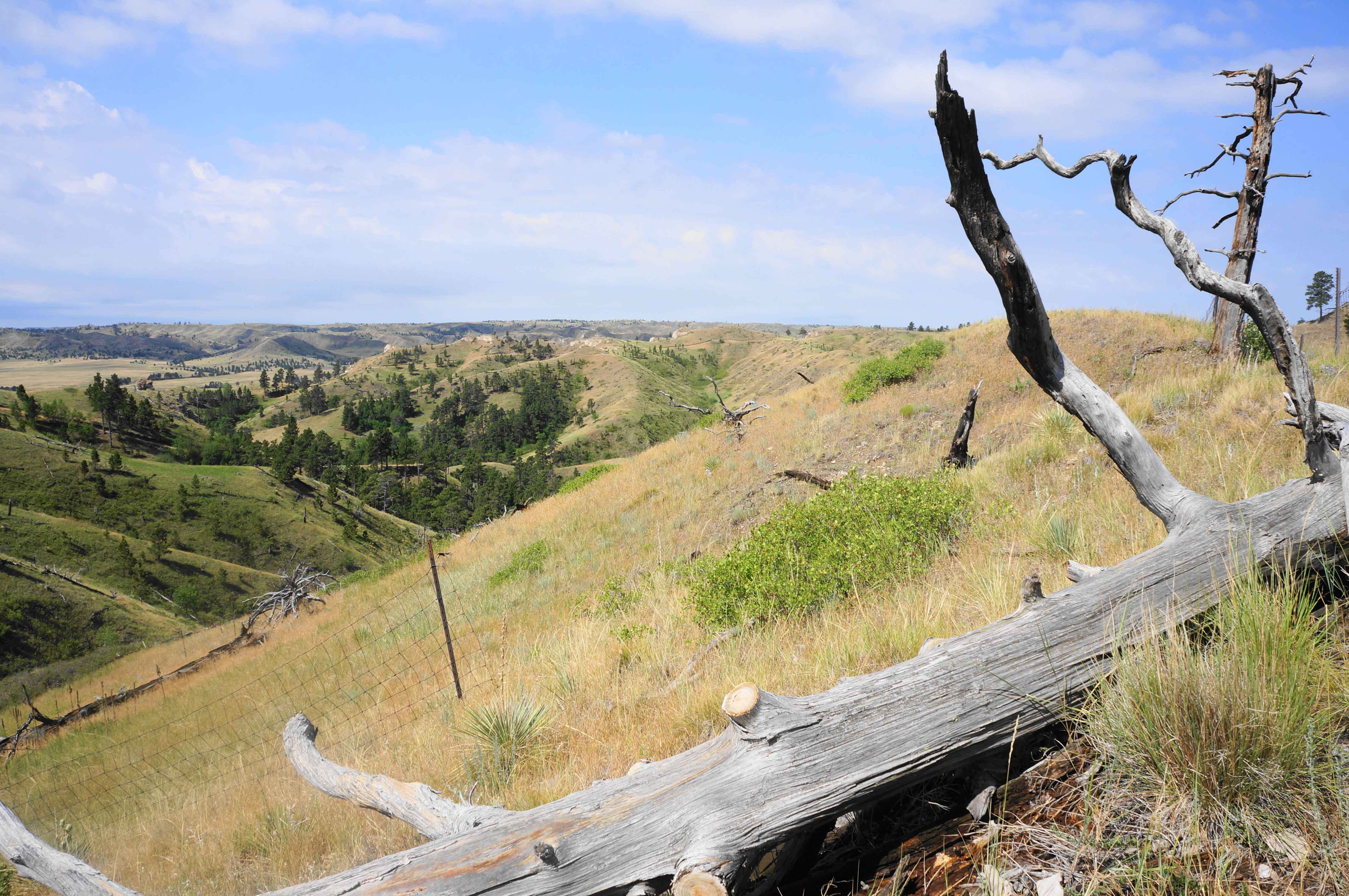
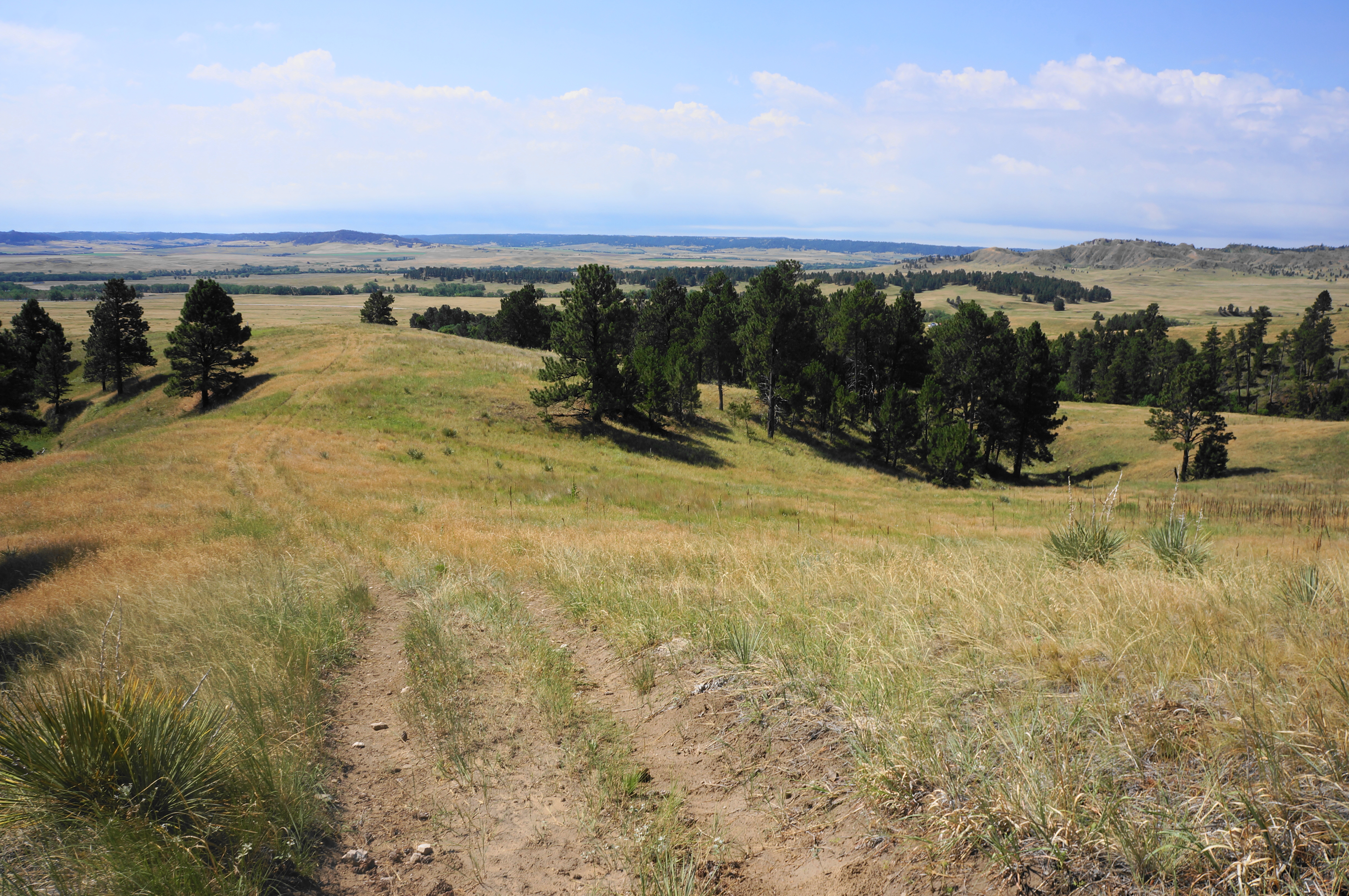
Here the faded grassy path becomes harder to follow, but white stakes generally lead the way, and the path becomes more visible as it climbs the ridgeline. Soon, at 1.4 miles, the trail reaches a much better-defined intersection, with wide and well-worn paths heading left and right. The views from the junction are excellent, with up-close vistas of the cliff-line and grand panoramas down to the Soldier Creek Basin and Fort Robinson area.
and the Mexican Canyon Trail

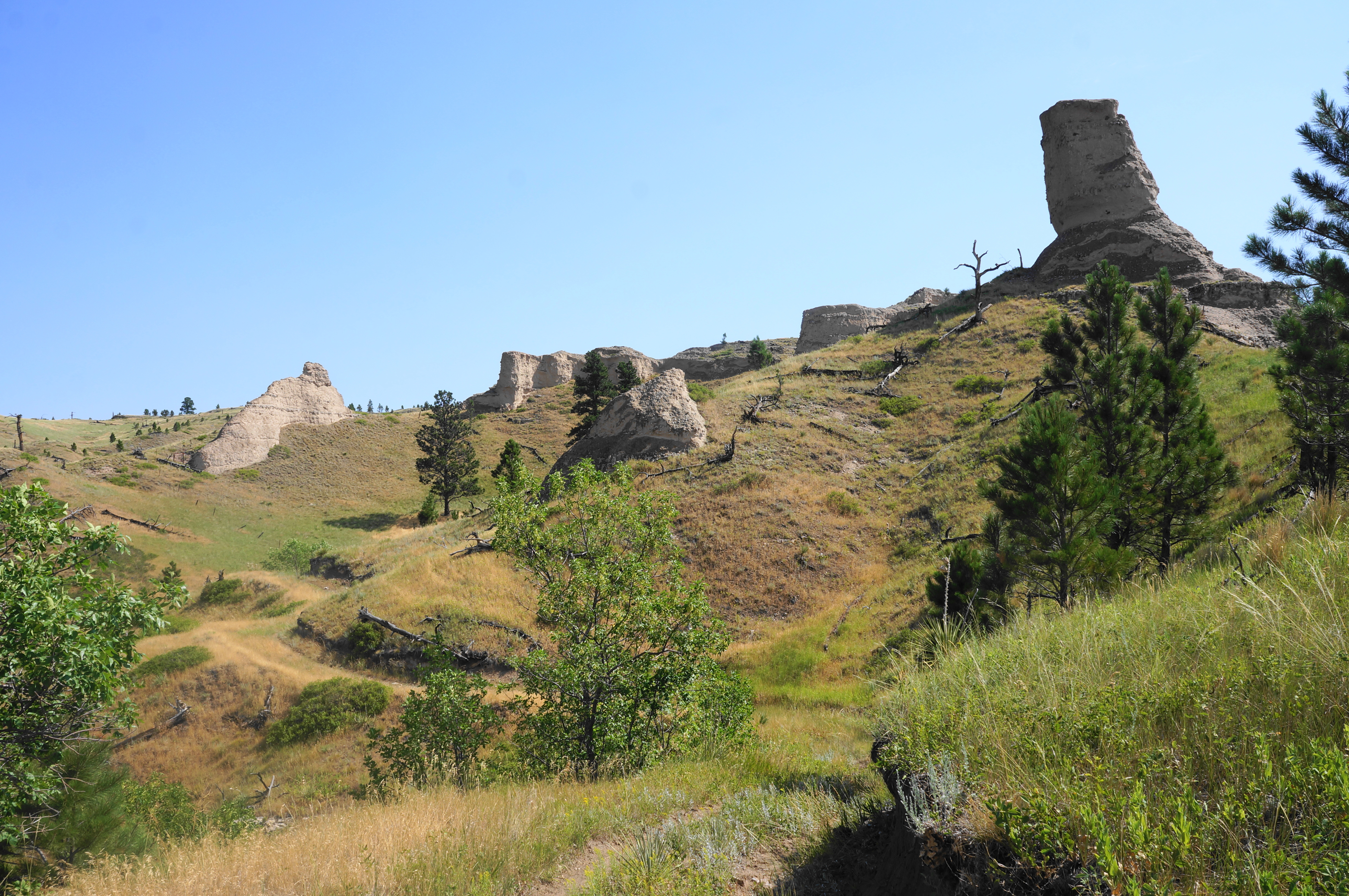
While the loop continues right (east), it is hard to resist taking the spur path left on the Scenic View Trail, a ¾-mile out-and-back that ends at the northern park boundary. Hikers in a hurry can skip this, but those with more flexibility are rewarded with an interesting detour that tucks behind the upright buttes and traverses high ridges.

The out-and-back begins by cutting left, following the sandy doubletrack up and around a protruding outcrop. Rounding north and east, the Scenic View Trail rises to a gap with views south across the rolling plain, with a peculiar thumb-shaped hoodoo ahead.
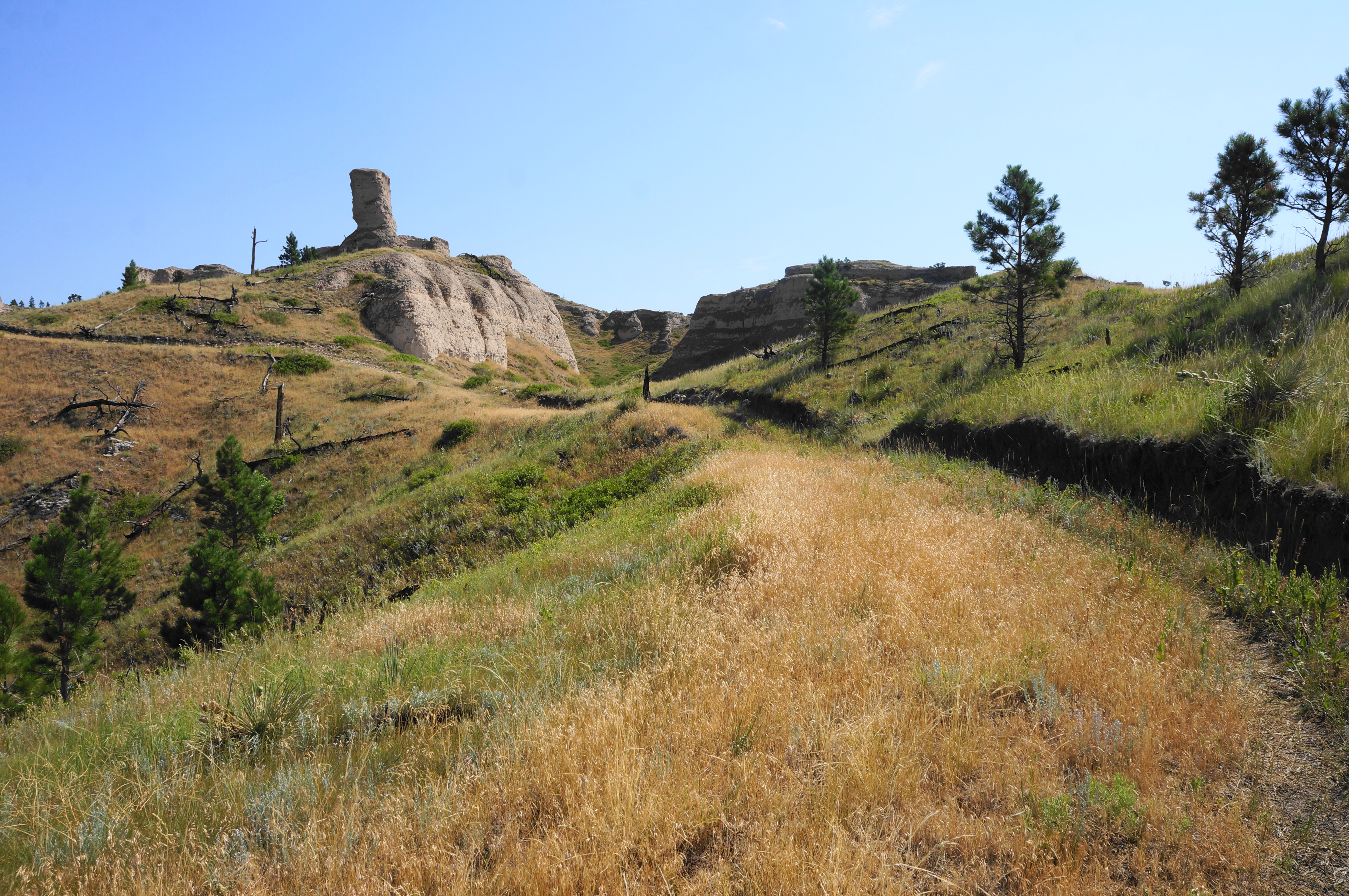
Minutes later, the trail comes to a second gap, with views east to a series of dark-colored buttes. The onward path then keeps the thumb on the right and bounds toward the park boundary, edging a hillside with occasional pines and plenty of high grasses and flowers. Eventually the trail fades significantly, but a thin trace continues through the lawn.
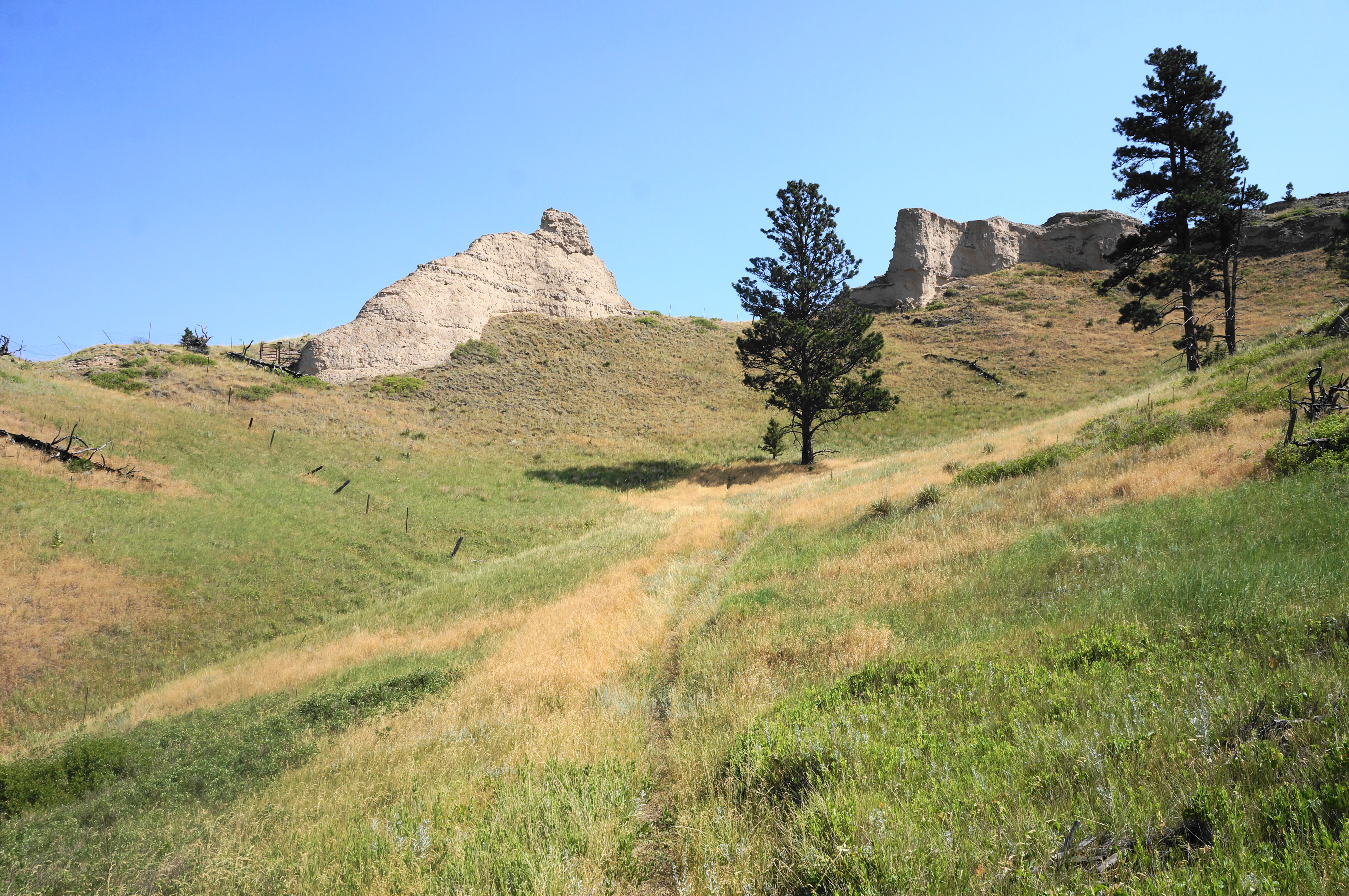

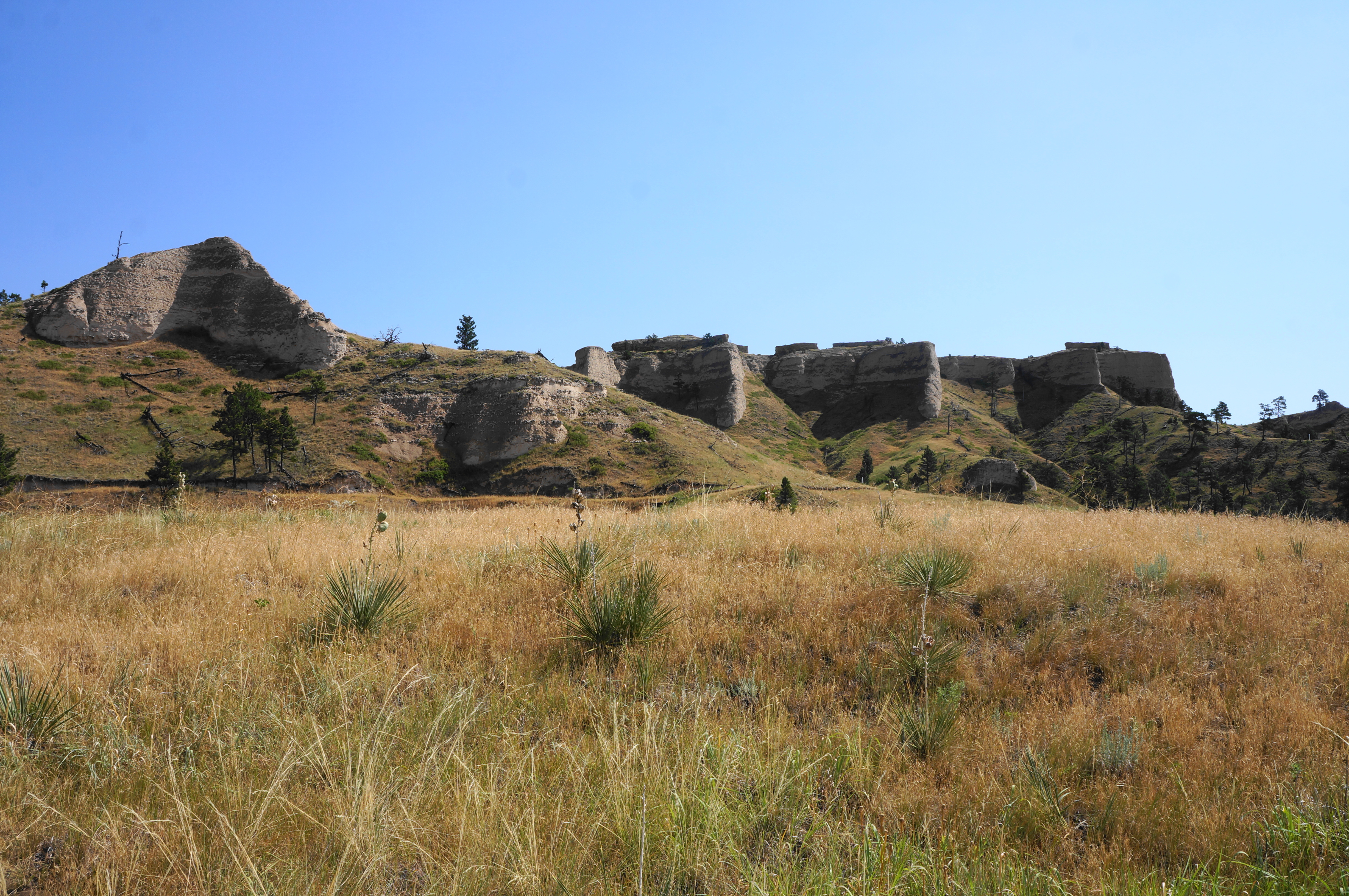
The spur ends perhaps unceremoniously with a steep climb to a closed gate, with private property beyond. This is the northern boundary of Fort Robinson State Park. There are nice views back south, however, and up-close views of the conglomerate cliffside, with dark stones cemented into the peachy rock.

When ready, return the way you came, returning to the East Mexican Canyon Trail. Bear left on the wide track, which follows a shelf below the striated cliffs and rounds a left-hand bend with fine views. Upon clearing the next major drainage, the trail passes below a row of towering sentinels—the same impressive cliff faces visible from near the trail’s start around 2.25 miles back.

Beyond, the track rounds a series of wiggles, skirting minor side ravines, eventually coming to a junction with the Deer Trail at 2.4 miles. Stay right on the East Mexican Canyon Trail, descending a ridgeline with a double-lane dirt track. The incline soon weakens, and the trail traverses an open grassland. The chalky knobs and buttes are now far in the rear-view mirror, and the end of the hike is near.
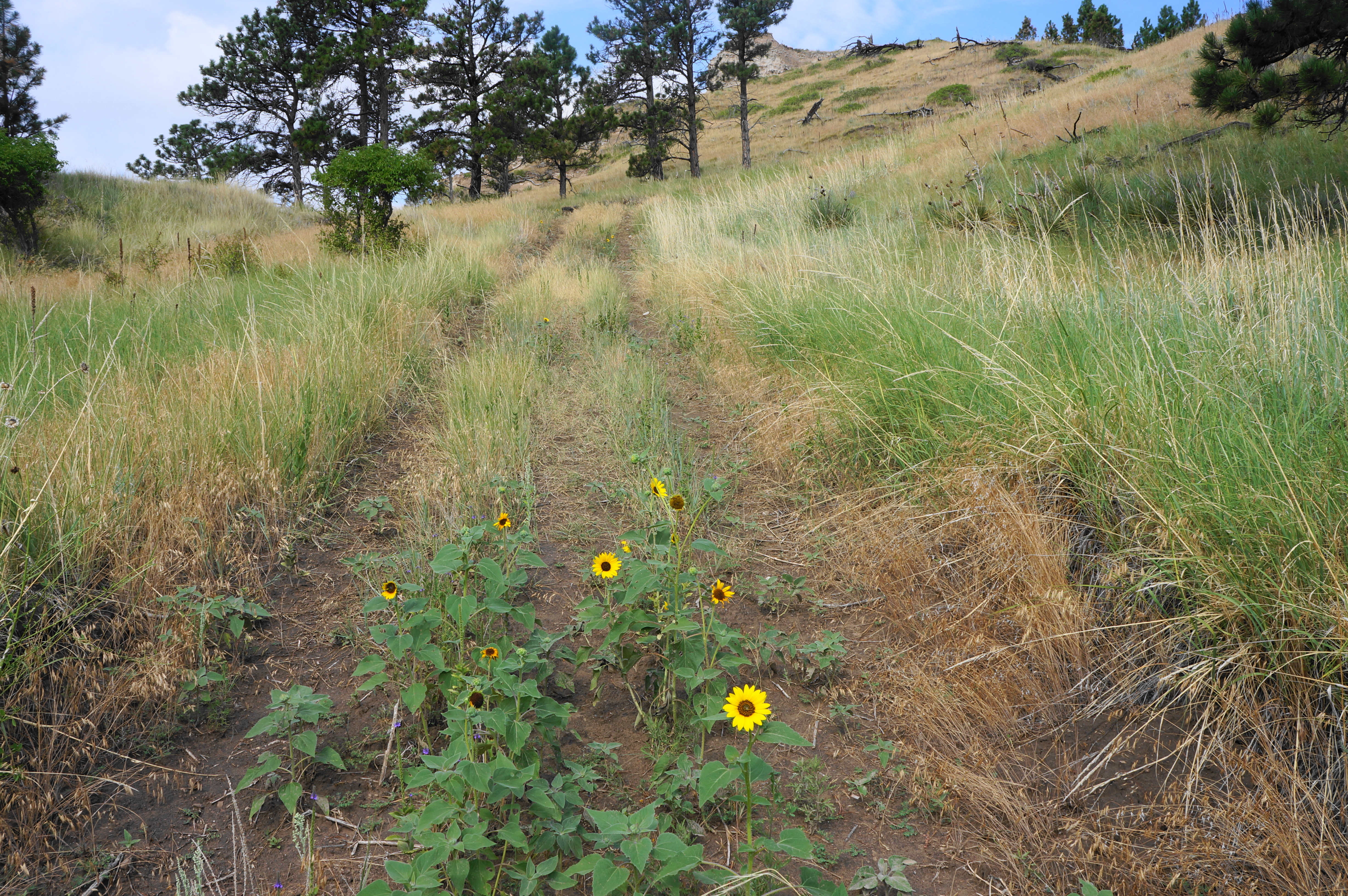
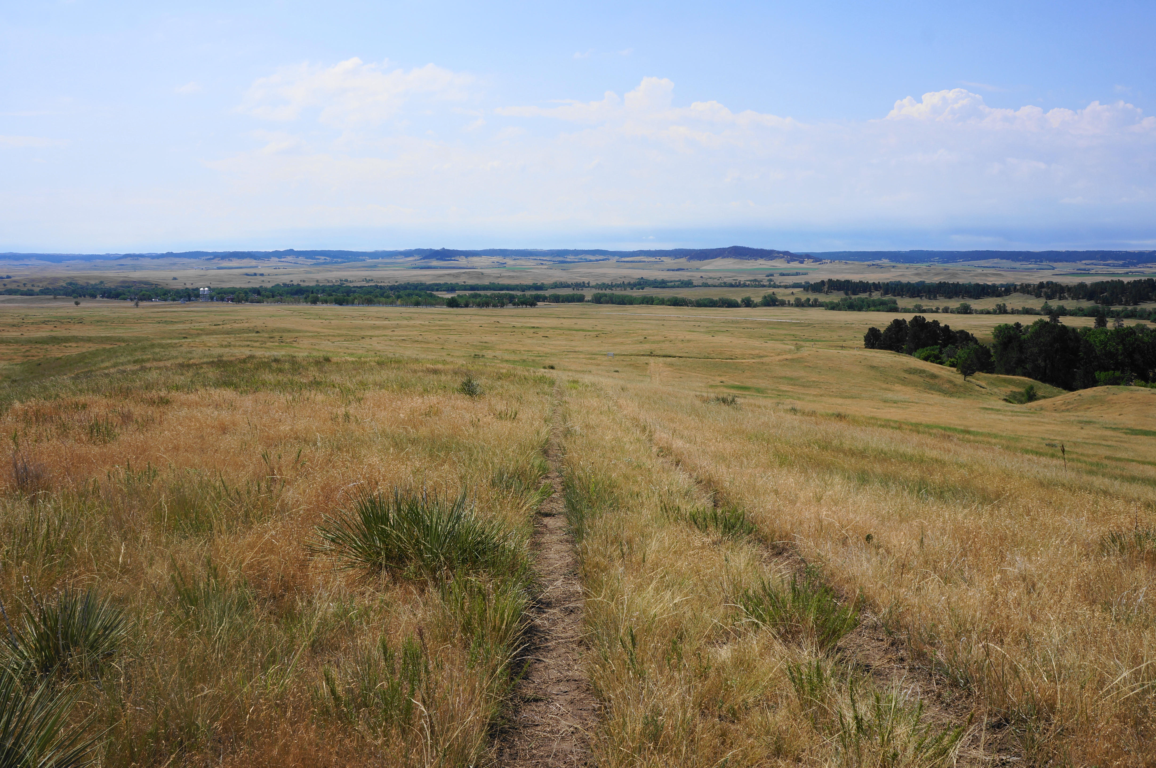
At 2.8 miles, come to a junction and stay right, returning to the (West) Mexican Canyon Trail, which continues south for another 200-250 yards. Pay close attention for an unmarked four-way junction, where hikers should take a hard right. Traverse a woody drainage with small, mucky pool on the right, then take a final left at the last junction. From here the trail rises a modest slope and returns to the white-fence enclosure and trailhead. This marks the end of the 3.2-mile stem-and-loop hike.


Pingback: Top 10 Hikes in 2022 | Live and Let Hike