
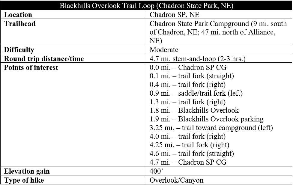
Rising suddenly and surprisingly, the scenic Pine Ridge cuts like a furrowed eyebrow across northwest Nebraska, revealing an elevated landscape of thick ponderosa forests and chalk canyons. The 100-mile ridge is a sudden break from the flats of the Great Plains and bears some of the best hiking in the Cornhusker State. Situated at roughly the ridge’s halfway point (west-to-east), Chadron State Park is a popular destination off U.S. Route 385 between Chadron and Alliance, Nebraska, and the park’s best hike is the Blackhills Overlook Trail, a moderately-difficult 4.7-mile adventure. Along the trail, hikers will traverse tallgrass prairies and ponderosa woodlands and rise to heights above the Niobrara chalk bluffs that dominate the landscape. (Note: Be sure to wear long pants on this hike, as ticks are a major problem in this area.)

The hike
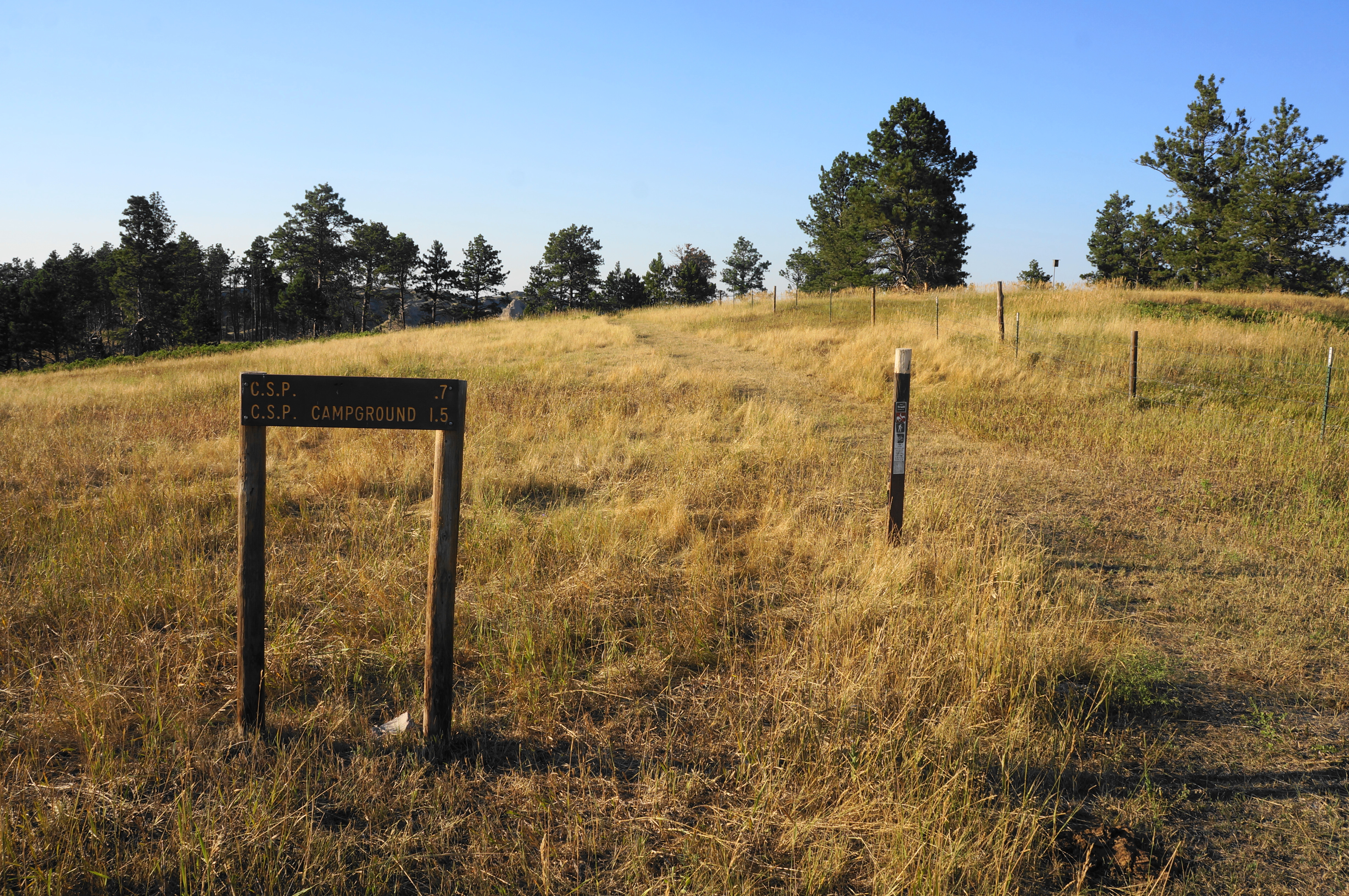
To reach the trailhead, enter Chadron State Park (entrance fee required) off Highway 385 and make your way north to the park campground. Round the one-way loop through the camping area until passing sites #47 and #49 on left and right; thereafter, pass the non-reservation tent camping area on the right and park at a small and unmarked pull-off just before the road heads back east. (Note: If you pass Sites #50 and #51, you have gone too far.) The unassuming trailhead lies on a crest just above a typically dry tributary of Chadron Creek and the pleasant tent camping area, set at the edge of a ponderosa pine stand.
The Blackhills Overlook Trail is a bit of a misnomer: while there are very distant views of the Black Hills in neighboring South Dakota, the predominant vistas are of Pine Ridge, a curious feature punctuated by chalky bluffs and deep canyons. (Note: There are multiple options for loops on this hike, but the below description follows the recommended route in the “Northwest Nebraska Recreational Trails Guide.”)
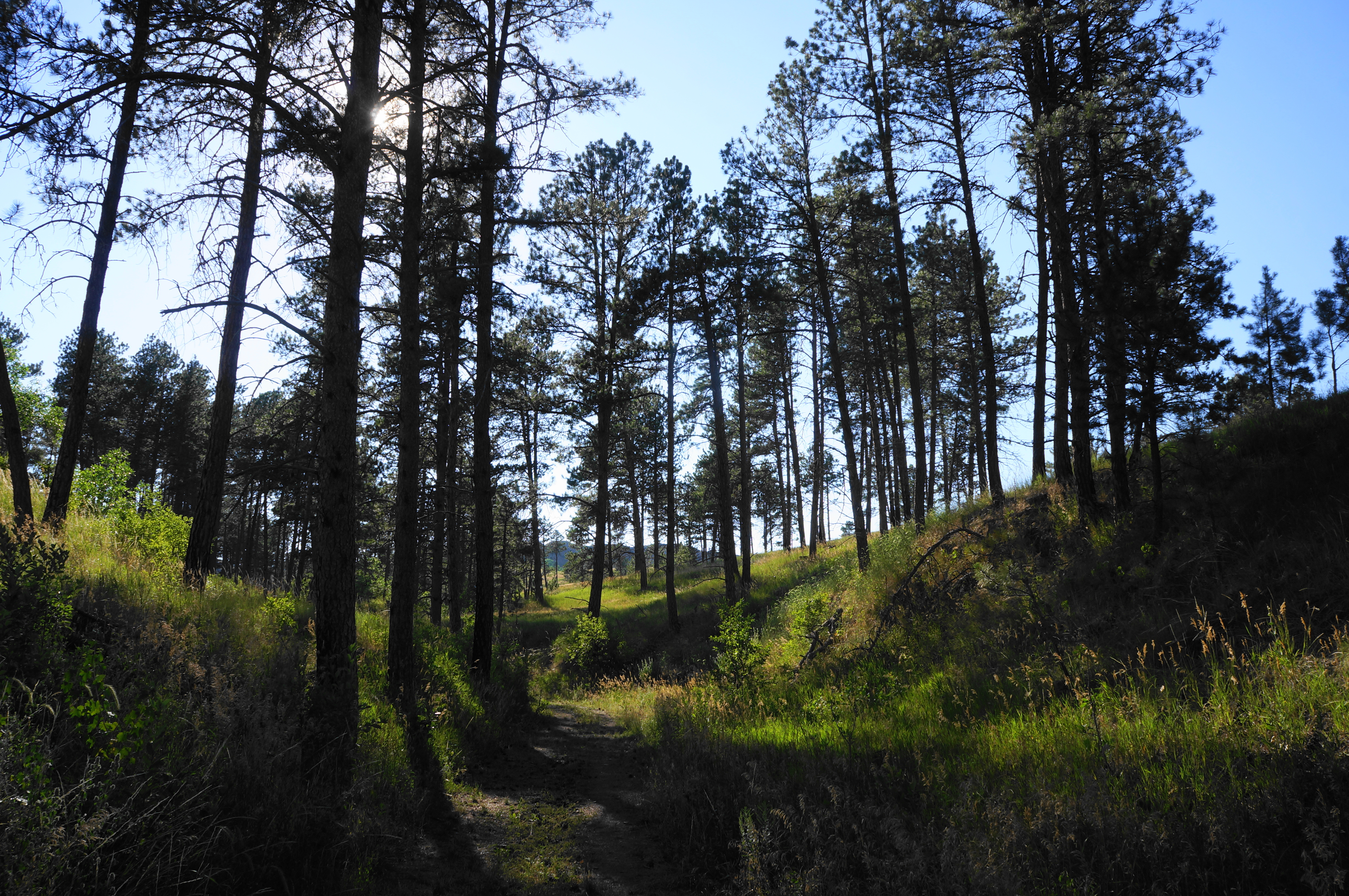
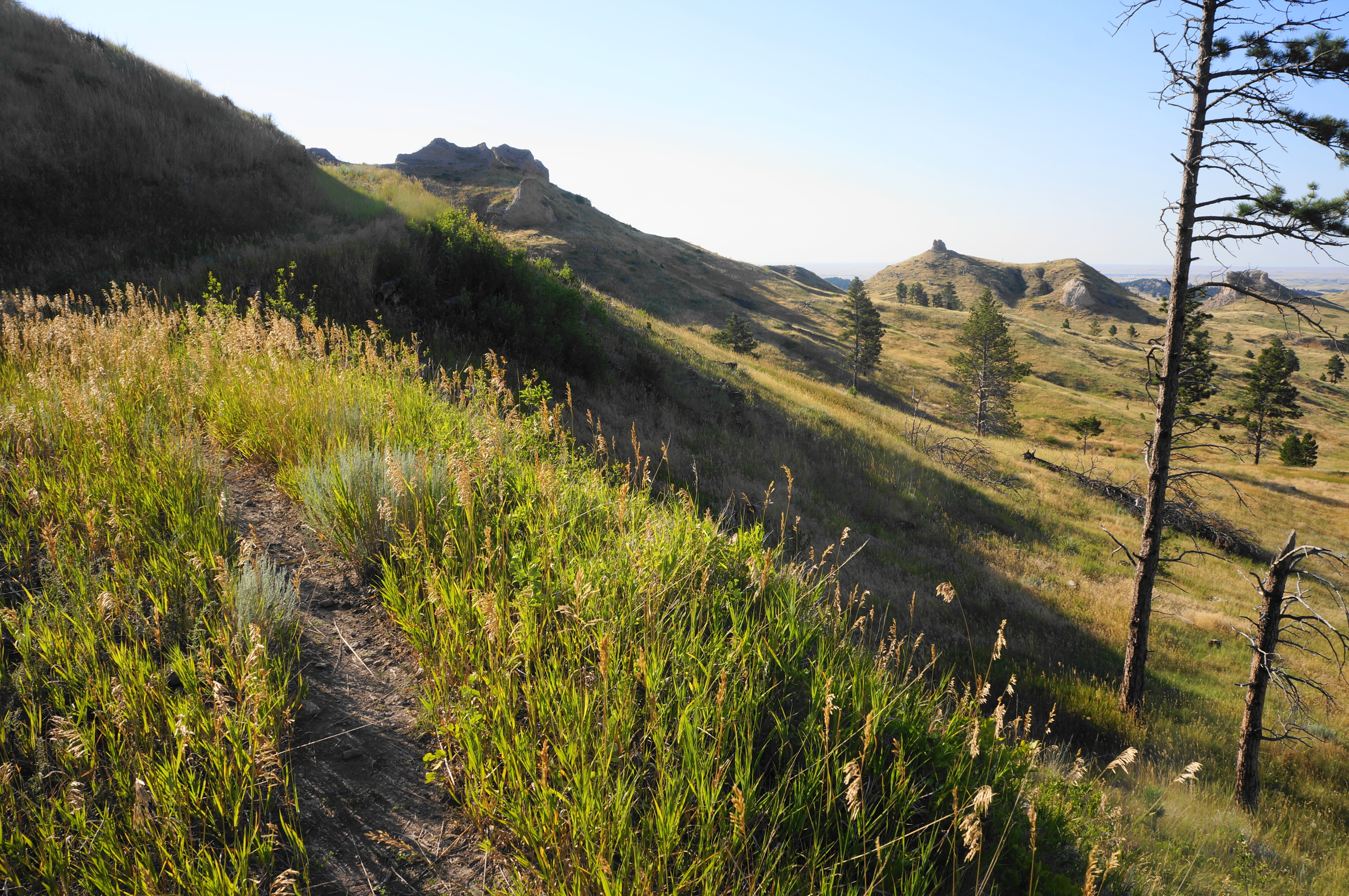
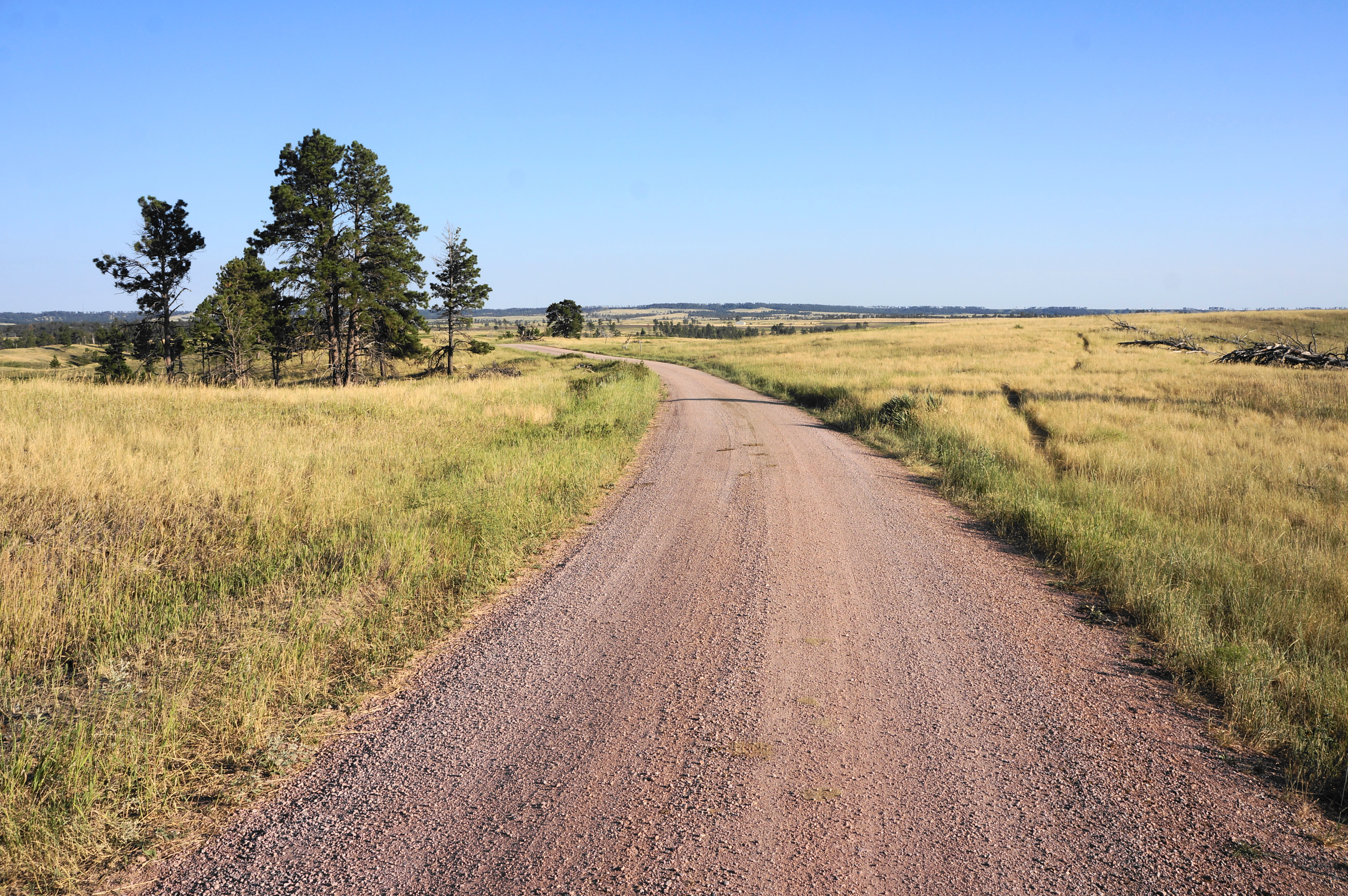
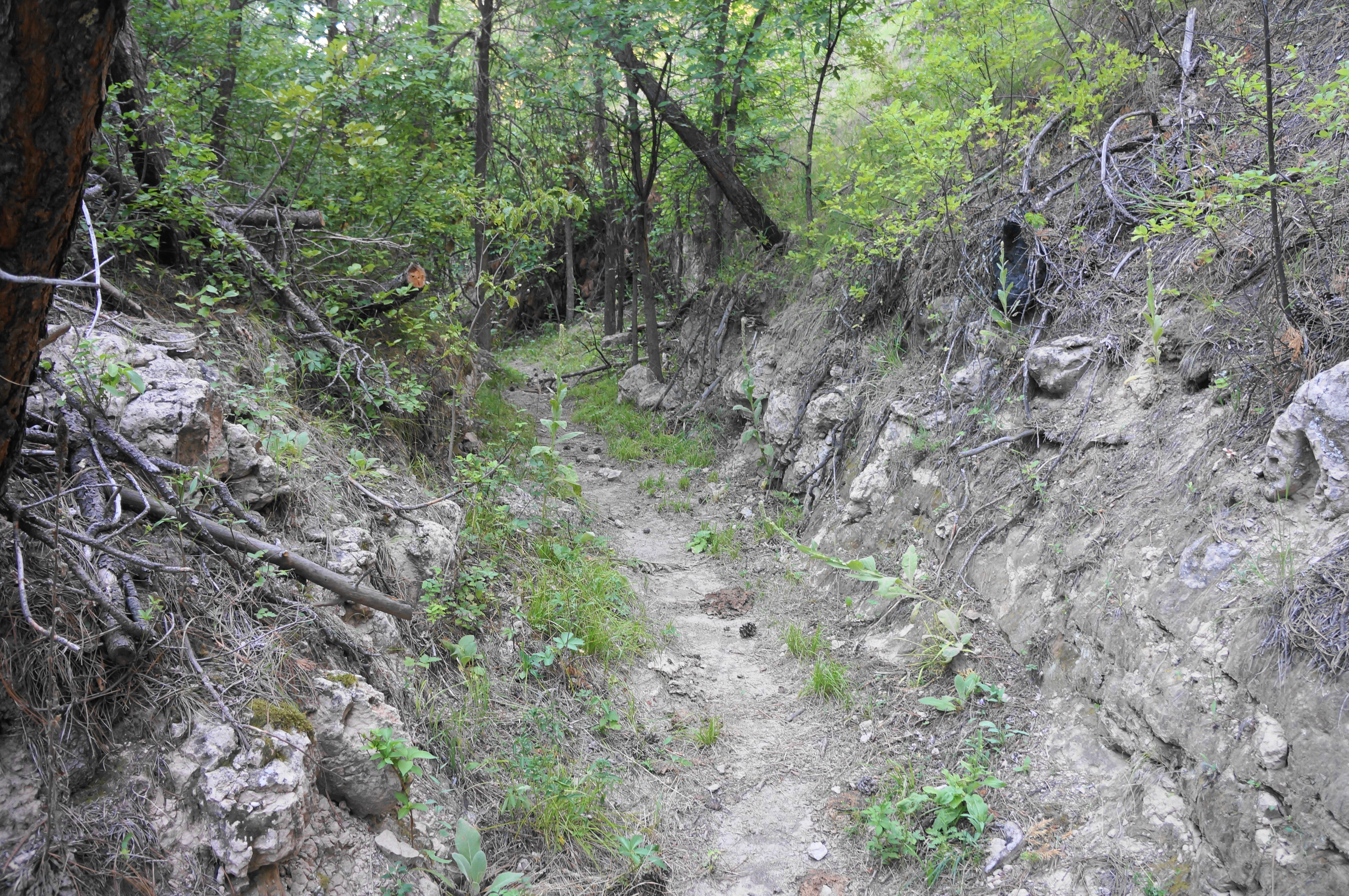
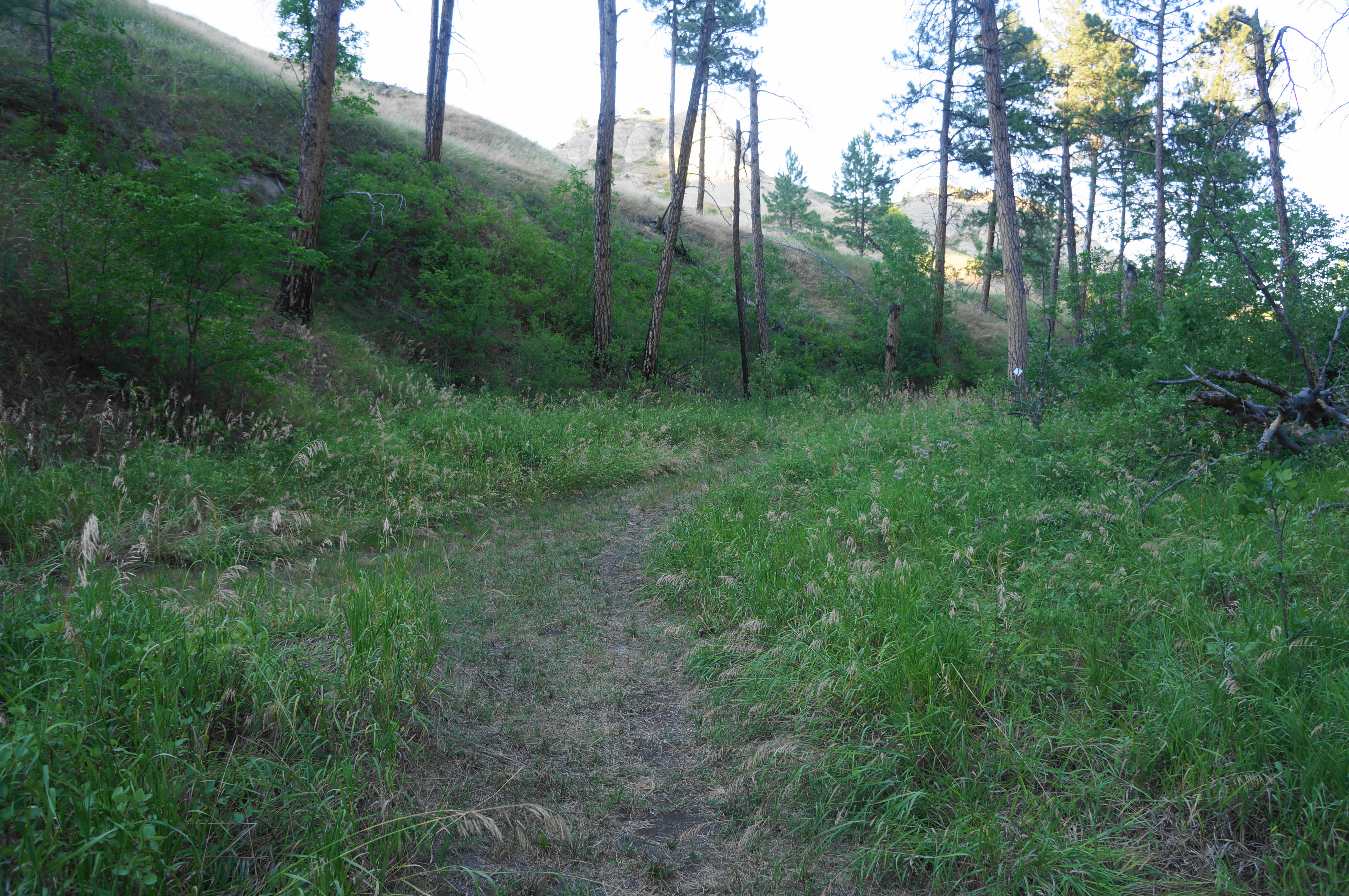
At this stage, the towering bluffs are not yet visible, and the unmarked but evident trail traverses a grassy upland. Soon a barely helpful sign emerges—it says merely “start trail”—and the route cuts through prairie before dropping into the ravine, keeping the tent area on the right. Pass through a rarely-used campsite and then through an open gate, immediately reaching a four-way junction set at the edge of the pine forest. Stay straight, following the path as it eventually bears westward, following what feels like a long trench on a double track that was likely an old ranching or logging road.
After about ¼ mile, still in the shaded gully, pass through another gate and enter a “special hunting area” (October-December), followed soon by the abrupt exit out of the ravine, entering open prairie. At 4/10 mile, there are finally some more robust trail signs (but even these are not incredibly helpful; be sure to carry a map with you): while the quickest route to Blackhills Overlook is to head left, the more scenic route heads right. Take the right fork to enjoy the alluring ascent to the sandstone bluffs.
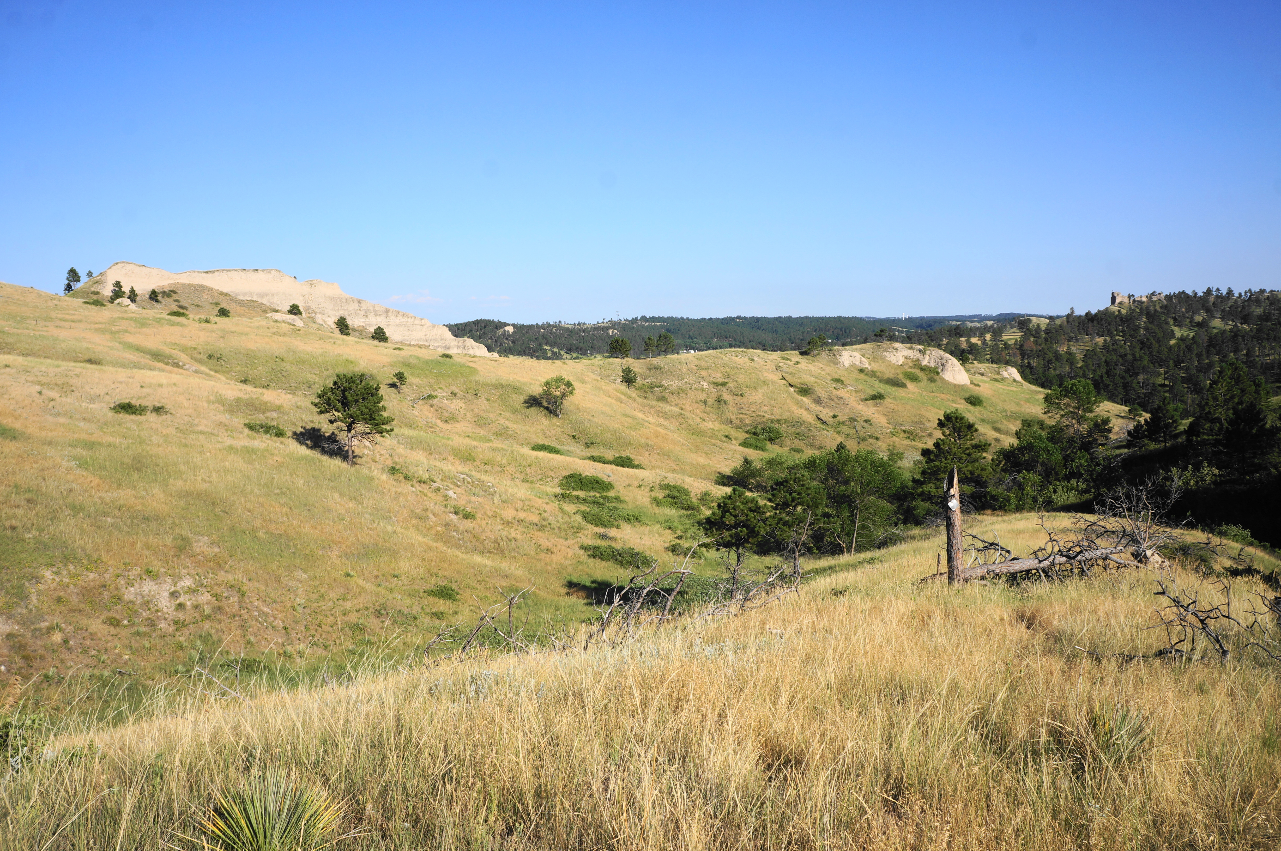
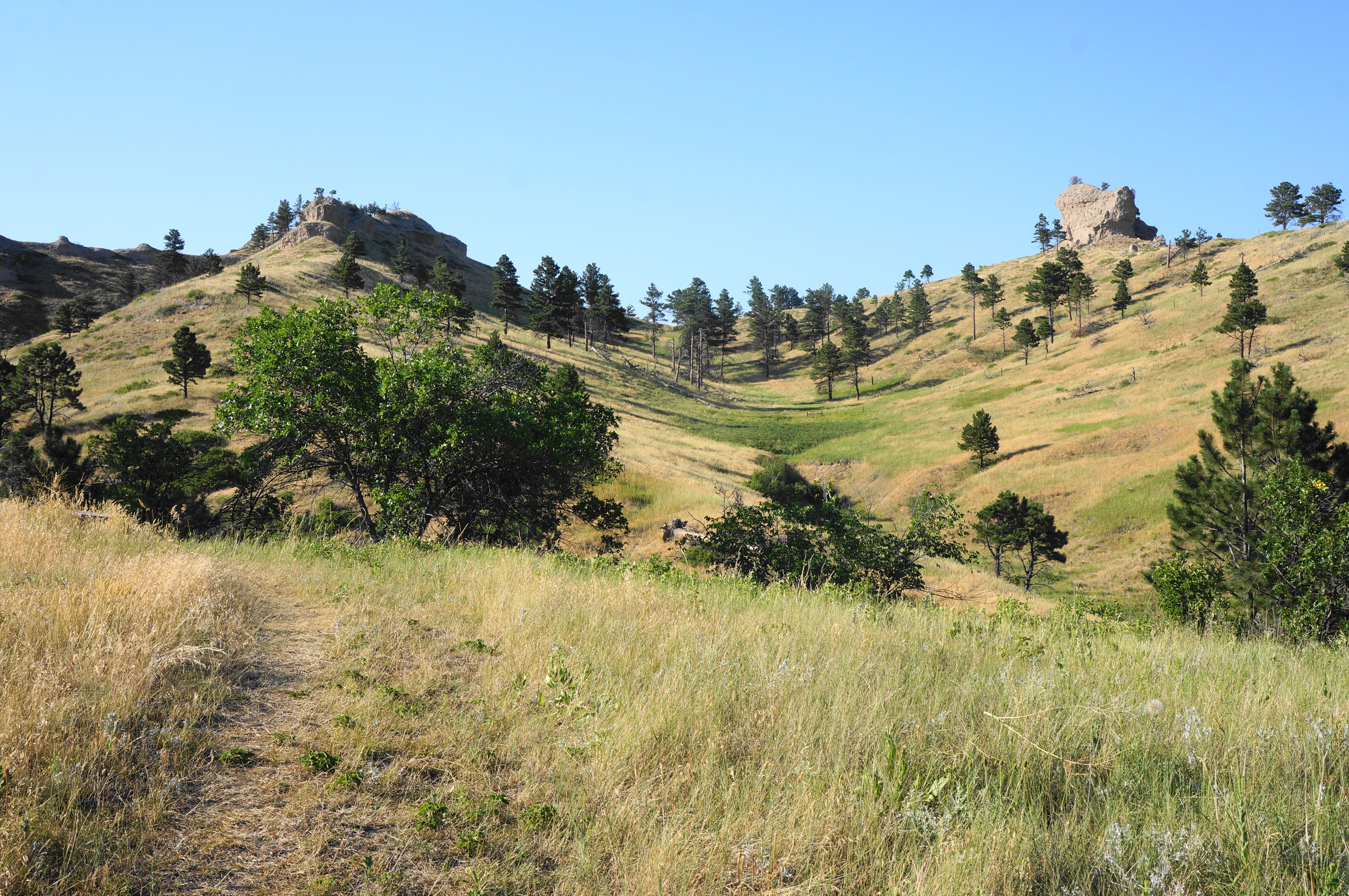
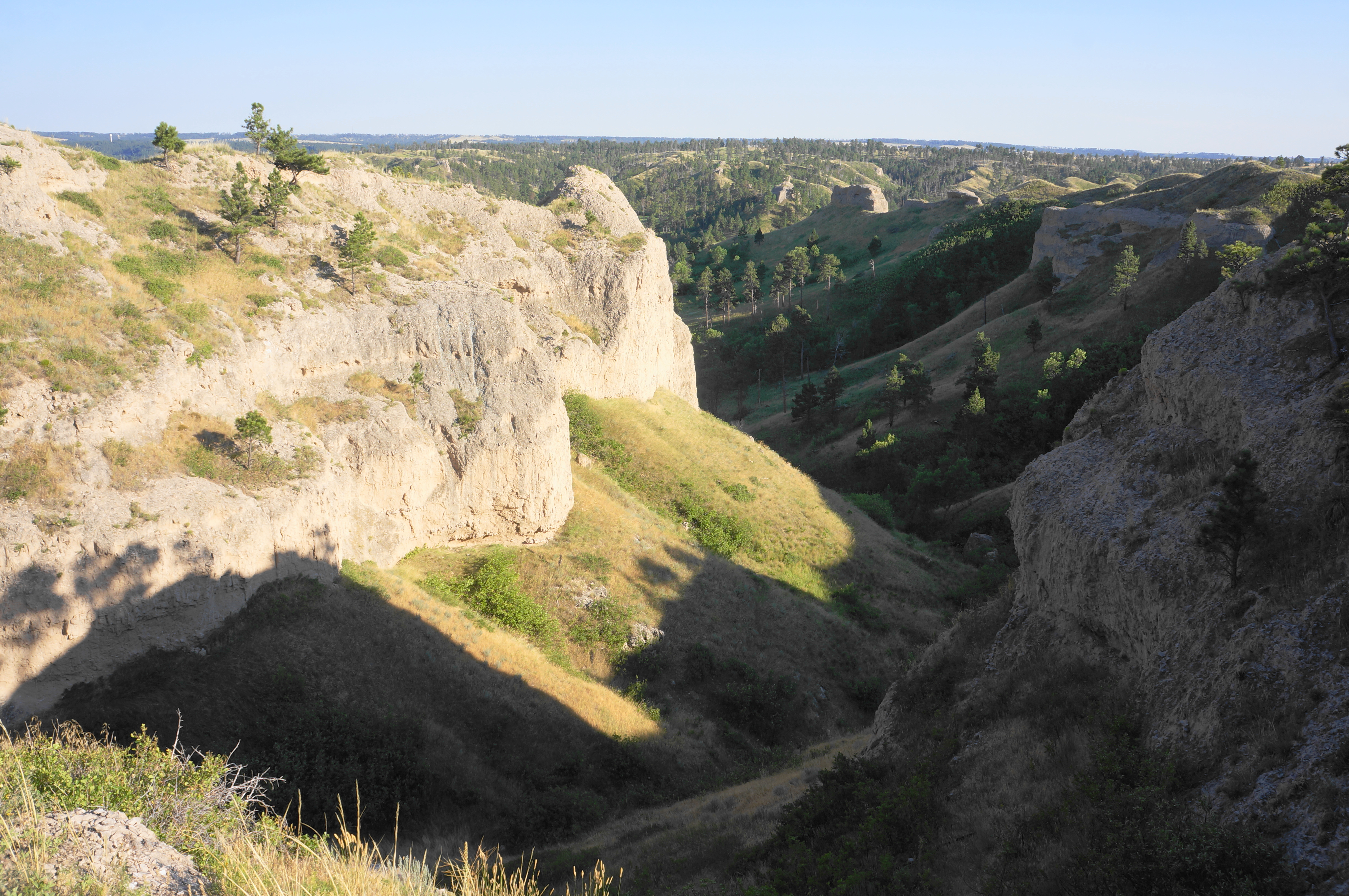
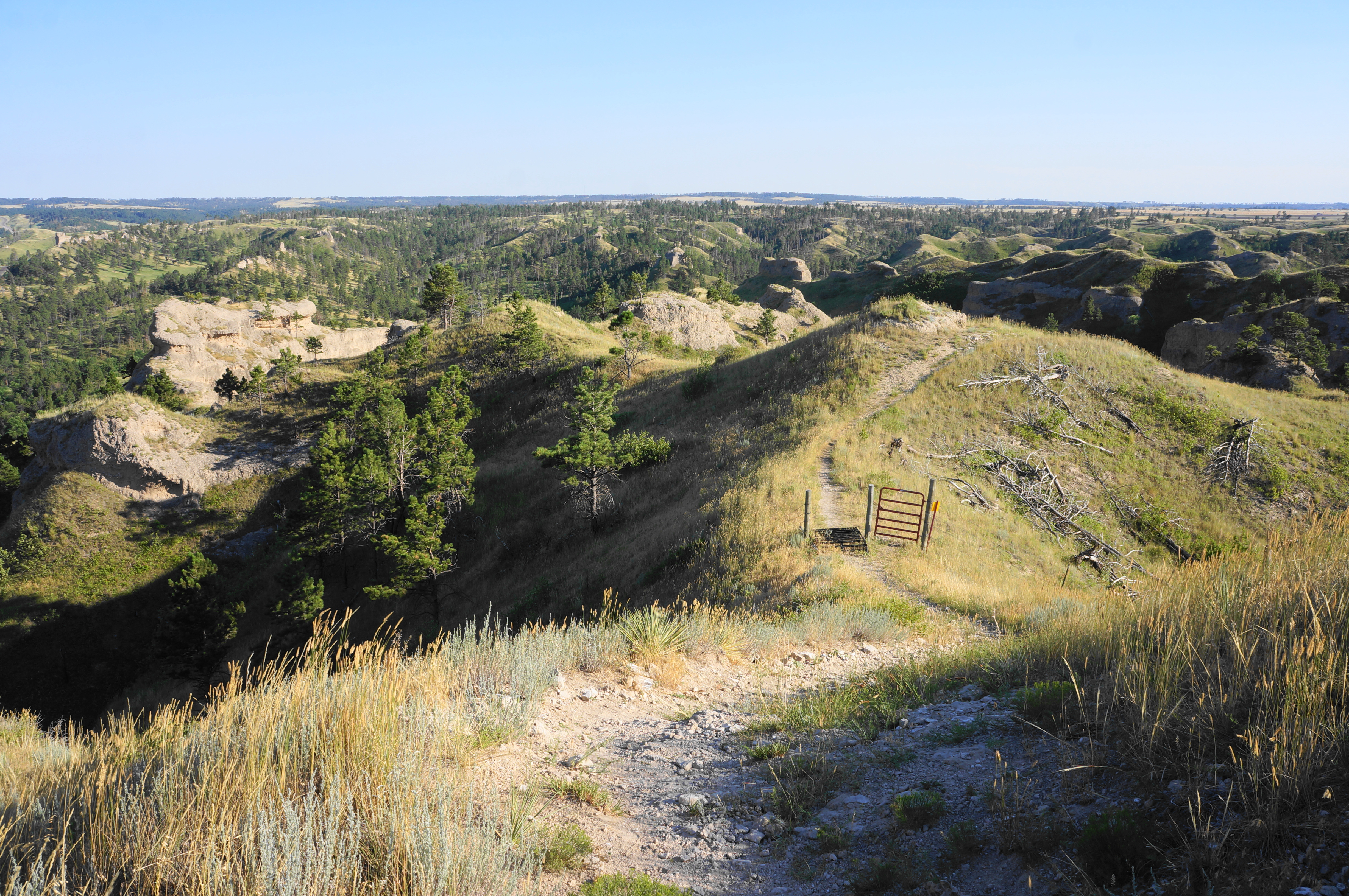
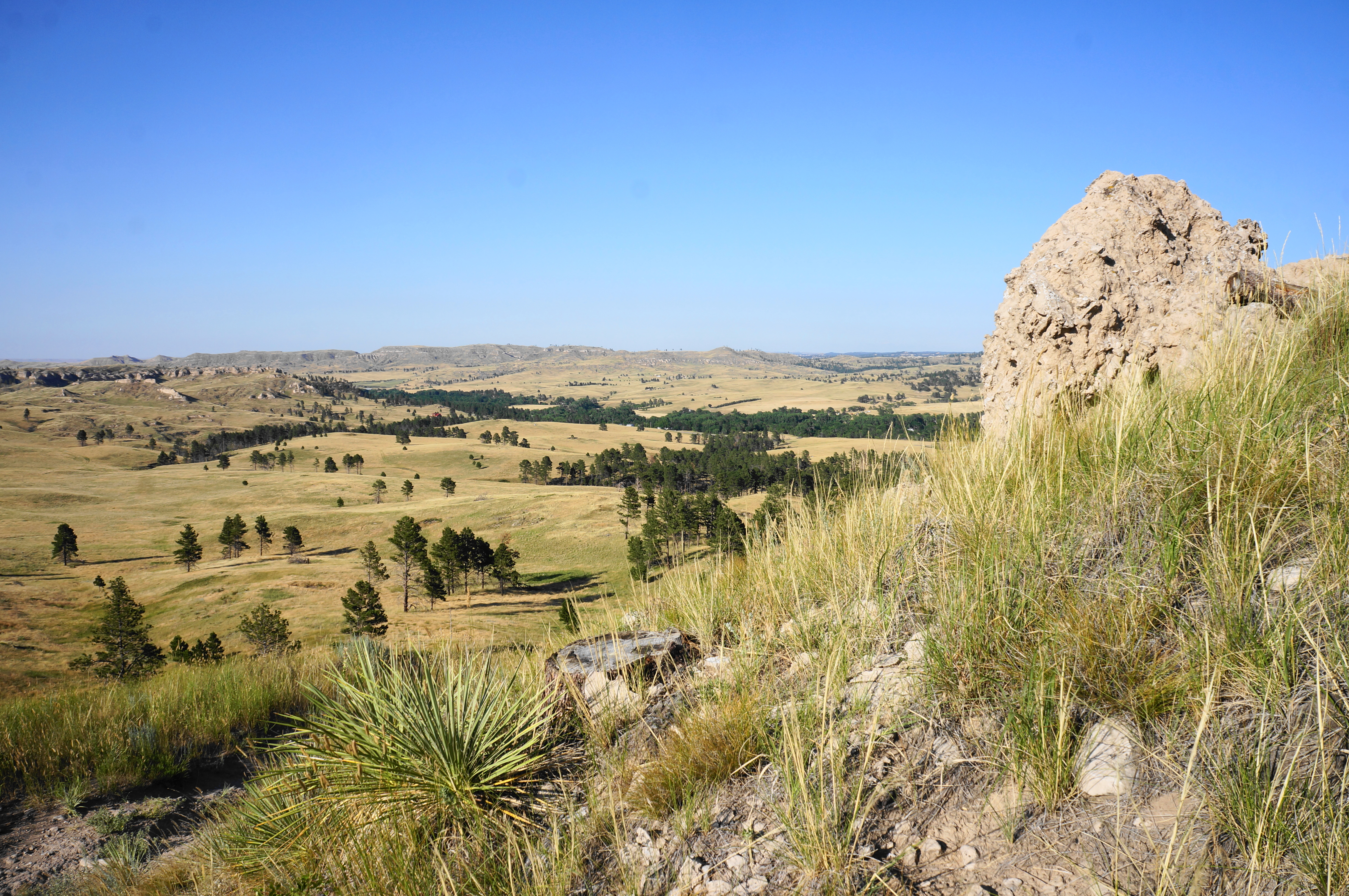
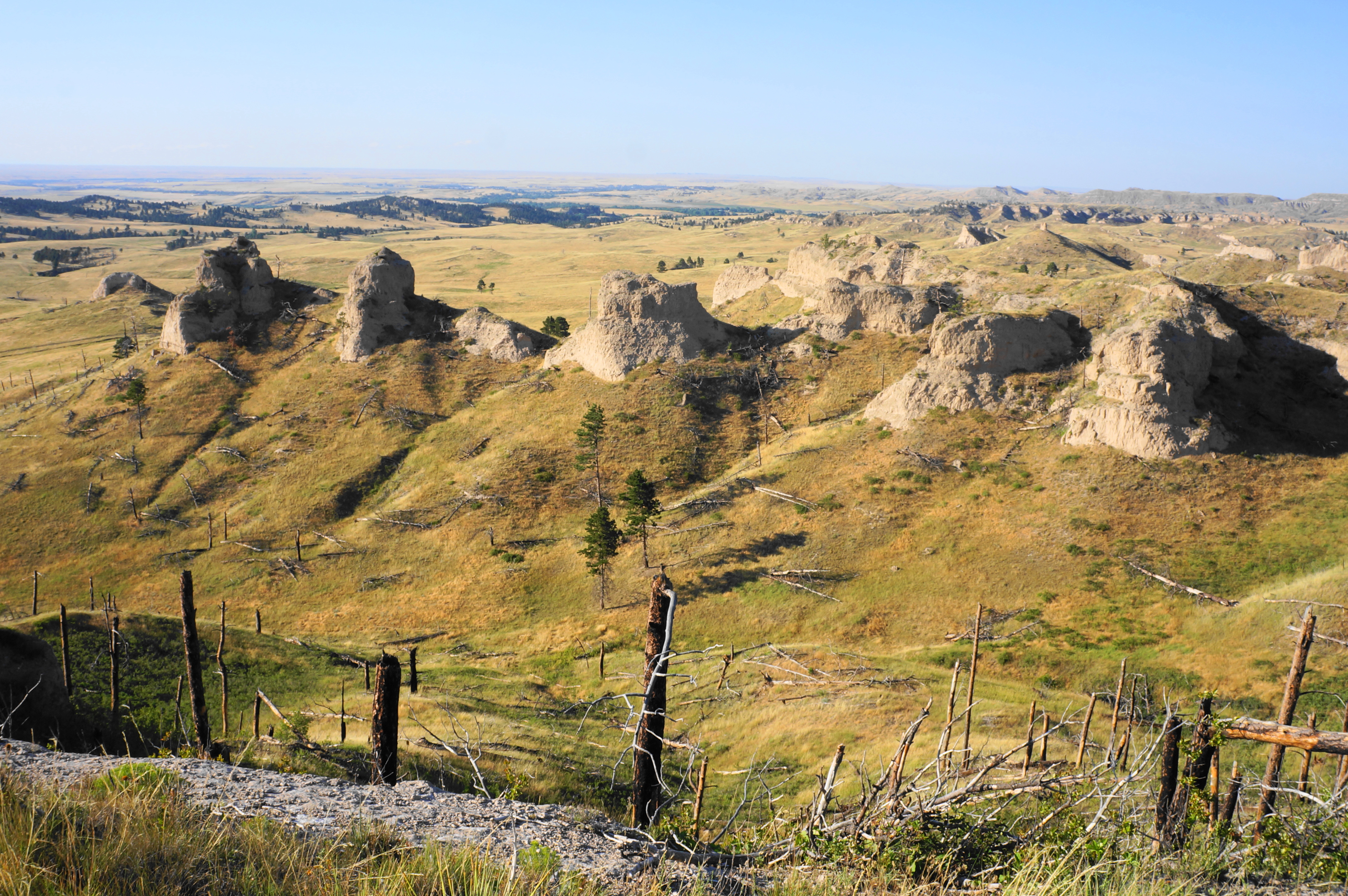
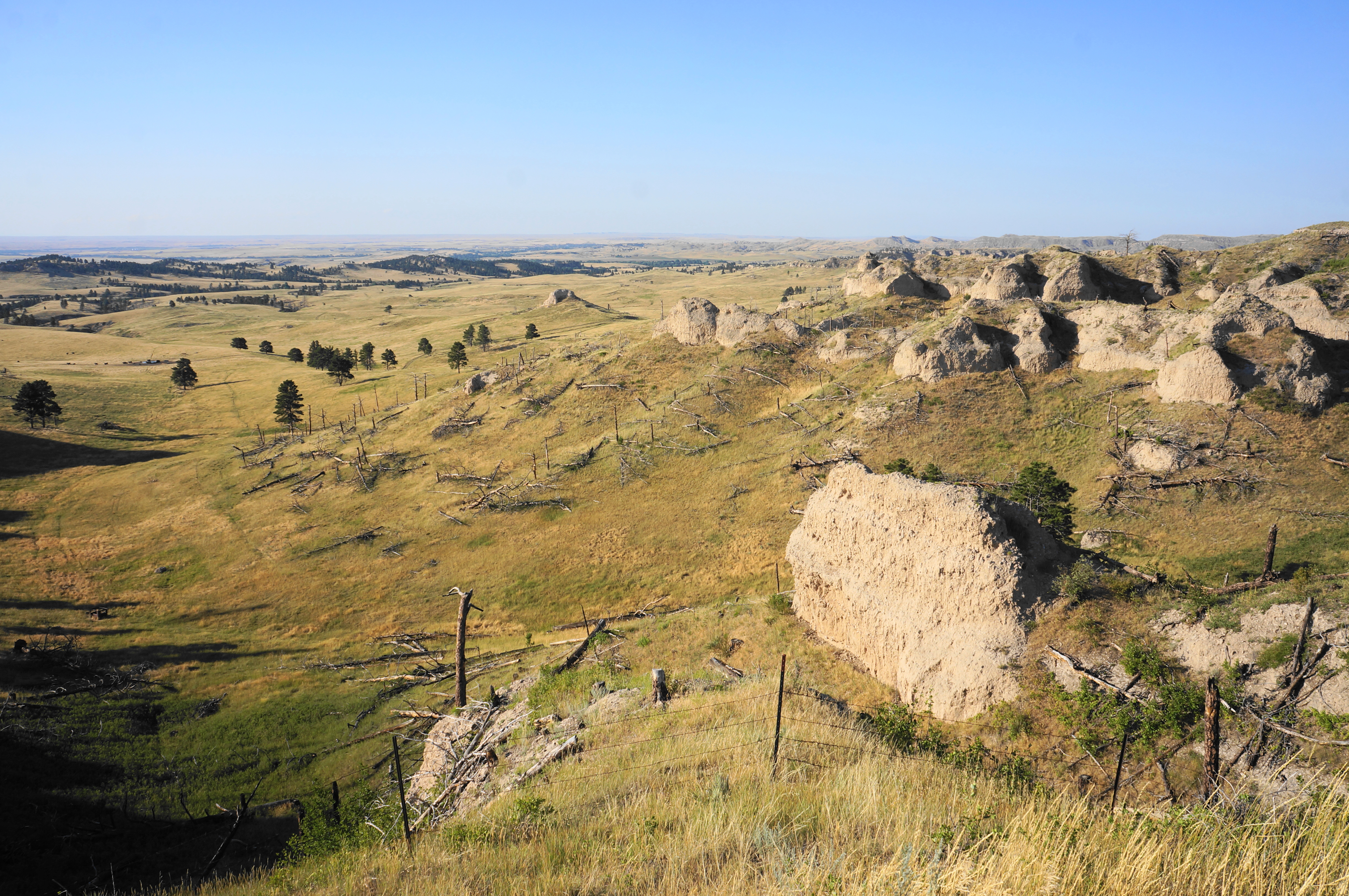
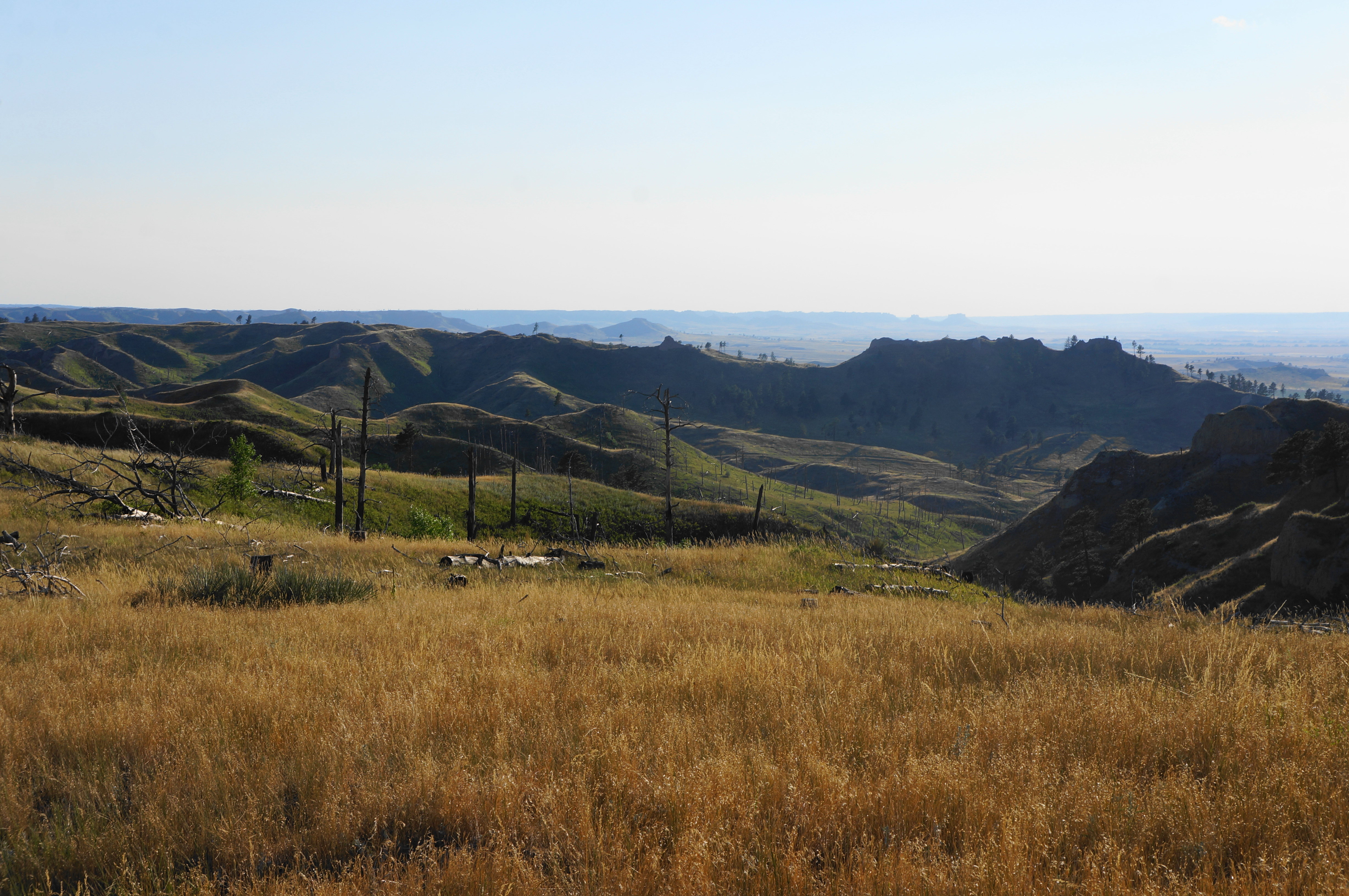
These bluffs finally come into view soon after the junction, as the doubletrack quickly fades into a single lane and the route parallels a minor drainage on the right. The exquisite cliff faces gleam in the morning and evening sun, and the valley begins to resemble more of a canyon as the trail continues. At 0.55 miles, the incline picks up, and the path cuts away from the drainage. Tree cover gradually fades away, and the route levels off as it approaches a beautiful amphitheater of rock with several chalk outcrops. Pass a bench on the right and then drop to clear the drainage again, rising again to an open pitch with a solitary pillar on the right.
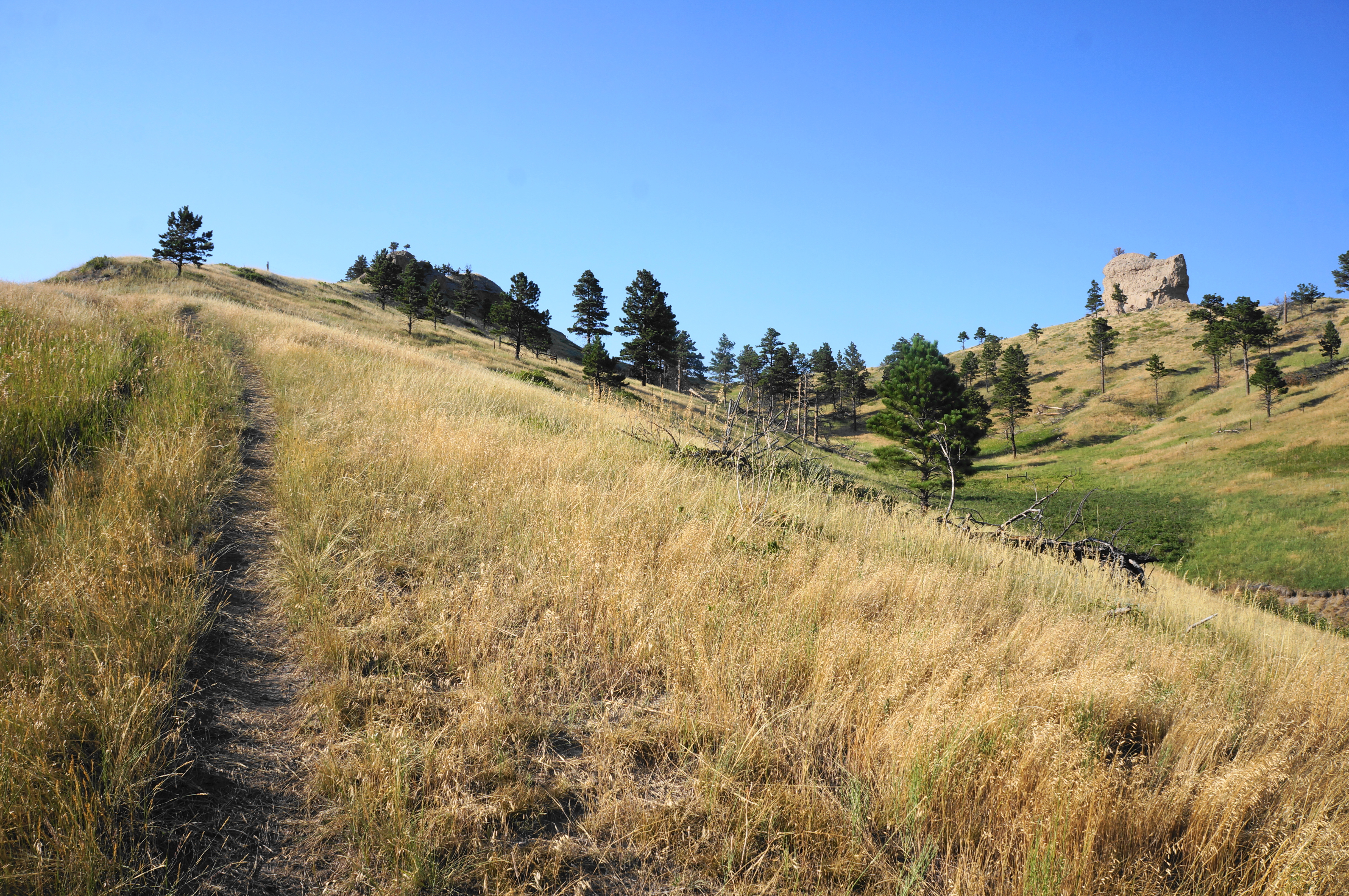
Ascend gently through a sun-soaked section, coming closer to a high saddle. After passing through a cattle guard at 8/10 mile, the Blackhills Overlook Trail briefly leaves the confines of the park. Soon the onward route comes to the pass, revealing additional vistas beyond: north and east to additional bluff structures along Pine Ridge and—on the very, very distant horizon—the Black Hills of South Dakota.
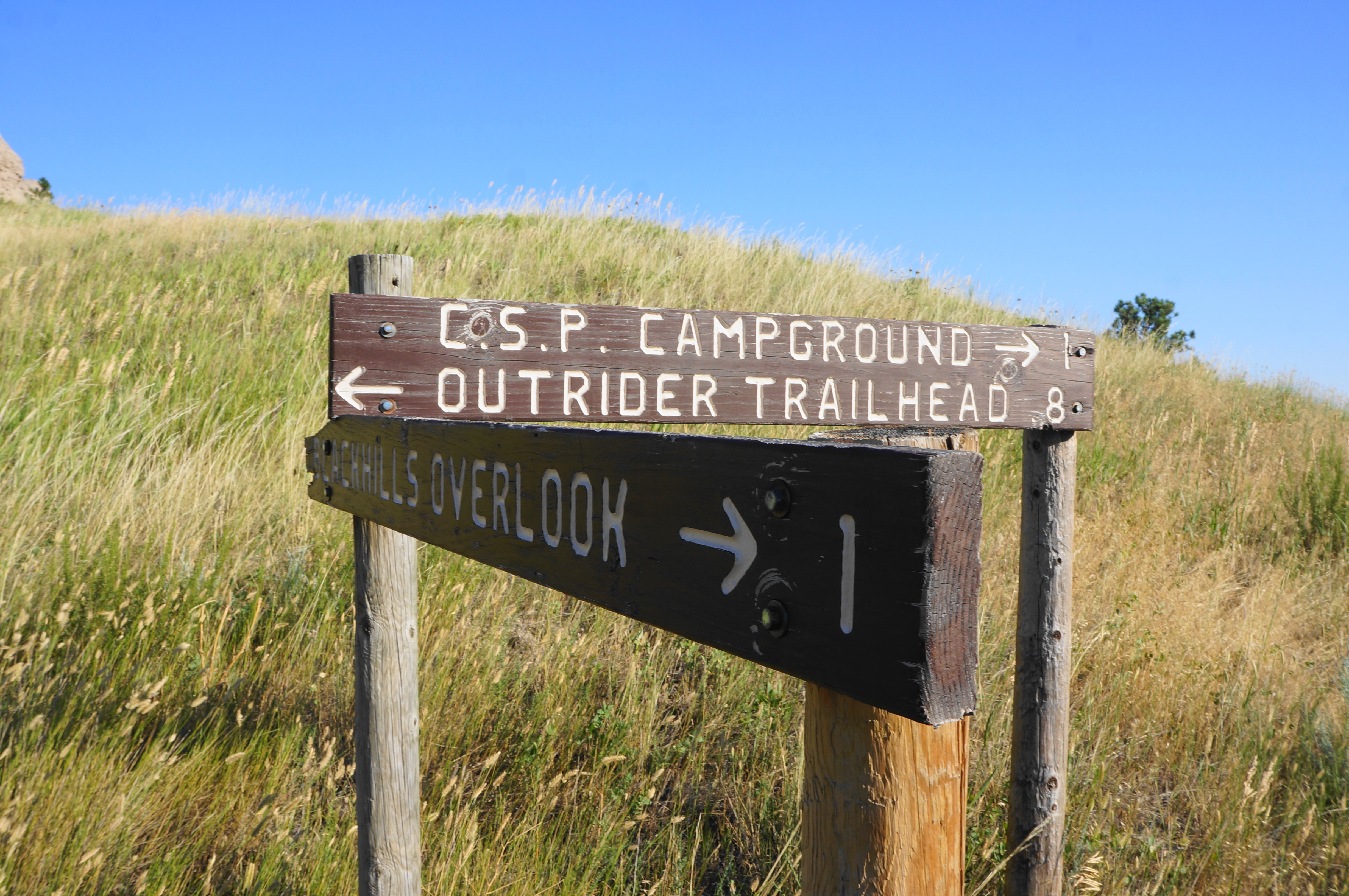
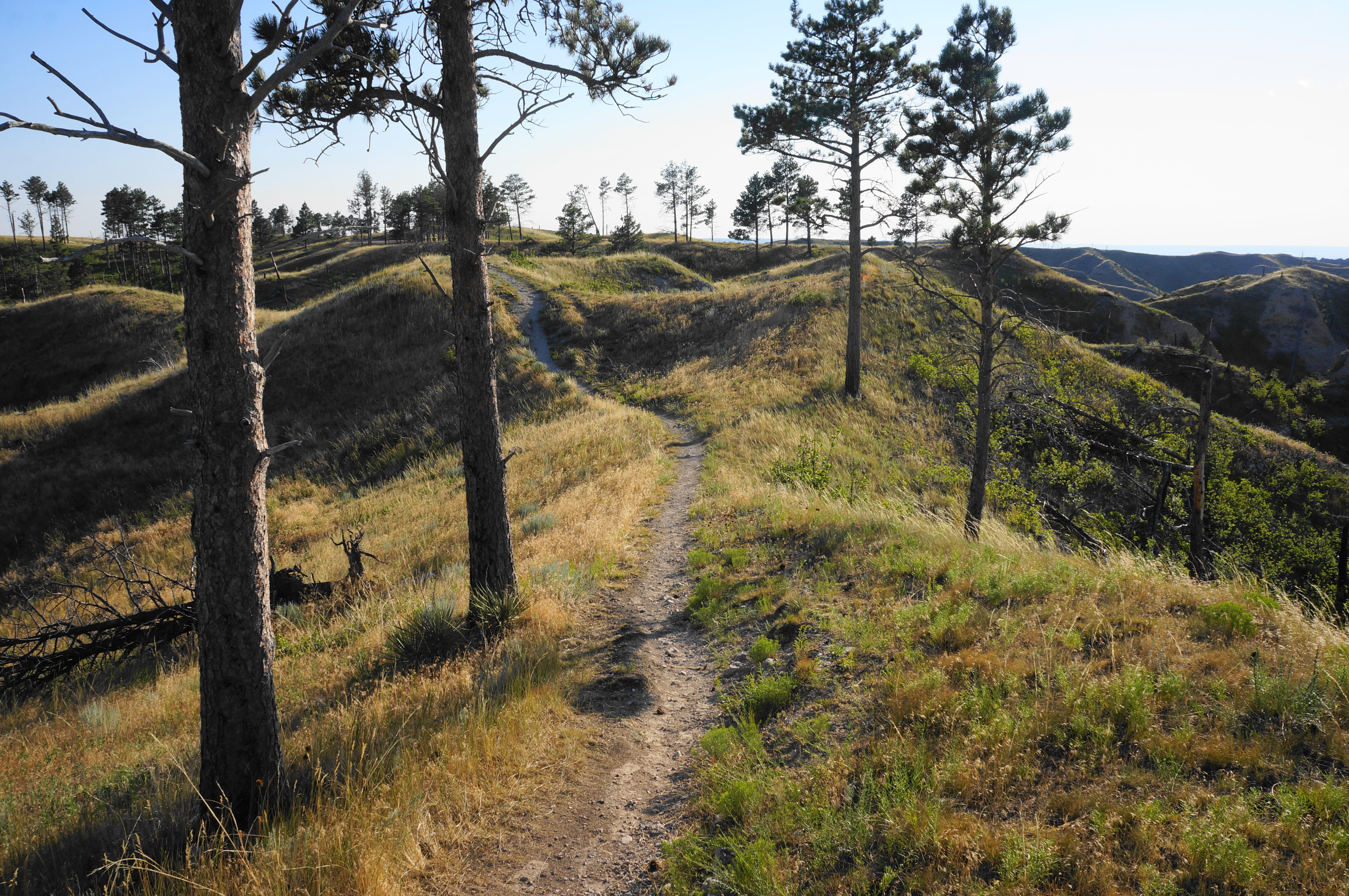
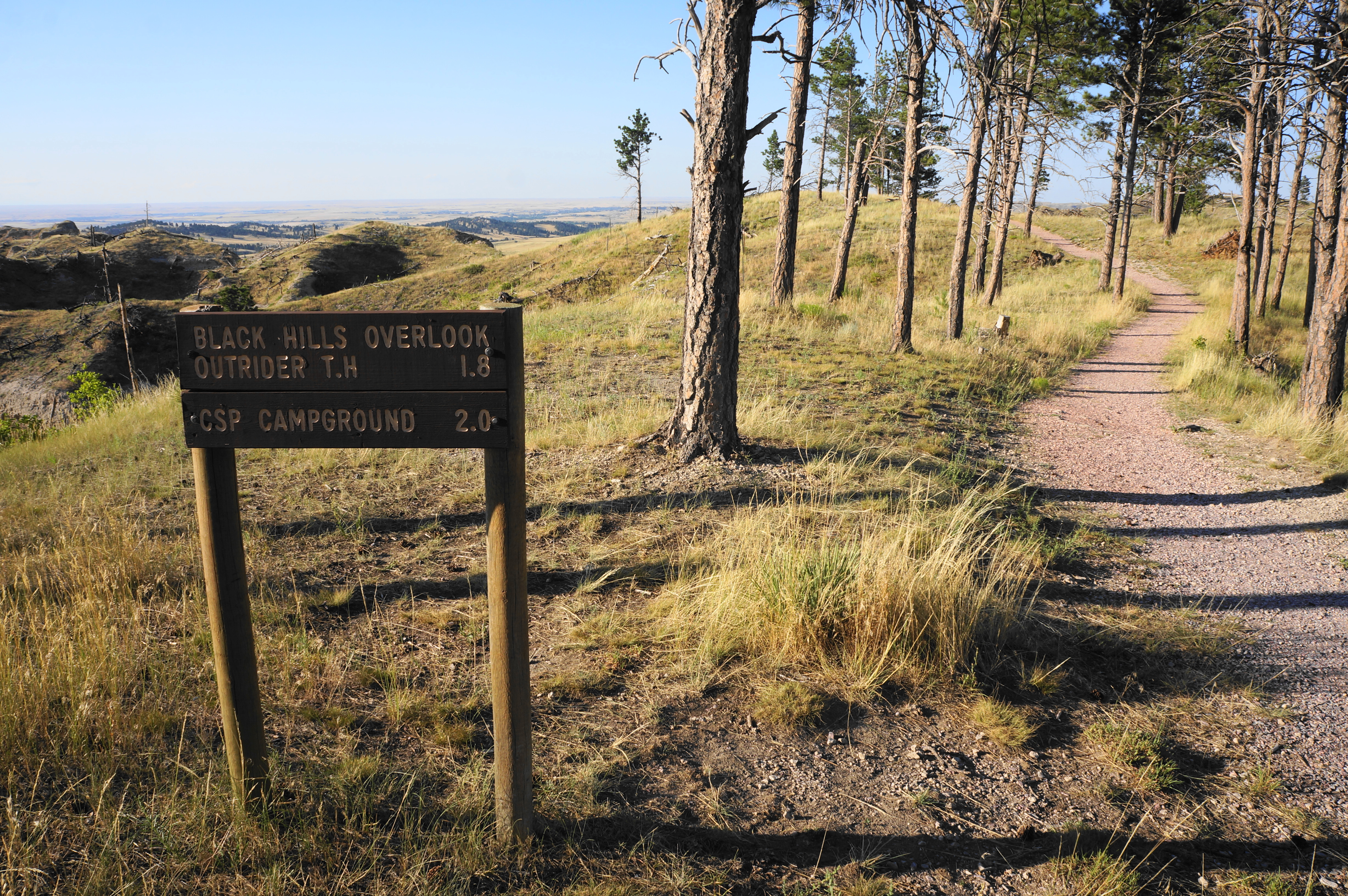
After cresting the saddle, hikers are greeted with some ever-elusive trail signs. The route heading right leads to the Outrider Trailhead, an alternative approach to the overlook loop that starts just north of the state park. Heading left continues to Blackhawk Overlook. Looking out across Crawford Valley, follow the narrow singletrack left as it skirts the hillside. A steep uphill comes abruptly at the one-mile mark, and the path ascends to the wind-swept ridgetop, passing occasionally desert yuccas.
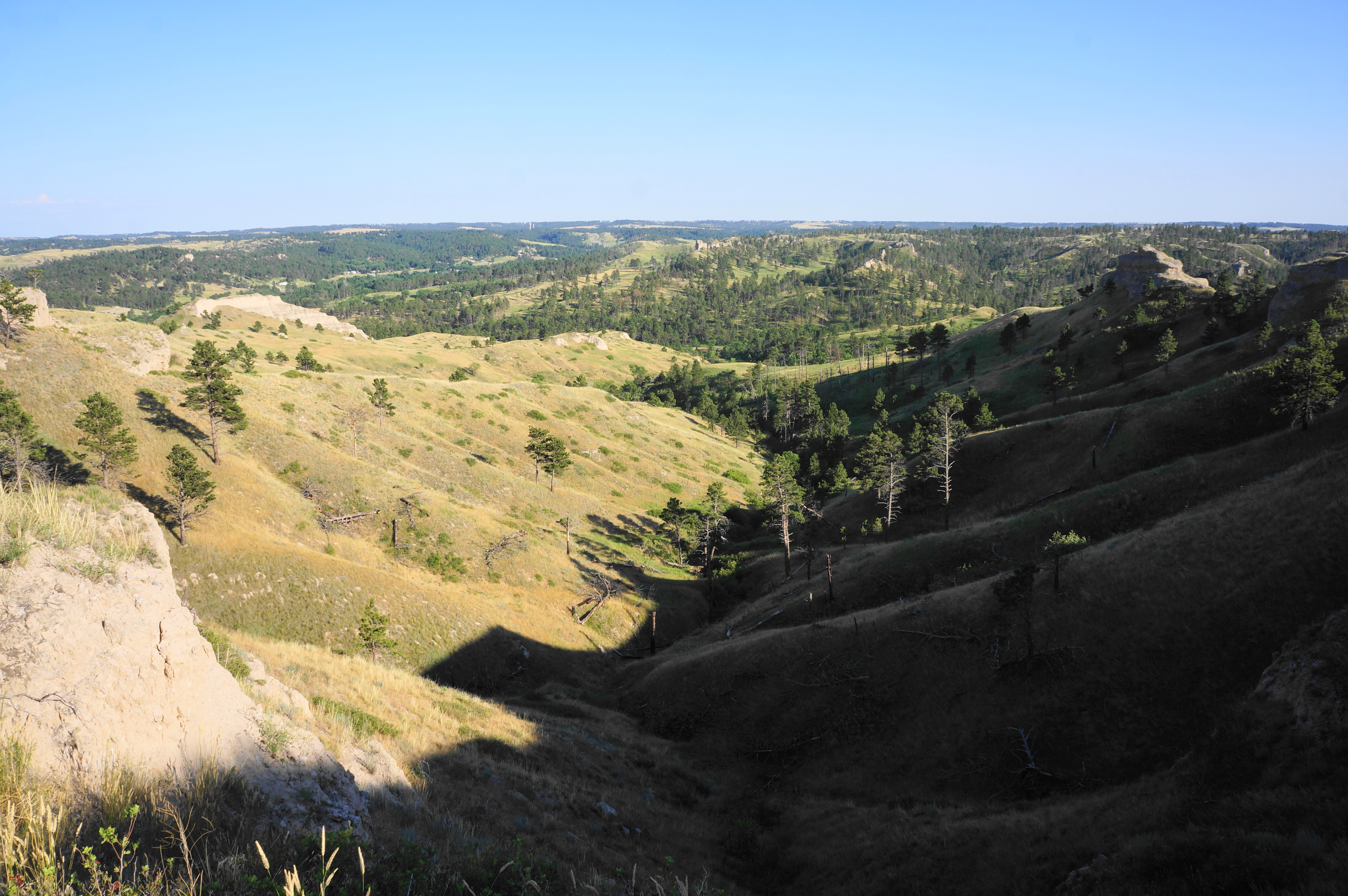
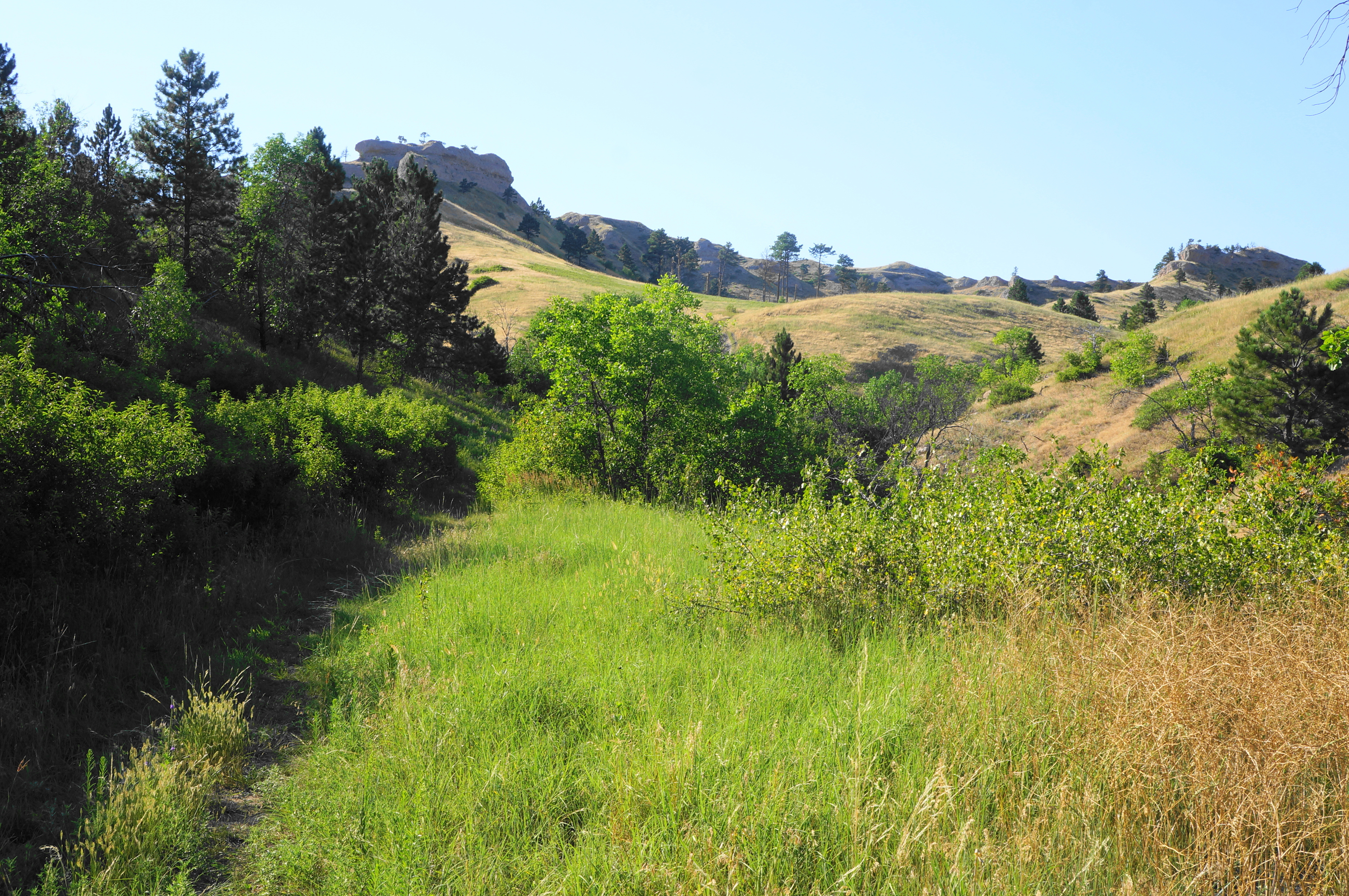
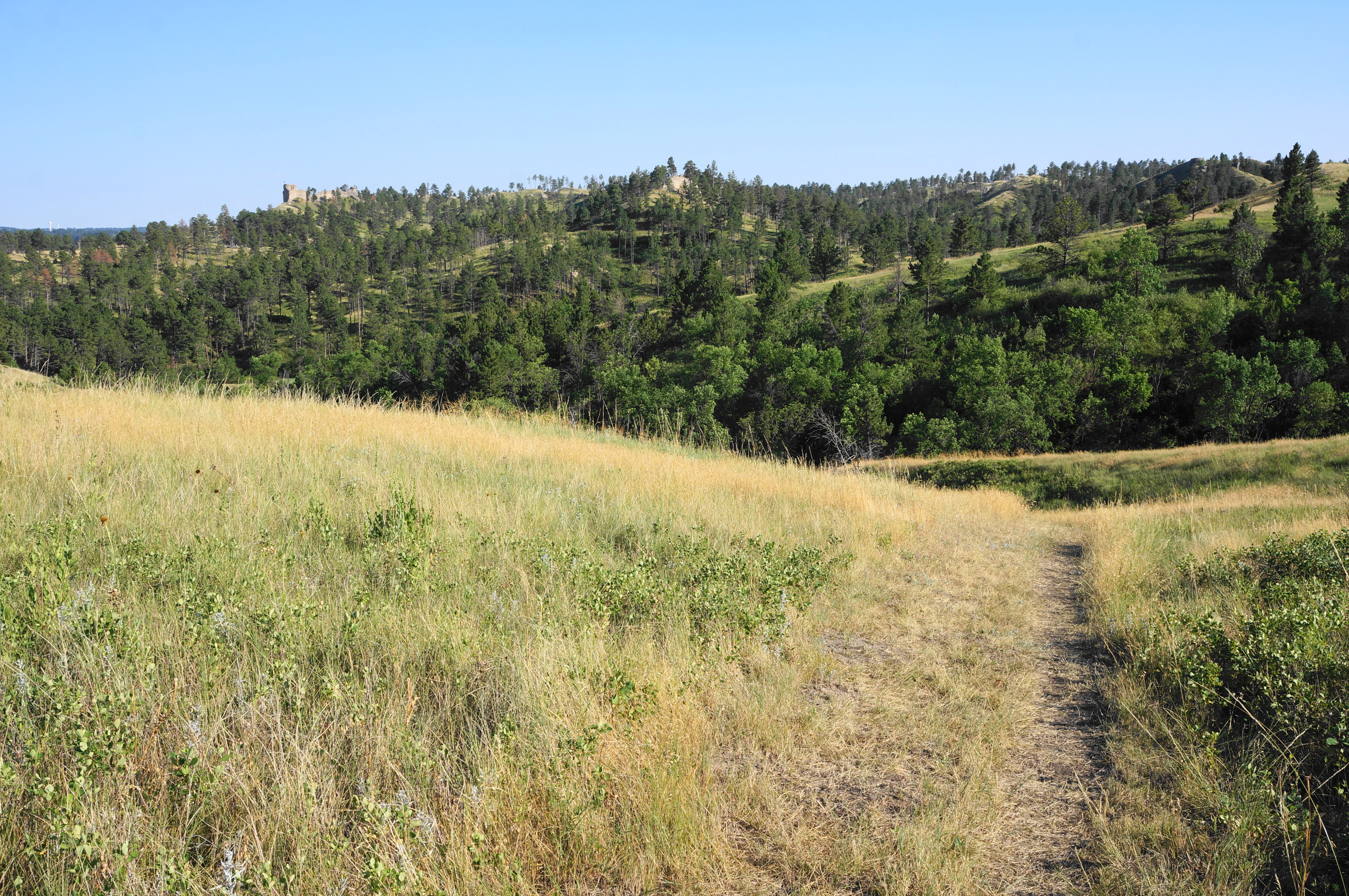
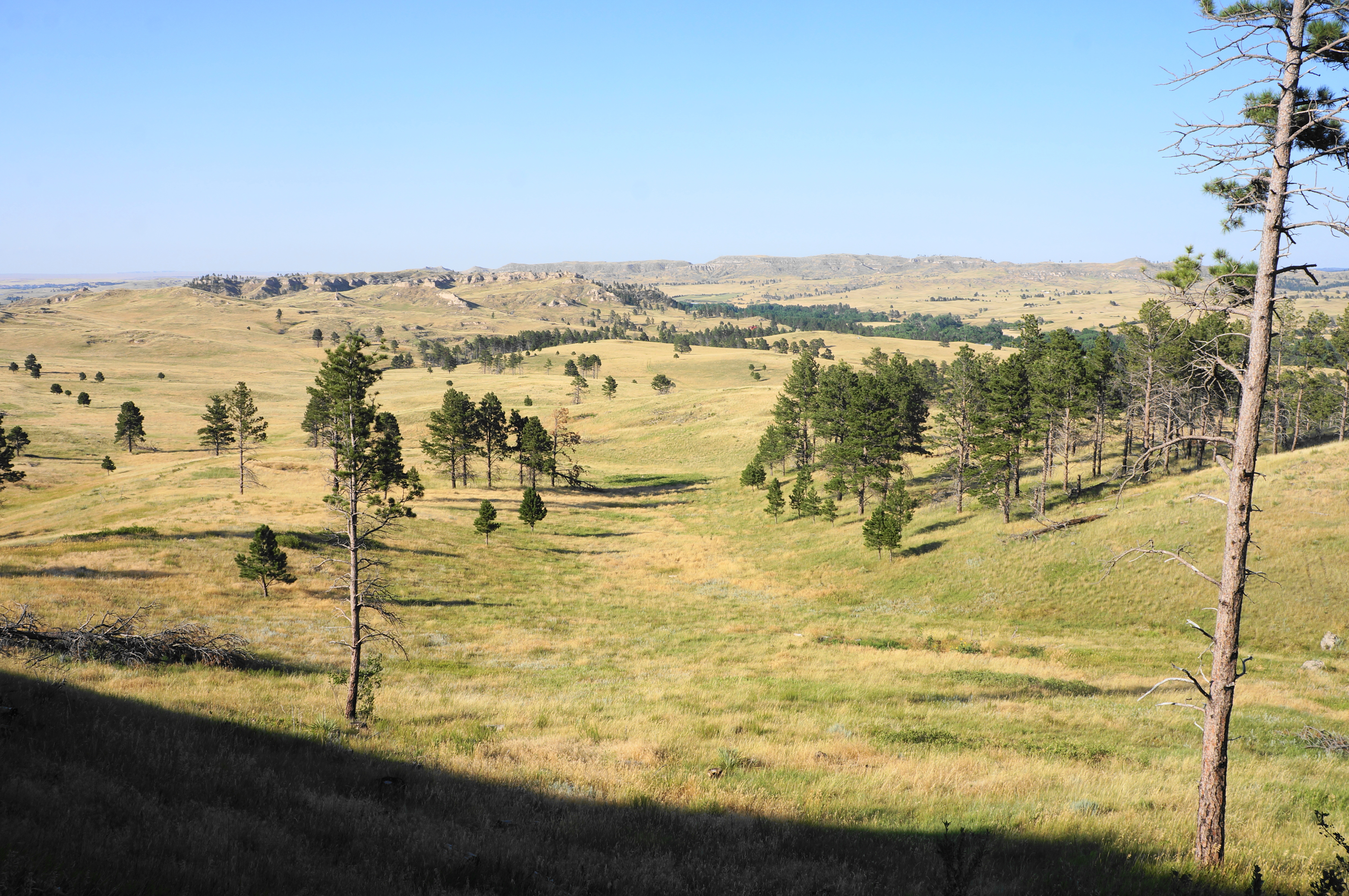
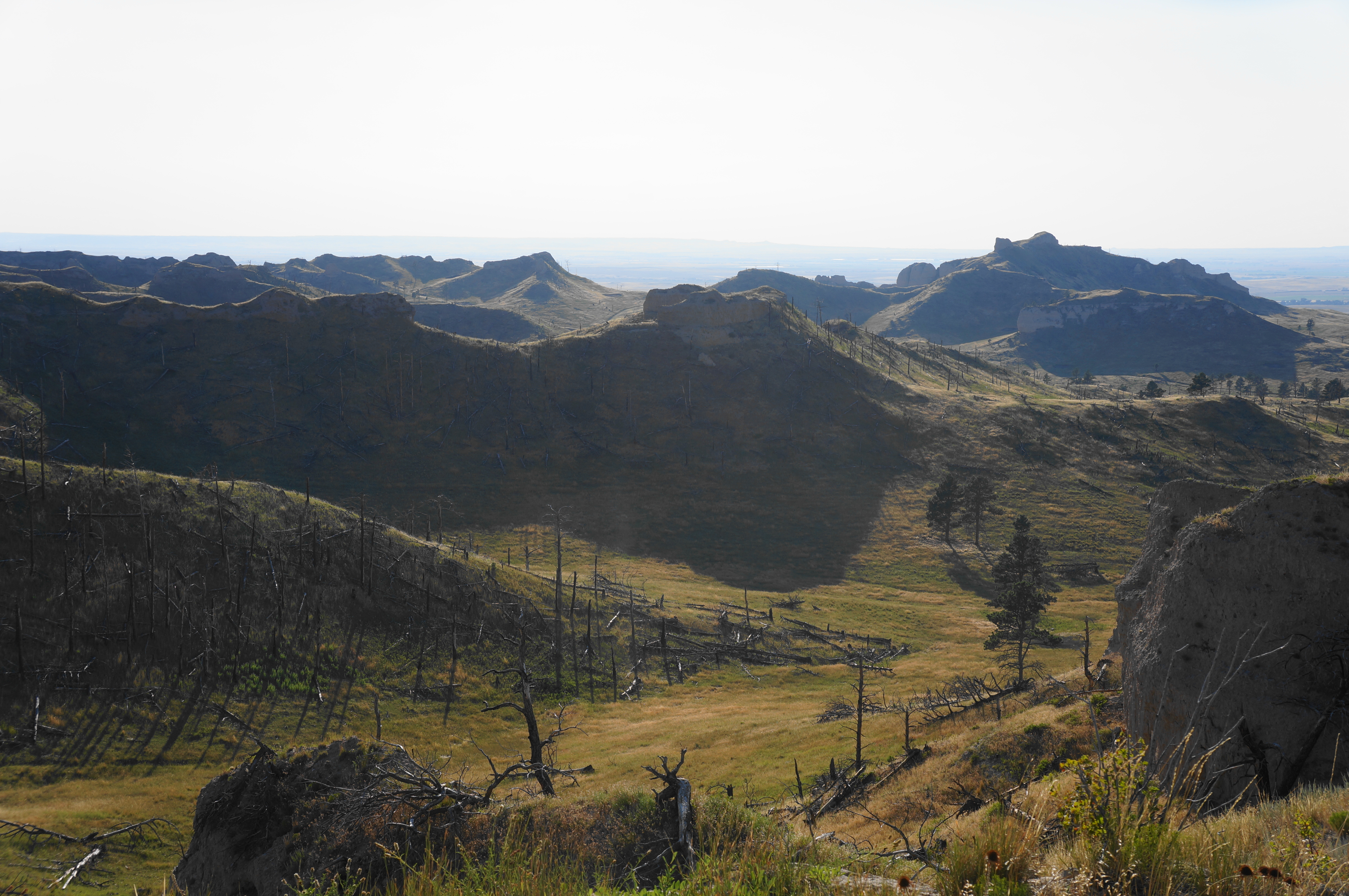
Climb to a point that offers a look both north and south, with lots of dead wood from a recent fire, then start a roller-coaster section that dips up and down along the ridgeline. The landscapes on the left get better and better, as hikers pass narrow and deep-carved canyons. The vistas to the north are grand and wide, with views out to prominent Flannigan Butte (4,236’). Here the trail also reenters Chadron State Park.
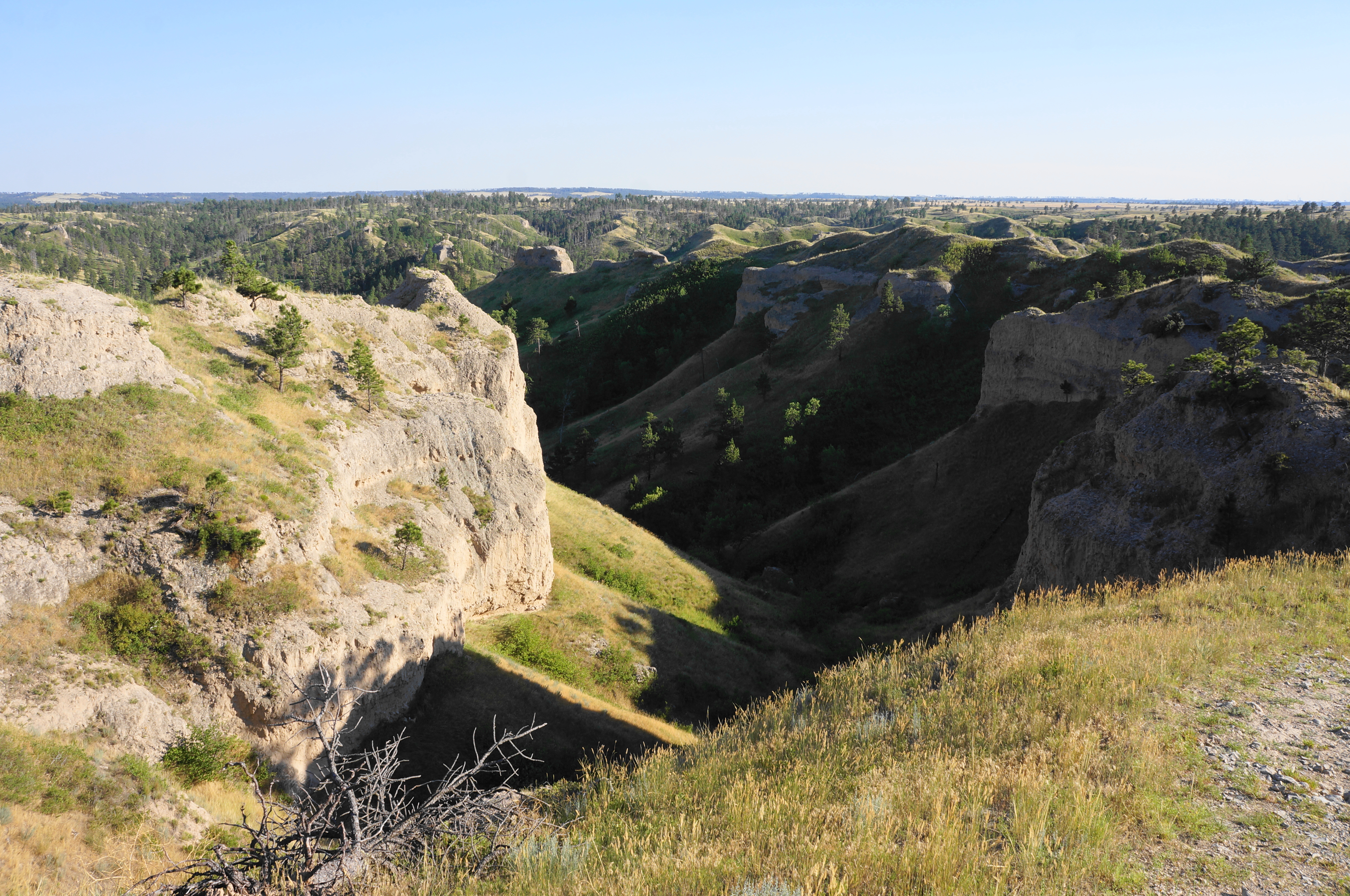
At 1.3 miles, the trail forks again. Continue right toward Blackhills Overlook, continuing to follow the ridgeline on a mostly level tread. This splendid section is easily better than the overlook itself, with tree cover at a minimum.
Soon the pines do come back, and the westward trail leaves the park again at 1.5 miles, passing through a gate and cattle guard. The official Blackhills Overlook can be found at 1.8 miles, a little over 1/10 mile from the dirt parking area at the end of a long road. After taking in the overlook, follow the path southward to the parking lot—relatively under-utilized but accessible by car. By now hikers have travelled just under two miles from the Chadron SP Campground.
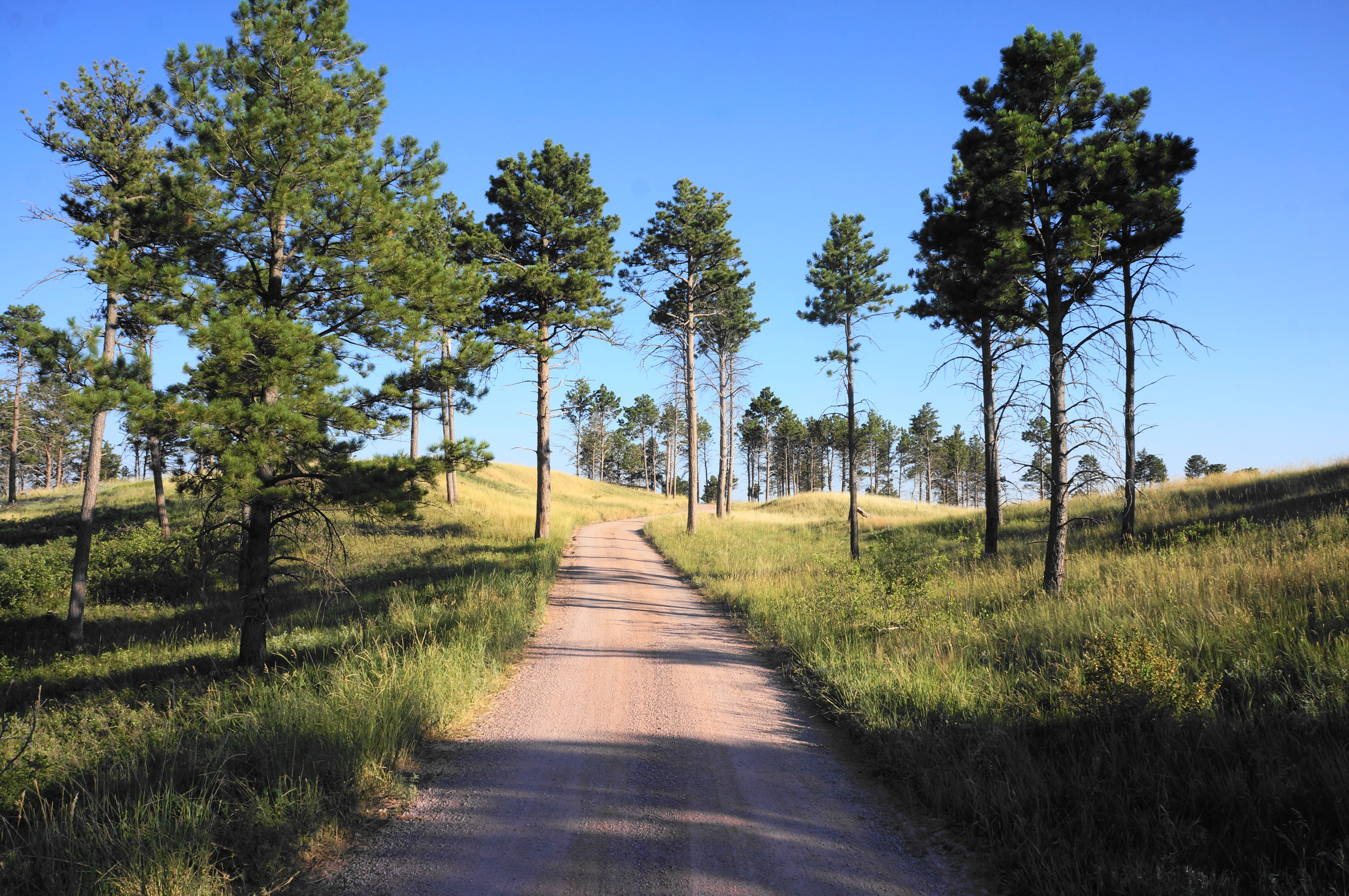
Alas, the rest of the loop is not quite as scenic as the first half, with the next leg requiring hikers to follow a well-graded dirt road for nearly 1.5 miles. The road starts by cutting through a clutch of pines, then reaches an open plateau with the hike’s first views westward to more of the conifer-clad Pine Ridge.
After a left-hand bend at 3.1 miles, the trail approaches the park boundary again—and the official exit route for the hike. There is no gate at the boundary at 3.25 miles, but there is one steps later. Just before it, look for a marked path heading left, paralleling a modest fence. Take this trail, which starts as a grassy doubletrack. At 3.35 miles, the route appears to split, with a well-trodden path heading left, but the correct route bears right, close to the fence.
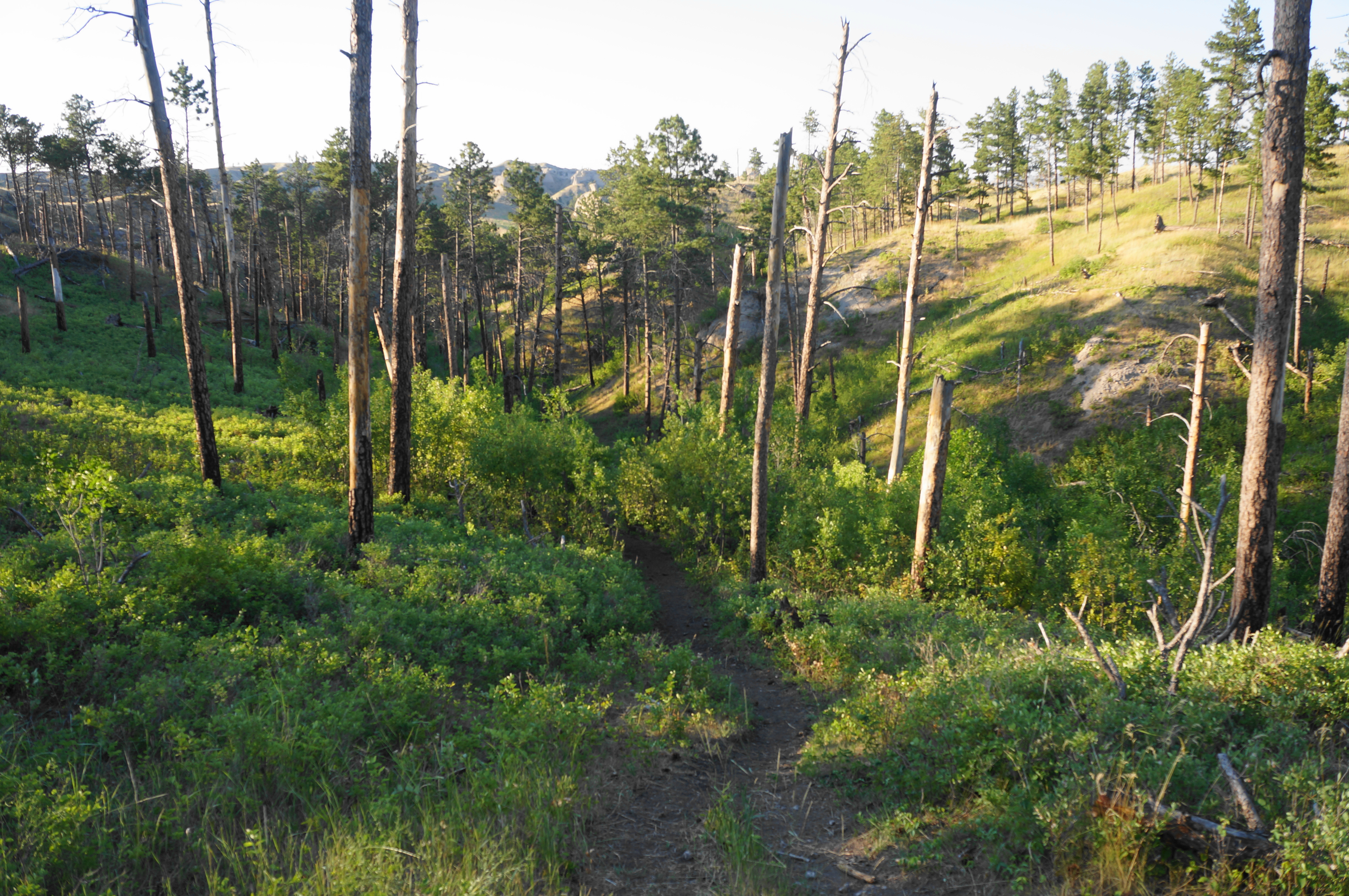
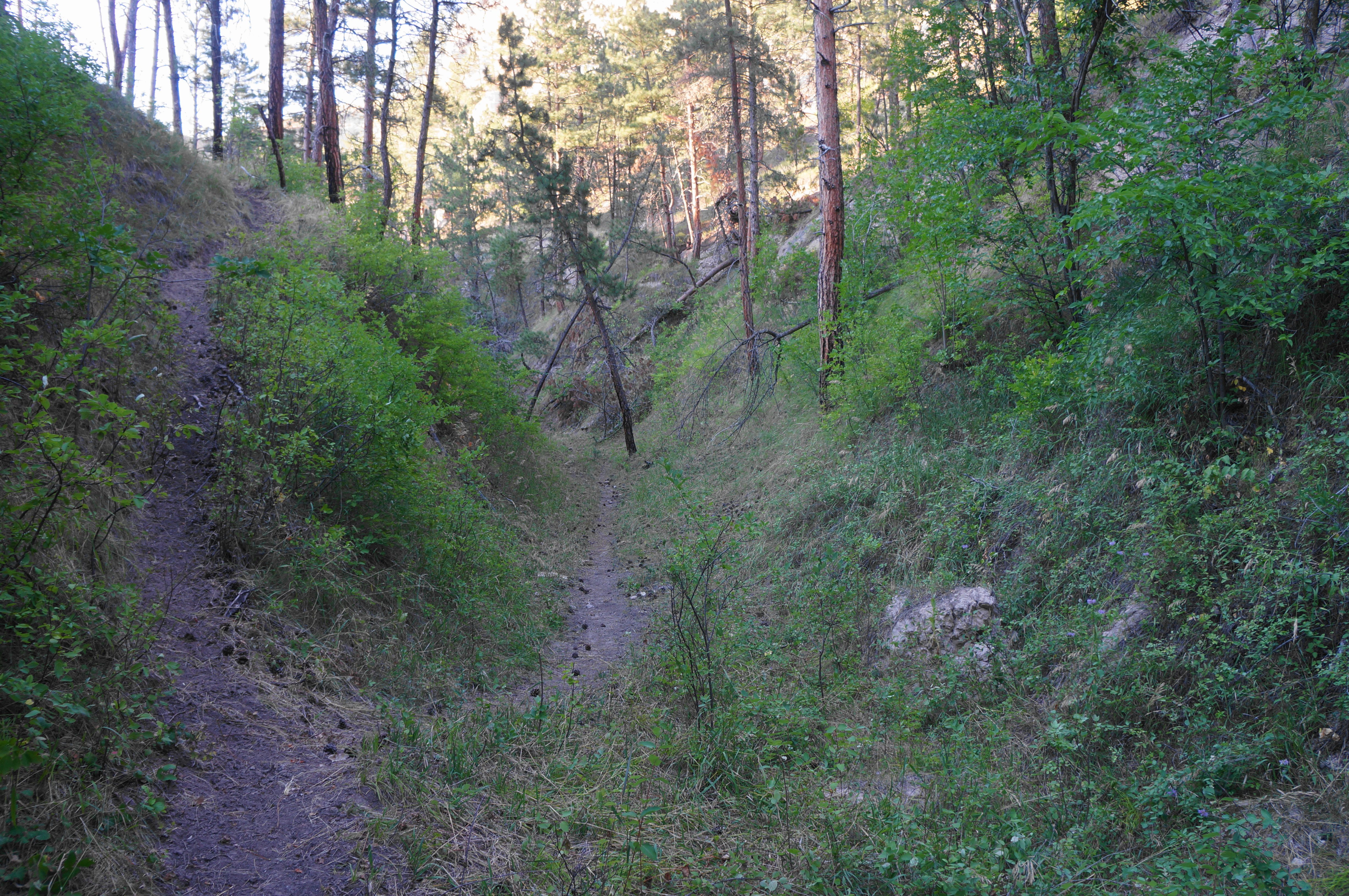
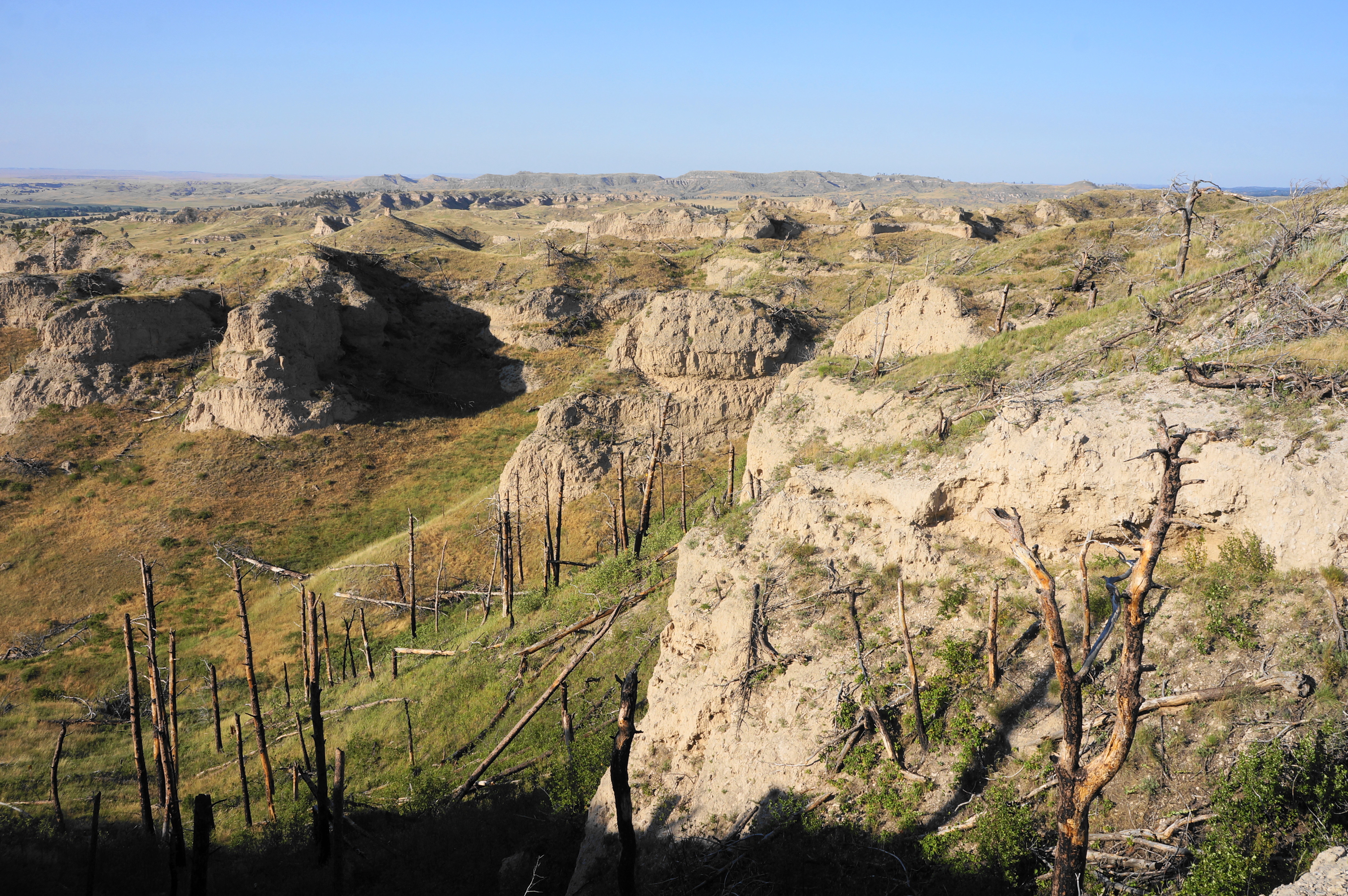
Soon the path drops into another side ravine, a tributary of the initial one encountered at the start of the hike. But the trail initially stays clear of the bottom, instead staying high above it on the left for a lengthy period. At 3.75 miles, the route splits into three: generally staying left is the best option here, eventually dropping sharply into the main canyon. Once down in the bottom, the route splits again; bear right, heading down the gully northward.
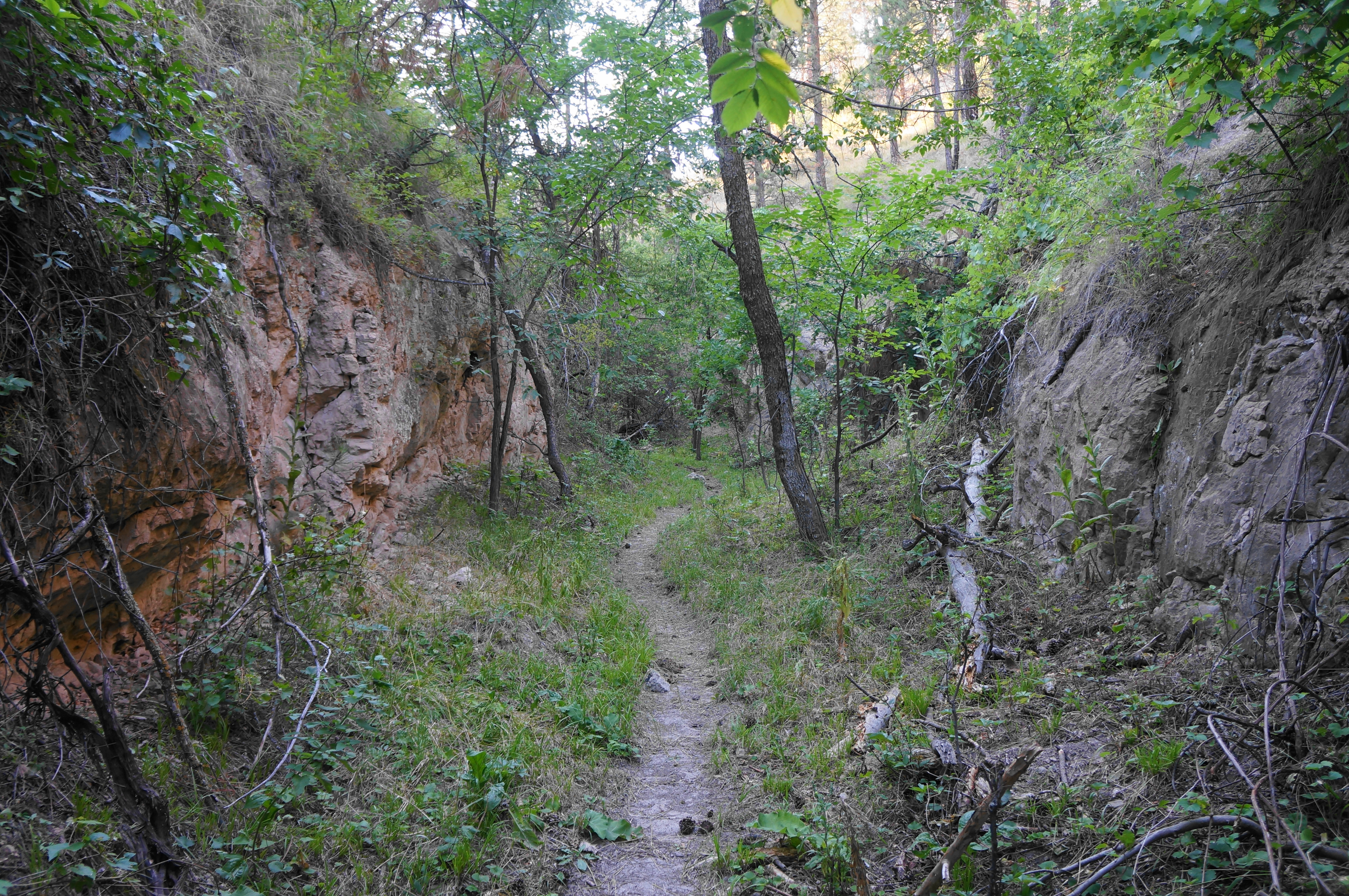
The gulch narrows and deciduous cover returns, giving the feeling of a spooky, dark canyon. Briefly reenter the special hunting zone, where the canyon is very narrow and scenic. Finally, at four miles, another path enters from the left, and the main trail heads east, with the valley widening again. About a quarter-mile later, the path climbs briefly up and out of the ravine, returning to the junction encountered near the start of the hike at 4/10 mile.
From here hikers must simply retrace their steps, heading right and dropping down into the initial pine-studded ravine again. After emerging out of the woods, don’t forget to take the trail heading uphill across the prairie to the unmarked trailhead where the 4.7-mile stem-and-loop hike began.
All told, this scenic hike—one of the best in northwest Nebraska—takes about 2-3 hours to complete and is moderately strenuous with some steep sections and some route-finding required.

Pingback: Top 10 Hikes in 2022 | Live and Let Hike
Thank for the details on the Black hills overlook hike! I followed exactly as written using my watch to track the millage. I would have got lost without the details provided. It is poorly marked and at times barely a trail. I hiked on June 7 and the ticks were horrible. Especially on the finally section in the narrow canyon. The grass was high and probably 100 ticks on my pants and shirt. I think I would skip that section next time. Overall it was well worth it, beautiful views.