
Southern Arizona’s Saguaro National Park—split into two districts separated by the San Luis Valley—feels in some ways like a local park due to its proximity to Tucson, Arizona’s second-largest city. Taking off from this neighborhood or that, numerous hiking trails wander into the arid, desert landscape, exploring cactus-studded ravines and climbing craggy peaks. Short, one- to two-hour hike options abound, offering local residents the opportunity for an early, before-work walk or late evening jaunt. One such hike is the Scenic – Packrat Trail Loop, an hour-long meander in the northern reaches of Saguaro’s Tucson Mountain District. Its location, cut-off from the heart of the park, means that, even on weekends, it is relatively sparsely-visited by visitors and tourists—a quiet walk frequented mostly by Tucson locals.

The hike
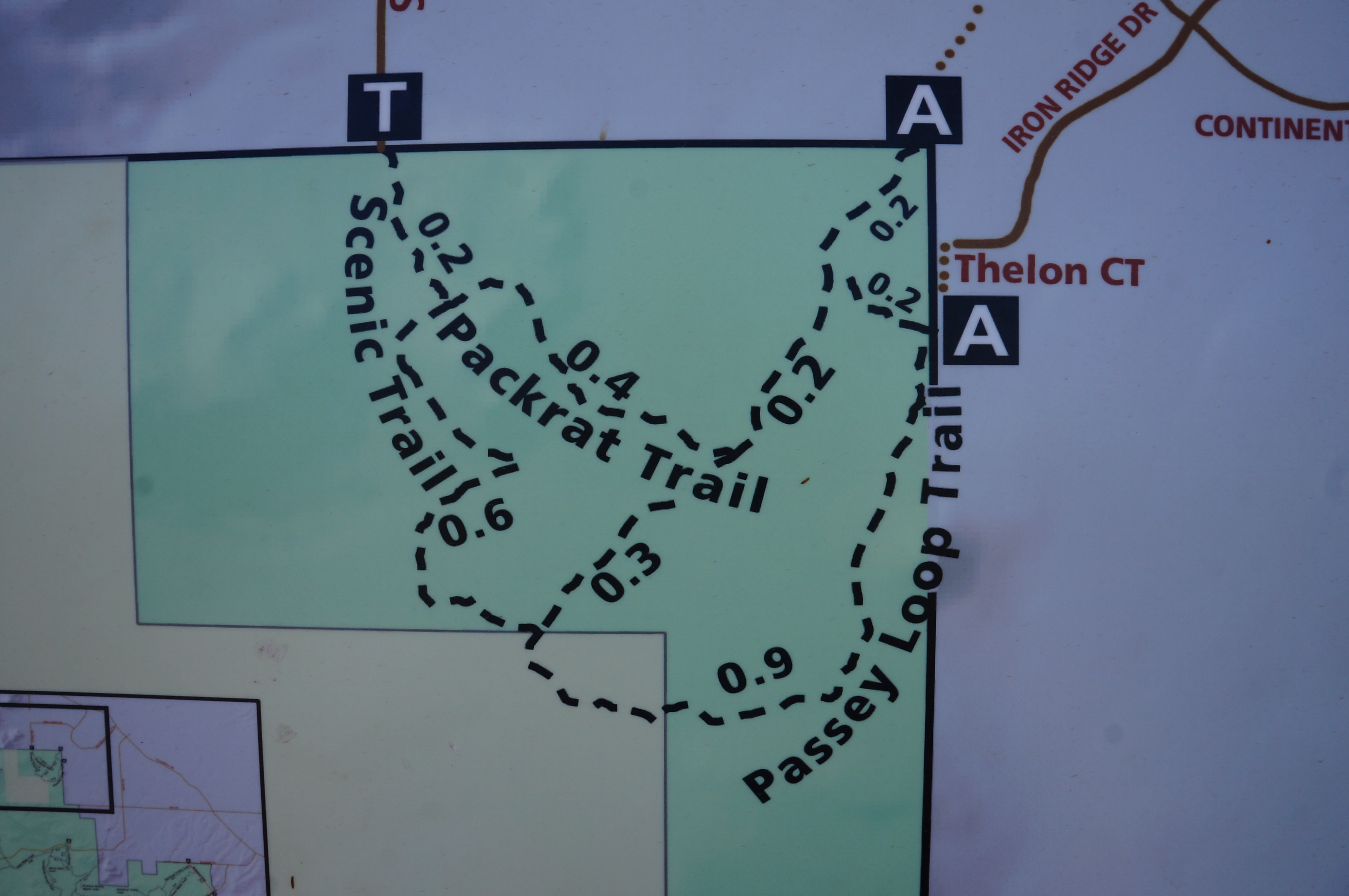
The Scenic Trailhead is situated at the end of North Scenic Drive, which runs north-south through a residential section of Marana, Arizona into Saguaro National Park. Most of the drive is paved until the very end, when the road runs up to the park boundary and turns to gravel. Park in the small parking area and head south on the Scenic Trail, which runs through a gate and enters Saguaro.
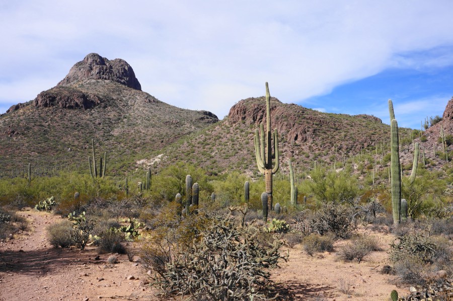
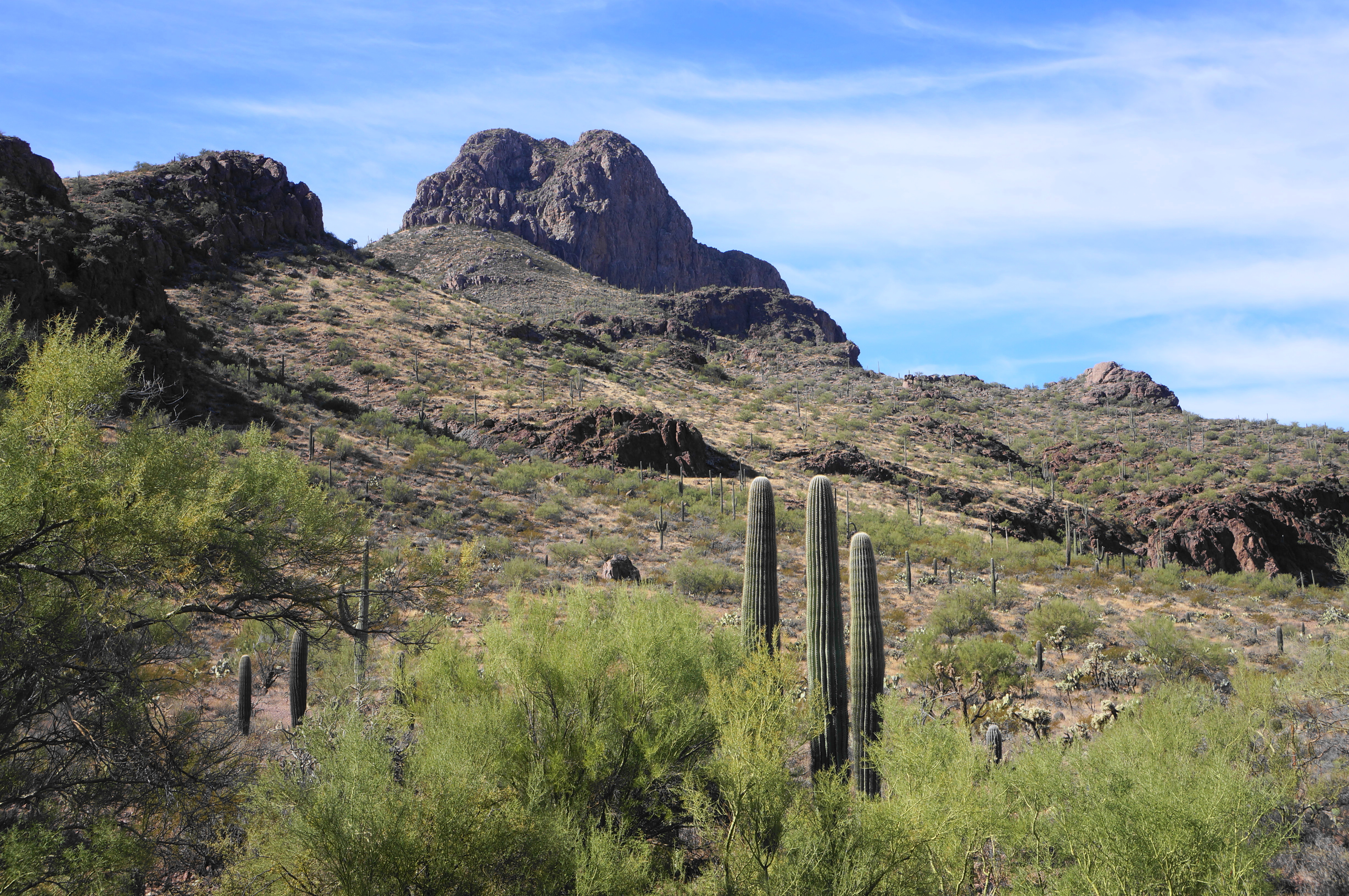
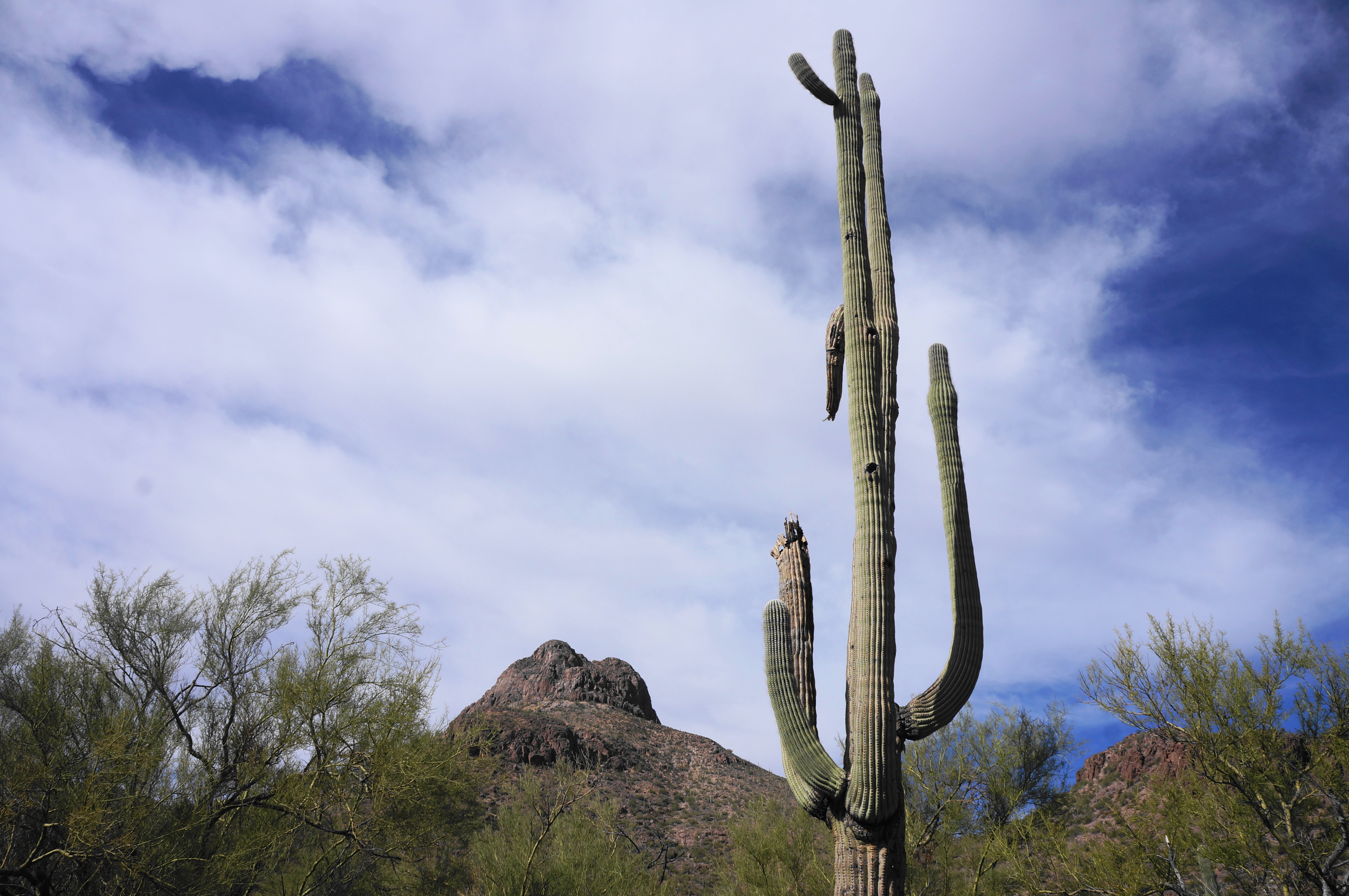
One of the first things visitors will notice—in addition to the multitude of cacti—is the imposing headwall of Safford Peak (3,563’) (known locally as Sombrero Peak), one of the highest and most striking mountains in the Tucson Mountain District of Saguaro. The trail does not approach the peak but offers some of the area’s best views of the mountain, which comes in and out of view as the route continues.
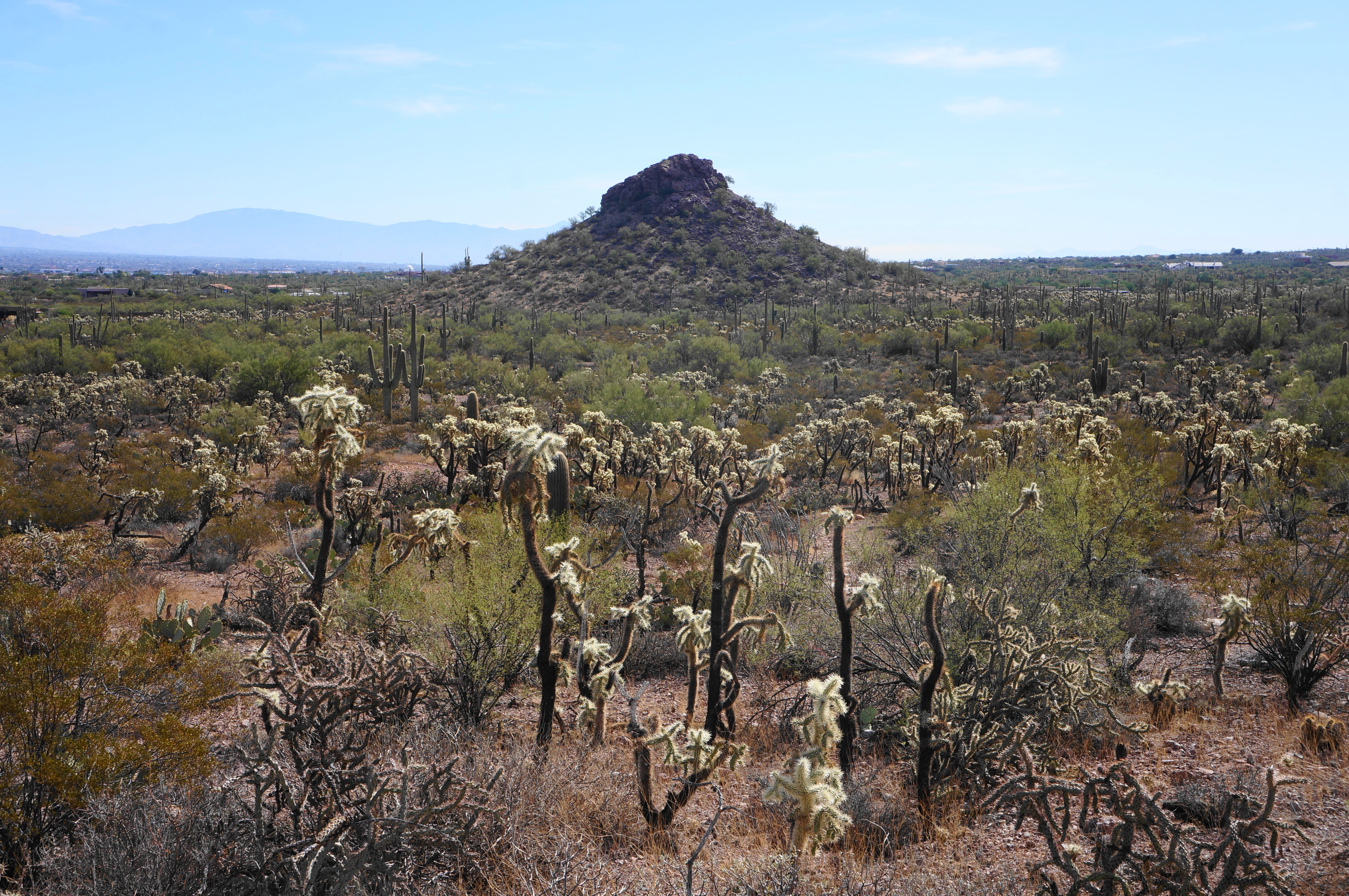
The Scenic Trail is well-worn and well-marked, but it is quite rocky from the start and ascends steadily toward low gap between outcrops. Climbing around 100 feet in the first ¼ mile, the path ascends a set of switchbacks at around 2/10 mile, where hikers will find a large concentration of prickly pear cacti. (Note: Of course, the namesake saguaros are also mixed in, as well as the very common buckhorn cholla.)

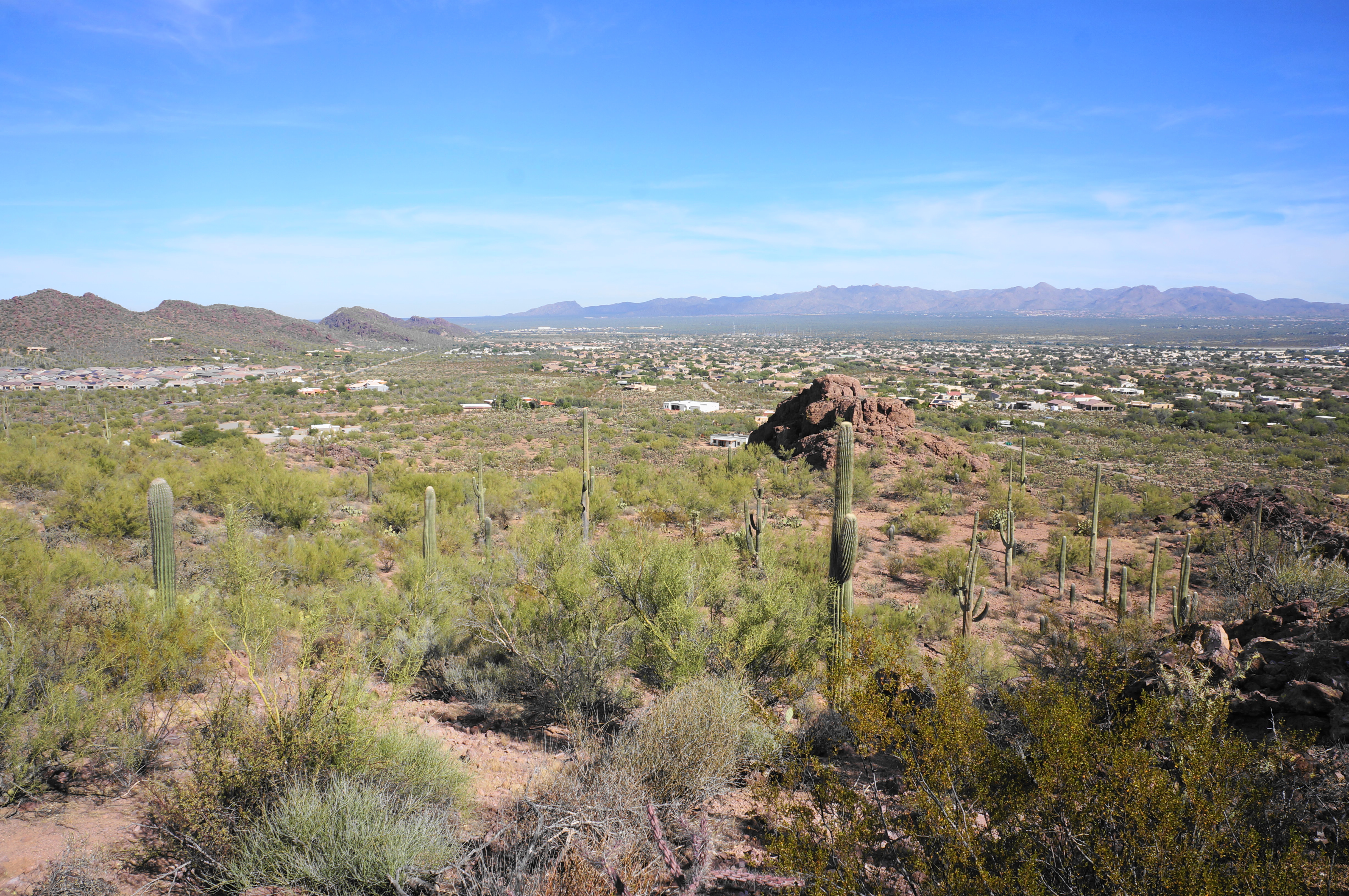
At ¼ mile, hikers face the walk’s first junction. Heading either way is fine, but this description chooses to go left (clockwise) around the loop. By doing so, hikers pick up the Packrat Trail, another well-trodden path that ascends modestly to a higher notch and rewards hikers with expansive views of the San Luis Valley, with the northern suburbs of Tucson visible down below. As the trail levels off and wraps around to the south, there is a nice vista point where hikers can stop to take photos and admire the views before heading on.

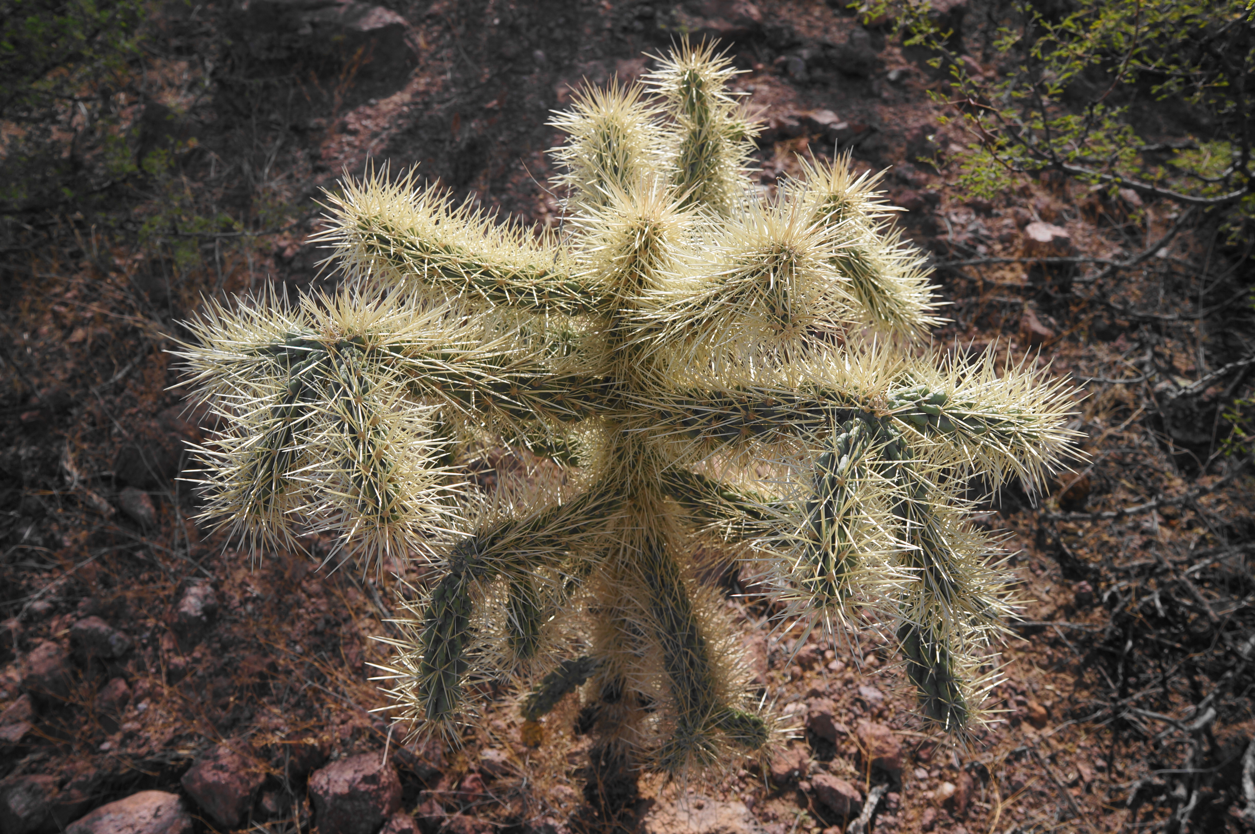
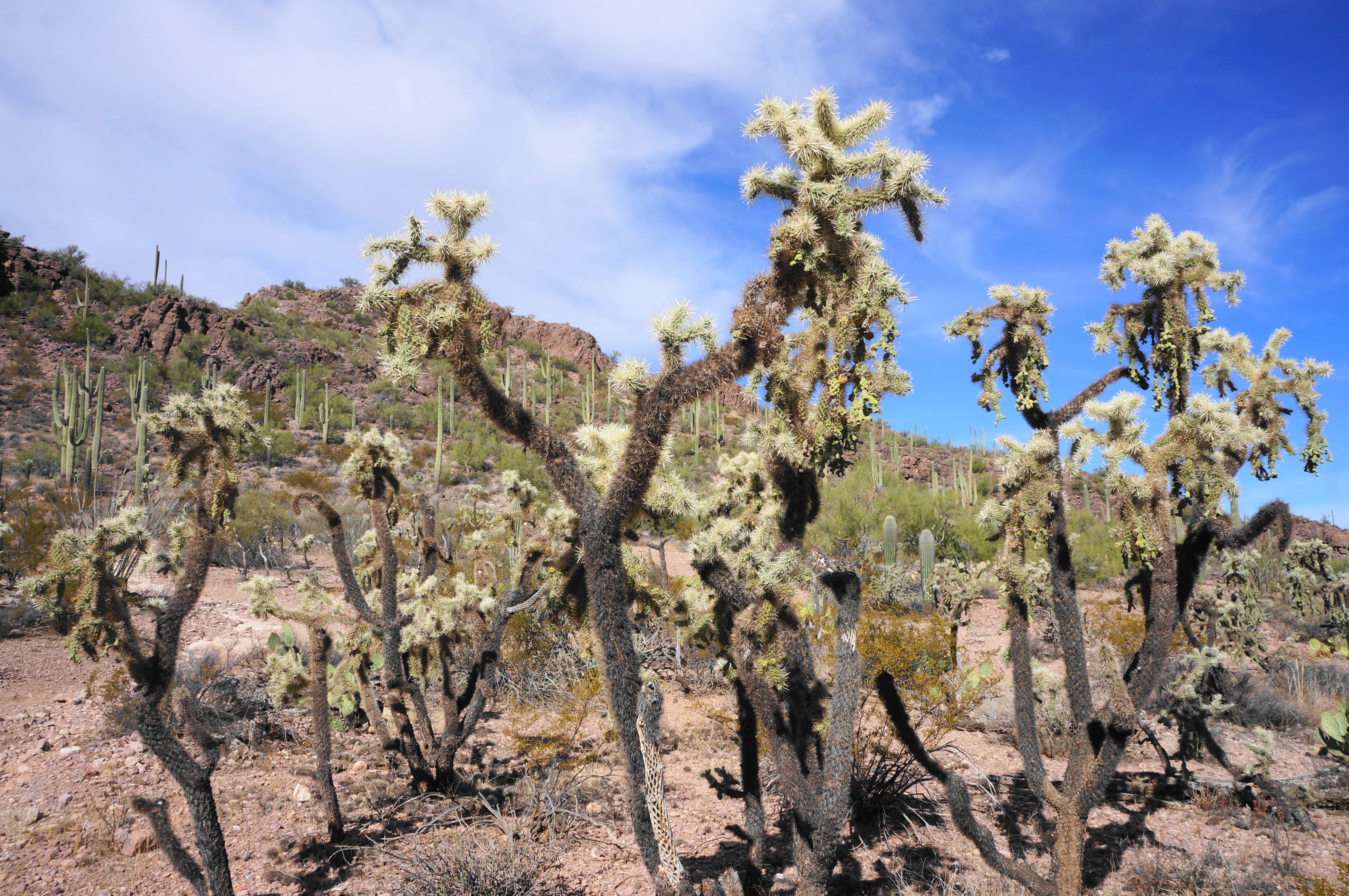
From here the Packrat Trail descends steadily, entering a scenic drainage basin featuring one of the area’s highest concentrations of jumping cholla, a beautiful and very spiky Sonoran cactus species. As the incline eases, hikers pass several clusters of these photogenic cacti before dropping to clear a modest (usually dry) arroyo. Just past the wash, come to another junction. Here hikers have another choice: heading right offers the quickest way to close the loop; heading left on the Passey Loop Trail allows for a mile-longer circuit.
Those strapped for time or seeking a walk under an hour should bear right, returning to the Scenic Trail as it traverses a ¼-mile stretch with limited elevation gain. Enjoy the wondrous Sonoran flora—replete with cacti, sagebrush, and palo verde trees—in addition to supreme views of the east side of Safford Peak, with a peek at part of Panther Peak (3,435’) beyond.

Stay on this track until a junction at 9/10 mile, at which point the Passey Loop Trail comes in again from the left. Bear right on the Scenic Trail, beginning a gradual ascent back toward the initial saddle. Cross the drainage again at 1.2 miles, then rise more steadily, returning to the top of the pass minutes later.


The views northward—to Rattlesnake Pass and beyond—return as the path crests the ridge and then descends again to the initial junction. Bear left here, retracing your steps for ¼ mile—down the switchbacks and out of the bowl-shaped gulch—returning to the parking area and North Scenic Drive. All told, this 1.65-mile walk is a relatively easy journey with some limited elevation gain, taking most around an hour to complete.

Are dogs allowed on leash
I don’t think so, no. National Parks almost always restrict pets to only roadways or paved trails. See more here: https://www.nps.gov/sagu/planyourvisit/pets.htm#:~:text=For%20the%20protection%20of%20your,Trail%20%26%20Desert%20Discovery%20Trail).