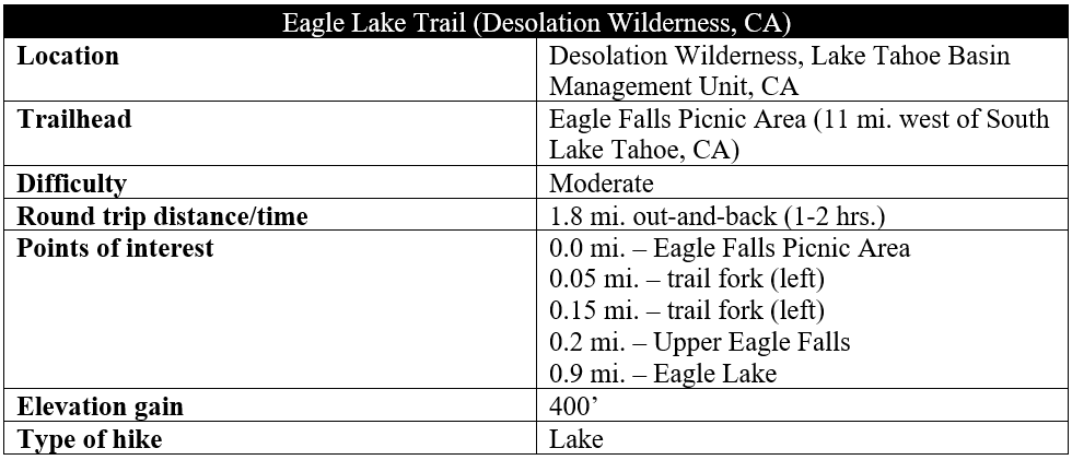
Nestled in a scenic drainage nearly 800 feet above Emerald Bay, the pristine Eagle Lake is one of the most popular day hike destinations in the Lake Tahoe area. Less than a mile’s walk into the Desolation Wilderness, the lake sits in a granite bowl surrounded by craggy peaks, a significant “bang for one’s buck” for visitors in search of a short but satisfying day hike. Starting at the Eagle Falls Picnic Area, across California State Route 89 from Emerald Bay State Park, the 0.9-mile one-way trek follows a narrow stream and minor cascade at Upper Eagle Falls before rising steadily along a well-worn but moderately-strenuous path to the shores of the spectacular lake.
The hike
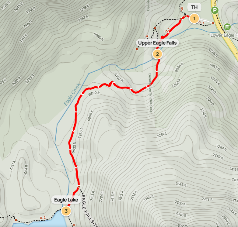
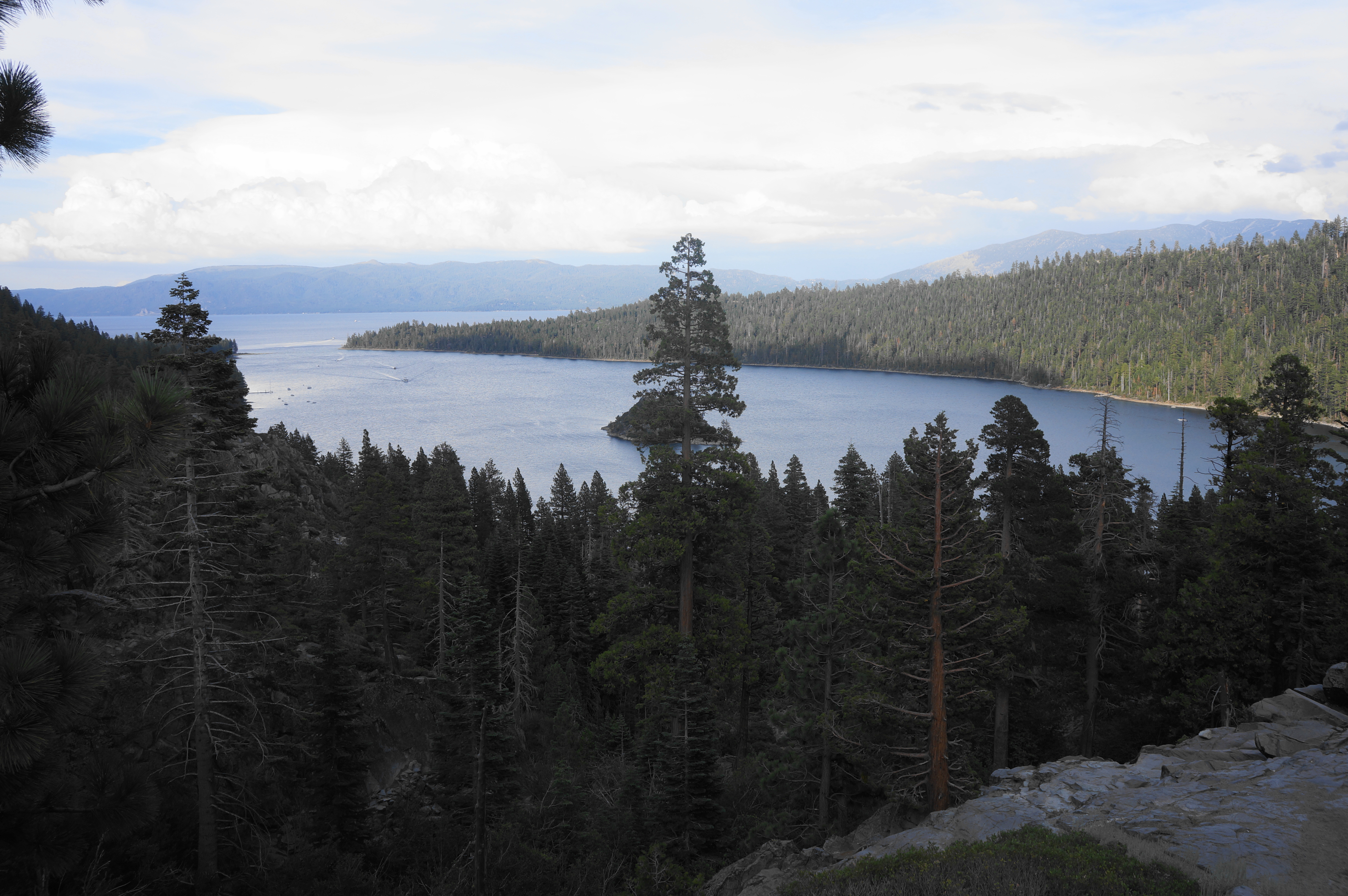
Start your hike at the parking area for Eagle Falls Picnic Area, situated just off Highway 89 in the southeast corner of the Lake Tahoe Basin, just outside Emerald Bay State Park. Before hiking, enjoy the views from the pull-off just above Lower Eagle Falls; the falls are difficult to see from this vantage point, but Emerald Bay is in full view: this scenic inlet, speckled with Fannette Island in the center, is one of the most intriguing and picturesque portions of Lake Tahoe.
Walk from the roadside parking down into a broader parking area (where spots are more limited), following a wooded boardwalk to the main trailhead and Eagle Falls Picnic Area. Here there is a restroom and several information boards, with a well-established stone staircase inaugurating the Eagle Falls Trail, one of many thoroughfares into the national forest and Desolation Wilderness. Ascend the stairs to the start of the hike, bearing left—away from Lake Tahoe—and into a dense forest of pines and brush. (Note: Free day-use permits, which can be found at the trailhead, are required for entrance into Desolation Wilderness if not spending the night.)
Quickly one will find a sign and junction marking the start of the Eagle Trail Loop. Heading right leads to a modest viewpoint, but out-and-back hikers will want to simply stay left for quickest access to Eagle Lake.
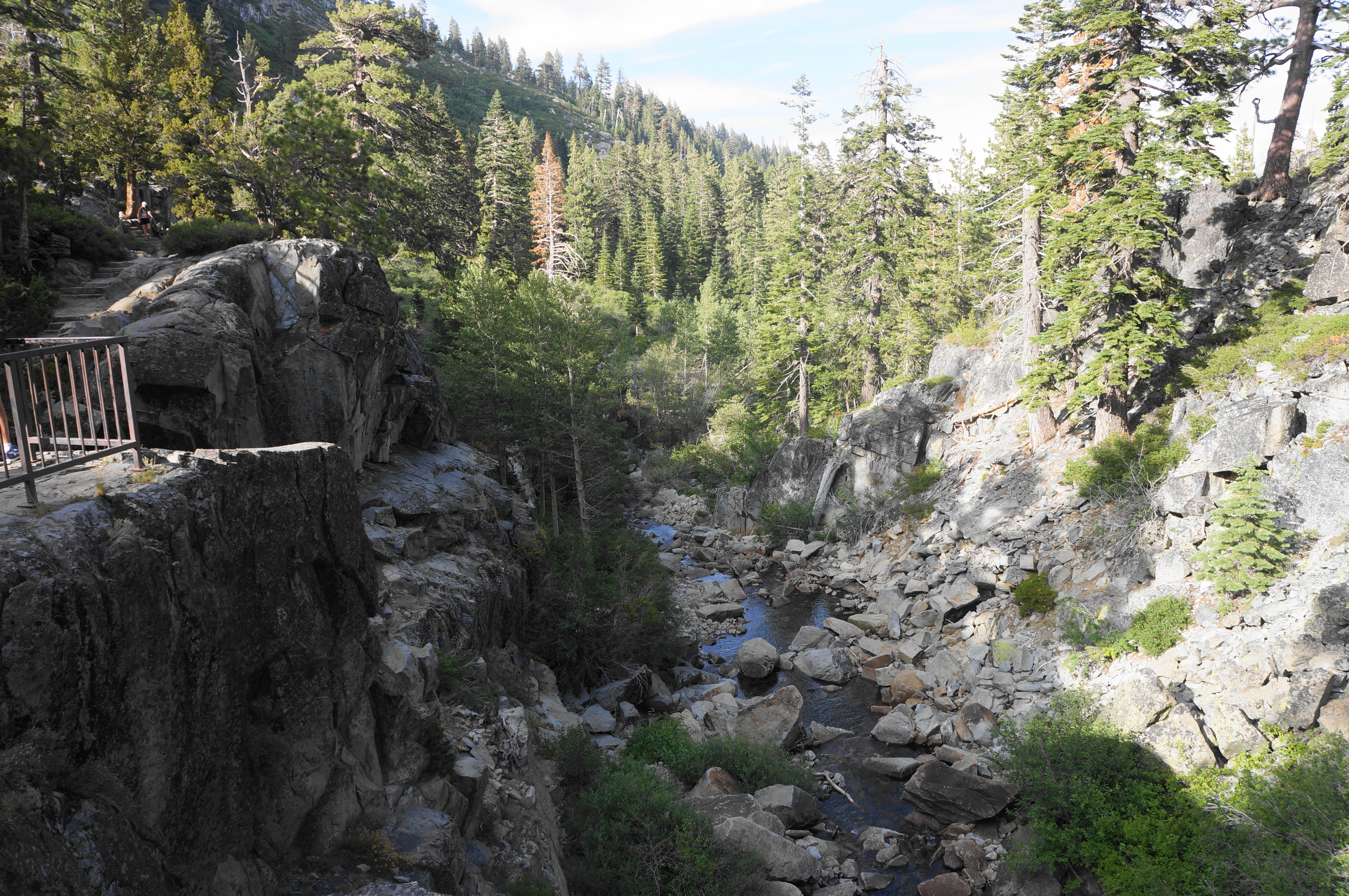
Steps are a recurring feature of this walk, and hikers bearing left will encountere a healthy dose of them right away, climbing steadily as the path rises to an elevated position well above Eagle Creek. One can hear the stream before one sees it, and it is not until 1/10 mile that hikers first lay eyes on the creek. This is the unofficial base of Upper Eagle Falls, a cascading waterfall that squeezes through a narrow chute.

The falls are better viewed as one continues onward, coming to a set of switchbacks and another meticulously-laid staircase that ends with a level viewpoint and bridge crossing. The man-made span is positioned right over the highest drop of the falls, with hikers looking down straight at the modest chute. Many visitors turn around here, but a good deal continue on to Eagle Lake.
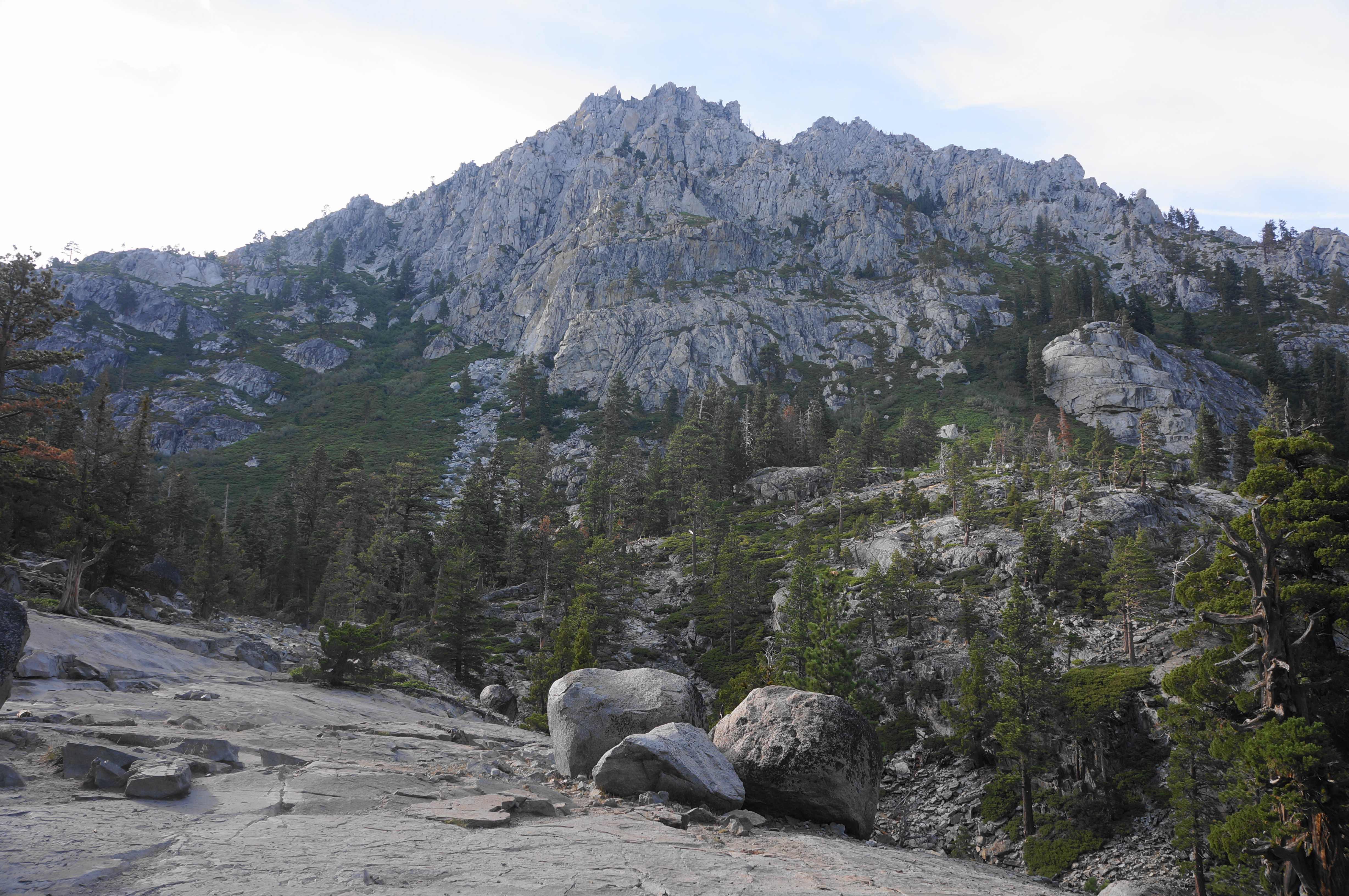
Now on the south side of the creek, the trail turns southward, then west, launching into another set of stairs. Traversing scree fields and fresh pine woodlands, the Eagle Falls Trail climbs perhaps 150 feet in elevation before levelling off briefly. Here the route crosses open granite slabs with views north to an unnamed crag that is part of broader Jakes Peak (9,187’).

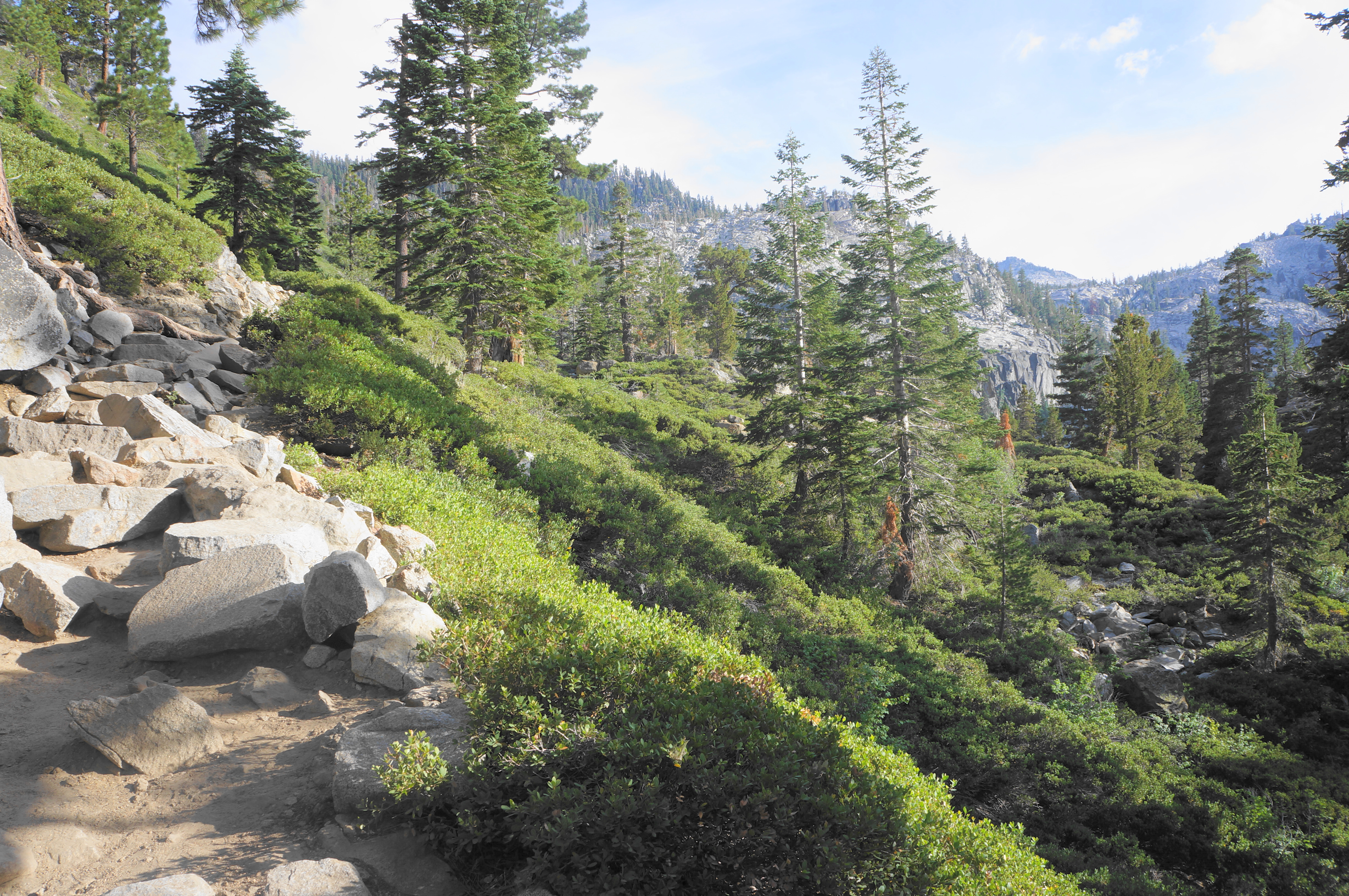
Follow the cairns pointing the way across the slickrock, but be sure to glance back for a window view of Emerald Bay and Lake Tahoe, gleaming in pearly blue. From here the trail resumes its stairmaster, interrupted by occasional but very brief flats. The trail rounds a bulging hill but more or less follows the drainage of Eagle Creek.

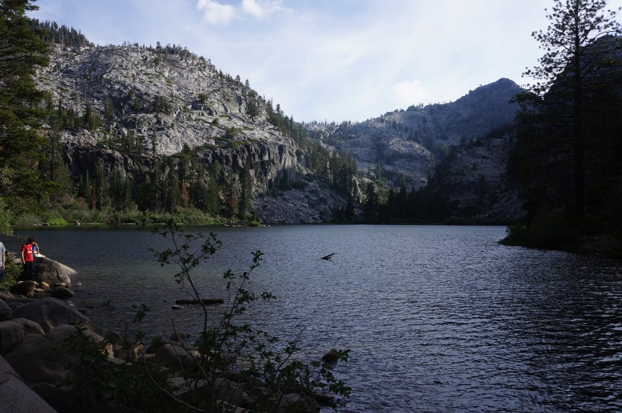
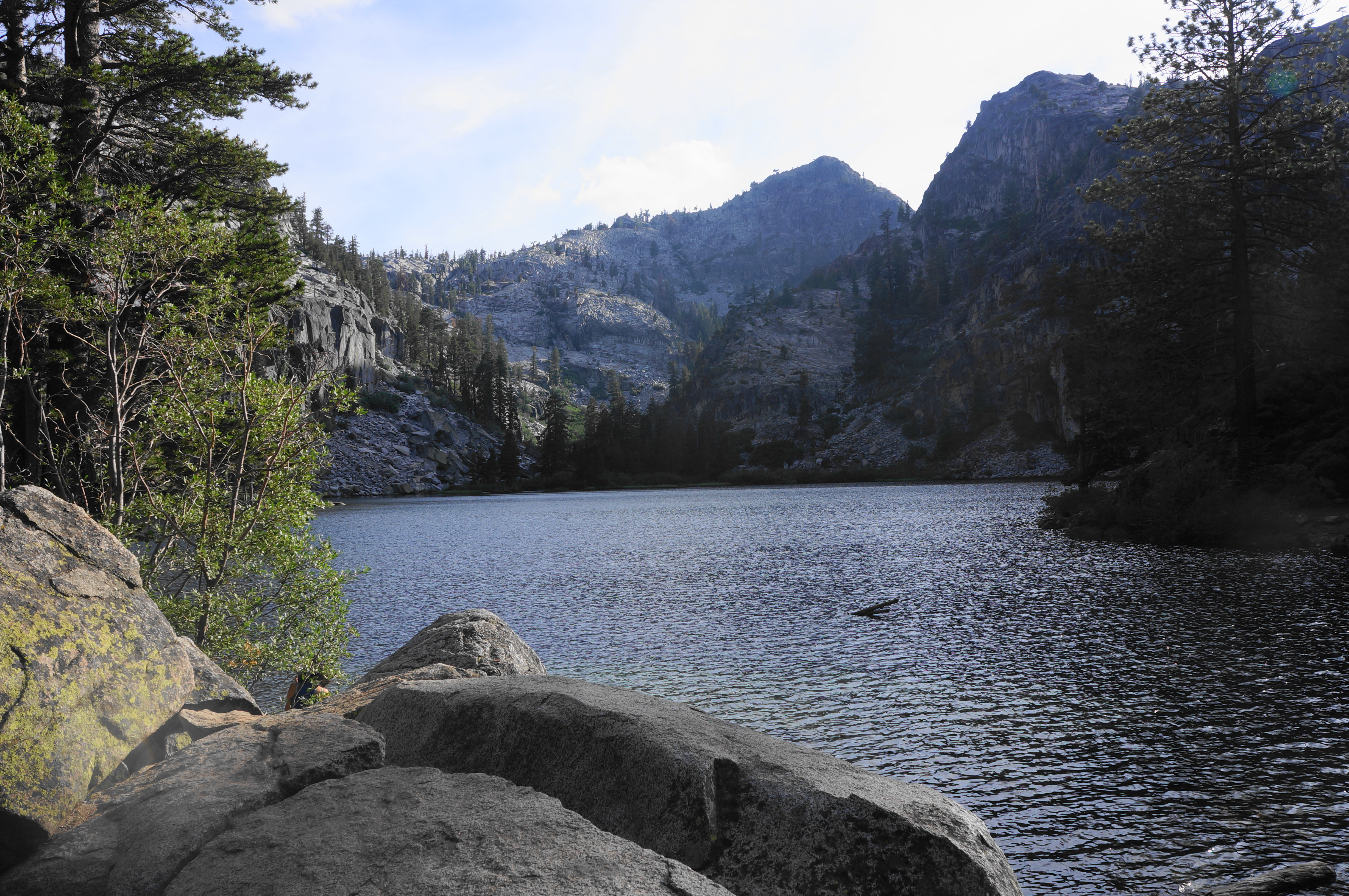
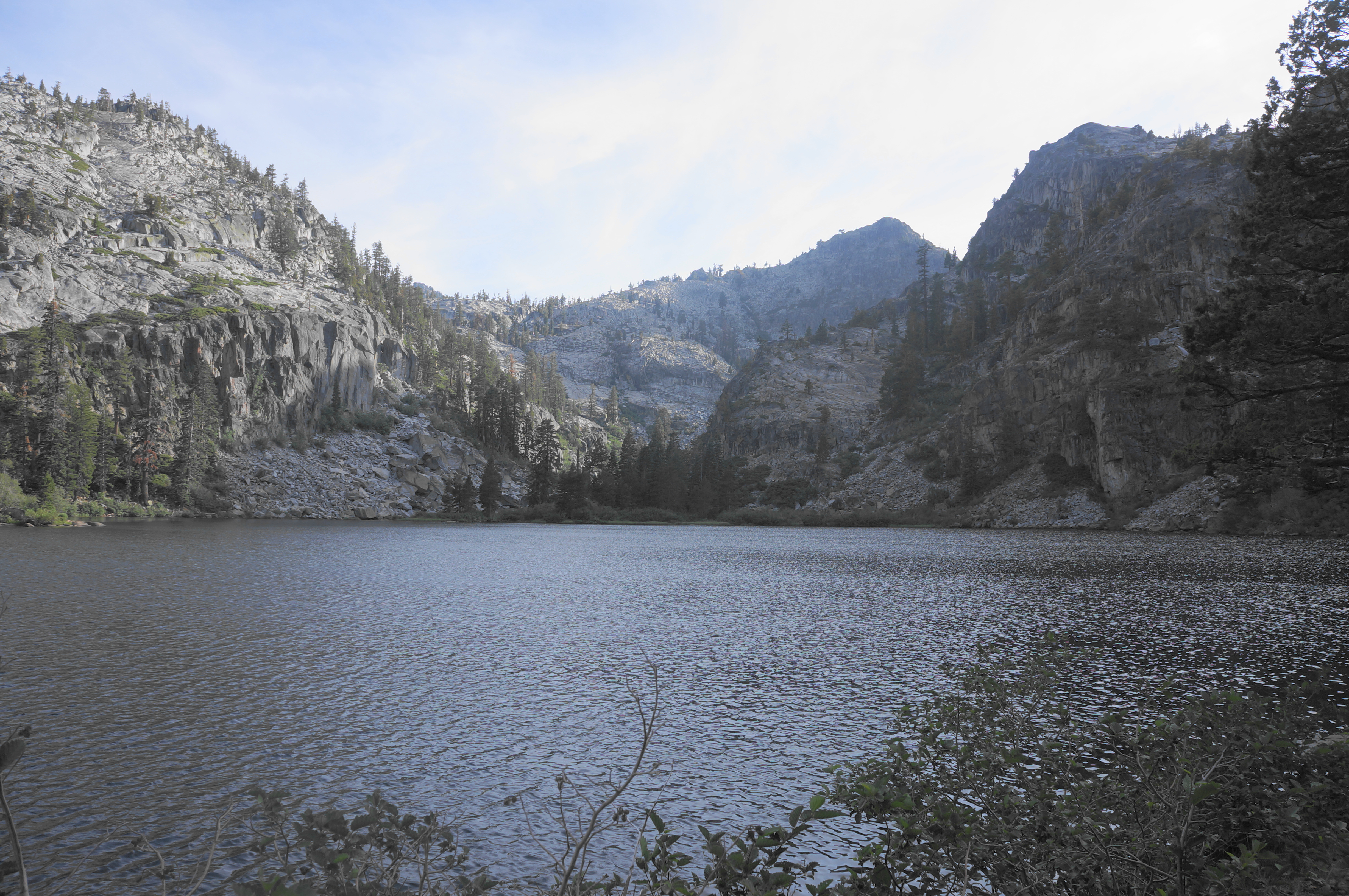
At about ¾ mile, pass a partly-obscured, moderately-sized cataract down to the right. Minutes later, come to a trail junction, with the Eagle Falls Trail continuing left, deeper into Desolation Wilderness, providing access to the Velma Lakes, Rockbound Valley, Crystal Range, and more. The route to Eagle Lake bears right, at first heading downhill but soon rising again to clear a granite crest. With the contours of the sub-alpine lake starting to come into view, the trail drops down a final stretch and ends at the banks of Eagle Creek and the mouth of Eagle Lake.

The lake, like many in the Sierra Nevada, is beautifully rimmed by pine-studded slopes and sharp granite walls, with higher peaks looming beyond. Views improve as one skirts the shores beyond the narrow inlet at the north end. Well-established social trails line the sides, leading to hidden camp spots (permit and reservation required!) and quieter nooks.
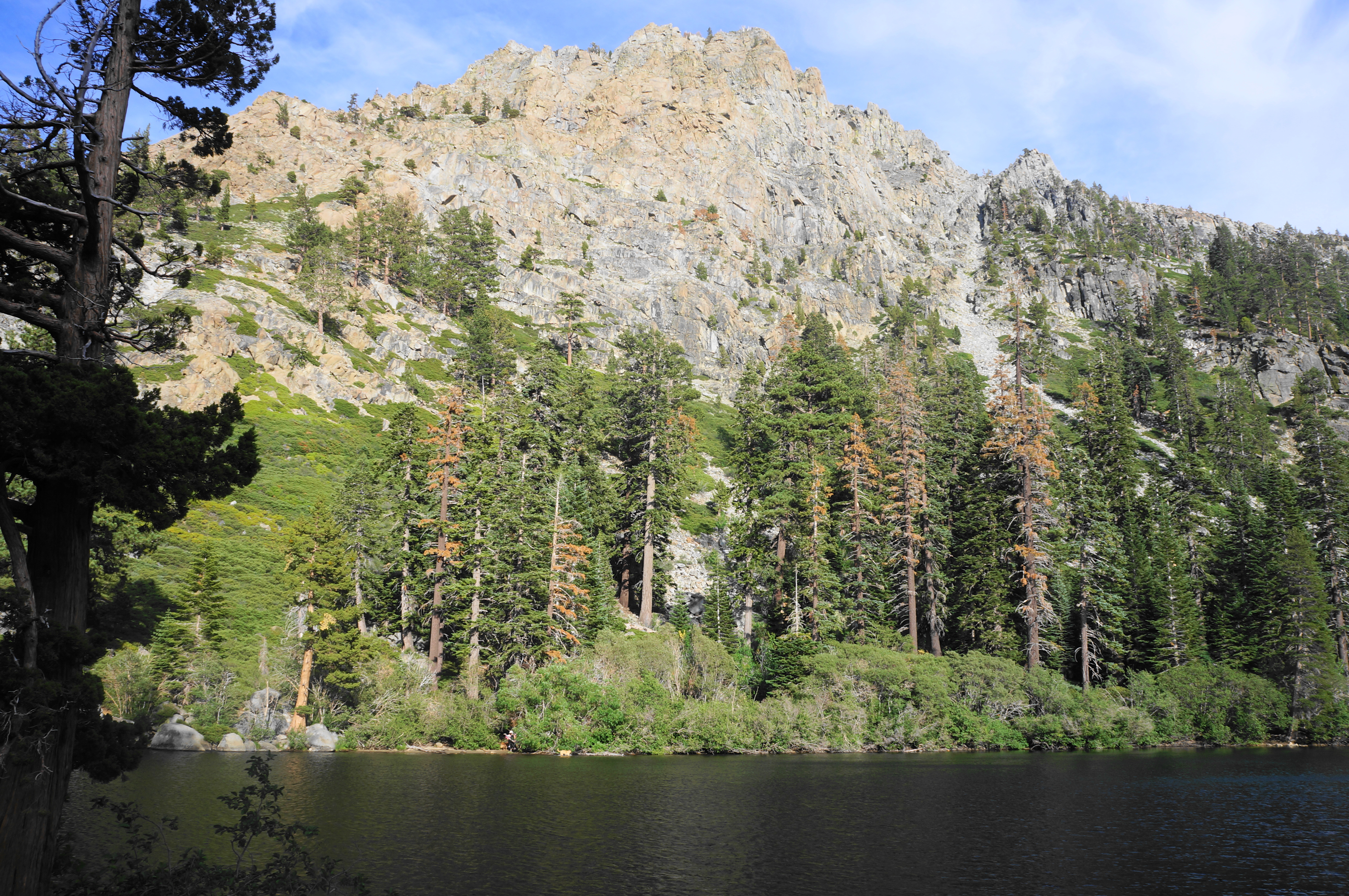
Take a moment to rest and reflect at the peaceful shores of the lake, but when ready, return the way you came, dropping back down the staircases to Upper Eagle Falls and the parking area. This 1.8-mile out-and-back is a moderately challenging walk but a manageable (and enormously popular) jaunt for most visitors seeking a satisfying 1- to 2-hour day hike.
