Idaho’s City of Rocks National Reserve—one of only two national reserves in the National Park system—protects a 14,000-acre tract that includes an extensive cluster of granitic formations known as the “Silent City of Rocks.” While the chalky white and grey spires are perhaps not as visually stunning as, say, the deep red rocks of southern Utah, it is easy to get lost in the enormity of this wonderland of granite, gneiss, schist, and quartzite, a rock climbers’ paradise and home to a robust hiking trail network. The 6.6-mile hike described below offers the “grand tour” of the main concentration of rocks in the center of this remote park, situated in the lonely Basin and Range of southern Idaho, near the Utah border. The strenuous City of Rocks Loop ascends to heights of over 7,200 feet, well above the playground of rocks, but then descends to the open plains below the granitic structures before rising again, passing several climbing pitches, back to the start.


The hike
City of Rocks National Reserve, one of six National Park Service units in Idaho, is certainly not one of the most easily-accessible. Approaching by way of the rough and washed-out road network to the west is highly ill-advised, and the approach from the south—from Utah—is slow and rugged via gravel roads of varying quality. The best approach is to take the paved but lonely Route 77 to Almo, Idaho, a tiny town with a visitor center and a few small shops situated in the Upper Raft River Valley. Then from here an unpaved but well-maintained track leads into the park.
It takes awhile for visitors heading west from Almo into the national reserve (not to be confused with nearby Castle Rocks State Park) to begin to make out the details of the rock formations, situated in a depression at the base of the Albion Mountains, a north-south range typical of the Basin and Range area. As with much of the Mountain West, the geologic story here is one of ancient faulting activity, followed by layering, uplift, and weathering. What is somewhat unique here is the significant range in age of the rock layers: here the 2.5-billion-year-old Green Creek Complex and the very “young” (28 m.y.a.) Almo pluton rest side by side.
The Almo pluton comprise the bulk of the rock formations, which start to come into focus as the unpaved City of Rocks Road enters the park, following the old trace of the California Trail, used by pioneers in the mid-19th century. As one can imagine, the cluster of jagged rocks represented both a considerable obstacle and spectacle for such travelers—emigrants left their mark at a series of trail registers, carving their names into the rock or painting them with axle grease.
Drivers pass Register Rock on the left at an intersection about 2.6 miles from the reserve entrance, where visitors seeking access to the heart of the park should stay right. From here the route climbs steadily amid the granitic landscape, passing the bulging Elephant Rock on the left and the start of a sprawling campground on the right. (Note: Camp sites, rather than being concentrated in one area, are instead interspersed among the rocks across a several-mile stretch.)
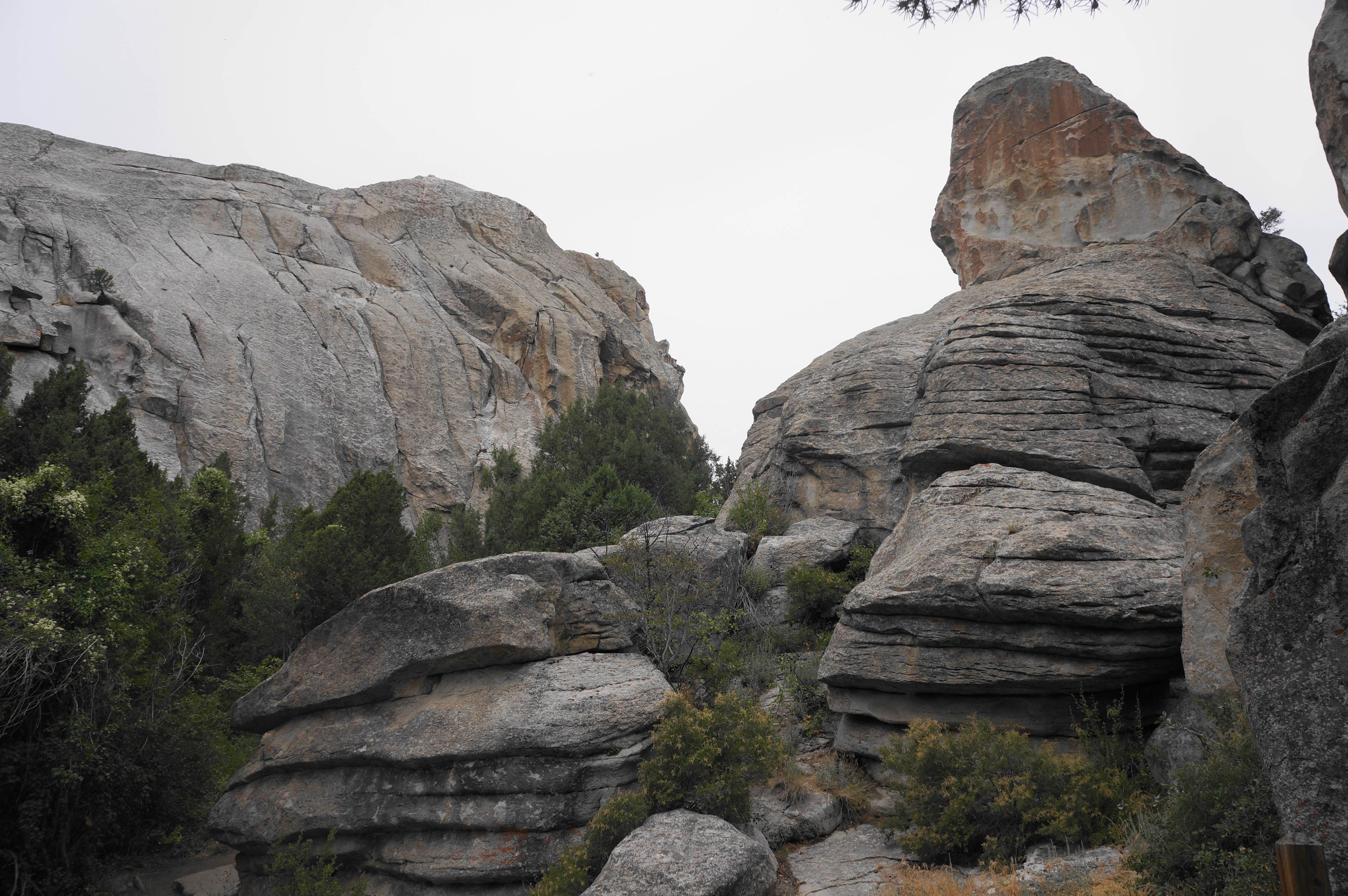
Pass the spurs for Window Arch (right), Bath Rock (left), and Parking Lot Rock (right), continuing up to a flat that appears to be near the western terminus of the rock formations. Here, just before rounding a sharp left-hand bend, park on the left at the Emery (or Emery Pass) Parking Area. The small lot is positioned at the base of a long plutonic fin called Bread Loaves (one of many creative names encountered on the hike).
Emery Picnic Area to North Fork Circle Creek Trail (1.6 miles)
And so begins the hike. Though a path leads west and south from the parking area into a shady scrubland at the base of the Bread Loaves, this is not the way; instead, exit the parking lot and cross City of Rocks Road, finding a large sign for the North Fork Circle Creek Trailhead.
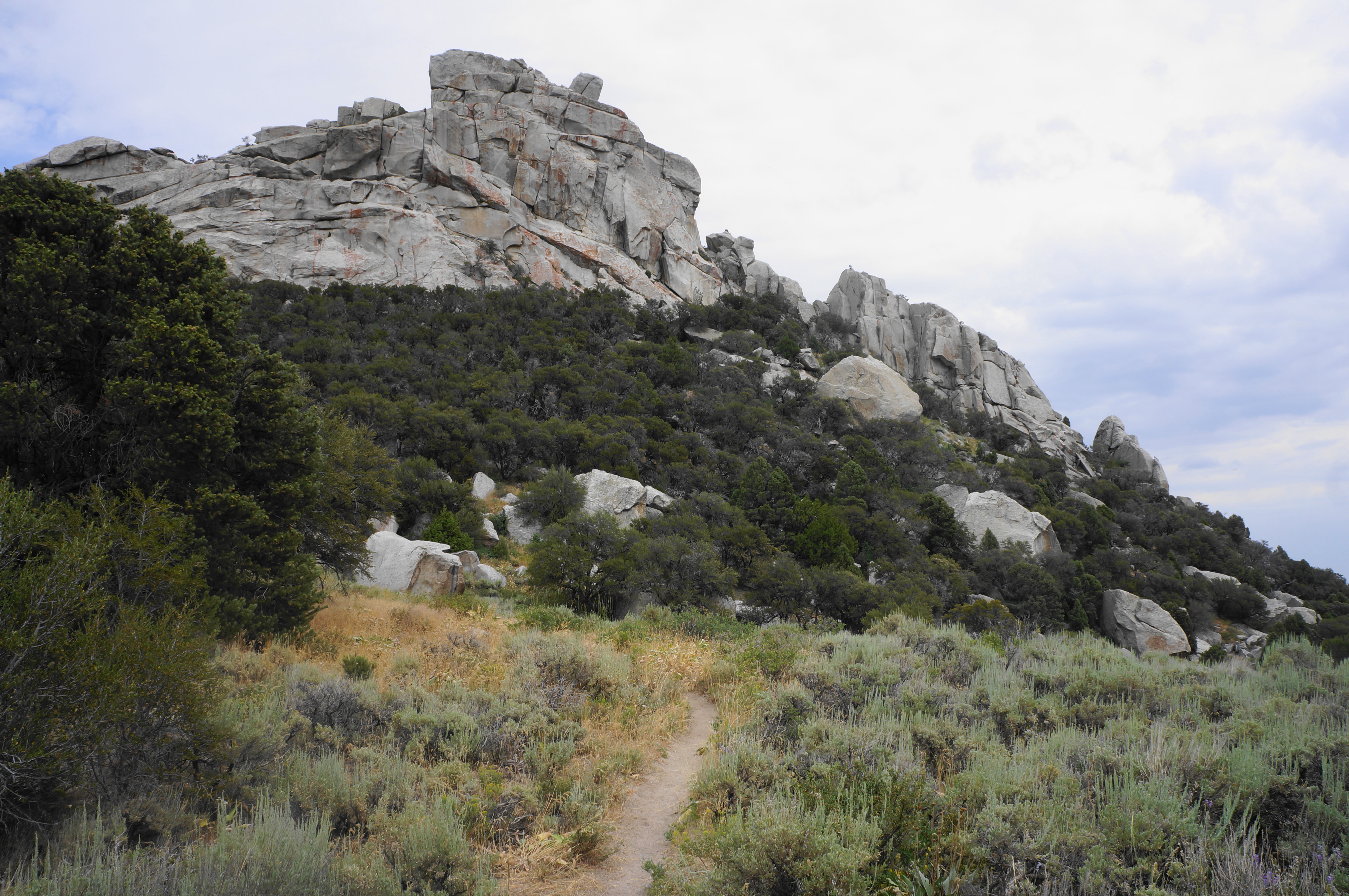
Follow the dirt singletrack leading up a scrubby slope and into a low aspen grove, leaving the road and parking area behind. The shade is temporary as the path winds and bends up toward a pass, coming into the open with views ahead to the granitic formations. Skirt a dry wash on the right, then cross it at around 2/10 mile before tackling a sharp right-hand bend, rising through a patch of scraggly trees to the first of many, many junctions encountered on the hike.
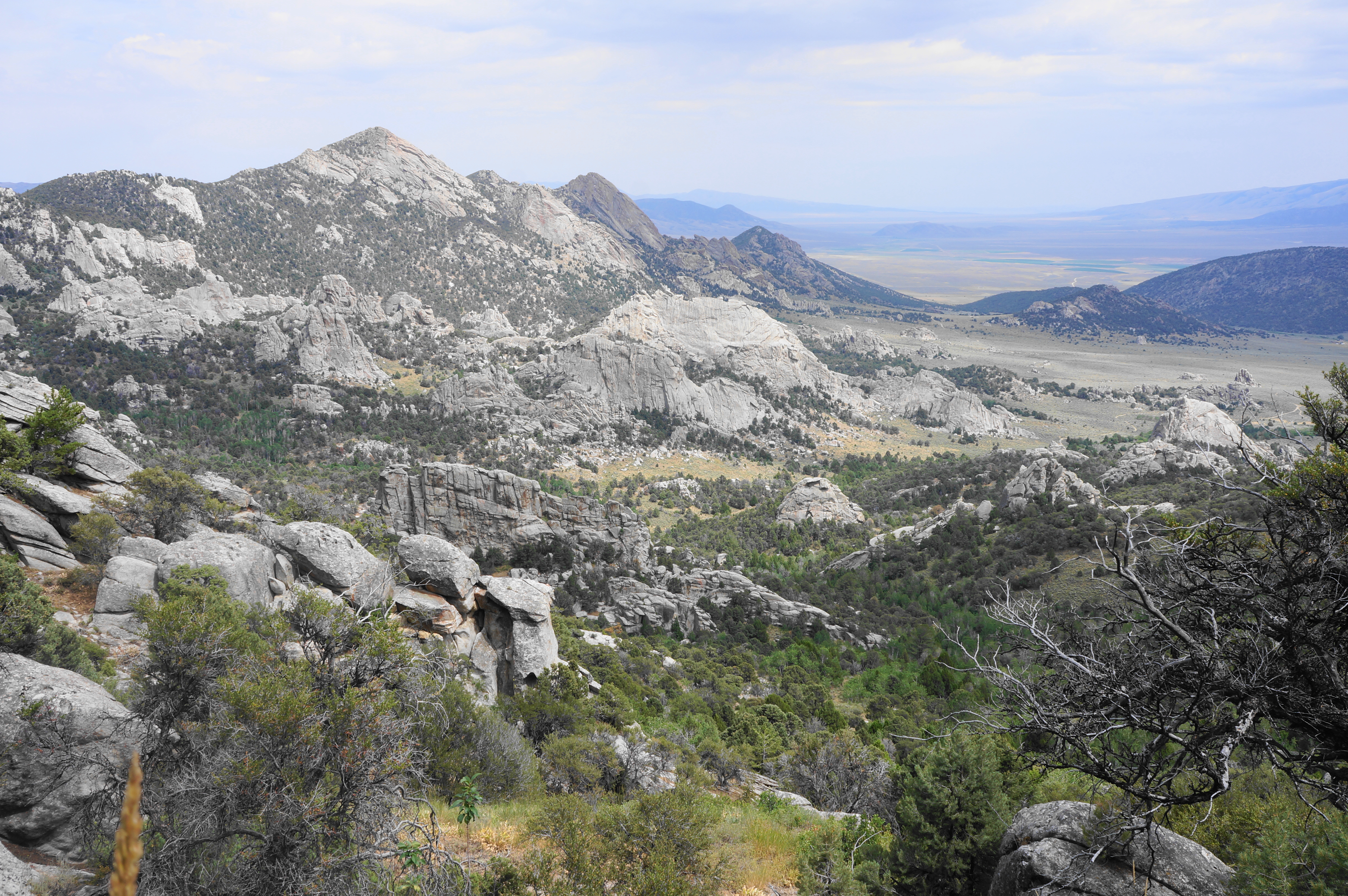
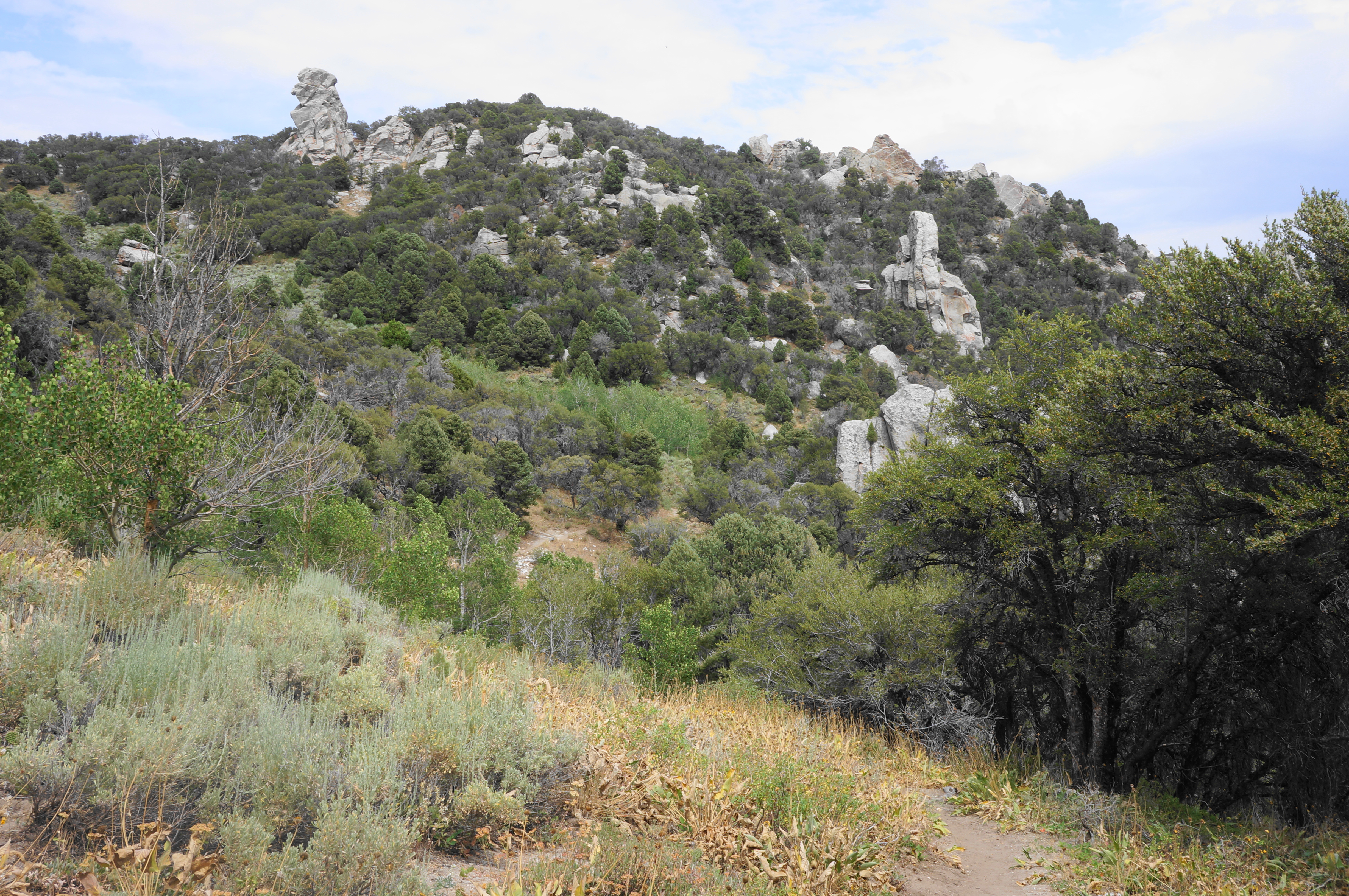
This intersection is notable for being the start of the circuit portion of the City of Rocks Loop, which comprises the vast majority (6+ miles) of the hike. It is also remarkable for being positioned steps from a granitic bench with the hike’s first expansive views down into the valley, with a far-reaching look across the rock formations of the reserve. This is just the first of many overlooks, which improve as the hike continues.


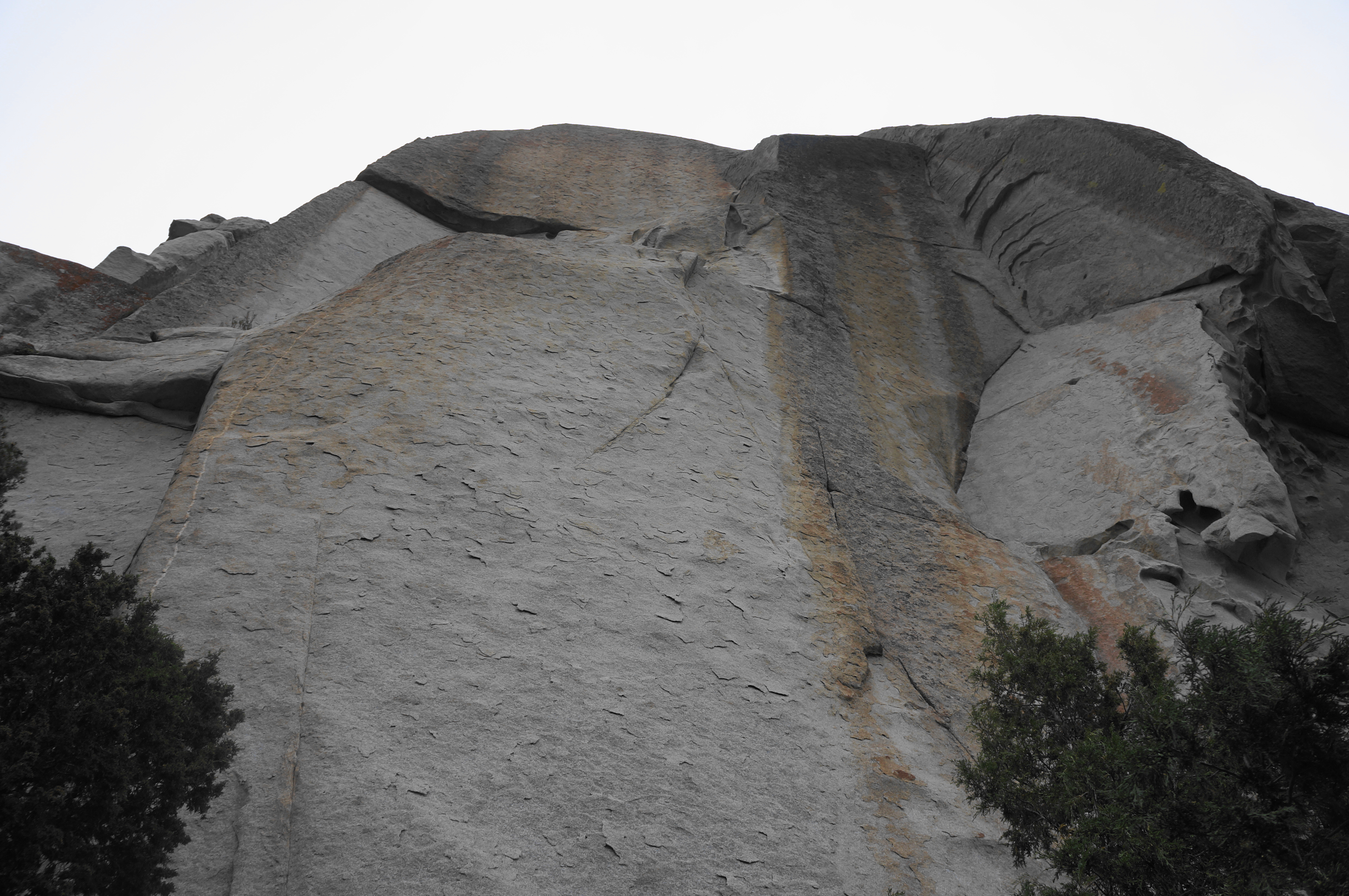
Bear left to follow the loop in a clockwise direction—starting with the sagebrush heights while ending with a traverse of the densest pack of rock formations. Here hikers follow the North Fork Trail as it emerges out of the forest and through a grassy gap below a massive outcrop of grey rock stained with reddish iron streaks. The onward path bears north, treading up and down and traversing some slickrock as the views eastward start to improve.

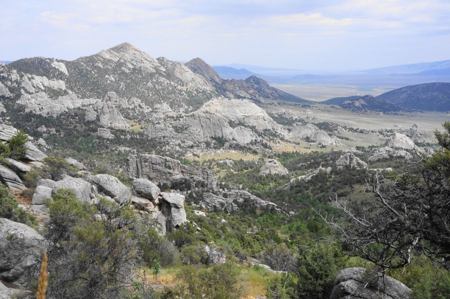
Soon the uphill path rises to a higher gap on the right but does not pass through it; instead it leads into a series of switchbacks, climbing steadily to loftier heights. The City of Rocks unfolds in the valley below—a speckled landscape bounded to the north by Granite Peak (7,689’) and Steinfells Dome (7,359’), which will be touchstones for much of the hike. Hikers can also begin to see south—past the bulking mass in the foreground—to the Twin Sisters area, the other major rock concentration in the reserve.

At around 0.85 miles, the trail levels off, passing through a stand of aspens and approaching a sunny gap and a wooden fence. Although cows can often be seen grazing beyond, hikers are not leaving the park. Yet the landscape changes dramatically: after passing through a gate, the rock outcrops mostly disappear from view and give way instead to a largely featureless scrub, with the Albion Mountains rising higher beyond. The mostly tree-less ridge to the north leads up to Indian Grove, while the higher mountain to the right is Graham Peak (8,867’), the highest point in the park. Beyond is the vast expanse of Sawtooth National Forest.

Follow the open pasture into a slight downhill, paralleling a fence on the left, and stay straight at an unmarked fork at 1.35 miles. Then come to a wider saddle, approaching the upper reaches of North Fork of Circle Creek and passing through some lightly wooded areas. At 1.5 miles, the singletrack trail begins to descend through another aspen stand and quickly reaches another junction. This time stay right, following the North Fork Circle Creek Trail.
North Fork Circle Creek Trail to Bumblie Trail via Striped Rock (2.6 miles)
As the onward route descends steadily into the North Fork drainage, the character of the hike changes considerably, with the open fields with long-reaching views quickly replaced by a more subdued walk through thicker woodlands. Descend to the initially dry drainage, then pass through a gate at 1.7 miles. After crossing the wash, the North Fork Circle Creek Trail passes North Fork Springs (which fills a small tub) on the right.
After another descent, the path briefly rises to a thin gap between high outcrops, then resumes the downhill tread. Even as the route temporarily moves well away from the main drainage, it is steadily descending into the watershed, which boasts much more diverse vegetation than the windswept west side of the Albion range.

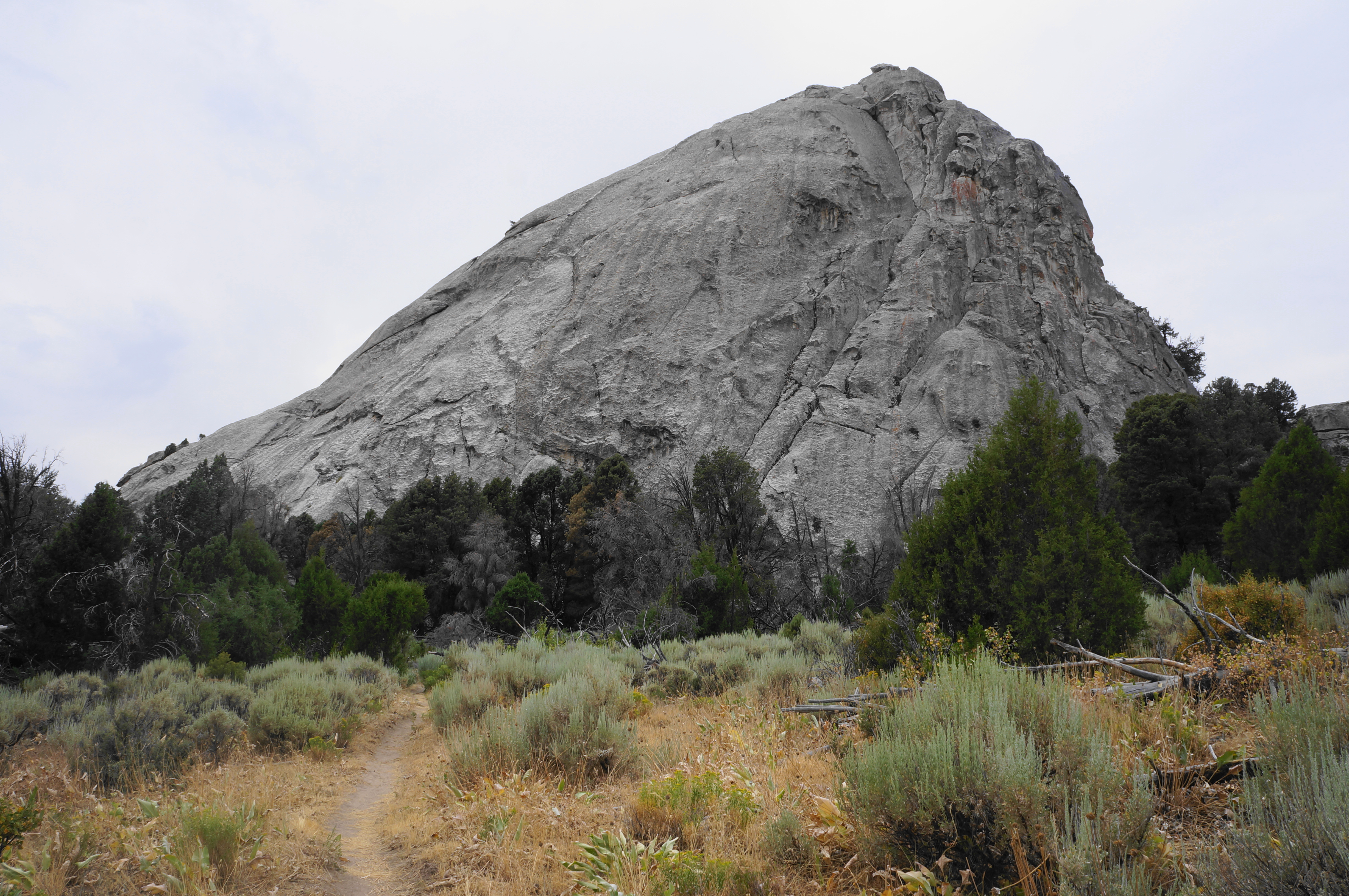
Continue down a set of switchbacks, then cross to the west side of North Fork Circle Creek again and take a hard left at 2.75 miles, passing another outcrop on the right. The high unnamed outcrop to the east conceals a climbing area just beyond humorously called “Beef Jello.”
Drop down two switchbacks, then another pair, followed by a horseshoe bend that leads into a southward tread. Passing under a canopy of junipers and aspens, the trail then suddenly emerges out into the open at a wide scrubby flat. Cross the North Fork drainage once again and come to a junction with a spur marked “Beef Jello/Banana.”
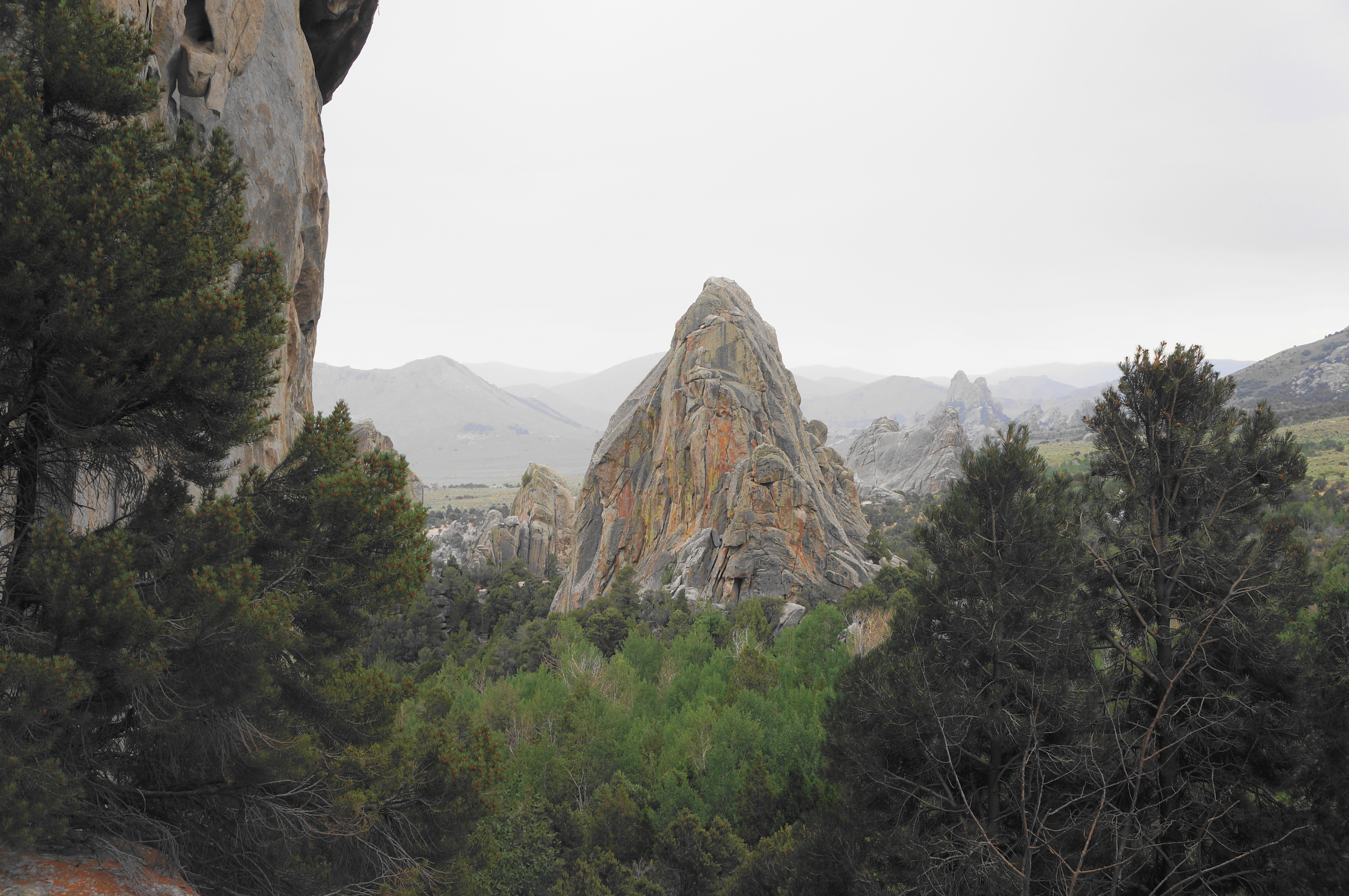
Stay straight, continuing to follow the creek on the right as it deepens and gets wetter, supporting much denser and taller vegetation. Traversing open scrubland, there are views back to the upper amphitheater of rocks, as well as west to the prominent Stripe Rock, which has several popular climbing pitches.

Just before a large gate at 3.6 miles, take a hard right on the Boxtop Trail. Pop over the drainage (with the water piped through a drain), then head uphill toward Stripe Rock. As the Boxtop Trail edges around to the south side of the massive outcrop, it cuts through a tighter passage and rounds a right-hand corner, revealing a playground of fins and knobs ahead.
Here the dusty path bears south and reaches a three-way junction, where hikers should continue right. Then, at another fork seconds later, visitors have a choice: either way—right or left—is a reasonable way to round out the loop, but heading right, via the Bumblie Trail, is perhaps preferable because it weaves through the granitic formations while the alternative largely edges around them.


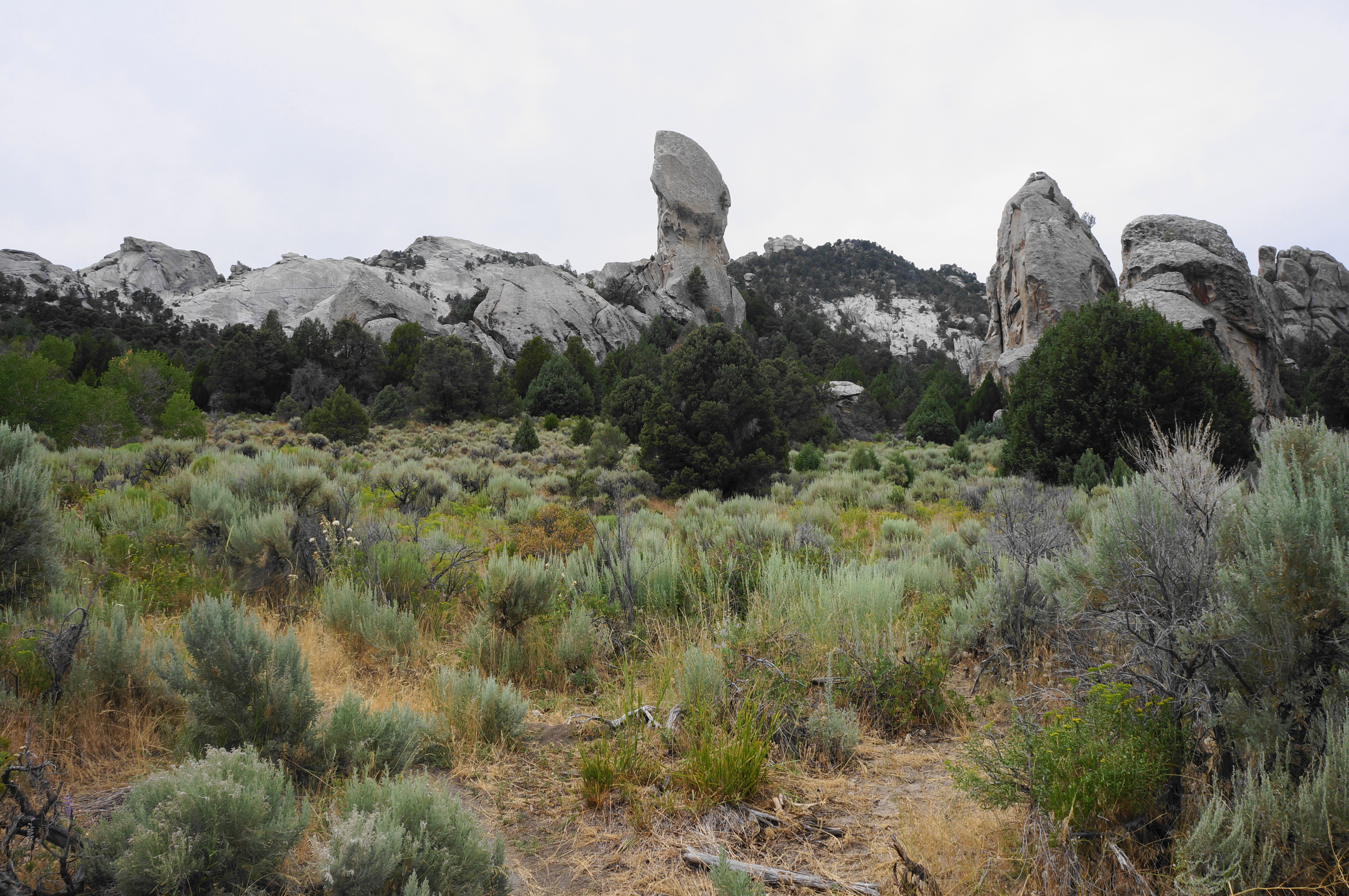
Taking the right fork, one of the first things hikers will notice is a prominent, solitary spire rising seemingly 50+ feet high. This is Lost Arrow Spire, an iconic thumb tackled regularly by rock climbers on various pitches. The trail seemingly heads straight for the pinnacle but then veers a little left, reaching another junction at 4.25 miles that marks the end of the hike’s second section.
Bumblie Trail to South Fork Trail (0.8 miles)
Stay right at this intersection, following the Bumblie (or Bumblie Wall) Trail westward into the fantasyland of rocks. Pass a spur leading to Lost Arrow and the No Start Wall on the right, staying straight as the path enters a more wooded area, climbing more steeply uphill with a drainage on the left: this is the Center Fork of Circle Creek. At 4.4 miles, traverse a short bridge over the wash, then cut southward, up and around a bulging outcrop that reveals itself to be the site of the “Lady J” pitches, a series of trads that appear comparatively easier to some of the surrounding climbing walls.
Pass Lady J on the right, then continue south on the Bumblie Trail to crest a higher hill. Pass through a gate, then follow a relatively granite-free saddle where the onward route becomes harder to follow. At one point, just as hikers start to get a further look south down to the South Fork drainage, the path appears to split, with a well-defined track continuing to skirt the ridgeline to the left and a less-trodden path bearing right, dropping down a minor ravine. Counterintuitively, the correct route is to stay right on the fainter path, as the deceptive alternative eventually sputters out amid a set of cliffs and ledges.
Bearing right, the Bumblie Trail sheds elevation as it heads for the South Fork of Circle Creek and another major climbing area. About ¼ mile from the confusing junction, pass the Bumblie Wall pitches on the left, then continue to a junction, marked by a trail sign indicating “Slabbage” (another goofy name for a climbing wall). Bear right here, passing through a notch that offers a shortcut to the South Fork Trail. This area is popular with climbers, on their way to nearby Slabbage, Bumblie, Transformer, or other pitches.
South Fork Trail to Emery Picnic Area (1.6 miles)
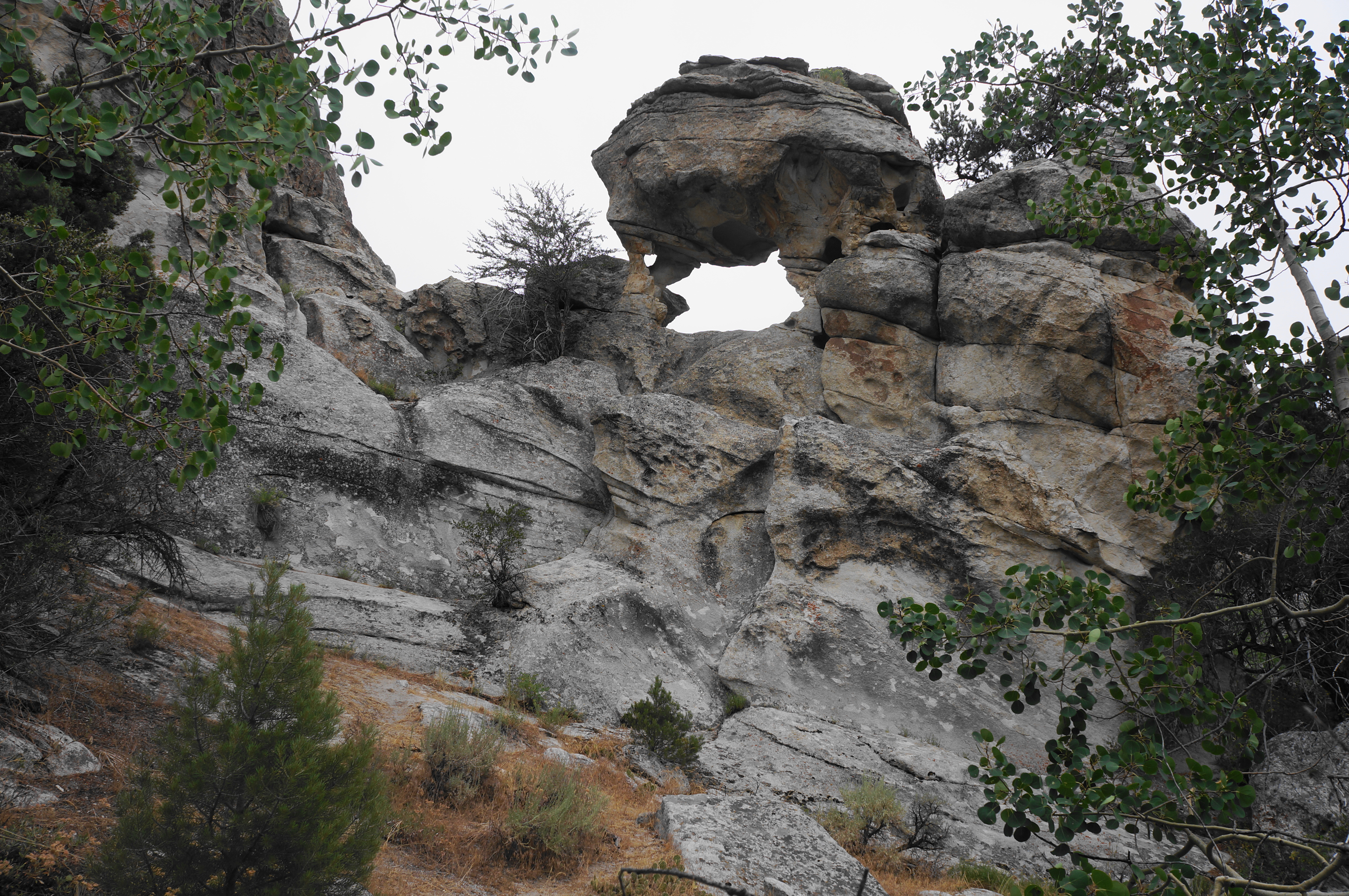
By now hikers are back in the thick of the City of Rocks, and the South Fork Trail (ak.a. South Fork Circle Creek Trail, or S.F.C.C.) cuts a winding passage through the heart of “the city,” gaining more than 600 feet in elevation en route back to the start of the loop. Bear right on the trail, quickly passing a spur on the right to the Slabbage pitches, in addition to a small natural arch that is worth the couple-dozen yard detour to view.
Continue on the S.F.C.C. Trail as it closely hugs the drainage, which now cuts a relatively deep trough. Stay straight at the fork, heading in the direction of “Parking Lot”—which is not a reference to a staging area for vehicles but rather another climbing area known as Parking Lot Rock. The onward trail stays on the right side of the South Fork (don’t cross the bridge at the fork), leading into a steep slope that is a wake-up call for hikers who have largely enjoyed mild inclines to this point.
The path eventually does cross over a short bridge, but this is merely a brief break before the resumption of a sustained, challenging ascent lasting around 1/3 mile. With the plutonic fins largely running north-south, the South Fork Trail parallels the mass outcrops, rising steadily. Cross another bridge at 5.6 miles, then approach a junction with another climbers’ route that leads to the “Drilling Fields” complex.

Stay left on the S.F.C.C. Trail, then ascend in the direction of a high gap and narrowing passage. Pass a spur leading to the base of a massive, iron-streaked wall marked as “Redtail.” Continue uphill, then cross a short bridge and come to an unmarked junction in front of Parking Lot Rock. By now hikers have travelled around 5.7 miles.
Head right at the junction, keeping Parking Lot Rock on the left as the South Fork Trail continues to climb higher, passing several unmarked spurs to Parking Lot Rock. Come to yet another junction after 1/10 mile, and stay right again. After a short downhill staircase, approach a subsequent fork and bear left, staying on the S.F.C.C. Trail and heading toward “Window Rock West.”

Follow the bulging pitches of Window Rock on the right as the trail comes right up to the cliff face, ascending a very steep but short section before cresting a shaded juniper-studded hump and dropping again. It’s a short walk to another junction, just beyond the northern reaches of Window Rock.

Head right, then left at the next turn seconds later, continuing northward. After passing the “Animal Cracker” routes on the right, the trail makes a final sustained climb, ascending a drainage with views back over the City of Rocks to Steinfells Dome and Smoky Mountain.

The ascent culminates with a slickrock section, and soon hikers come to a familiar spot: the initial overlook at the first of the hike’s many junctions, encountered more than six miles ago. Here hikers finish out the loop portion and should bear left, following the initial ¼ section back to the start. The mild path descends a set of bends, weaving in and out of low forest, before finally ending back at City of Rocks Road and the Emery Picnic Area. Cross the street to return to your car.
All told, the 6.6-mile up-and-down route is tiring and action-packed enough to feel like an all-day affair, although most hikers will be able to finish in 3.5-5 hours. Combine this hike with a visit to other sites in the park, such as Window Arch and Twin Sisters, or venture into nearby City of Rocks State Park for a different collection of granitic formations. The City of Rocks Loop is easily the most varied of the hikes in the park and a must-do for visitors with time and energy for a scenic adventure.

Pingback: Top 10 Hikes in 2022 | Live and Let Hike