
The Silver Peak Wilderness covers 31,555 acres of the Santa Lucia Range along the central coast of California between Monterey and Cambria. Hikers can explore the heart of the wilderness area by combining the Buckeye, Cruikshank, and Salmon Creek Trails for a 15-mile circuit that covers diverse terrain—from chaparral scrub to pockets of dense redwood forest—with seaside vistas and flowing streams. A worthwhile spur leads to Upper Salmon Creek Falls, a rarely-visited waterfall that drops into an attractive pool in winter and spring. The loop, which covers more than 3,000 feet in elevation gain, can be completed as a long and arduous day hike. But most will prefer to do the trip as an overnight backpack or even a 3-day trek. Signage along the route is excellent, and there are several established campsites (complete with picnic tables and fire pits): Buckeye, Silver, Lion Den, Estrella, and Spruce Creek. (Note: Yours truly did the trip as a 2-day backpack, camping at Silver Camp—6.2 miles in—but the best sites are Lion Den, Estrella, and Spruce Creek.) This relatively popular circuit is best done in the winter or spring, when water sources are abundant and temperatures are mild. (Note: No wilderness permits are needed, except for the standard California campfire permit—required even for camp stove use. Bear canisters are suggested but not required.)

The hike
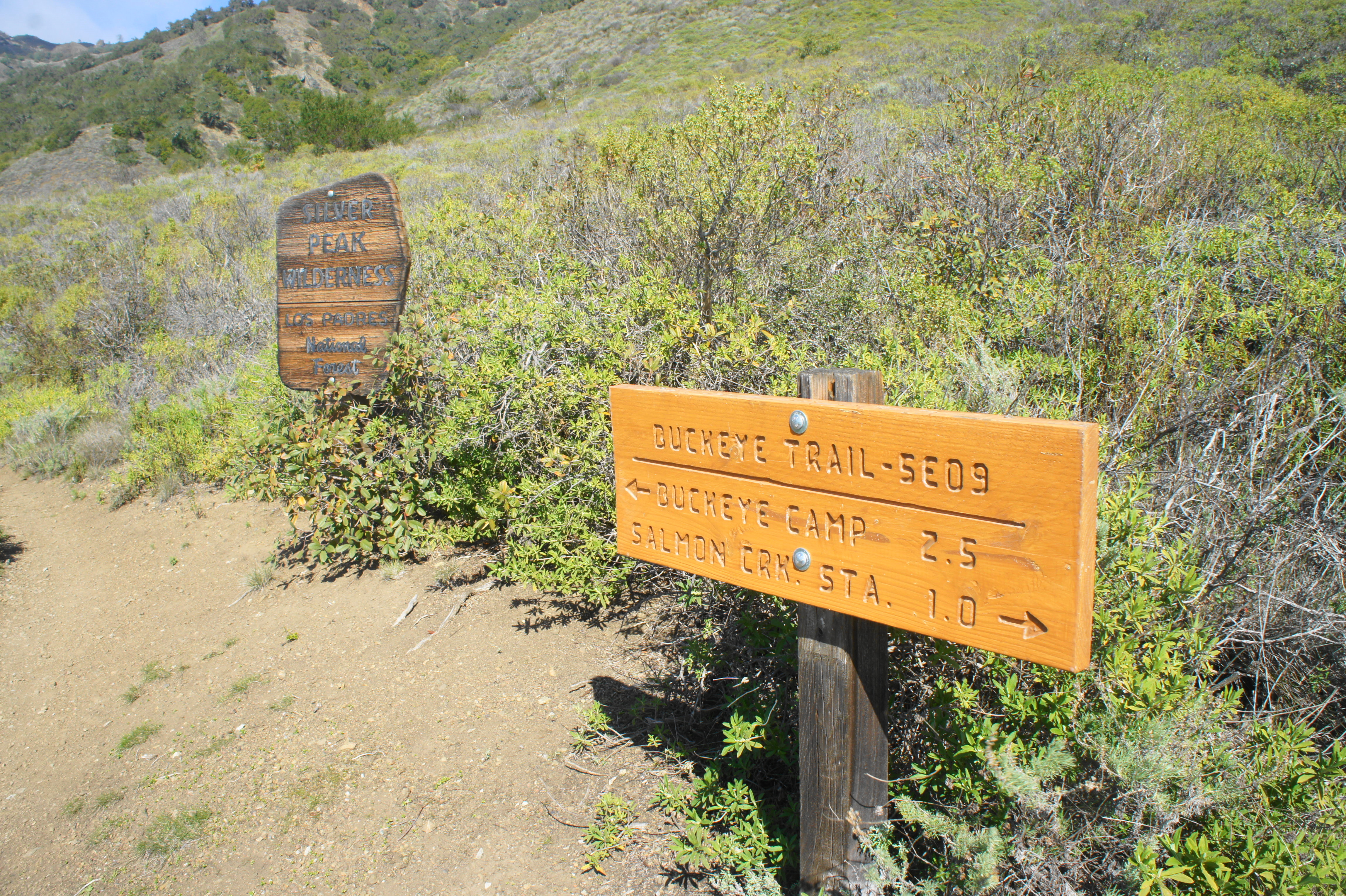
Primary access to Los Padres National Forest and the Silver Peak Wilderness is via California Highway 1, which follows the Pacific Ocean through Big Sur between Monterey and Cambria. (Note: As of 2021, a significant stretch of Highway 1 was closed due to landslide damage, requiring those travelling from the north to detour south to Cambria, then return north along Highway 1 to reach the trailhead.) The hike begins and ends at Salmon Creek, an inlet along the coast roughly 27 miles northwest of Cambria. This a popular area, especially on weekends, with the majority of visitors headed for Lower Salmon Creek Falls, a 120-foot double waterfall that is one of the tallest in the area. There is parking along the shoulder and in a small lot at the site of the old (long closed) Salmon Creek Ranger Station. Park anywhere, but begin the hike at the Ranger Station parking lot, a short walk down Highway 1 from the trail to Salmon Creek Falls.
The circuit is best done clockwise—covering the Buckeye Trail first—because the climb, while still strenuous, is considerably more gradual than trying to tackling the steep Salmon Creek Trail uphill. (Note: Hikers arriving in the mid-afternoon can still easily reach Buckeye Camp by nightfall; in this case, however, I would recommend spending a second night at Estrella or Spruce Creek.) Visitors can think of the hike as unfolding in three parts: an initial, especially scenic section of the Buckeye Trail that climbs to unobstructed ocean vistas; a second, mostly wooded climb up the Cruikshank Trail to Lion Den and South Coast Ridge; and a third, downhill stretch along the Salmon Creek Trail, with a worthy detour to lovely Upper Salmon Creek Falls. The loop circles around the namesake Silver Peak (3,590’), one of the highest and most prominent peaks in the area.
Buckeye Trail to Cruikshank Trail Junction (5.5 mi.)
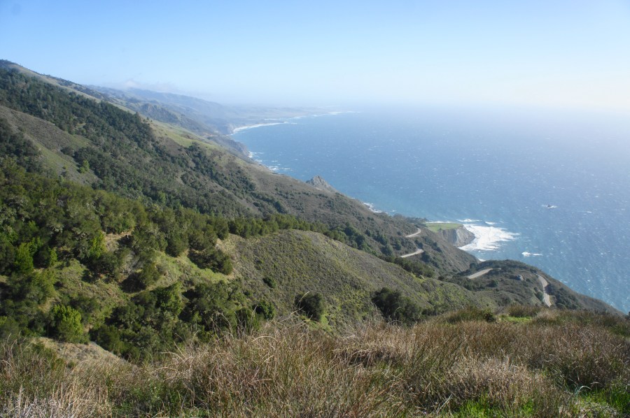
The first section covers about 2,000 feet in elevation gain, followed by a steady downhill to the junction with the Cruikshank Trail near the Villa Creek drainage. Starting from the Ranger Station, follow the marked path up through the wooden gate, beginning a short but brutal ascent that is perhaps the hardest of the entire hike. Amid a mix of oaks, bay laurel, and scrubby brush, the Buckeye Trail gains about 500 feet in elevation in just ½ mile, cresting a high, windswept saddle that offers the trail’s first unobstructed views of the vast Pacific Ocean.
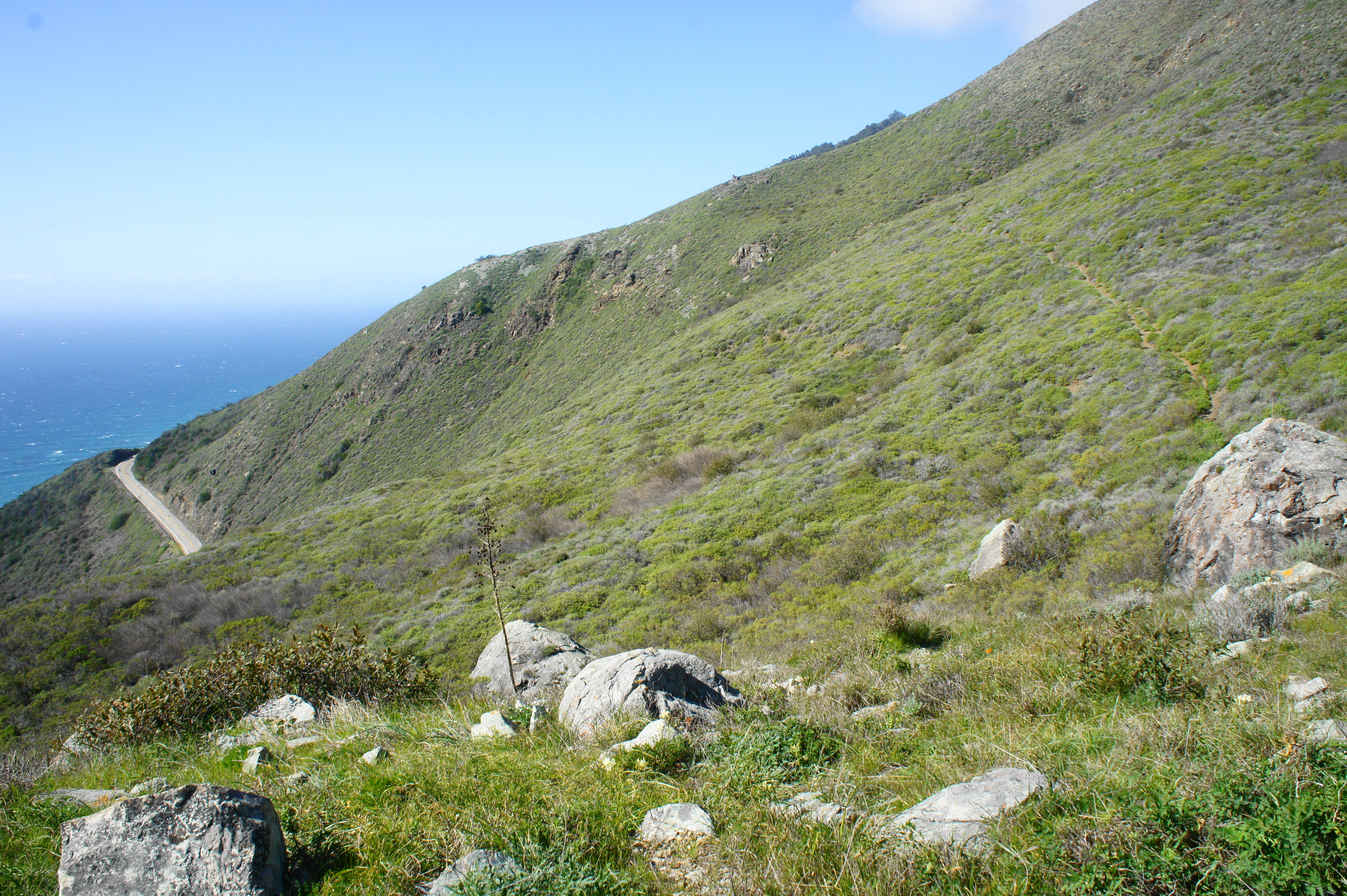
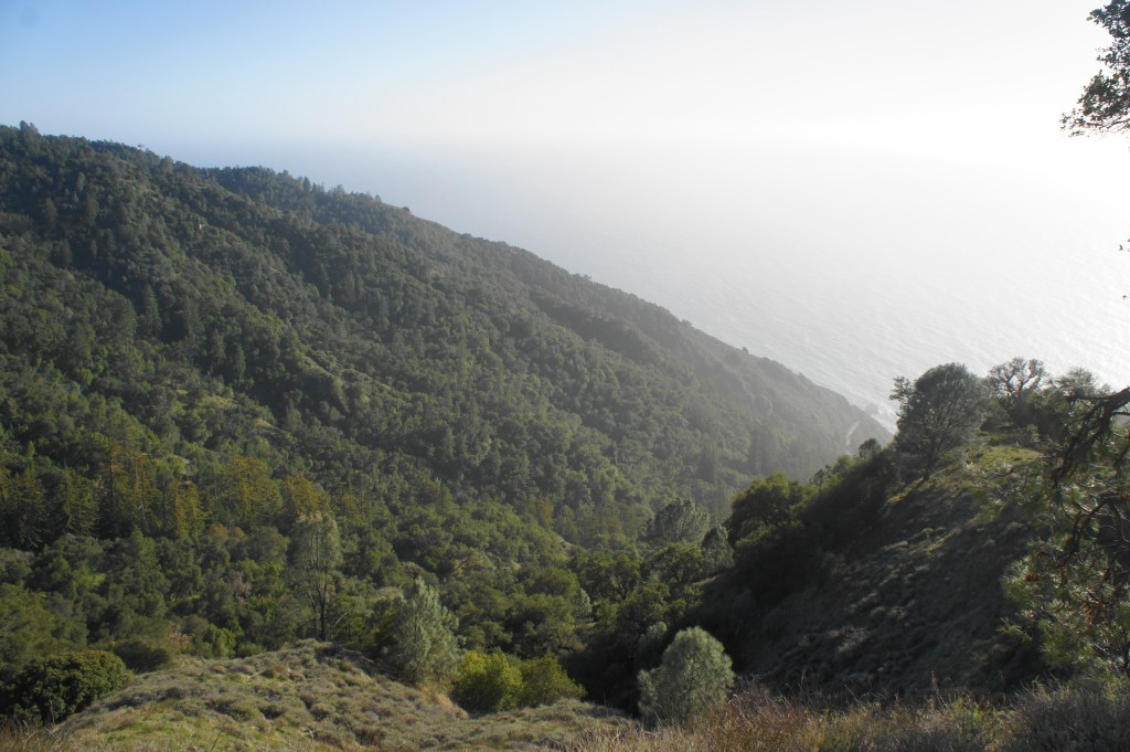
Once past the initial climb, the vegetation becomes much more subdued—with trees replaced by a mix of various short shrubs, as well as wild yucca plants that flower nicely in spring. As the Buckeye Trail continues westward, the steep slopes give way to Highway 1 several hundred feet below, with the crashing waves of the Pacific beyond. Hikers are thus spoiled almost right away with excellent vistas along what is one of the finest stretches of coastal trail in California.

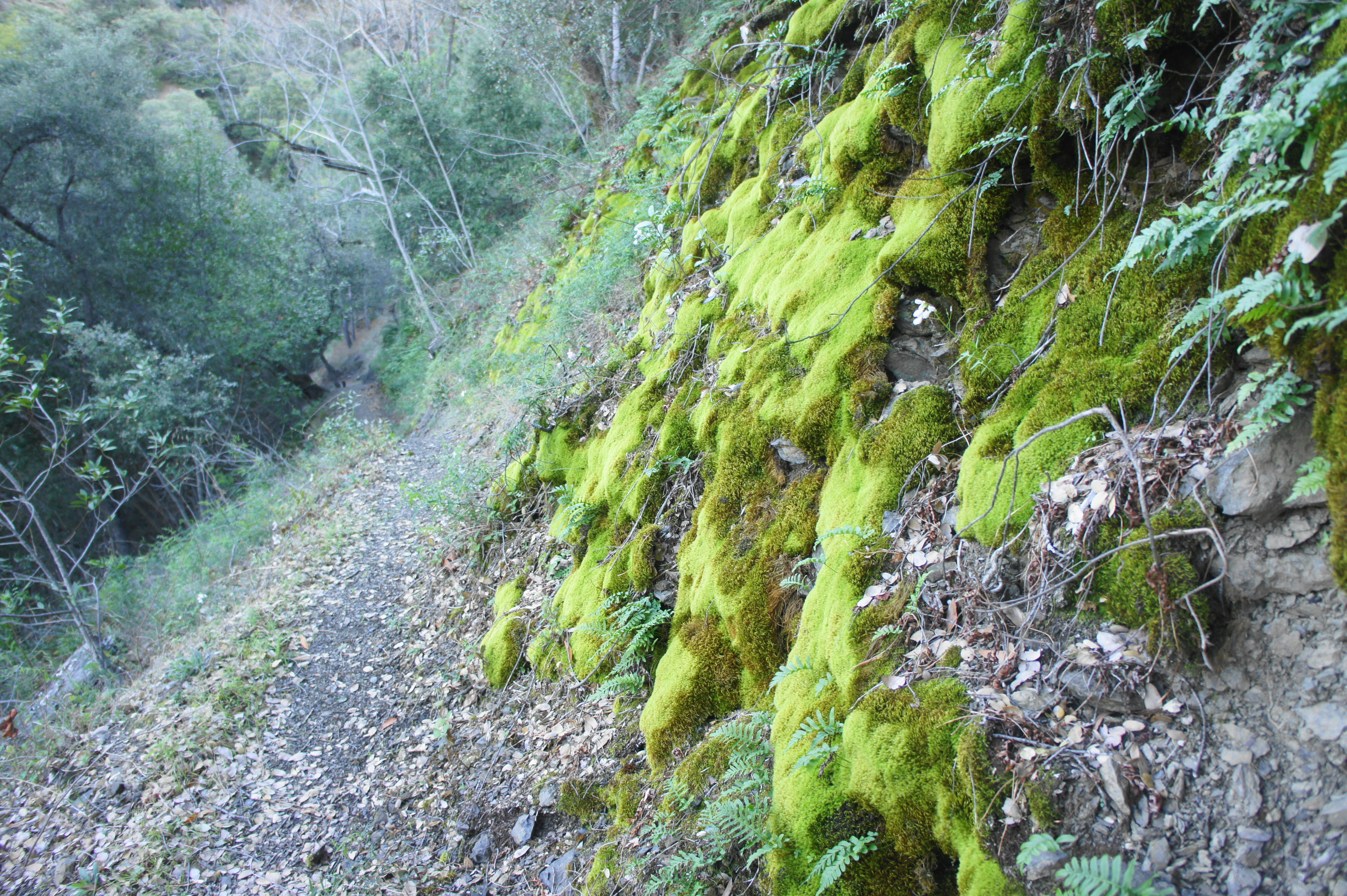
The next waypoint of interest after a relatively flat and scenic stretch is an opening in a small fence, with the first junction just beyond. Here the Soda Spring Trail joins from the left; stay right on the Buckeye Trail and continue into the Silver Peak Wilderness. The onward route returns to the shade of oak and bay trees, passing a drainage at 1.1 miles that, after rainfall, would form a nice waterfall. (Note: Even in February, however, this was dry.)

Junction with the Soda Spring Trail 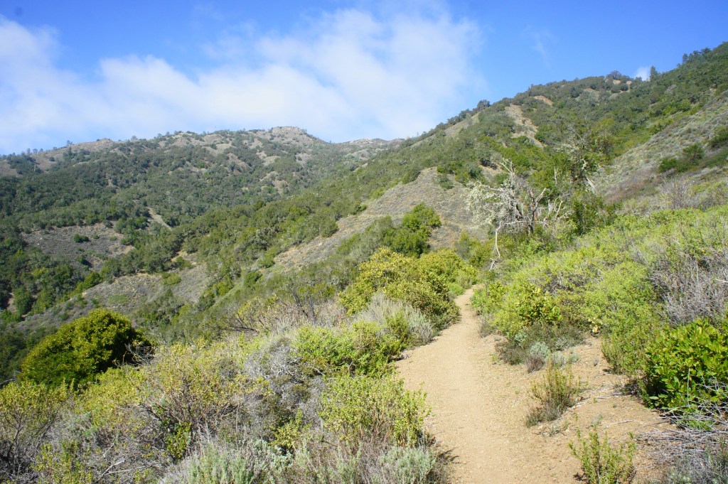
Silver Peak Wilderness

The elevation gain along the next mile is relatively modest, and the trail leisurely weaves in and out of rocky ravines, passing the first relatively reliable water source—Soda Spring Creek—at 1.8 miles. Climbing more steadily thereafter, the Buckeye Trail rises to an open and scrubby hillside at 2.5 miles, revealing more excellent views southward, down the coast toward San Simeon and Cambria.

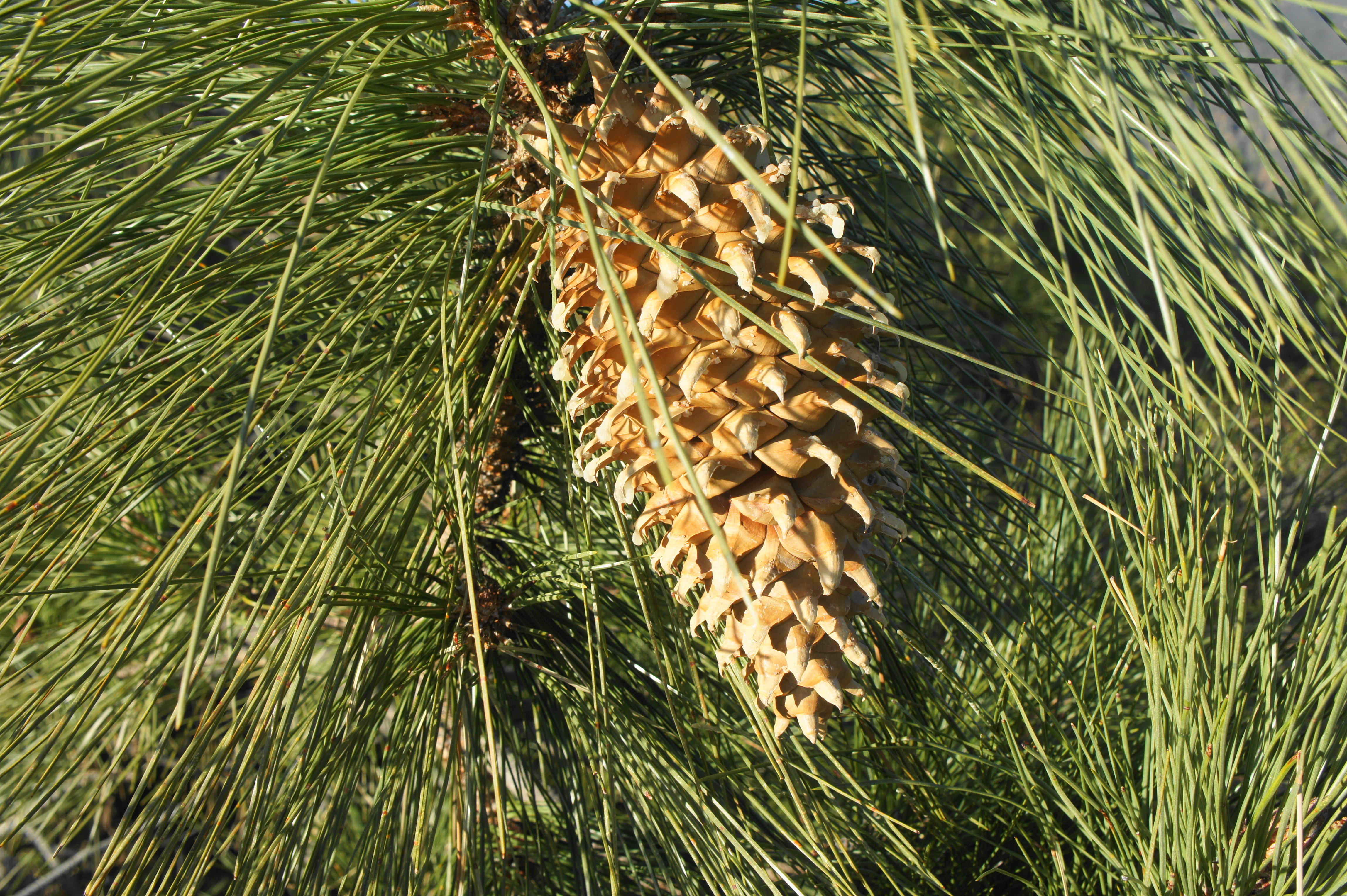
Now steeply ascending, the Buckeye Trail wanders into the first grove of Coulter pines—notable for their wispy needles and massive pine cones; Coulter pine cones are the largest and heaviest in the world. At 3.3 miles, the trail approaches an excellent vista point on the left that has likely been used as a campsite; from here the trail turns away from the coast briefly and begins a descent that sheds about 200 feet.

First vistas up the coast to the north 
Massive Coulter pine cone

At 3.6 miles, hikers reach Buckeye Camp, a lovely meadow lined with stubby pines but devoid of ocean views. There are several designated campsites here. The most easily accessible is off to the right, just after passing over a small stream that serves as a seasonal water source. There is a fire pit and picnic table. Other sites are situated farther down the trail, near the west and northern ends of the meadow. As the path reenters the woods, it drops to two designated sites on the left. The path quickly descends to clear the main stream flowing through Redwood Gulch, which is likely—although not assuredly—to carry water year-round.

Meadow at Buckeye Camp 
Looking back at Redwood Gulch drainage
Many hikers simply camp at Buckeye and then turn around. But onward hikers can continue across the creek, then ascend again, gaining about 300 feet to clear a pair of ridgelines, both of which offer additional vistas of the ocean.

Sun setting on the Pacific 
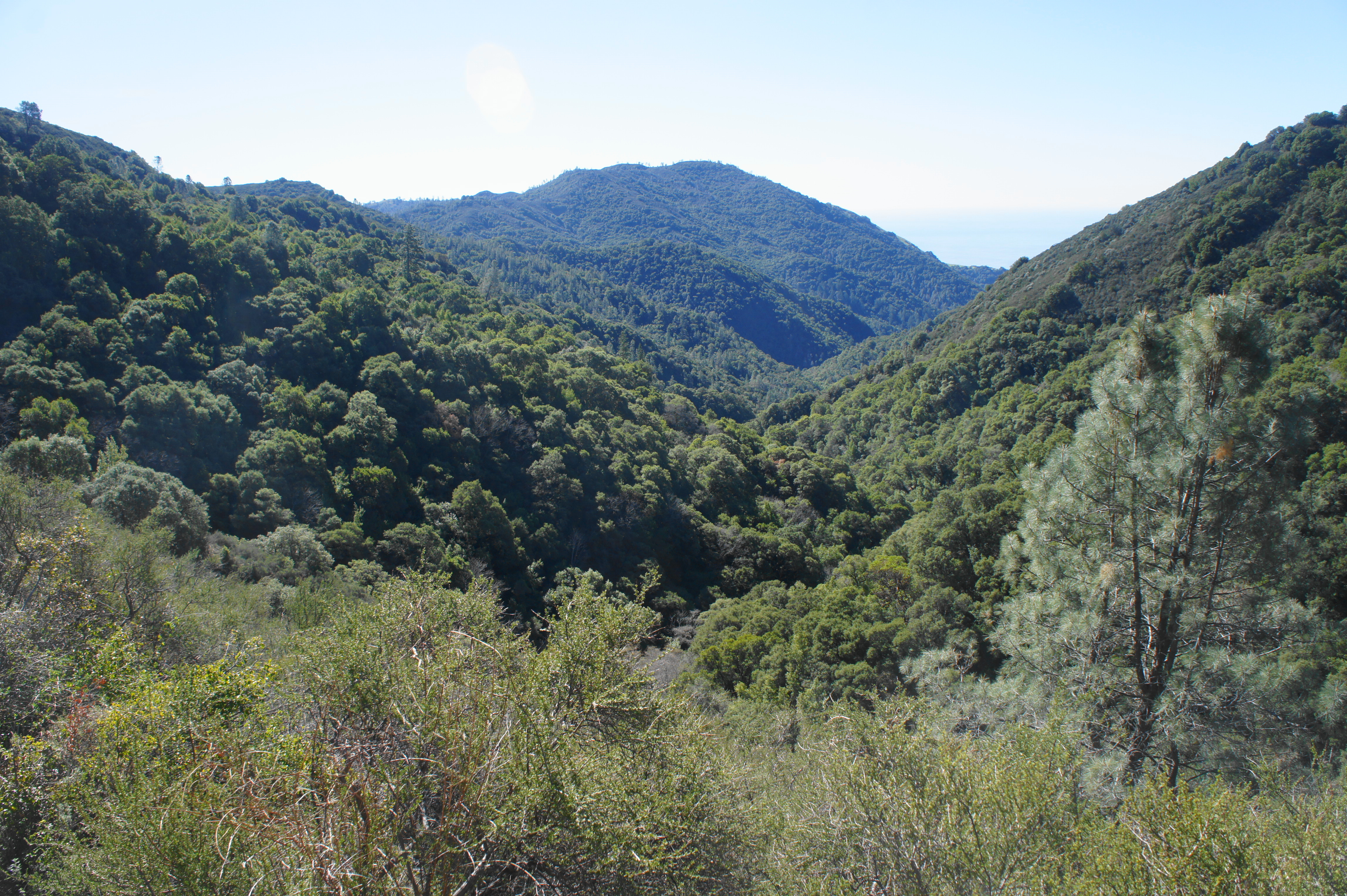
Santa Lucia Range and Silver Peak


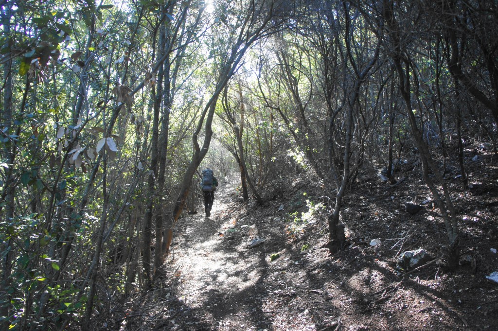
At 4.5 miles, a spur trail leads to a decent vista (and campsite) off to the left, but the main Buckeye Trail continues right, beginning a steady, winding descent into Villa Creek Canyon. Mostly wooded, there is not much to note about this section, except for one surprising sight just before the junction with the Cruikshank Trail at 5.5 miles: a small but pretty grove of coast redwoods off to the left. Silver Peak Wilderness marks the southernmost reach of these world’s tallest trees (the range extends all the way north to southwest Oregon).

A couple minutes past the redwood stand, hikers reach the trail junction. The Buckeye Trail continues left down to Villa Creek, while the Cruikshank Trail—part two of the hike—bears right.
Cruikshank Trail to South Coast Ridge (3.9 mi.)
The Cruikshank Trail begins by making up for much of the elevation lost during the final stretch along the Buckeye Trail. If still hiking on Day 1, the ascent will not be particularly welcome. After gaining about 600 feet in ¾ mile, the trail finally levels off around Silver Camp. This heavily wooded site is probably the least interesting of the five camps encountered on the hike. A very modest stream allows for water treatment, but don’t count on it in the summer, when it is likely to be dry. A more reliable source—a flowing tributary of Villa Creek—lies about 2/10 mile further up the Cruikshank Trail (although this too may be dry by late summer).
Hikers continuing onward from Silver Camp should cross the aforementioned stream, then tread very carefully as the narrow path traverses a set of crumbly scree slopes. While the path is well-trodden and wide enough, a misstep here could send one tumbling down the steep incline into the rock and brush below. Angling northward, then east, the Cruikshank Trail passes a series of rock outcrops with decent views down the Villa Creek drainage to the ocean.

The sketchy scree section 
Views down Villa Creek drainage to the ocean


From here the Cruikshank Trail settles into a mild and mostly shaded ascent. (Note: Some have noted that there may be heavy poison oak in this area; in late winter 2021, however, there was little to be found. Perhaps best to wear long pants regardless—and to hike in winter when the undergrowth is less thick.) Instead of rising to a pass visible ahead to the east, the trail abruptly juts right at about 8.2 miles, ascending a group of switchbacks to clear a high ridgeline. This steep section is over relatively quickly, however, and the Cruikshank Trail rises to clear the ridgetop at 8.5 miles.
Climbing switchback section to the high ridgetop 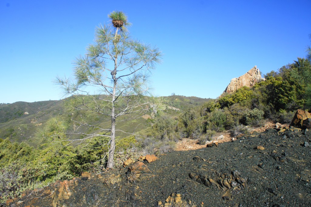
Rocky outcrops along the Cruikshank Trail


More limited vegetation allows for more open vistas, with hikers getting a peek back down Villa Creek drainage and ahead toward Lion Peak (3,499’) and the Salmon Creek drainage to the east. The trail also widens and even mildly descends as it snakes eastward across the scrubby chapparal. About 4/10 mile past the ridge, the route reaches Lion Den Camp, an excellent spot (though with a limited, seasonal water supply). While there are several disturbed sites at Lion Den, the best lies up the woody knoll to the right, which offers excellent views toward the coast.


Lion Den Camp 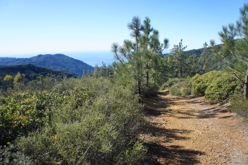
Looking back toward Mount Mars and the ocean


Beyond Lion Den, follow the wide path as it continues east, then ascends rather sharply, culminating at a junction with the South Coast Ridge Road (a dusty, rarely-used track) at 9.4 miles. This marks the end of the Cruikshank Trail and leg two of the journey.
South Coast Ridge and Salmon Creek Trail to Highway 1 (5.7 mi.)
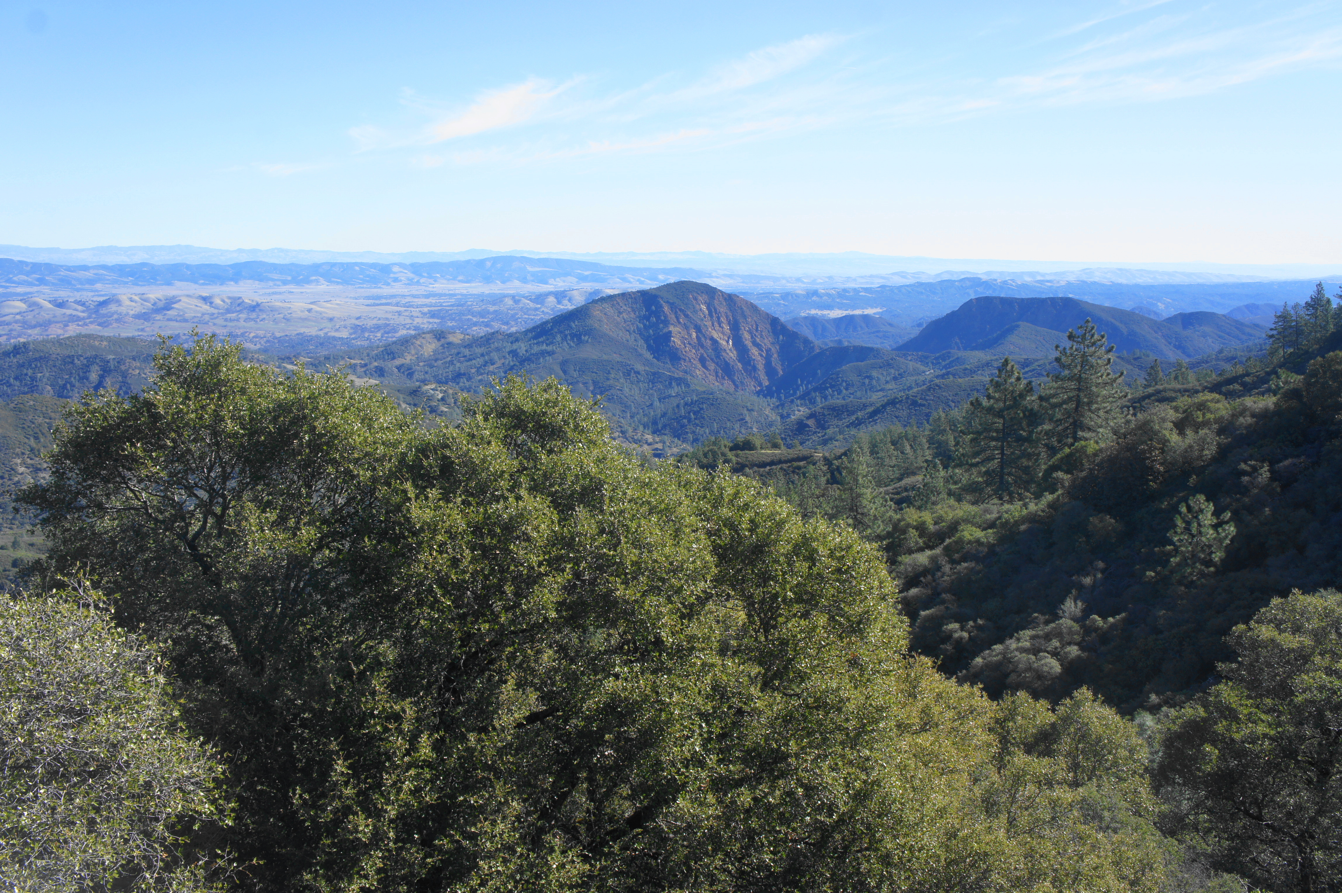
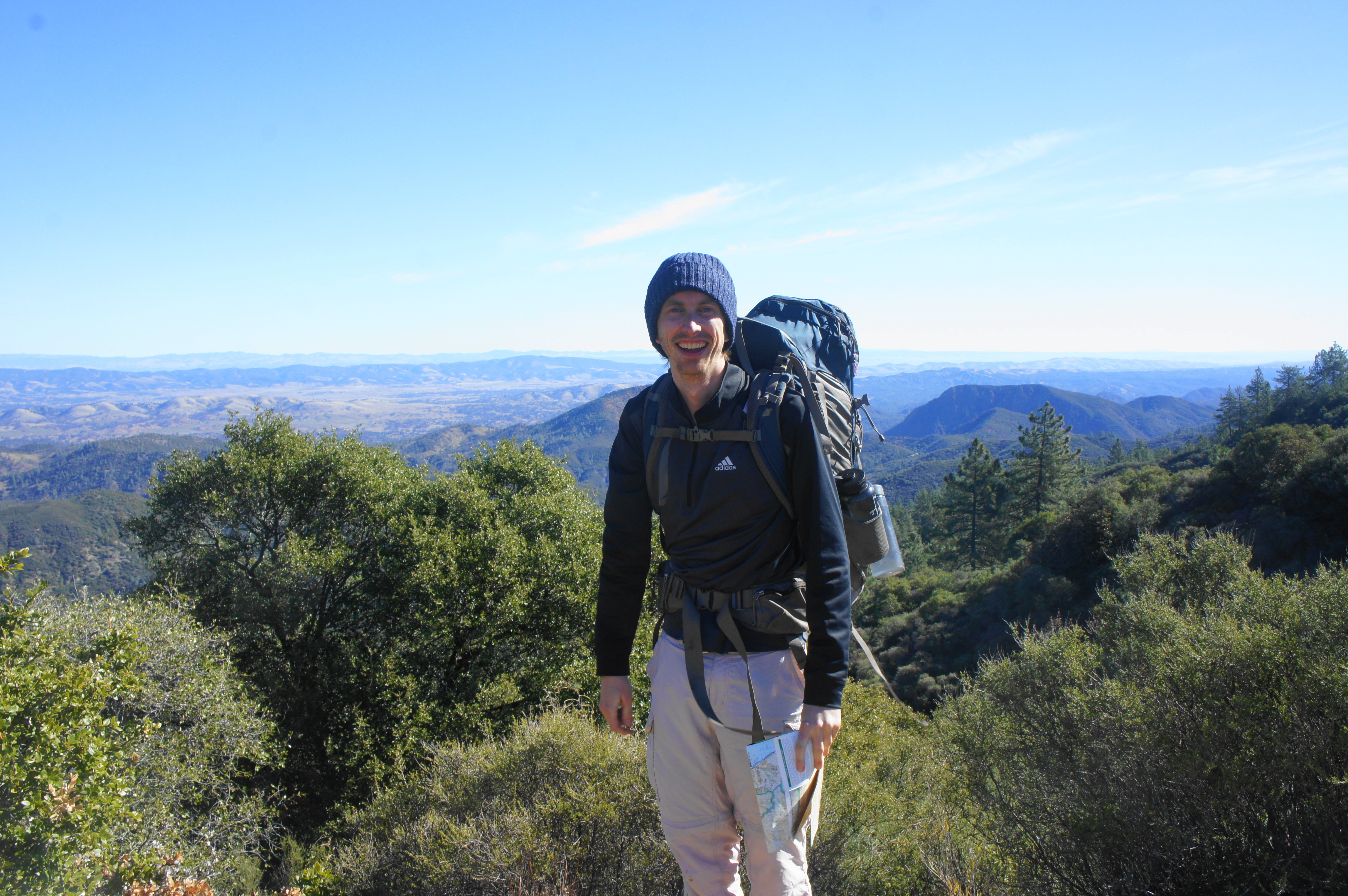
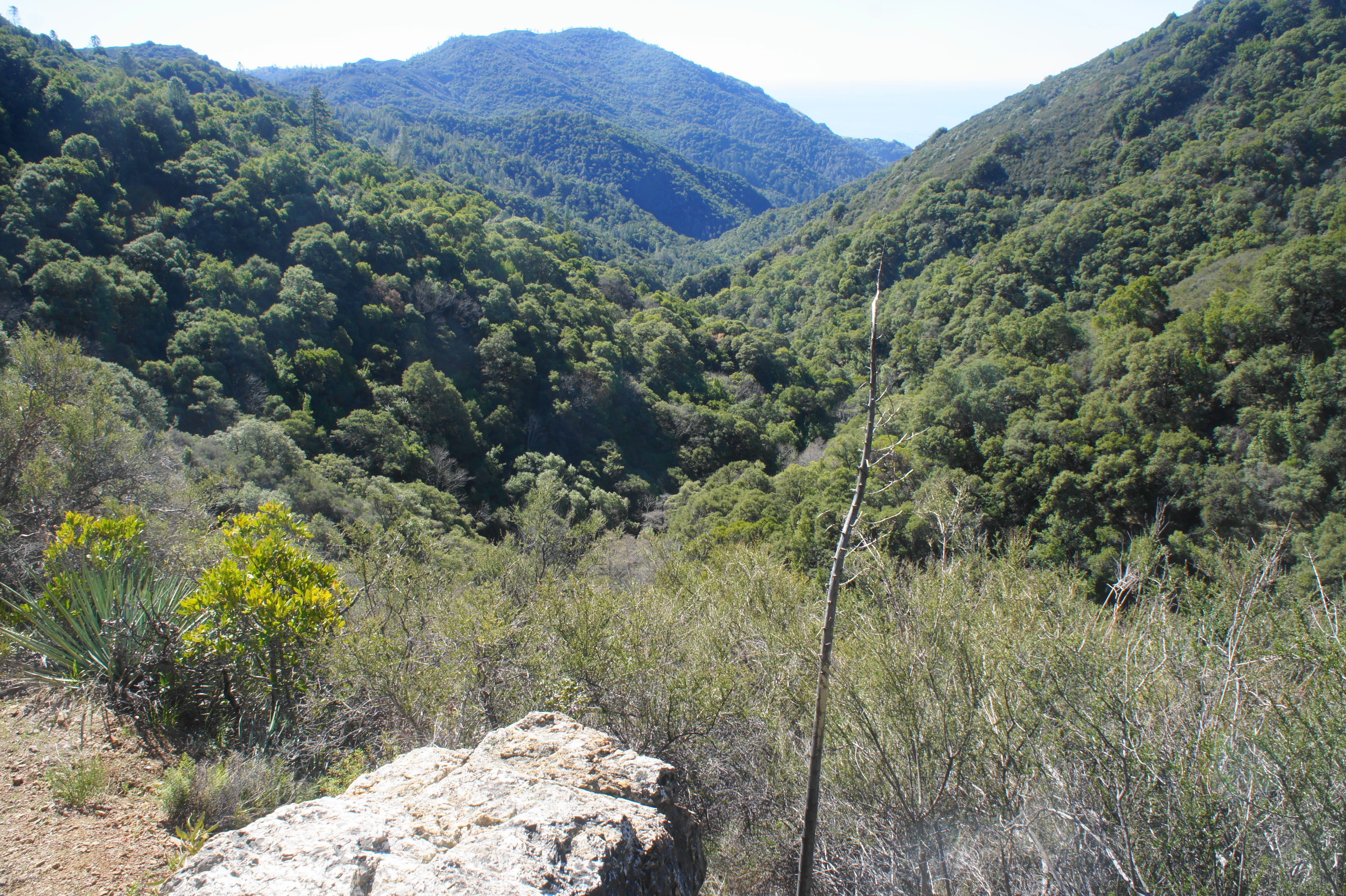
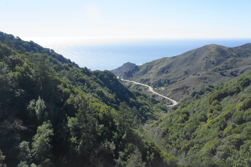
Bear right on South Coast Ridge Road, then emerge at a high gap with perhaps the hike’s best views. To the right, one can see down the Salmon Creek drainage to the coast, with Silver Peak and Mount Mars (2,674’) dominating the skyline. To the left, the views are better: hikers can see clear across the Santa Lucia Range to Burro Mountain (2,827’), Stony Valley, and the San Antonio drainage. On the horizon, one can see past Highway 101 and the Salinas Valley to the southern Gabilan Range.
West to Silver Peak 
Yours truly at the ridgetop

After soaking in the views, continue straight until one encounters the clearly-marked Salmon Creek Trail on the right. This is the exit route and sheds about 3,000 feet in elevation over the course of 5.5 miles. (Note: Hikers not content to return yet can continue east toward Lion Peak and Three Peaks (3,379’), where there are additional views and a couple of campsites.)

Start of Salmon Creek Trail 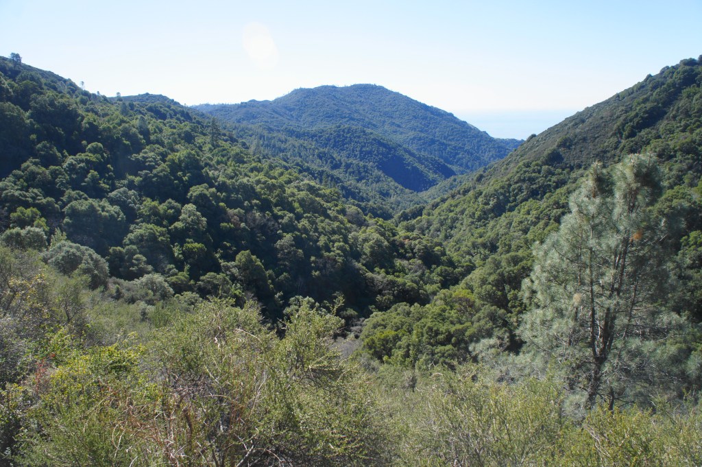
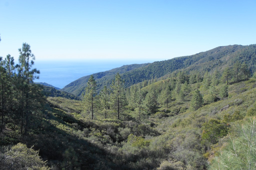
View down Salmon Creek drainage
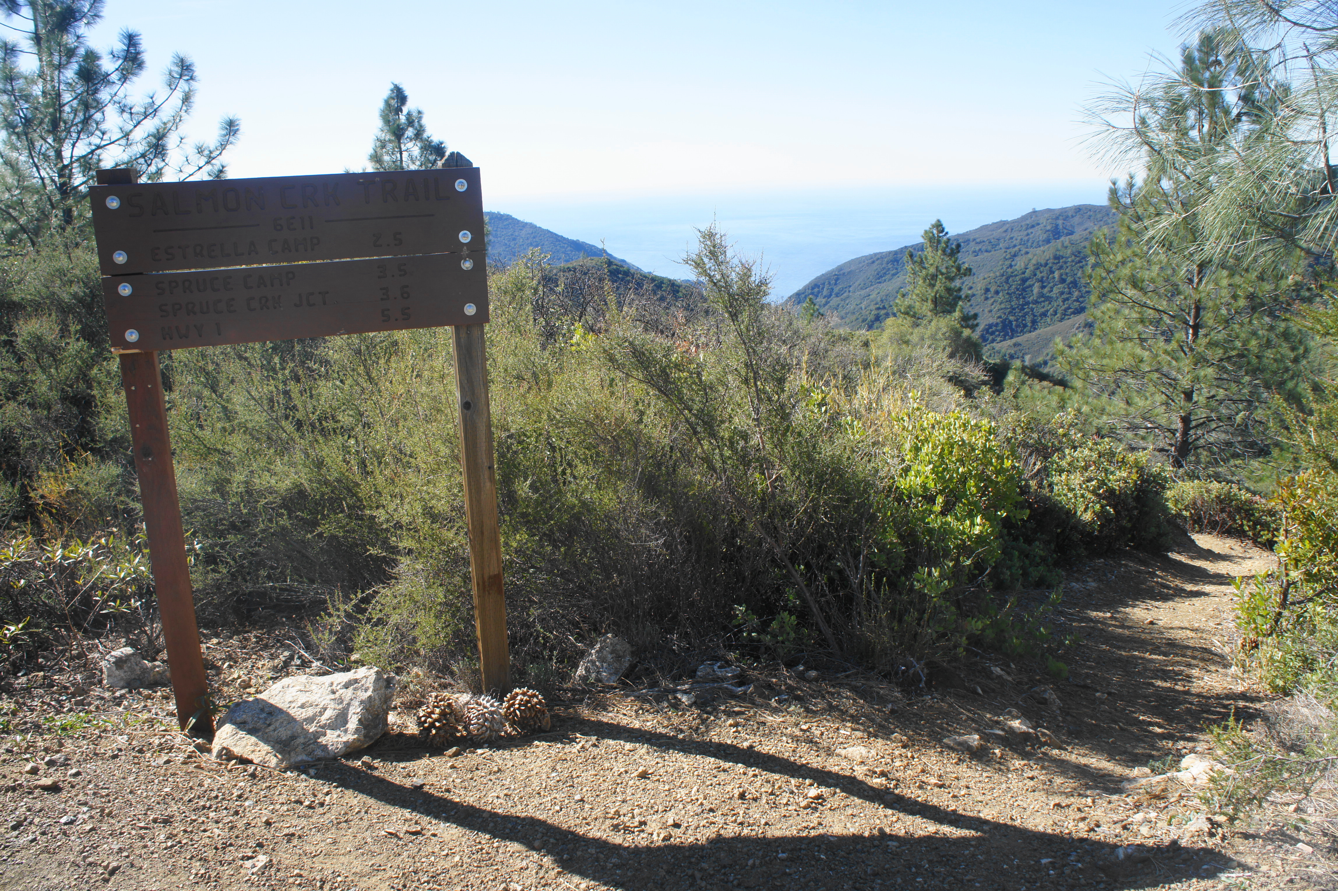
The Salmon Creek Trail begins descending right away, although the switching bends make for a relatively mild incline. Weaving in and out of the sun, hikers regularly gain views down canyon, with Silver Peak dominating the east-facing slope. It is a little over two miles of steady descent from the top to Estrella Camp, a lovely and popular spot situated in a shady glen next to a tributary that flows year-round. There are several places to camp here, although most of them are within striking distance of one another. After rock-hopping over the creek, the trail climbs sharply to another pair of campsites and then continues onward down canyon.

Estrella Camp 
Top of Upper Salmon Creek Falls

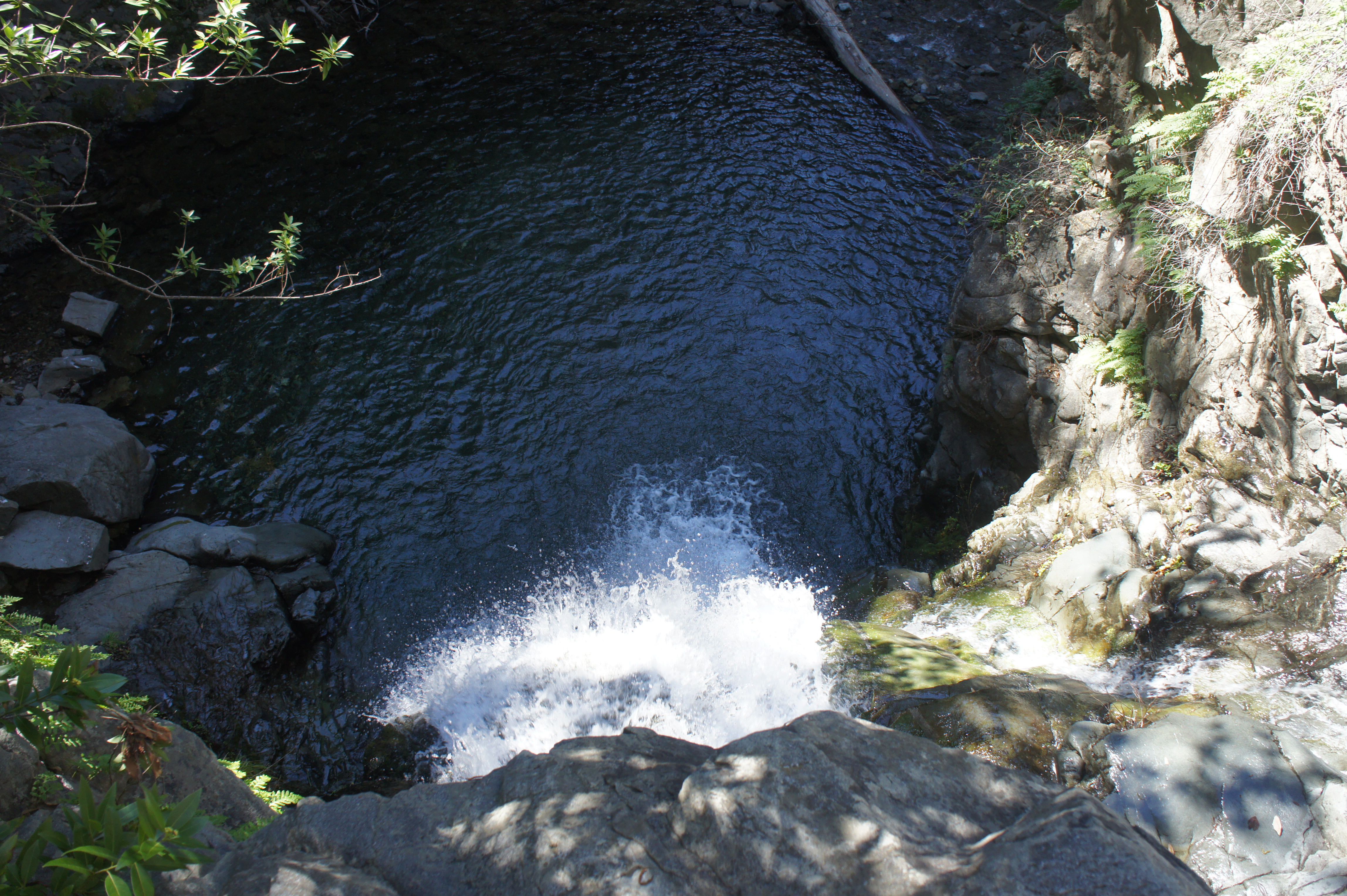
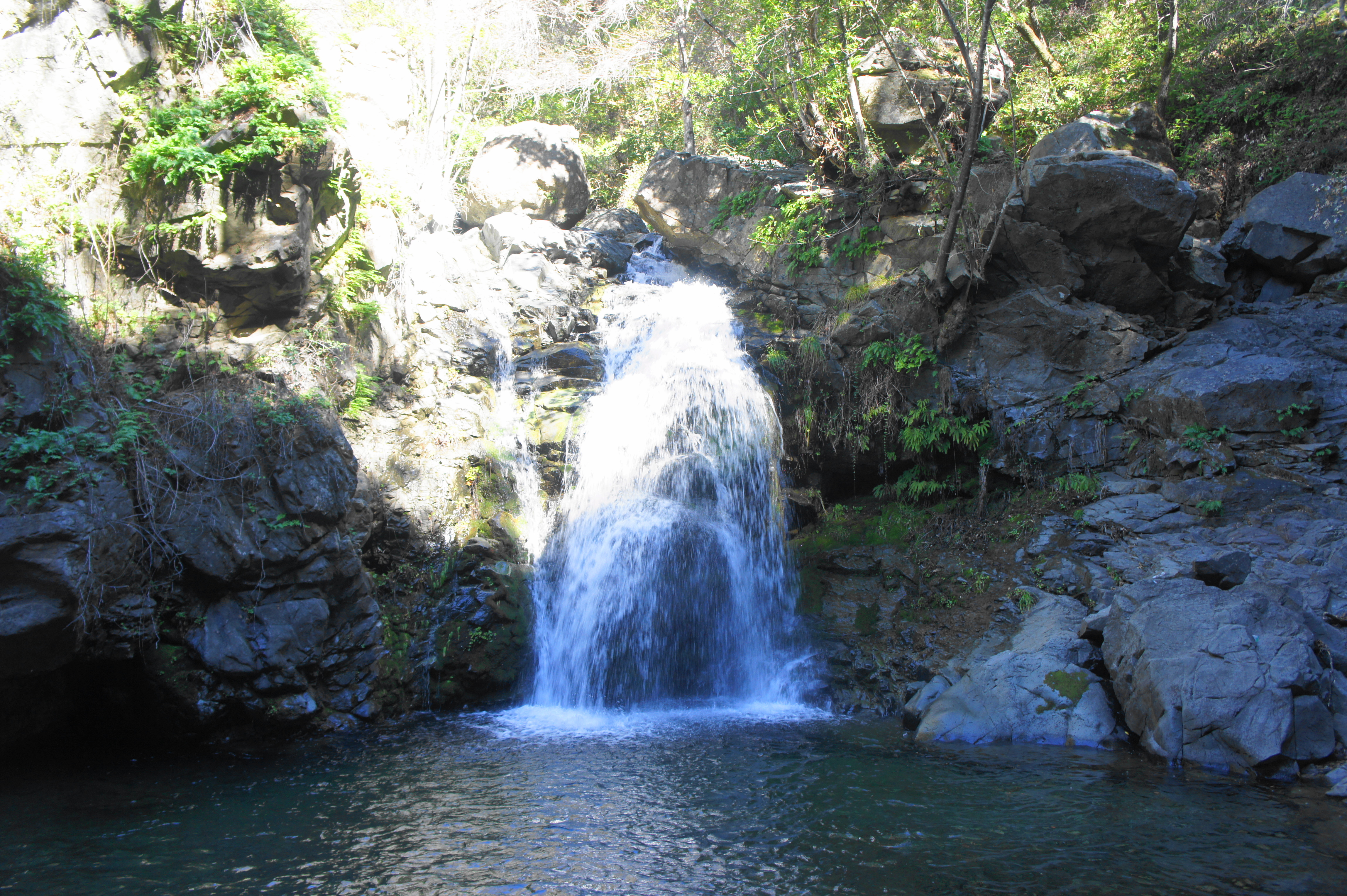
Roughly 6/10 mile beyond Estrella Camp, look for a steep but well-worn path heading off to the right. This track descends to Upper Salmon Creek Falls, a secluded and beautiful spot that makes for a worthy detour. Drop your packs and be careful descending. The trail pops out above the falls; from here it is a 30-foot, Class 2/3 scramble down to the base of the waterfall, where there is a nice bowl-shaped pool. This is a clear highlight of the hike and a nice spot for a lunch/snack break.
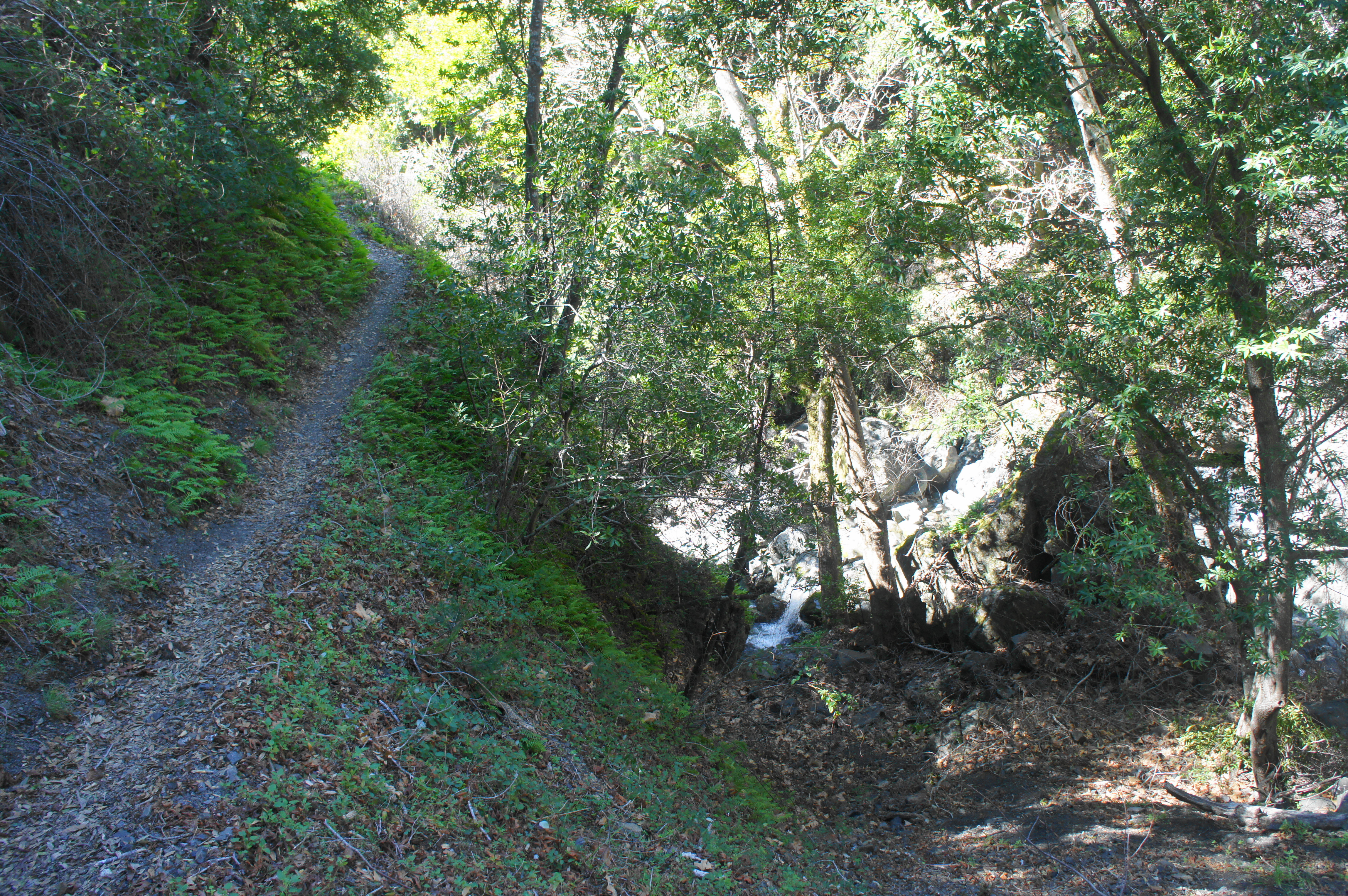
Returning back to the main trail, continue southward for a half-mile to reach Spruce Creek, a pleasant drainage that converges with larger Salmon Creek. The rocky cascades in this area are splendid, flowing nicely in winter/spring. Just across Spruce Creek is Spruce Creek Camp, where there are a couple sites that sit partly up the hillside above the drainage below.
Follow the signs for the onward trail, which—perhaps surprisingly—climbs sharply, gaining about 150 feet in elevation gain before reaching a trail junction at 13.3 miles. Here the Spruce Creek Trail leads left toward Dutra Flat and Three Peaks. The Salmon Creek Trail continues right.
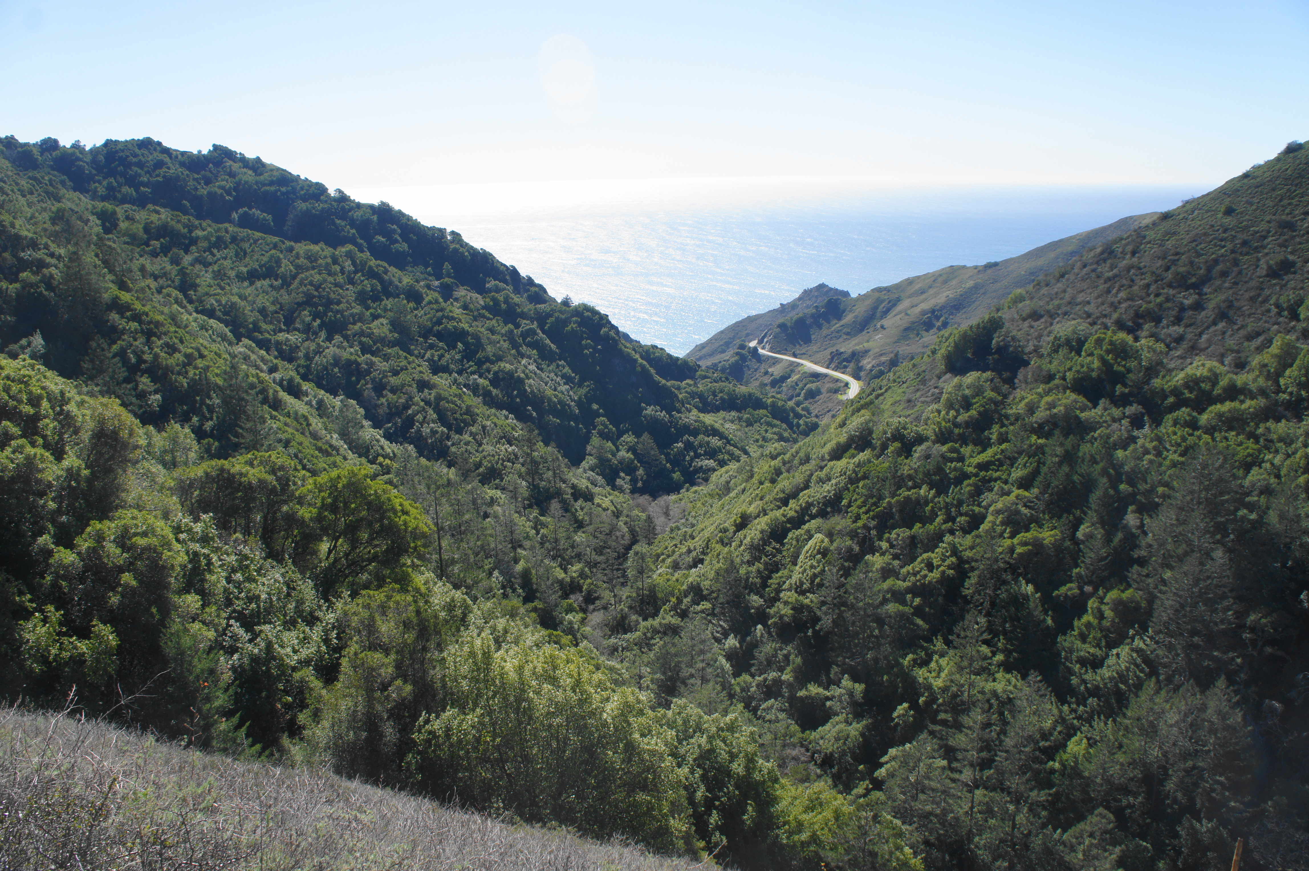
Beyond the fork, the Salmon Creek Trail continues to climb briefly, positioning the path several hundred feet above the base of the canyon. Finally, the path settles back into a mild downhill, passing three separate openings in turn, each of which provides a closer view of Highway 1 and trail’s end. But the path remains high above the road until seemingly the very end, when a rock outcrop inaugurates the final descent. Here the trail sheds 500 feet in elevation in about a half-mile, ending finally at a junction with the track to Lower Salmon Creek Falls. Head right to check out the falls, or bear left to reach the hike’s end point. (Note: The path comes out a little north of the ranger station, so, if parked there, follow the road down to one’s car.)
High views across Highway 1 to the ocean 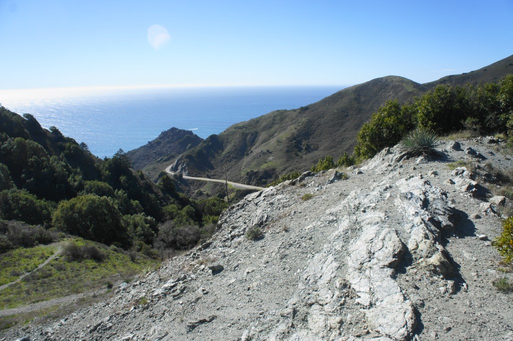
Start of descent


All told, the entire loop—excluding spurs and detours—clocks in at about 15.1 miles. Enjoy this scenic traverse as a long day hike or up to three-day journey. The steady elevation gain offers good practice during the winter season for summer journeys in the Sierra Nevada.

Masterful presentation!
Any idea if its possible to through hike from this trailhead to Monterey?
In theory yes, but right now I believe there is a big section in southern Ventana Wilderness that is closed, which would block your path. The trails in Ventana are also often faint and hard to follow.
Thank you so much for this post! It helped me feel so much more comfortable going out there this past weekend and the descriptions were extremely helpful!
Glad it was helpful, hope you had a good time!
Did this hike a few weeks ago and your post was an invaluable resource! I downloaded it to my phone and checked it a bunch, and it was super helpful knowing all the water sources. Upper Salmon Creek Falls was great, definitely a highlight as you said! Thanks so much!
Glad to hear it!
Pingback: Top 10 Hikes in 2021 | Live and Let Hike