
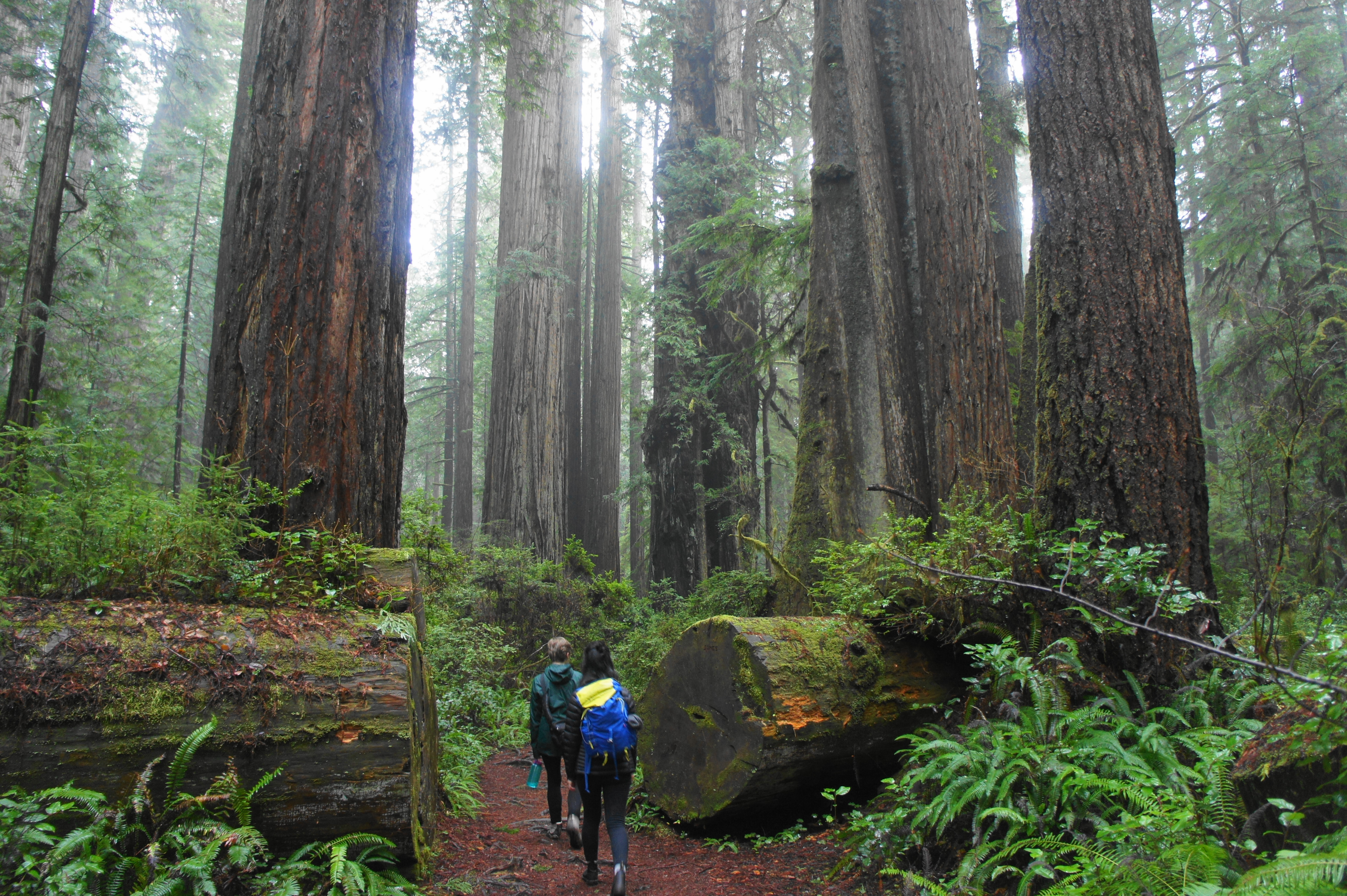
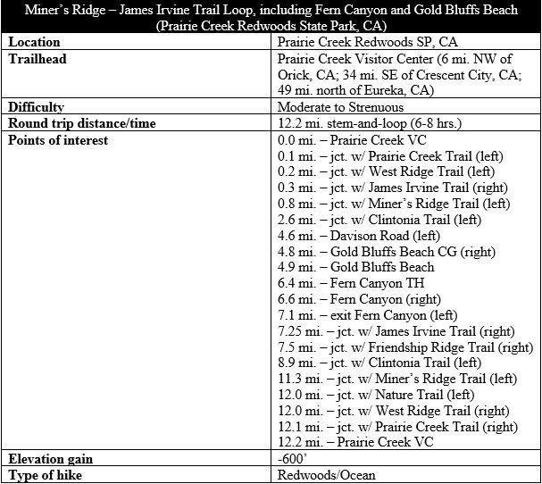
If ever there was a premier, unforgettable hike in northern California’s Redwood National Park, this is it. The Miner’s Ridge – James Irvine Trail Loop combines long stretches of spectacular redwood groves with a brief jaunt along the Pacific Ocean at Gold Bluffs Beach and an otherworldly experience at Fern Canyon, making for a magisterial 12-mile circuit. The scenery here is lush and verdant year-round, damp with moisture and shaded by thousands of titanic trees. Of course, such a trail is unlikely to lie in secret: the rangers at Prairie Creek Redwoods State Park, where the loop is located, will tell you that the James Irvine Trail is one of the most popular hikes in the area. But visiting during the off-season (winter/early spring) offers a better experience where the crowds are less dense and views more intimate and spectacular.
The hike
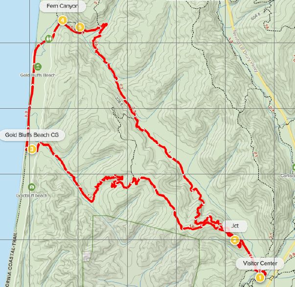
Described as an “All Day-Hike Through Redwoods to the Ocean – and Back,” the Miner’s Ridge – James Irvine Trail Loop begins and ends at the Prairie Creek Visitor Center in Prairie Creek Redwoods State Park, itself a subset of the broader Redwood National and State Parks. The Visitor Center is situated just off Newton B Drury Parkway, a scenic byway that runs through the heart of Prairie Creek Redwoods. Opposite the Visitor Center are a set of parking areas and the broad Elk Prairie, where the namesake creatures are known to roam.
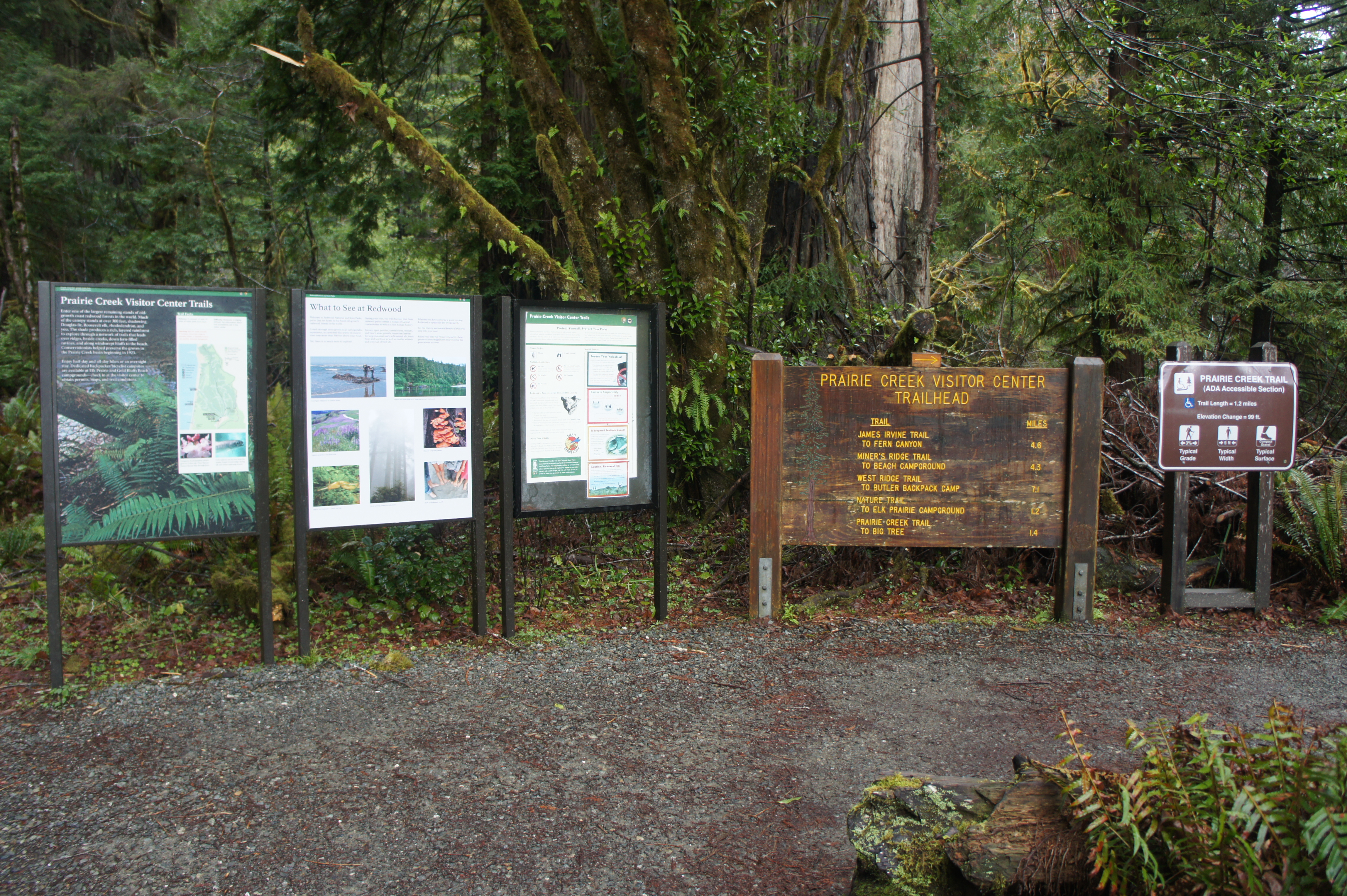
Facing the small Visitor Center, look off to the right, where a set of five informational signs marks the start of a network of hiking trails. After reading the various maps and signs, head right on the Prairie Creek Trail, a wheelchair-accessible track that weaves through some of the world’s best coast redwoods. (Note: See trail description here for an easier, 2.6-mile loop on the Prairie Creek and Foothill Trails.)
Prairie Creek Visitor Center to Gold Bluffs Beach via Miner’s Ridge Trail (4.9 mi.)
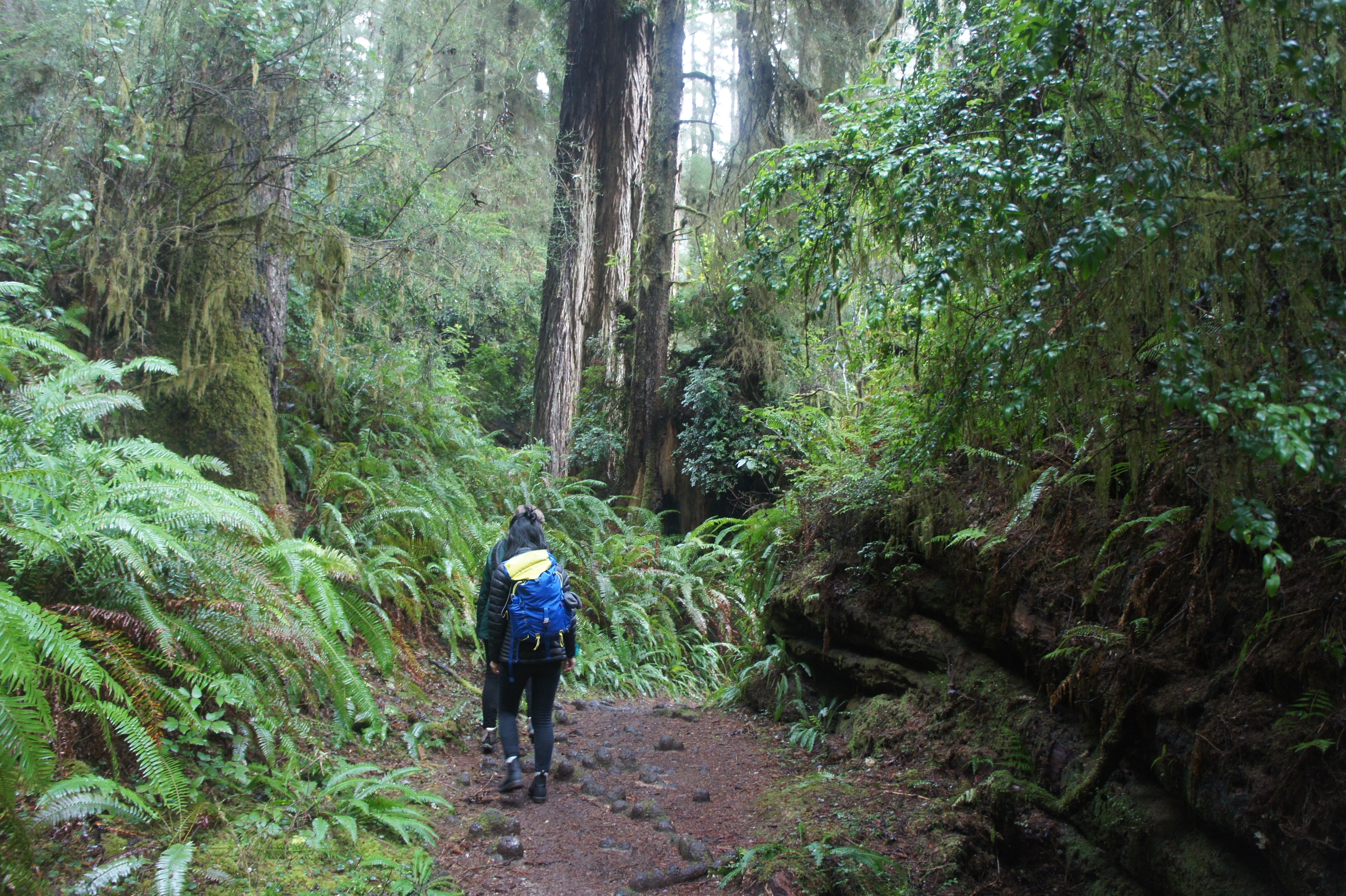
Even the first 100 yards of the Prairie Creek Trail are spectacular. Just before crossing a bridge over Prairie Creek, massive, spindly redwoods line the trail on the right. Beyond the bridge, hikers will quickly reach the first of several junctions. Bear left on the broad Nature Trail, leaving the Prairie Creek Trail behind. Now heading west, the path keeps Prairie Creek on the left, then approaches a second junction at about 300 yards. Bear left again, following the signs for the James Irvine and Miner’s Ridge Trails.
The track then immediately traverses a bridge over Godwood Creek, a tributary of Prairie Creek that is lined with ferns. At 2/10 mile, hikers reach a third junction, with the James Irvine Trail bearing off to the right. Take this turn, leaving the easy Nature Trail behind.
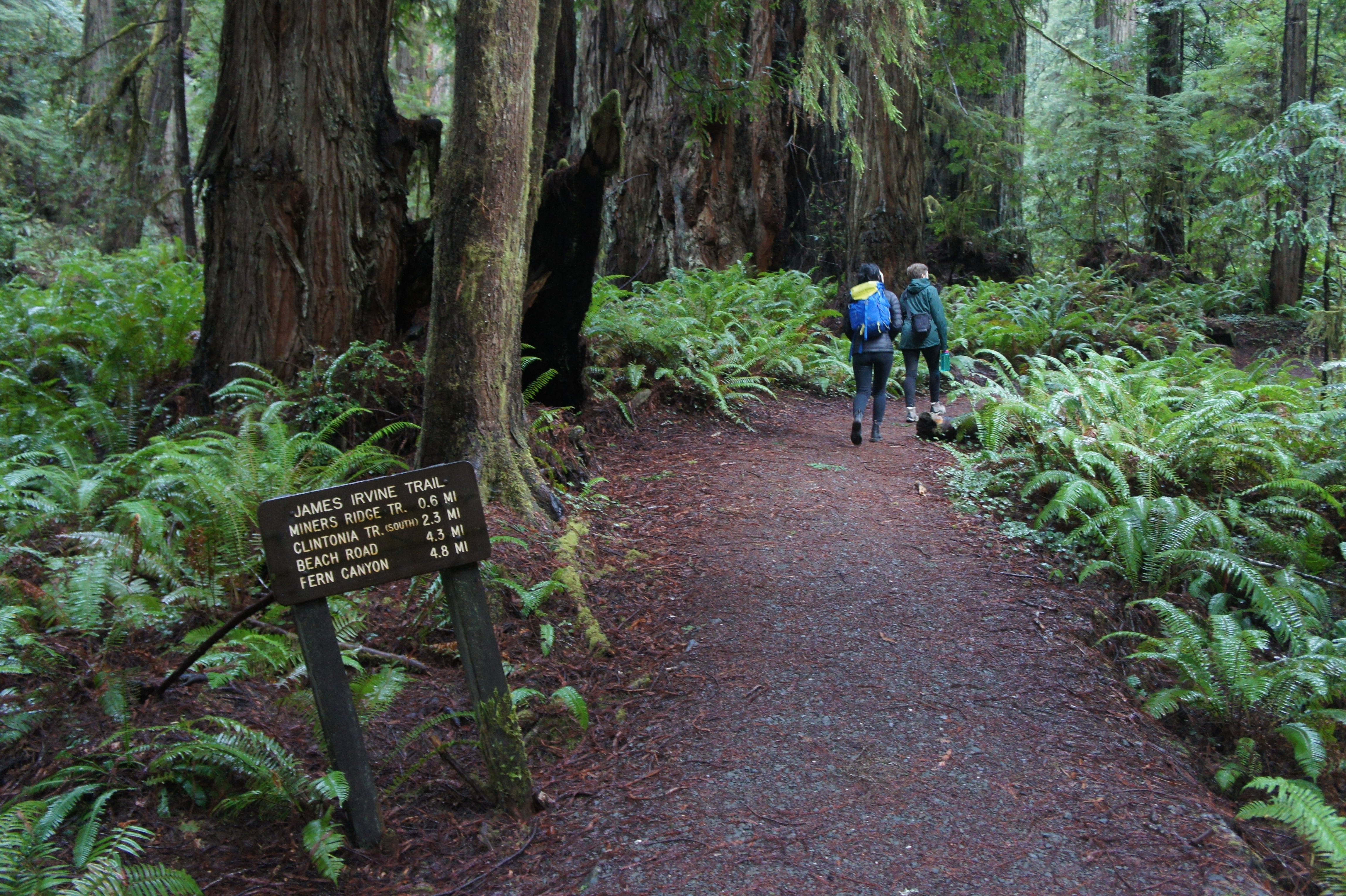
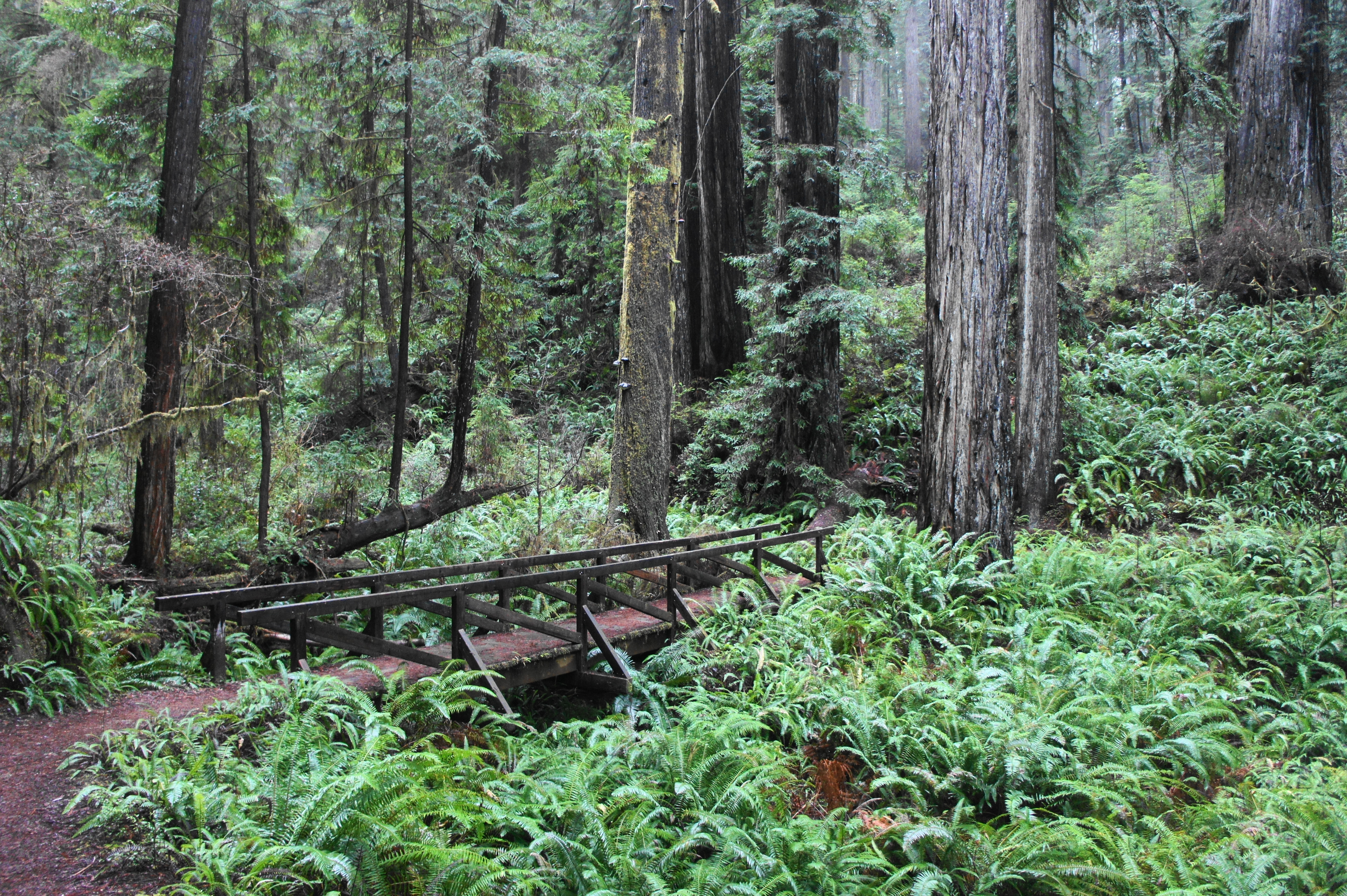
The James Irvine Trail moves steadily northward, crossing a long boardwalk at 1/3 mile, with a bevy of ferns, redwoods, Douglas firs, and moss-covered bay laurel filling in the dense surroundings. Gently climbing, the trail hugs an east-facing hillside above the Godwood Creek drainage, passing over two more short bridges in turn. The incline steepens as the trail switchbacks abruptly left, then bends right again, reaching a junction at 8/10 mile.
This trail fork marks the start of the loop portion of the hike. The James Irvine Trail continues right, but I recommend heading left to cover the Miner’s Ridge Trail first. This track treads uphill to the upper reaches of a wooded ridgetop. After cresting the ridge at the one-mile mark, the trail briefly descends, then climbs again at a steady but mild incline. A bench at the “Loomis Grove” at 1.3 miles offers a decent place for a snack break before the uphill continues beyond.

Trail junction 
Miner’s Ridge Trail
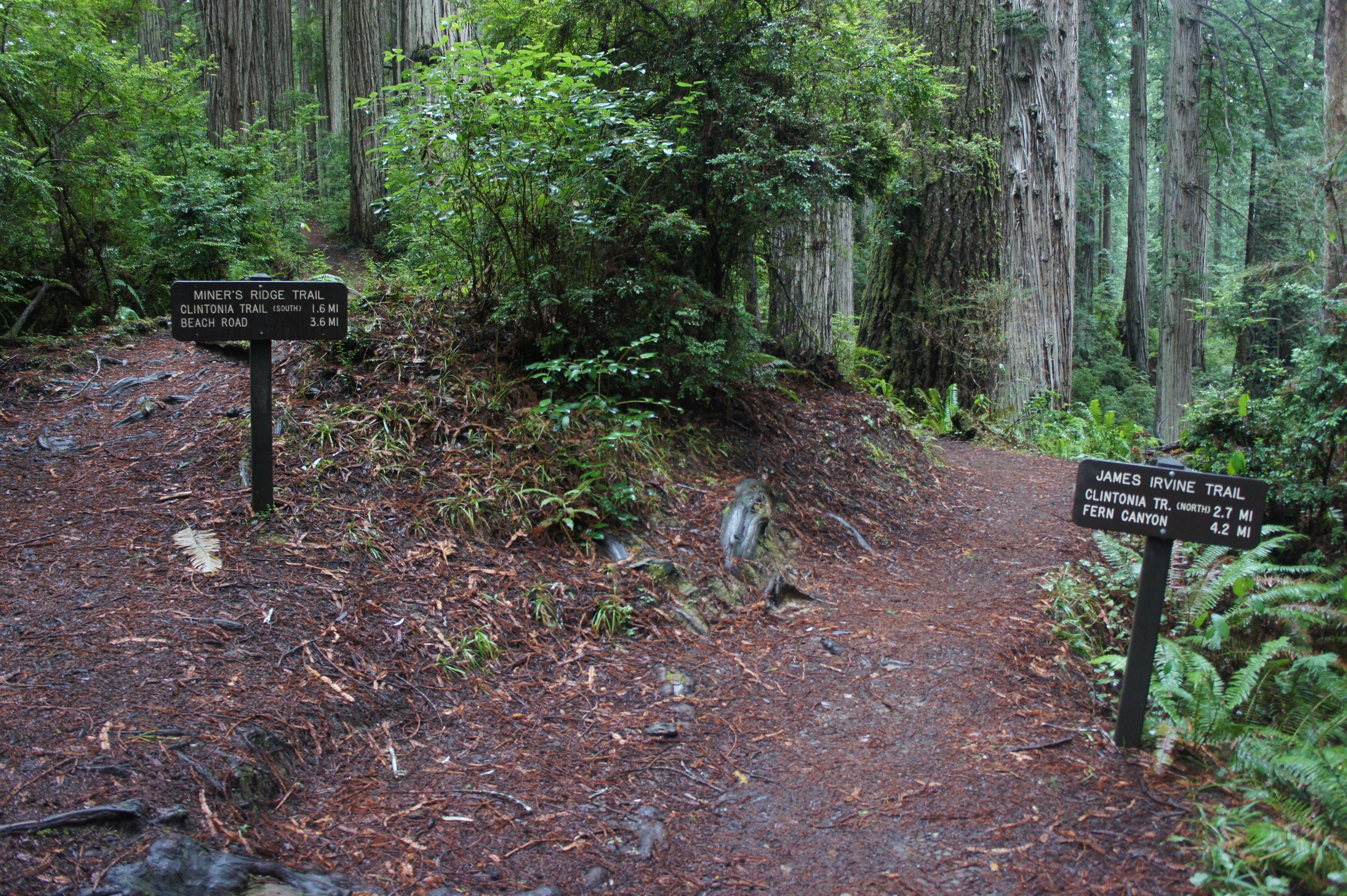

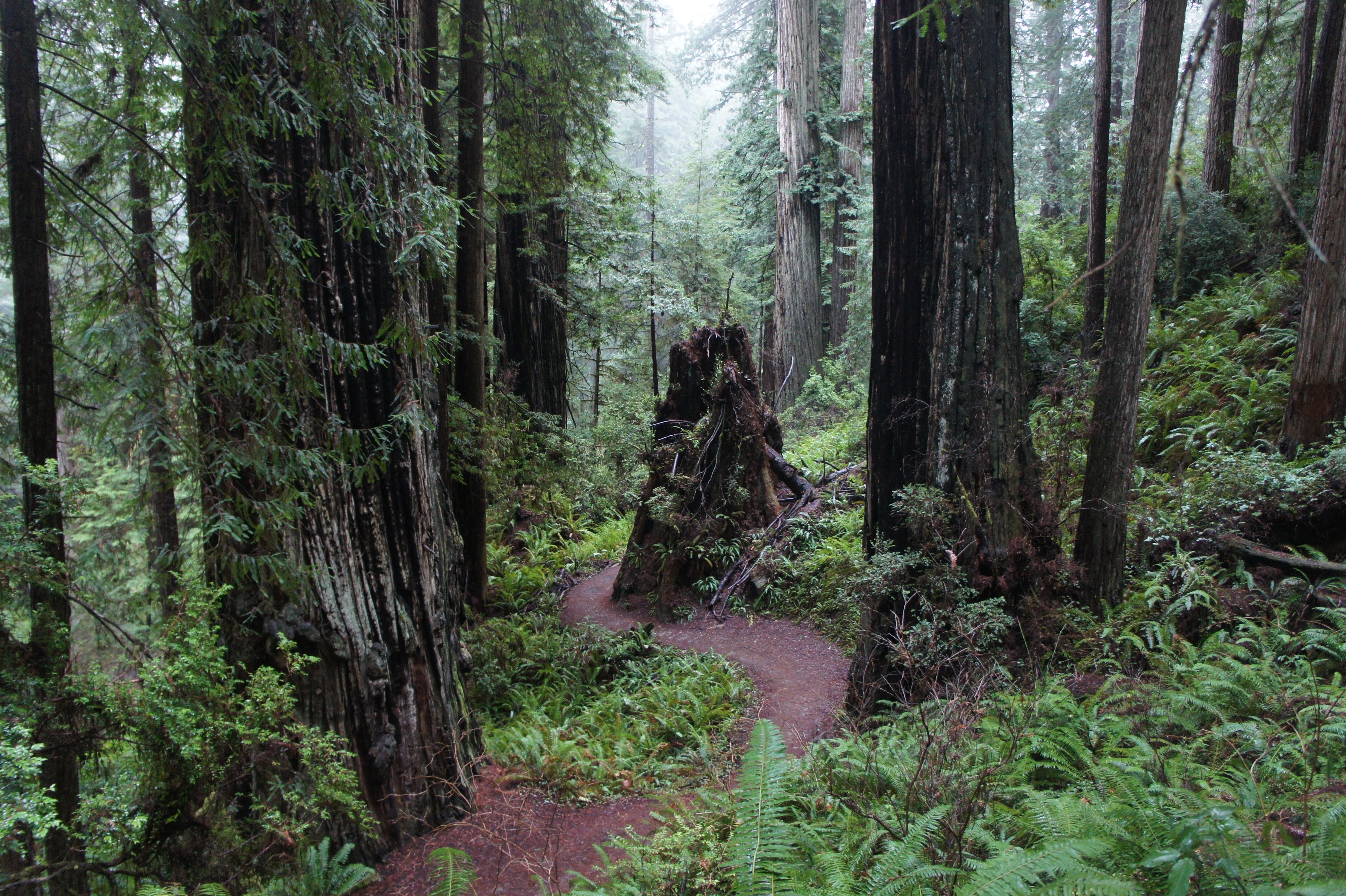
By 1.5 miles, the terrain begins to level off, and hikers may be able to hear (but not see) the distant waves of the Pacific Ocean. As the path descends the west flank of Miner’s Ridge, the composition of the tree canopy begins to change from redwoods to Sitka spruce, commonly found in a narrow coastal belt that stretches northward from California to southeast Alaska. After an abrupt right-hand bend at 2.5 miles, the trail descends sharply to a junction with the Clintonia Trail.

Redwoods along the Miner’s Ridge Trail 
Miner’s Ridge Trail as it descends
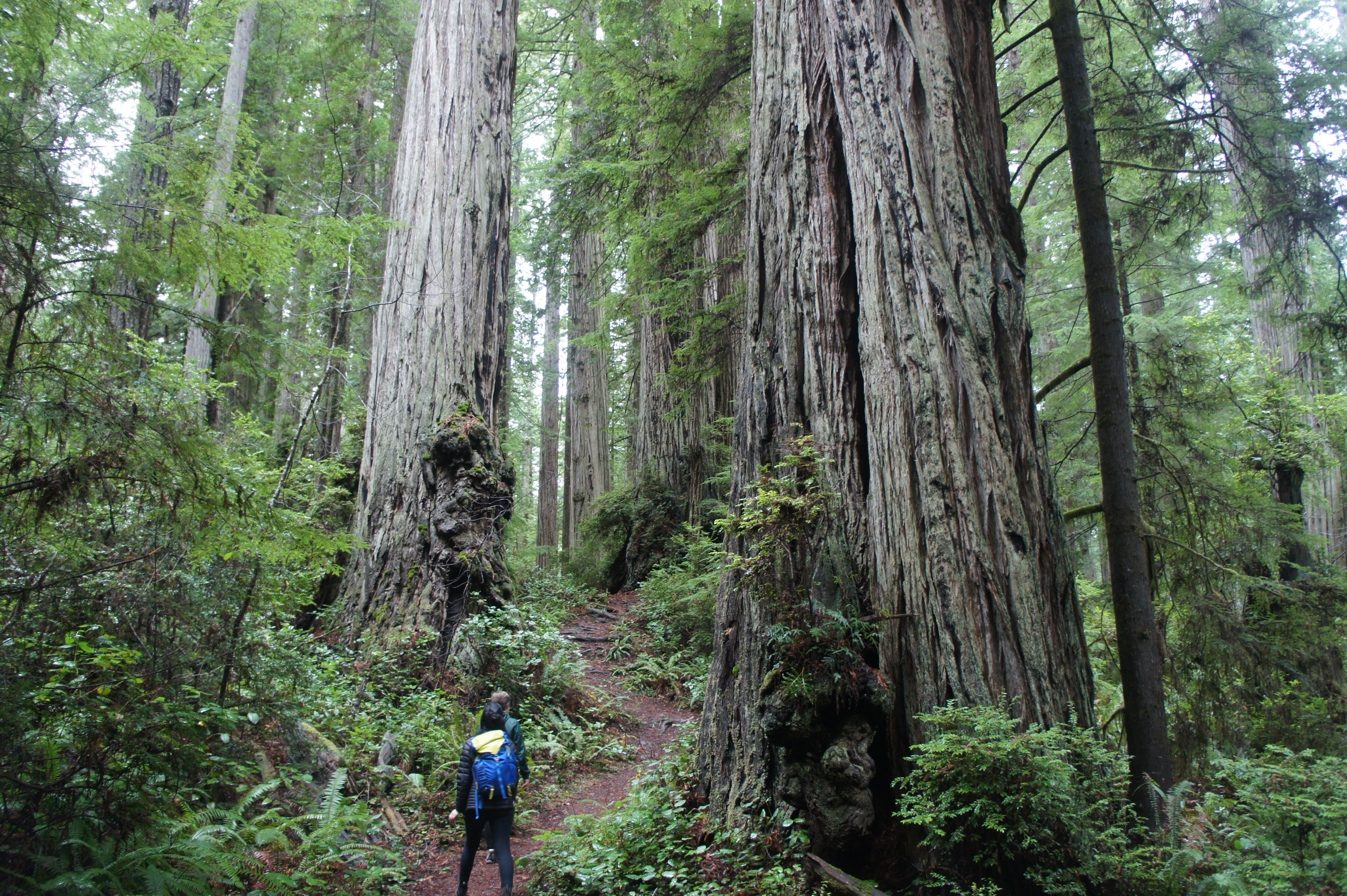

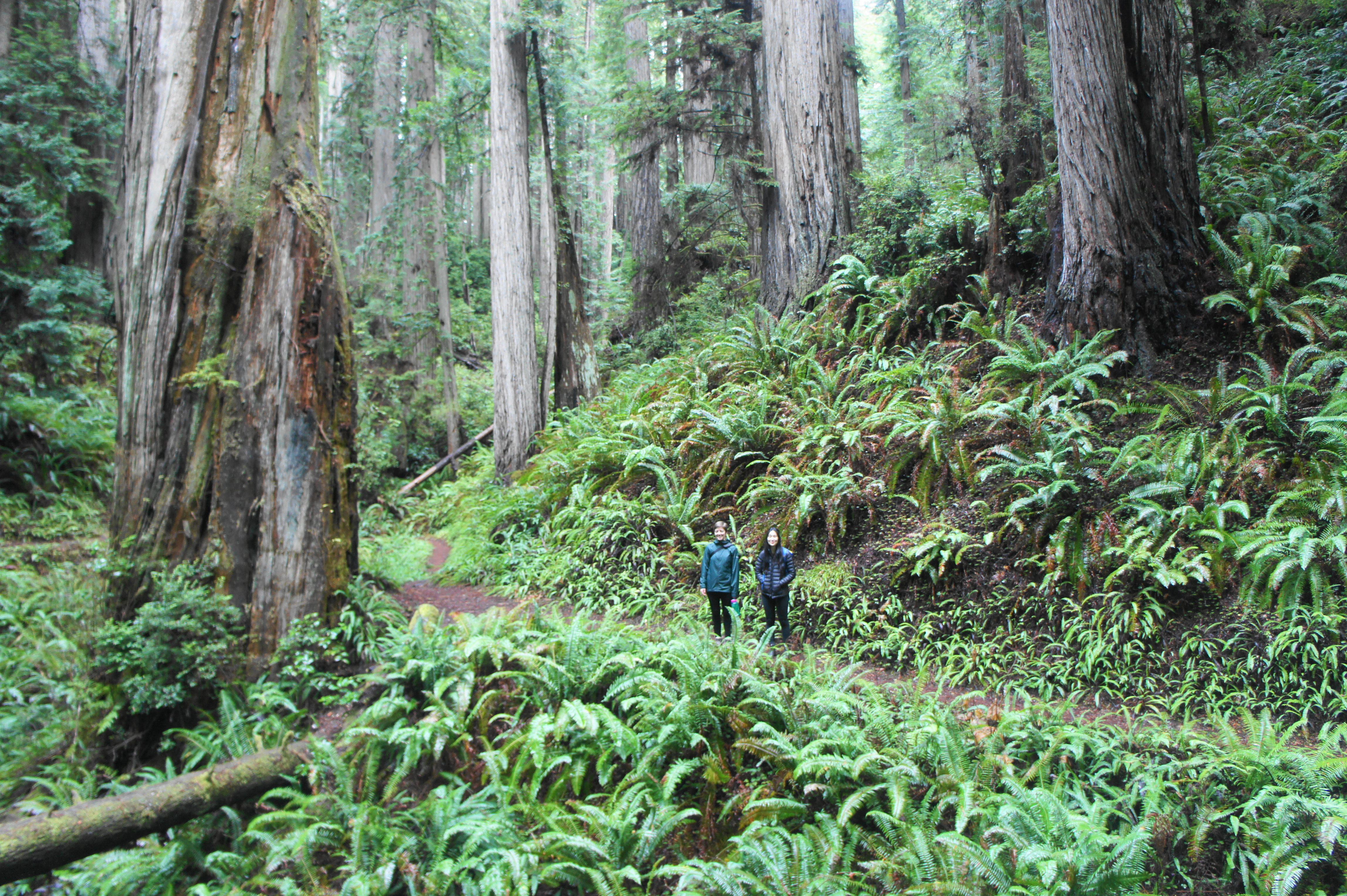
The Clintonia Trail is a short-cut route that connects the Miner’s Ridge Trail with the James Irvine Trail to the north, but taking this way would skip the beach portion and Fern Canyon, two highlights of the loop hike. So stay left on the Miner’s Ridge Trail, passing a massive redwood on the right. In about 1/3 mile, hikers reach another bench in the so-called Owings Grove, an exceptionally beautiful stand of redwoods situated on the flanks of a lush ravine. Rounding this gully is one of the most memorable sections of the hike, with thousands of sword ferns blanketing the hillsides and silent sentinels rising high toward the sky.
On the far side of the ravine, hikers pass a sign for the Donald L. Quaife Grove on the right, then the trail continues its descent to the Squashan Creek drainage. At 3.9 miles, the trail reaches the base of the drainage, which is choked with willows. Staying to the right of the main creek, hikers will cross eight short bridges in turn before the trail turns into a broader old road.
Follow this old road to its terminus, where the track merges with Davison Road (aka Gold Bluffs Beach Road), an unpaved but well-trafficked drive used mostly by day hikers heading for Fern Canyon. Onward hikers can continue right along the road to reach Fern Canyon, but a more interesting alternative is to follow the beach for a little over a mile. To reach Gold Bluffs Beach, head left on Davison Road, then, after a couple minutes, bear right at the entrance to the Gold Bluffs Beach Campground.
The campground is notable for having warm water and flush toilets (a rarity in the wilderness!), making for a nice rest stop. Continue across the campground to Gold Bluffs Beach, a wide tract of sand with the vast Pacific Ocean beyond.
Gold Bluffs Beach to James Irvine Trail via Fern Canyon (2.3 mi.)
The Gold Bluffs Beach section can vary widely by season. In summer, at least at low tide, the tufty sands are relatively easy to traverse. In winter and spring, however, the flows of Squashan and Home Creeks make for more significant, but not insurmountable, obstacles.
Heading north from the campground, follow the beach as the waves come crashing in, often leaving a foamy sea suds. After about ¼ mile, Squashan Creek comes in from the right. In winter, traversing the stream will require briefly getting your feet wet (unless you’re a stellar long jumper).

Home Creek poses a greater challenge and serves as the signal for hikers to exit right, returning to Davison Road and the Fern Canyon parking lot. In summer, the creek is much shallower, allowing hikers to follow it inland to Fern Canyon. In winter, however, the mouth of the creek forms deep, chilly lagoons. In this case, exit right, across brushy meadows and through spruce stands, to return to the road. There is no trail, however, and route-finding may require some mild bushwhacking.

Once back on the road, follow it north to its end at the Fern Canyon Trailhead, a large parking lot that is sure to have visitors nearly every day year-round. Fern Canyon is a very popular, short day hike, so don’t expect to be alone. (Note: See here for a description of this shorter hike.)
The Fern Canyon portion begins with a short, 2/10-mile walk along the Coastal Trail, which passes boggy marshes and wooded slopes before descending to Home Creek. Bear right on the creek to enter Fern Canyon. The canyon is lined with wooden planks that allow easier passage in summer, but in winter and early spring, you’re on your own: expect to conduct either some master rock-hopping or embrace the chill over your boots.

Entering Fern Canyon 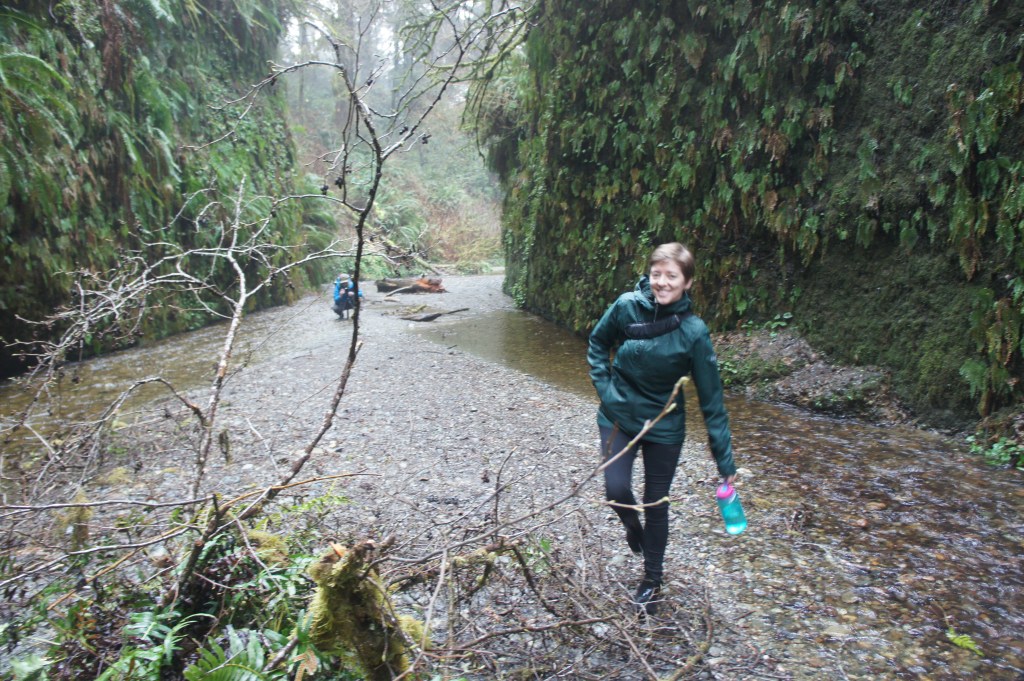
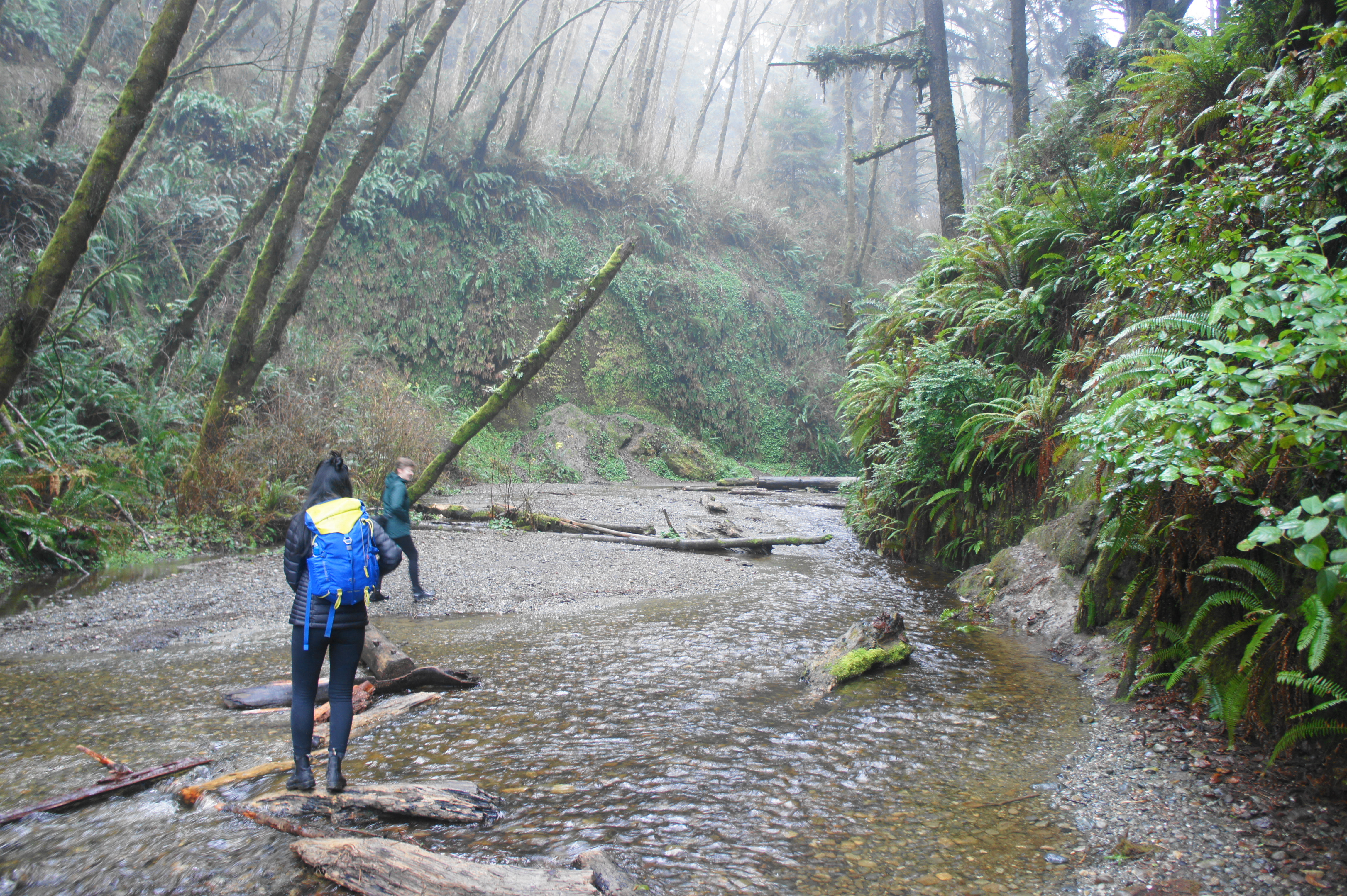
Crossing Home Creek in Fern Canyon

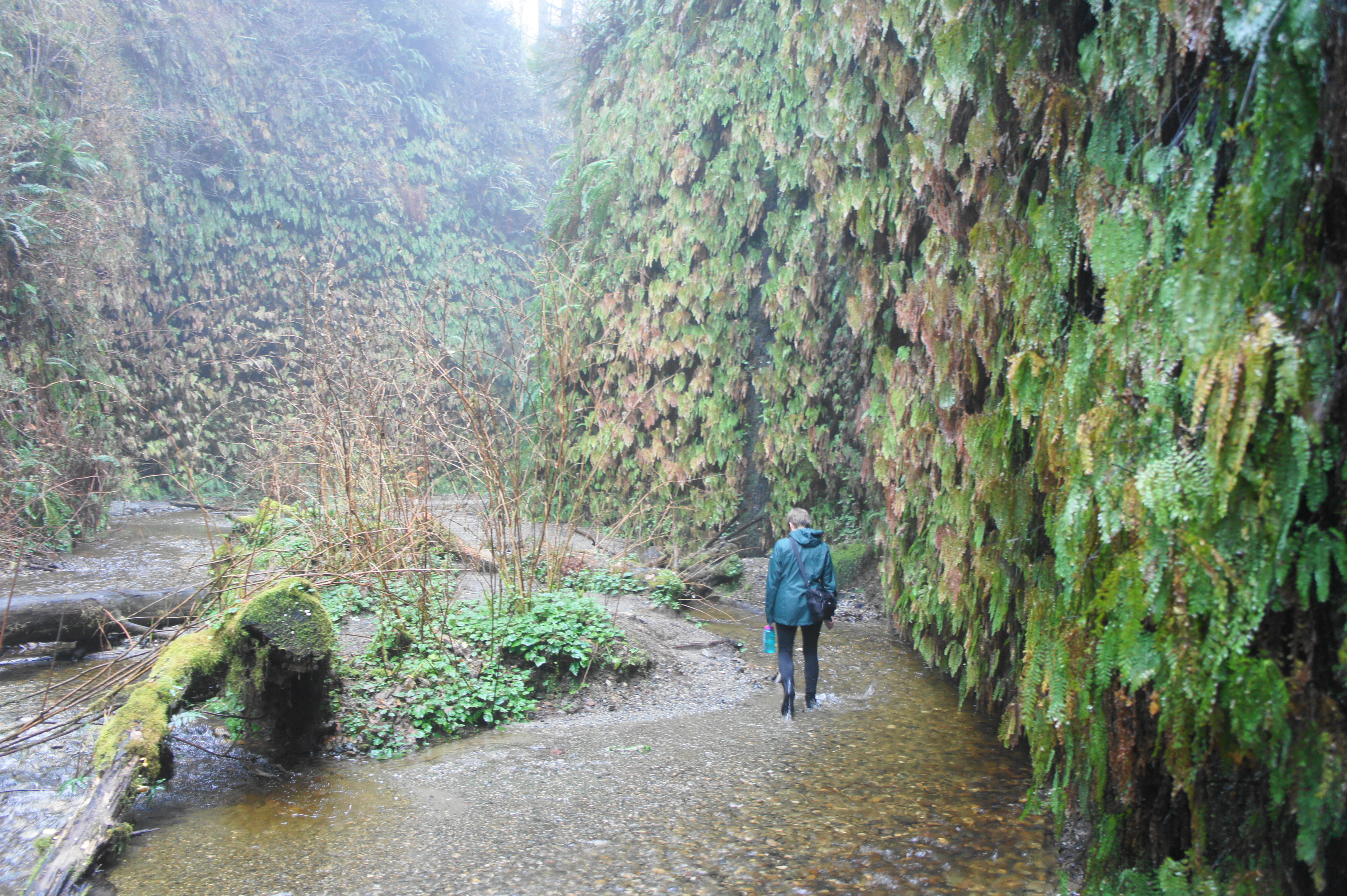
The tricky traverse, however, is made worthwhile by the spectacular scenery. A film location for Jurassic Park 2: The Lost World, Fern Canyon boasts verdant, 30- to 50-foot walls lined with the namesake shrubs. This includes the five-finger (or maidenhair) fern, which is rather rare, as well as the ubiquitous sword fern.

As hikers go deeper into the canyon, the walls gradually close in, with small waterfalls spraying the sides with trickles of water. In winter, some of the ferns take on an unattractive brownish hue, but they rebound easily in spring and summer, returning to their brilliant verdant state.
After negotiating several stream crossings and sandbars, the trail offers one last obstacle: a large tree jam that requires climbing over—or ducking under—the massive trunks. After the blockage, the canyon begins to open up. Look off to the left for the continuation of the Fern Canyon Loop Trail, which climbs sharply, up a set of bends, to a wooden bridge and junction with the James Irvine Trail. This makes for a good stopping point to ring out your wet socks and grab a snack before continuing onward.
James Irvine Trail to Prairie Creek Visitor Center (5.0 mi.)
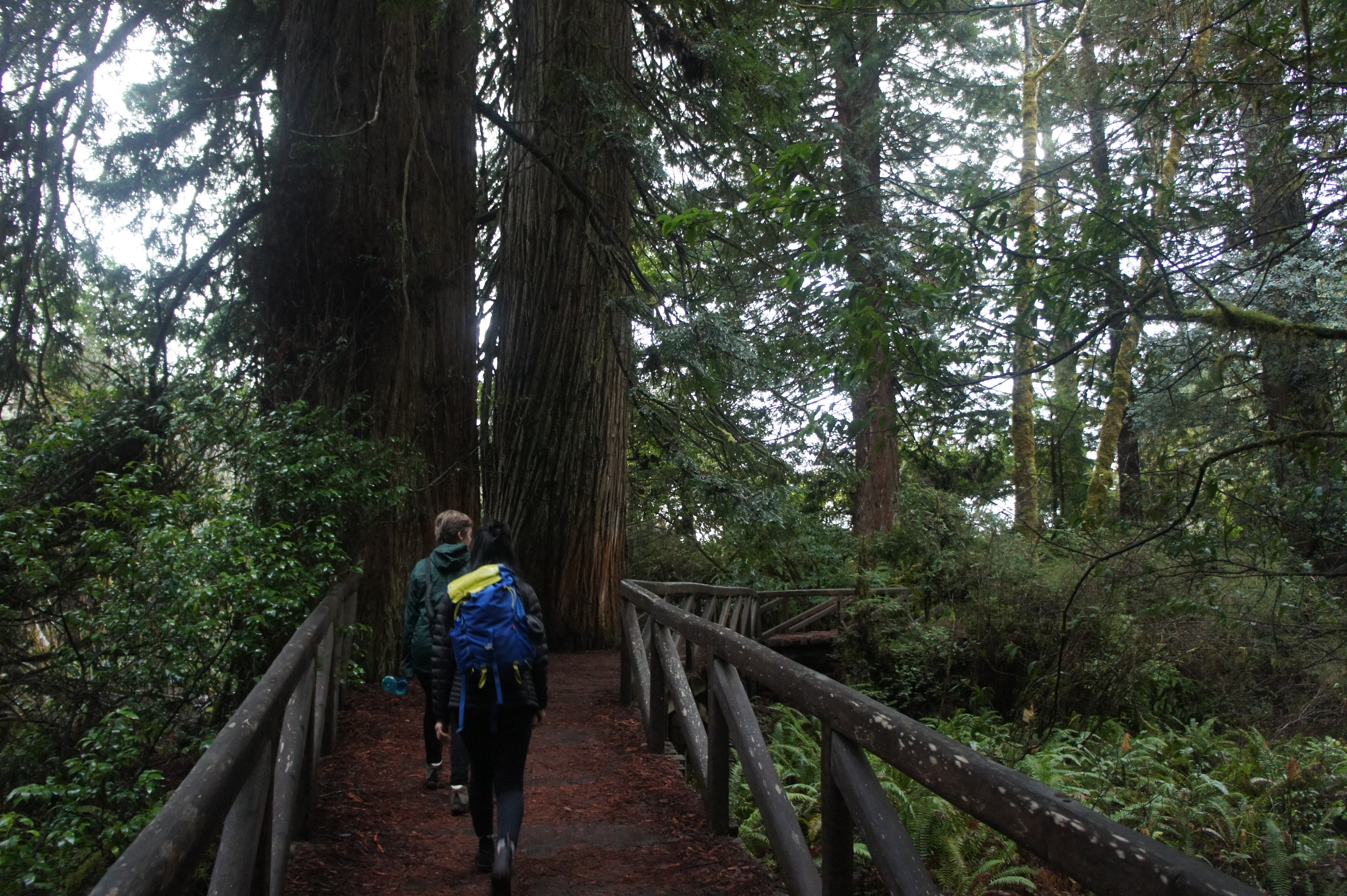
By now, the hike is more than halfway done (about 7.25 miles from the start), and the James Irvine Trail is relatively mild in terms of elevation gain, so hikers should be able to make good time in returning to the trailhead. Bear right at the junction, following the track back through a redwood grove. After crossing a bridge over a prominent tributary, stay right at the junction with the Friendship Ridge Trail. Traversing the Bissell Grove, the path crosses another bridge at around 7.6 miles, then climbs steeply up a set of stairs. As the trail eventually reverts to a downhill, the redwoods return in full force.

James Irvine Trail 
Creekside seats!

The rest of the James Irvine Trail entails a modest climb, snaking in and out of fern-studded ravines. A bridge at 8.2 miles traverse what looks like a deep and dark chasm, followed a couple minutes later by another traverse over a Home Creek tributary. The trail crosses Home Creek proper at 8.6 miles, then hugs the right bank until reaching a junction with the Clintonia Trail.

Stay left at the fork, climbing to an impressive grove of redwoods situated in a low pass between the Home Creek and Godwood Creek drainages. This area is very flat, eventually settling into a slight downhill tread.

At 10 miles, the James Irvine Trail crosses a bridge over a gully lined with tons of ferns, then it is back uphill gain, following the east-facing slopes of Miner’s Ridge. For a good half-mile, the James Irvine Trail follows a very similar track as the Miner’s Ridge Trail, situated just 100 yards above, before finally merging again with the latter trail at 11.3 miles. This marks the end of the loop portion.
The rest is a repeat of the terrain covered in the hike’s first 8/10 mile. Gradually descend to the junction with the Nature Trail, then bear left. Stay right at the next junction (with the West Ridge Trail), then pass back over Godwood Creek and return to the initial junction. Bear right on the Prairie Creek Trail, which crosses its namesake and returns to the Visitor Center, wrapping up a 12-mile trip.
Expect this hike to take most of a day. While not particularly strenuous, the distance—combined with negotiating the beach and obstacles in Fern Canyon—may be too much to handle for some. For those willing to make the journey, however, the region’s many wonders—stout redwoods, quiet coastal beach, and a wonderland of ferns—are on full display on this excellent hike.

You forgot to include about 100,000 people on any given day
Ah yes, visiting during the off-season is a must. We did a weekday in January and we saw virtually no one except for a few groups at Fern Canyon.
Thanks for an excellent article.
Pingback: Humboldt County Redwoods and Fern – It is all about the light
Pingback: Humboldt County Redwoods and Fern – It is all about the light
Pingback: Top 10 Hikes in 2021 | Live and Let Hike
Pingback: Top 10 Hikes in 2021 | Live and Let Hike
Pingback: Pfeiffer Falls Trail (Pfeiffer Big Sur State Park, CA) | Live and Let Hike