
More than 12 years after suffering significant damage in the 2008 Basin Complex Fire, the Pfeiffer Falls Trail in California’s Pfeiffer Big Sur State Park reopened for the first time in June 2021. The new and improved route—with its fresh boardwalks, staircases, and bridges—is an impressive feat of development, but it is of course the ancient, natural surroundings that make this short and moderately difficult hike memorable. Situated in a narrow canyon below Mount Manuel and the Santa Lucia Mountains, Pfeiffer Falls tumbles in several parallel chutes down a mossy wall, just above a grove of majestic, old-growth redwoods. Combine with the Valley View Trail to make this a 1.8-mile stem-and-loop.

The hike
The newly-renovated Pfeiffer Falls Trail starts directly across from Big Sur Lodge in Pfeiffer Big Sur State Park. However, most visitors will be forced to park further afield: after driving past the lodge and paying the entrance fee, park in the first parking area on the right. This is Day Use Lot #1 and the common starting point for most hikes in the state park. Here you will find restrooms and information panels on the park’s several hiking trails.
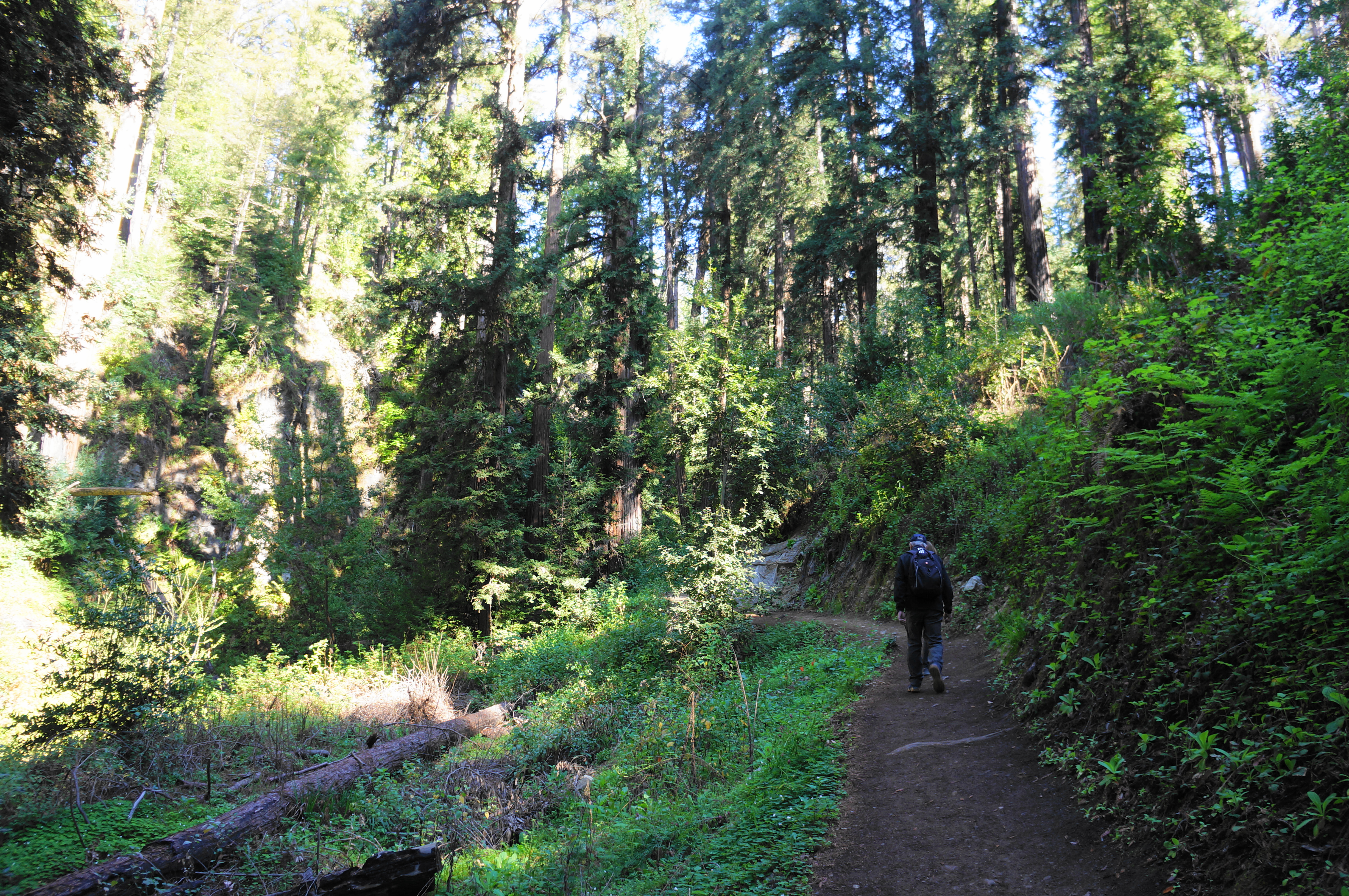
The route to Pfeiffer Falls begins on the very mellow River Path, a wide track that begins on pavement before turning to gravel. Take the path westward as it passes the amphitheater (called the “Campfire Center”) on the right and then roughly parallels the Big Sur River, which one can hear—but not always see through the brush—on the left. This 16-mile meandering waterway is somewhat unusual in that it parallels—rather than running perpendicular to—the Pacific Ocean for part of its course down from the Santa Lucia Mountains.
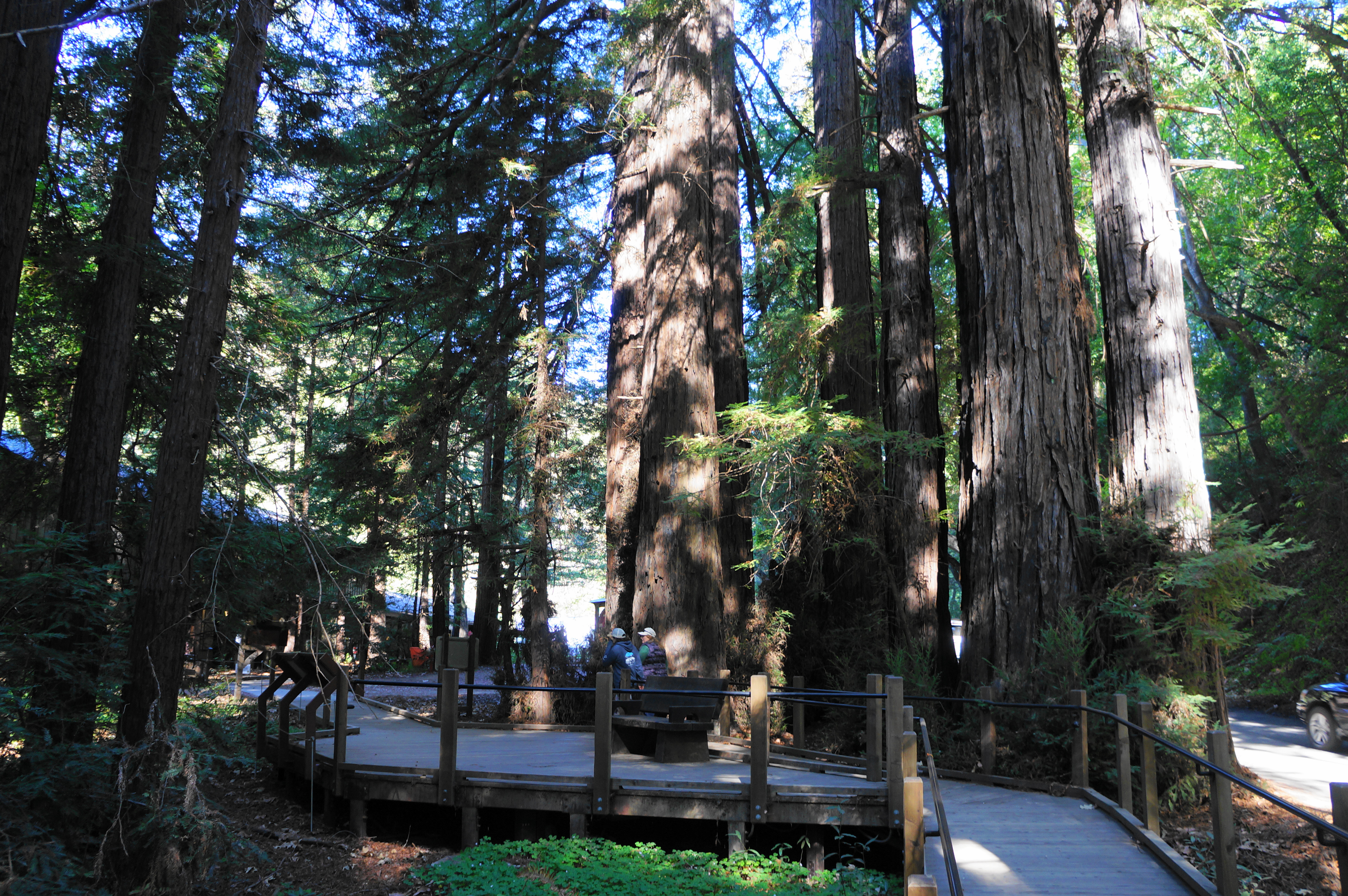
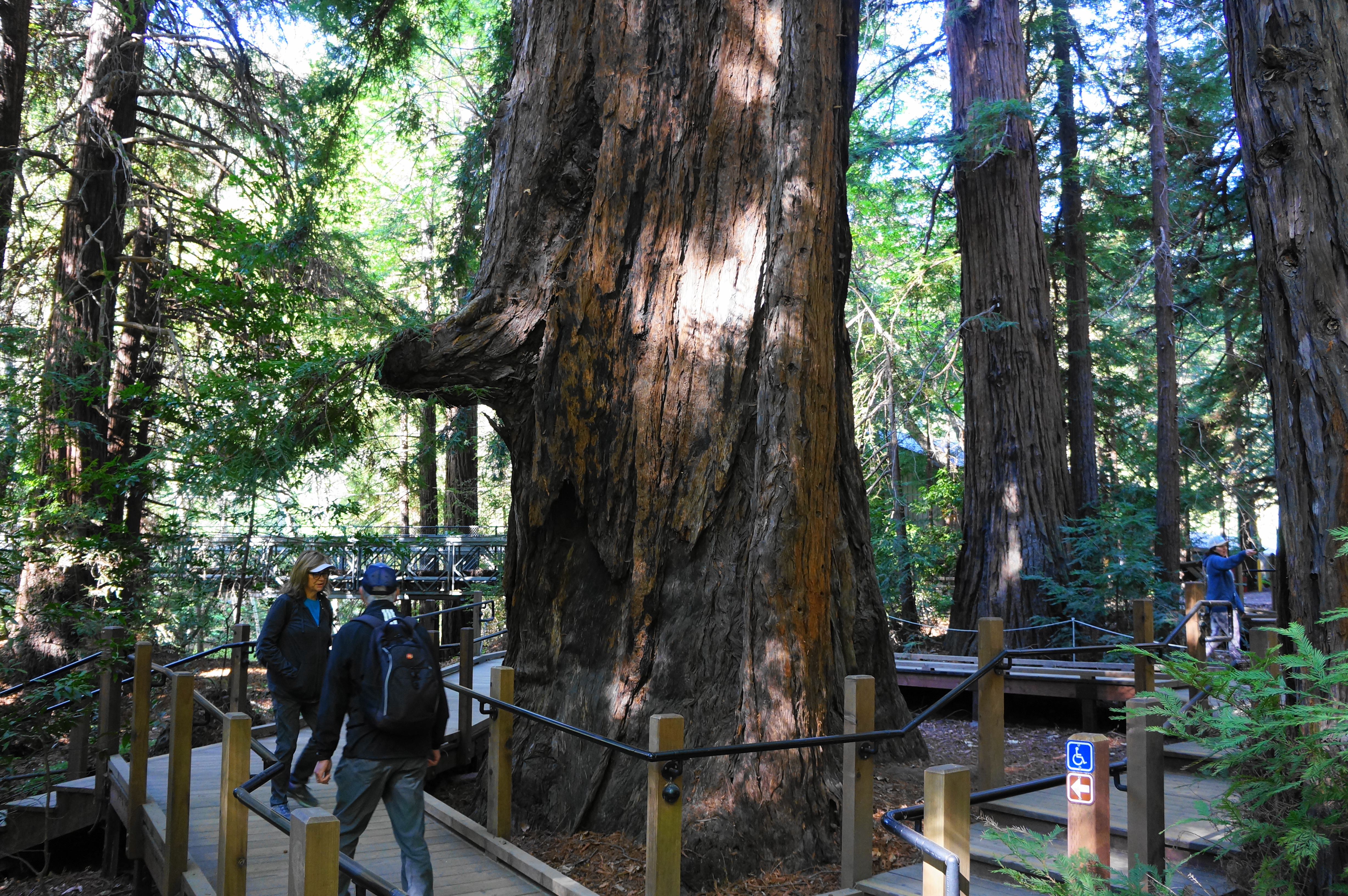
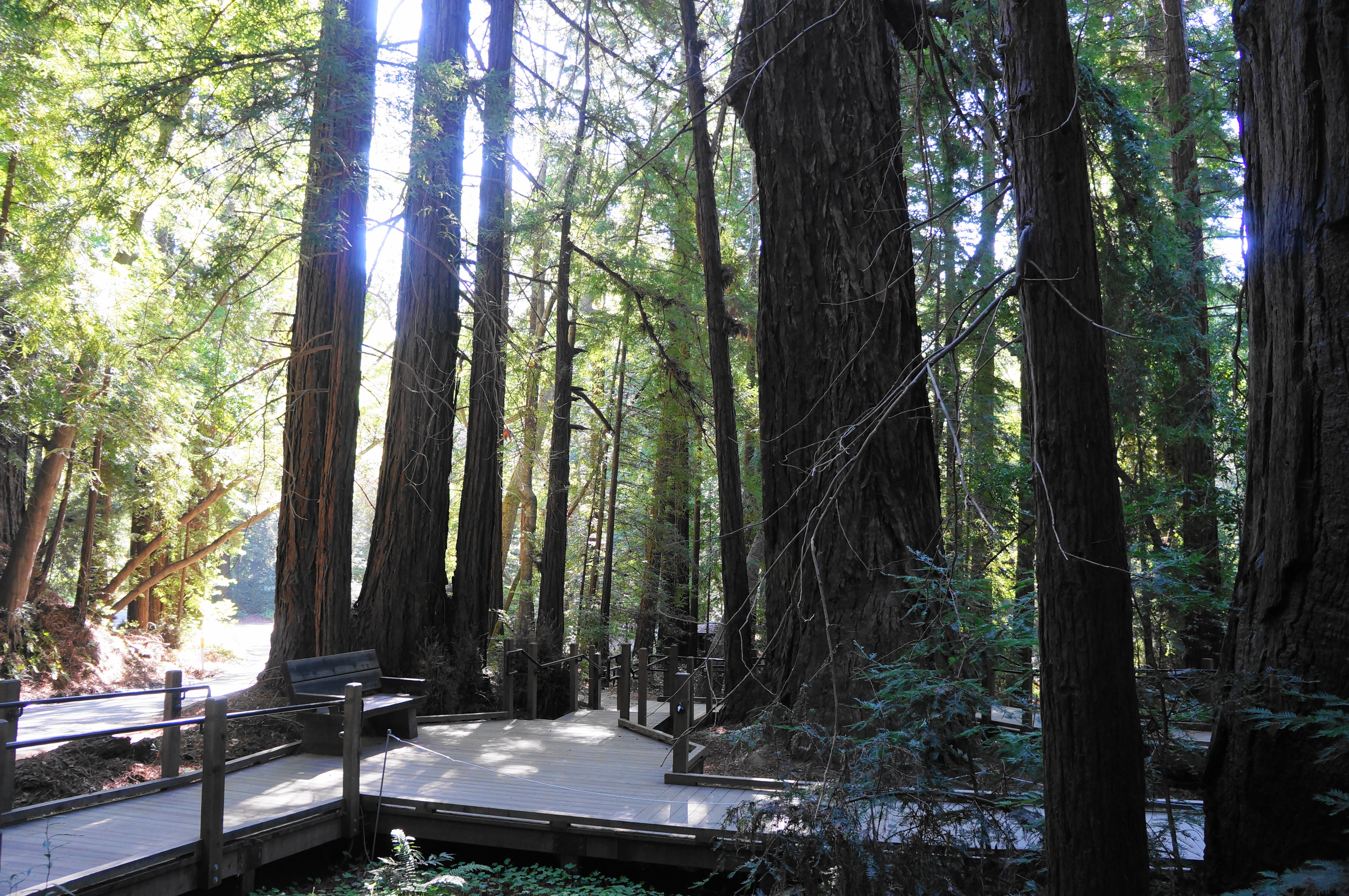
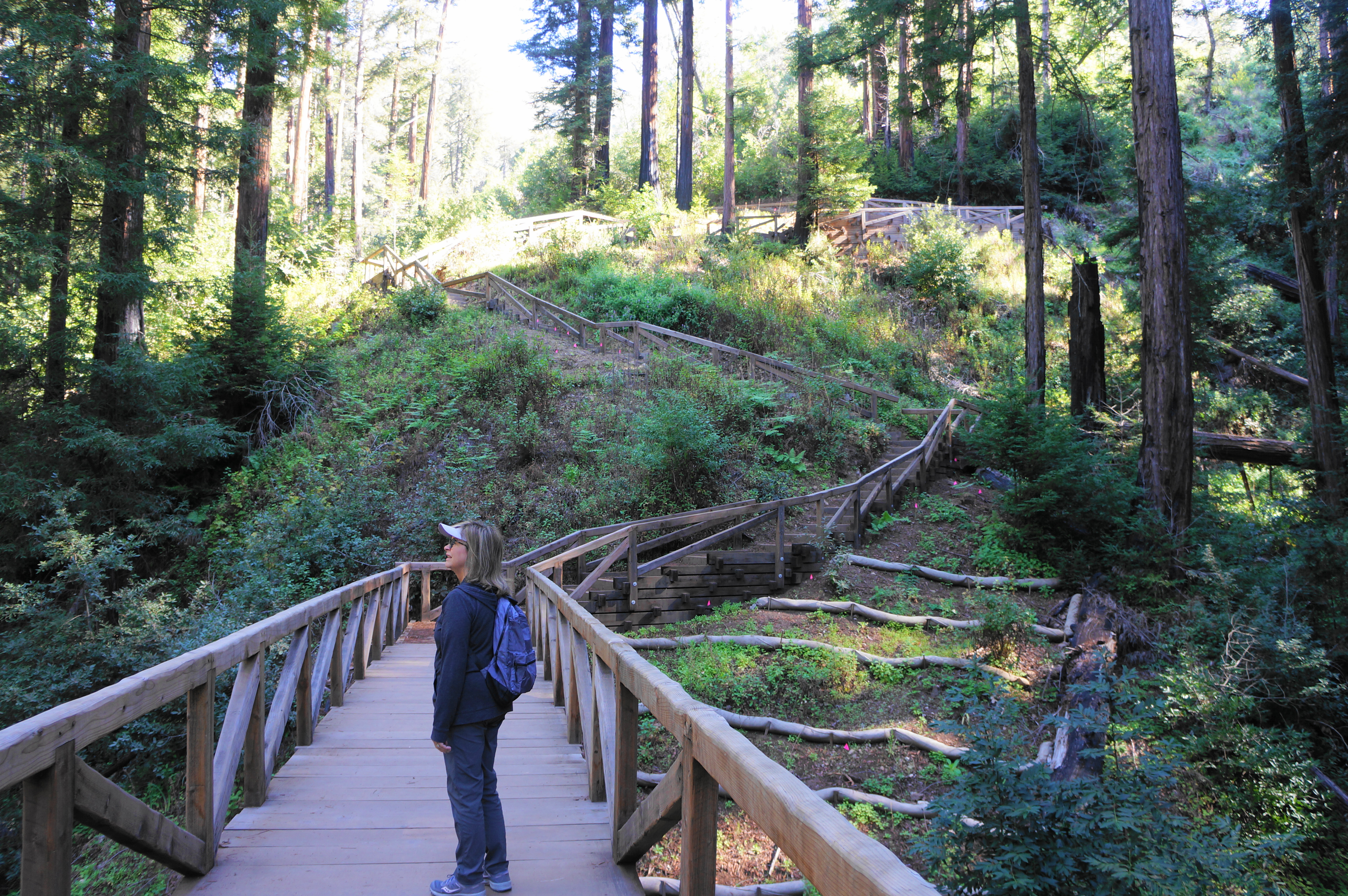
Follow the River Path to a set of picnic tables and a fork, where hikers can head right—across Pfeiffer Big Sur Road—to the Nature Trail. Stay left, however, to get to Pfeiffer Falls, passing soon through the Redwood Deck, a snaking, wooden boardwalk at the base of a set of wonderful old-growth redwoods. These hearty trees are near the southernmost part of the species’ range and—though they do not grow nearly as tall as their cousins farther north—are thoroughly majestic specimens nonetheless.
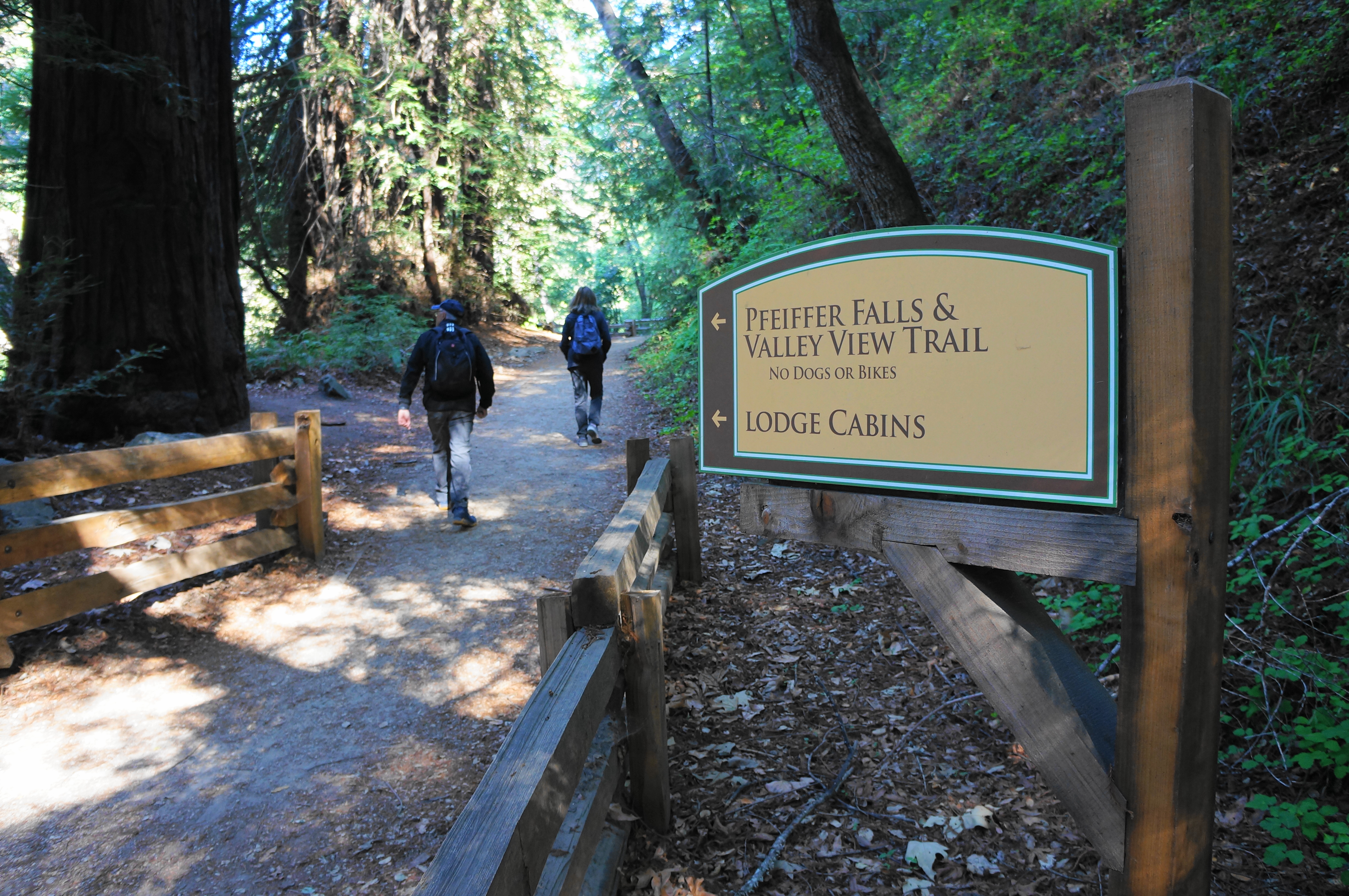
After passing through the Redwood Deck, the trail approaches Big Sur Lodge on the left. Cross the road here—away from the lodge—where hikers will quickly find the start of the Pfeiffer Falls Trail. The route begins at a gentle incline and quickly encounters a junction. Stay right, weaving through a more modest redwood grove and up a set of stairs. One can get views of Pfeiffer Redwood Creek—flowing in winter and spring—off to the left.
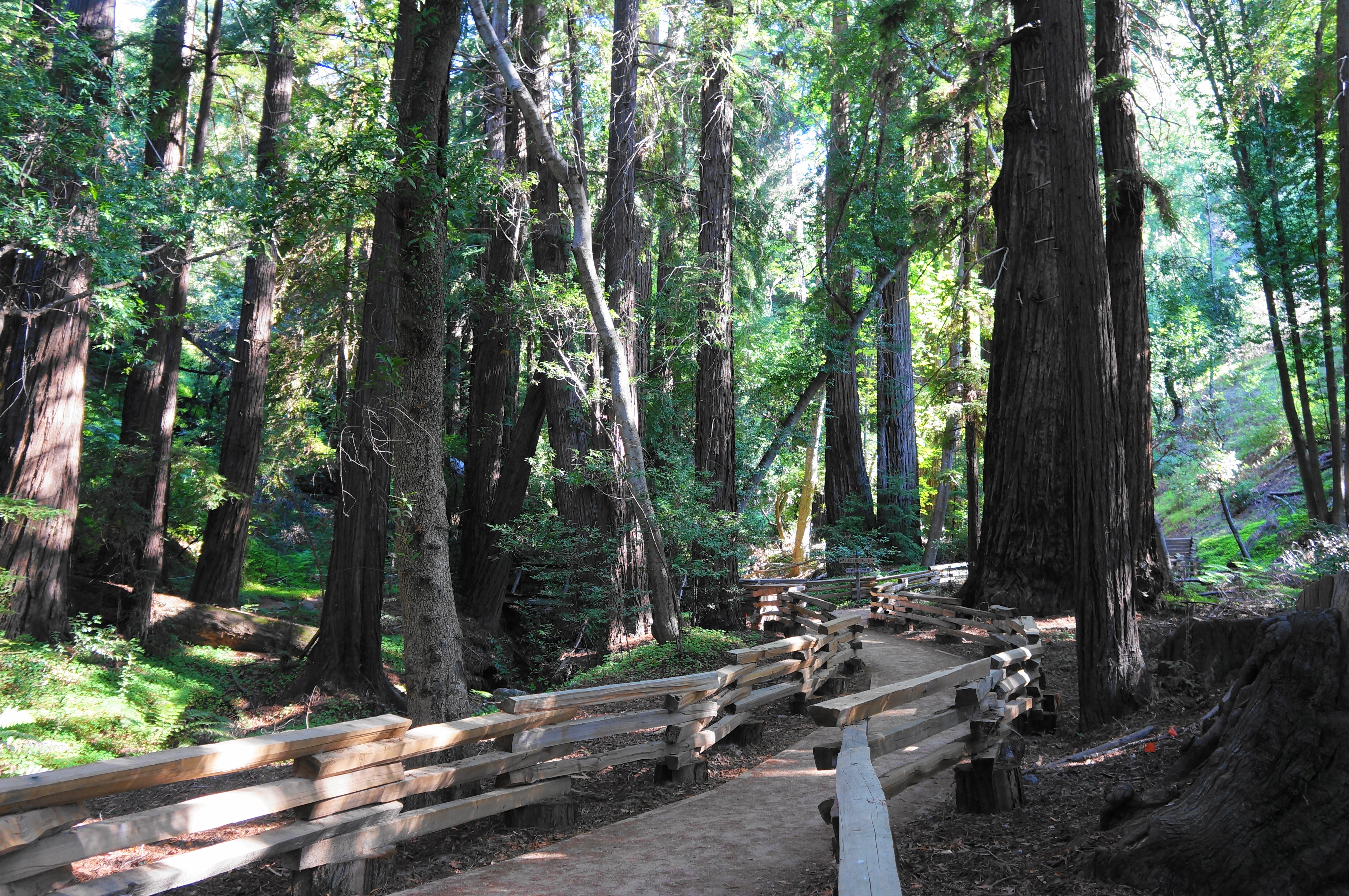
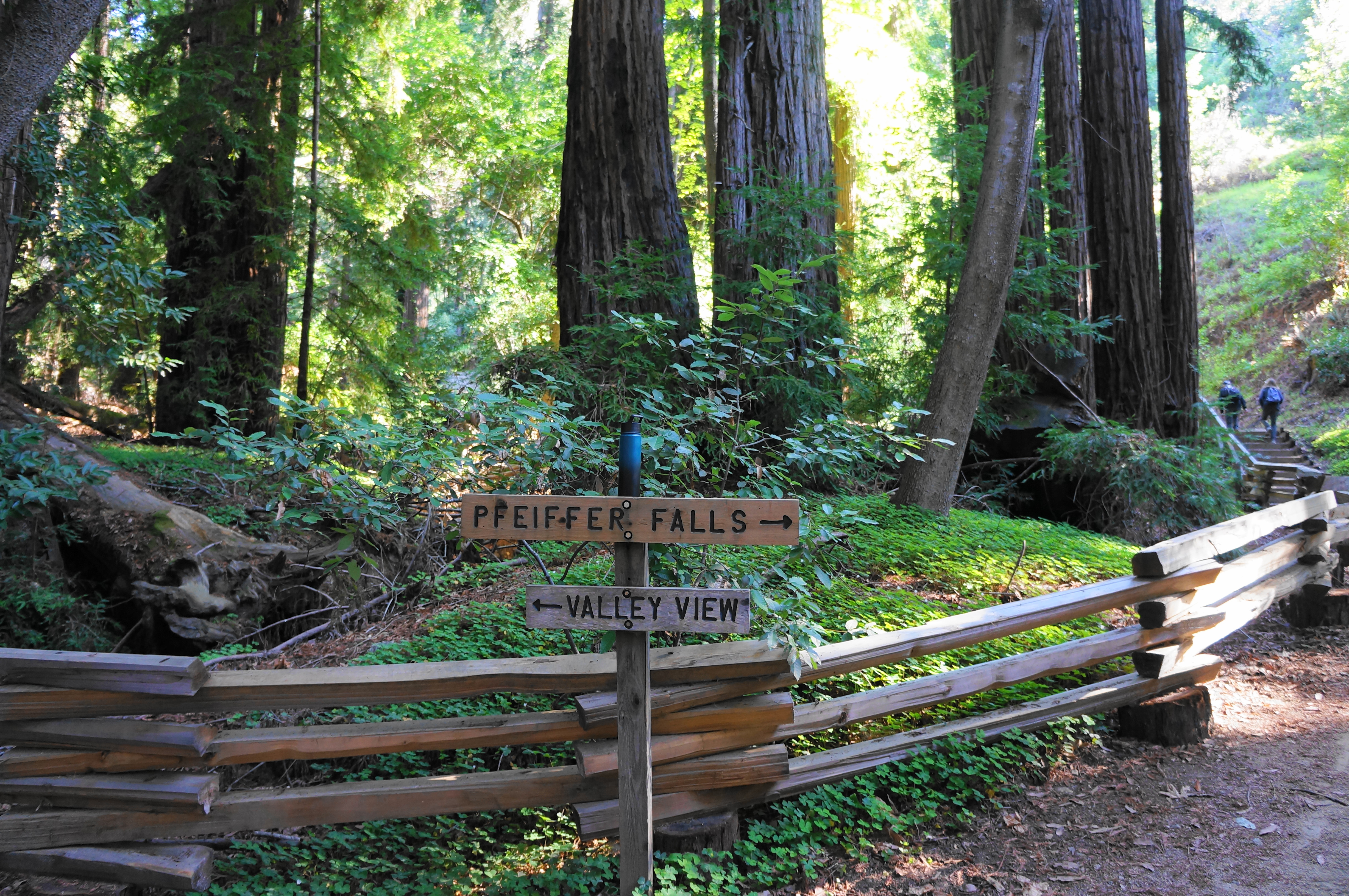
At 4/10 mile, the path abruptly empties out onto another road, with the official Pfeiffer Falls Trailhead (no parking though!) beyond. Here there is another information board and a bench or two. Head straight as the wide trail cuts through a denser redwood thicket. Soon enough hikers will find themselves at another marked junction: head right toward Pfeiffer Falls, leaving the Valley View Trail for the return route. (Note: Here the trail briefly leaves the state park and enters Los Padres National Forest.)
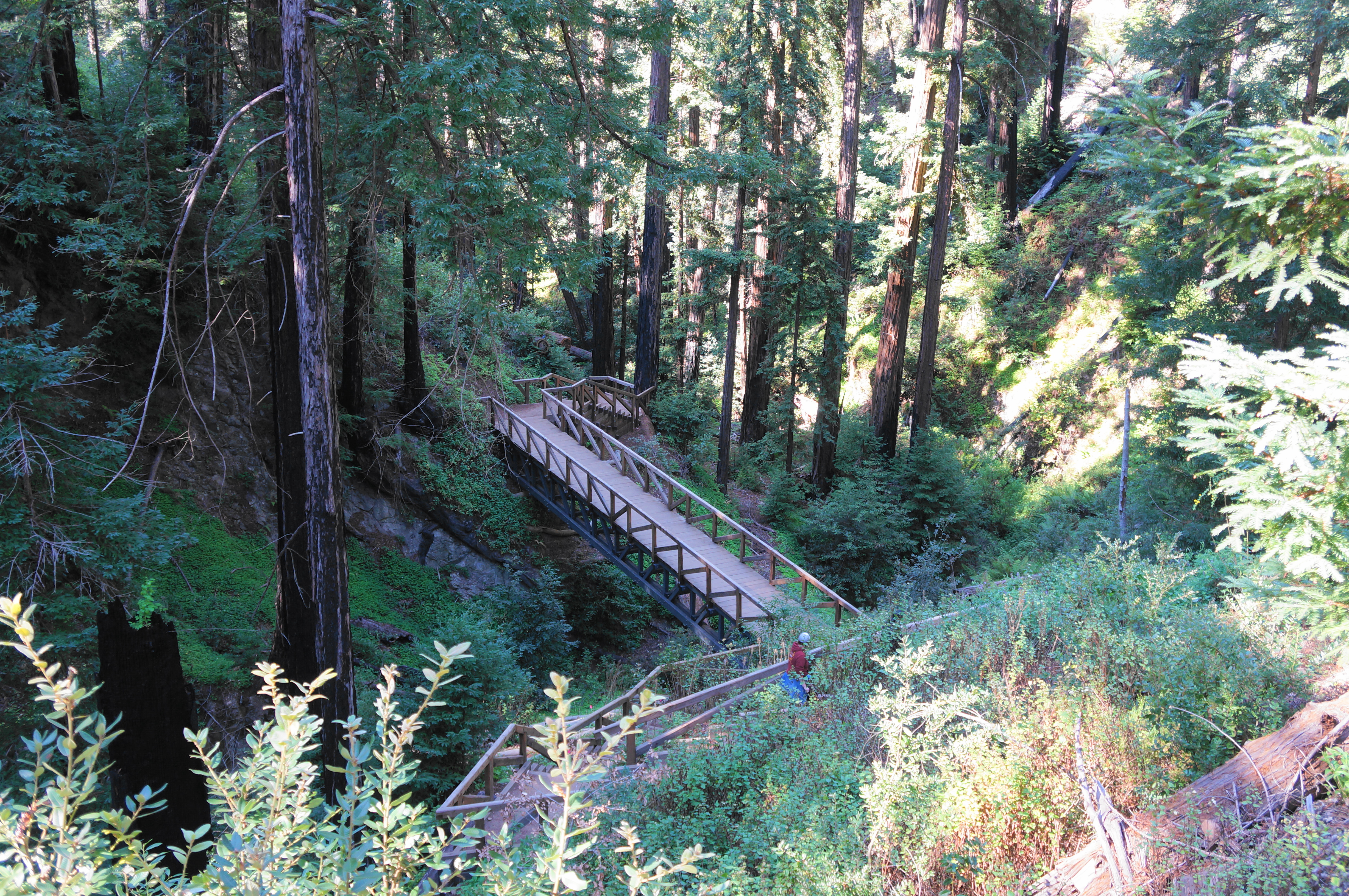
From here the trail rises more steeply, ascending staircases and skirting fern-lined hillsides as the canyon falls deeper off to the left. At 6/10 mile, hikers reach a long bridge (over a tributary creek), followed by a zig-zagging staircase that will leave some visitors huffing and puffing.
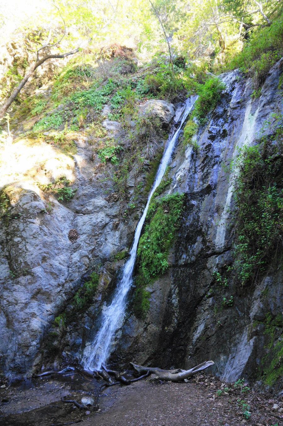
Thereafter, the Pfeiffer Falls Trail levels off considerably, making the remaining 2/10 mile to the falls relatively easy and enjoyable. The first look at Pfeiffer Falls comes at the upper overlook, a short spur that edges close to the base of the highest drop of the falls. After rains, the basin fills with water and the stream fans out in several chutes. Much of the season, however, the waterfall thins to a single veil on the far-left side of the wall.

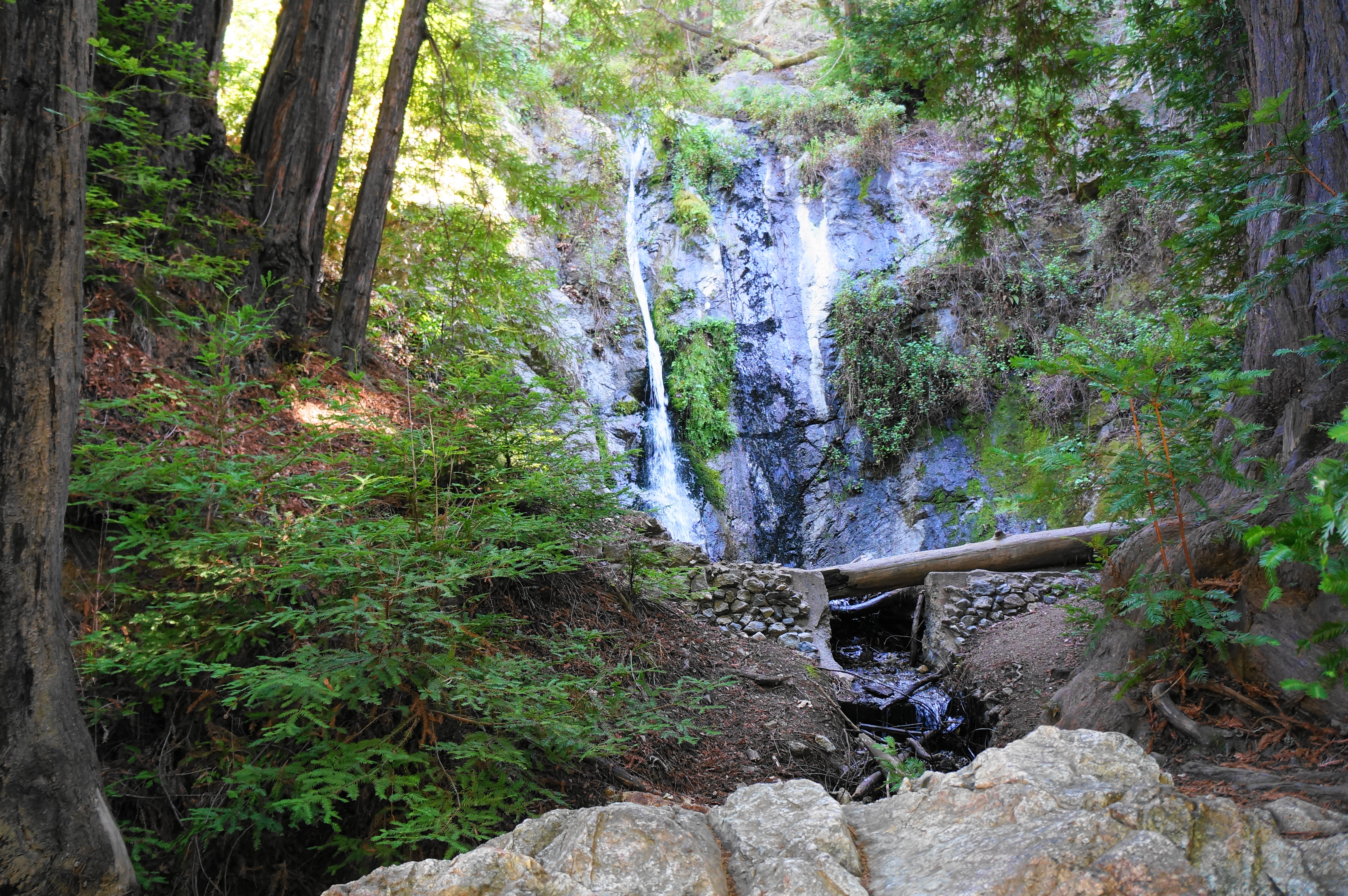
From the upper overlook, continue down the trail as it drops to another point with a farther view of the falls but that picks up some of the cascading stream below. Then the trail drops another level to a small bridge over Pfeiffer Redwood Creek, which offers the final view of the falls.
By now hikers are on their way back via the Valley View Trail, an alternative route that rises up out of the canyon and into the scrubby chapparal and oak/bay woodlands. Ascend a tributary, then follow the zig-zagging switchbacks to loftier heights, with partial, obscured views of the Big Sur River valley.
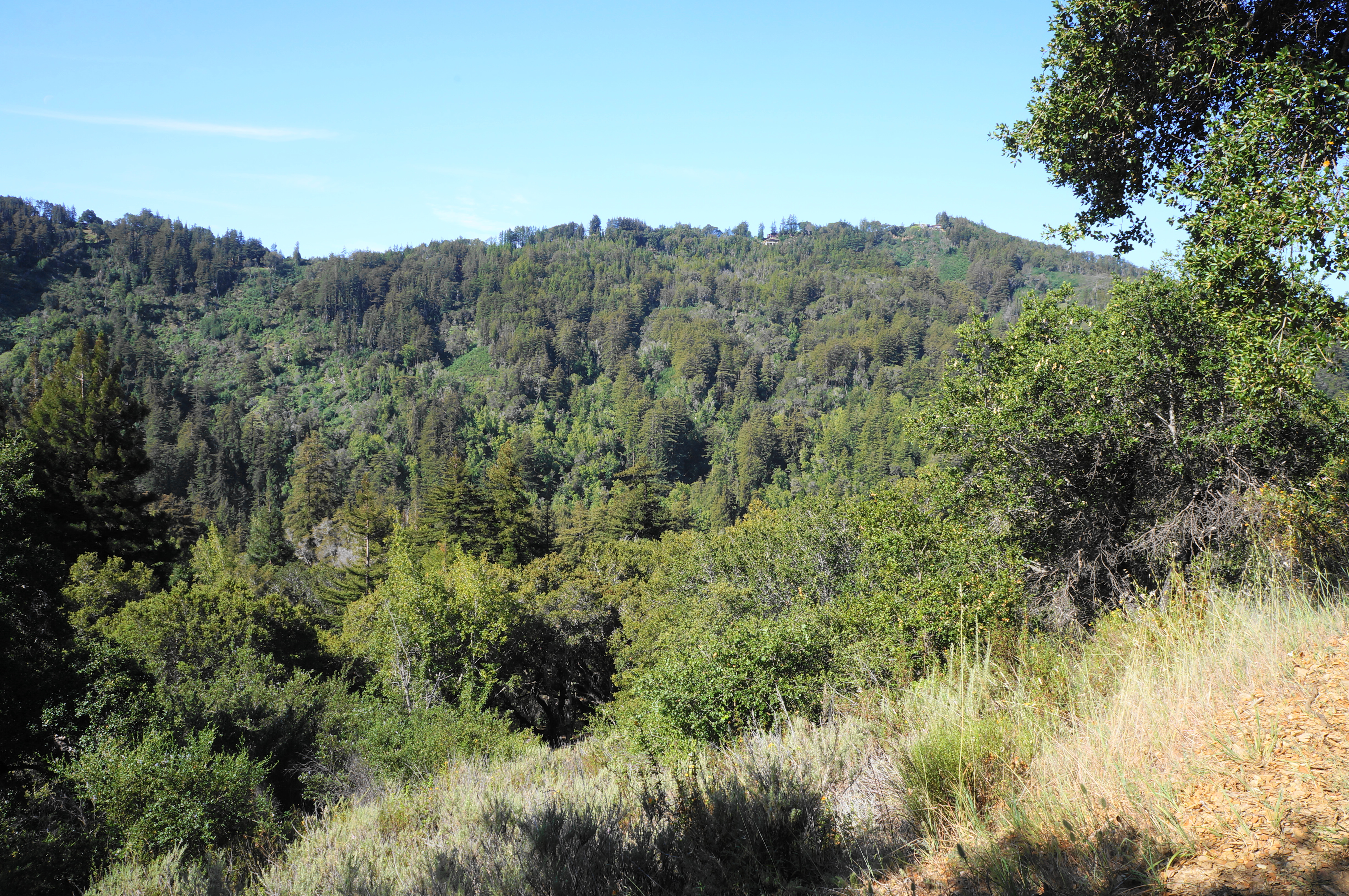
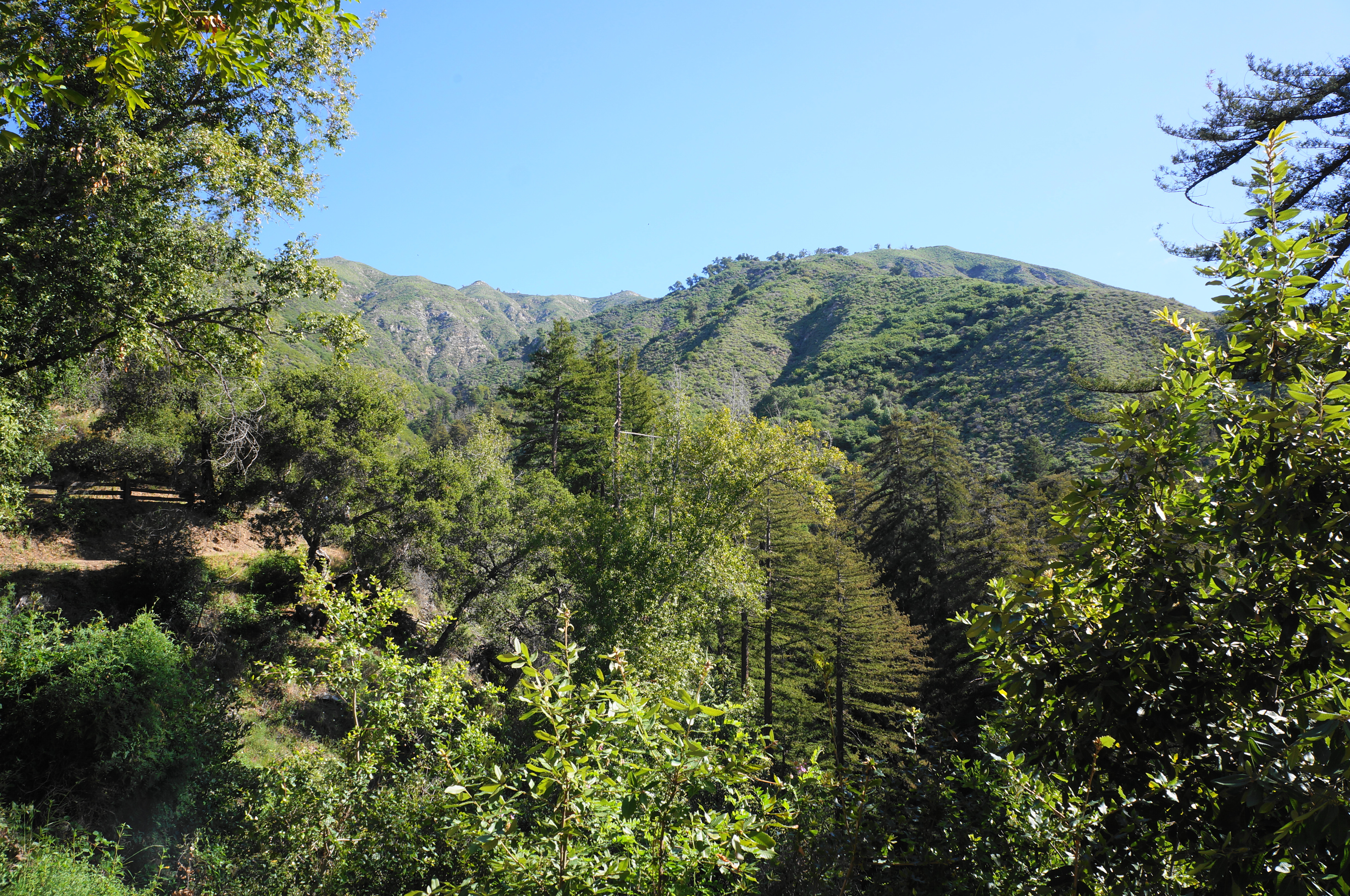
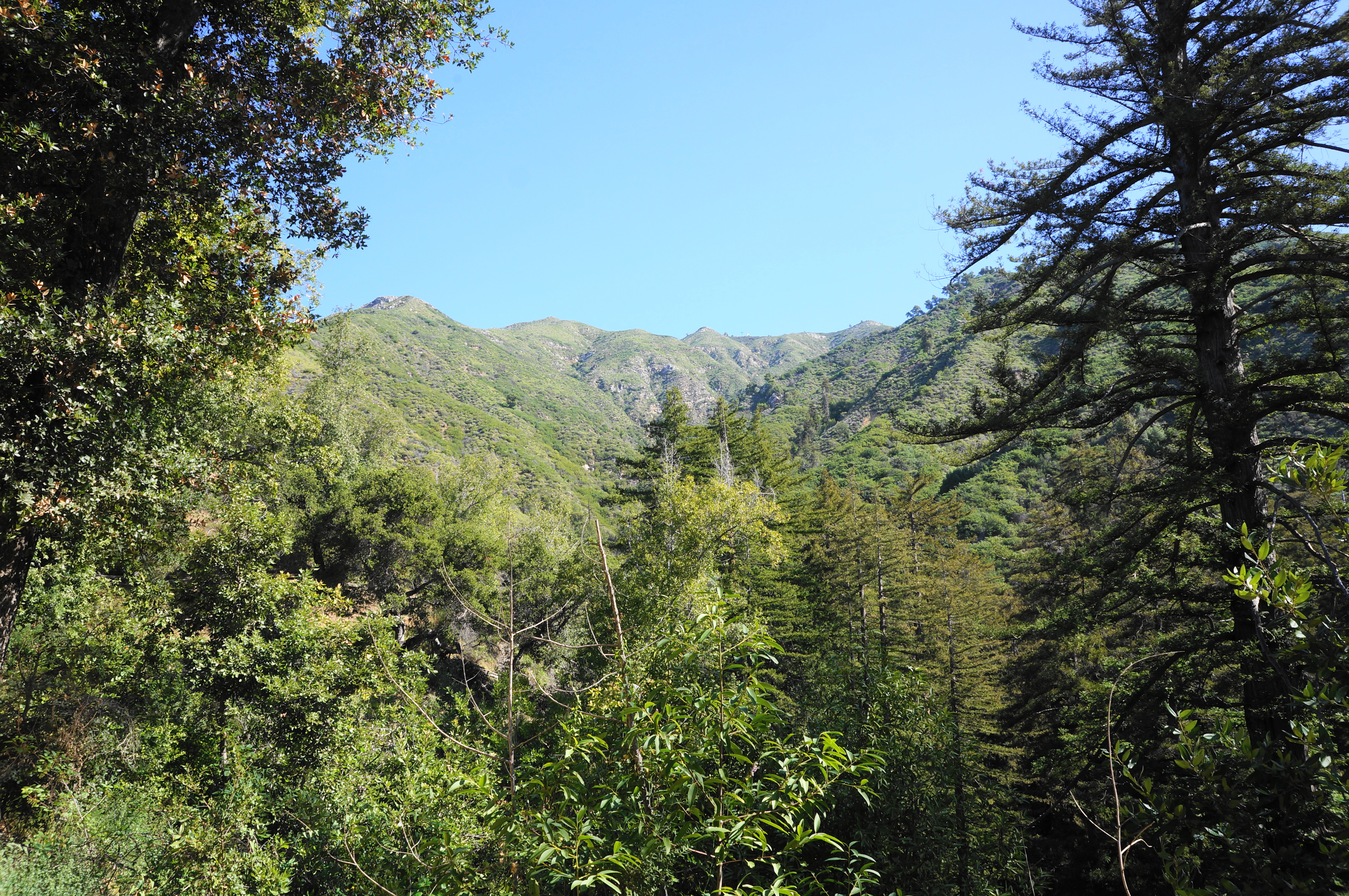
At the hike’s one-mile mark, a spur trail heads off to the right—this path offers access to Valley View, an open vista. Weary or hurried hikers, however, can continue left, dropping back down into thicker forest. After quickly shedding about 300 feet, the Valley View Trail returns to Pfeiffer Redwood Creek and crosses it, followed quickly by the junction with the Pfeiffer Falls Trail. Bear right, retracing your steps back to the road crossing. Follow the trail continuation as it returns to thick redwoods and descends to Big Sur Lodge. Here, bear left on the River Path, heading back through the Redwood Deck and past the amphitheater to return to the trailhead.

Pingback: Top 10 Hikes in 2022 | Live and Let Hike