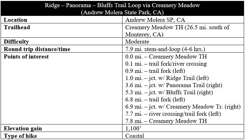
Traversing a scrubby escarpment above the Pacific Ocean, the Ridge – Panorama – Bluffs Trail is a pleasant 8-mile jaunt in the Big Sur area and one of the best hikes in Andrew Molera State Park. Don’t be fooled by the gads of visitors at the parking area: most are headed for the Molera Ranch House or the beach at Molera Point. The majority of the walk spans more rugged terrain that thins the crowds and opens up the fantastic views: up the coast to Point Sur and across the Big Sur River Valley to the Santa Lucia Mountains. The loop twice offers beach access (along short spur trails) and combines a diversity of flora, including a small patch of redwoods.

The hike
Most trips to Andrew Molera State Park—situated about 25 miles south of Monterey, California—begin at the Creamery Meadow Trailhead, where there is an entrance station and a large gravel parking area. Park here, make your way back past the entrance station, then take a hard right, passing under a white gateway. Follow the wide track, passing the pasture land of Molera Ranch on the left (this field is a favorite of ground squirrels!). At the first right, take the route heading down to the banks of the Big Sur River.
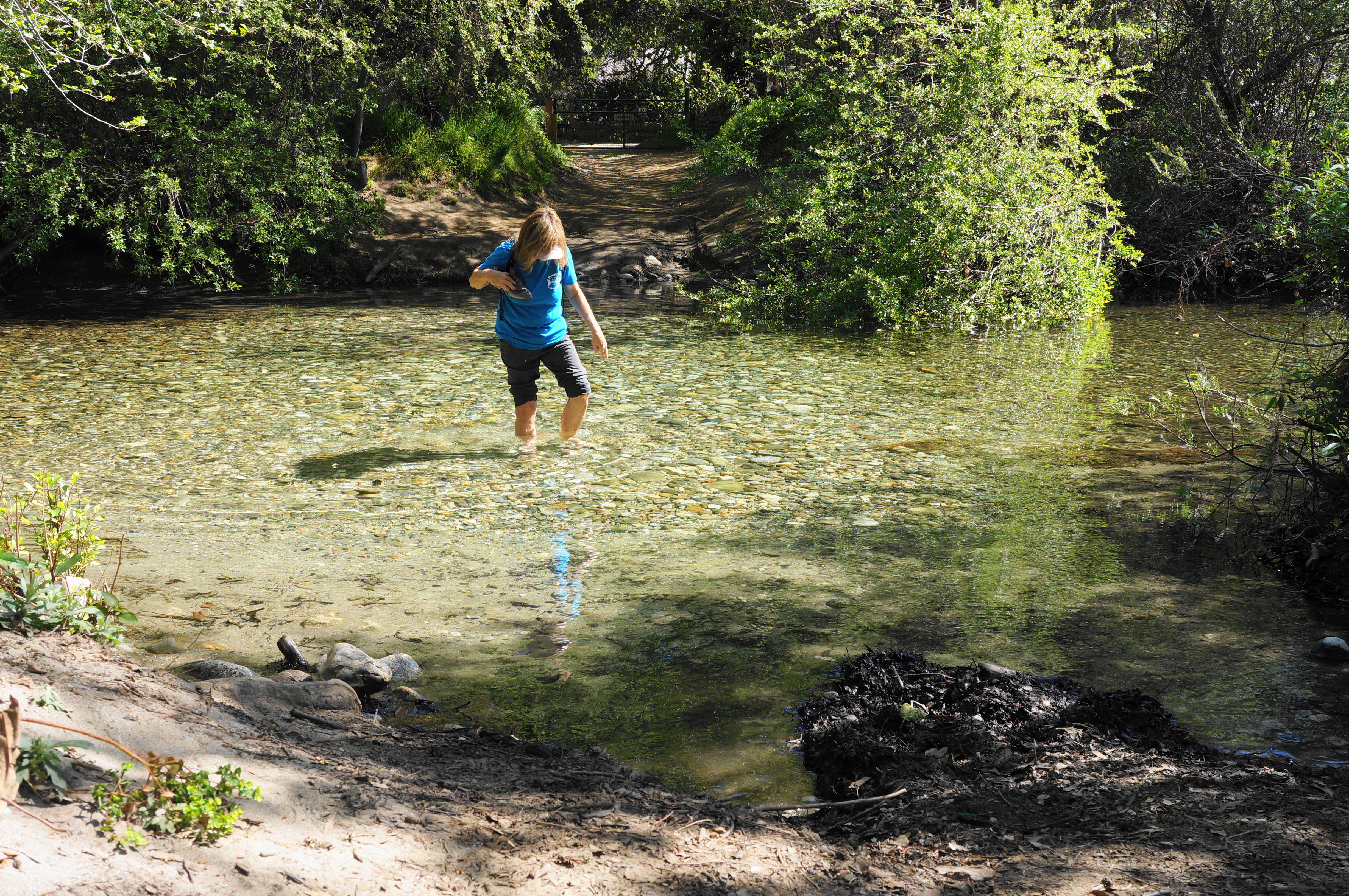
Here there is a footbridge that is only in place in summer; at all other times, hikers will have to ford the chilly but relatively still waters—expect at least ankle- to shin-high levels; there is no way to avoid wet feet here. This is the only river crossing on the hike, however (although one has to do it twice), and the onward trail returns quickly to dry, sunny flats along the northern edge of Pfeiffer Ridge.
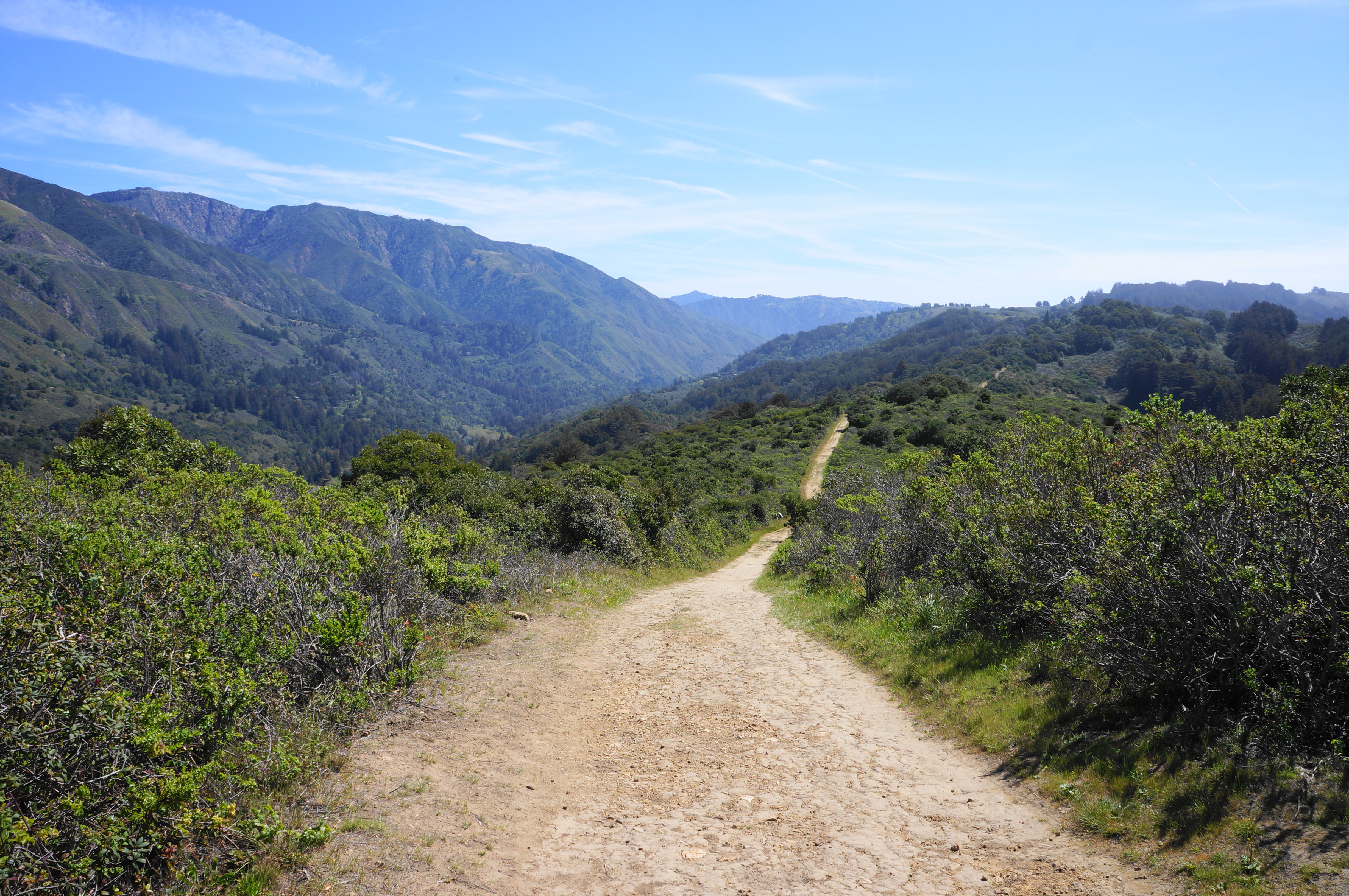
Bear right at the fork just past the ford, then follow the Creamery Meadow Trail for about ¾ mile, passing some open patches on the right astride what is largely a rather dull connector path. Things get more interesting after a junction at about 9/10 mile, where hikers should bear left, climbing immediately on the Ridge Trail. The thick scrub fades as the path rises to a low gap and second fork with open views of Pfeiffer Ridge and the surroundings. This is the start of the loop portion of the hike.
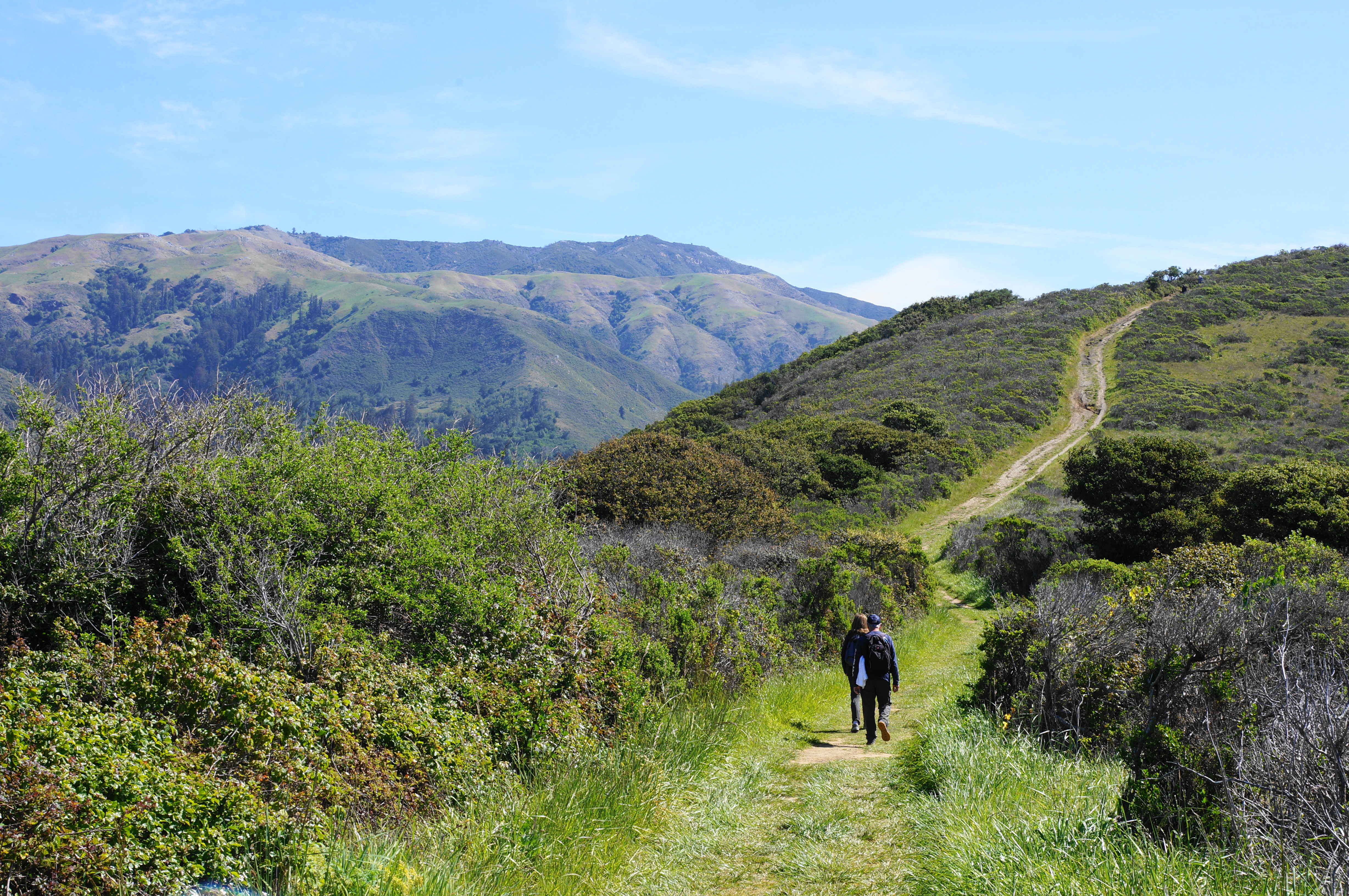
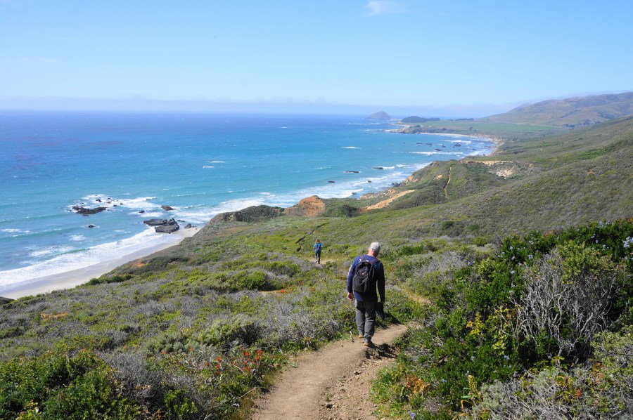
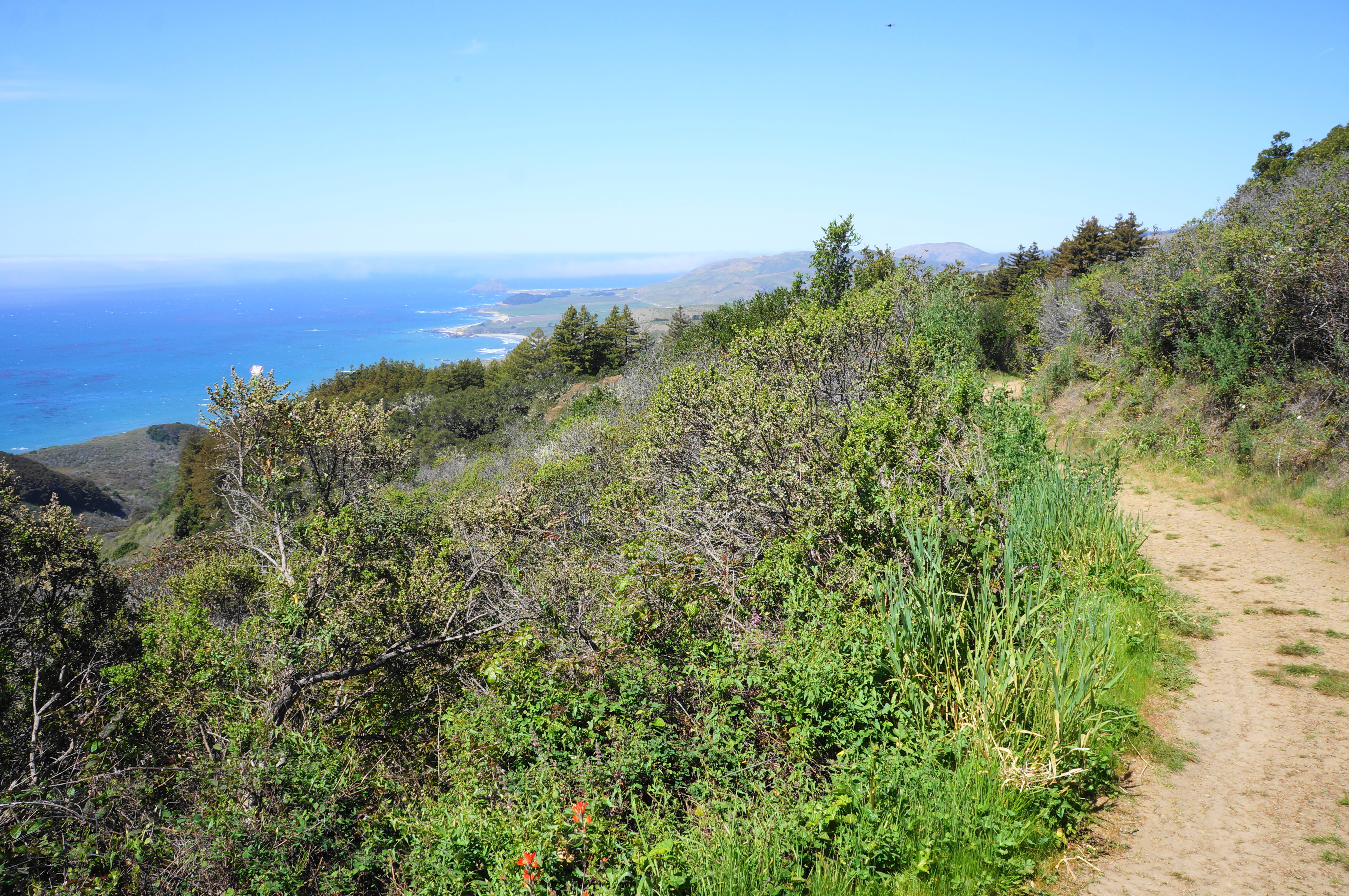
Bearing left to tackle the ridgeline first, follow the dirt track as it ascends through scrubby chaparral, steadily gaining height. Look back north for views of Molera Point and the primary beach, with a small cypress stand perched atop a windswept hill near the ocean. More and more of the coastline is revealed as the Ridge Trail rises further: eventually one can see to Point Sur and beyond.
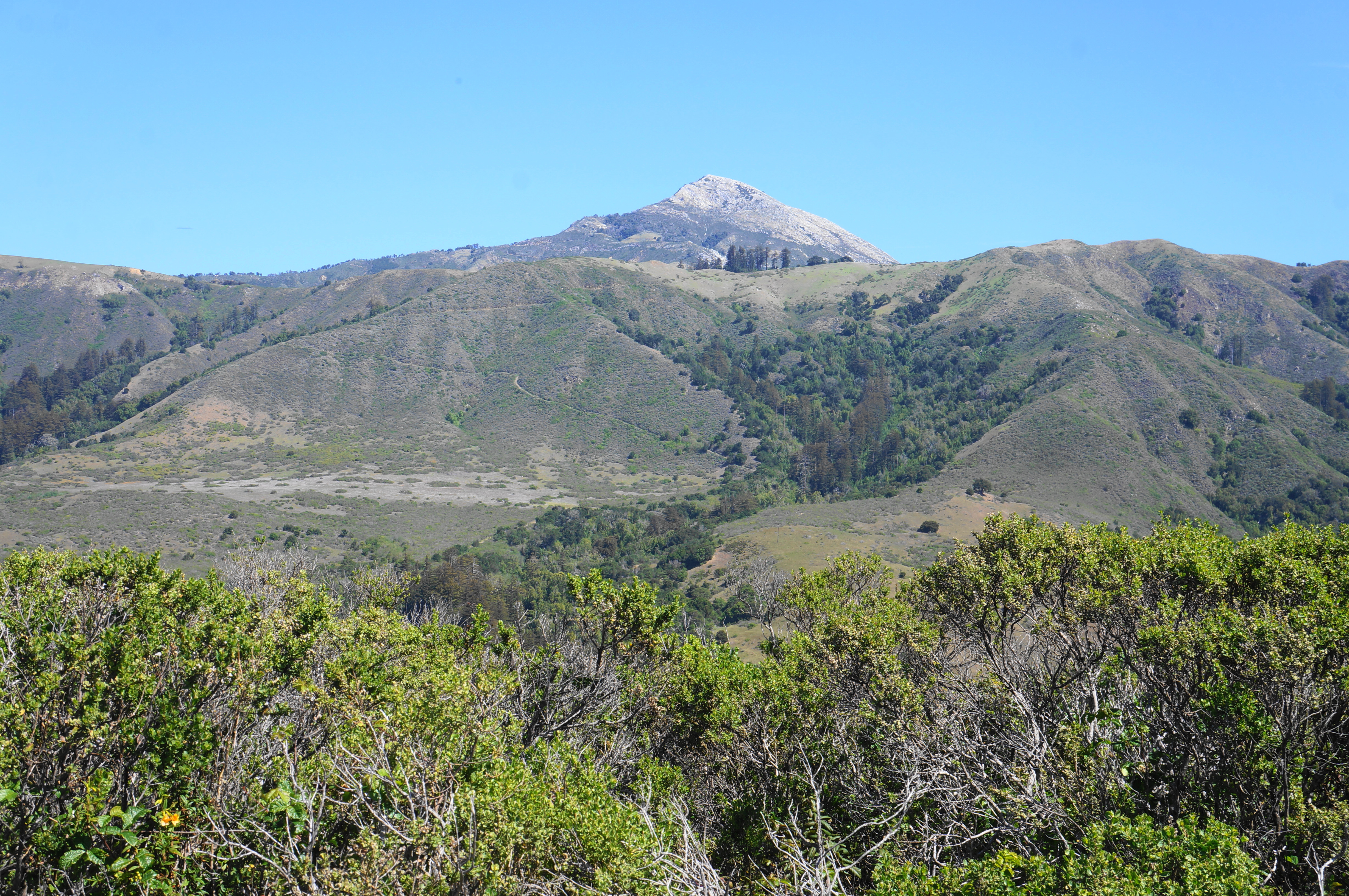
After about ½ mile of continuous climbing, there is a brief flat that offers views of Pico Blanco (3,709’), a towering mountain that at first glance appears snow-capped—until, upon closer inspection, it is revealed to be a mix of limestone and marble. Pico Blanco is considered to be central to the origin story of the native Esselen people and later came to be mined for its limestone deposits. The peak is not one of the highest mountains in the Santa Lucia Range but perhaps one of the most iconic.
By now hikers have gained around 400 feet, but there is plenty more to go. The incline picks up again for about 1/3 mile, then levels and even descends briefly. As Mount Manuel and Cabezo Prieto dominate the skyline to the southeast, the vegetation around the path grows thicker; eventually even the pines, oaks, and bay trees return, with some berry-bearing toyon mixed in. After passing a junction with the (closed) Hidden Trail on the left, there is a gap off to the right with views down to the Pacific.
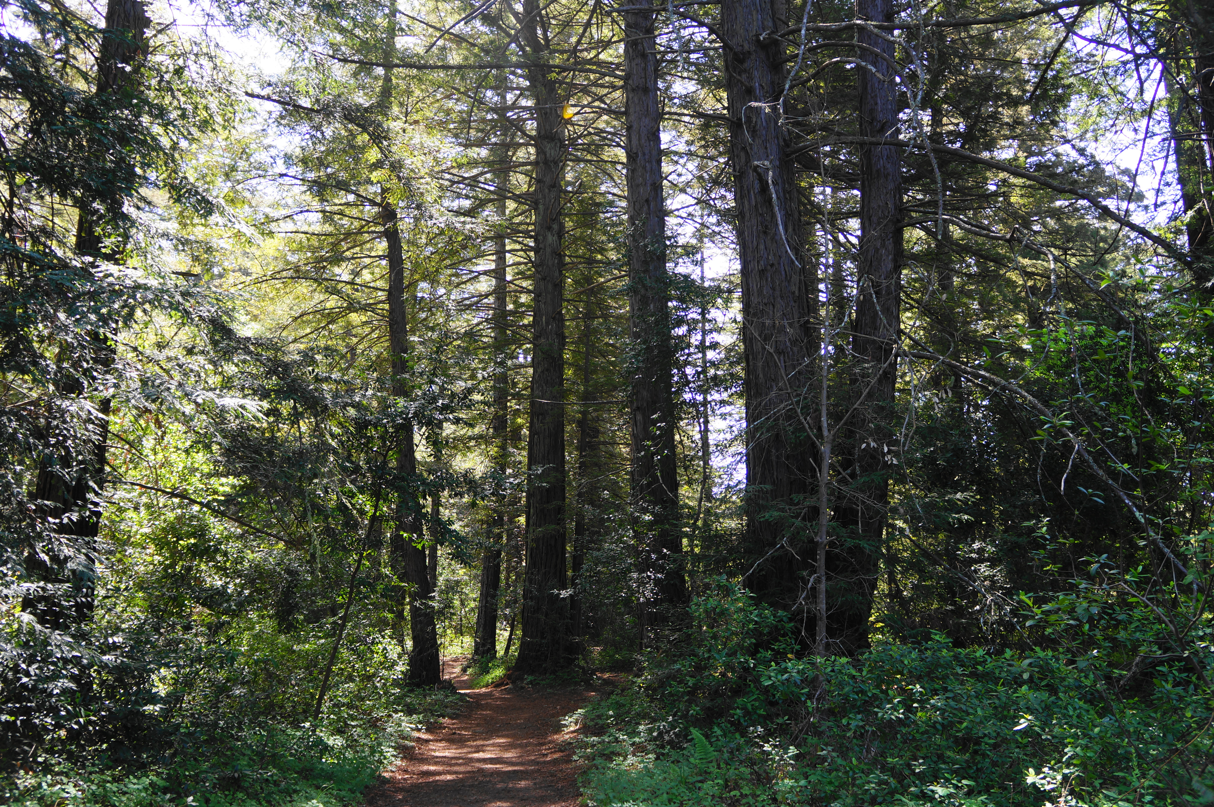
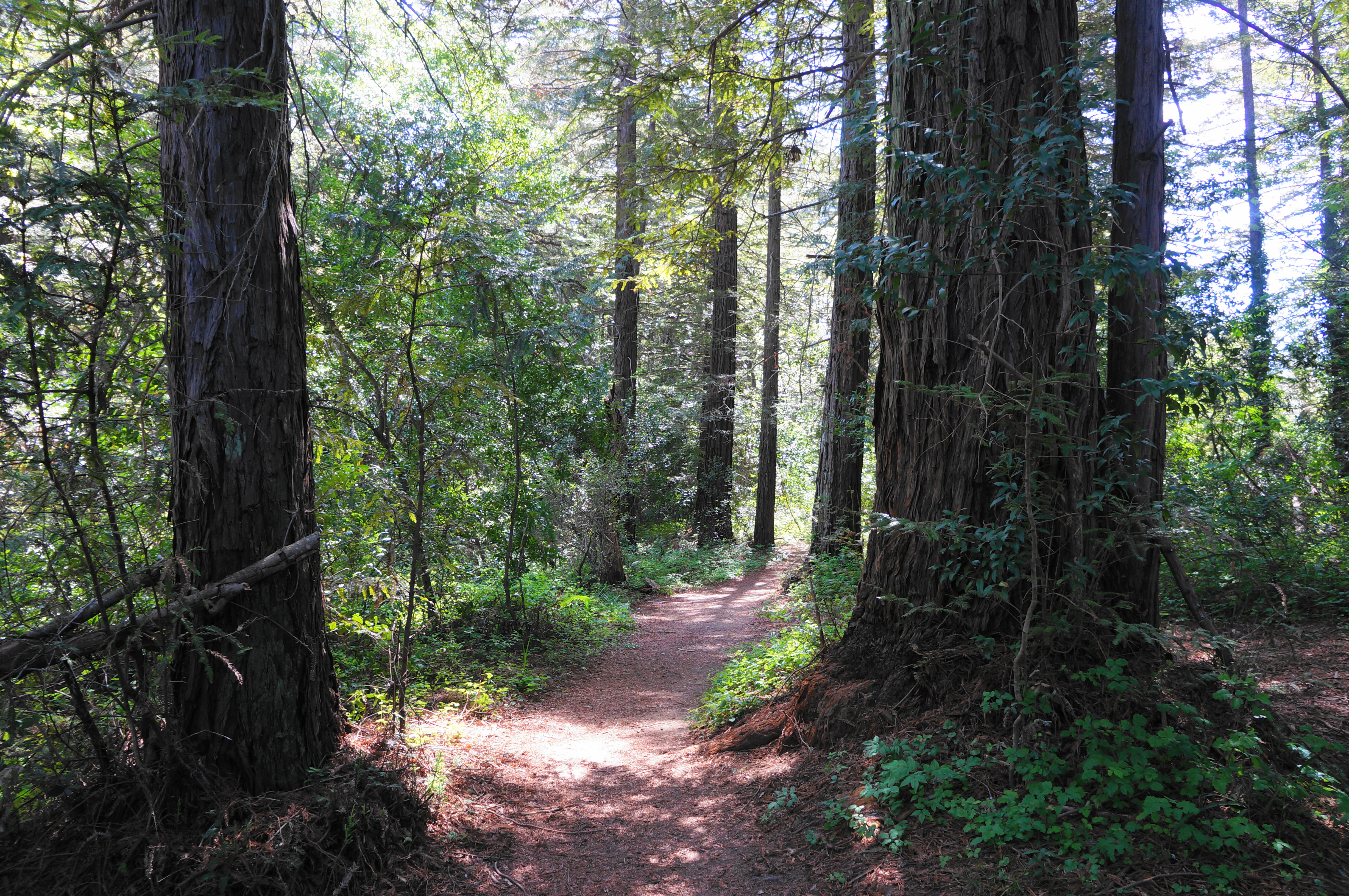
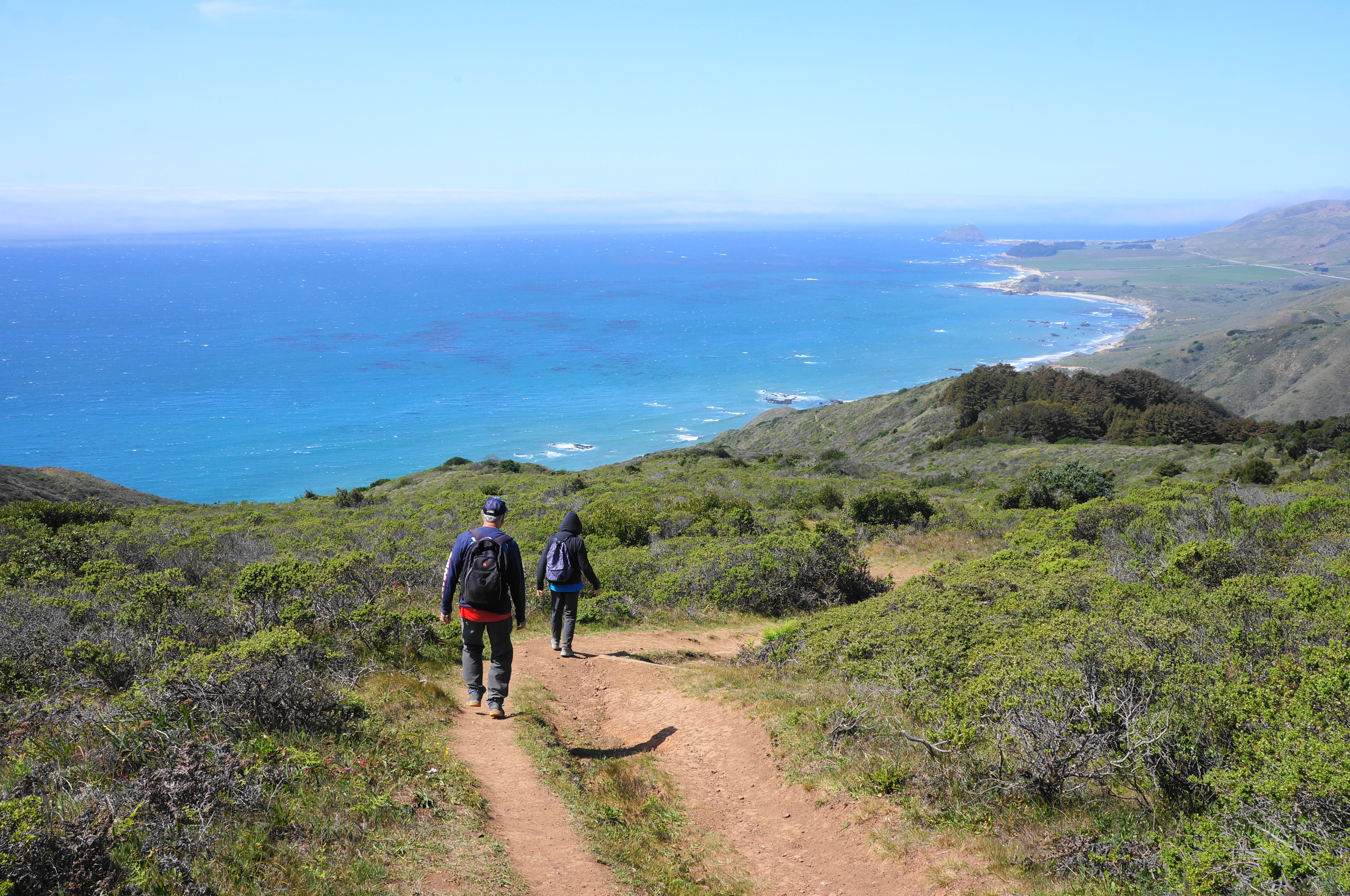
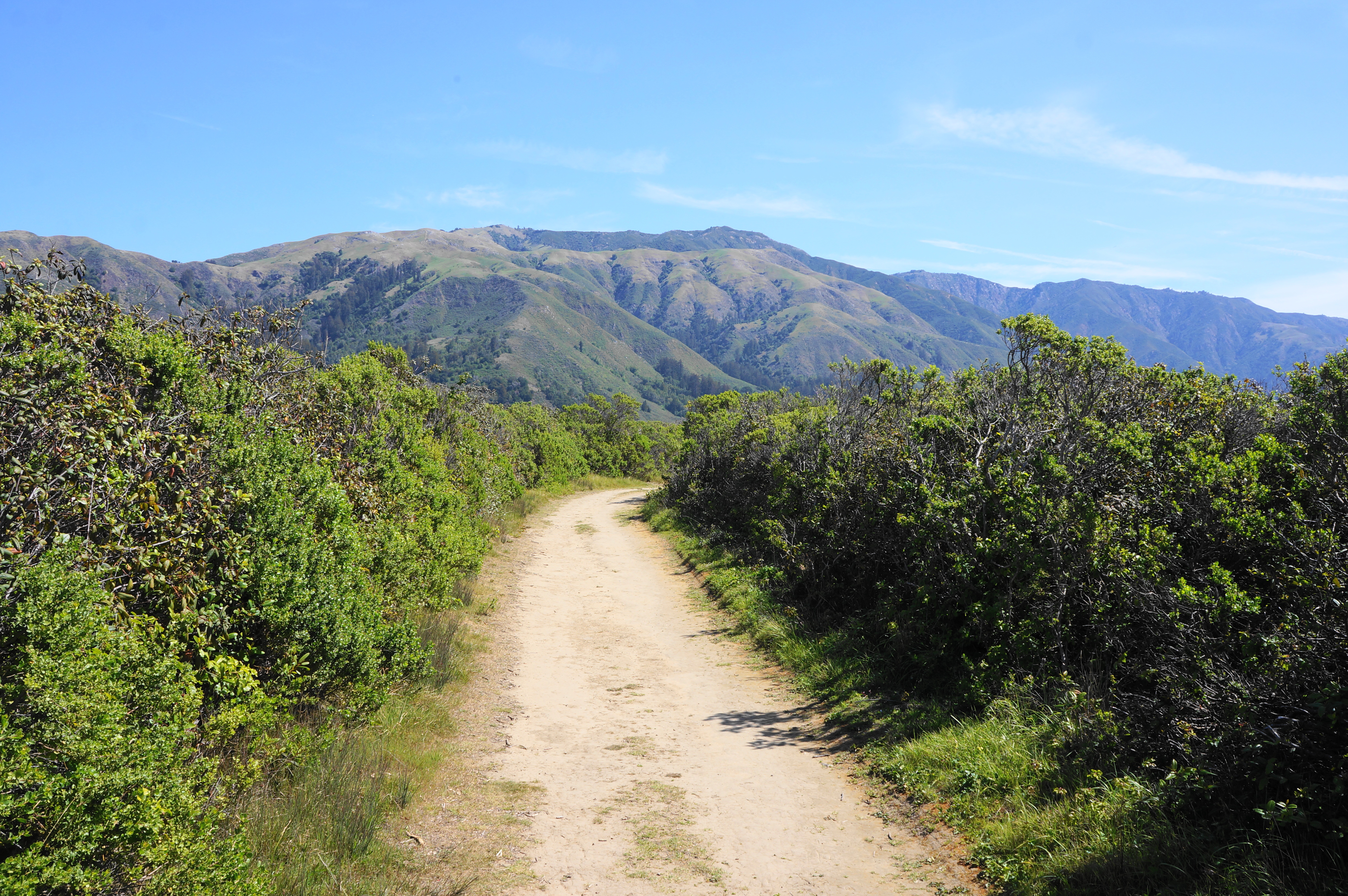
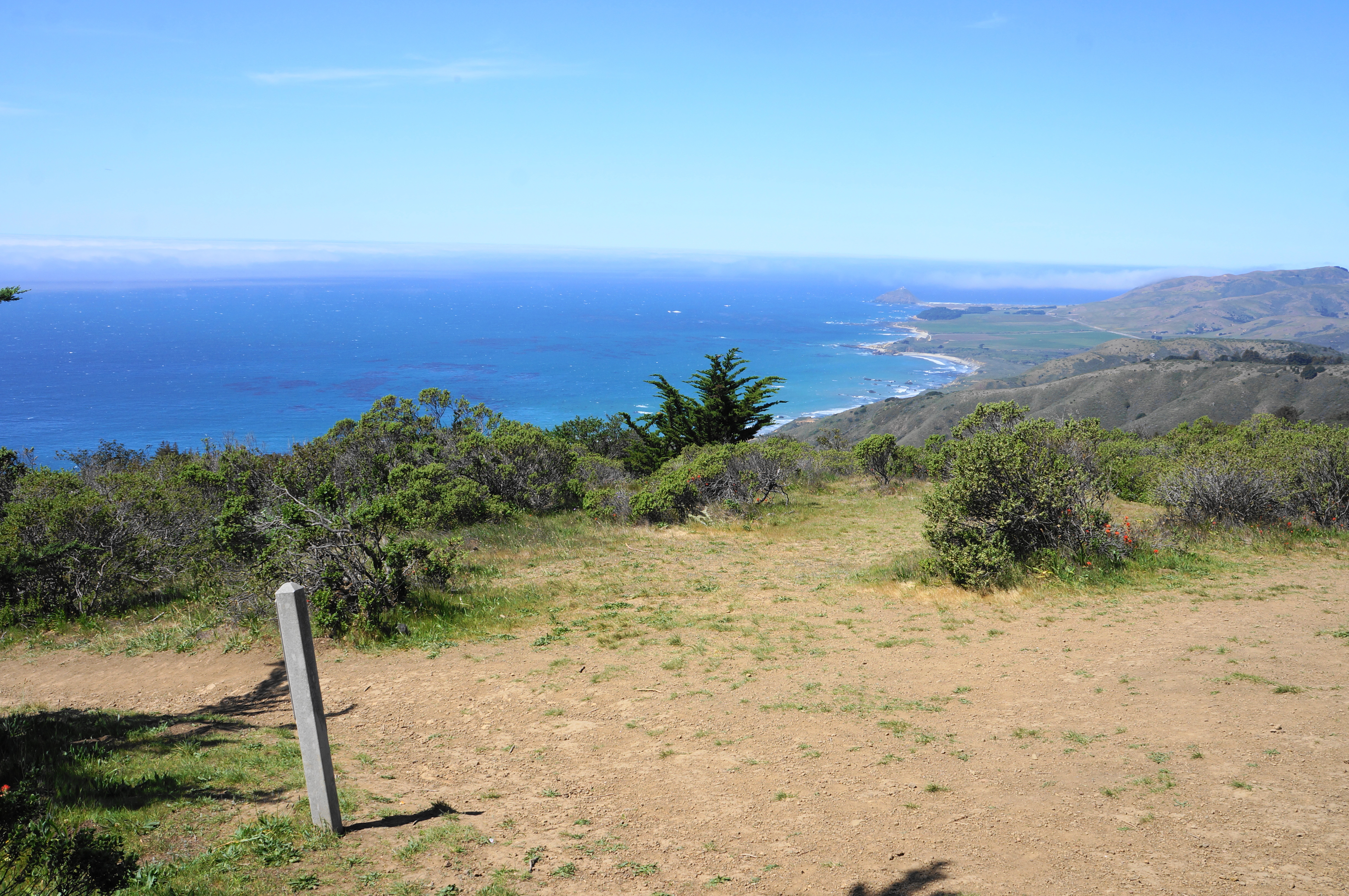
As the trail heads uphill again, madrones, bays, and oaks make for nice tree cover. After a junction with the South Boundary Trail, at about 2.9 miles, the route passes through a modest redwood grove—not one of the most impressive in the area but pleasant enough. After staying relatively level for around ¼ mile, the Ridge Trail makes a final push, with vistas back north along the coast. At last, about 3.6 miles from the start, the Ridge Trail ends abruptly at a high point under the shade of a large cypress tree. This is a natural spot to stop for lunch or a snack, enjoying the views of the Pacific.
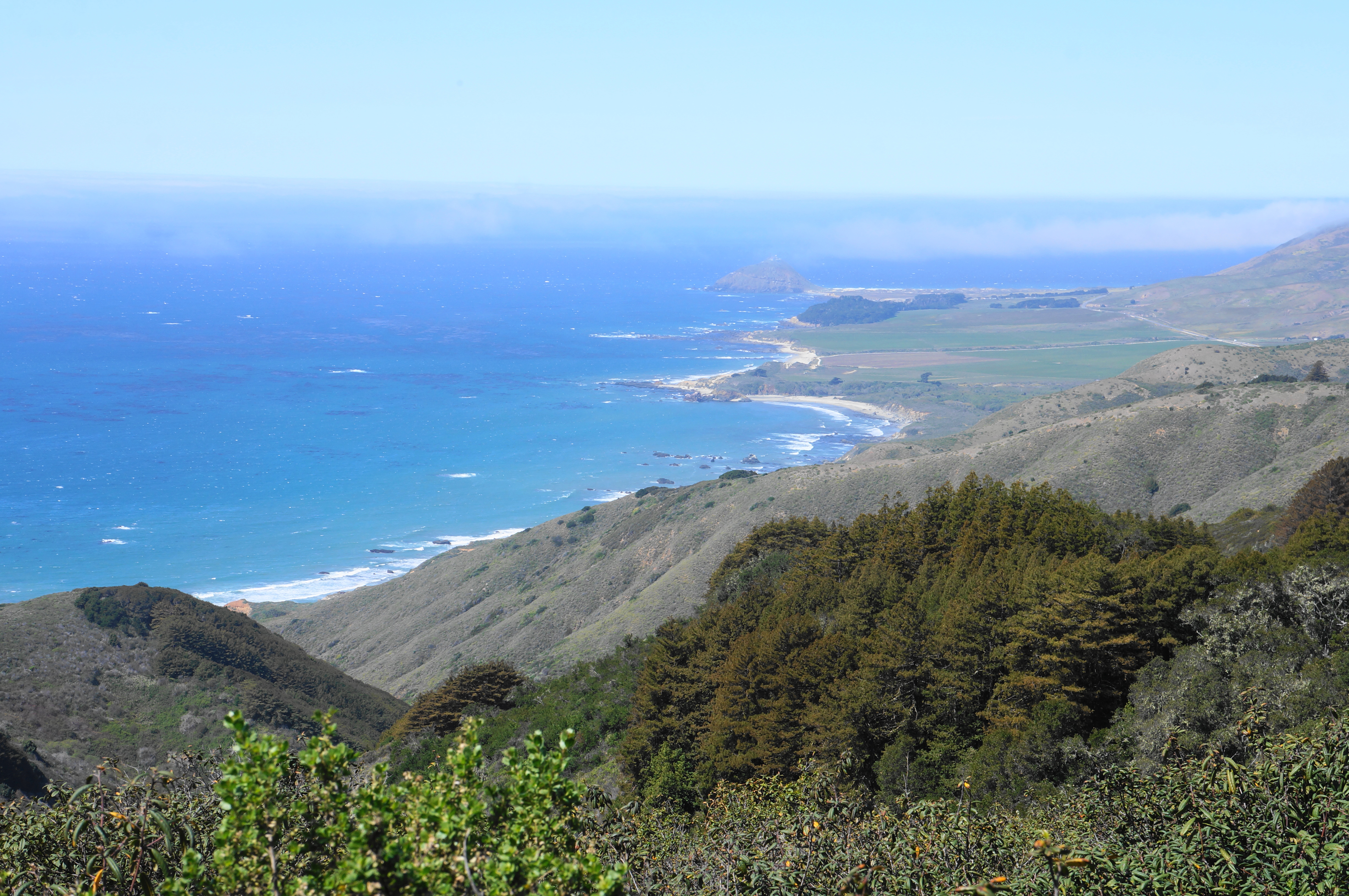
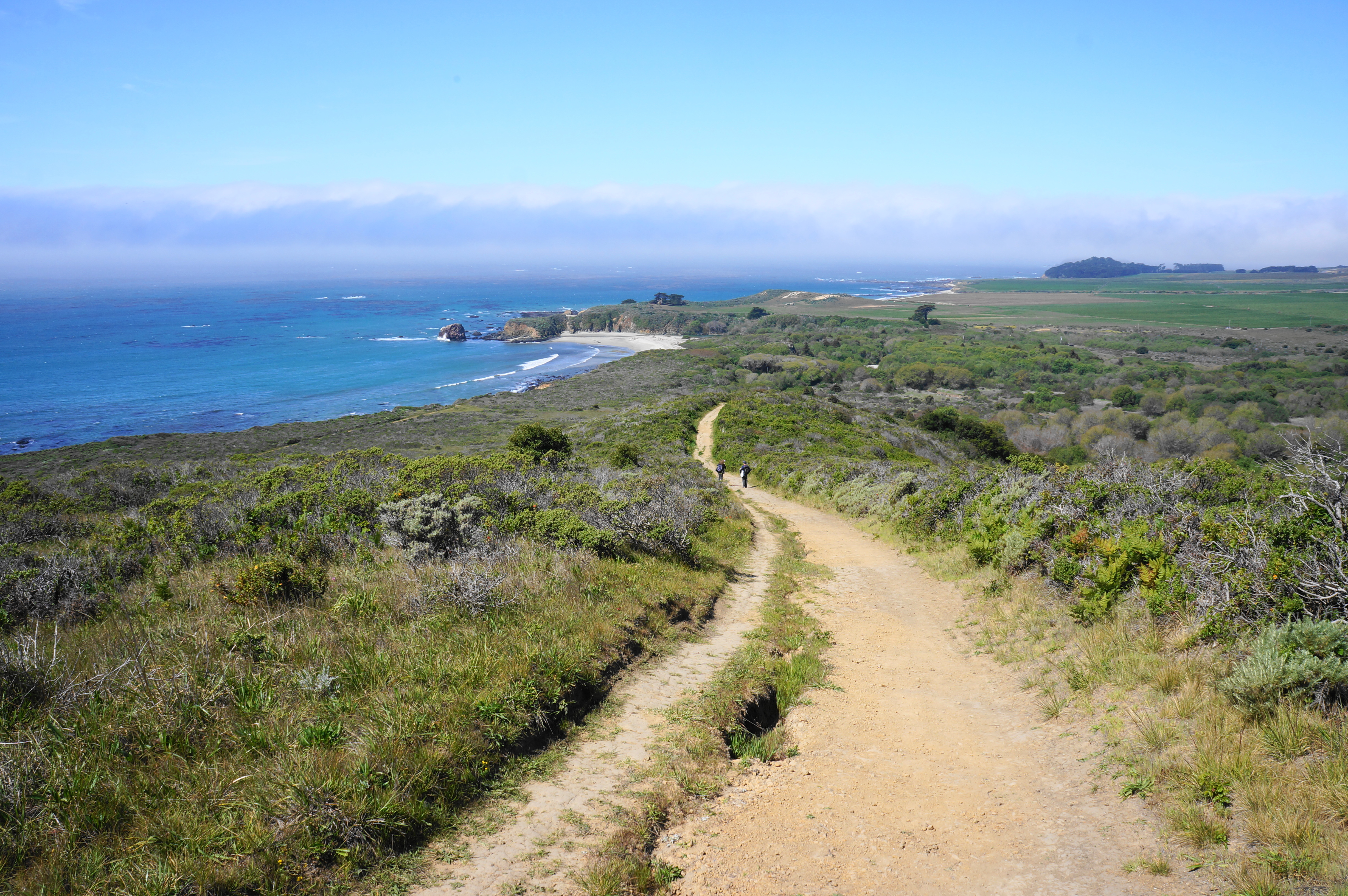
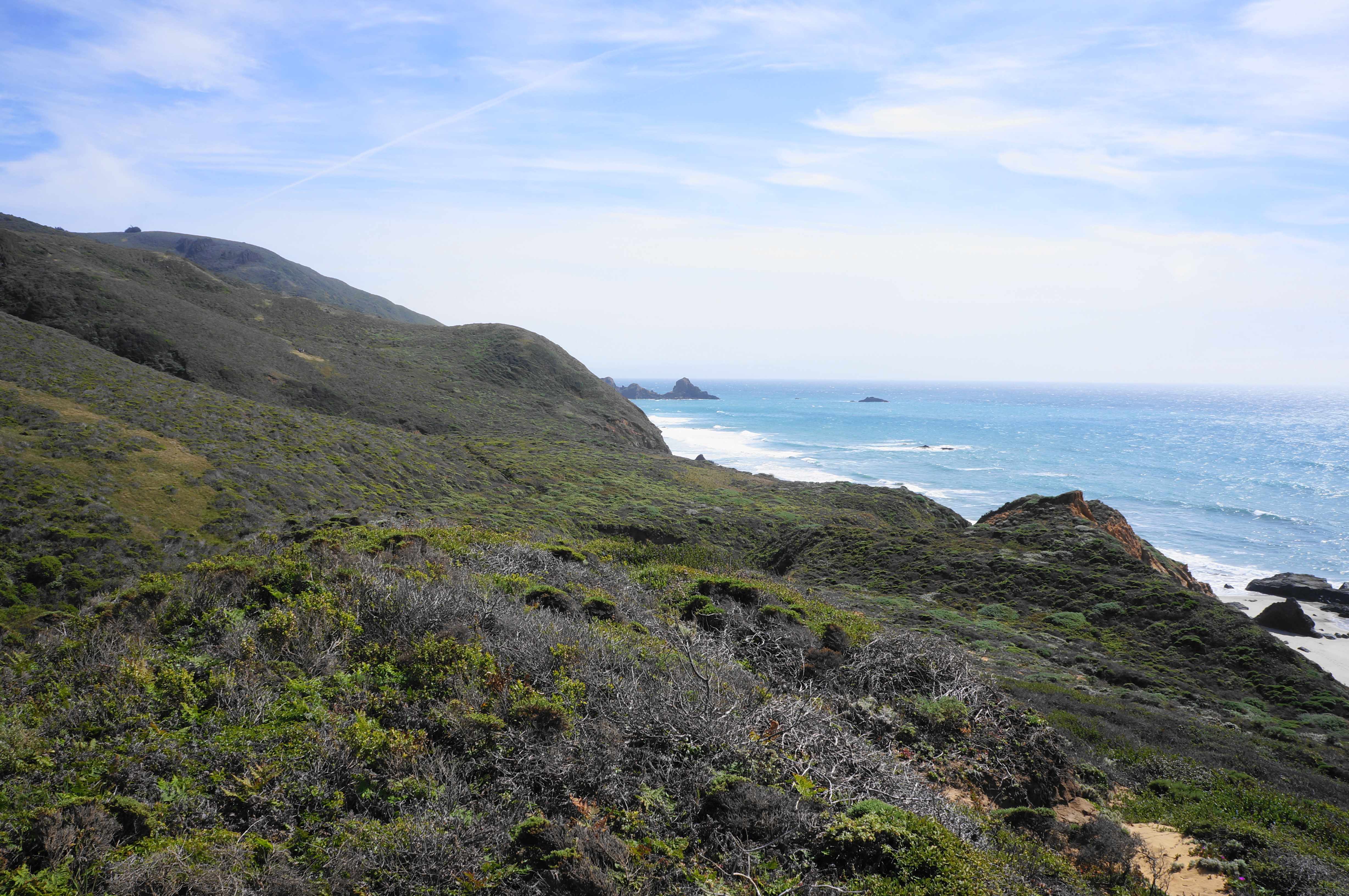
The Ridge Trail may end here, but the Panorama Trail picks up where it leaves off. Follow the steeply-descending path as it bears south and west, hugging the park boundary. At points hikers get elusive views south, down the Big Sur Coast—an area that is frequently socked in with fog.

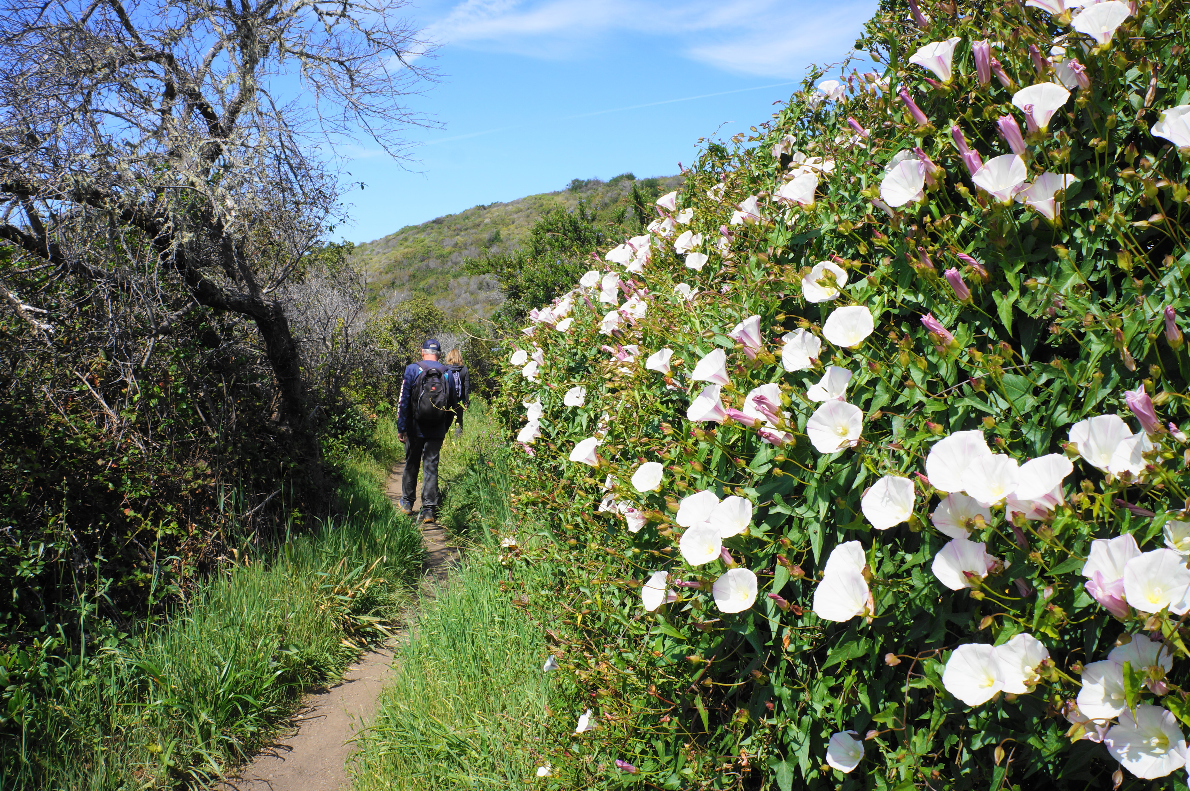
Thereafter, the trail moves away from the boundary fence-line and drops steadily, down a winding singletrack in full view of the ocean. In spring, the bushes here are dazzling with morning glories. Dropping ever further, the Panorama Trail routs down to a hairpin turn, bears left, and then resumes the descent. The path eventually settles into a relative flat on a shelf below the high ridge but still well above the beach. This windswept area is largely devoid of tall trees.
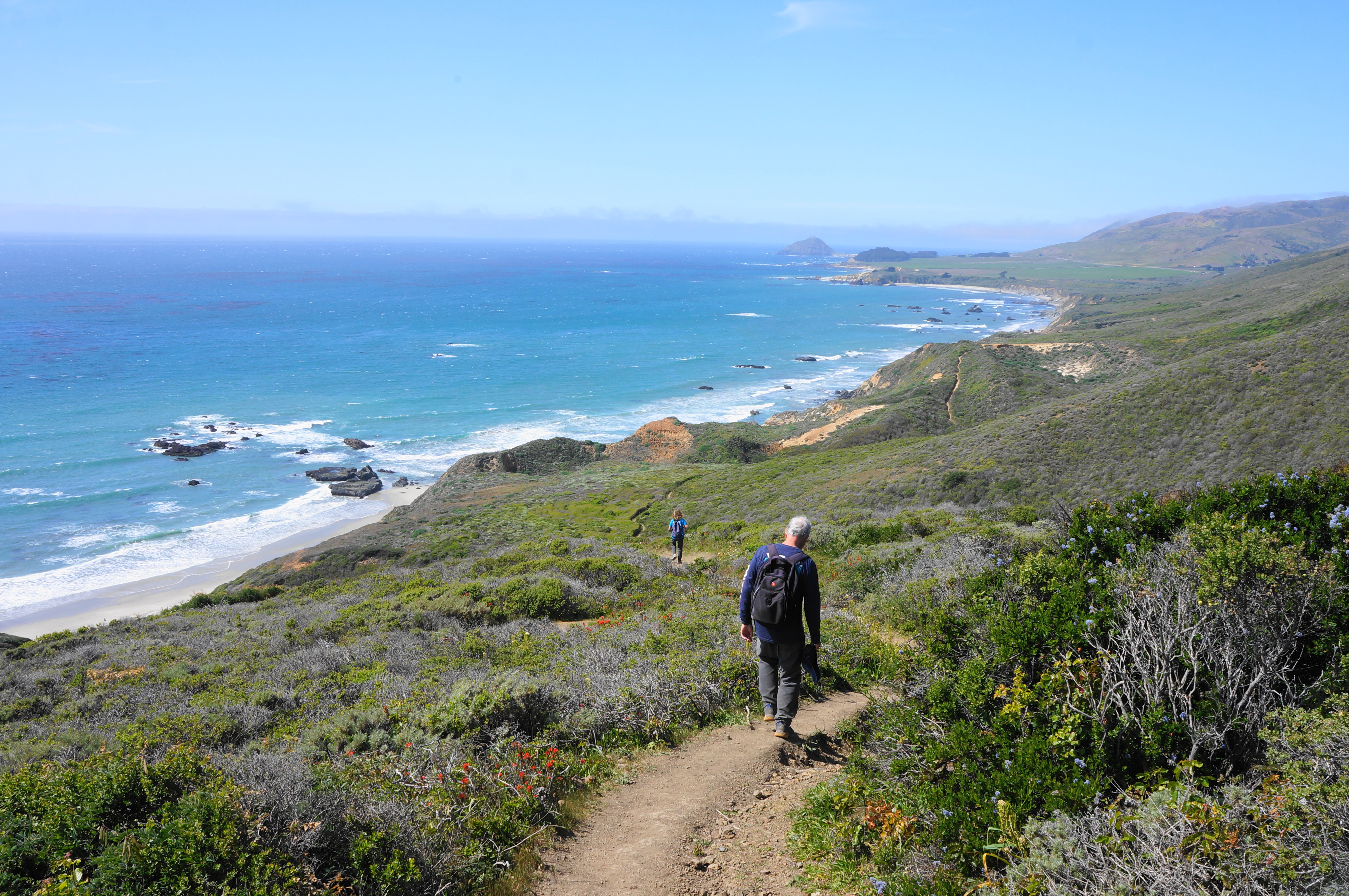
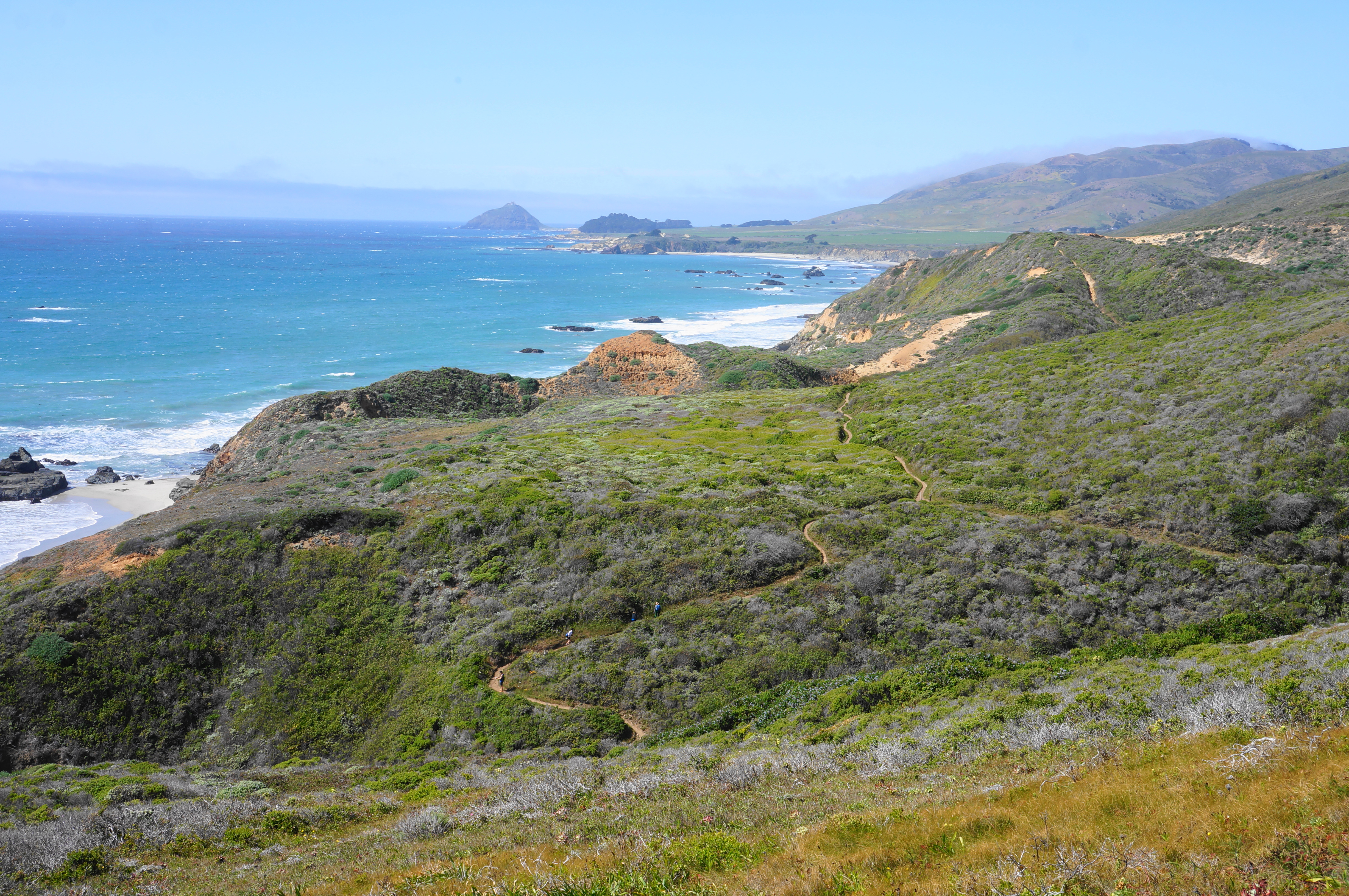
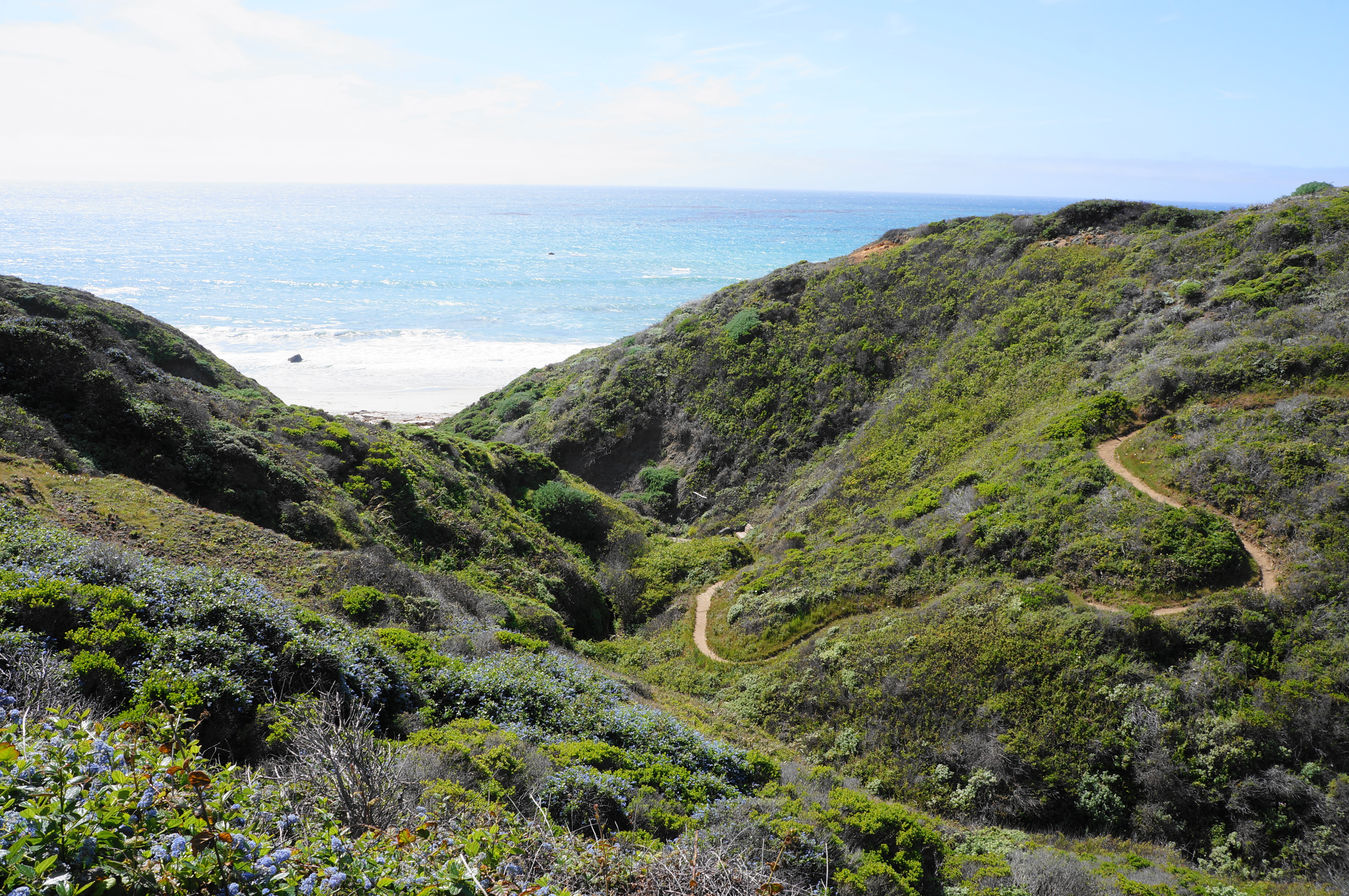
Soon the trail drops to clear a ravine with a small stream, then rises to a junction, where a spur trail leads left and offers access to Molera Beach. Take this brief detour down to the ocean, or continue right, following what is now the Bluffs Trail. In contrast with the Panorama Trail, this path is largely level, passing multihued mounds on left and right, including a set of orange tufts immediately after the junction.
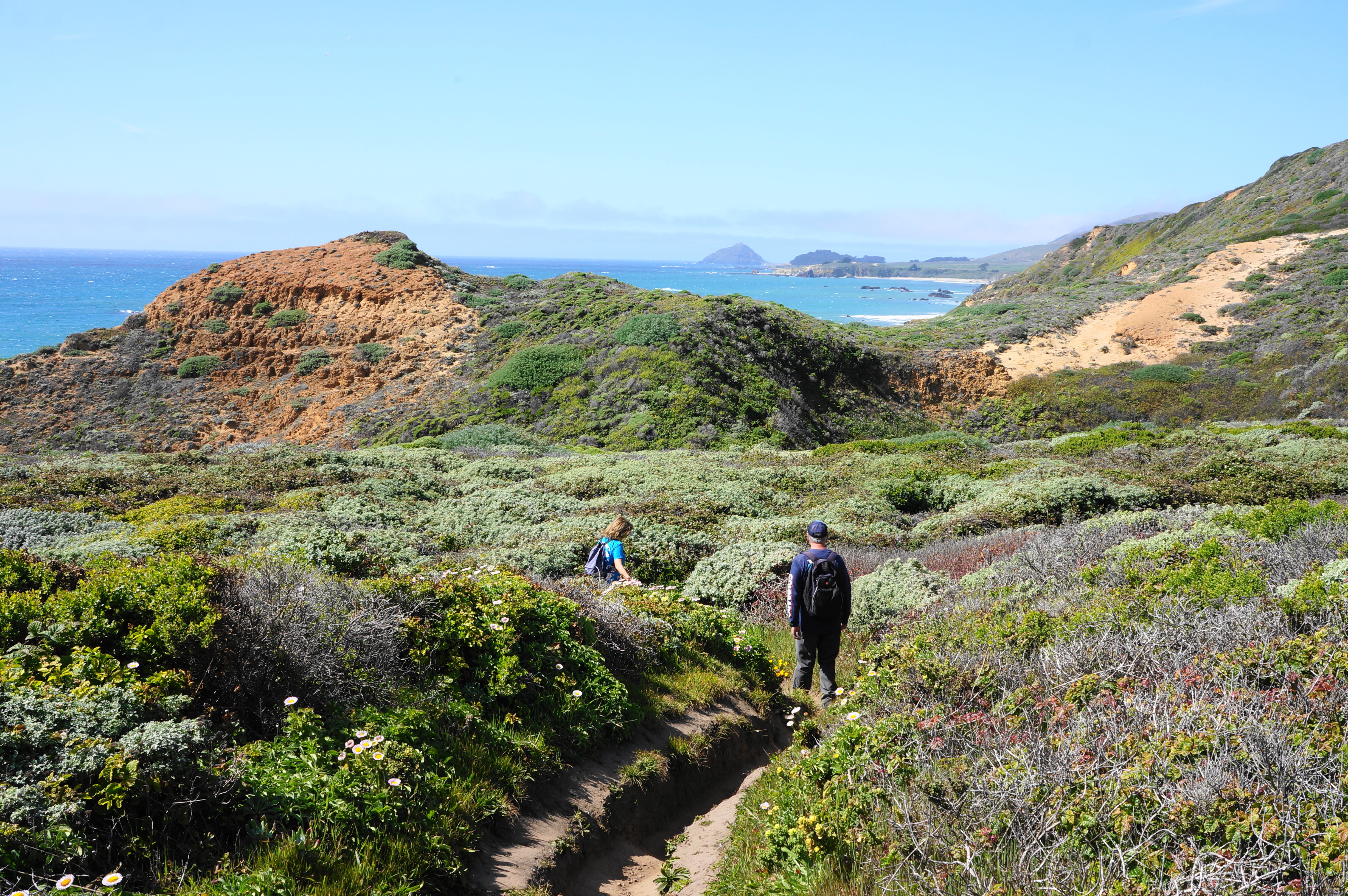
Follow this enjoyable path in a northwesterly direction for 1.5 miles, then rise back to the initial junction, having now completed the loop section. This time bear left and follow the path down to the Creamery Meadow Trail, where hikers should head right. It’s an easy and level walk from here to the river crossing: yes, given the water stands between you and your car, fording again is mandatory. Once back across the Big Sur River, hang a left and walk 1/10 mile back to the entrance station and trailhead.
All told, this hike clocks in at just under eight miles and should take about 4-6 hours to complete.
