

So jagged, sharp, and forbidding are the towering spires of central California’s Pinnacles National Park that there is no road able to bisect it, leaving visitors to drive up to the base of the breccia wonderland—and then hike the rest. The High Peaks area, easily the centerpiece of the park, is accessible from both the east and west entrances of Pinnacles—but hikers will have to work for it, slithering through rugged canyons and zig-zagging up sun-soaked slopes to reach the hightops. Once in the High Peaks, travelers are rewarded with far-reaching vistas across the Gabilan Range and ample opportunities to spot the park’s most famous residents: the California condors, reintroduced to the area under careful supervision in the late 1990s. In a previous post, I covered a 5.1-mile circuit hike that approaches the High Peaks from the east—and most popular—side of the park. In this post, I outline an alternative option—a stem-and-loop from the west side of Pinnacles—that rivals the eastern approach in its stunning beauty and, like its cousin, traverses the memorable “Steep and Narrow” section of the High Peaks Trail.

The hike
This strenuous circuit is steeper but shorter than the Condor Gulch – High Peaks Loop and begins and ends at Pinnacles National Park’s Chaparral Trailhead, which is located at the end of California Route 146 in the west side of the preserve. (Note: Access is via Soledad, California and the West Entrance; following a GPS to “Pinnacles National Park” will likely lead one to the east side, which is more than an hour’s drive away!) Arrive early to beat the crowds at Chaparral, which has only a small parking lot – otherwise one will be left to hike further from the Jawbone Parking Area, about ¼ mile away, or even the West Visitor Contact Station, more than two miles back. There are restrooms and picnic tables at the Chaparral Trailhead.
The Juniper Canyon Trail takes off from the southeast corner of the parking area, just near the entrance to the lot. The initial route is shared with the nearby walk to the Balconies area, which boasts an impressive talus cave and high canyon walls. But the two routes diverge quickly; bear right at the first junction, following a (usually dry) creek bed and entering Juniper Canyon. Ahead, the High Peaks of Pinnacles stand in an imposing clump.
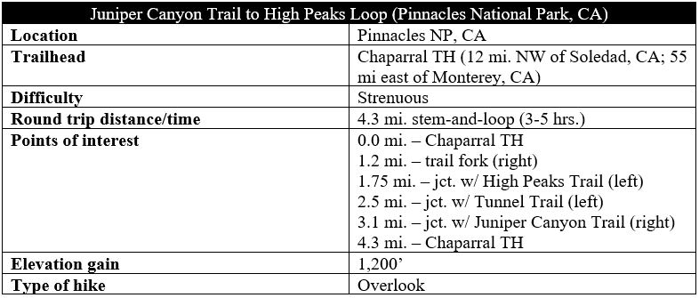
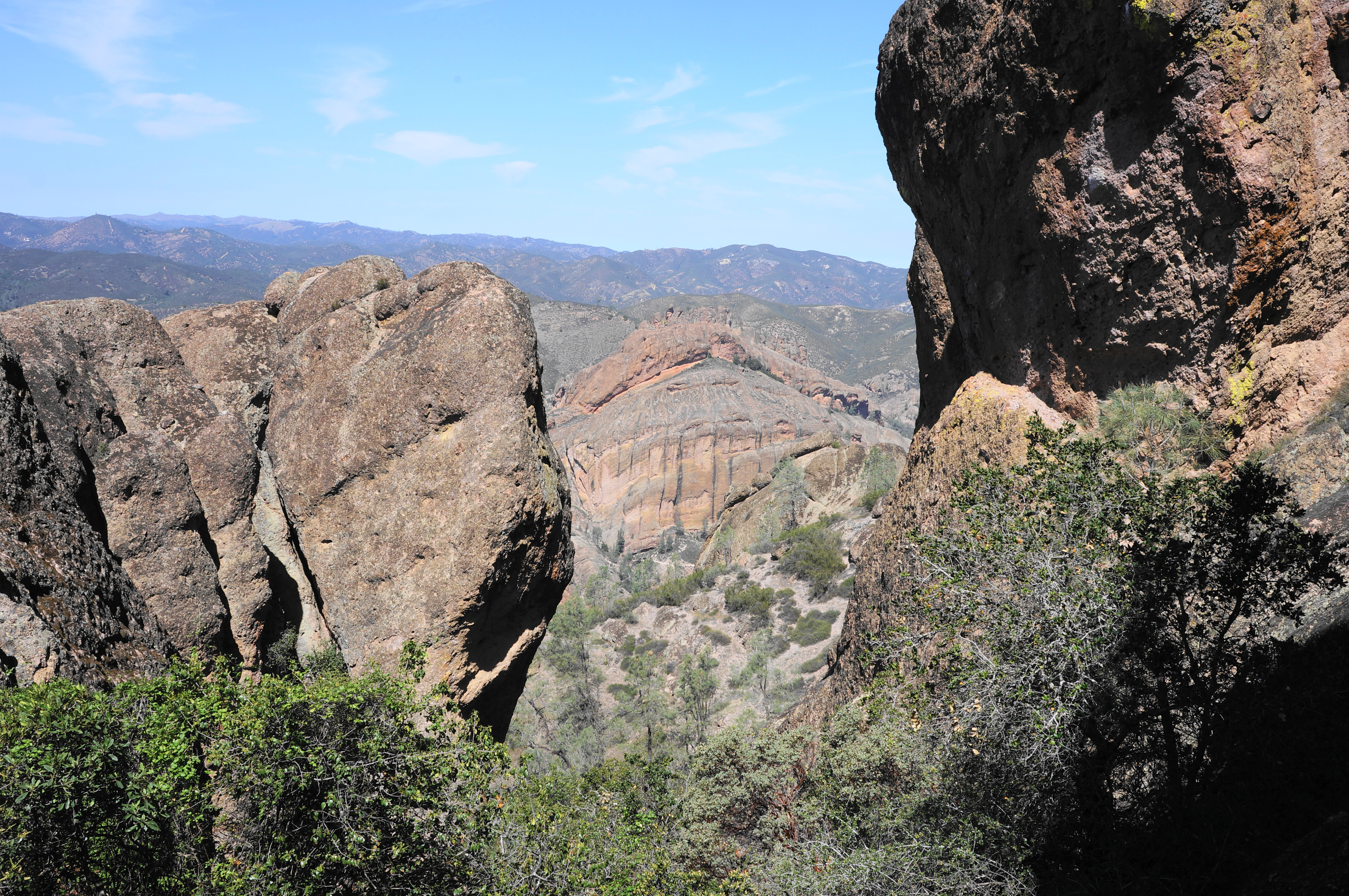
The namesake “pinnacles” are primarily composed of red-gray breccia, a form of volcanic rhyolite fused with fragments of minerals cemented together into a fine-grained matrix. The Pinnacles Volcanic Field took form around 23 million years ago and was thrust upward through volcanic activity along the San Andreas Fault Line. Movement of the plates transported the rock that now forms Pinnacles about 195 miles north from its original birthplace. Over time, the volcanic field began to sink and the rock layers eroded away, leaving behind the hard breccia and other rhyolitic formations seen today.
The initial stages of the Juniper Canyon Trail involve some mild walking through a riparian corridor with some tall trees, including a variety of oaks, cottonwoods, buckeyes, and gray pines. Follow the right flank of the canyon, passing the first rock jumble on the left after about 250 yards. The trail then drops to the streambed, follows it straight up the gut for about 30 yards, then exits again. After briefly following the left side of the waterway, the route crosses back to the right flank. Here one is greeted with a steeper incline, only a teaser of what’s to come.

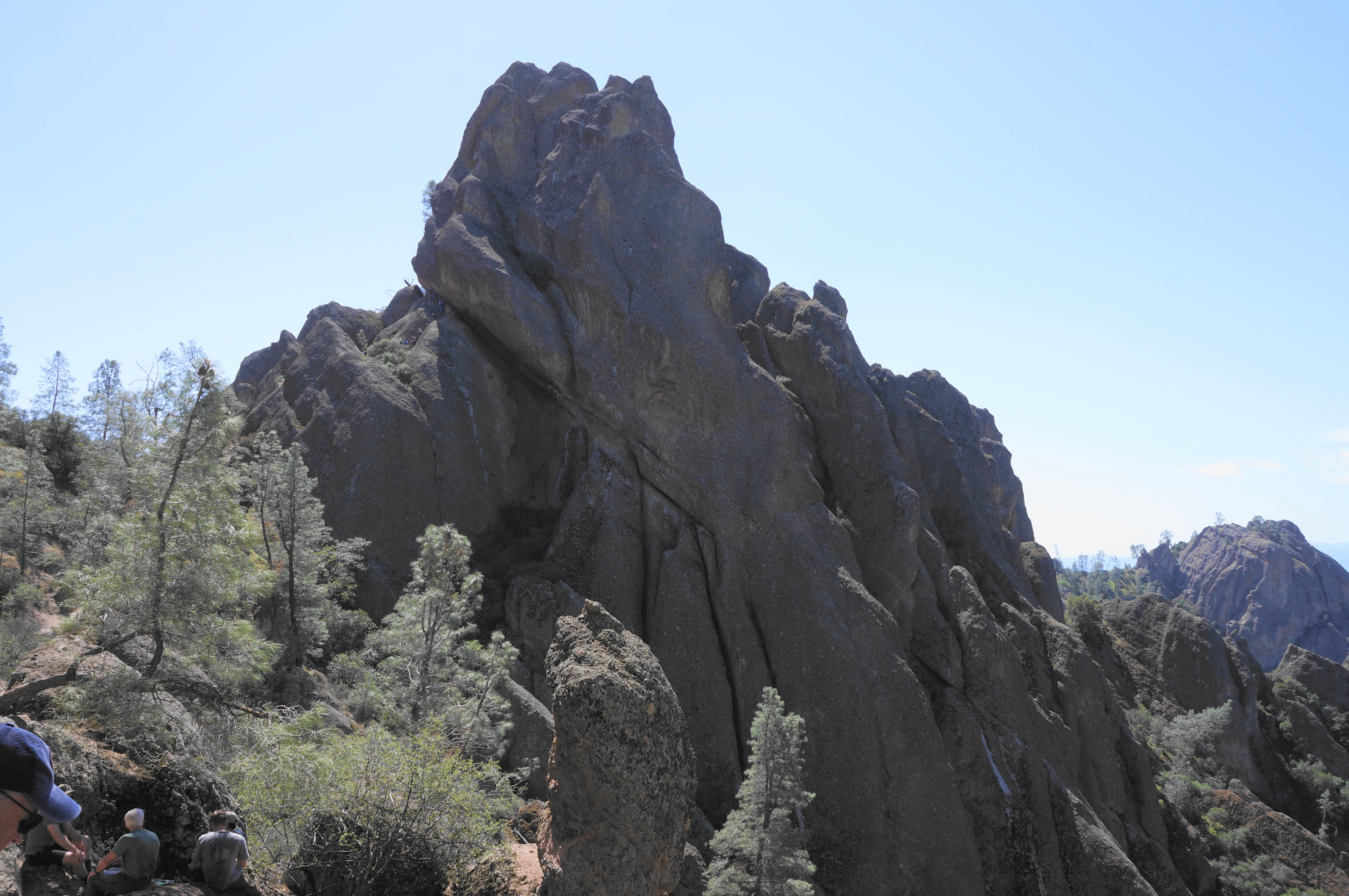
After around ¼ mile in the woodlands of middle Juniper Canyon, the trail crosses the streambed a final time and begins to climb a slope opposite the Resurrection Wall, a popular climbing spot. Immediately head up two switchbacks, followed by a third in the shadow of a gargantuan boulder that juts out like the bow of a mighty ship.

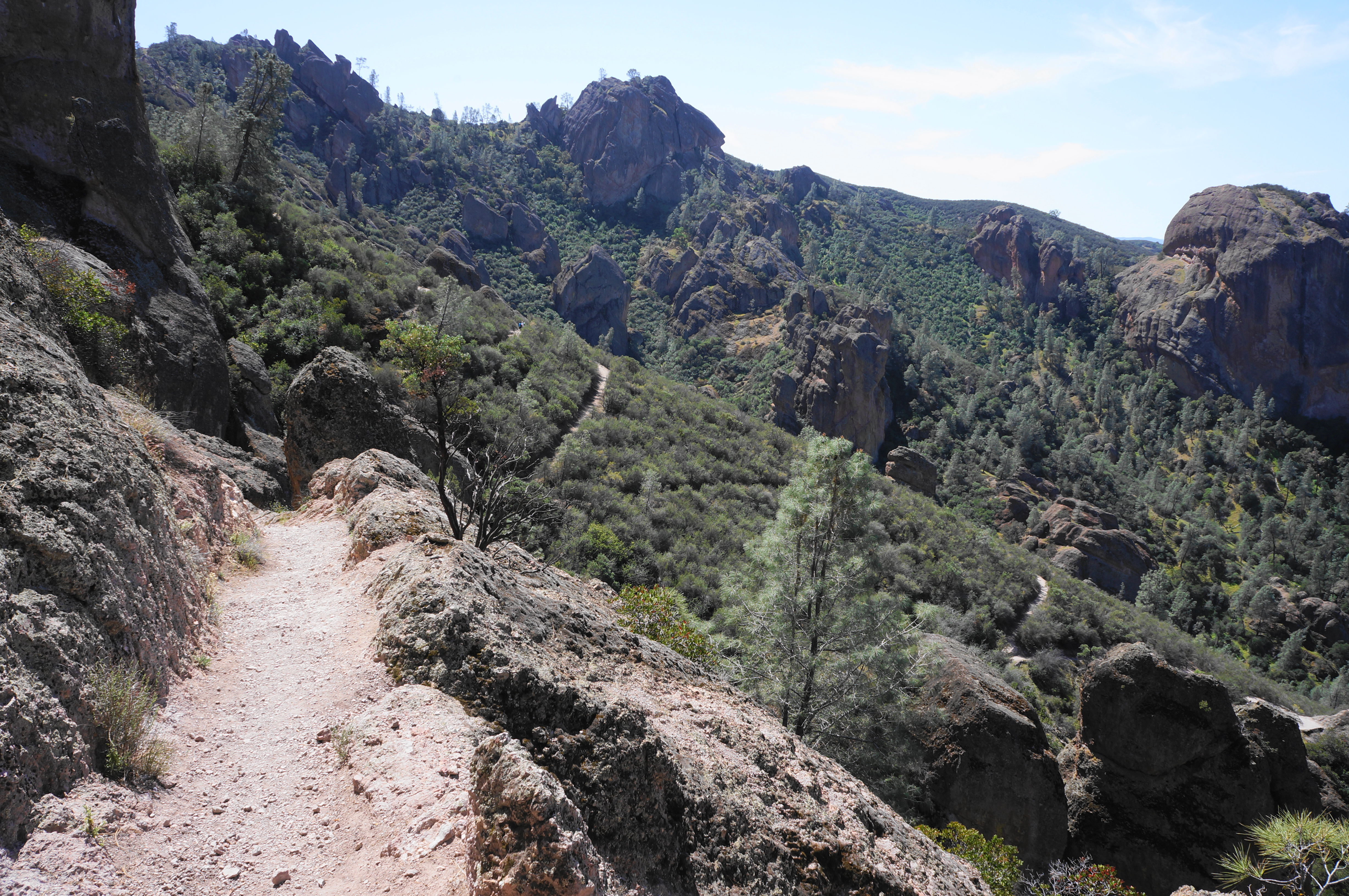
From here the Juniper Canyon Trail mounts a rocky crest with beautiful views of the Resurrection Wall and surrounding outcrops. After rounding another corner at about 9/10 mile, one can see north toward the Balconies area and Machete Ridge. The ever-ascending trail then proceeds to conquer about a dozen switchbacks, mounting a chalky slope with thick scrub, before reaching a trail junction at about 1.2 miles.
This is the start of the loop section, and here hikers have a choice: bear left on the squiggling Tunnel Trail or right on the squiggling Juniper Canyon Trail. Either route brings one to the High Peaks, although heading right and covering the loop in a counter-clockwise direction is perhaps a tad easier.


Continuing on the Juniper Canyon Trail, the route edges southward along the base of a series of outcrops, with ledges dropping off to the right. The trail even briefly descends for a bit before resuming a climb, up a set of four switchbacks. At the top lies the Junction Saddle and High Peaks “Comfort Station”—a fancy name for a bench and a pit toilet.
Here at the saddle, three routes converge, and hikers get their first views down to the east side of Pinnacles: down Bear Gulch and Bear Valley and through the Gabilan Range to the next range—Real de las Aquilas—beyond. One can also make out the Condor Gulch Trail, which rises steadily up a sun-exposed slope toward the High Peaks.
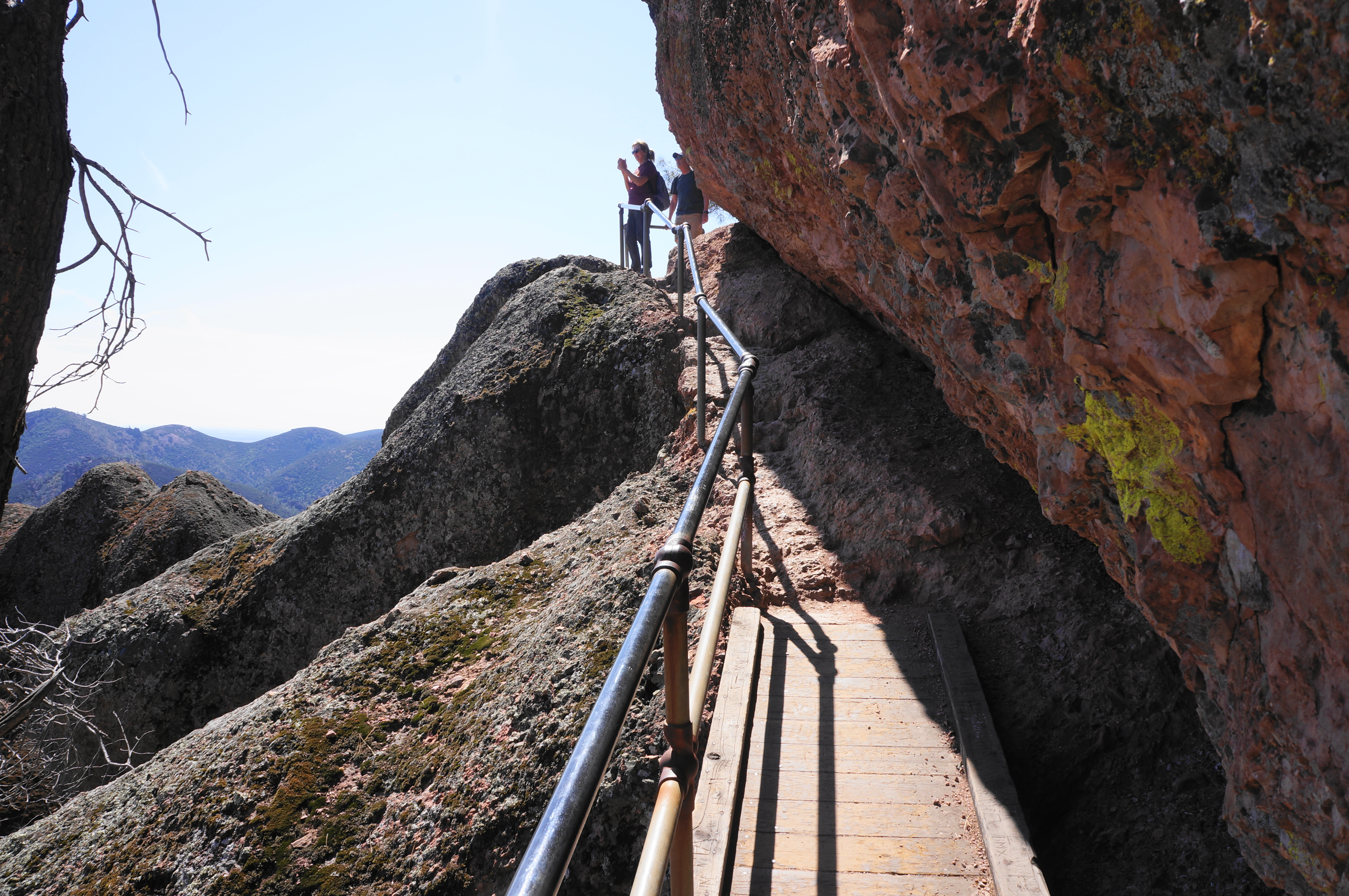
Once ready, continue the hike by heading left on a section of the High Peaks Trail that was once charmingly known as the “Fingers Foot Trail” but now takes on a less inviting title: the “Steep and Narrow” section. From here, hikers will climb steep, chiseled steps, duck under overhangs, gawk at the open views, and perhaps spot several condors over the course of the next ¾ mile.
The trail begins by edging along a west-facing slope then cuts over a pass and down to the east flank of the High Peaks, switchbacking down a scrubby hillside with wispy pines and open views to Bear Valley. Soon the path passes a series of fissures on the right, each giving way to a near-vertical drop to the gulch below.

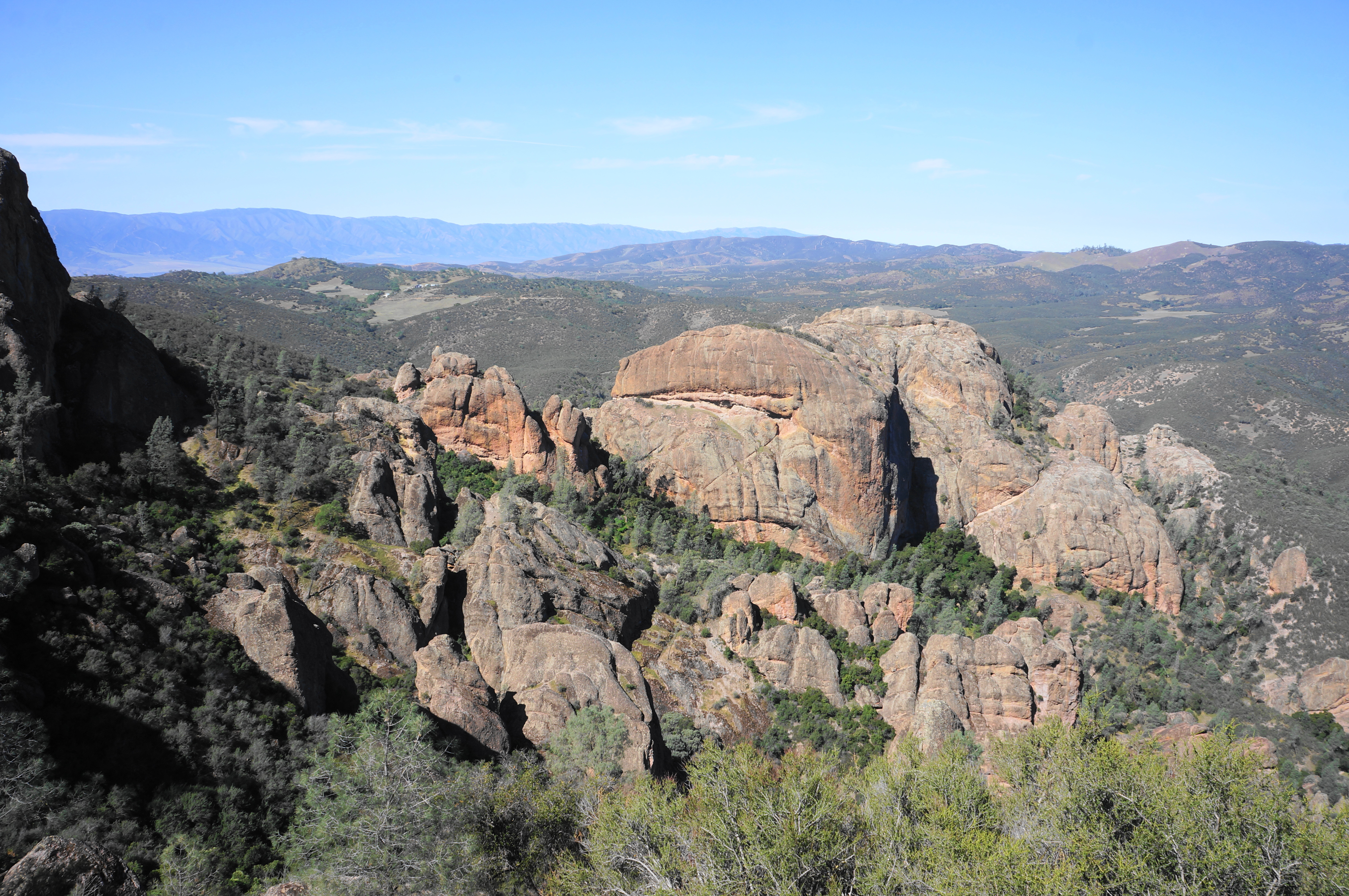
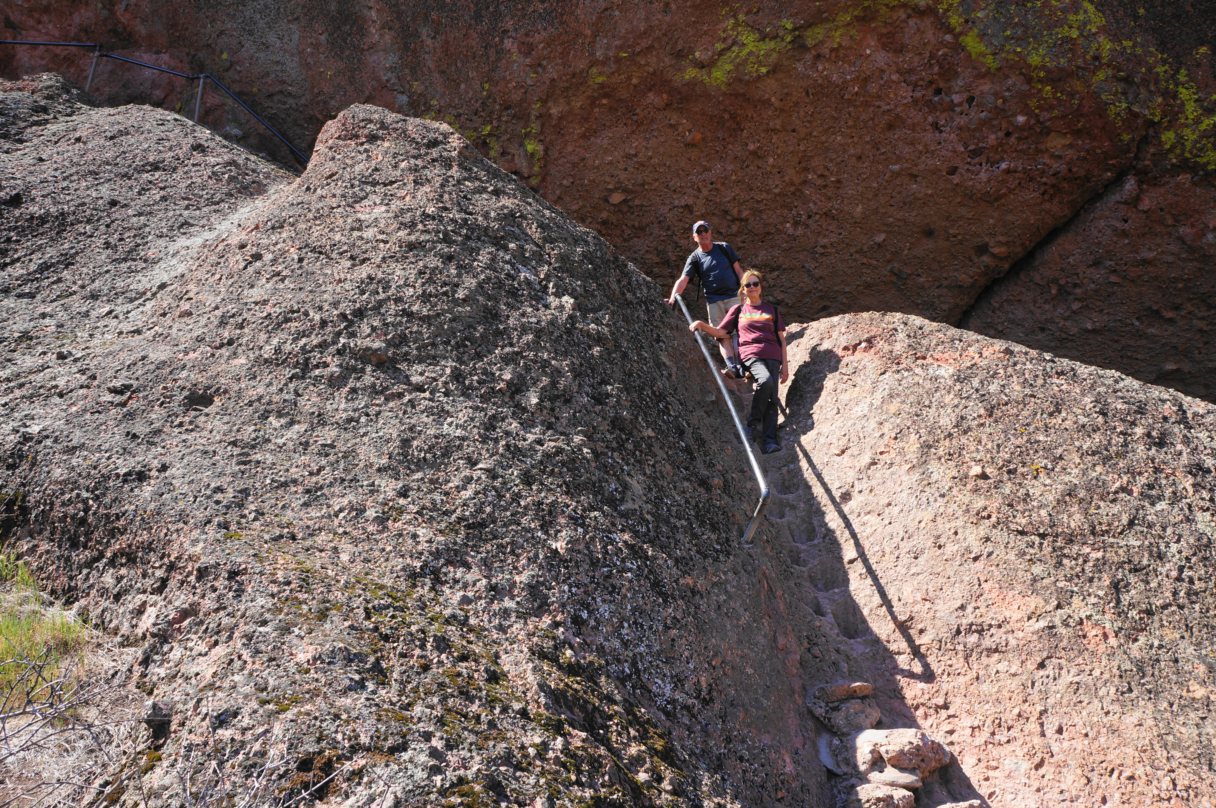
After rounding a shady bend, the High Peaks Trail embarks on its first of several staircases – this one a relatively mild ascent but right against a bulky outcrop, with a steel guardrail. Thereafter, the trail climbs an abrupt incline that mounts a steep ravine, then rounds to the base of a memorable staircase—this one wedged in a trough with a metal rail.

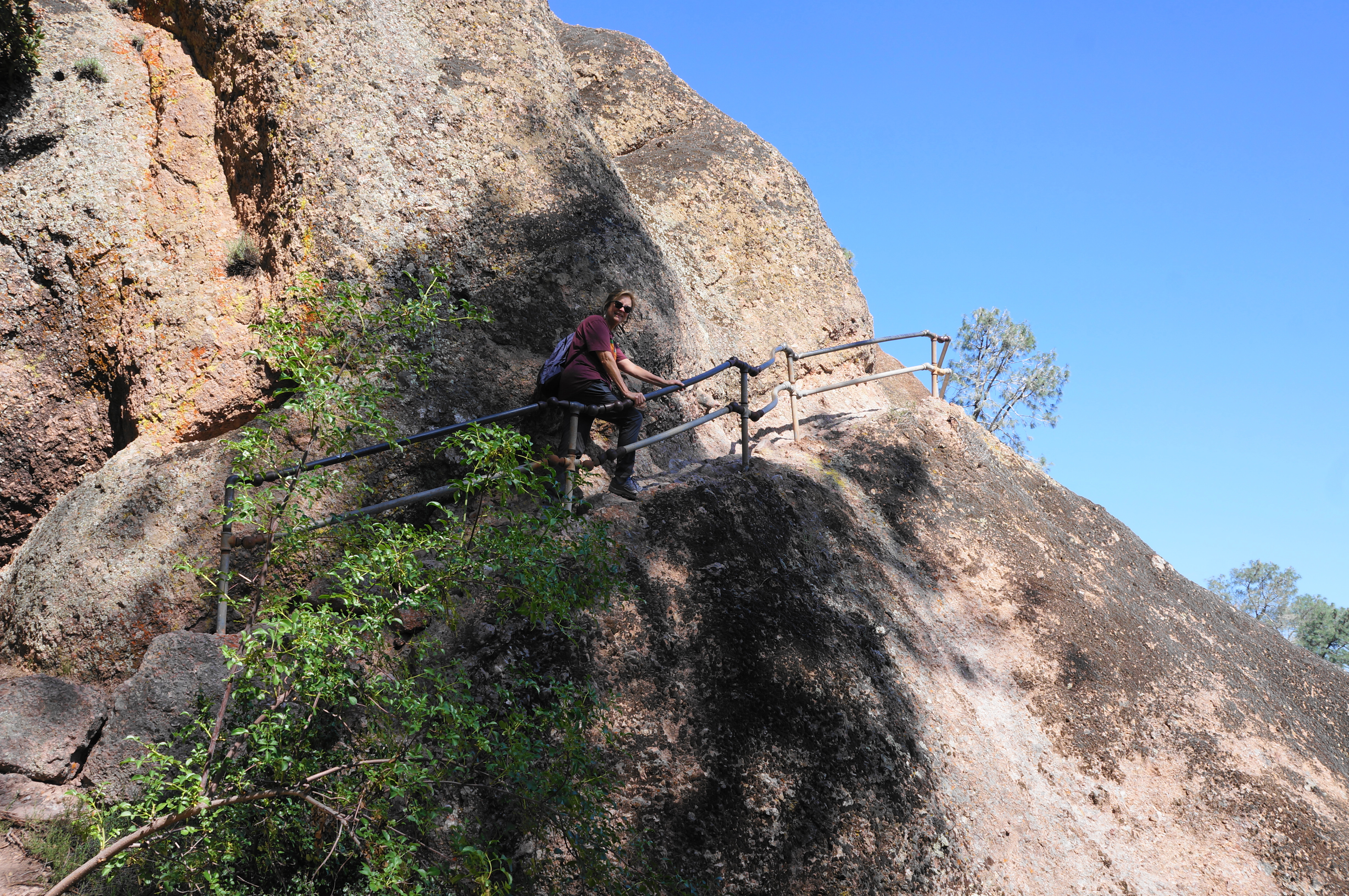

From here the path follows a high ledge and then abuts a protruding overhang, with hikers having to duck or lean away from the wall in a couple of places. Then it is down a steep staircase with steps carved into the rock—the handiwork of the Civilian Conservation Corps, which completed the trail in 1933.

Around the corner lies another staircase, after which the trail mellows, descending a modest slope before rising again to a high notch with more views to the north and west. From here it is a short walk, below Hawkins Peak, to the junction with the Tunnel Trail. Bear left here to continue the loop back to Juniper Canyon.
The Tunnel Trail does indeed culminate in a man-made tunnel, but the defining feature of the path is switchbacks, which come in bunches. After seven downhill wiggles, the trail rises to a high saddle overlooking the next drainage. Then it is down several more, moving through three more gaps and dropping to a bridge over a dark chasm. Hikers are greeted on the other side by a 120-foot tunnel carved through a solid rock buttress. The tunnel connects hikers back with the Juniper Canyon Trail, at the end of the loop section.

From here, hikers must retrace familiar territory, descending the dozen switches back down to the canyon floor. Upon returning to Juniper Canyon, it is about 2/3 mile back to the trailhead, treading in and out of the wash and through the riparian area. At last, after 4.3 miles of hiking—although it feels like much more—the Juniper Canyon Trail ends back at the parking area.

Like all hikes in Pinnacles, this strenuous stem-and-loop should not be attempted in the brutal summer heat: the temperatures in the High Peaks have been known to surpass 110 degrees. All told, the 4.3-mile hike takes between 3-5 hours to complete.

Pingback: Balconies Cliffs – Balconies Cave Trail Loop (Pinnacles National Park, CA) | Live and Let Hike
I’m so glad to see you are hiking the Pinnacles. This park has been on my list. Your blog always has the best information to follow. Good to see you have relocated to the west coast as we have.
Yep I am here in CA at least for a couple more years.
Pingback: Top 10 Hikes in 2022 | Live and Let Hike