Talus caves—formed when crashing boulders fall into chasms, flooding the canyon with darkness—are an intriguing feature of central California’s Pinnacles National Park, which boasts two such pseudo-karst caverns. The most popular of the two is Bear Gulch Cave, most easily accessible from the east side of the park. (Note: See my post from 2020 on this exploring this cave.) The other—seemingly even darker and lesser-travelled—is Balconies Cave, situated a short walk from Chaparral Trailhead in the western half of the park. This cave—actually more of a boulder-filled gorge than a true cavern—can be explored as part of a 2.6-mile stem-and-loop hike that combines the cave route with the high-flying Balconies Cliffs Trail. (Note: Balconies Cave is sometimes closed after heavy rains or due to bat activity. Given the darkness of the cave, bring a headlamp/flashlight!)


The hike
The Balconies Loop starts and ends at Chaparral Trailhead, which is the terminus of the California Route 146, running through the western half of Pinnacles National Park. (Note: Access is via Soledad, California and the West Entrance; following a GPS to “Pinnacles National Park” will likely lead one to the east side, which is more than an hour’s drive away!) Arrive early to beat the crowds at Chaparral, which has only a small parking lot – otherwise one will be left to hike further from the Jawbone Parking Area, about ¼ mile away, or even the West Visitor Contact Station, more than two miles back. There are restrooms and picnic tables at the Chaparral Trailhead.
Both the adjacent Juniper Canyon Trail (see detailed route description here) and the Balconies Trail take off from the southeast corner of the parking area at Chaparral, briefly adjoined as one dusty trail before quickly diverging. Head left on the Balconies Trail as it skirts a scrubby slope and bends northeast, passing under moss-laden oaks. Stay right at the junction at 250 yards (this spur trail leads to the back end of the Chaparral Picnic Area).
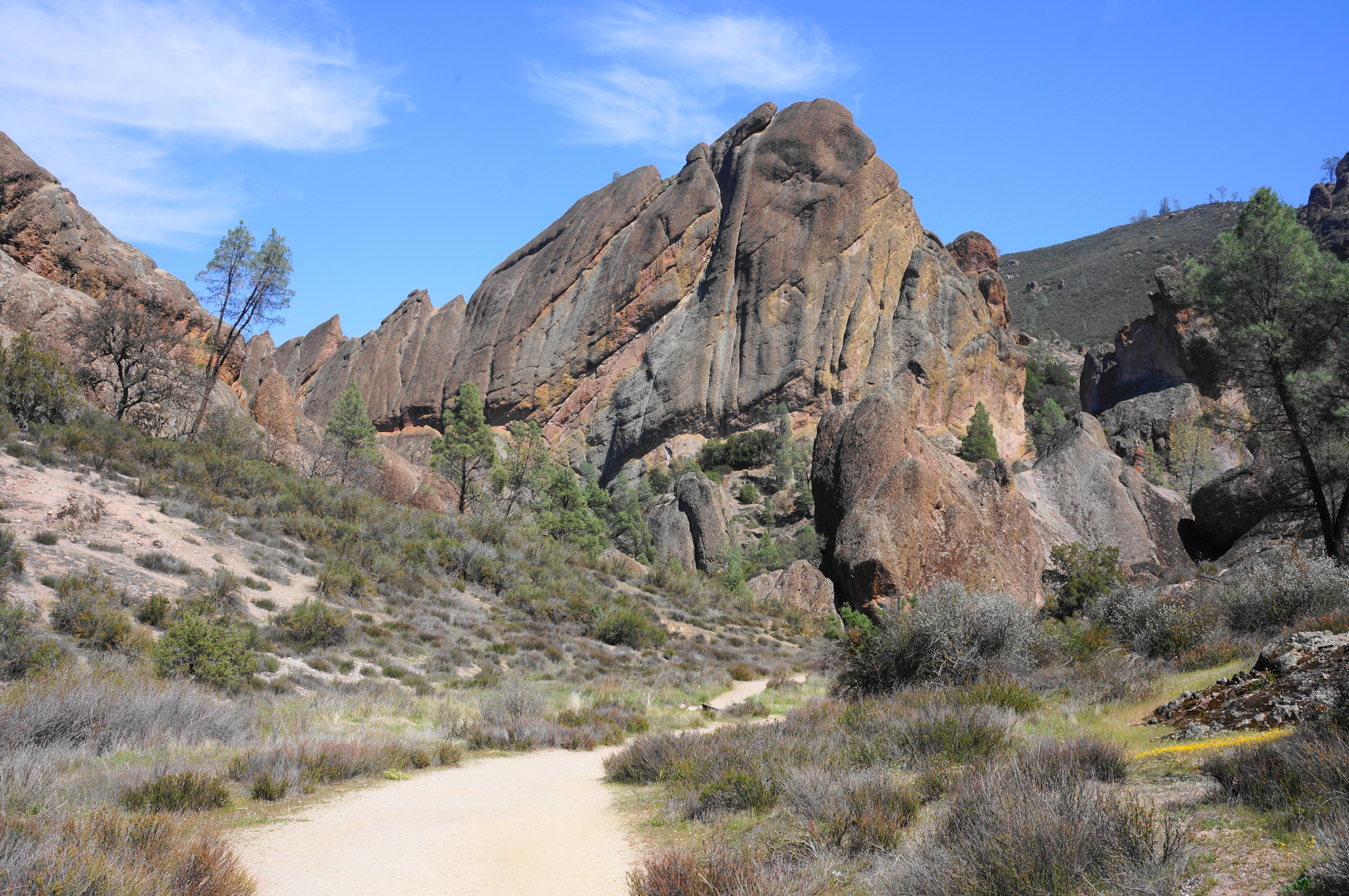
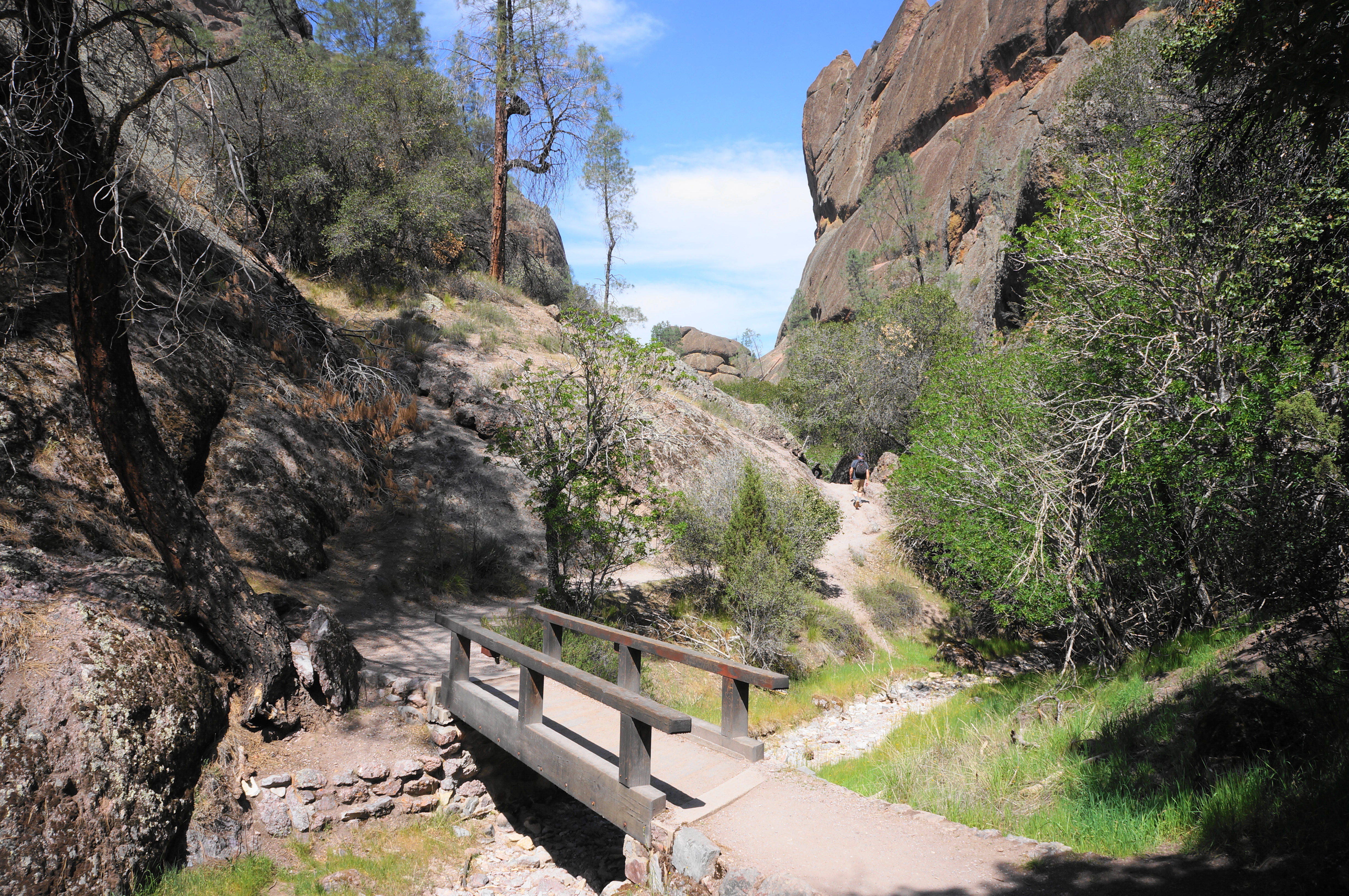
Follow the drainage as it gradually narrows and approaches the edge of the red-orange breccia outcrops—a gateway into the heart of Pinnacles. Pass a spur trail at 4/10 mile leading to the Elephant Rock climbing area, then follow the dirt path as it traverses three short bridges. With the canyon now strikingly slender, pass through a few lovely glens and bear left at the fork at 0.65 miles: this is the start of the Balconies Cliffs Trail.
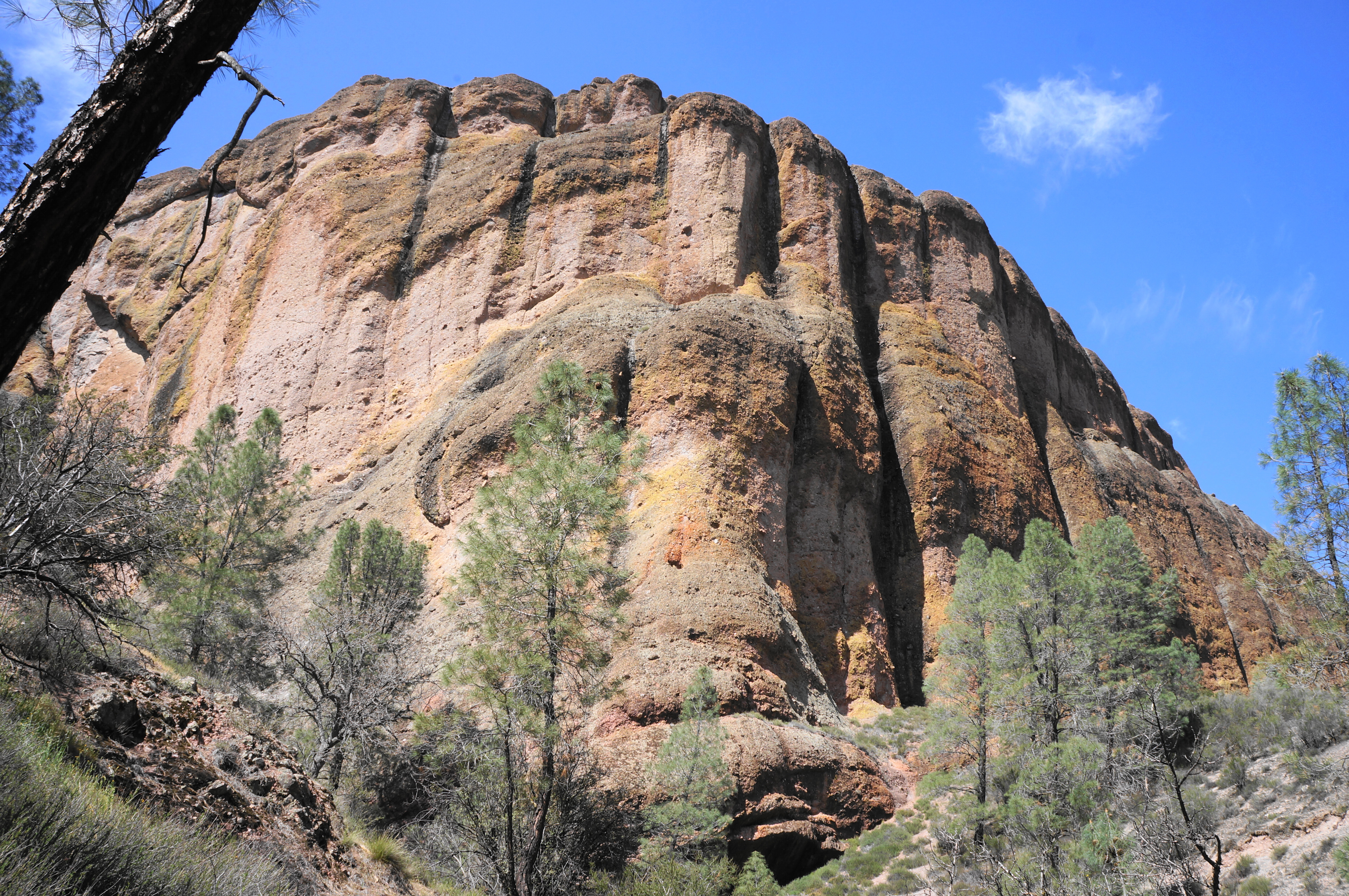

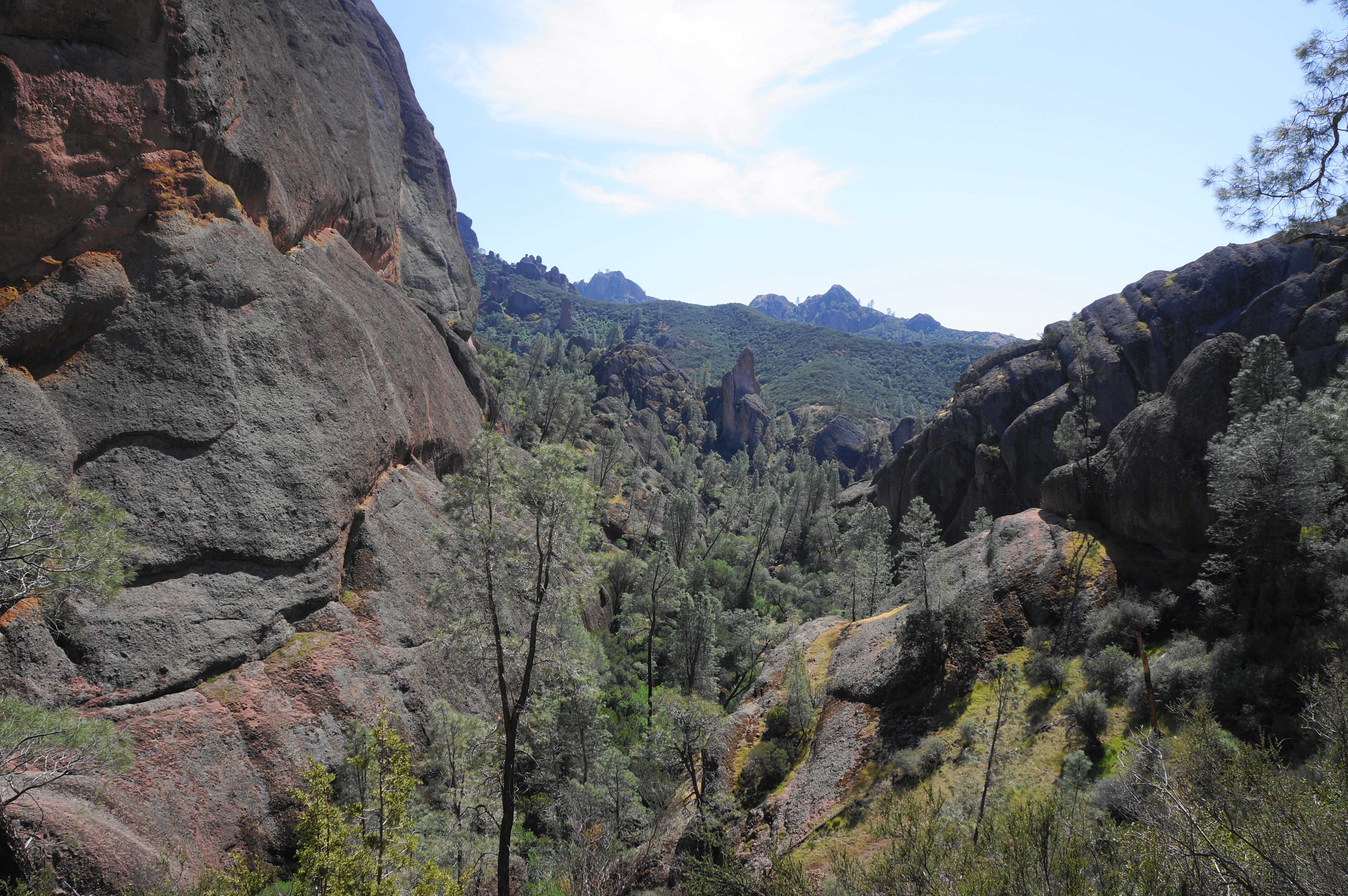

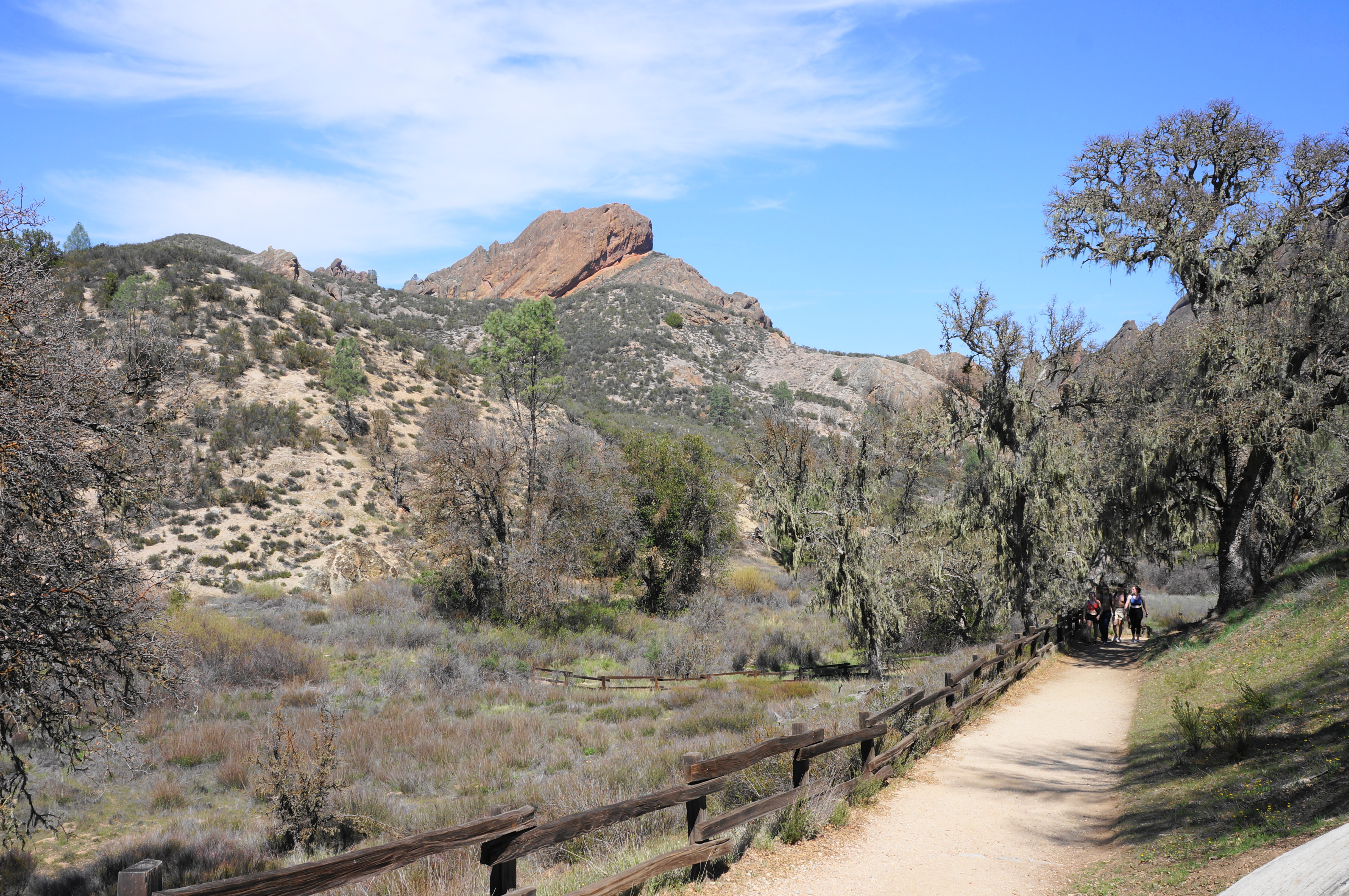
Saving the cave section for last, climb steadily up the cliffs trail, rising to a shelf overlooking the thin canyon, flanked by high walls laced with vertical and horizontal streaks. As the path approaches its high point, views unfold to the broader valley of the Chalone Creek drainage. Up to the left, hikers will see the iconic chimneys of the Balconies, a striking rock face with several climbing routes.

Soon the Balconies Cliffs Trail drops down and around a minor ravine and reverts southward to the streambed, connecting with the Balconies Cave Trail. Bear right here, embarking on a short and meandering walk through shady glens and narrows to the start of the cave.
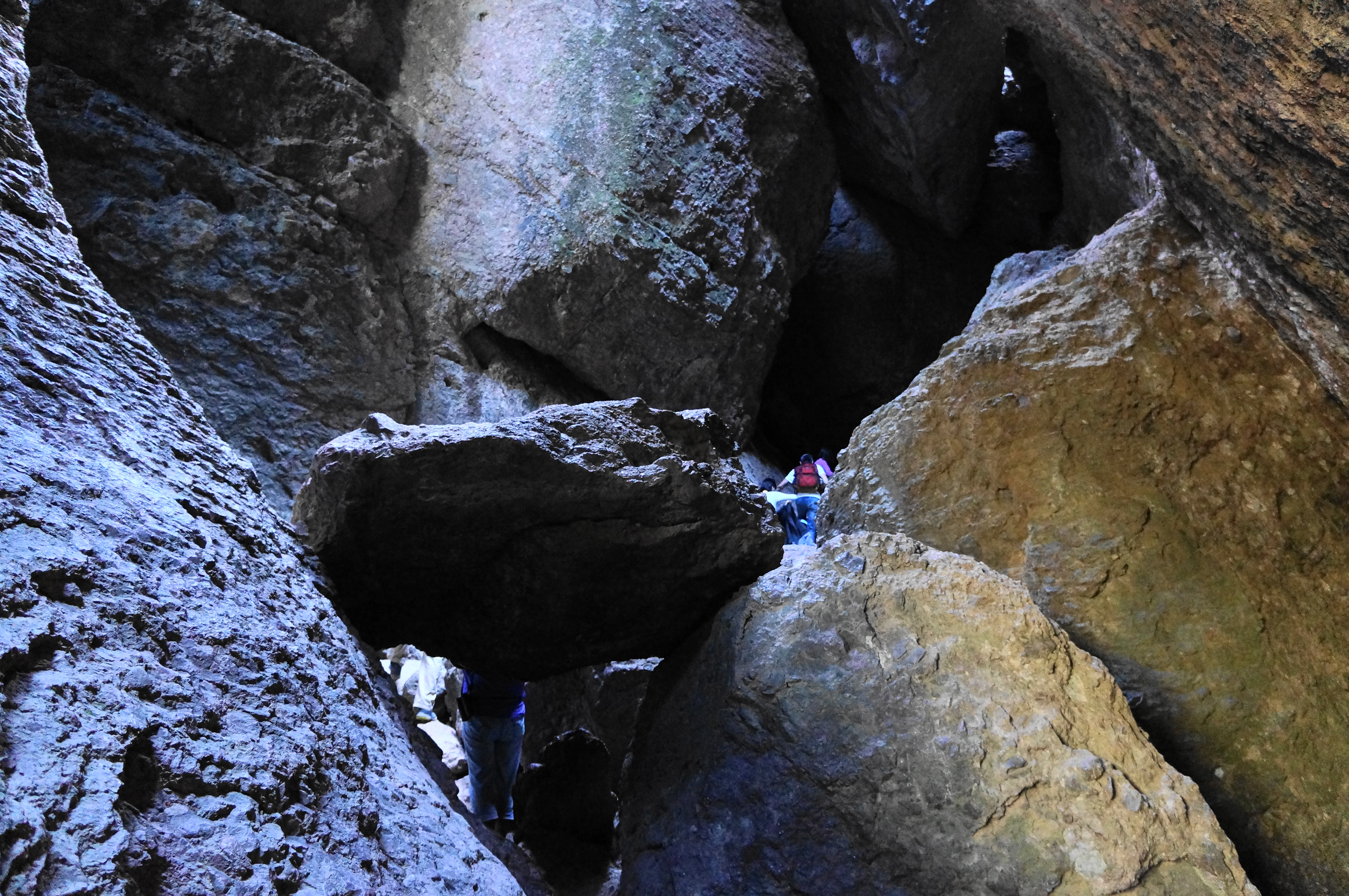

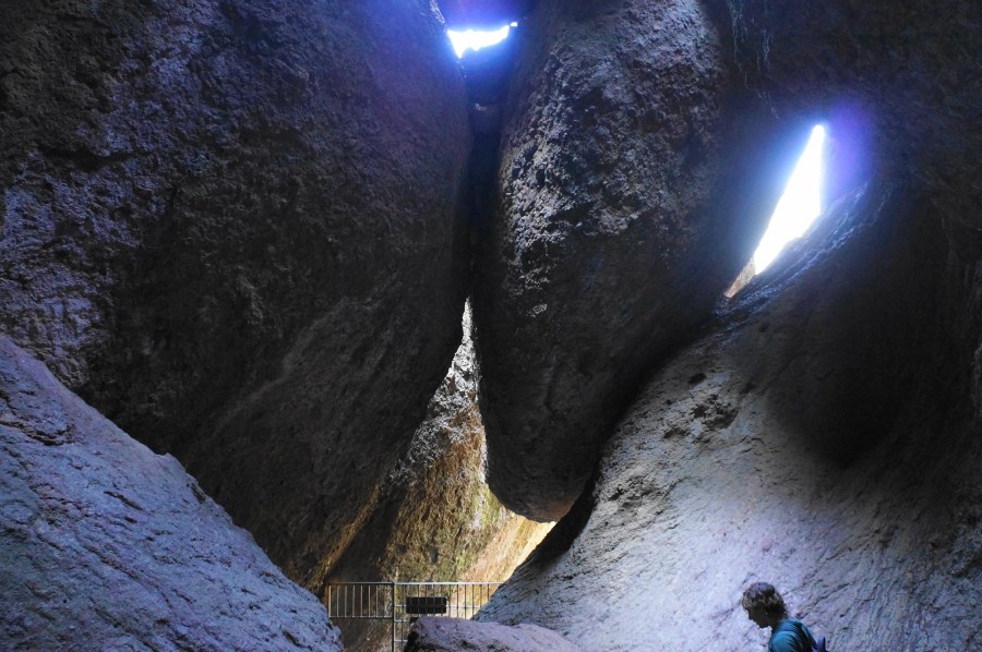
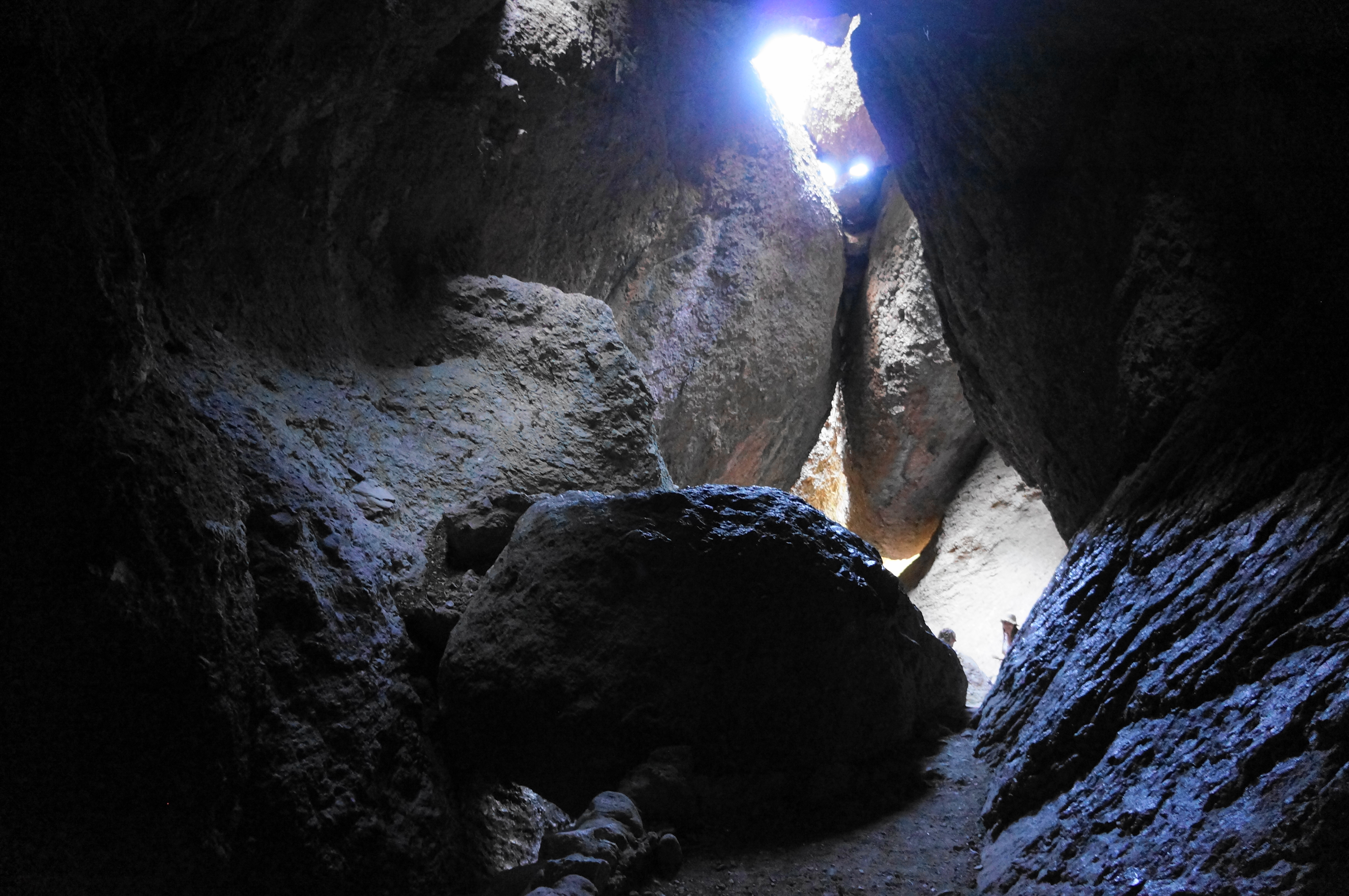
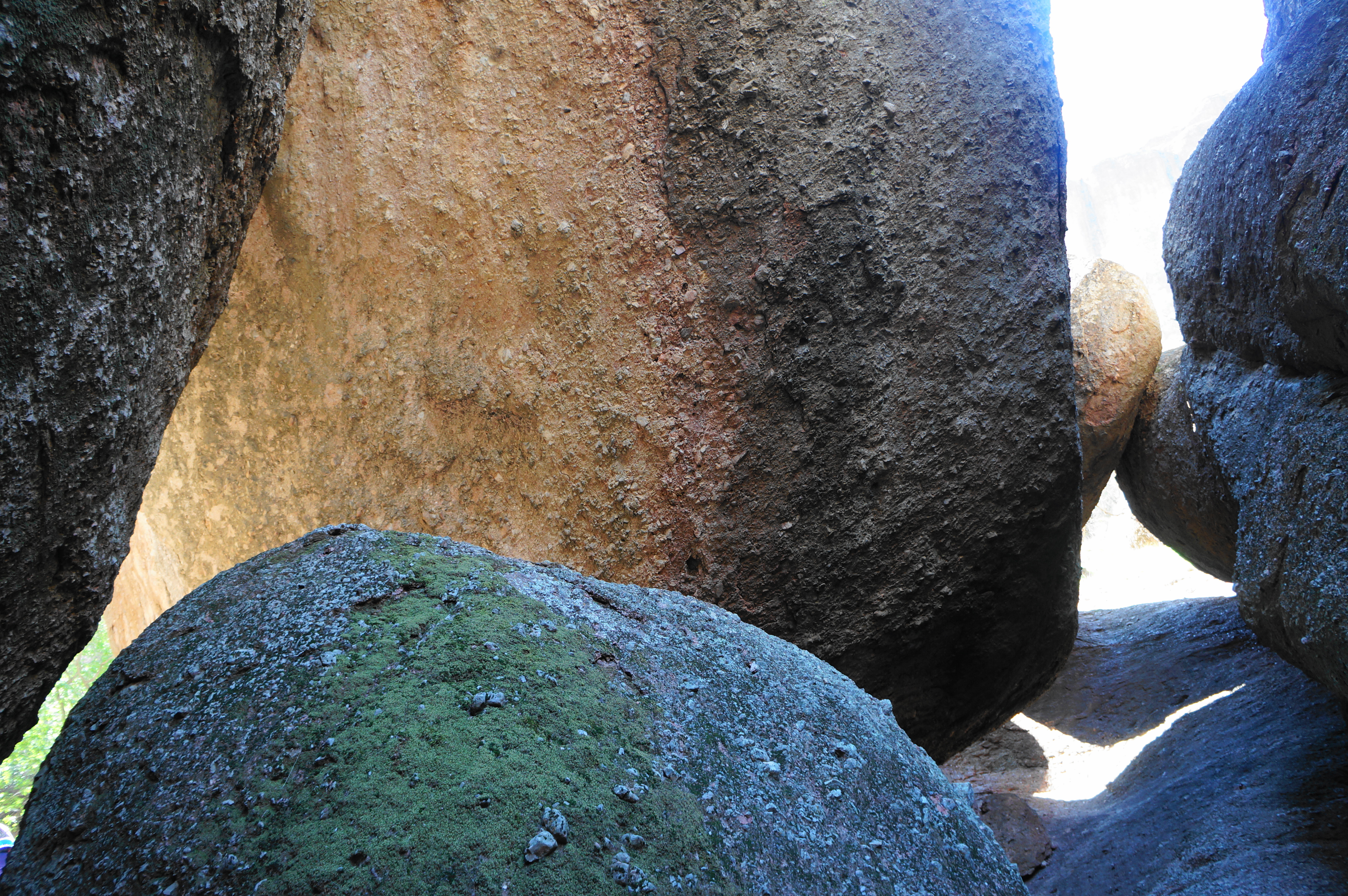
Pass through a gate to enter Balconies Cave, which is traversed in two sections, interrupted by a brief open section. The cave route immediately passes under an imposing chockstone, with the onward path cutting under a low-hanging boulder and up a thin staircase, leading into the darkest section of the cave—so dark, in fact, that one will need a light to see ahead. This area can be slow-going if the cave is crowded, with ramblers needing all four limbs to pull themselves through some moderately tight spaces.

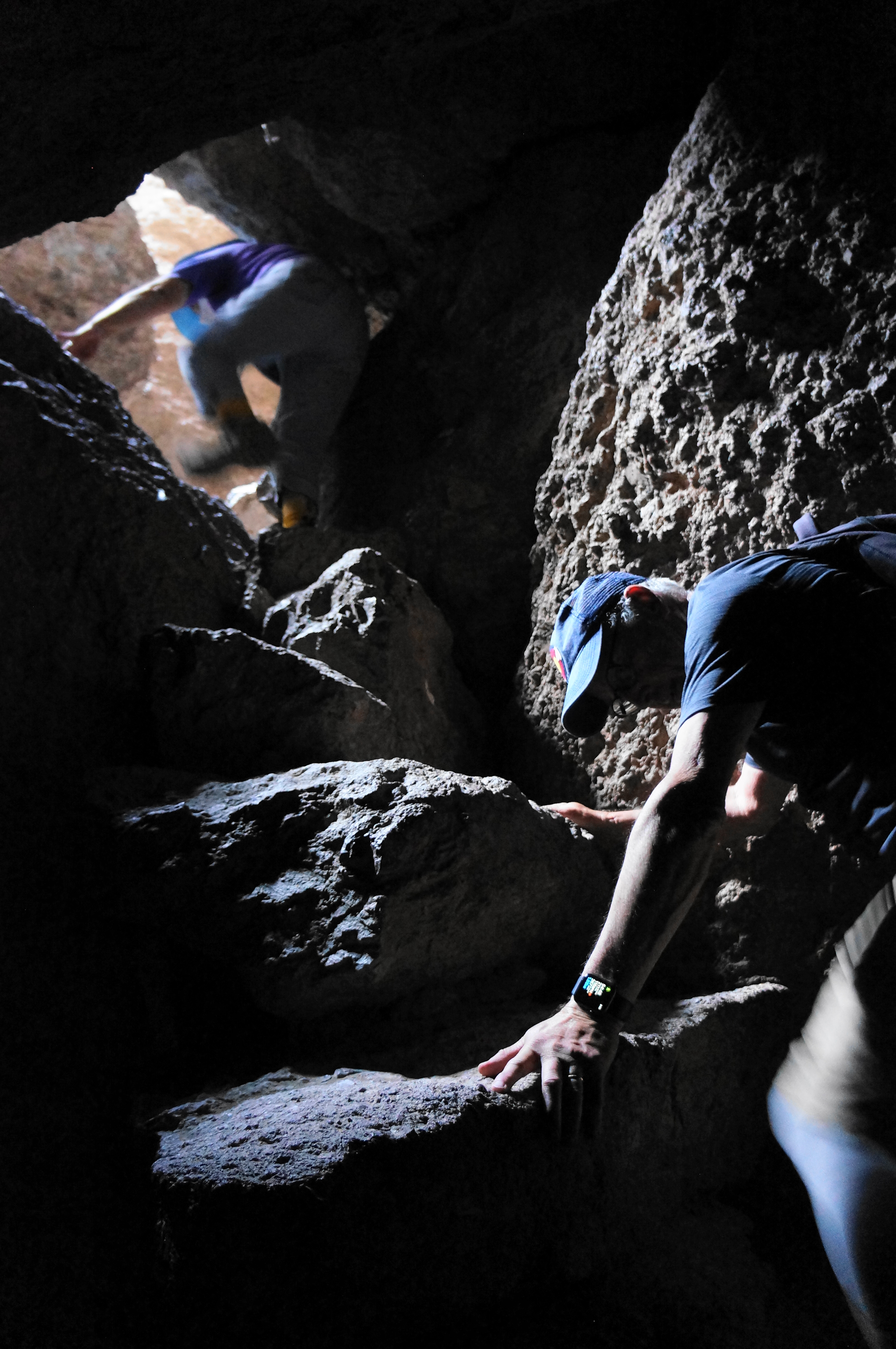
The first cave section culminates with a steep stairstep rise through a small break in the boulder-strewn ceiling, returning to the sunny open expanse. The respite is brief, however, as the onward trail returns within minutes to a second cave, this one much shorter but arguably more spectacular.

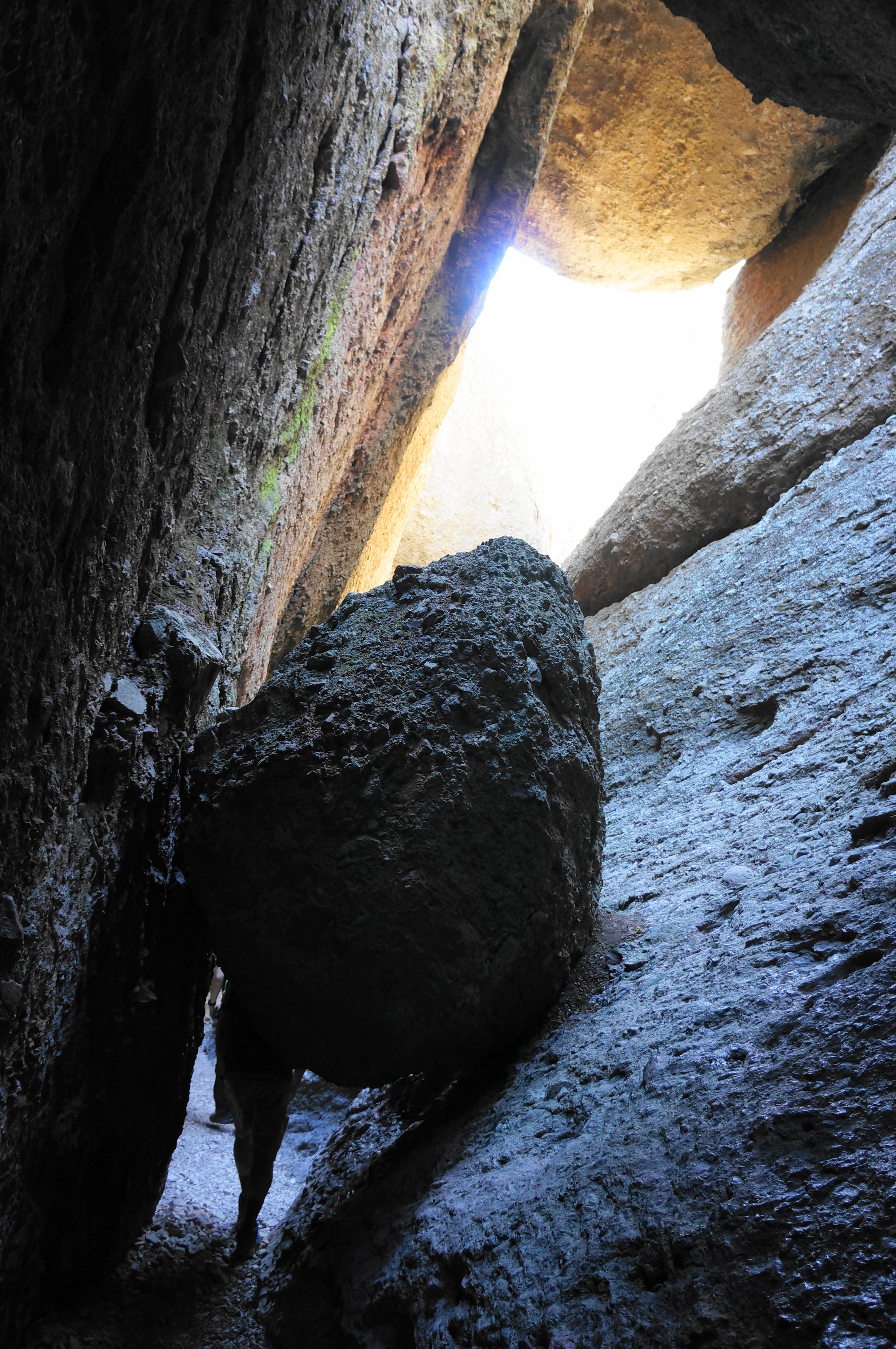
A few railings assist with ascents and descents, and the cave ends with a tremendous straightaway, where hikers will pass under a series of chockstones, with the light shining through the crevice to produce an alluring effect that is great for photographs.
Finally, after about ½ mile on the Balconies Cave Trail, hikers will reemerge from the talus cave and return to the junction with the Balconies Cliffs Trail, coming in from the right. Bear left, following the Balconies Trail for 6/10 mile back to the start of the hike.
All told, this 2.6-mile jaunt will take hikers 1-2 hours, depending on crowds and abilities. Be prepared for dark passages and some modest scrambling along what is one of Pinnacles’ most memorable hiking routes.

Pingback: Juniper Canyon Trail to High Peaks Loop (Pinnacles National Park, CA) | Live and Let Hike
Pingback: Top 10 Hikes in 2022 | Live and Let Hike
Just hiked it this morning. Awesome. Today was a hot day, and it got a bit hot up on the cliffs, but it stayed cool down in the canyons. And not too crowded this time of year. Plenty of parking, only a few other folks on the trail. Thanks for the great idea!