
Sure the towering California redwoods are lovely, but Muir Woods National Monument on the Marin Peninsula has become almost comically crowded, mobbed by throngs of locals and visitors to the San Francisco Bay Area alike. Visitors must now have advance reservations to park at the main entrance and wait in an often-lengthy line to pay the entrance fee at the small Visitor Center. Yet there are ways to experience Muir Woods while minimizing the hassles: the scenic loop hike described here starts along Panoramic Highway, dropping into the Redwood Creek drainage by way of the much less-crowded Fern Creek Trail. After a short spurt through the crowded gut of the park, the route then climbs the Dipsea Trail to the beautiful Sun Trail, which—as the name suggests—sports marvelous views of the surrounding hills. No reservations required—just lovely scenery in the world’s most famous redwood preserve.

The hike
This 4.7-mile circuit begins and ends near the Mountain Home Inn along Panoramic Highway, situated about 1.5 miles north of the turnoff to Muir Woods National Monument. There are several parking areas around here, all on the left side. The preferred spot is actually across the street from the California Alpine Club (see map), a short distance southeast of the inn. A couple graveled shoulders allow for free parking just south of the club. (Note: If hiking on a weekend, arrive early, as most spots are taken by 9 or 10am.) Down to the west is the Redwood Creek drainage, which runs through Muir Woods and Mount Tamalpais State Park.
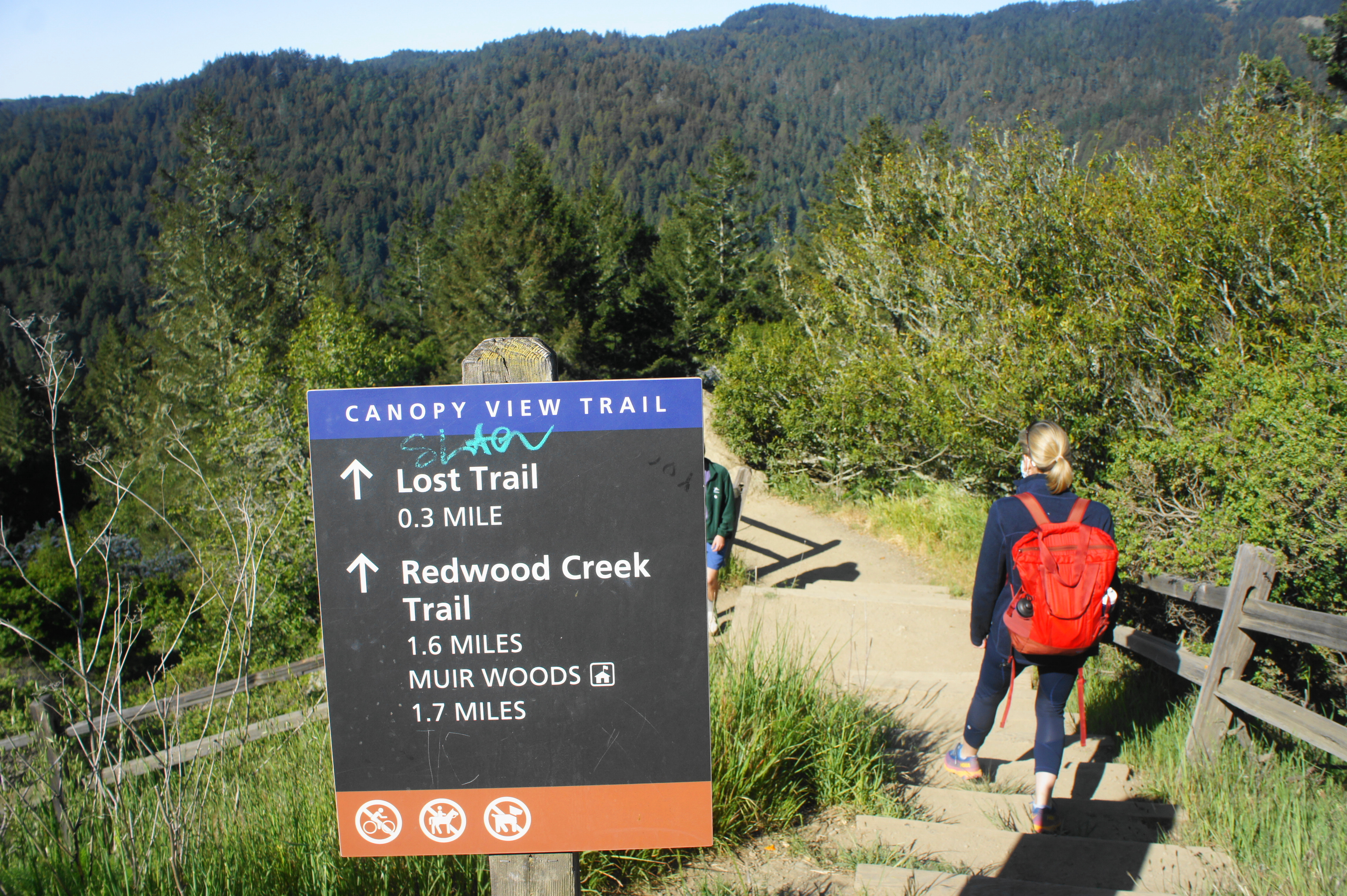
Across from the Alpine Club, there is a clear dirt path connecting quickly with the Panoramic Trail. Bear left and follow this track for 300 feet or so to a subsequent junction, where hikers should bear right on the winding Canopy View Trail. After a series of steps and switchbacks, the route eventually settles into a southward descent, plunging into the shady forest where hikers will spend the next few miles. Amid the dense thicket of bay and oaks, small redwoods begin to dot the landscape, along with ubiquitous sword ferns, a staple of the Bay Area. At 0.35 miles, the trail forks again; head right on the Lost Trail, a steep route with a seemingly endless set of wooden stairs.

Descending the Canopy View Trail 
Lost Trail to Fern Creek

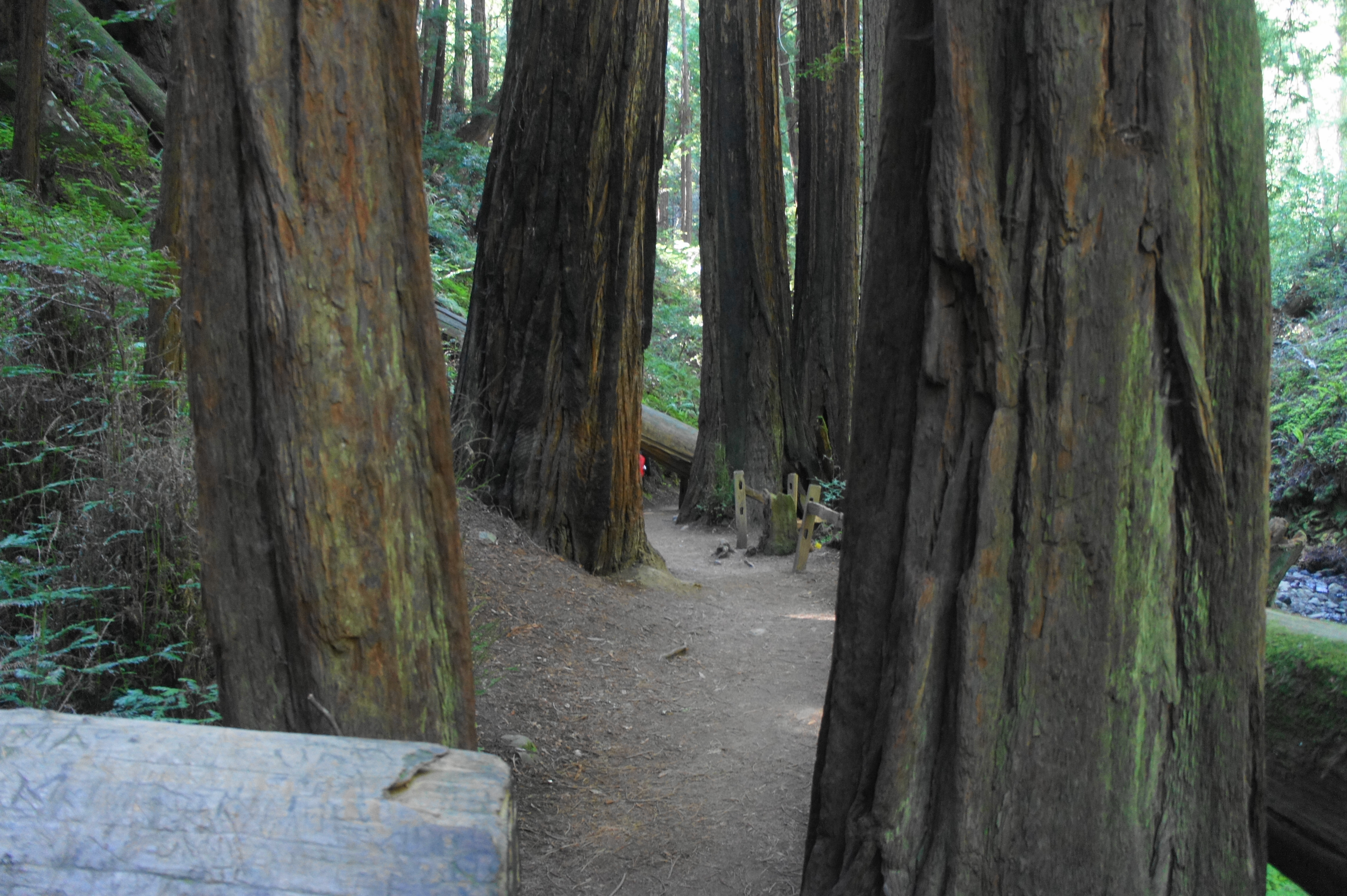
Shedding nearly 500 feet in less than a half-mile, the Lost Trail finally reaches the Fern Creek drainage at 8/10 mile, where hikers are greeted with another junction. With a long bridge off to your right, head left and follow the Fern Creek Trail for 4/10 mile, crossing the stream (on sturdy footbridges) twice. Here the redwoods grow larger and more impressive, hugging the banks of the flowing stream.


Bridge on the Fern Creek Trail 
Redwoods along the Fern Creek Trail

The Fern Creek section is the last bit of relative solace before catching up with the masses, who are mostly entering from the Muir Woods entrance. After crossing into the national monument at 1.1 miles, bear left at the junction with a paved path—the Redwood Creek Trail—which leads all the way to the parking area at the entry to the park.

Following its namesake waterway, the Redwood Creek Trail encounters many of the largest trees in the park, some of which are found in the lovely Cathedral Grove. Lovely redwood sorrel blankets the understory (as well as ferns, of course). Hikers have the option of bearing right at Bridge 3 and following the west bank of Redwood Creek (this tends to be less crowded), but the quickest route is to continue straight, passing through Founder’s Grove en route to the café, gift shop, and Visitor Center on the left.

From the Visitor Center, onward hikers should exit and cut across the accessible parking lot to a bend in Muir Woods Road, where one should stay right. Follow the path paralleling the road, then—at the sight of the main parking lot on the right, bear left, crossing the road toward the “administrative area,” which sports several ranger vehicles and warehouses. Here the marked Dipsea Trail bears off to the right, quickly leaving the road and following a partly graveled path back up a south-facing slope.
The trail gets gradually steeper as it ascends several staircases and briefly opens up at a very small parking area along Muir Woods Road at about 2.4 mile. Stay straight—cutting through the lot—resisting the temptation to head right on the wide but unmarked gravel road. Quickly the Dipsea Trail returns to single-track, following a mostly shady hillside in constant earshot of the road. At one point, the trail passes below a high reinforcing wall, followed by a short wooden boardwalk. From here it is another steady climb to a crossing of Muir Woods Road.
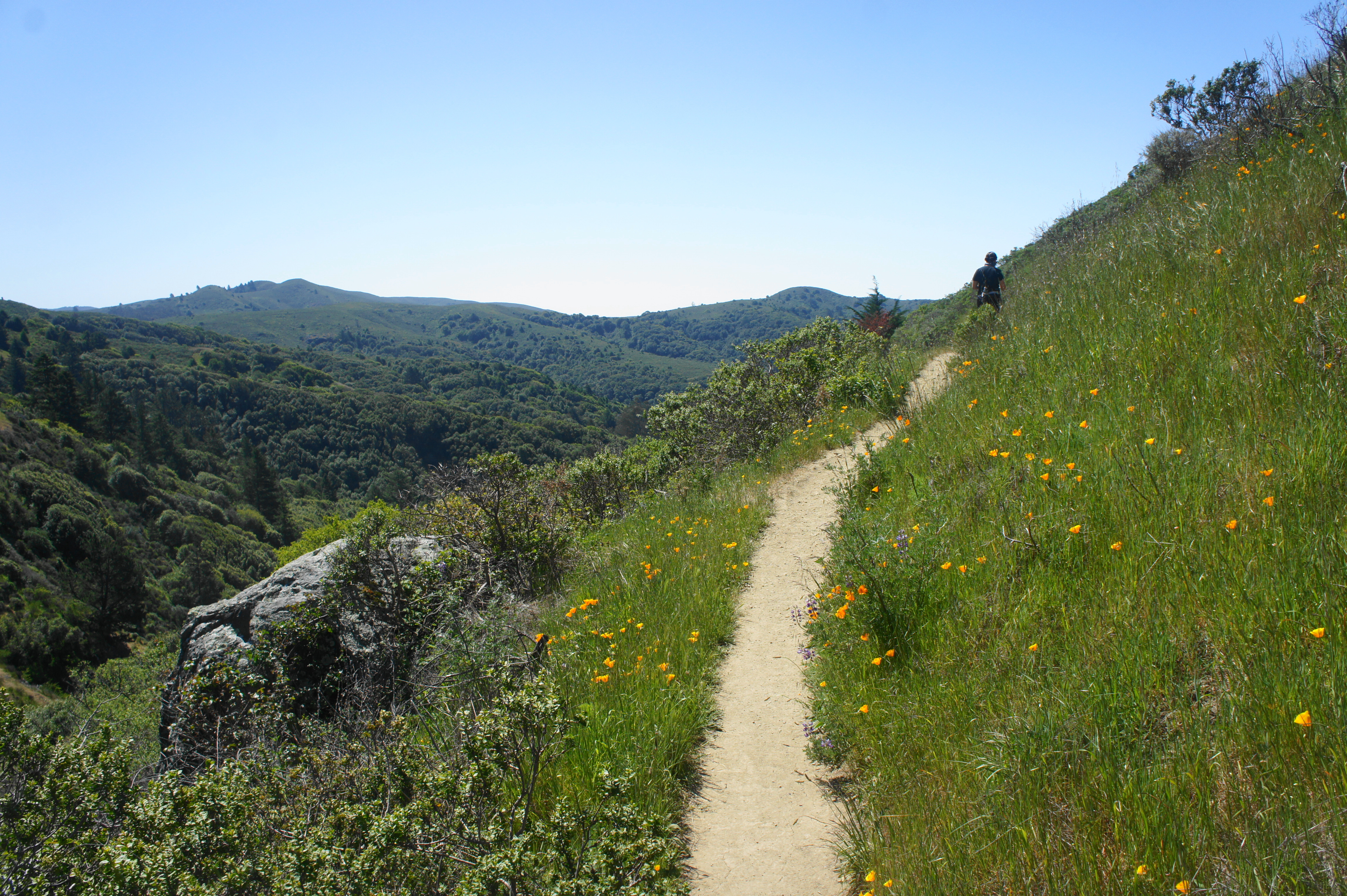
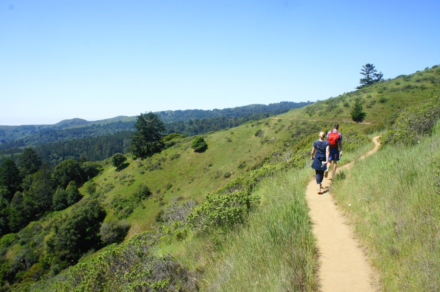
The onward Dipsea Trail, just before ending at Panoramic Highway, reaches a trail junction at around 3.1 miles. Take a hard left on the Sun Trail, one of the highlights of the hike. This stunning single-track immediately rises to heights with open views of the Redwood Creek drainage, with the various ridges of Mount Tamalpais State Park beyond. In spring, the hills are dotted with poppies, lupine, and other brilliant wildflowers.

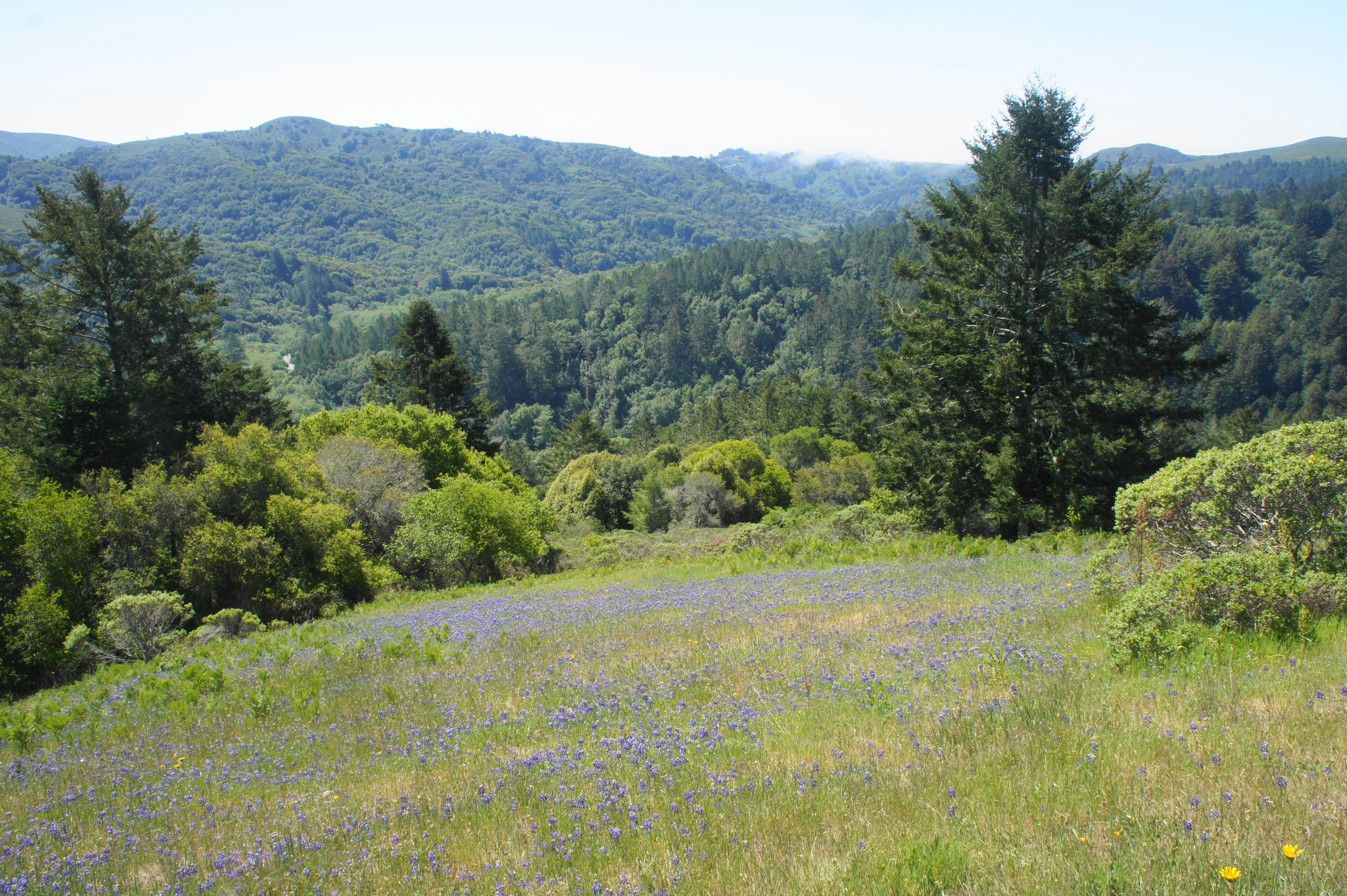
After this exceptionally scenic section, the Sun Trail ends at the confluence with a graveled road, where hikers should briefly bear left. The onward road leads down to the Nature Friends Tourist Club, while the path—now a single-track again—continues right as the Redwood Trail. Passing behind the Tourist Club to the left, the shaded path meanders for a quarter-mile or so before continuing a surprisingly steep climb, eventually emerging back above the trees.
After intersecting with the Panoramic Trail at about 4.5 miles, bear left and continue back toward the initial pair of junctions: bear right at each, ascending back to Panoramic Highway, where the hike ends.
Allot 3-4 hours for this pleasant and moderately-difficult walk, beginning and ending near Mountain Home Inn.
Extra credit
There are several other nice redwood hikes in the area, including the nearby Dipsea-Steep Ravine Trail Loop (4.2 miles), Ben Johnson-Bootjack Trail Loop (6 miles), and Steep Ravine-Matt Davis Trail Loop (6.6 miles).

Yes Andrew. The parking foe trails are mobbed on weekends around here.
LJ
Pingback: Top 10 Hikes in 2021 | Live and Let Hike
Pingback: Pfeiffer Falls Trail (Pfeiffer Big Sur State Park, CA) | Live and Let Hike