
The Steep Ravine – Matt Davis Trail Loop in California’s Mount Tamalpais State Park is a longer and more popular variant of the Steep Ravine – Dipsea Trail Loop (described in an April 2015 post). Though not as expansive as the views along the upper reaches of Dipsea, the sunny seaside vistas from the Matt Davis Trail are a main draw of the hike. Combined with a climb through redwood-studded Steep Ravine, this makes for a 6.6-mile, or roughly half-day, loop.


The hike
One can start this moderately strenuous hike at either the Pantoll Ranger Station in Mount Tamalpais State Park or down in the seaside town of Stinson Beach. However, the latter is much preferred, as one gets to start with the climbing before ending with a long and steady downhill and an oceanside meal or snack in town.
Park on the streets in town or, if you prefer, at the Stinson Beach parking area, and walk to the trailhead. The preferred route begins with a short stretch on the Dipsea Trail before ascending the Steep Ravine Trail to Pantoll before returning via the Matt Davis Trail. The Dipsea Trailhead is situated at the junction of Shoreline Highway (Highway 1) and Willow Camp Way (see here), marked with one of the Mount Tamalpais State Park’s excellent signs.
Dipsea Trail to Steep Ravine Trail (1.25 miles)
After ascending a set of wooden steps, the Dipsea Trail briefly levels off amid thick coastal scrub, with a grove of pine trees just ahead. Views of the Pacific Ocean are limited for now, but they improve after crossing Panoramic Highway in 1/10 mile. The steadily climbing path weaves amid grasslands, then wily oak-bay woodlands where the soil is blanketed with ferns. Climb a series of stone staircases before emerging out into the open again at about 4/10 mile.
Follow the sandy path, lined with coyote brush, as it continues to ascend, providing ever-better vistas of Stinson Beach, with the Point Reyes area beyond. At about ¾ mile, the trail crests a sunny hill then dips to clear a small gully before switchbacking uphill again. At the one-mile mark, the trail crosses a dirt road and then, keeping a patch of pines on the right, heads northeast toward the start of the Steep Ravine Trail.
Stay right at the junction at 1.1 miles, then left at the next, as the route descends into Steep Ravine. (Note: Turning right at the second junction leads ½ mile to Highway 1 and the Rocky Point Campground.) The riparian landscape is choked with trees and shrubs, including Douglas firs, tanoaks, and canyon/coast live oaks. At 1.25 miles, the Dipsea Trail skirts the banks of Webb Creek, the primary sculptor of Steep Ravine. Just beyond, hikers reach another junction: the Dipsea Trail continues right, across a wooden bridge, while the Steep Ravine Trail heads left. Take the latter option, leaving the Dipsea Loop for another day (see here).
Steep Ravine Trail to Pantoll (1.5 miles)
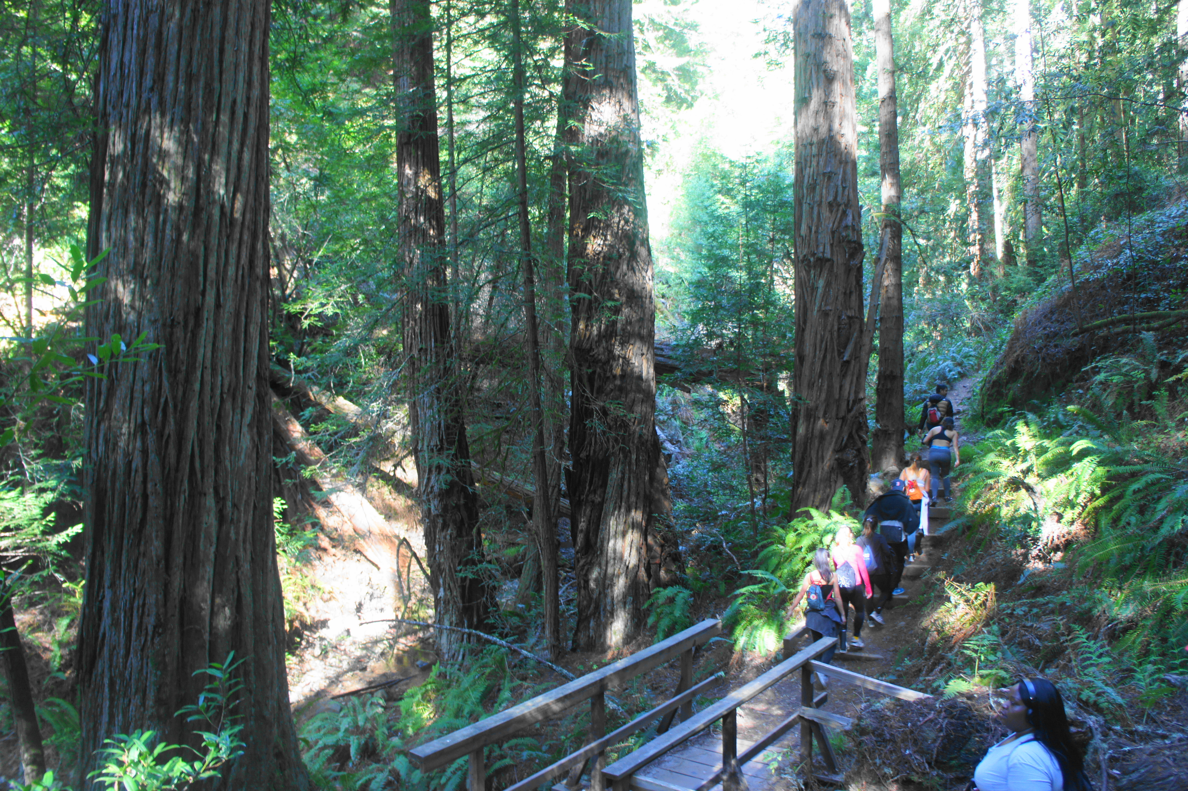
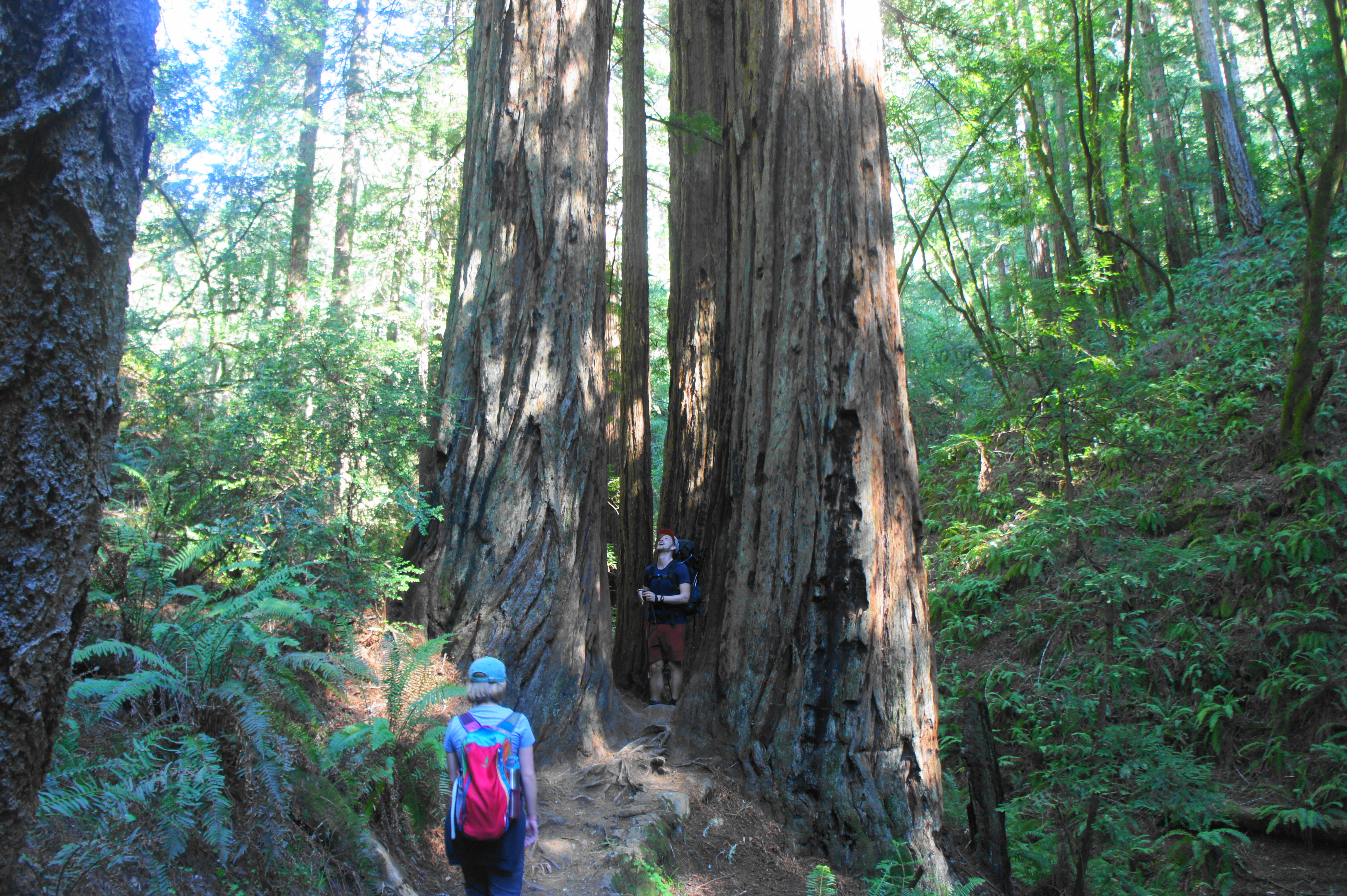
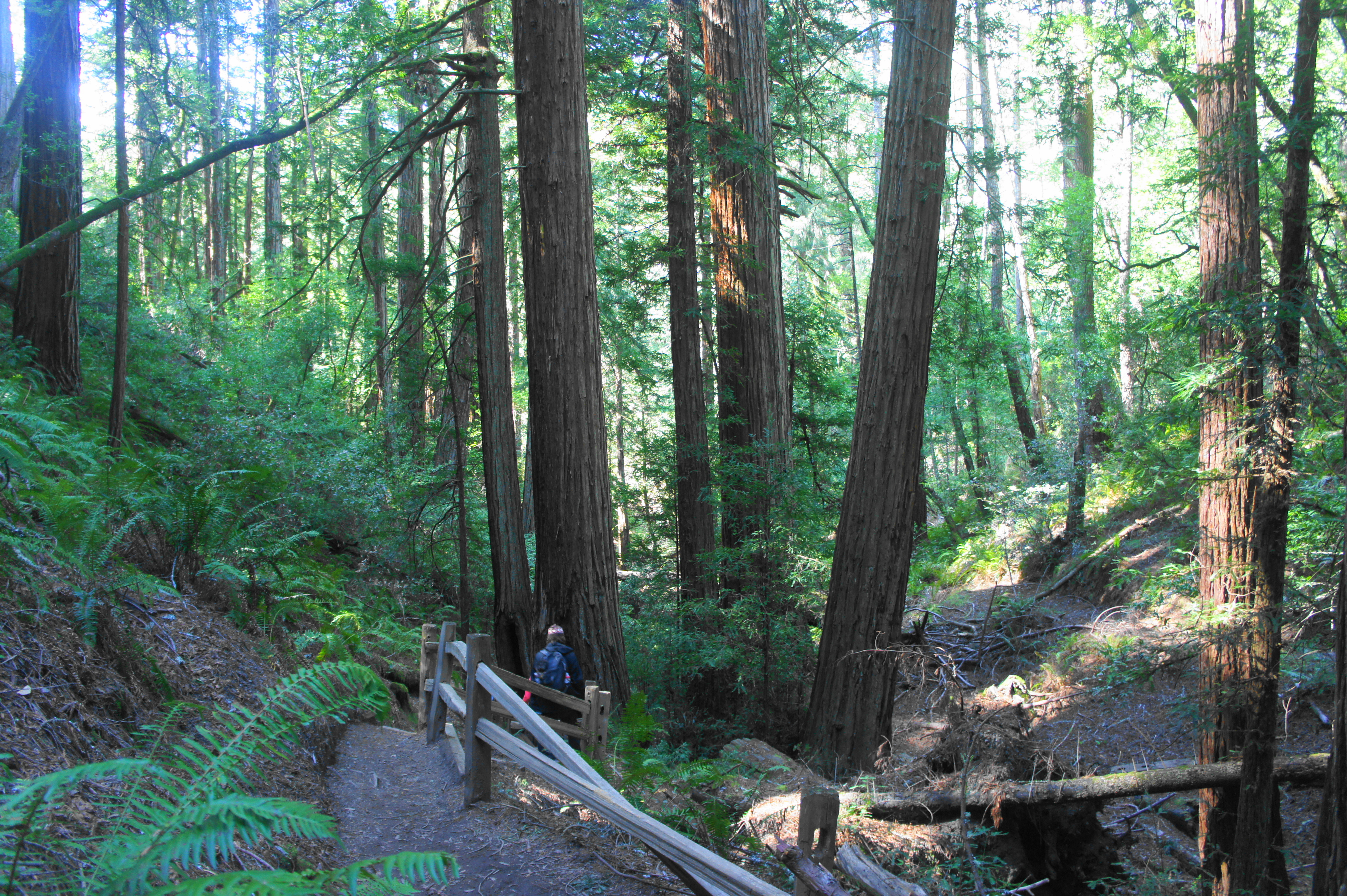
As the Steep Ravine Trail gradually climbs, the scenery becomes more and more grand. Trickling waters become steady flows, and the primarily oak-bay woodlands add iconic California redwoods to the mix. Two bridges at around 1.3 miles cross the stream in quick succession, followed by a third about 100 yards later. On the right bank, the trail ascends two sets of stony stairs, entering one of the best redwood groves on the hike.

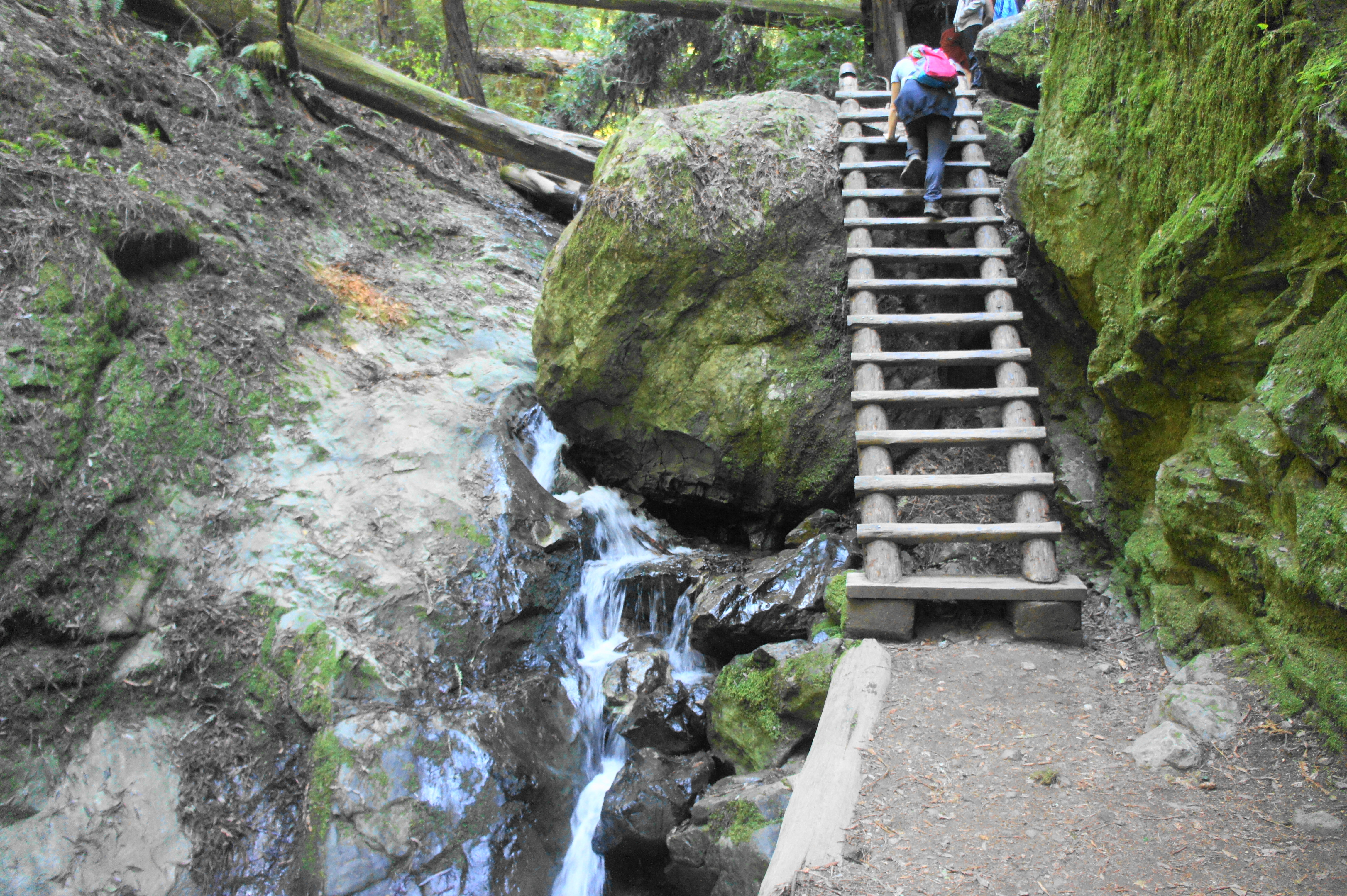
Here the trail briefly levels off, then traverses two more bridges, leaving one back on the right side. After climbing again, the Steep Ravine Trail reaches the iconic ladder: a 15-rung wooden structure that abuts one of the most beautiful cascades on the Marin Peninsula. If you’re lucky to have the place to yourself, this is one of the natural wonders of the Bay Area. Well…at least the falls, but the man-made ladder is nice to have in order to surmount the massive greywacke boulder wedged in the stream.
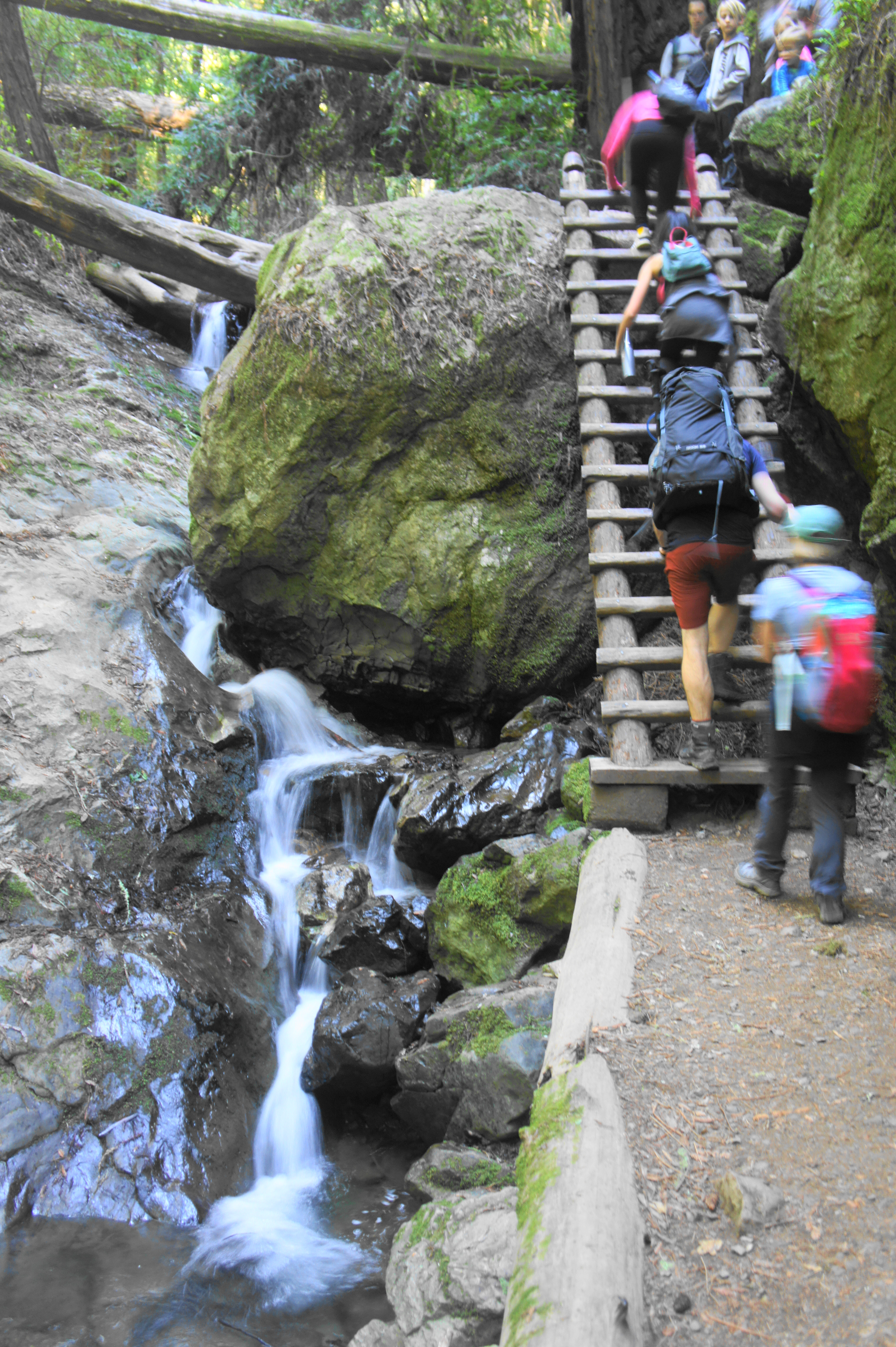
Having cleared the ladder, the trail continues along the southern banks of Webb Creek, passing small but impressive groves of second-growth redwoods and crossing to the left side. At 2.4 miles, the Steep Ravine Trail switches again to the right side, then eventually climbs out of the canyon. After a series of switchbacks, a final ascent leads to Pantoll Ranger Station and parking area, 2.8 miles—and more than 1,300 feet in elevation gain—from the start.
Matt Davis Trail to Stinson Beach (3.8 miles)
Take a restroom or snack break at Pantoll, a bustling parking area on weekends. Then head out of the parking lot and cross Panoramic Highway to the west side, where one can catch the Matt Davis Trail, your return route to Stinson Beach. This trail is much longer than Steep Ravine but stays high for the first mile and a half.
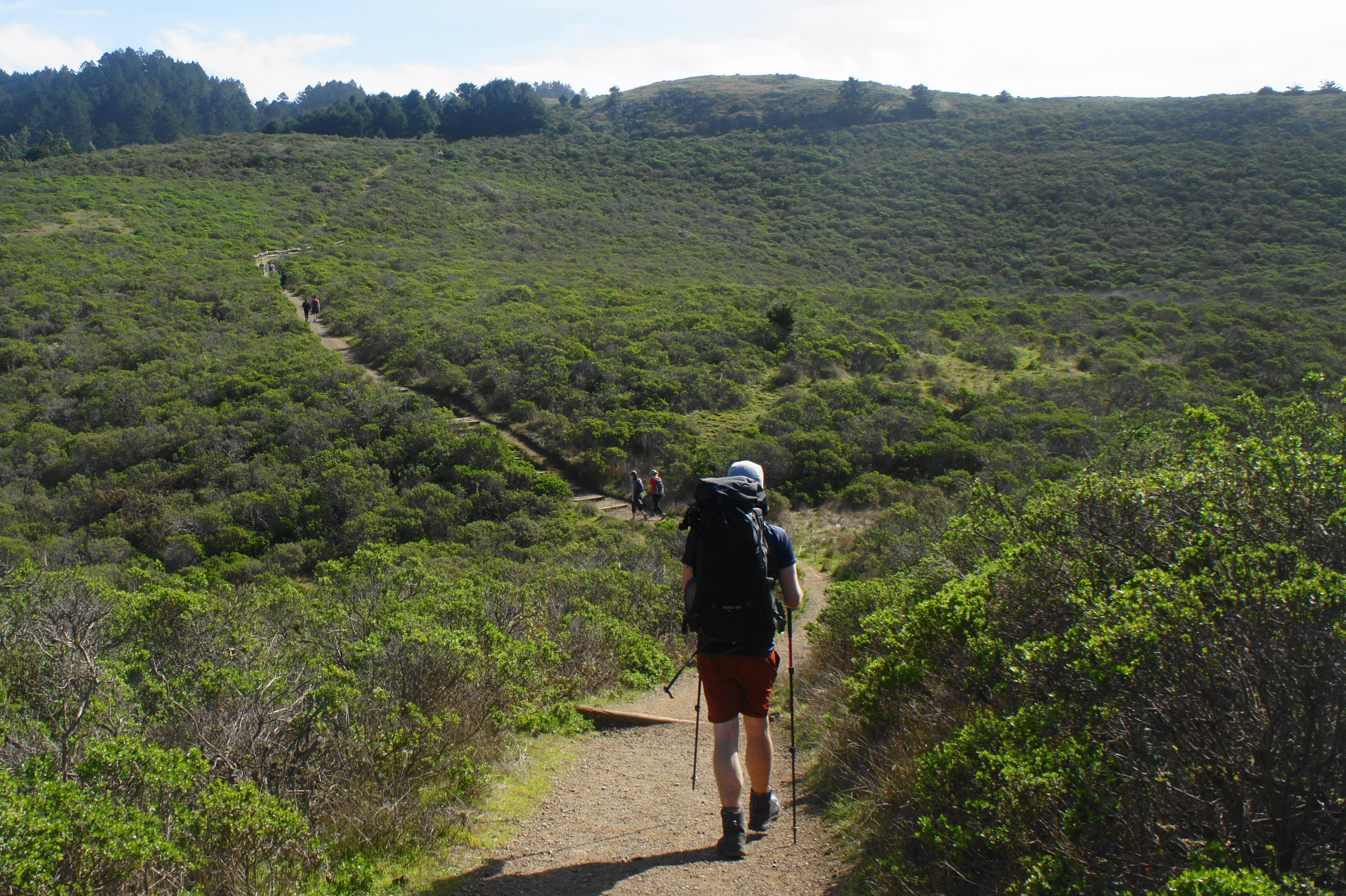
The first stretch is largely uneventful, with views largely blocked by thick woods. Stay left at the first junction at 2.9 miles, then follow the well-trodden single-track for over a mile. Weaving in and out of woody ravines, the trail stays at around 1,500-1,600 feet, making for easy and level walking.
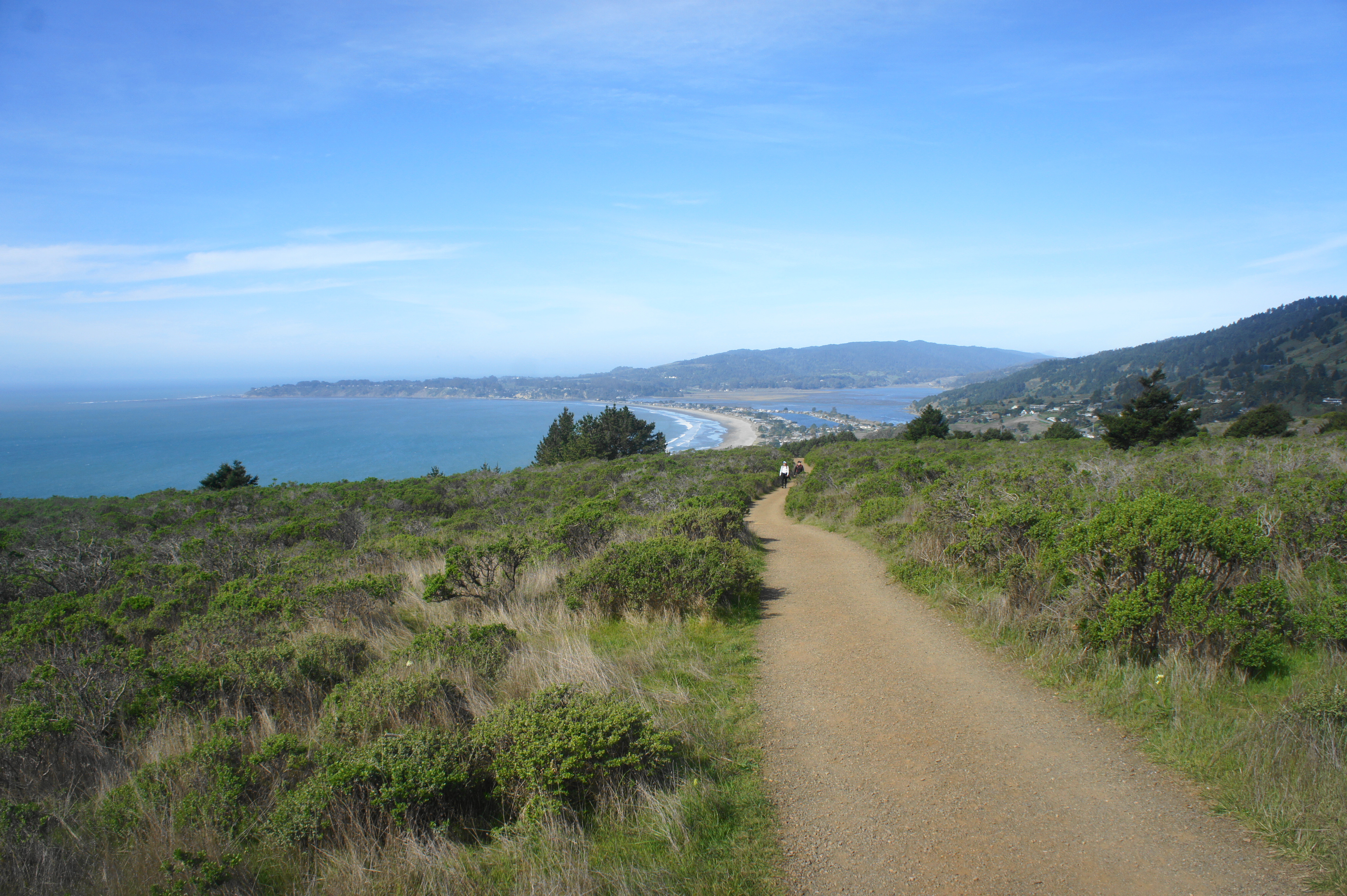
Finally, at about mile four of the hike, the Matt Davis Trail bursts out into the open, revealing excellent views of the Pacific Ocean. Here the path follows the scenic slopes of Bolinas Ridge, cresting a high notch at 4.2 miles, then pops in and out of an oak-lined ravine called Silva Gulch. Out in the open again, the trail forks: the Coastal Trail continues right, while the Matt Davis Trail heads off to the left. Stay left, beginning a long, switchbacking descent to Stinson Beach.
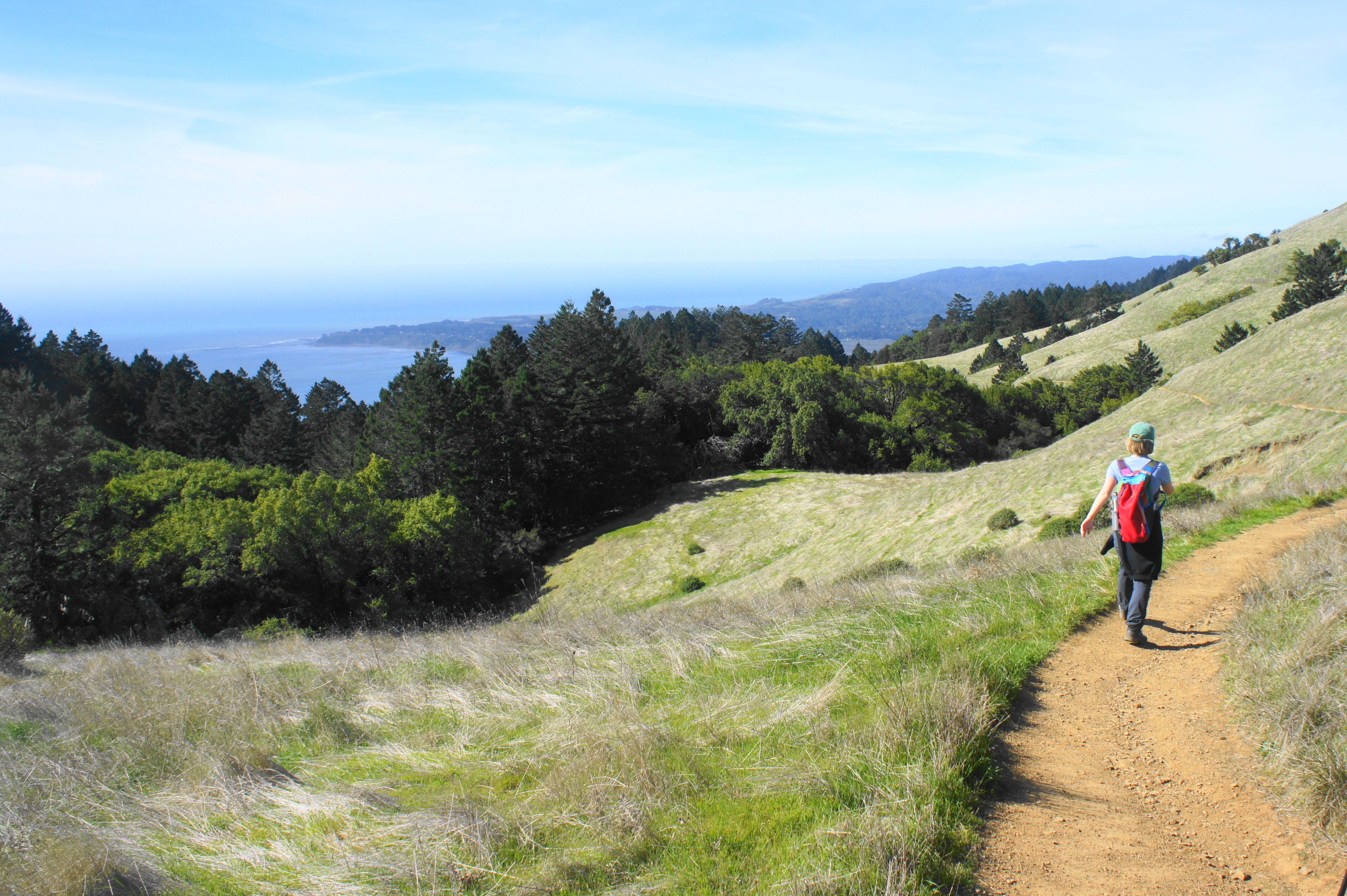

While the Matt Davis Trail remains high for the next ¼ mile, it begins to drop sharply at about 4.75 miles, entering a heavy woodland that does not let up until the end of the hike. The ever-descending trail roughly follows an intermittent stream–Table Rock Creek–which forms a steep-sloping ravine. Dropping amid the oaks, pines, bay trees, and ferns, the Matt Davis Trail briefly emerges from the woods at Table Rock, a nice outcrop at 5.8 miles, but then continues to descend again through the shady gully. At 5.9 miles, there is a nice seasonal cascade on the right.

At the six-mile mark, the trail briefly levels and crosses a wooden bridge and then pokes back out into the sun, revealing closer views of Stinson Beach and the endless ocean beyond. Descend a set of switchbacks, then stay left at the trail fork at 6.3 miles. Minutes later, stay right at the next junction. From here it is a short, downhill jaunt back to Stinson Beach. Around 6.6 miles from the start, hikers are back on pavement on residential Belvedere Avenue.

From here, it is a short walk (south, or downhill) back to Shoreline Highway and central Stinson Beach. The loop hike clocks in at 6.6 miles, a roughly 3-5 hour stint, depending on fitness levels.

Please note that the parking areas you have described for this hike are currently closed due to COVID-19. They may not be open for some time.
Thank you. This description is from February so does not reflect current conditions. I will direct any interested viewers to the Mt Tam State Park site for latest updates.
Pingback: Top 10 Hikes in 2020 | Live and Let Hike
Pingback: Fern Creek – Dipsea – Sun Trail Loop (Muir Woods National Monument, CA) | Live and Let Hike
Pingback: Top 10 Hikes in 2021 | Live and Let Hike
Preferred starting point for this hike is actually at the intersection of Panoramic Highway and Shoreline drive – listed on Google maps as “Dipsea Trailhead parking”. From this point, it’s around 7 miles total to do the full loop, taking into account the connection from Matt Davis trailhead in Stinson Beach, back to Dipsea parking lot, via the road/ fire station/ short trail opposite Willow Camp Way.