
The East Bay, for all of its wonderful hiking, is not known for its waterfalls. Flowing streams, let alone tumbling cascades, are scarce amid the largely scrubby, chaparral hills that separate San Francisco Bay from California’s vast Central Valley. After springtime rains, however, there a handful of seasonal streams that come alive. One of the best-known spots is the lush, shady landscape of northeastern Mount Diablo State Park, where a moderately-difficult loop hike leads to a series of modest but beautiful waterfalls. Of course, the waterfalls largely disappear by summer, but the towering cliffs and diversity of plant life in Donner Canyon may be enough to entertain hikers year-around.
Update Spring 2021: Due to complaints from neighbors and restrictions imposed by the City of Clayton, parking at the ends of Rialto and Regency Drives is now restricted to permit holders only. Alternatively, park at Mitchell Canyon Staging Area ($6/vehicle), adding around 2 miles round-trip to this hike.

The hike
As of January 2020, there were a few options for starting this 5.5-mile loop hike, but the choices have since narrowed as the city of Clayton has placed restrictions on parking in the area. The ideal place to start is at the end of Rialto Drive, a residential street in Clayton that abuts the edge of Mount Diablo State Park. But the neighbors were onto this, and non-resident parking is now limited to permit-holders only. Hikers should now park at the nearby Mitchell Canyon Staging Area ($6 park entry fee required). Note: Starting at Mitchell Canyon adds at least two miles round-trip to the loop described below.
Starting at the Rialto Drive staging area (which was allowed on weekdays as of January 2020, when this hike was completed, but since has been prohibited), hikers should pass through the entry gate to enter Mount Diablo State Park, the East Bay’s largest. With the namesake peak visible ahead, the route splits just steps beyond the start. While possible to go either way, the route as described heads right, following the Falls Loop in a counterclockwise direction.

The westward route quickly climbs out of the grassy ravine and crests a low ridge before reaching a second fork within 250 yards. Stay left here, continuing as the old road drops into Donner Canyon, laced with the East Bay’s ubiquitous oak-bay woodlands. After crossing Donner Creek, the path weaves around a pair of bends, climbing to Donner Canyon Road, about 1/3 mile from the trailhead. (Note: Here the entry path from Mitchell Canyon comes in from the right.) Bear left at the fork, following the dusty Donner Canyon Road for the next 1 ¼ miles.
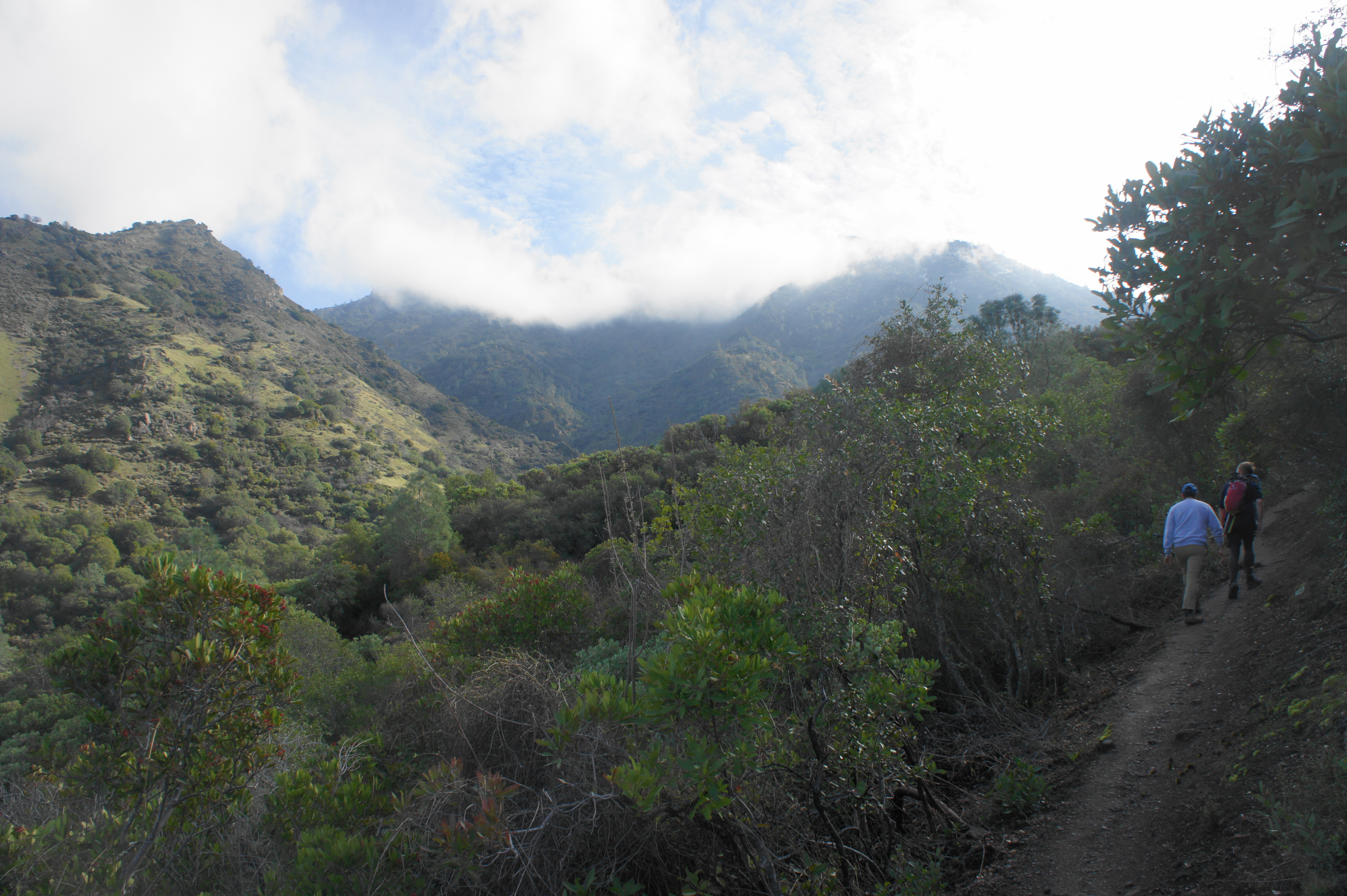
As you proceed, the diversity of plant life increases, with lovely manzanita and toyon beginning to appear amid the oak-bay mix. Ahead, one can the high mountain tops of (from left to right) Mount Olympia (2,946’), North Peak (3,557’), Mount Diablo (3,849’), and Eagle Peak (2,369’), the titans of this scenic stretch of the Diablo Range.
Following the creek on the left, the fire road ascends gradually, passing a string of junctions at about the one-mile mark. First, a spur trail heads left to Donner Cabin, then the Donner Cabin Trail bears off to the right up ahead. Finally, stay straight on the fire road as the Hetherington Loop Trail bears left toward the creek bed. Just beyond, Donner Canyon Road begins to ascend more rapidly, the first heavy-breather of the hike. The track rises well above the creek, providing wider vistas up and down the canyon.
At 1.3 miles, pass the junction with the Tick Wood Trail on the right, then come to a junction with the Hetherington Loop Trail again on the left. Stay straight on the double-track; finally, at 1.6 miles, deviate from the main route by heading right (uphill) on Meridian Ridge Road. The westward turn is only temporary, as hikers should head south again on the Middle Trail, which begins 100 yards up the road on the left.
Now, for the first time, the path turns to single-track, a pleasant, narrow, and winding trail that weaves through dense patches of toyon, chamise, manzanita, oak, and bay. The Middle Trail provides access to Wild Oat Canyon, the heart of the falls area.
Climbing uphill through the thicket, the Middle Trail reaches a fork at 2.2 miles. Bear left on the Falls Trail, the highlight of the hike. In the shadow of Mount Diablo, this scenic track skirts the eastern flank of the canyon, then switchbacks down to the first of several stream crossings, 2.3 miles from the start. The cascades here are modest, but better waterfalls are ahead.
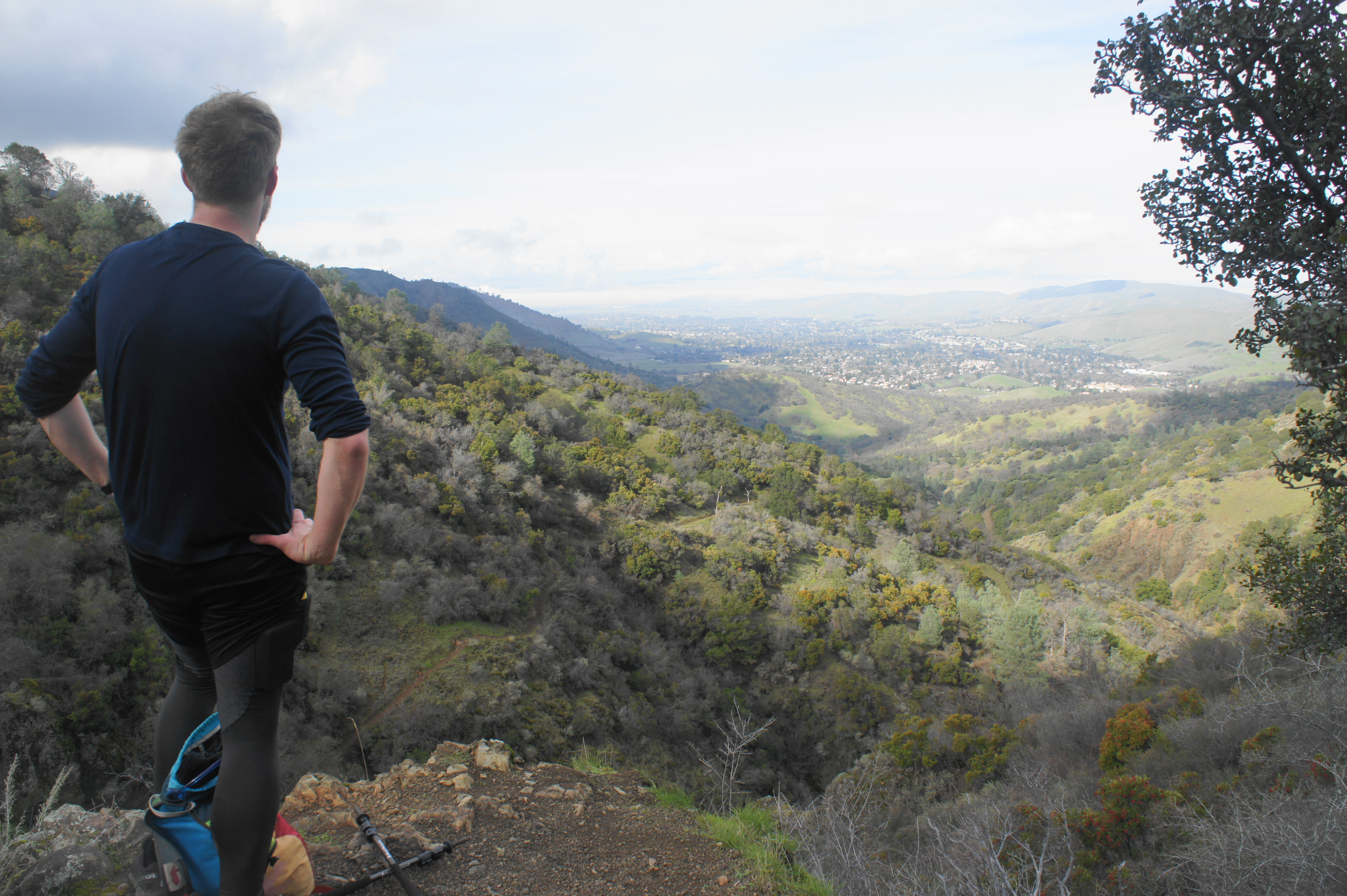
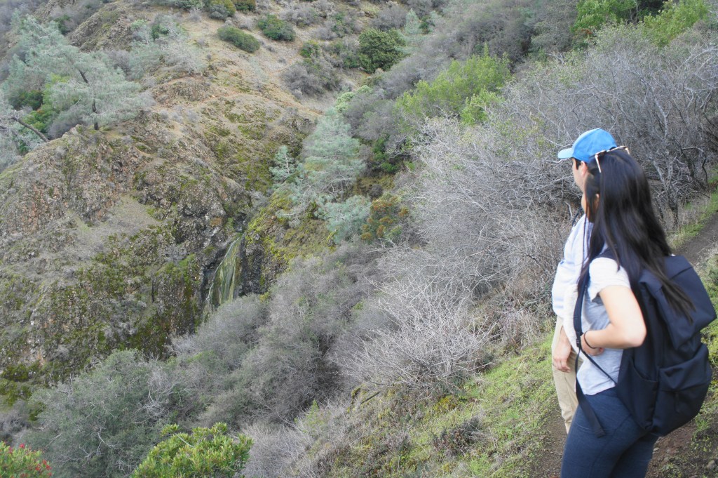
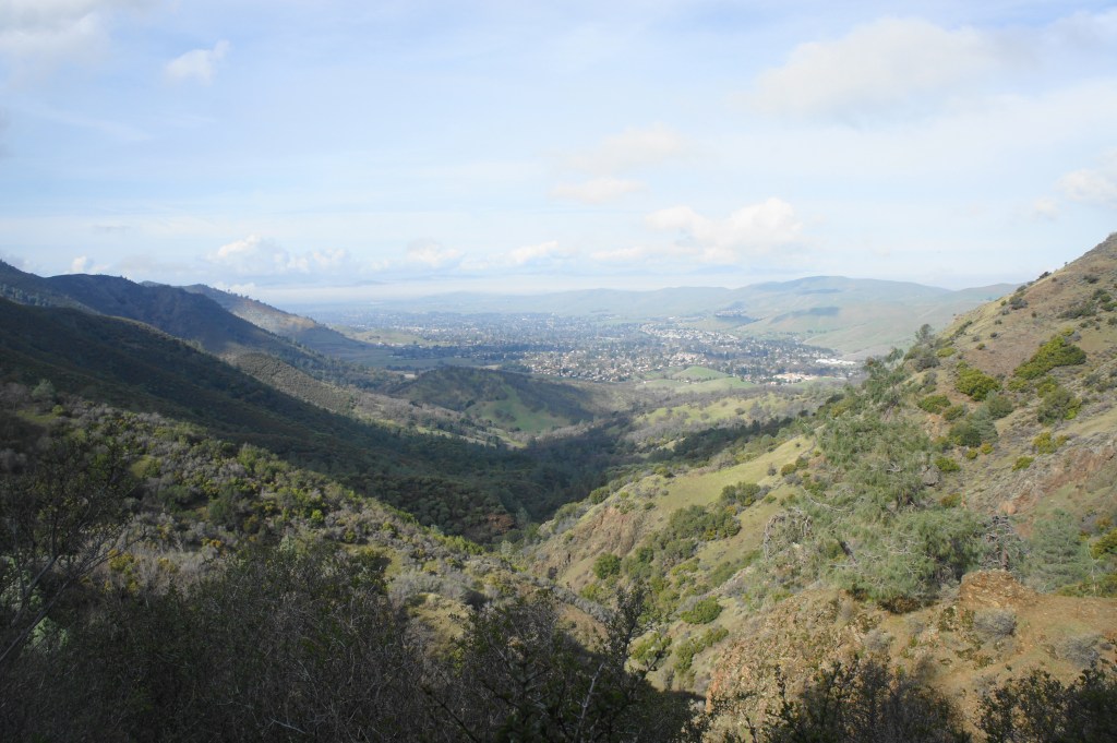
After crossing the first stream, the Falls Trail crests a hill topped by a gnarly juniper, then traverses a second creek. Beyond, the single-track climbs steeply to an excellent viewpoint in which one can see down-canyon to Clayton, with the Concord Hills and Suisun Bay beyond.
Rounding the next scrubby slope, the first “real” waterfall comes into view, firing off a mossy cliff and plunging into Donner Canyon below. The water flow here rarely becomes a torrent, but the sight of flowing waters is welcome nonetheless. The Falls Trail descends steeply to cross the stream above the flume, then proceeds to climb again on the other side.
After this third stream, the trail approaches a rock outcrop with a nice view back at a 15-foot falls. Then the rocky path descends again to cross a fourth creek, this one sporting a trailside cascade that is relatively modest; the stream below, however, drops more precipitously, a sight only realized after the trail pulls away from the creek on the other side.

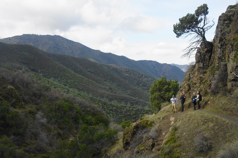
After crossing a fifth and final stream, the route hugs a scrubby hillside and descends a set of switchbacks, offering views back at the highest and most impressive of the falls, a multi-tiered chute. The waterfalls are not easy to access, however, leading most visitors only to admire from afar.

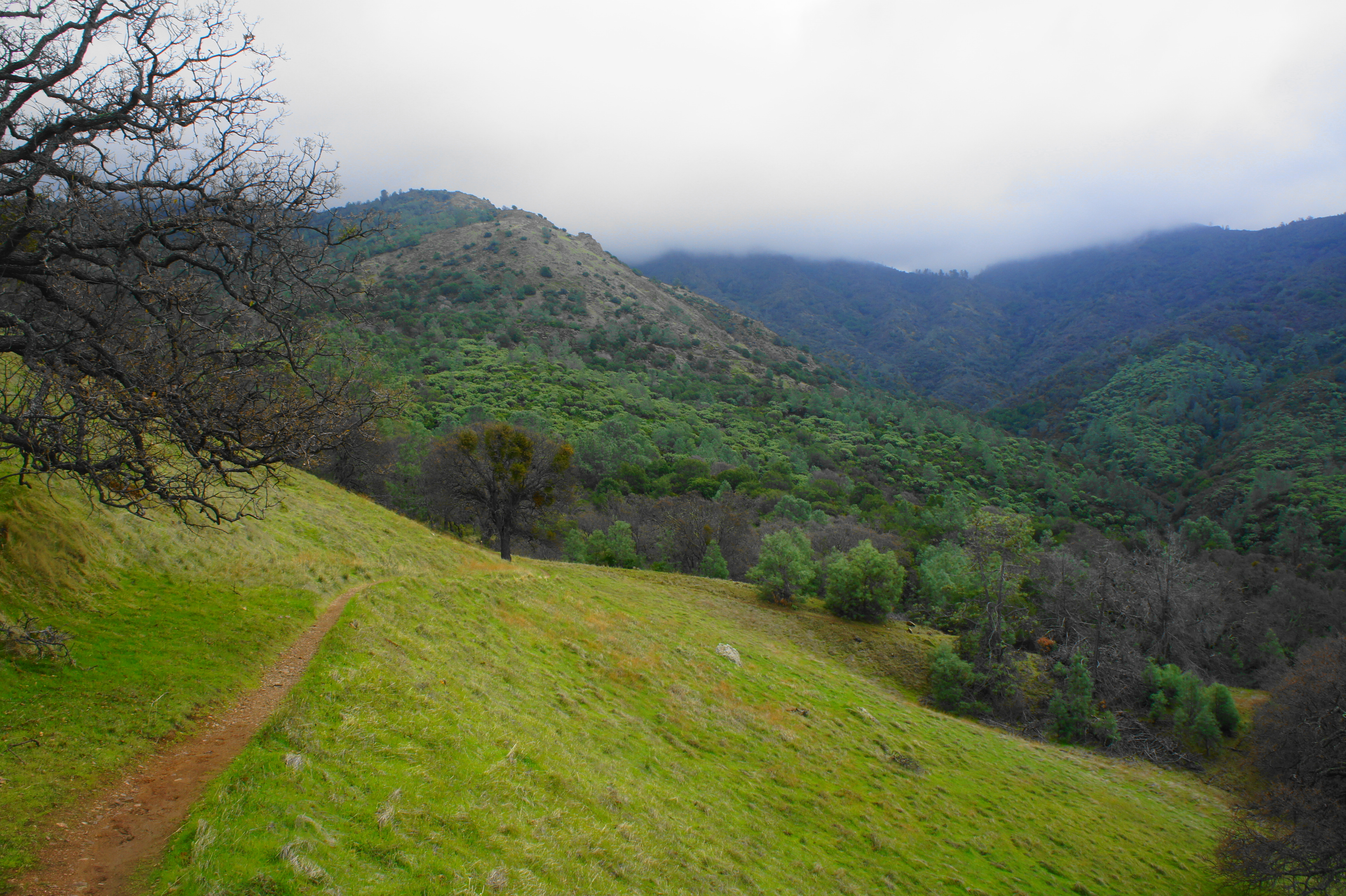
By now the trail is situated high up on the scarred western slope of Wild Oat Canyon. The brownish Franciscan chert forms high, impressive walls, and the grade drops sharply—roughly 300 feet—off to the left. This is the end of the falls section; hikers are now heading back north toward the trailhead, although by way of a different route than the approach.

At 3.4 miles, the Falls Trail ends, merging with the wide Cardinet Oaks Road, another double-track fire road. Bear right (uphill), then turn left at the next fork on the Wasserman Trail. This scenic path meanders through very dense thickets of toyon and manzanita. Stay left at an unofficial junction at the park boundary at 3.6 miles, then descend a mild slope, partway down into Donner Canyon.

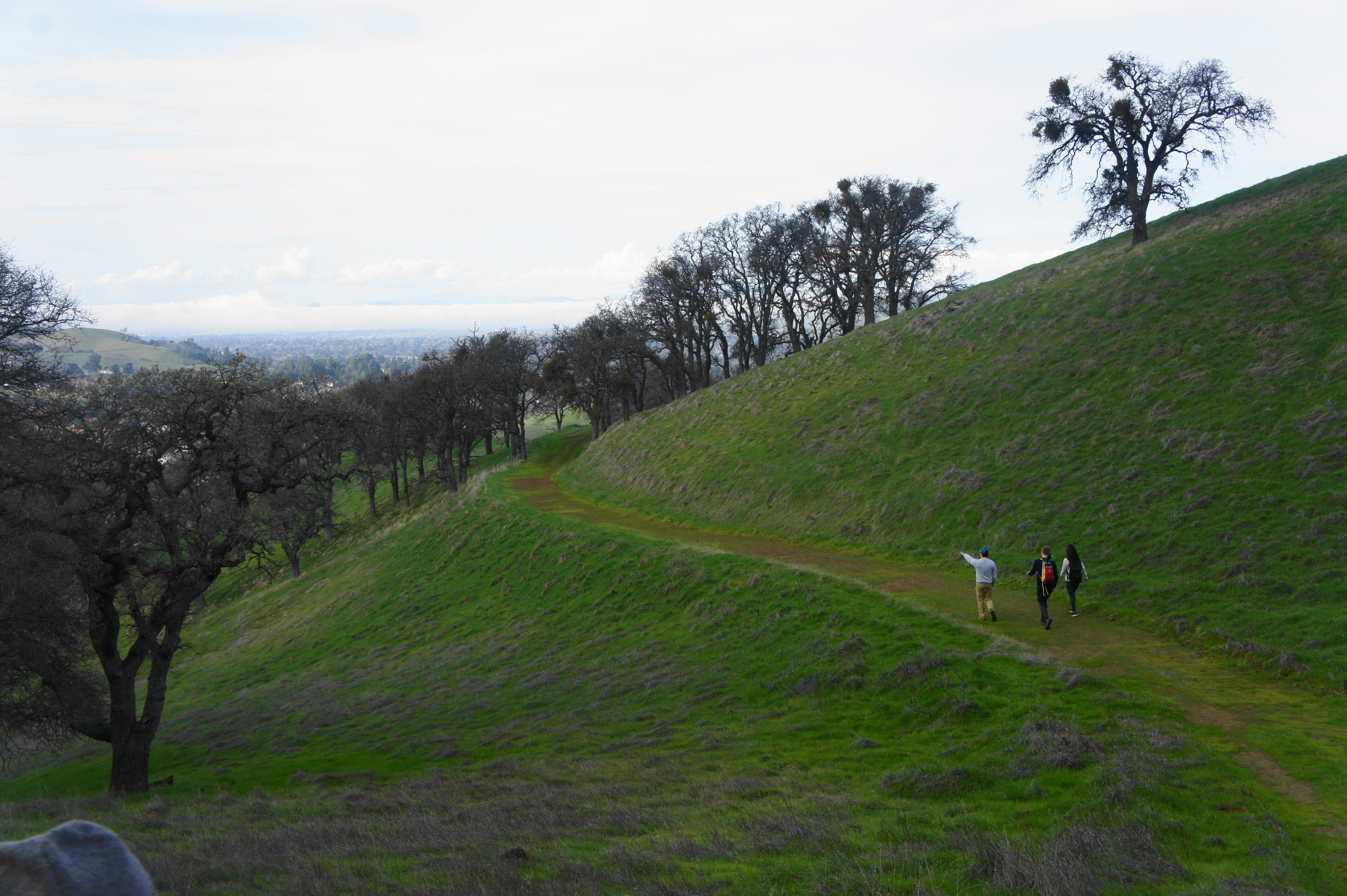
At 4.1 miles, the trail emerges into a pretty clearing and bounds down to another junction; bear right on the Donner Trail. Amid grassy, oak-studded slopes, this path heads northwest for 250 yards. Bear right on the Bruce Lee Spring Trail, which climbs again to clear a low ridge, then skirts a long ravine before ending at Clayton Oaks Road, now 4.6 miles around the loop.
Follow the fire road left as it passes two junctions (stay left) and gradually descends a beautiful ridge dotted with oaks. Eventually the strip mine of Mount Zion (1,635’) becomes visible ahead. At last, after a steady descent with open views, Clayton Oaks Road returns to the familiar starting point: the initial trailhead at Rialto Drive.

The entire loop clocks in at about 5.5 miles and, despite some occasionally steep ascents, is a moderately-strenuous circuit. Allot roughly 3-4 hours for the hike, or more if you plan to explore some of the many interlocking trails along the way.

Pingback: Top 10 Hikes in 2020 | Live and Let Hike
Good luck parking on Rialto or Regency. All permit parking and they do ticket. Start from Mitchell Canyon where there are bathrooms water and tabless.
I saw that the city of Clayton cracked down on this last year, yes, thank you. Note that this post was completed back when parking was allowed on weekdays.
Best just to go to Mitchell Canyon.. Support State Park.
As Gatekeeper said, this is all wrong. Permit parking 24/7 for Rialto and Regency. Police are active to ticket and tow. Need to go to Mitchell canyon which is there is a parking lot and needed facilities
.1st off, there are NO waterfalls this time of year so don’t get duped. 2ndly the trails are not all lush and green like the photos. It’s all brown and dried out and miserable to hike cuz of the heat and terrain.
3rdly, there is only like 10 parking spaces on Regency open to public. Both Regency Dr and Rialto are PERMIT parking only and you will get cited and towed.
If your going to do any of these hikes start off at the REAL State Park Entrance on Mitchell Canyon. They actually have picnic tables, running water and bathrooms. Regency and Rialto do not. In fact there are no trash cans either. So support Park district and go from the real entrance on Mitchell Canyon. Lots of shade parking
Dont want to see anyone doing anything inappropriate at Rialto trail entrance right 😉
Steeling fruit lol.
See update in the post above.
As Gatekeeper said, this is all wrong. Permit parking 24/7 for Rialto and Regency. Police are active to ticket and tow. Need to go to Mitchell canyon which is there is a parking lot and needed facilities
“All wrong” is a stretch, but yes, see my comment above. Note that this hike was completed back when weekday parking was allowed.
Pingback: Top 10 Hikes in 2021 | Live and Let Hike