
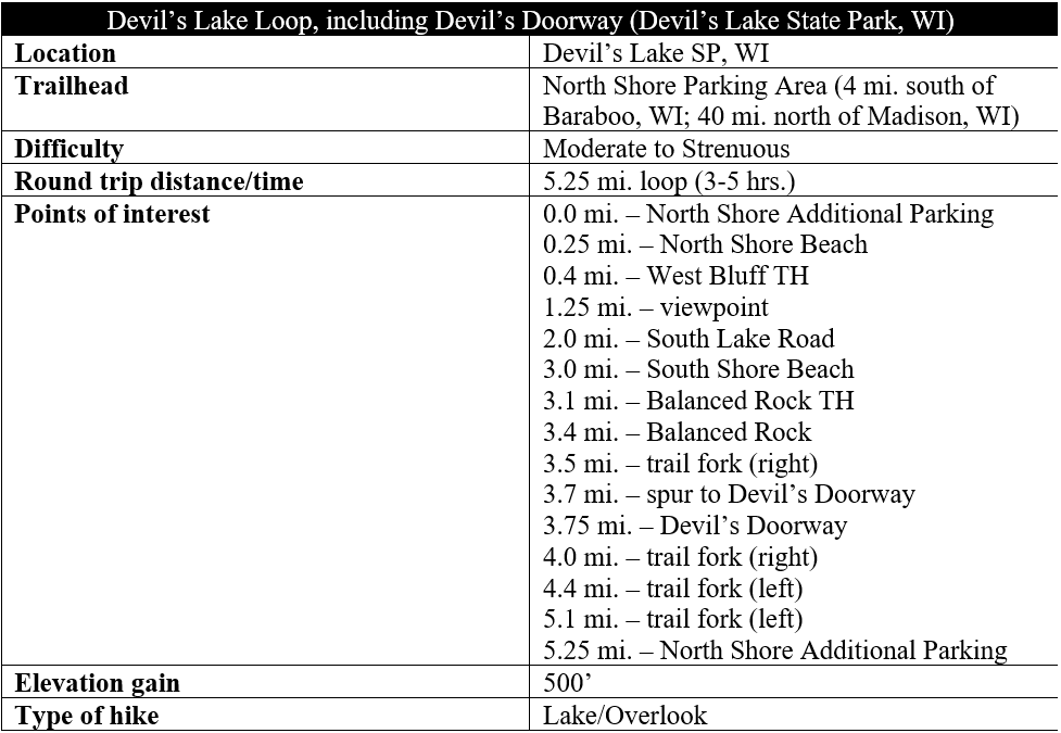
It’s not too often that visitors are able to walk in a mountain range with rocky bluffs dating to 1.6 billion years ago, in addition to a rare freshwater endorheic lake—a body of water situated in a natural depression with no external drainage. And yet one can find such sights in perhaps the most unlikely of places—south-central Wisconsin—at Devil’s Lake State Park. Popular mostly as a summer beach destination, Devil’s Lake also has an extensive trail network, with the best hike being a 5.25-mile circumnavigation of the lake basin, including a short spur to Devil’s Doorway, the most recognizable rock formation in the state. This circuit hike—rated moderate to strenuous—can satisfy much of a day for visitors to the area and is unlikely to disappoint.

The hike
Devil’s Lake State Park is located about an hour from Madison, Wisconsin and an even shorter distance from Wisconsin Dells and the town of Baraboo. There are two primary entrances—North Lake and South Lake—with either offering access to the Devil’s Lake Loop hike described. For ease of navigation, this description begins at the more popular North Shore, an area containing a lengthy lakeside beach, many concession stands, several campgrounds, and a modest Visitor Center. Drive past the Visitor Center, paying the fee for entrance, and make your way toward the parking area at the northeast corner of Devil’s Lake. On a busy day, it’s likely you will be compelled to cross the railroad tracks and turn right at the Additional Parking Area. This is all the better, as this is an even more convenient start/end point for the loop hike.
North Shore to South Shore via West Bluff Trail (3.0 mi.)
Once parked, make your way back north, beginning the loop in a counterclockwise direction. Reach a four-way road junction and bear left, crossing the active railroad tracks and staying to the left on a paved sidewalk. Pass parking on the left, then angle southwest on the wide strollway as it heads to the Park Headquarters, changing rooms, and North Shore Beach. You’ll have to pass hordes of noisy swimmers, sunbathers, and picknickers before you get some natural peace again, at the western edge of the beach, around 1/3 mile from the start.
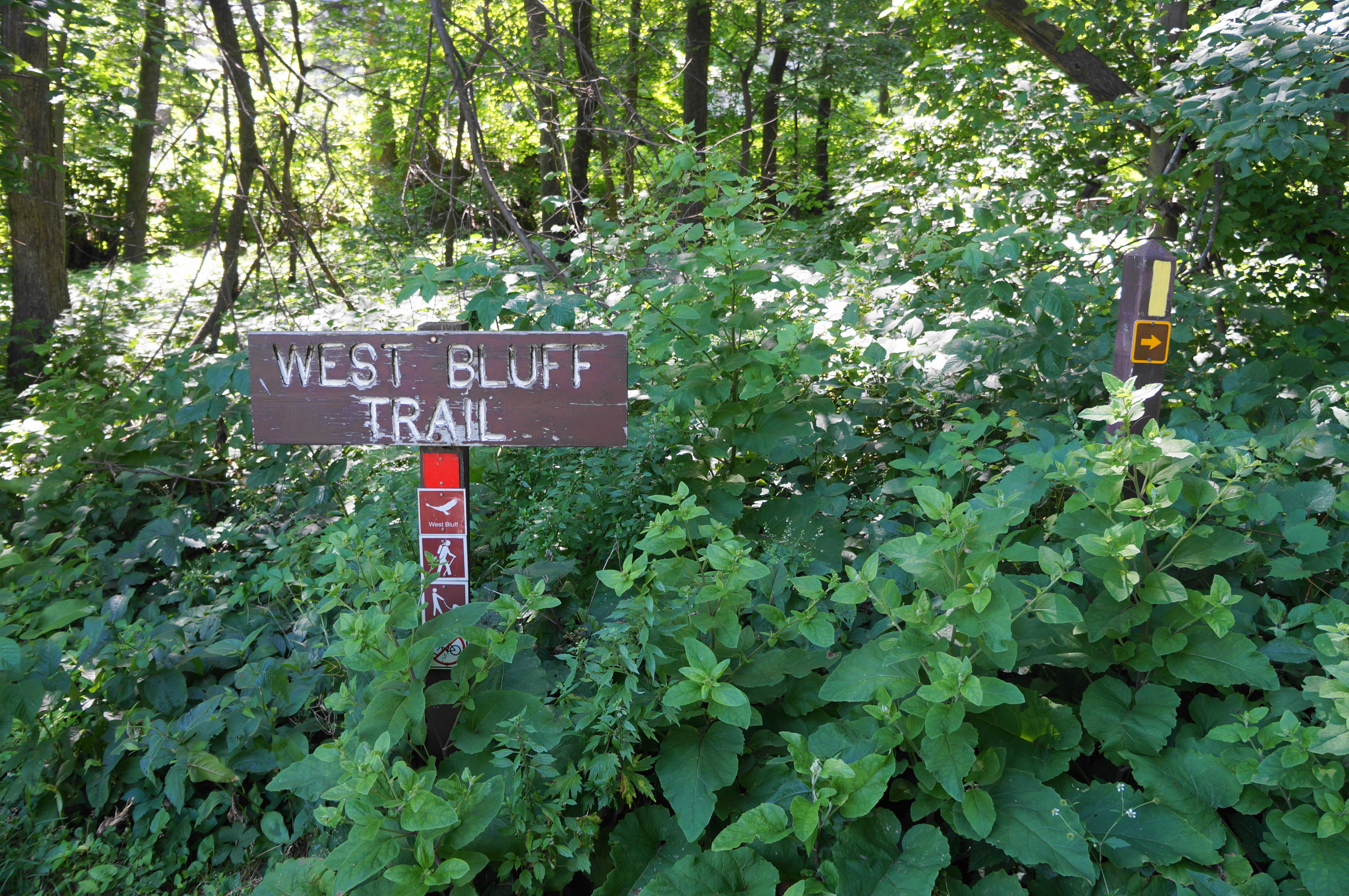
Follow the paved track to its conclusion, at the base of a sloping rock pile of quartzite, the predominant rock type in the area. Here the onward route veers right and turns to crushed gravel, the start of the red-blazed West Bluff Trail. This marks the start of the first of two significant ascents on the hike—though it begins mildly at first as the trail keeps the quartzite slope and a small drainage on the left.
At ½ mile, the route rises to catch a bend in Park Road, the main entryway for the North Shore area. Here there is a map and signage for the Ice Age National Scenic Trail, a partly-completed, 1,200-mile route through Wisconsin that follows the formerly glaciated hillocks and valleys of the state from the Minnesota border to Sturgeon Bay on Lake Michigan. Devil’s Lake is one of the highlights of the Ice Age Trail, and hikers on the Devil’s Lake Loop will follow a portion of it for the next three miles.
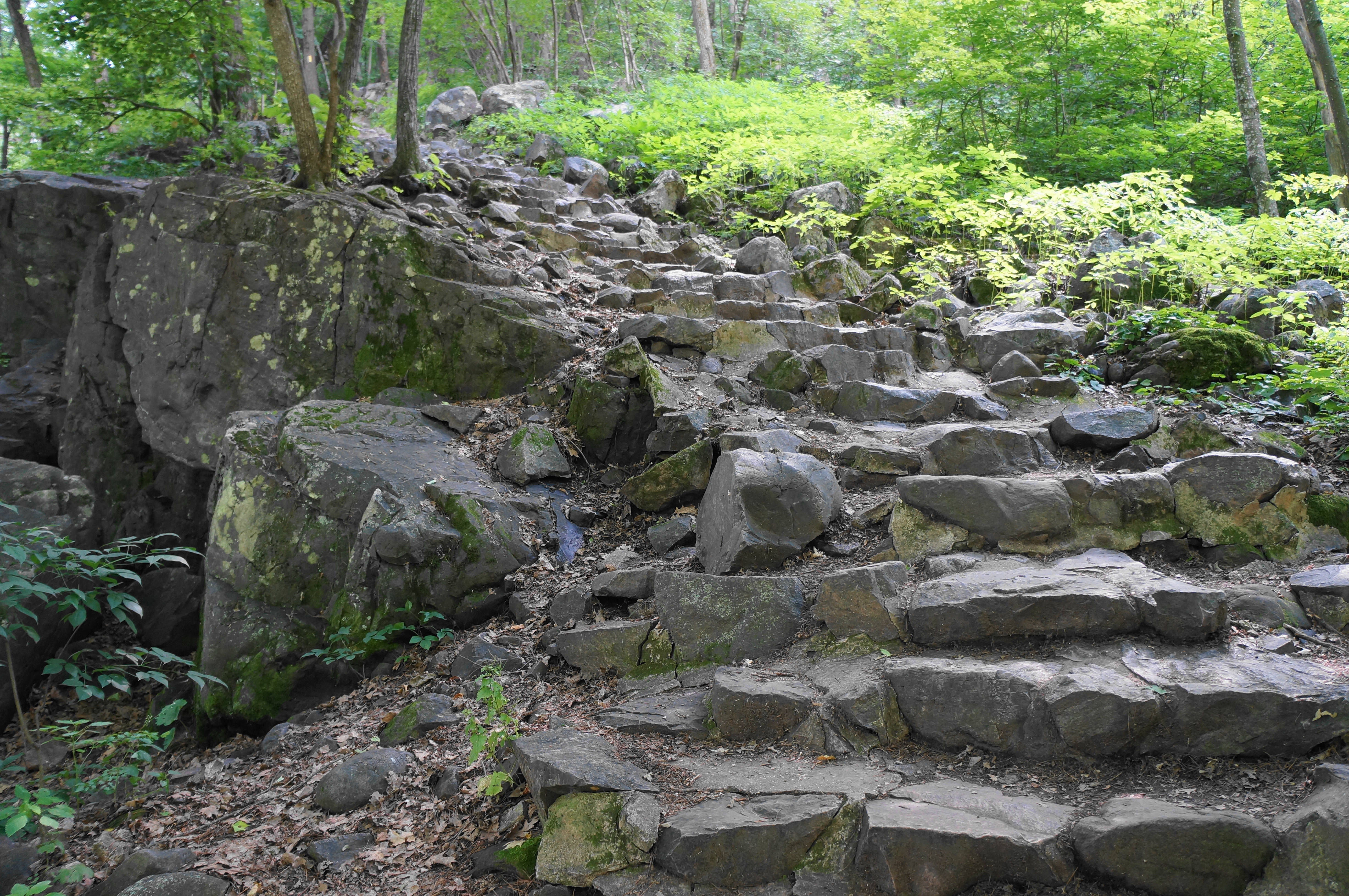
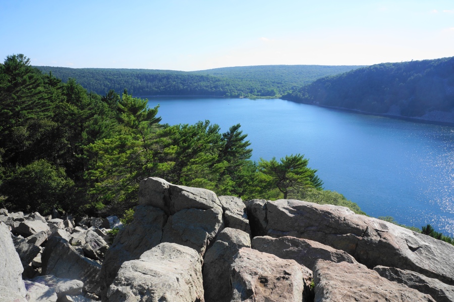
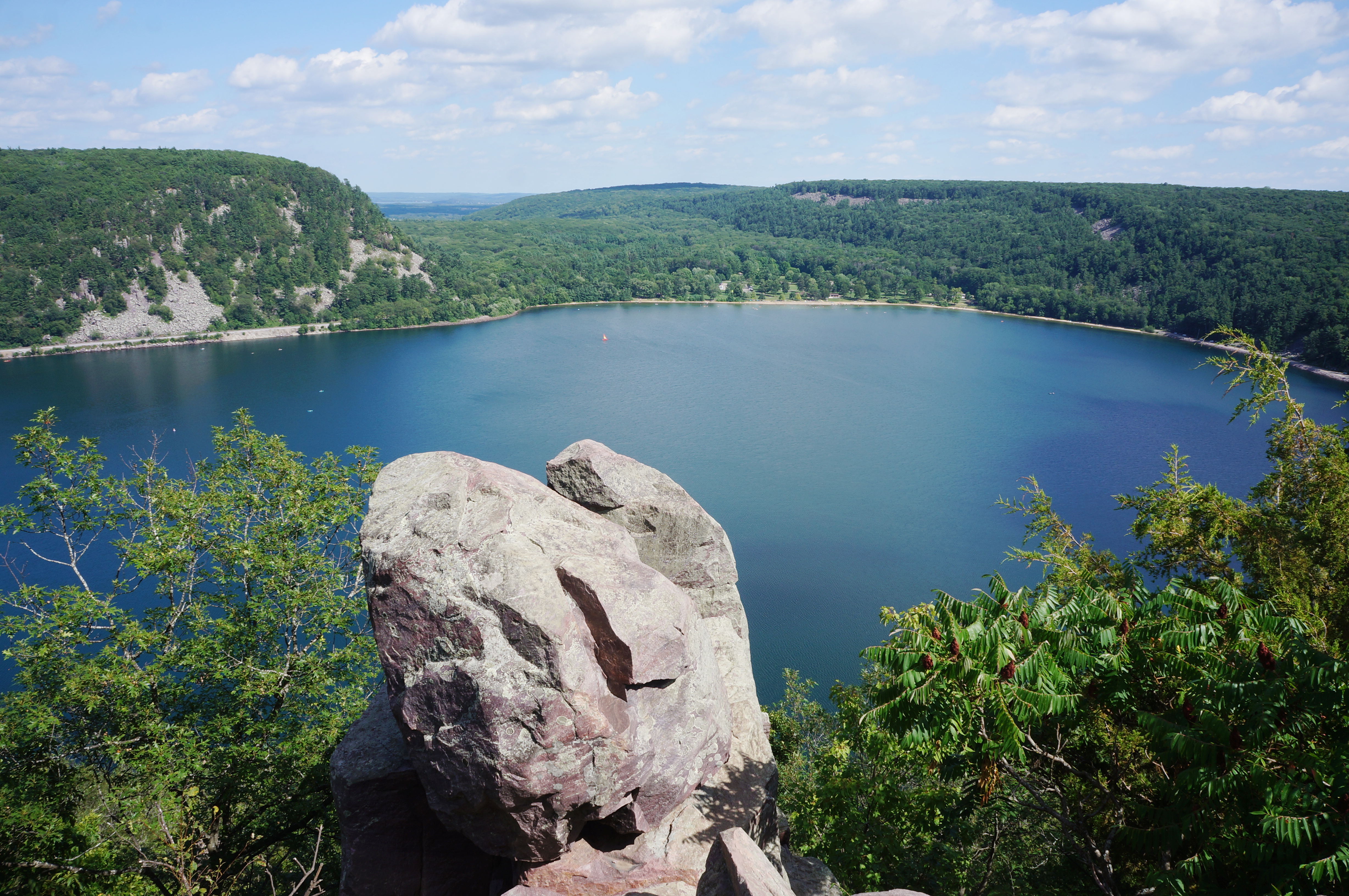
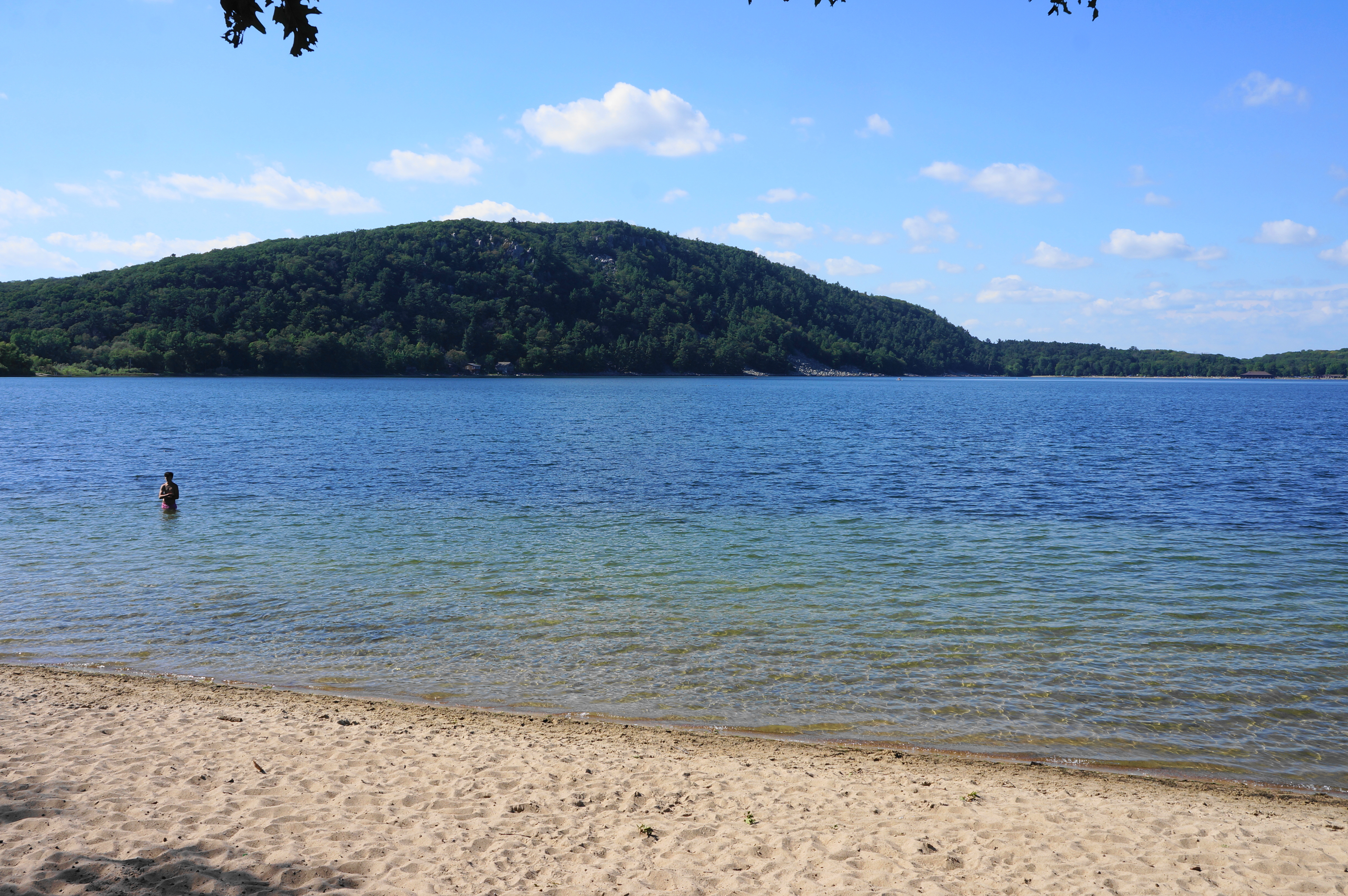
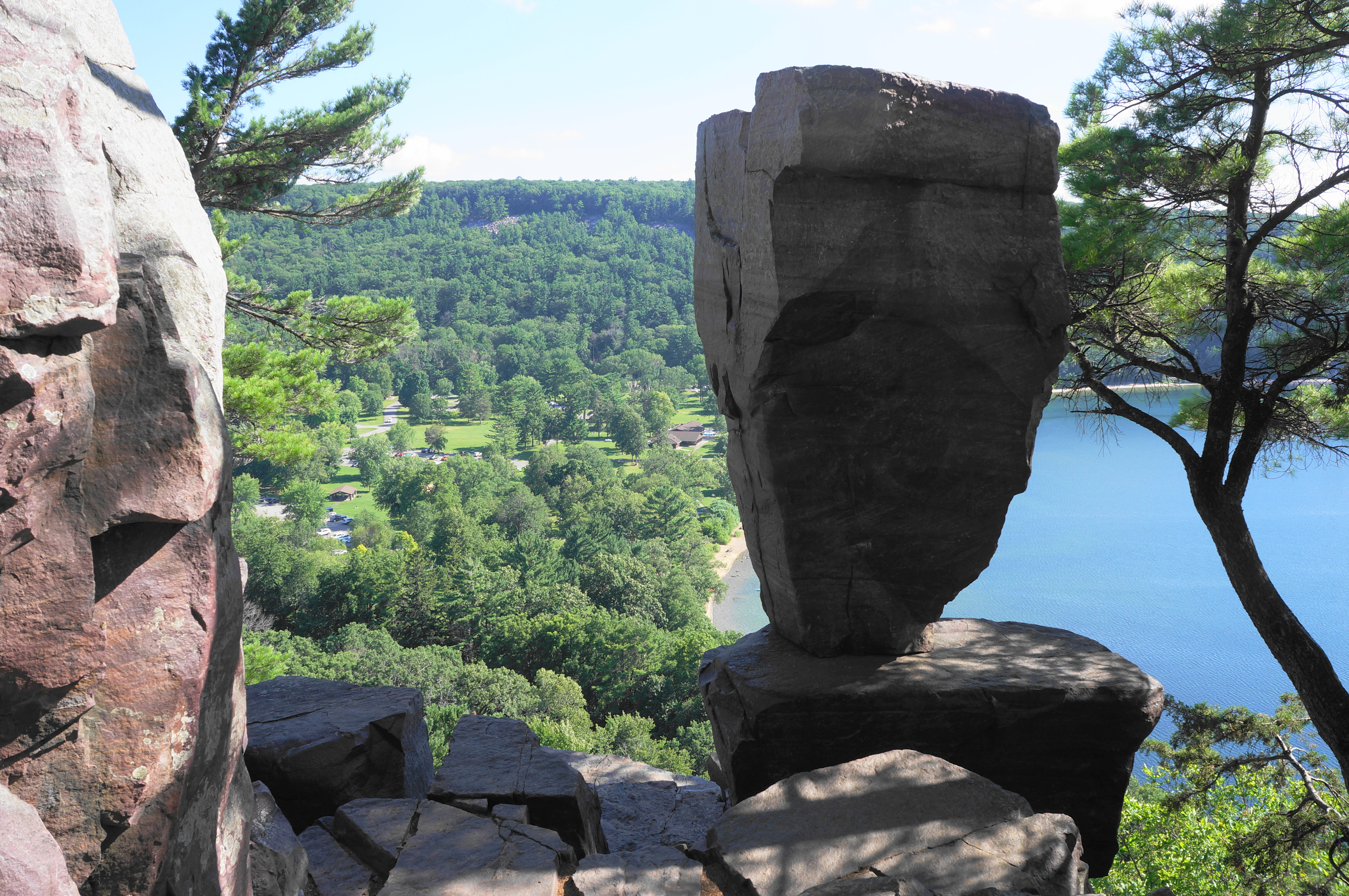
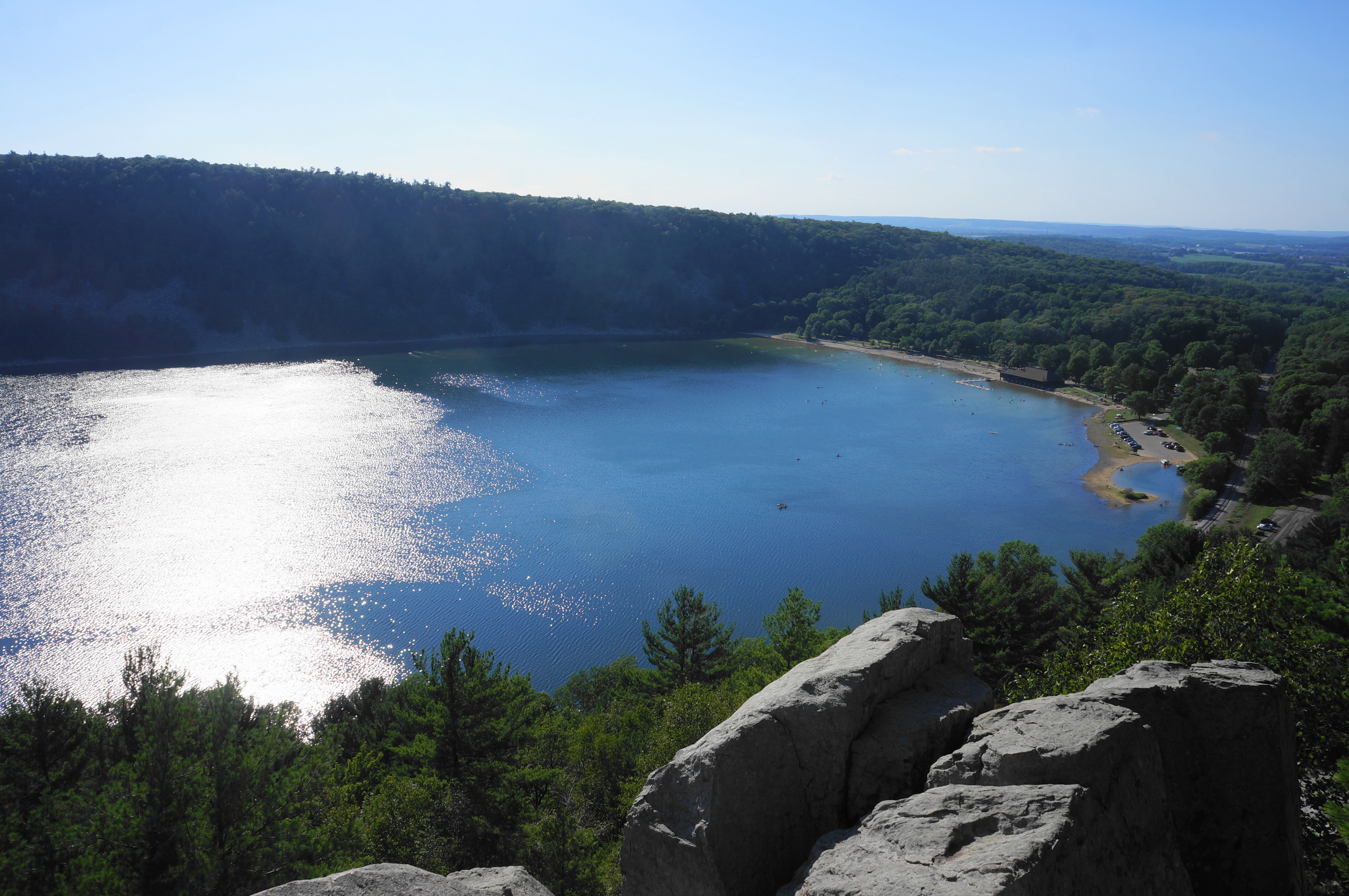
Follow the path to the base of a sharp left-hand bend and start of a stony staircase, inaugurating the steepest portion of the West Bluff Trail. Hikers will have to ascend 200+ steps in the next ¼ mile, rising seemingly endlessly to the top of the quartzite bluffs overlooking Devil’s Lake. At 8/10 mile, there is a bench with one of the better vistas, followed by a short up-and-down section with two additional staircases. By now one can see across the lake to the railroad and East Bluff on the opposite bank: this depression formed during the uplift of the Baraboo Range, a modest syncline that stretches east-west for around 25 miles, with the sink filling with fresh water that has no natural outlet.
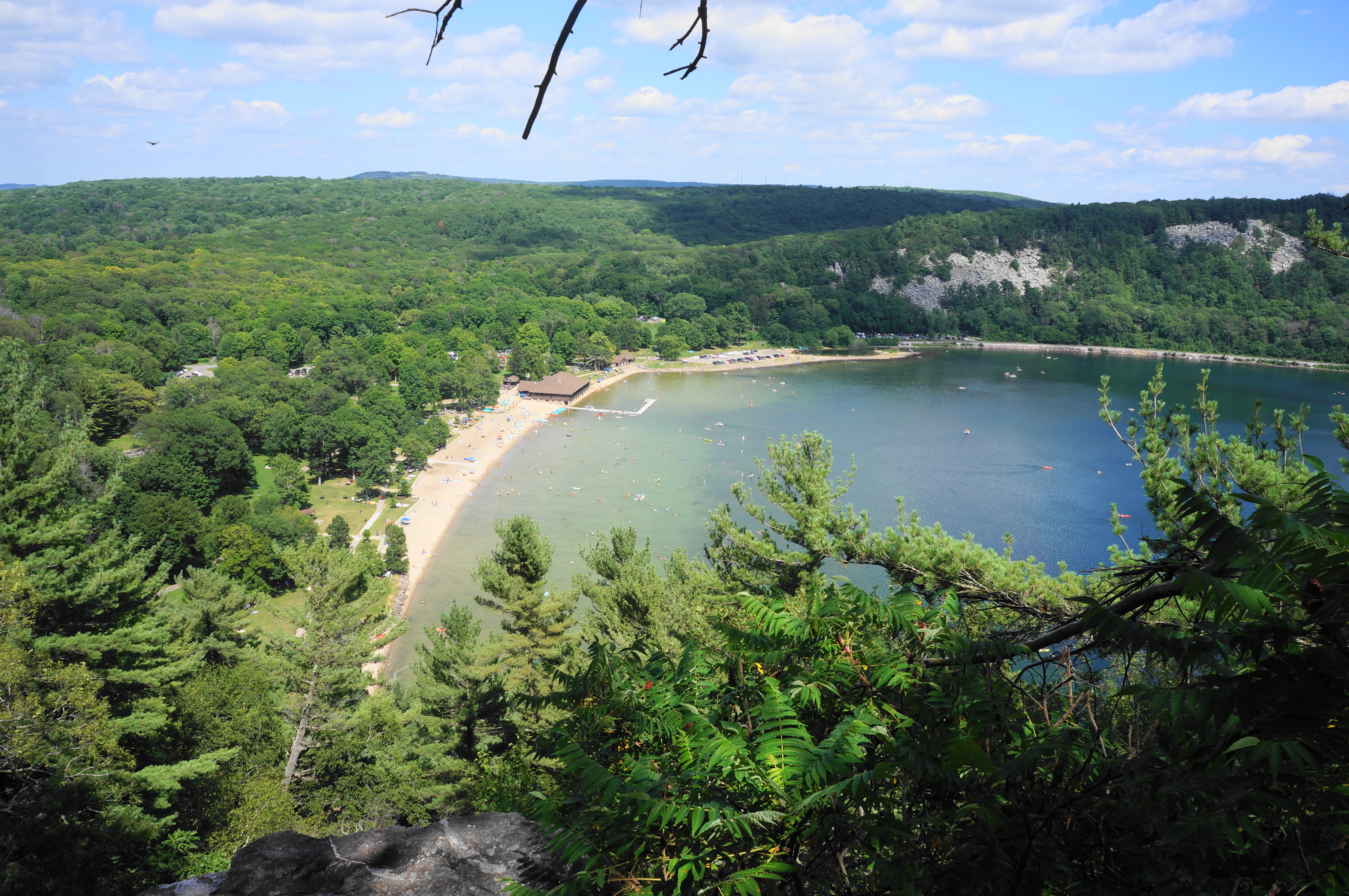
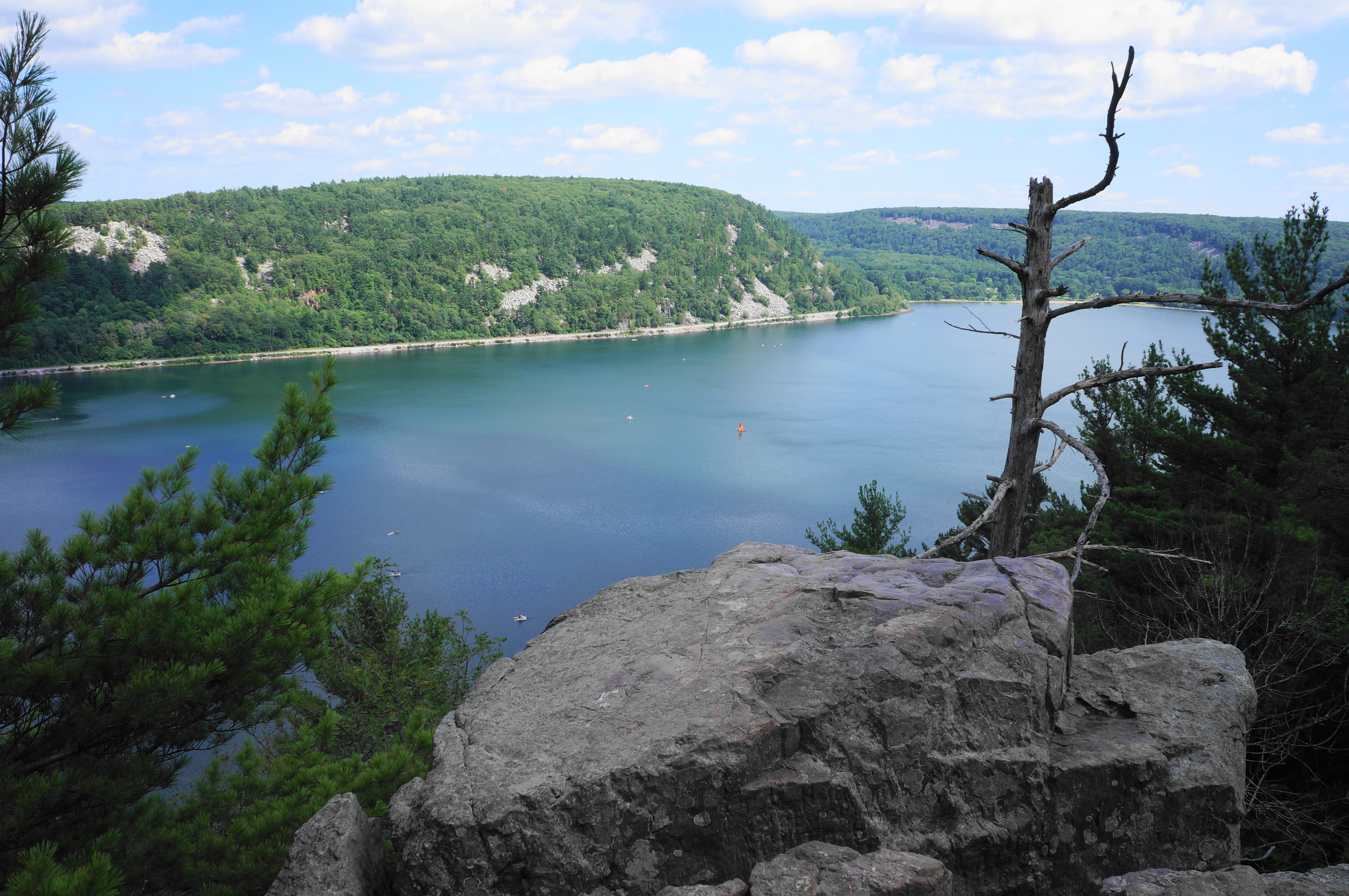
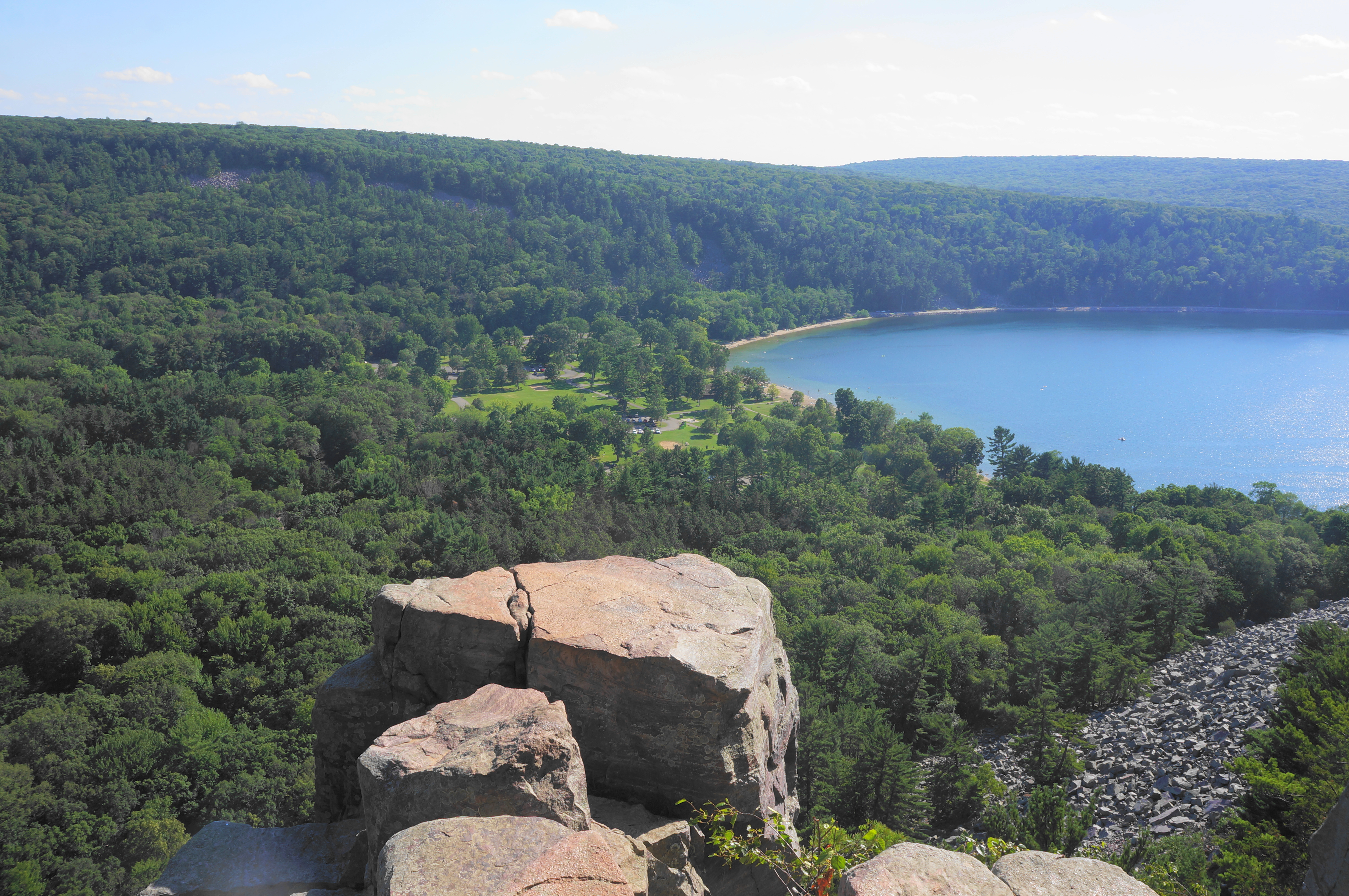
The next stretch involves a milder but persistent ascent, starting to leave the dull noise of the crowded beach behind. At 1.25 miles, with a short radio tower on the left, there is an official viewpoint on the right. Here one can look through the viewfinder at the lake and mountains below and walk out to the edge of the craggy bluffs, nearly 500 feet high. This is one of the most interesting vistas in the entire park—and perhaps one of the best in the entire state of Wisconsin.
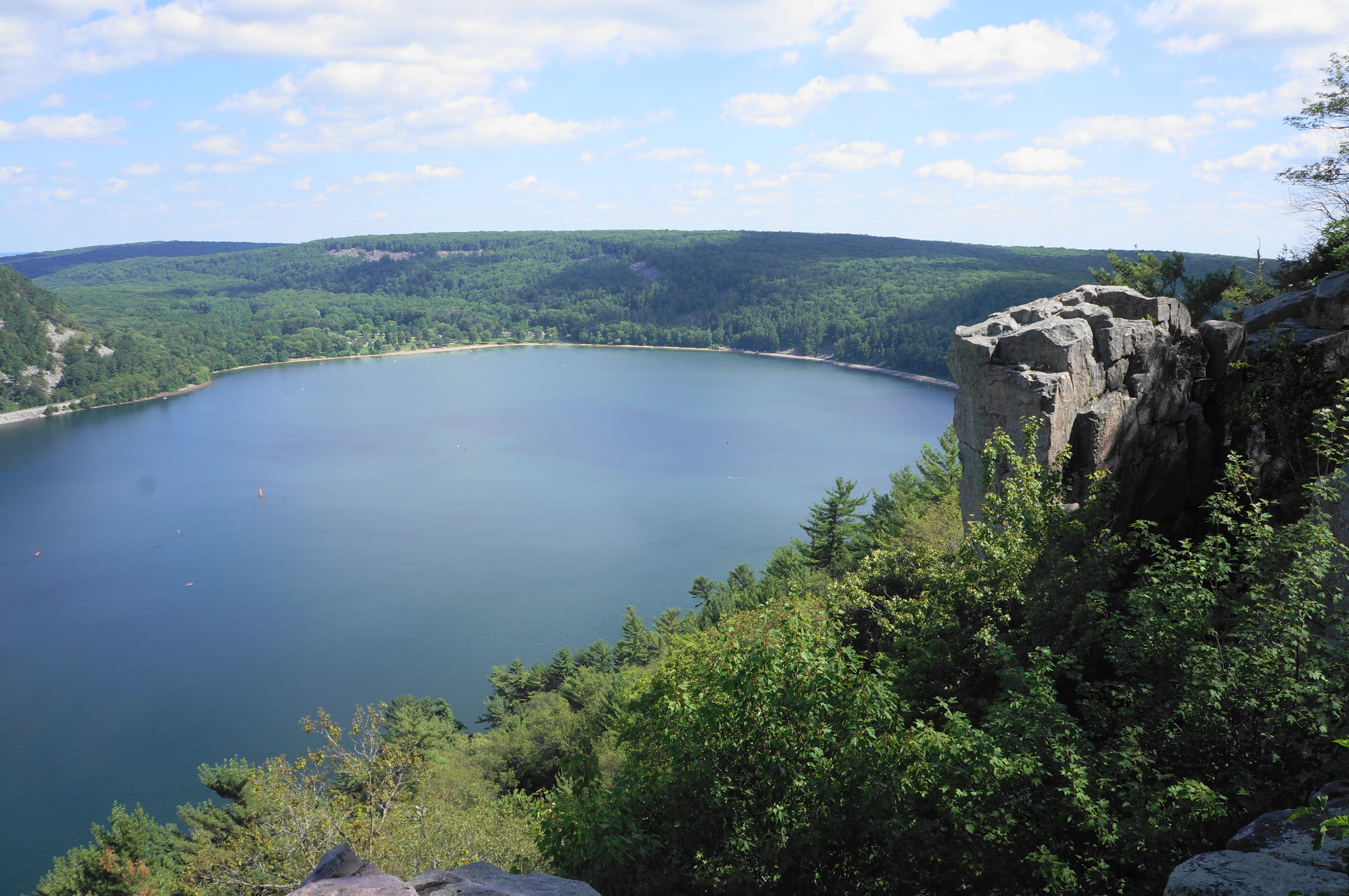
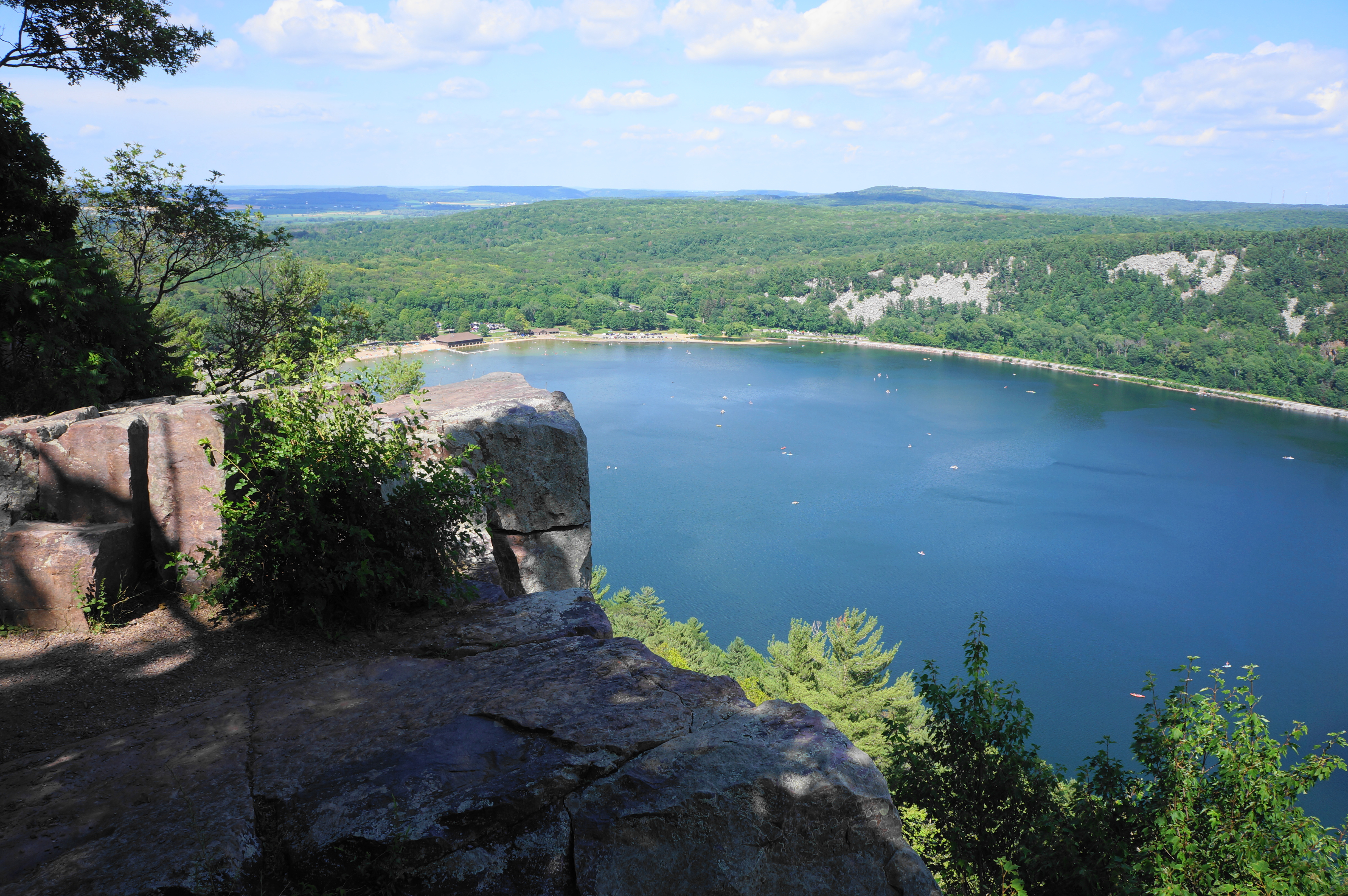
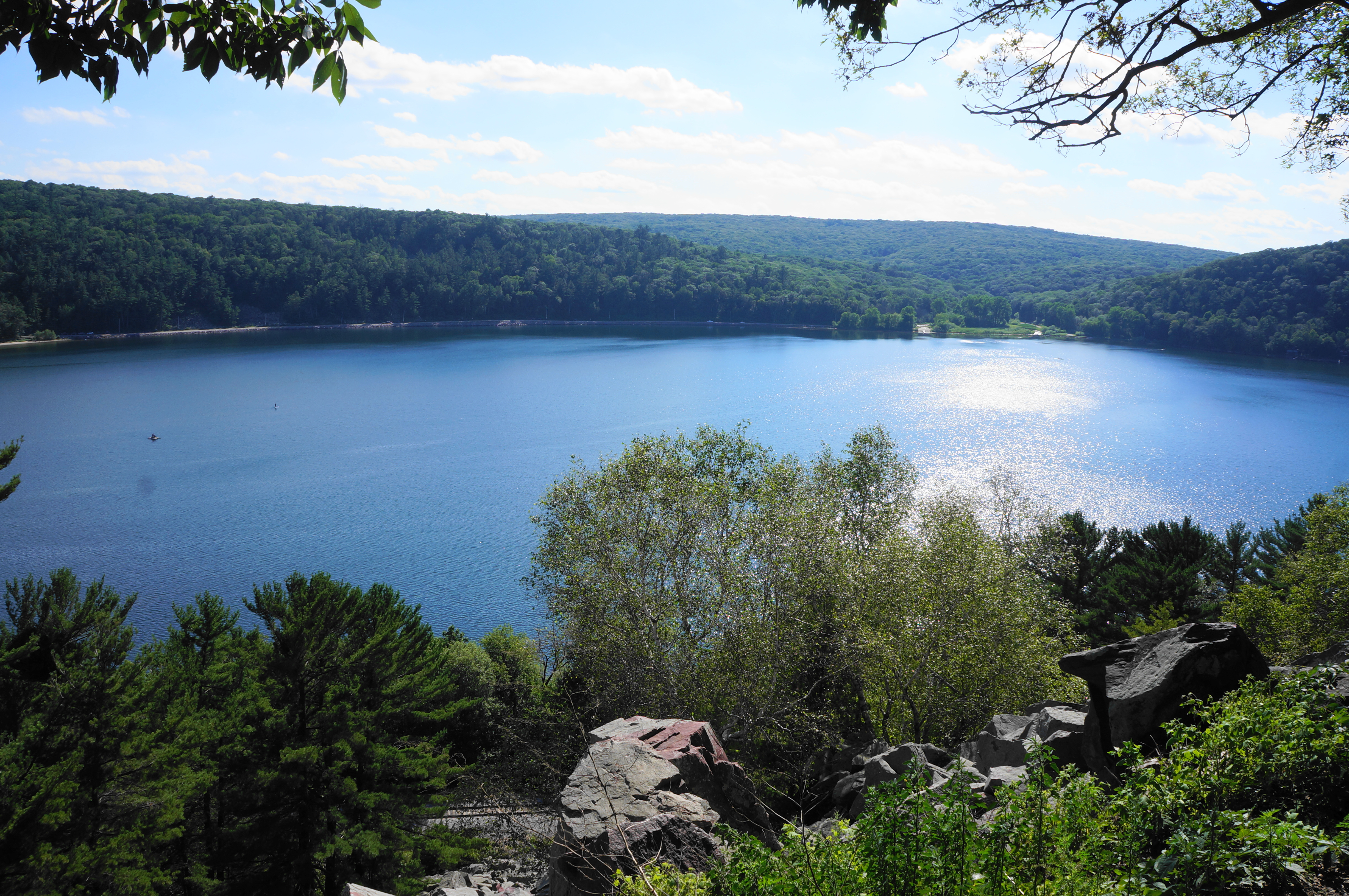
From here, continue south on the West Bluff Trail, following a weathered asphalt path that drops mildly to another spur with great views at 1.5 miles. This vista sits atop Cleopatra’s Needle, a named feature of the bluffs that is visible from South Shore Beach below.
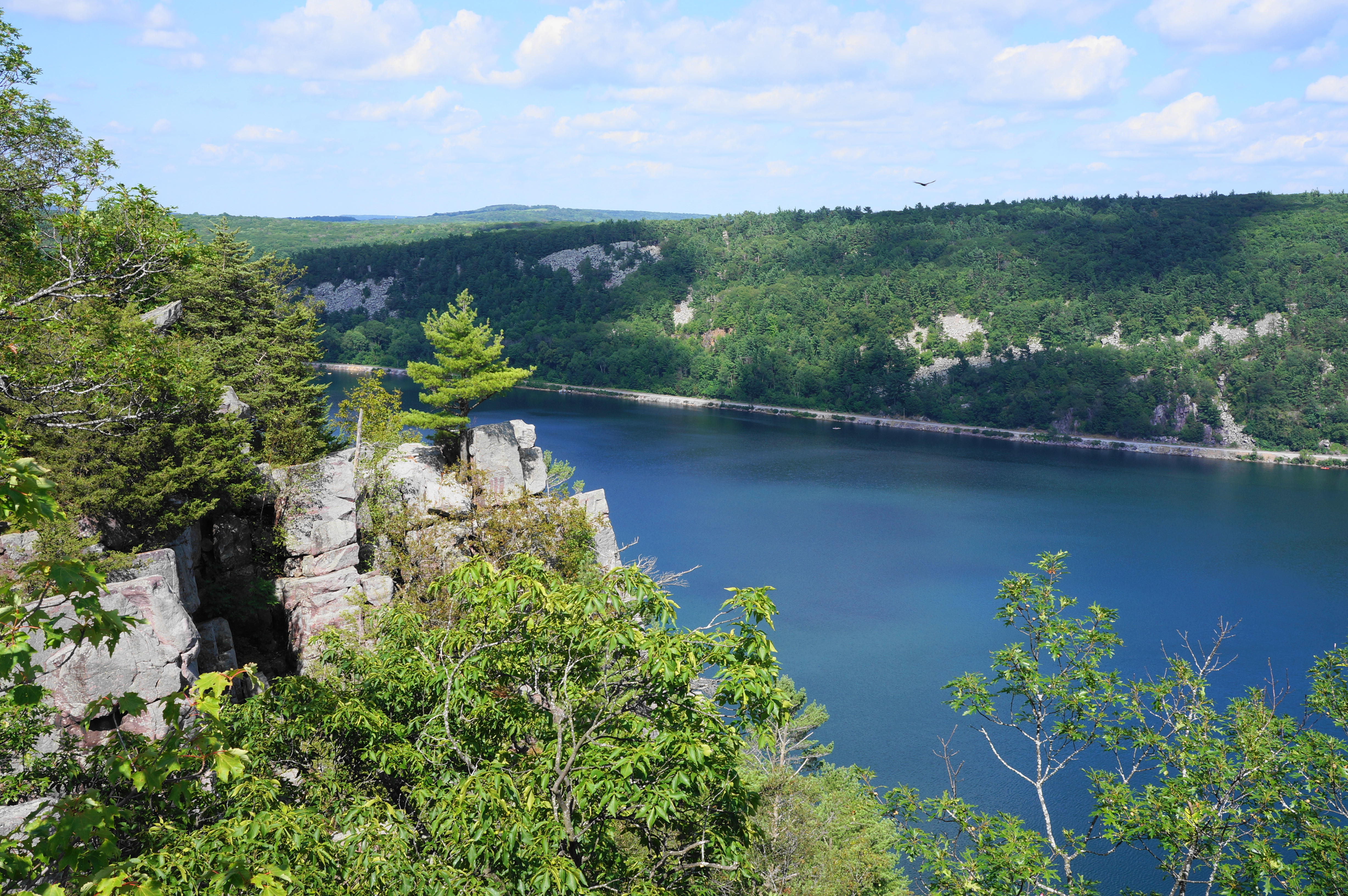
Thereafter, the trail moves away from the cliffside and descends steadily, winding to an unknown spur at 1.6 miles (stay right). After swinging westward, the trail rounds a left-hand bend and makes its final descent to a road junction, where an unpaved, dead-end track merges with the popular South Lake Road.
Head straight, following the left shoulder of South Lake Road eastward. The road quickly passes a swampy inlet of Devil’s Lake on the left, followed by a road spur to the South Lake Boat Landing and Pet Swim Area. Continue along the road, eventually coming to a more established sidewalk that directly hugs the walled shoreline.
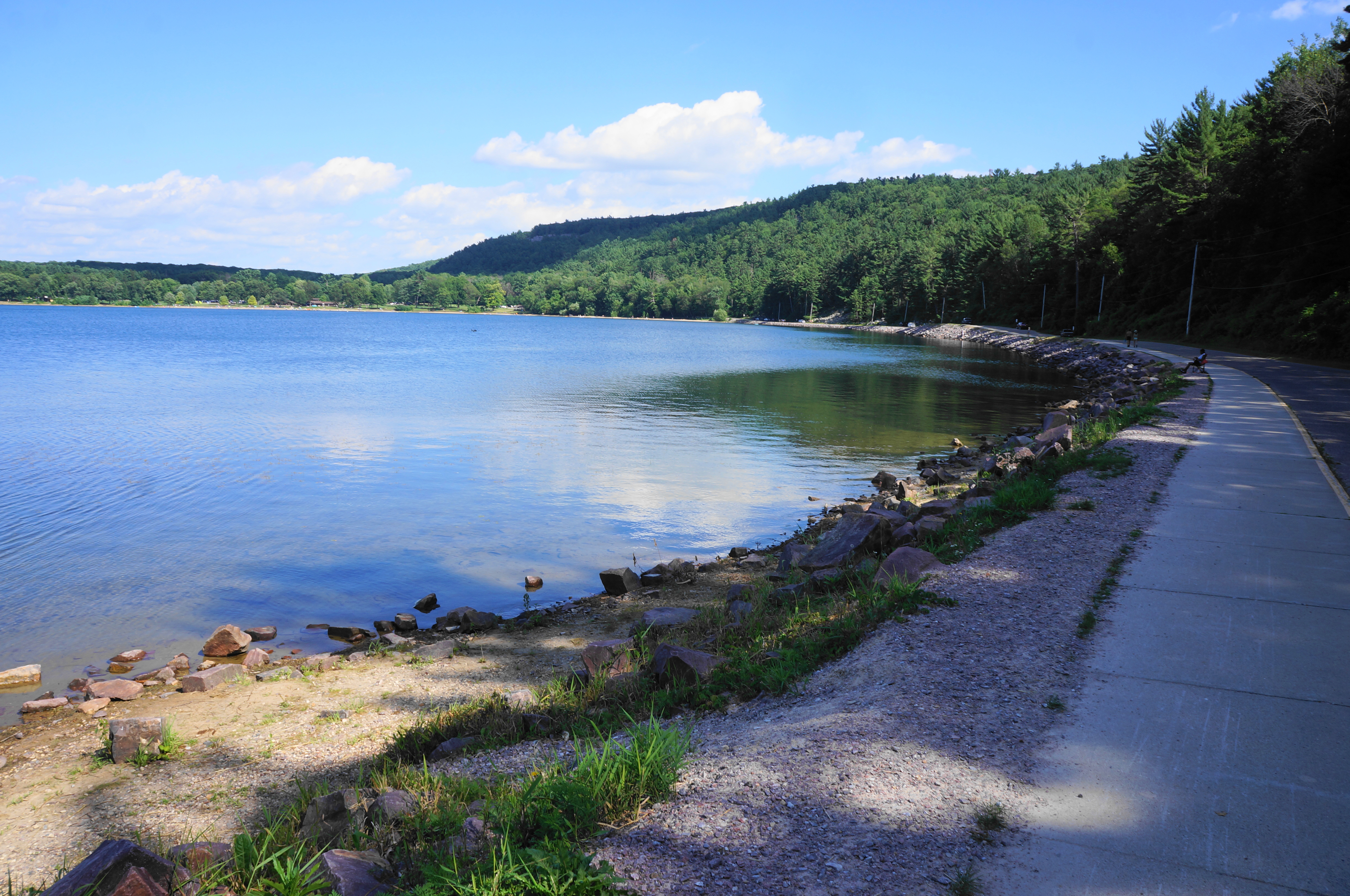

This roadside walk doesn’t feel like a “hike” per se, but it is pleasant enough as visitors pass anglers and beachgoers with sweeping views of the lake and the bluffs to the north. At about 2.6 miles, stay left as the route turns into a boardwalk, leaving the road behind and flanking the edge of South Shore Beach. This shore, while still popular in the summer, is much less crowded than the North Shore side.
South Shore to North Shore via Balanced Rock, Devil’s Doorway, and East Bluff Trail (2.25 mi.)
Make your way past the concession stands, restrooms, and picnic tables at South Shore, eventually coming to the end of the paved track and start of a wide, dirt path. This is the Balanced Rock Trail, which quickly traverses the railway tracks again and initiates a steep and steady climb up the East Bluff cliffside.
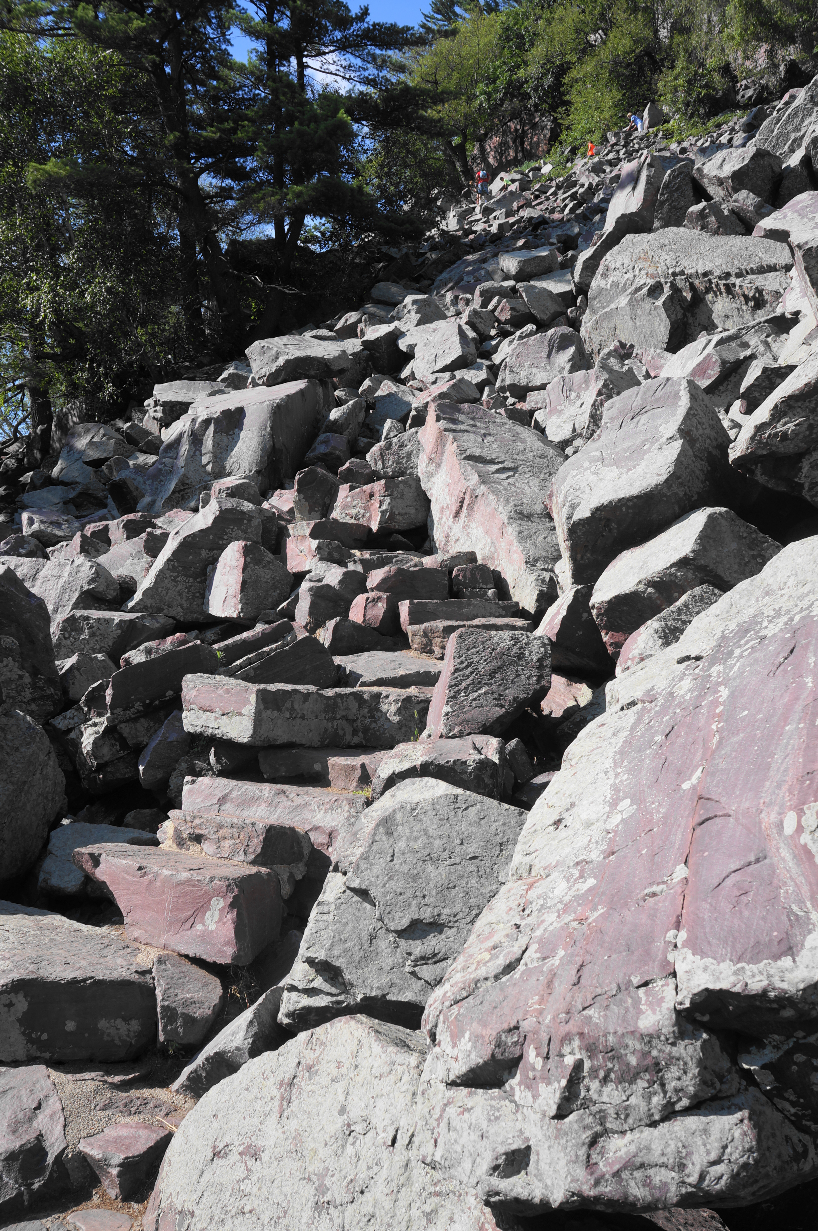
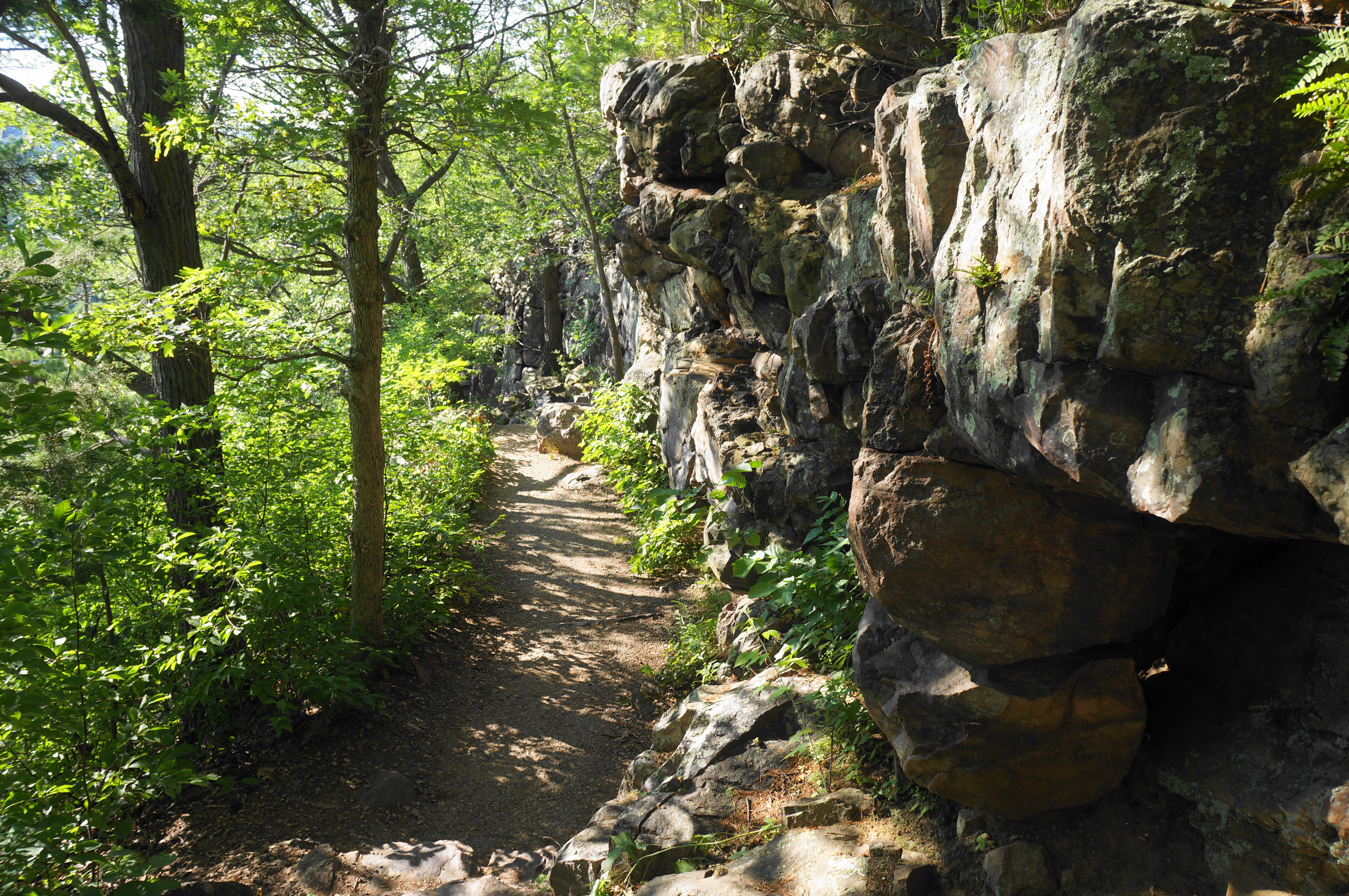
Follow the narrow staircase through the boulder field, noticing the shift in the color of the quartzite from gray to a deep and attractive red. The exposed switchbacks can be slow-going if the trail is crowded—but be patient and take your time, using careful footing to work your way up the boulder slope. After a brief level section, the path rounds a right-hand bend with excellent views of the lake, then hugs a high cliff on the right.
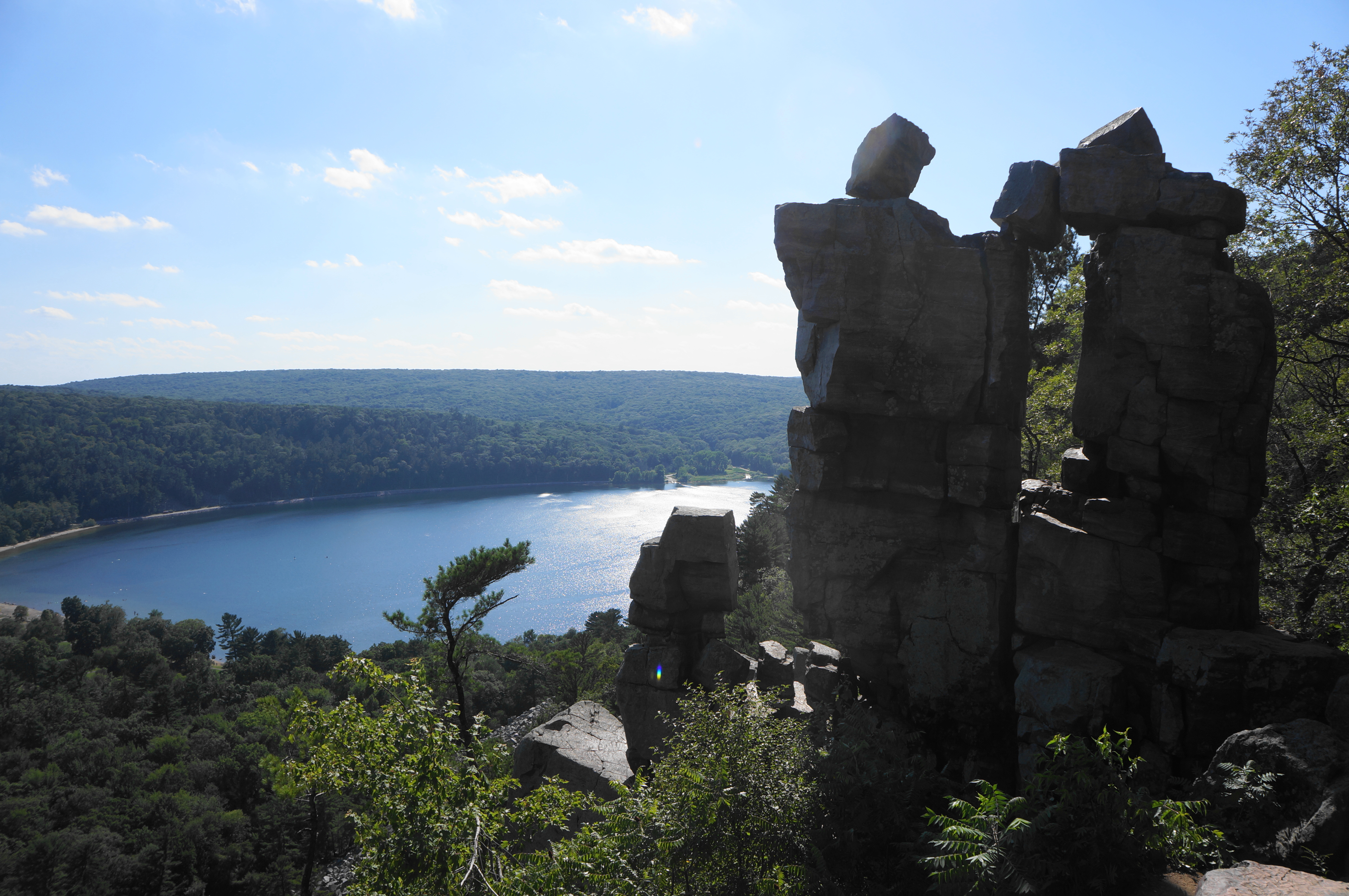
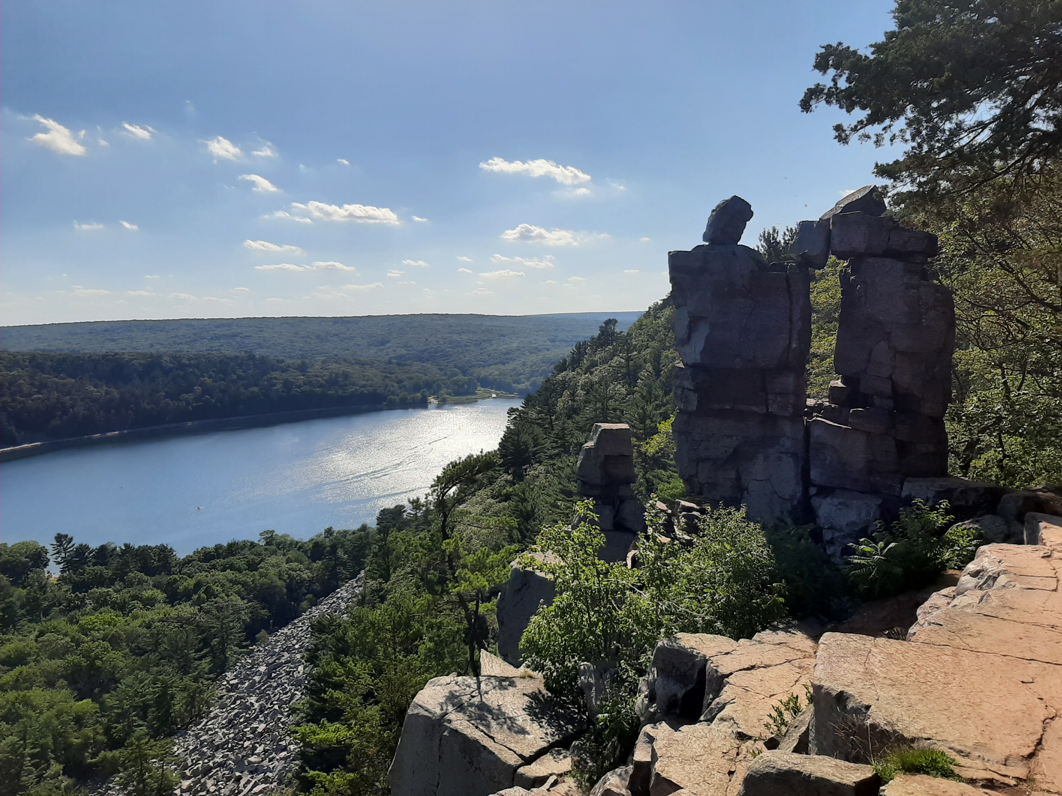
Edging back eastward, the trail reaches a junction at 3.4 miles. Head right on a short and rocky spur to the trail’s namesake Balanced Rock, an impressive, tooth-like formation precariously perched on a bluff overlooking the South Shore area.
Make your way back to the main trail and continue right, traversing more stairs through shadier terrain. At 3.5 miles, there is an open cliffside view on the right, followed quickly by a junction where the trail levels off. This trail fork is your cue to head right on the 0.5-mile spur to/from Devil’s Doorway, a worthwhile detour.
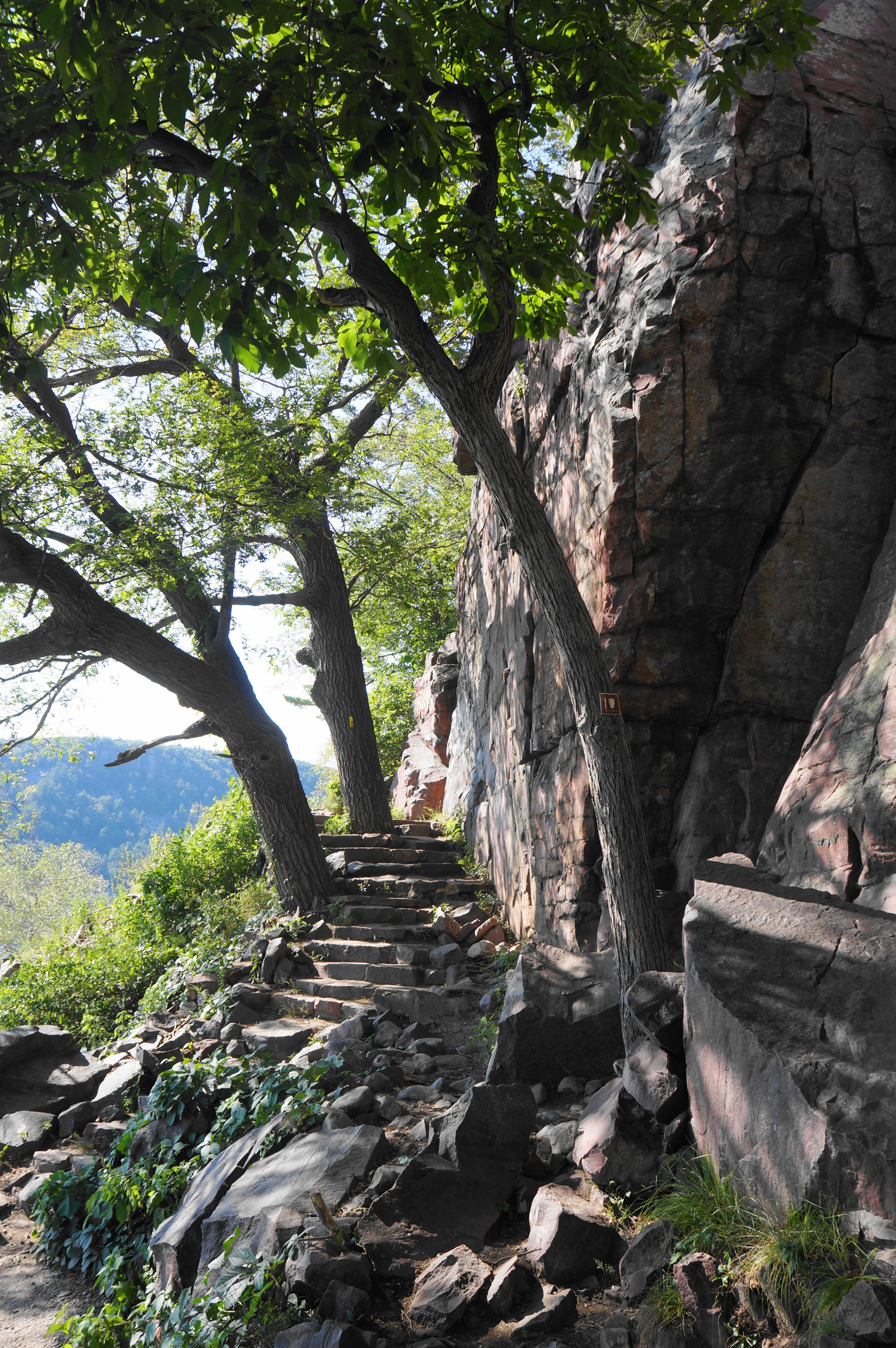
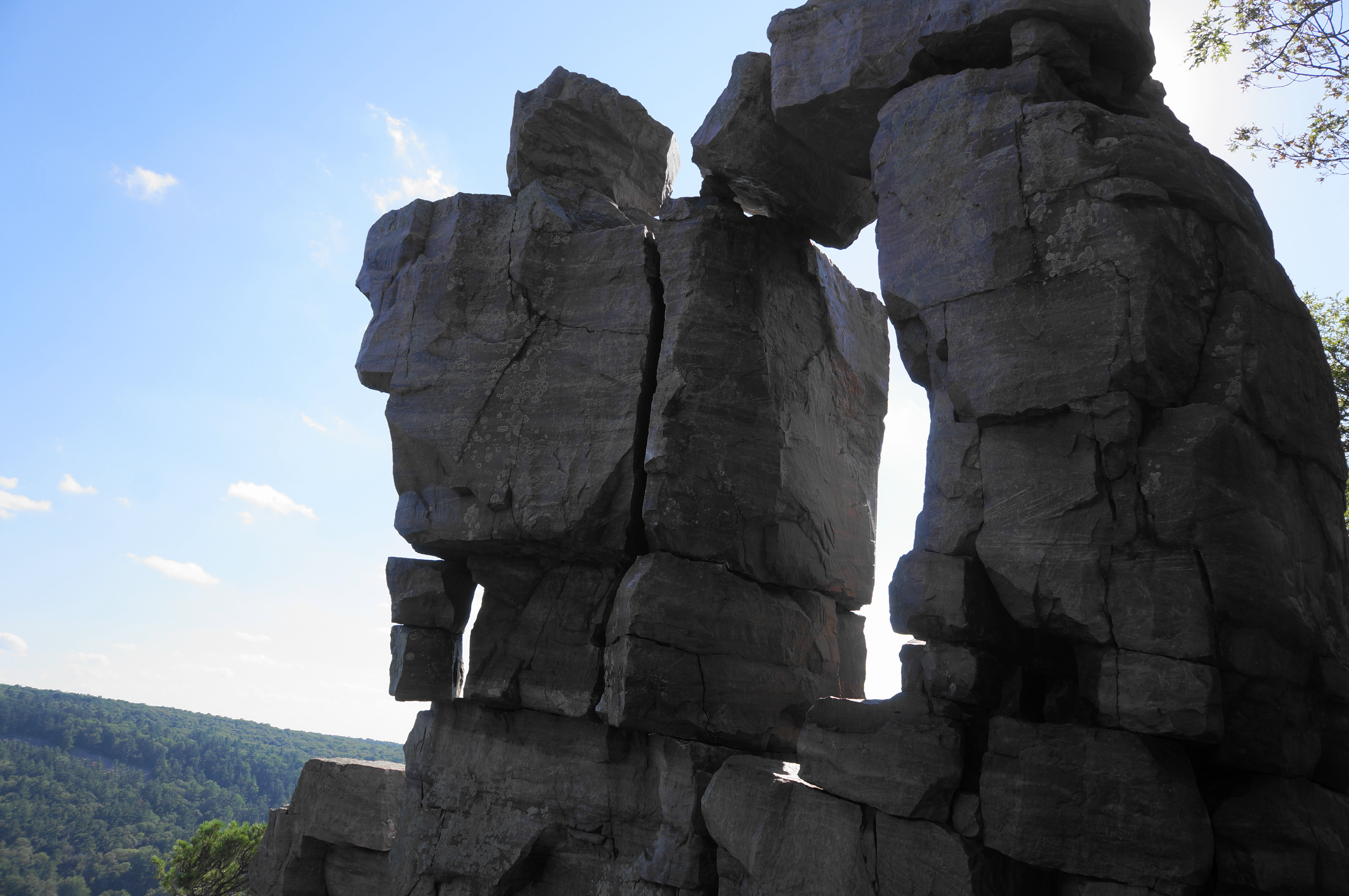
Heading east on the partly paved track, it is an easygoing walk on the East Bluff Trail for 300 yards, with limited views through the trees down to the valley and South Bluff. At 3.7 miles, bear left on the marked spur to Devil’s Doorway, which drops precipitously down a shelf (which may require the use of hands) and then descends steeply to a natural ledge at the precipice of the cliffs. Look to your right, where an impressive collection of stony blocks has formed a natural archway, high above the lake below: this is Devil’s Doorway, one of the most iconic natural sights in the state of Wisconsin. (Note: The sun is best here in the mornings; by evening the setting sun casts a shadow over the rock face and it is tough to photograph.)
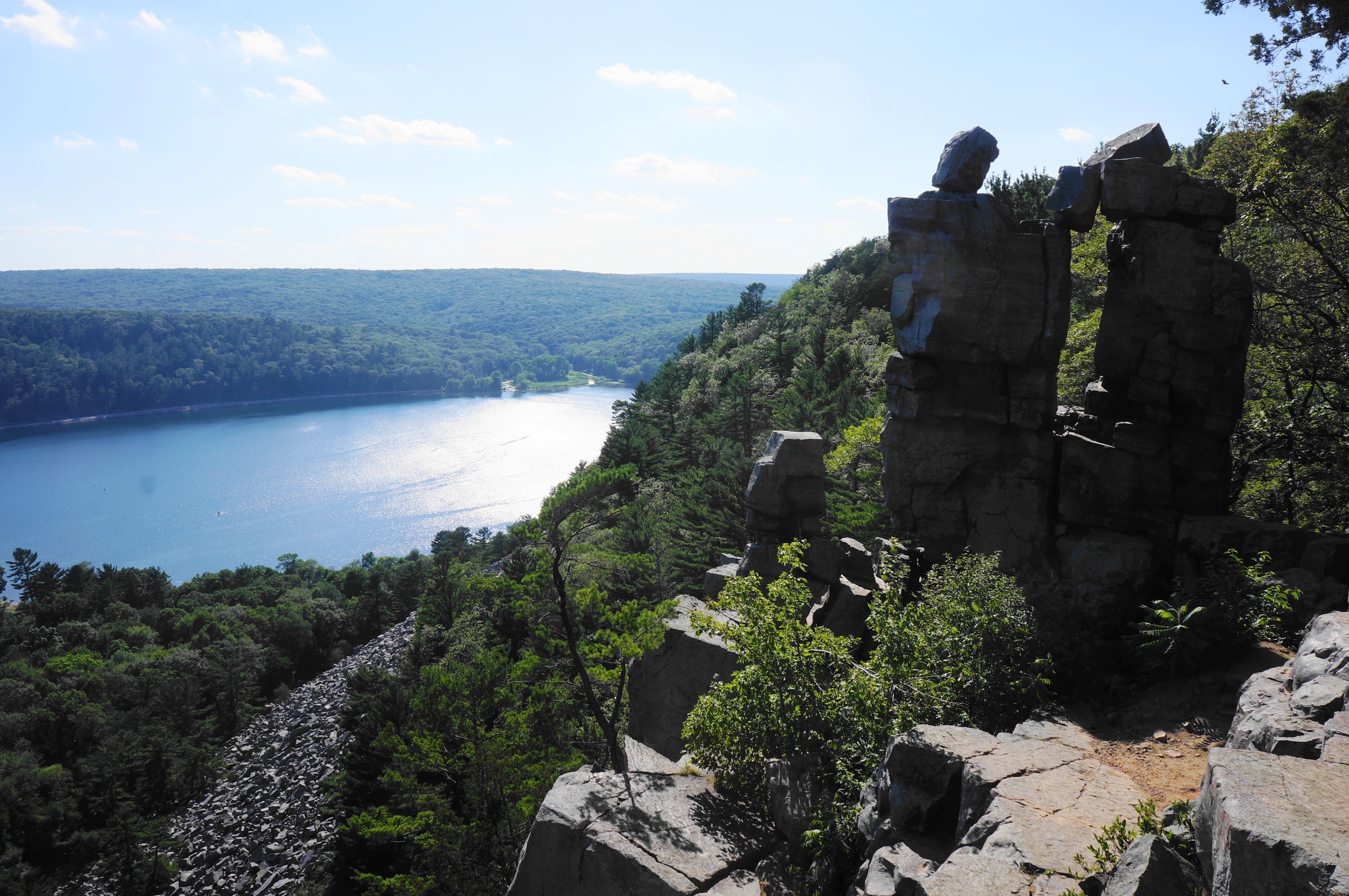
The Devil’s Doorway Trail continues past the arch for another 75 yards, ascending a staircase to return to the East Bluff Trail. Bear left, passing the initial entry to the Doorway area and retrace your steps back to the junction at the end of the Balanced Rock Trail. This time, bear right on the path nearest to the cliffside heading north: this is the continuation of the East Bluff Trail.
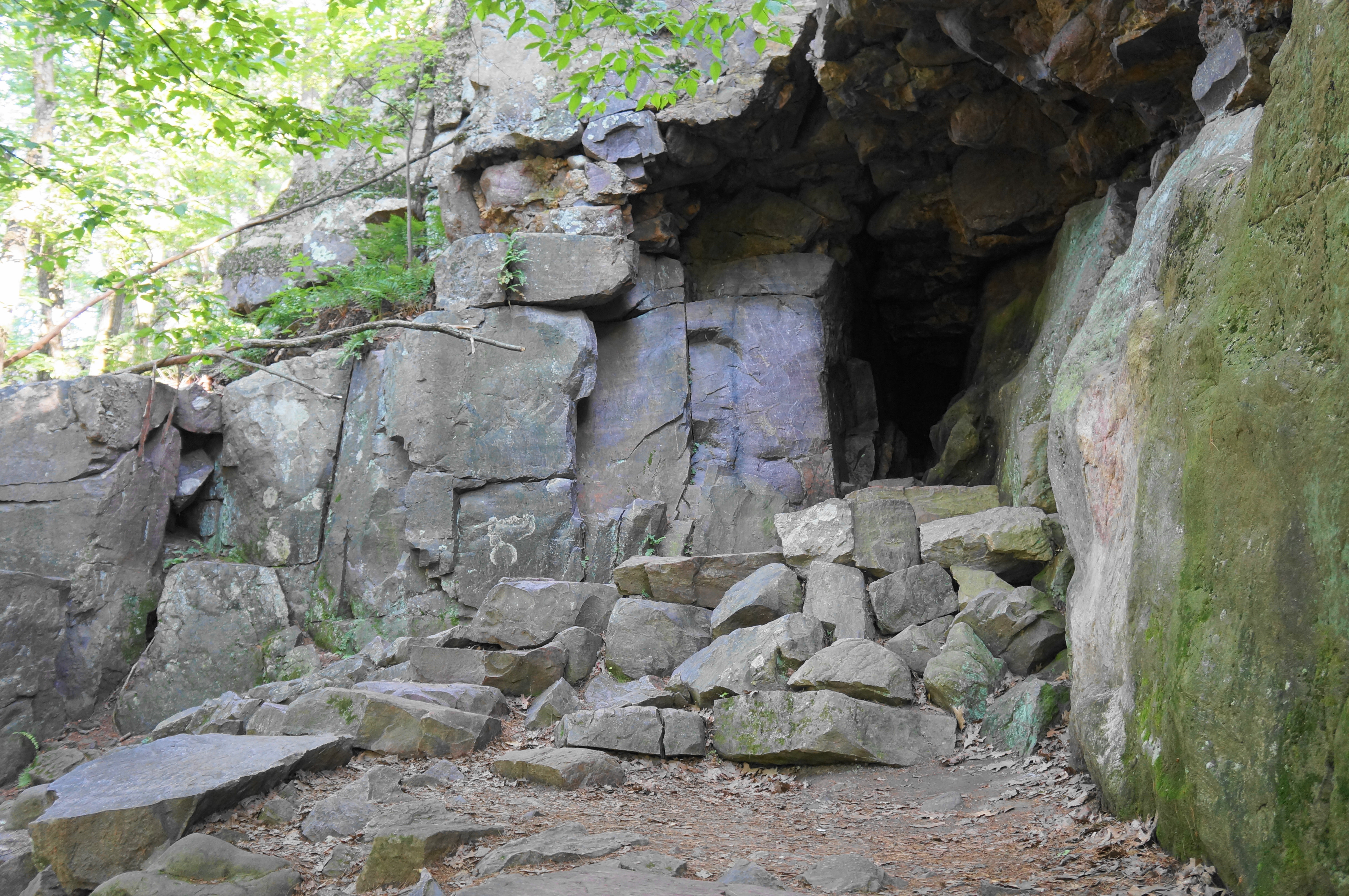
At first the trail keeps its distance from the cliffside and lake, weaving through dense woods and edging northeast. The path comes to a junction again at about 4.4 miles, with an unnamed connector coming in from the right. Stay left and head north, passing occasional rock outcrops and treading progressively downhill. The path comes close to the cliff’s edge again at a point called Pride Rock; vistas become more common as the East Bluff Trail descends further to Bison Rock and rounds a right-hand bend with a small but surprisingly deep cave on the right.


After briefly inspecting the darkness of the cave, continue downhill on the East Bluff Trail, staying right at a prominent spur trail at 5.1 miles. Minutes later, bear left at the wide junction with the East Bluffs Woods Trail, continuing northward. From here it is a short and easy walk to the Additional Parking lot, capping off the 5.25-mile hike.
All told, despite the crowds and road noise, the moderate to strenuous Devil’s Lake Loop is one of the most scenic adventures in Wisconsin, a worthy day trip from Madison or the Wisconsin Dells area. Combine with a visit to nearby parks for a nice weekend outing or week-long stay.

Pingback: Parfrey’s Glen (Parfrey’s Glen State Natural Area, WI) | Live and Let Hike
I wish you people would stop advertising this gem. I grew up at Devil’s Lake and my heart belongs there. It is so over visited and over populated now, that even the locals don’t like going there, or just simply not able to due to the crowds. Besides the trash, the wildlife there is diminishing and the trees are dying due to foot traffic. There’s so many other things effected because of excessive crowds. Stick to your micro breweries and arcades. Stop advertising and over populating Devil’s Lake.
Alexander, thanks for your note, although I think it would have been more appropriate for you to send an email rather than a public, vitriolic comment, all too common on the Internet these days. I hear your concerns about overcrowding, although I think your overstate the impact that this rather banal and niche blog has on influencing this situation. Devil’s Lake is not a private preserve belonging only to locals, and while–as a former volunteer in a national park–I am sad too to see overcrowding, the answer seems to require engaging in productive conversation to try to manage the inevitable explosion of public interest in visiting state and national parks. Accusatory messages (“stick to your micro breweries and arcades”?) don’t seem like a mature or effective way of addressing the delicate balance between conservation and recreation. Happy to discuss further over email (liveandlethike@gmail.com). Thank you!
Very well said.
Pingback: Pothole Trail (Interstate Park, WI) | Live and Let Hike
Pingback: Top 10 Hikes in 2022 | Live and Let Hike