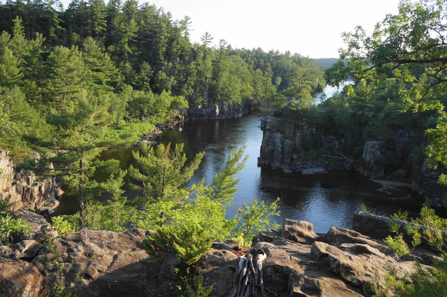

Evidence of ancient lava flows, prehistoric seas, and glacial erosion abounds at the Dalles of the St. Croix, a narrow gorge situated on the border of Minnesota and Wisconsin, about an hour’s drive from the Twin Cities. In addition to the high basalt walls that frame the dalles, the St. Croix River—once much higher and more powerful than it is today—has left behind peculiar potholes, some quite deep, with many dotting the clifftops on both sides of the waterway. Perhaps the best option for seeing them is the Pothole Trail, situated in Interstate Park on the Wisconsin side (not to be confused with Interstate State Park on the Minnesota side). The short, 0.4-mile loop also offers some of the area’s best views down into the gorge.
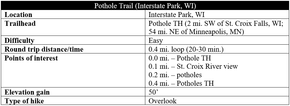

The hike
To access the Pothole Trail, enter Interstate Park in St. Croix Falls, Wisconsin, passing the Ice Age Interpretive Center on the left. Continue around a left-hand and right-hand bend, then bear right and park in the small parking area at the intersection of the North Campground road with the main park track. Here one will find signs for the Pothole Trail, which doubles as the end of the long-distance Ice Age National Scenic Trail.
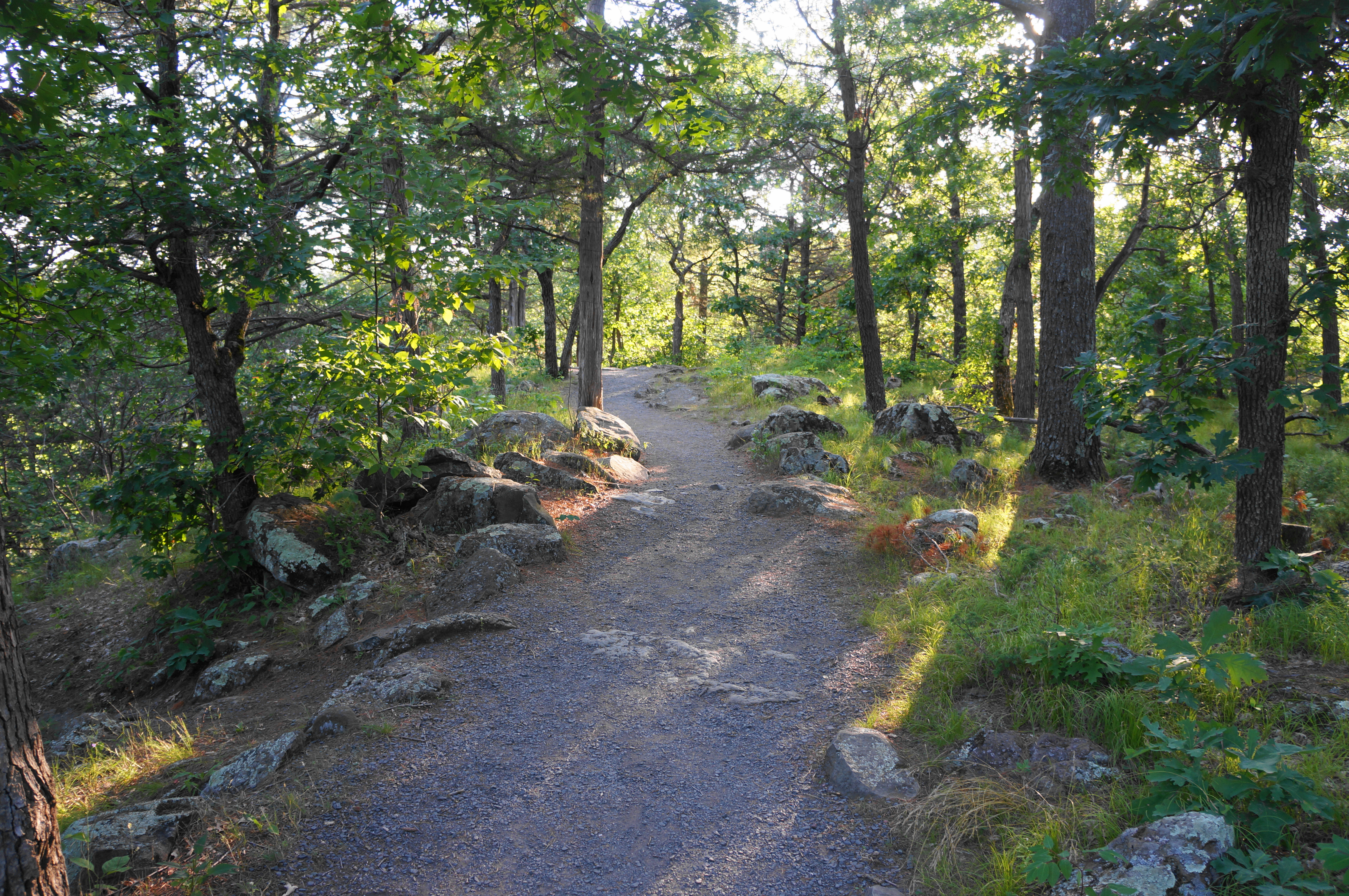


Head west on the gravel-packed trail and stay left at the junction, following the widely-used track as it approaches the cliffside. Basalt boulders abound on both sides of the trail, remnants of an ancient faulting process dating to around one billion years ago. Within 1/10 mile, the Pothole Trail offers its first views of the Dalles of the St. Croix, a narrow gorge carved by relentless water flows at the end of the last Ice Age, when glaciers melted and the riverway carved a deep channel in the basalt. Downstream (south), the river takes an abrupt right turn before widening and easing as the dalles section ends.

Near the first look at the Dalles is a large stone marker signifying the western terminus of the Ice Age Trail, a 1,200-mile path that weaves up and down much of central and southern Wisconsin. The Dalles are one of the most visually-stunning features of the entire hike (as is Devil’s Lake in south-central Wisconsin, the subject of another blog post).

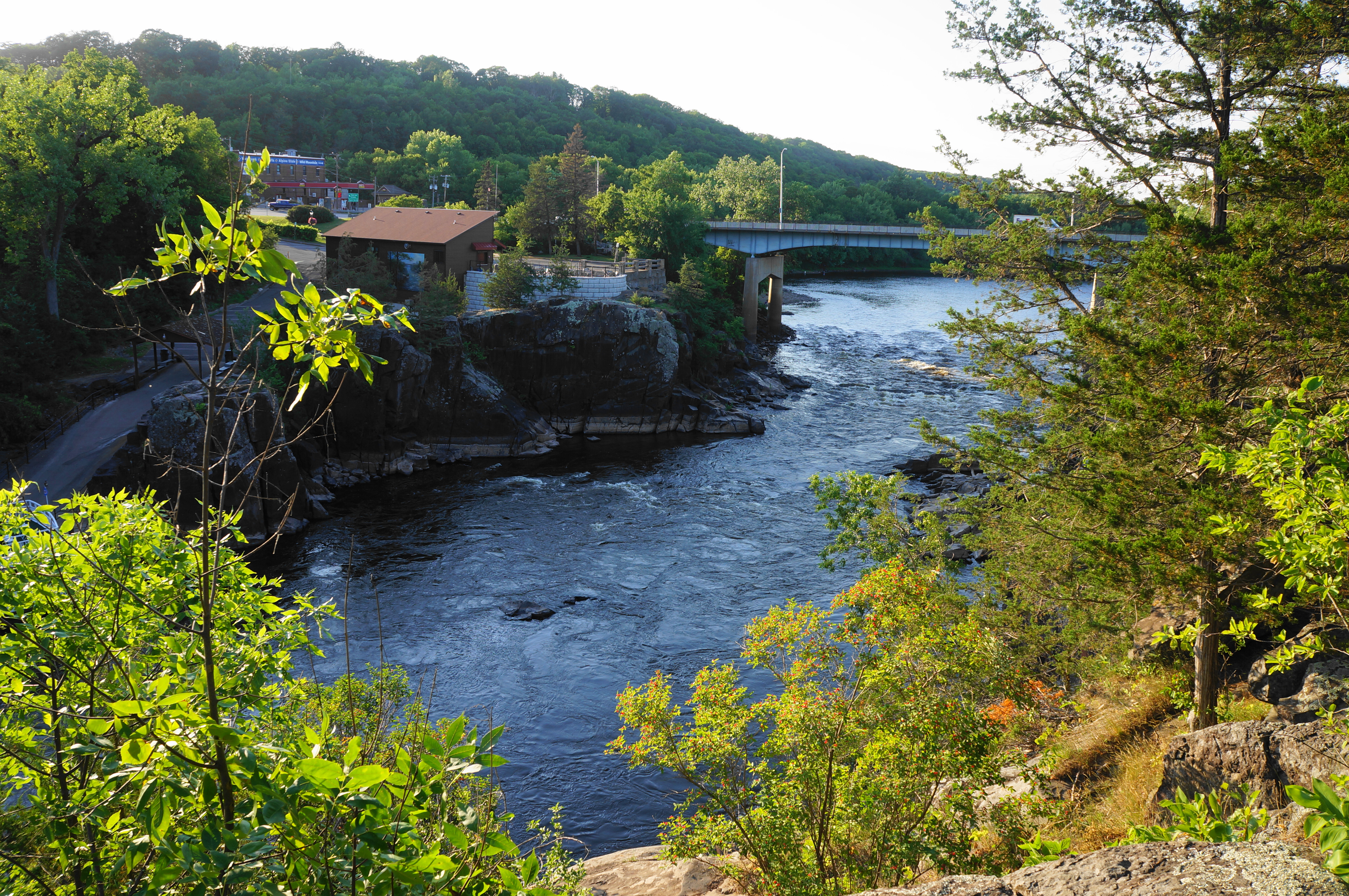
Here the Pothole Trail takes a hard right, continuing north, offering additional views down to the launch point for boat tours (on the Minnesota side), as well as the Taylor Falls Bridge, which connects the two sides of the St. Croix River. Here the trail can get trickier to follow: it appears that the new route has abandoned a couple old viewpoints, which were constructed with stone but now seem to have fallen into disrepair. Generally stay straight, following the cliff’s edge as the trail bounds in and out of small slickrock portions.

Here one also encounters the iconic potholes—deep ovular incisions that appear to drop several feet, the result of swirling waters when the river once covered significantly more volume. This area has the highest concentration of potholes in the world, with some (hidden in the river below) reaching depths of more than fifty feet.
Stay straight, heading toward the bridge, before taking the more evident path bearing eastward, returning to solid ground and passing through the deciduous woods. From here it is a short walk back to the start of the loop and the parking area. All told, the 0.4-mile circuit should take hikers 20-30 minutes to complete.

Pingback: Summit Rock, Echo Canyon, & River Bluff Trail Loop (Interstate Park, WI) | Live and Let Hike
Pingback: 17 Top Trails to Hike Around Minneapolis–St. Paul in 2025 - Family Vacations US