The mighty Mississippi River—2,300 miles long and the centerpiece of the United States’ largest drainage basin—begins in Minnesota, passing through the Twin Cities before settling into a broad valley on the border with Wisconsin. Here—around the town of Winona, Minnesota—the river is bounded by towering bluffs and rolling hillsides characteristic of the so-called “Driftless Area,” which was conspicuously spared from the many periods of glaciation that flattened much of the surrounding terrain. Such a landscape produces grand vistas amid the patchwork of prairies and hardwood forests, all encapsulated nicely in Great River Bluffs State Park, a 3,000-acre park situated roughly halfway between Minneapolis and Madison. The signature hike in the park is the easy, 2.3-mile out-and-back to King’s Bluff Overlook, a beautiful vista point perched above the Mississippi and across a steep valley from Queen’s Bluff, notable for its steep slopes and goat prairie, a relatively rare sight.
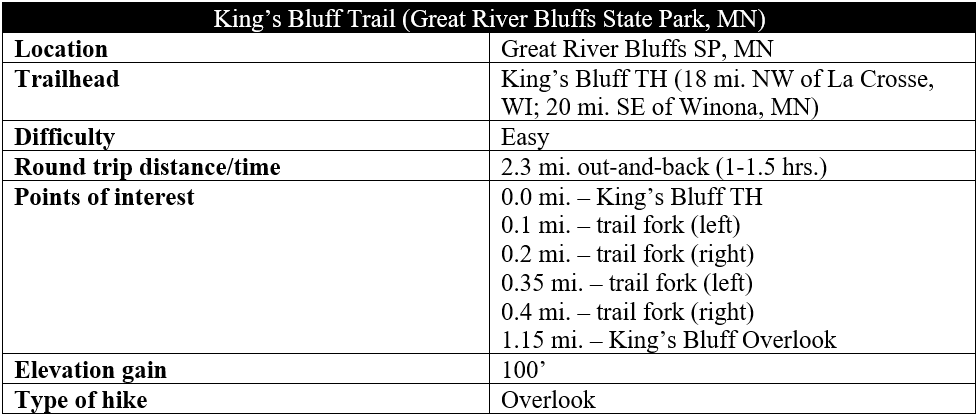
The hike
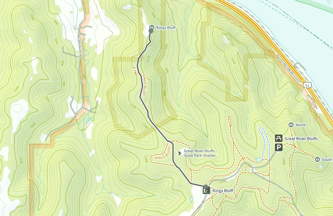
Minnesota’s Great River Bluffs State Park is situated just north of Interstate 90 as it approaches the Mississippi River and Wisconsin. Take exit 267 and head north on County Highway 3, following signs for the park. Bear right on Kipp Drive and enter Great River Bluffs, where the road turns to dirt and gravel. Pay the modest (usually self-serve) entrance fee before continuing on to the first notable parking lot on the left. This is King’s Bluff Trailhead, which has space for a half-dozen vehicles.

The King’s Bluff Trail heads west, following a matted track at the edge of a restored prairie on the left. Soon, just after a trail junction (stay left), the trail bears northwest and enters a dense pine plantation; these coniferous plants were planted long ago and contrast with the natural hardwood forest, which is visible through the thicket to the left. At 2/10 mile, hikers can bear left to take a slight detour through the hardwood forest or continue straight on the quicker path, remaining among the pines.
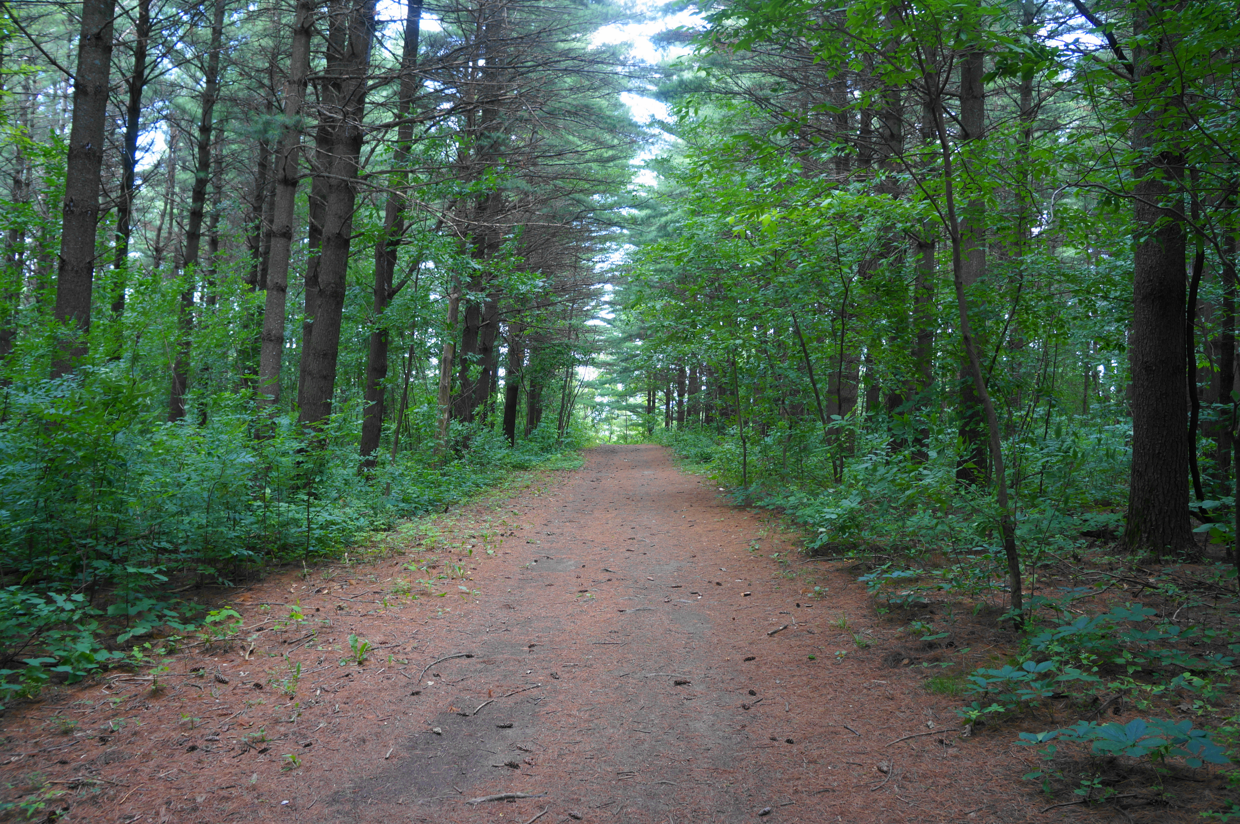

Stay left at the next junction, then right at a second, formally entering the King’s and Queen’s Bluff Scientific and Natural Area, where the planted trees are replaced with natural hardwoods, the original treescape in the area. Hikers will quickly come across the first notable slope of the hike, a short and mild drop that further immerses visitors in the oak and hickory woodland.
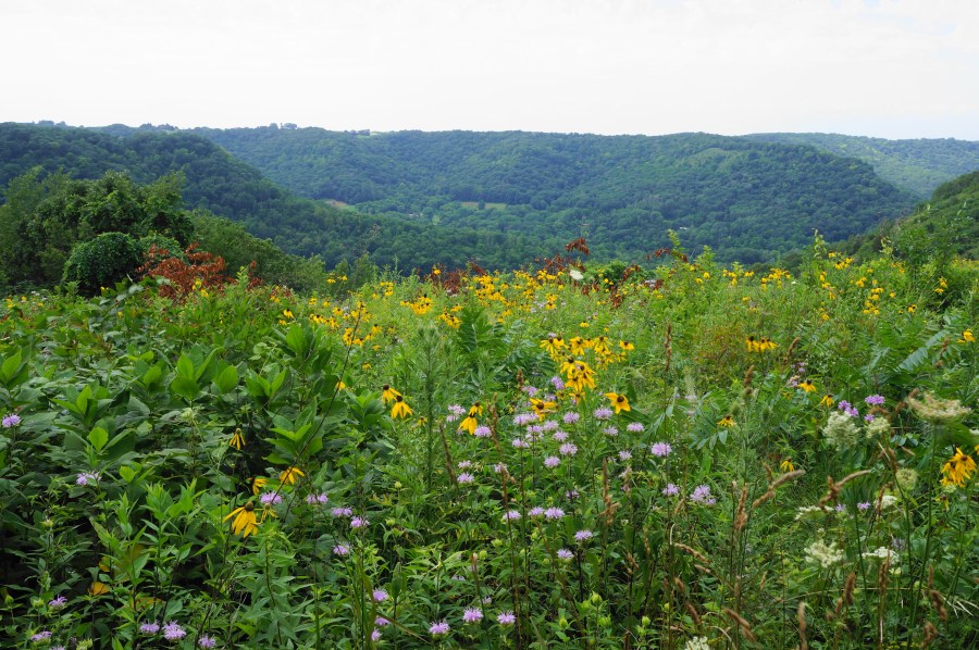
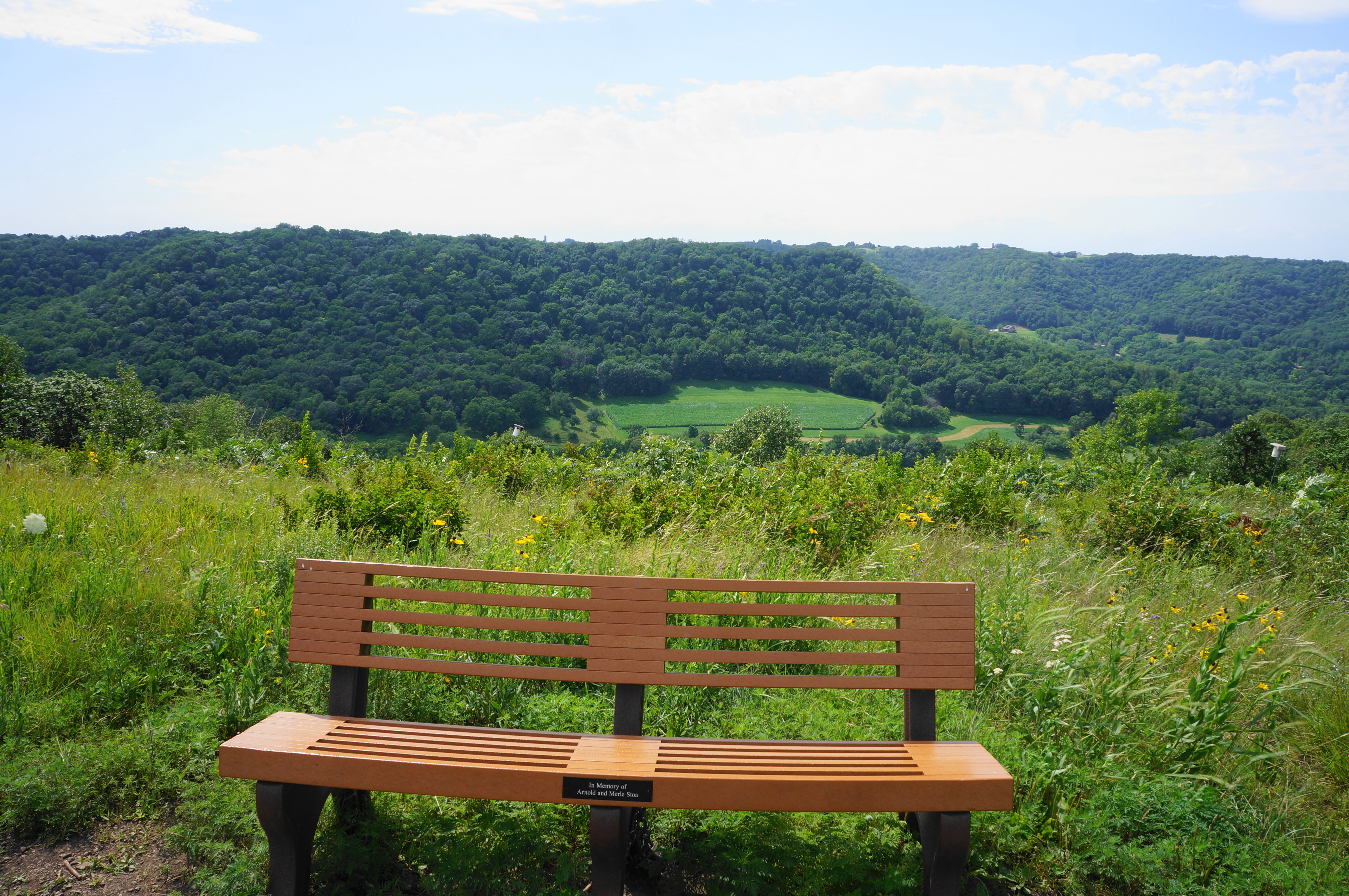
As the ridge around you begins to thin, the King’s Bluff Trail routes uphill gradually at around 6/10 mile before levelling off again, with a bench offering a place to rest. Continue north along the wide path, coming to the hike’s first significant vista at 9/10 mile. Here one can see westward across a goat (or bluff) prairie, so-named because of their steep slopes braved only by goats. In summer, the field is brimming with wildflowers of vibrant colors, and the views down to Miller Valley—situated just outside the park—are absolutely lovely.


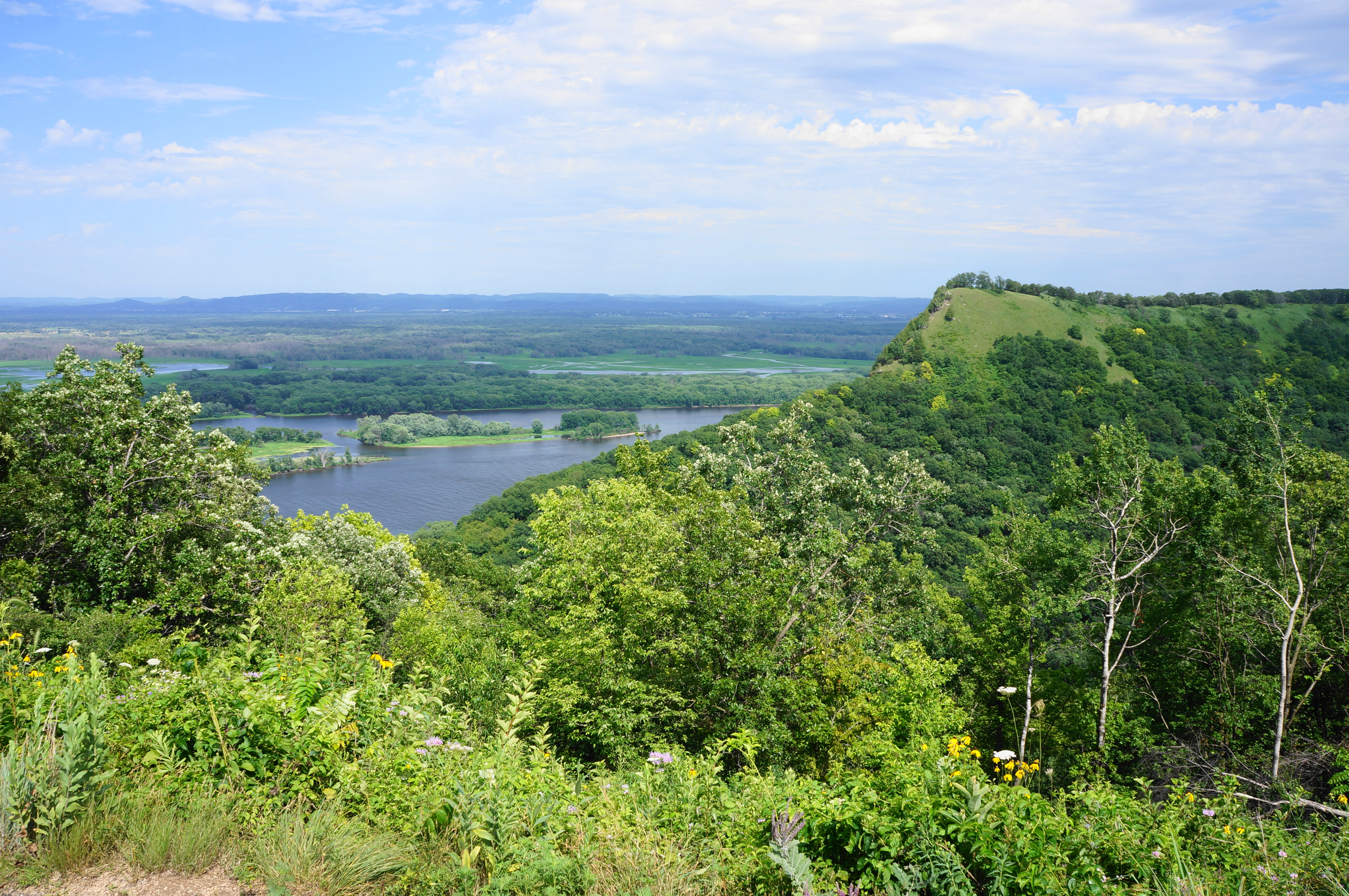
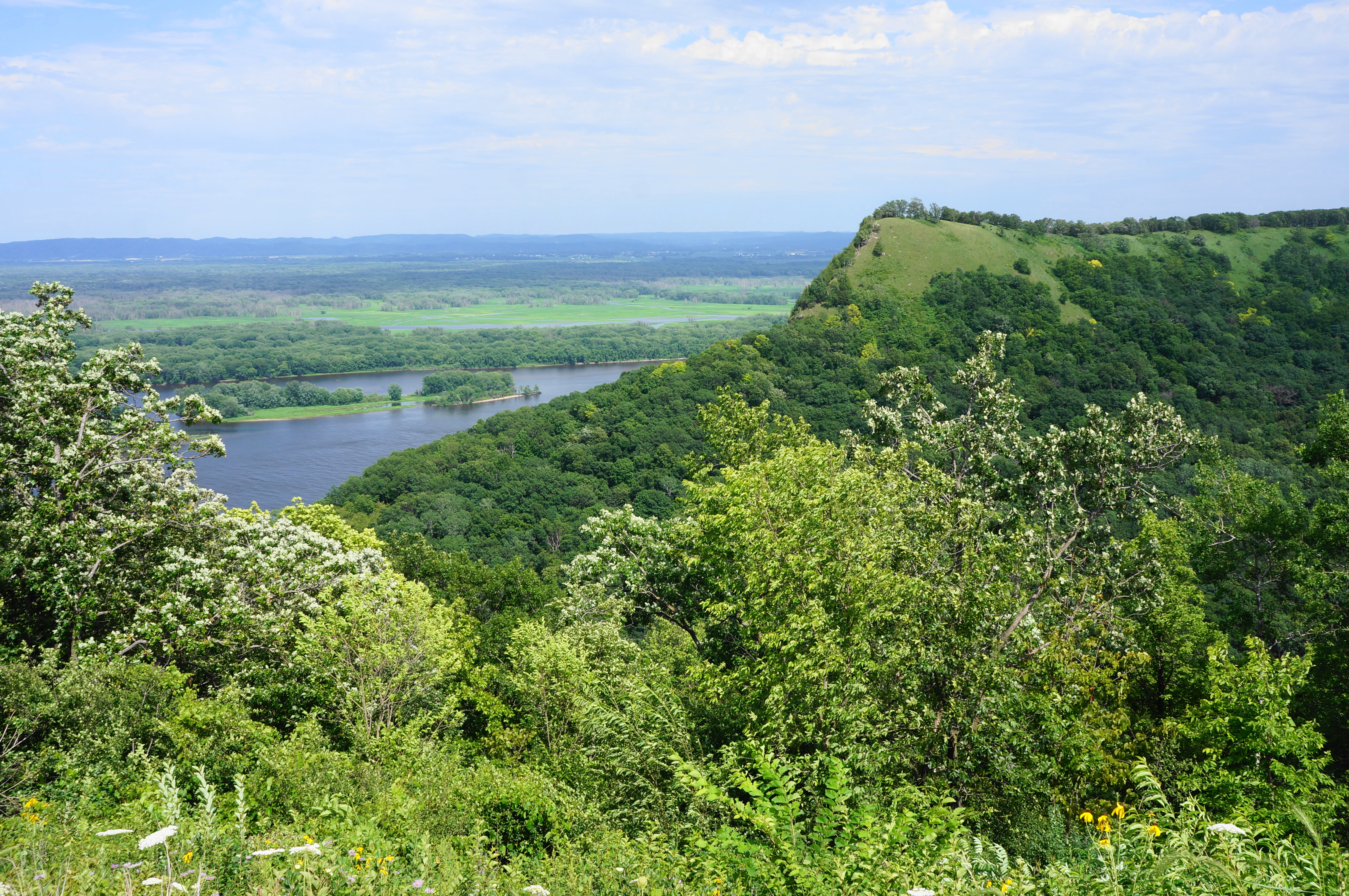
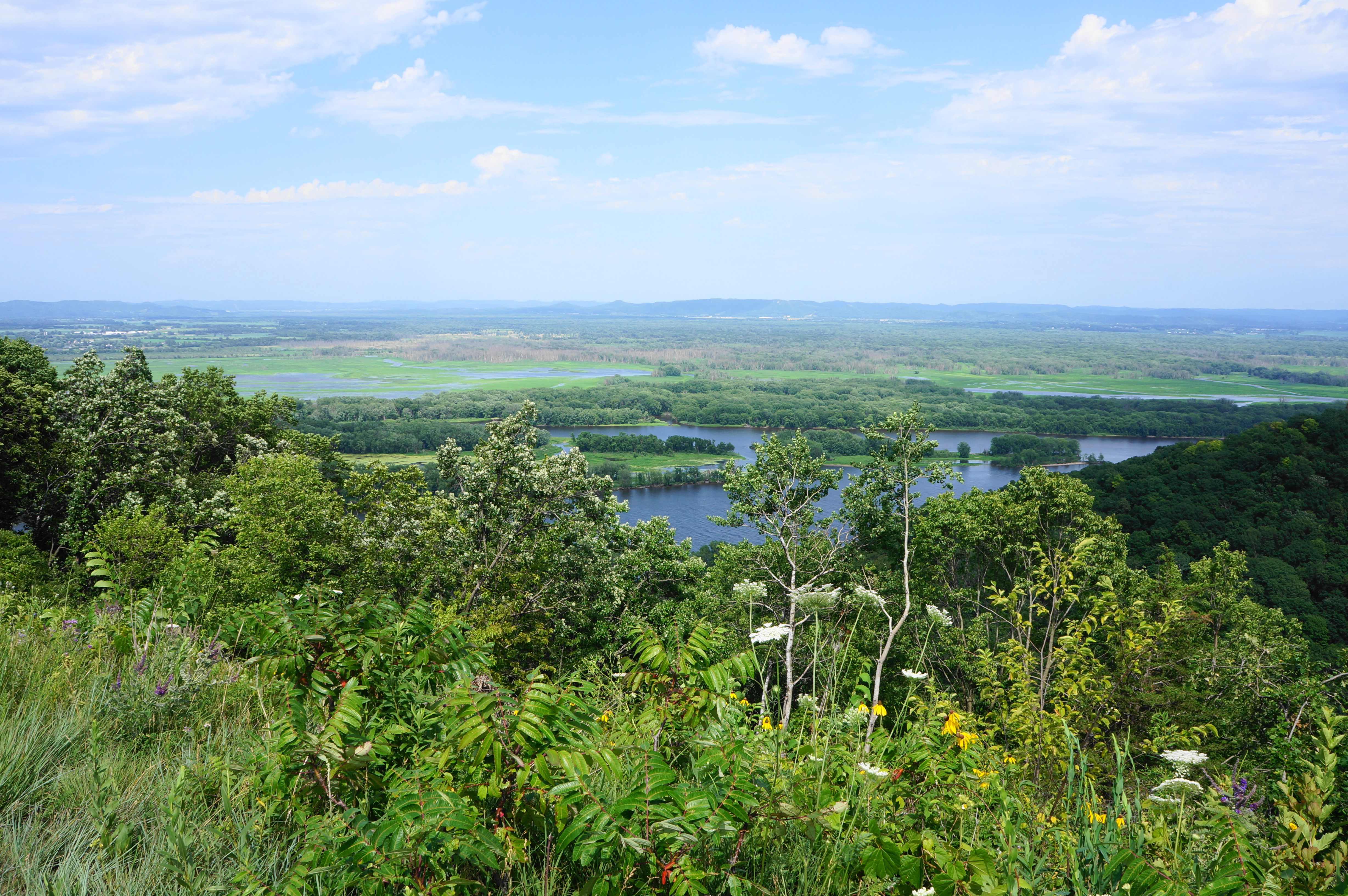
After this scenic vista, the trail briefly returns to the woods but quickly comes out at another open patch, situated at a saddle on the ridgeline. This is the end of the trail, with King’s Bluff Overlook offering views in both directions, including the premier look at Queen’s Bluff and the mighty Mississippi River. Queen’s Bluff is notable for its goat prairie and dry cliff habitats, situated atop the sandstone and limestone highline. Hikers can see eastward across the Mississippi to the many islets of the Upper Mississippi National Wildlife and Fish Refuge and the distant hills of central Wisconsin. Views northward are blocked by the continuation of King’s Bluff.
Alas, this is an out-and-back hike, so visitors must return the way they came. But the return journey is mild and interesting; be sure to stop to read the various interpretive waysides, which describe the natural and human history of the area. The round-trip is about 2.3 miles in total (2.5 if one takes the short detour described above) and is easy and family-friendly.

As always, thank You!!
Pingback: Top 10 Hikes in 2022 | Live and Let Hike