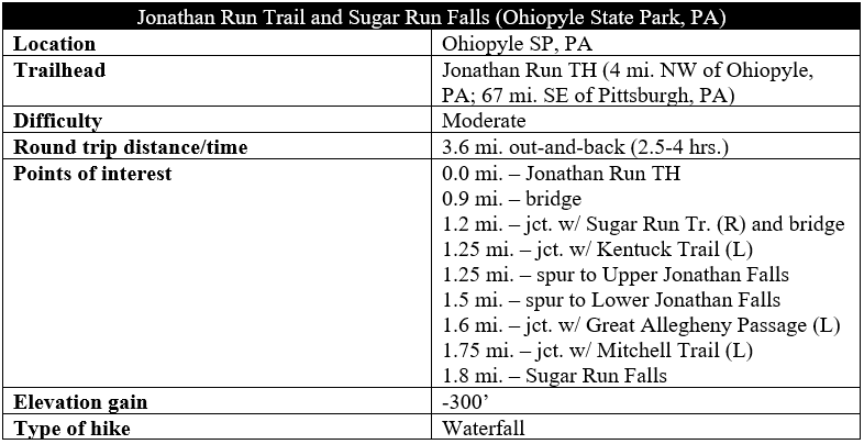
The Youghiogheny River Gorge in southwest Pennsylvania’s Ohiopyle State Park has many echoes of other, arguably grander canyons in the area, such as New River Gorge in southern West Virginia and Cheat River Gorge at Coopers Rock State Forest near Morgantown: sweeping vistas and lush side canyons, flush with rhododendrons and picturesque waterfalls. While most visitors to Ohiopyle—a 1.5-hour drive from Pittsburgh—flock to the main Ohiopyle Falls and Ferncliff area, hikers seeking relative solitude can find it on the Jonathan Run Trail in the northwest section of the park. In the course of 1.6 miles, the trail passes two beautiful waterfalls, and it is a short walk from the end of the trail to a third, Sugar Run Falls. Visitors in late spring can expect terrific flows through dense green thicket, with the three flumes inviting hikers to stay awhile…

The hike
Jonathan Run, a modest tributary of the Youghiogheny River, cuts through the northwest arm of Pennsylvania’s Ohiopyle State Park. While also accessible from the Kentuck and Sugar Run Trails, the best access point is its namesake path, the Jonathan Run Trail, which begins roughly 1.5 miles up the Holland Hill Road. (Note: From the Visitor Center at Ohiopyle Falls, head south on Highway 381, bear right on Ohiopyle Road, passing Cucumber Falls. Then stay straight at the four-way intersection, where the name changes to Holland Hill Road.)
The Jonathan Run Trailhead, situated at a sharp left-hand bend in the northbound road, is tucked away in the trees off to the right. A small, unpaved parking area has space for maybe a half-dozen cars.
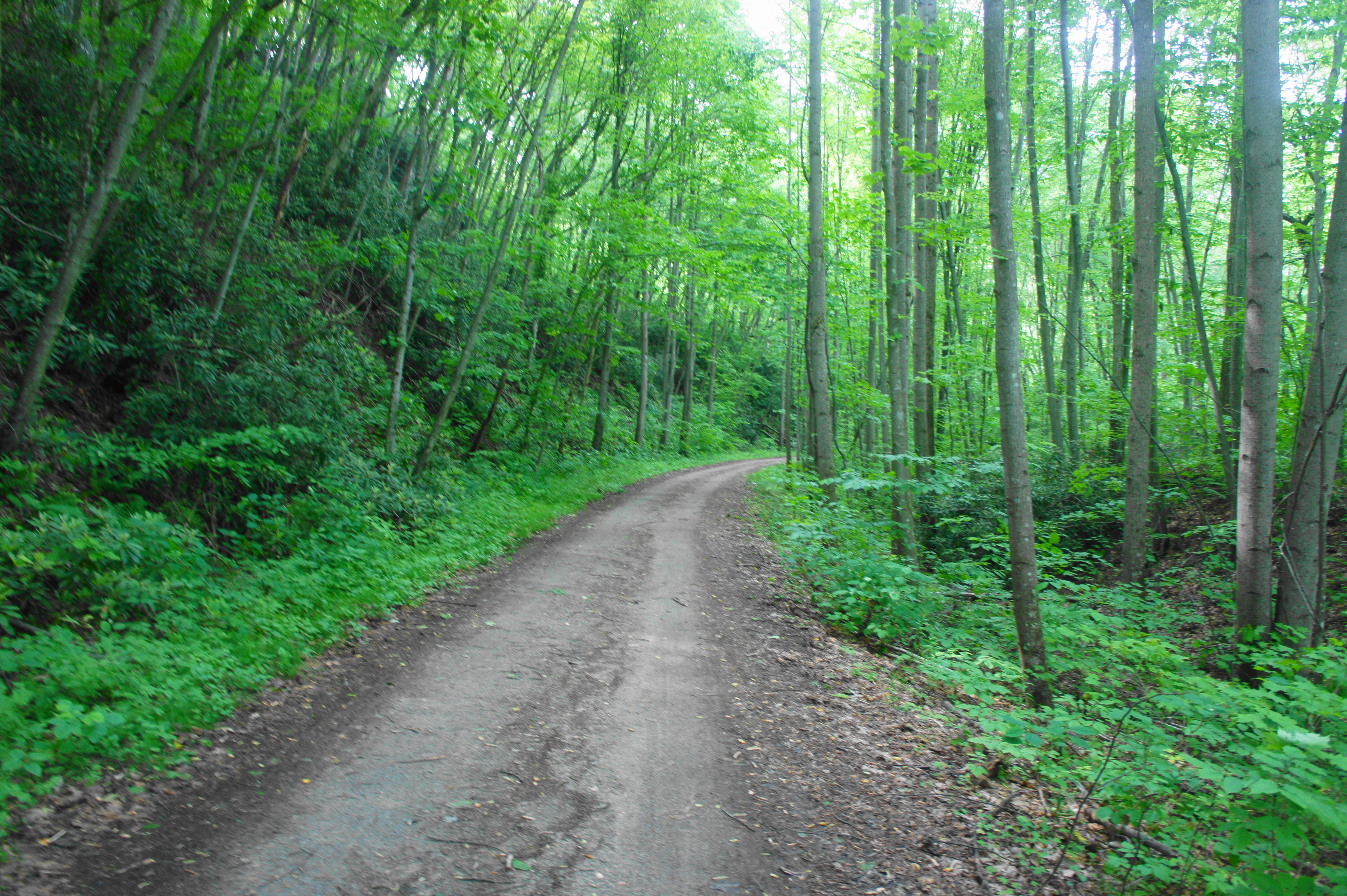
The Jonathan Run Trail, the only path that heads off from here, begins by keeping its distance from its namesake creek but sporadic views of the stream appear on the left. The easy-to-follow path bears uphill in fits and starts, crossing a muddy ravine after about 1/3 mile. From here the trail drops down to creekside, following yellow blazes.
Now over a half mile from the start, the trail begins an abrupt climb to a higher level, putting hikers at least 30 feet above the creek bed. The track stays at this height for around 200 yards then drops back to stream level.
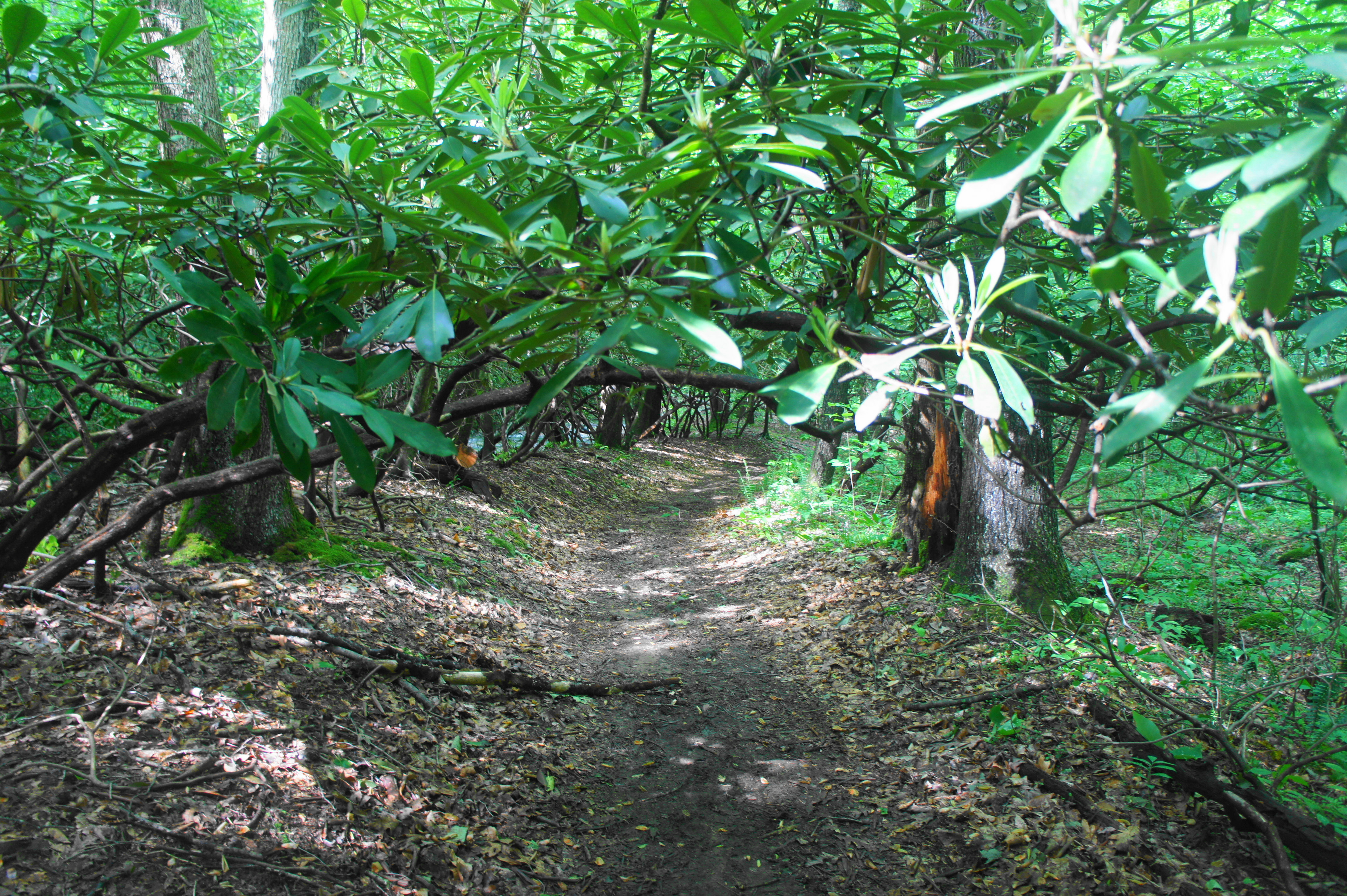
The hike, to this point pleasant but nothing spectacular, becomes considerably more interesting as it ducks under a canopy of leafy rhododendrons at 8/10 mile. These beautiful plants thrive in the moist, streamside setting, giving the ravine a more memorable character.
Steps further, the trail crosses a wooden bridge that, at the time of the author’s hike, appeared freshly constructed. Staying in the floodplain, the trail along the western bank gains little elevation. At 1.1 mile, the yellow-blazed path leaves the main track to the left. (Note: The path heading right leads to a difficult creek ford that is no longer used.)
Hikers will again cross the creek, however, in about 100 yards, just after a fork with the Sugar Run Trail (stay right). (Note: Visitors can venture a little way up the Sugar Run Trail, however, for a peek at nearby Fechter Run Falls.) The Jonathan Run Trail, after the second bridge, quickly ascends to another trail junction, this time with the Kentuck Trail, which offers access to the Kentuck Campground.
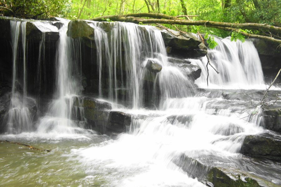
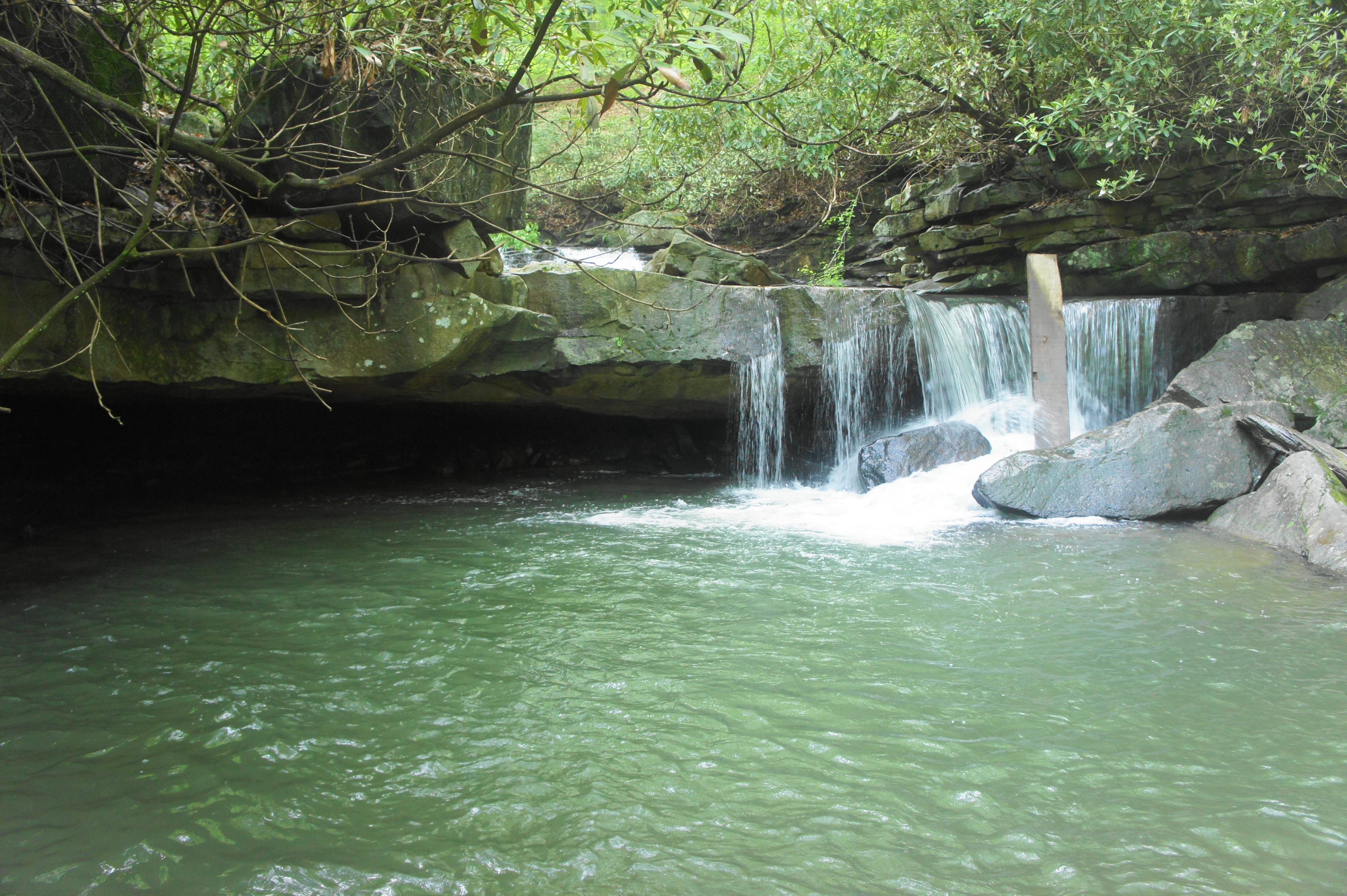
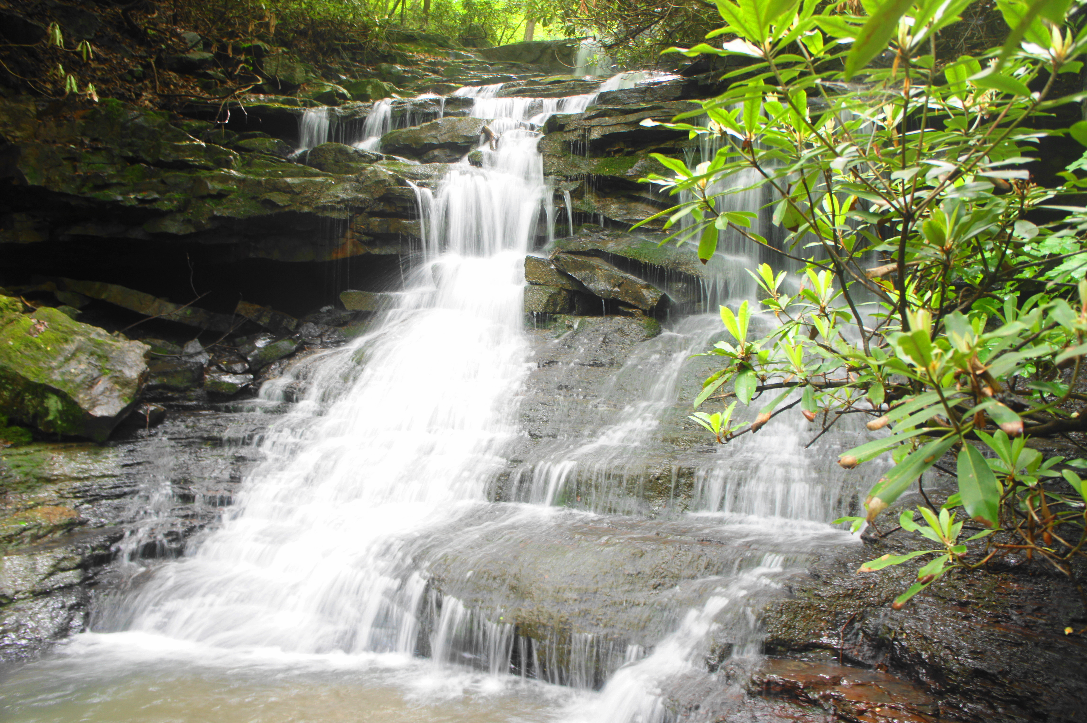
Continuing left at the fork, start to look for a set of social trails bearing off to the left. These paths, well worn but still steep and requiring careful footing, converge on the base of Upper Jonathan Run Falls. (Note: This waterfall, unlike the other two, is NOT labelled on Ohiopyle maps.) While not particularly high or wide, this private cascade is arguably the best of the bunch because of its secluded location and multitiered tumble that leaves visitors with the sense that they are surrounded by flowing water.

Below the main falls, Jonathan Run drops another three feet off a sandstone ledge, pouring into a beautiful bowl-shaped pool that is attractive for swimming. It is easy to spend upwards of an hour relaxing in this beautiful area, and crowds are likely to be few or nonexistent.
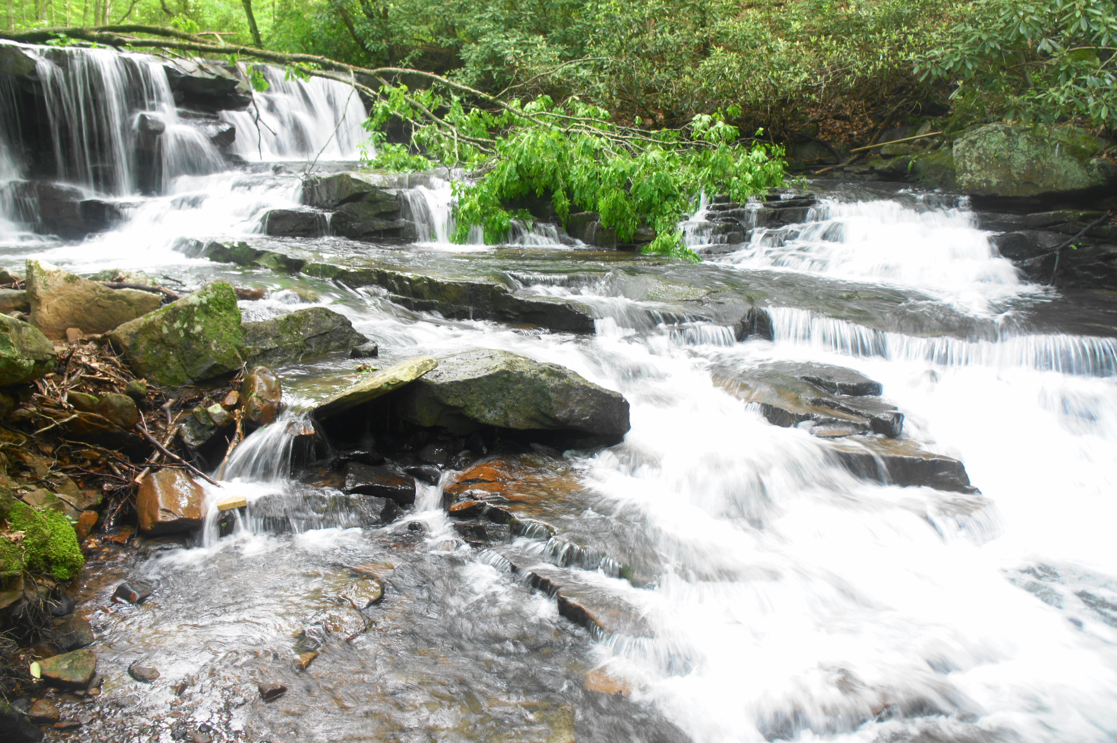
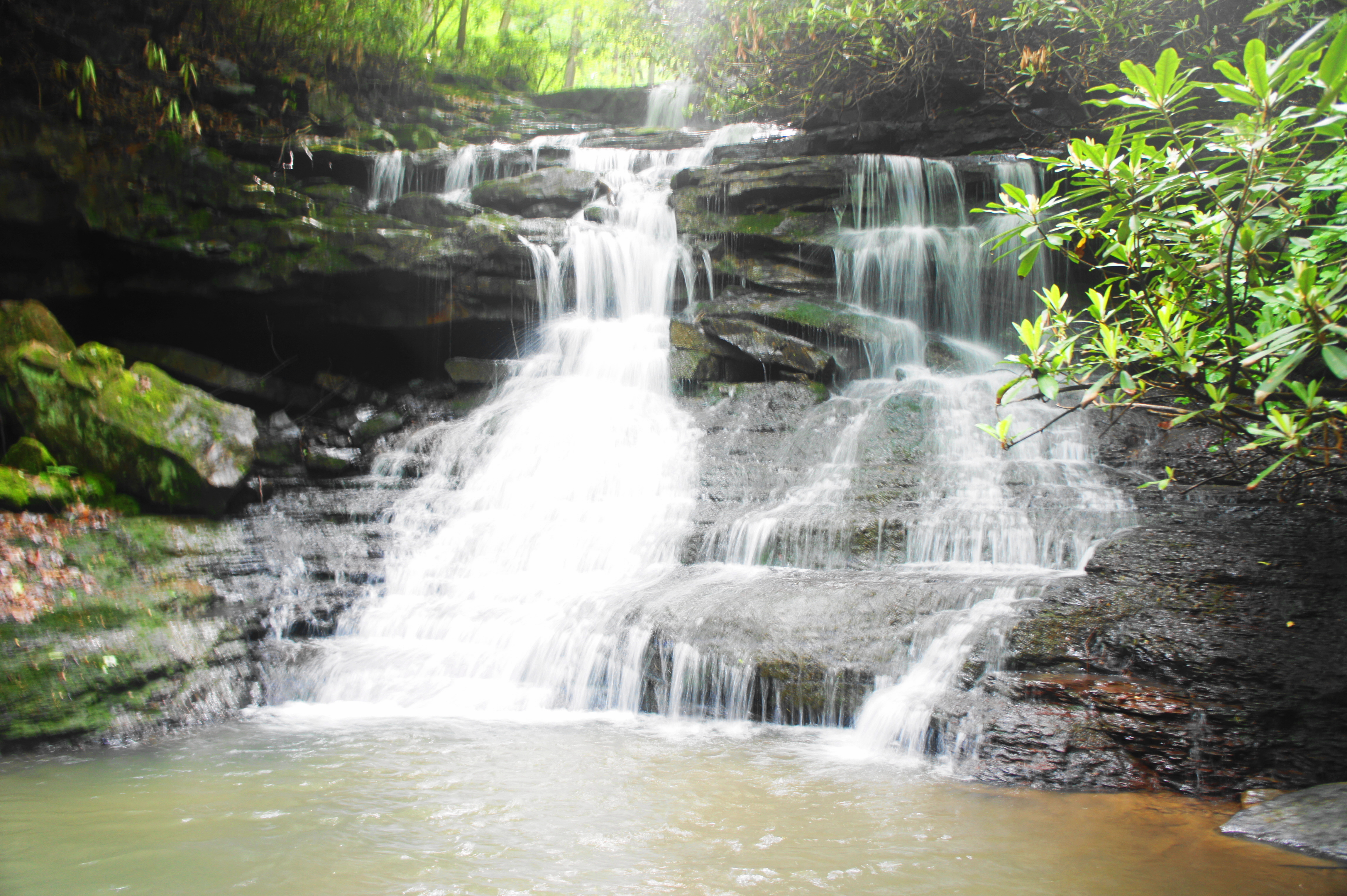
Once ready, climb back up to the main trail and bear left, heading downhill on the wide path. Keeping to the right of the creek, the Jonathan Run Trail descends steadily for ¼ mile to the next attraction: Lower Jonathan Run Falls. At the sounds of rushing water, start to look again for a set of interconnecting social trails on the left. This time, the descent to the falls is considerably more difficult—and not recommended for small children or those without proper footgear. (Note: At one point, the path is so steep that a rope has been installed to assist with the descent.)
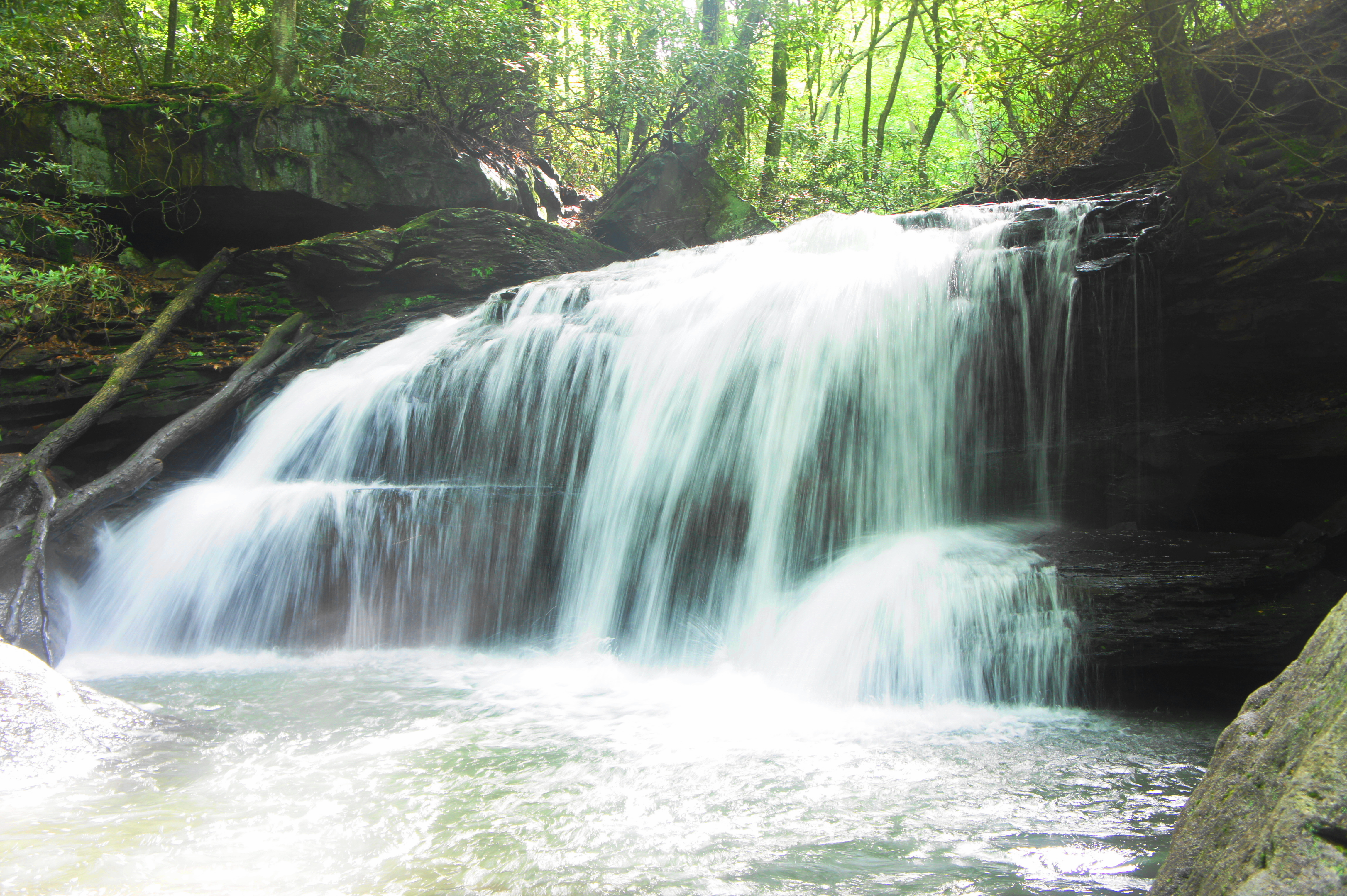
Those who brave the drop, however, are rewarded with another intimate waterfall. Unlike the upper falls, Lower Jonathan Run Falls tumbles over just one main drop that ends in a small pool. Large boulders along the creek offer a nice place to again rest and take in the scenery.
After a grueling ascent back to the Jonathan Run Trail, bear left again. The trail ends soon after, spilling out onto the Great Allegheny Passage, a hiking and biking superhighway that extends 150 miles from Pittsburgh to Cumberland, Maryland. In Ohiopyle, the wide and largely flat path follows the Youghiogheny—partly visible straight ahead—for the roughly 10 miles that it weaves through the park.
Hikers can use the end of the Jonathan Run Trail as a stopping point, a prompt to turn around and retrace your steps back for 1.6 miles to the trailhead. But those thirsty for one more waterfall can bear left on the Great Allegheny Passage and follow it for 250 yards to the junction with the single-track Mitchell Trail.
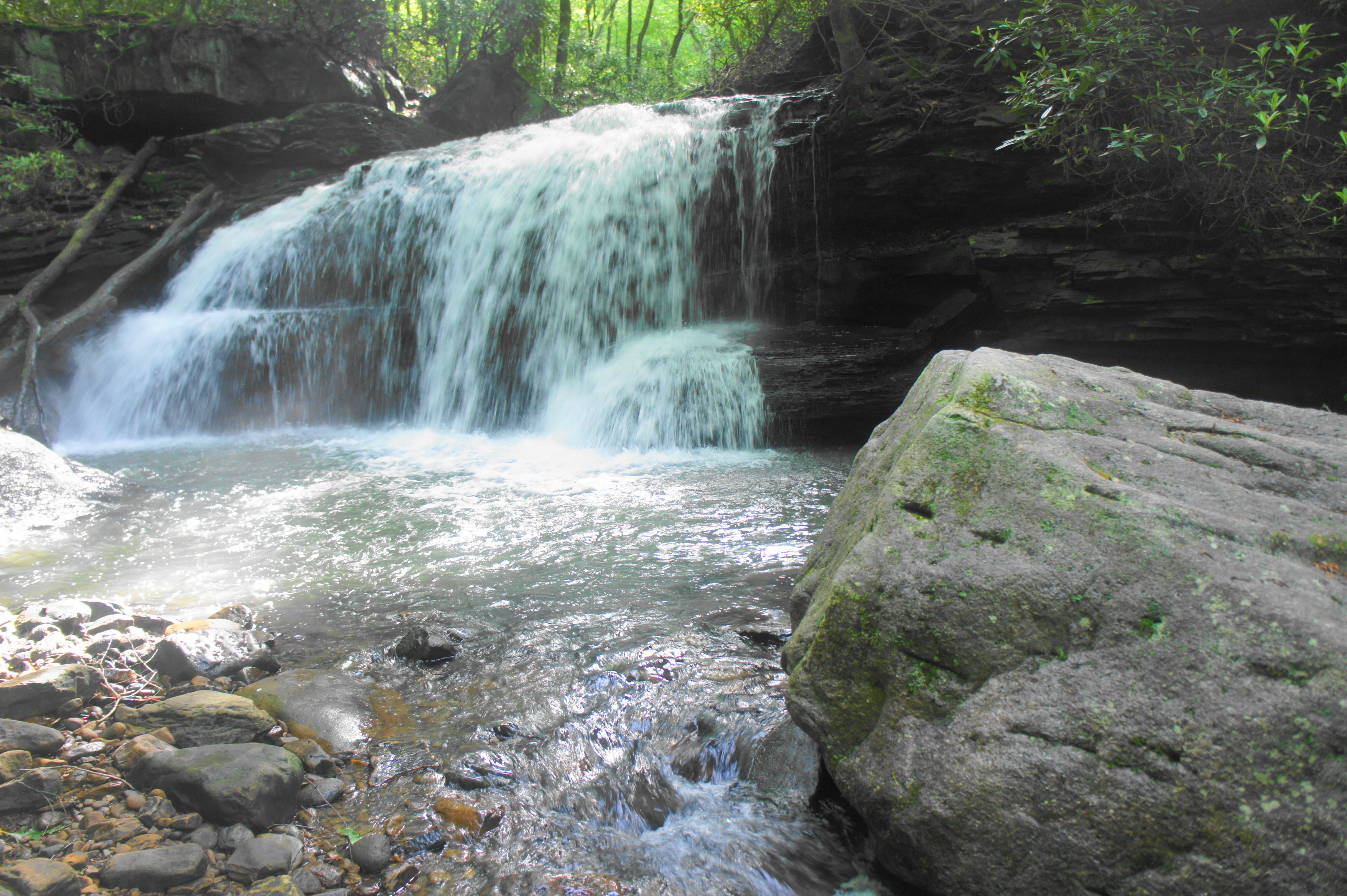
Bear left on the Mitchell Trail, entering a dark ravine with the sounds of more rushing water. After a few minutes of climbing, the footpath reaches the base of Sugar Run Falls, a small but beautiful cascade that is even more likely than the others to be devoid of crowds. Be careful scrambling around here, as the viewing space along the banks is tight and rocky.
While the Mitchell Trail continues uphill from here, it is time to turn around and return to the trailhead, following the route you came. It is a roughly 1.8-mile journey, this time covering a modest but steady uphill gain of about 300 feet in elevation.
The entire 3.6-mile journey, with little to no breaks, can be completed in less than two hours. But those seeking some serenity at the three falls, should allot for at least three hours for the moderately-difficult hike.

Pingback: Top 10 Hikes in 2019 | Live and Let Hike