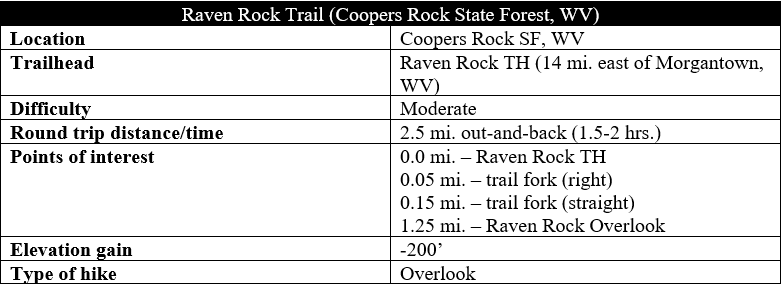
At Coopers Rock State Forest in northern West Virginia, the Cheat River carves a deep, sandstone canyon through thick forest, making the area one of the most popular outdoors destinations in the Morgantown area. While most flock to the overlook near the main parking area at Coopers Rock, the nearby Raven Rock Trail offers an opportunity to stretch your legs and visit a quieter viewpoint that is arguably even more expansive. Short but rocky, the out-and-back track forms a 2.5-mile round trip.
The hike
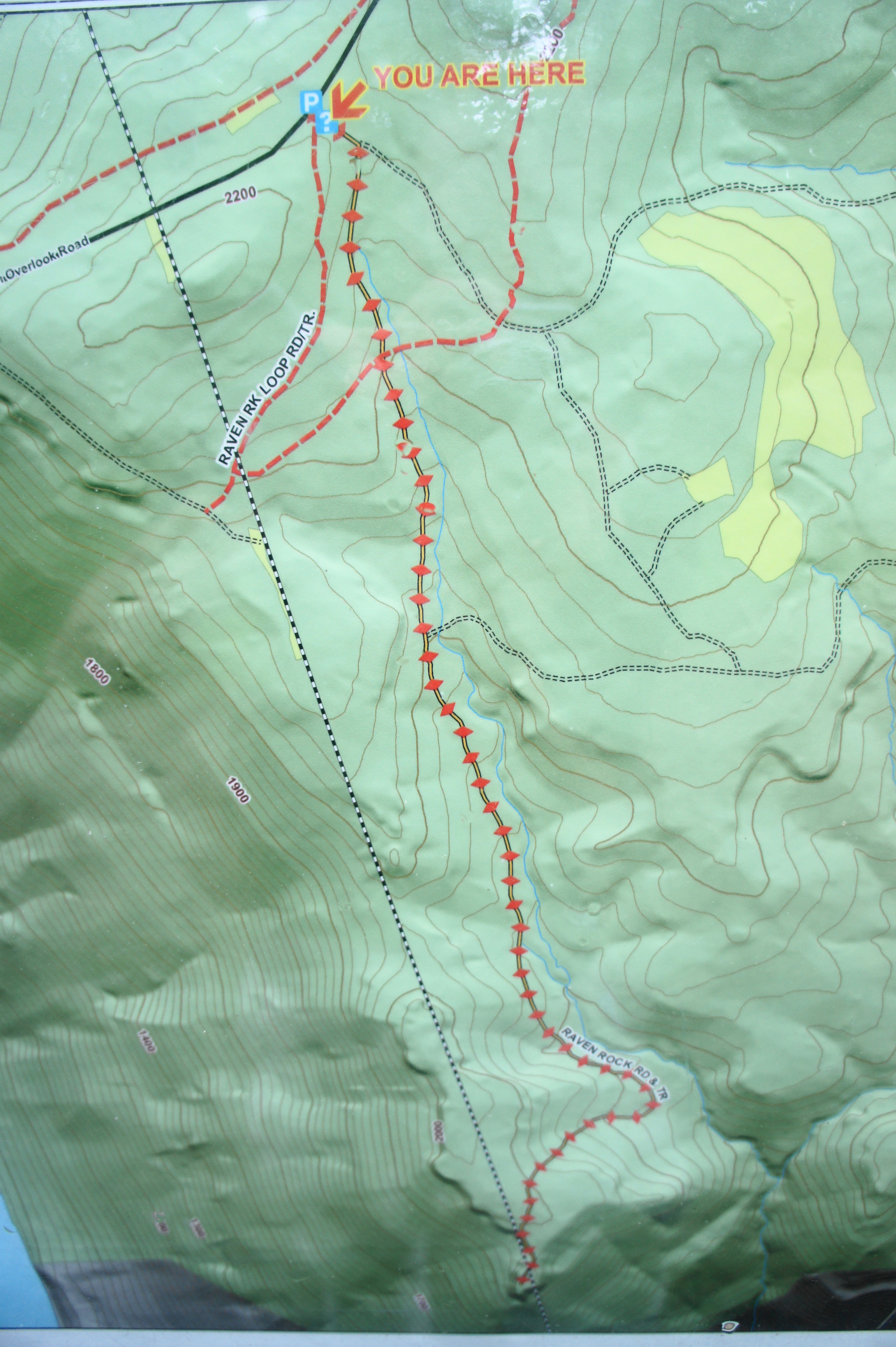
The Raven Rock Trailhead is situated roughly 2.2 miles down Coopers Rock Road, a short drive from the entrance to Coopers Rock State Forest at the junction with Interstate 68. Heading south from I-68, the marked trailhead will be on the left, although the parking area is located opposite the start on the right.
Passing around the closed gate, the trail begins as a wide gravel road. Maps are located at a small information stand on the right, after which the track leaves the parking area behind. In about 50 yards, bear right at the junction, leaving the dirt double-track as it bears left into the woods. The trail from here remains wide but rockier and more natural.
A steady downhill pace sets in as the track descends a wooded hillside en route to the rim of the Cheat River Gorge. At about 300 yards, stay straight at the trail junction—the orange-blazed trail that bisects the path offers connections to the McCollum Campground and Coopers Rock area.
Descending amid a sea of ferns and other greenery, the trail approaches a large rock monolith on the right at about ¼ mile. The declivity remains but eases slightly, still bearing south toward the canyon. The ravine on the left gradually takes on more form, with a trickle of water becoming a steady flow.
Another row of cliffs come into view on the right at 4/10 mile, followed by an unmarked path that enters from the left. Within the next 300 yards, the trail flattens out considerably. At 7/10 mile, a brief uphill leads quickly into a sharp decline, with the stream becoming louder on the left and hemlocks and rhododendrons become more ubiquitous.
At about 9/10 mile, the trail reaches a somewhat confusing fork, with a spur trail heading straight while the main track veers sharply to the right and begins an abrupt uphill. (Note: The left spur is worth exploring, as it leads to a beautiful, shaded stream.) The next section is the most difficult of the hike, climbing roughly 120 feet in elevation in less than 300 yards. But the sharp ascent ends at about 1.1 miles, and—even though trees still obstruct the view—one can sense that the canyon rim is near.
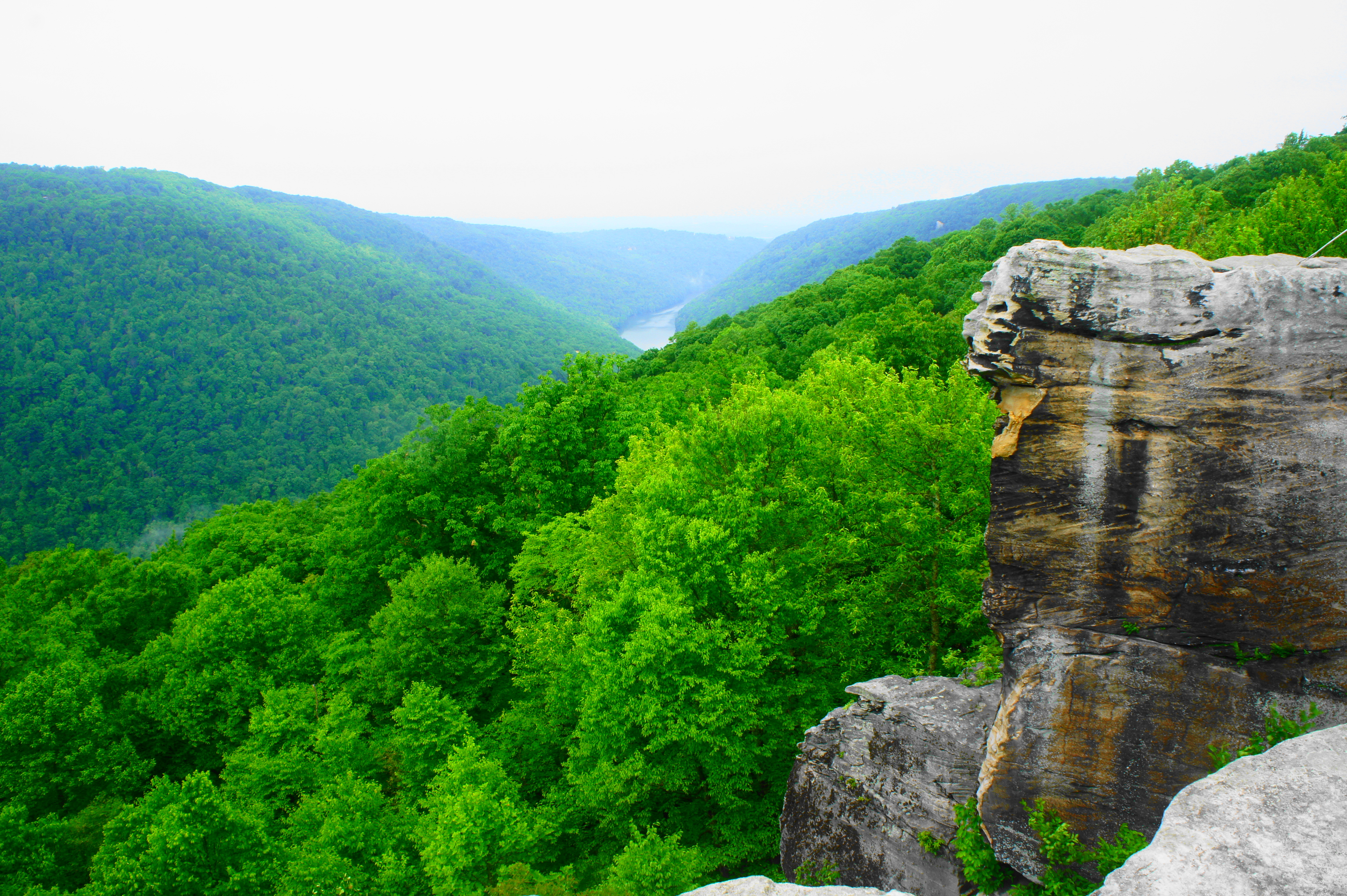
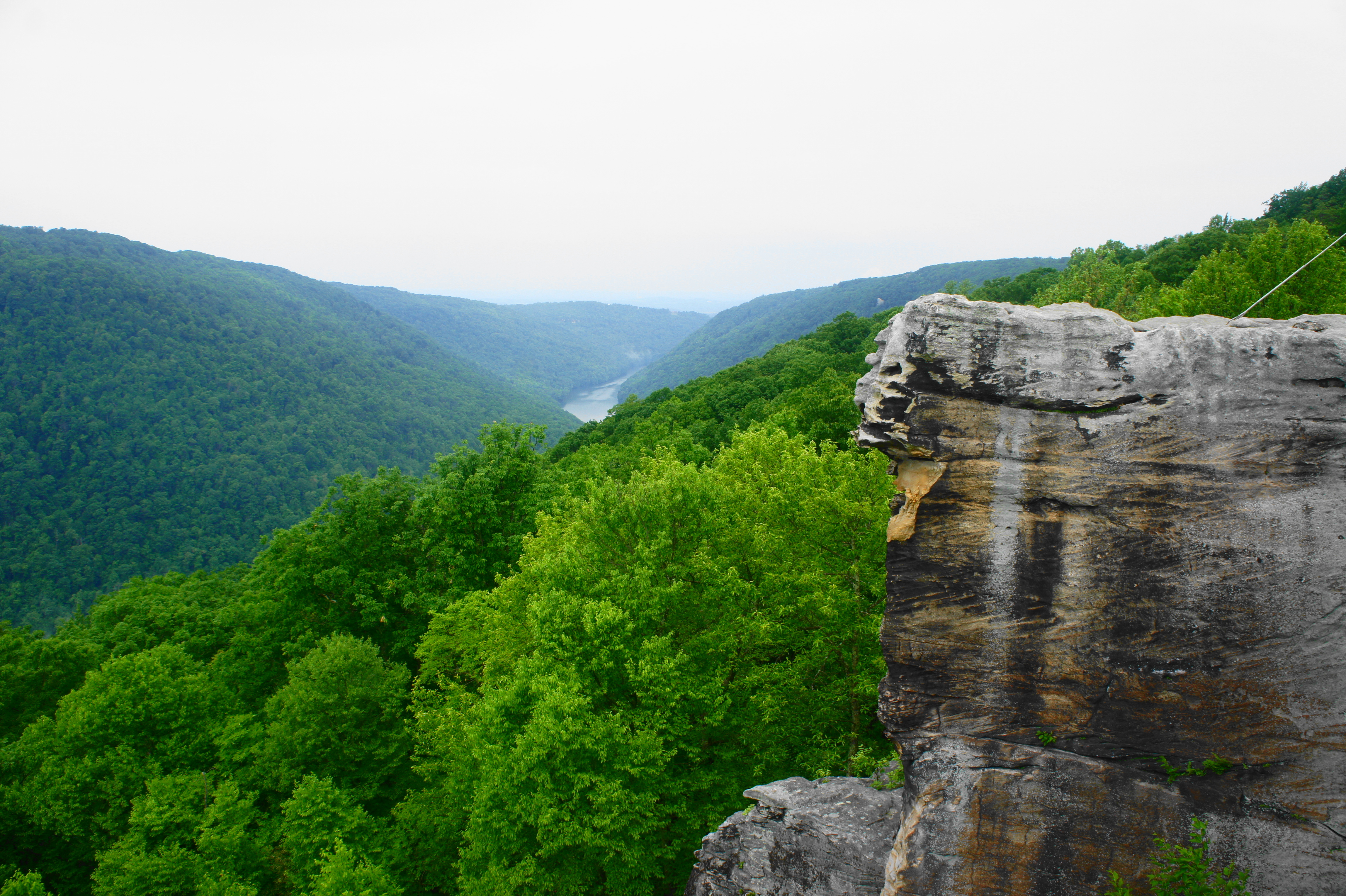
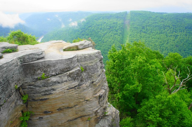
At 1.2 miles, the trail veers toward a set of power lines, towering over a jumble of rocks that are worth exploring in themselves. Finally, continuing south on the trail, the path passes directly under the power lines and ends at the stunning Raven Rock Overlook.
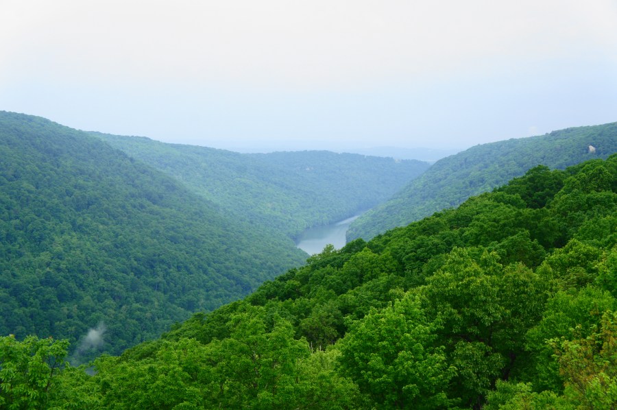
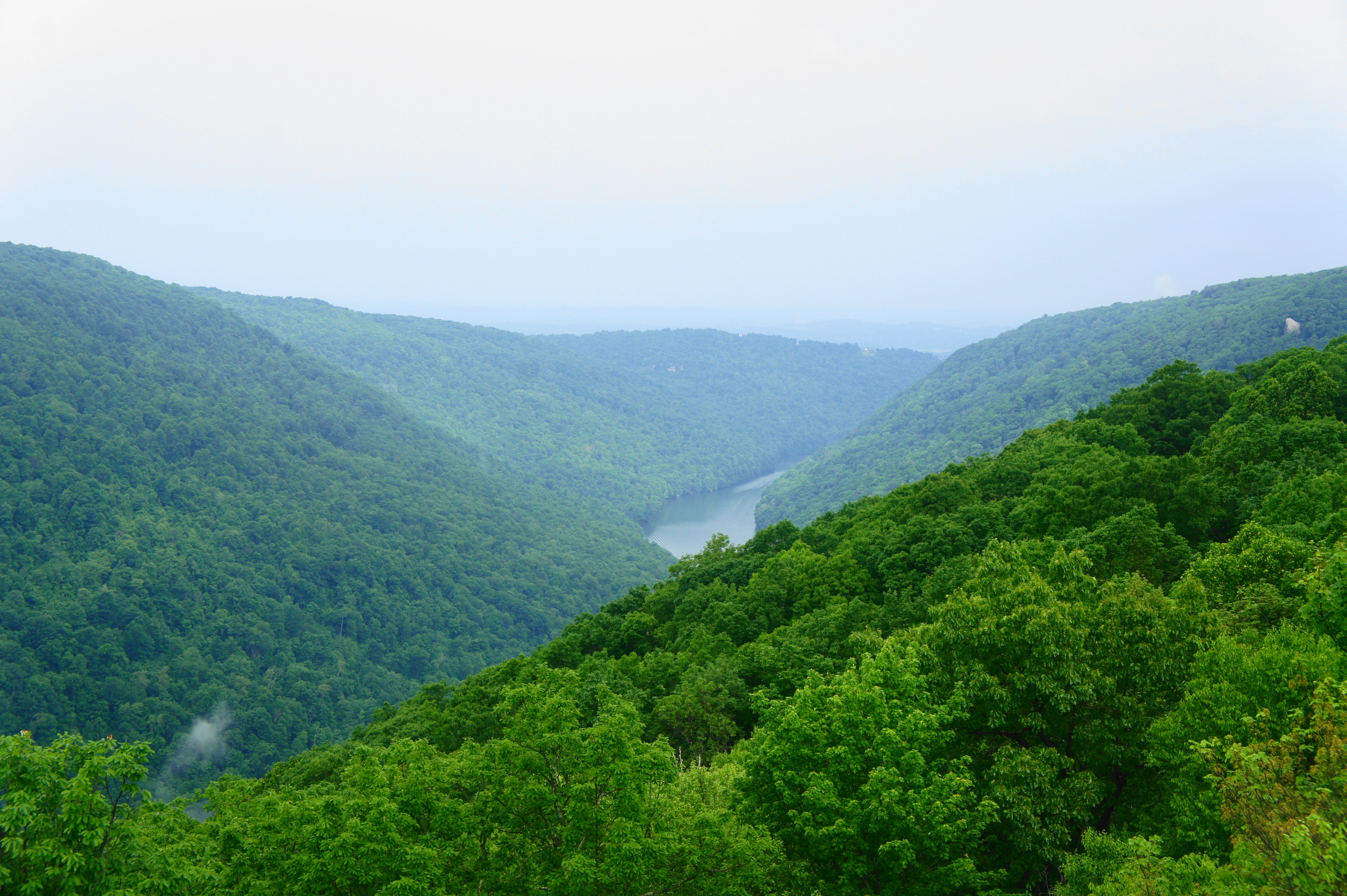
Below, the majestic beauty of the Cheat River Gorge unfolds, with the waterway itself visible off to the southeast. It is a jaw-dropping 1,100 feet from here down to the base of the canyon, a height that eclipses the better-known New River Gorge in southern West Virginia. Looking right, it is possible on clear days to spot Coopers Rock to the northwest, a small protrusion of sandstone on the near side of the canyon. Beyond, the Cheat River forms a lake, a popular destination for swimming, rowing, and fishing.
Arriving early in the morning, there is a good chance of having this spectacular viewpoint all to yourself. But once you are ready to return, turn back and follow the way you came—this time the ups and downs are reversed, with a sharp downhill followed by a slow but relentless climb that will feel much harder than the arrival trek.
Allot at least 1.5-2 hours for this out-and-back hike.

Pingback: Jonathan Run Trail and Sugar Run Falls (Ohiopyle State Park, PA) | Live and Let Hike
Pingback: Top 10 Hikes in 2019 | Live and Let Hike
Pingback: 153 Things to do in Morgantown, WV – ACE Mindset Journey