
The roughly one-mile circuit hike in Maryland’s Swallow Falls State Park would be impressive enough if its only attraction was the last remaining stand of virgin hemlock and white pine trees in the state. But in addition to this exquisite forest, the Swallow Falls Canyon Trail also passes four waterfalls, cuts under towering sandstone cliffs, and spans a shady landscape dotted with alluring rhododendrons, all in one brief and relatively easy jaunt.


The hike
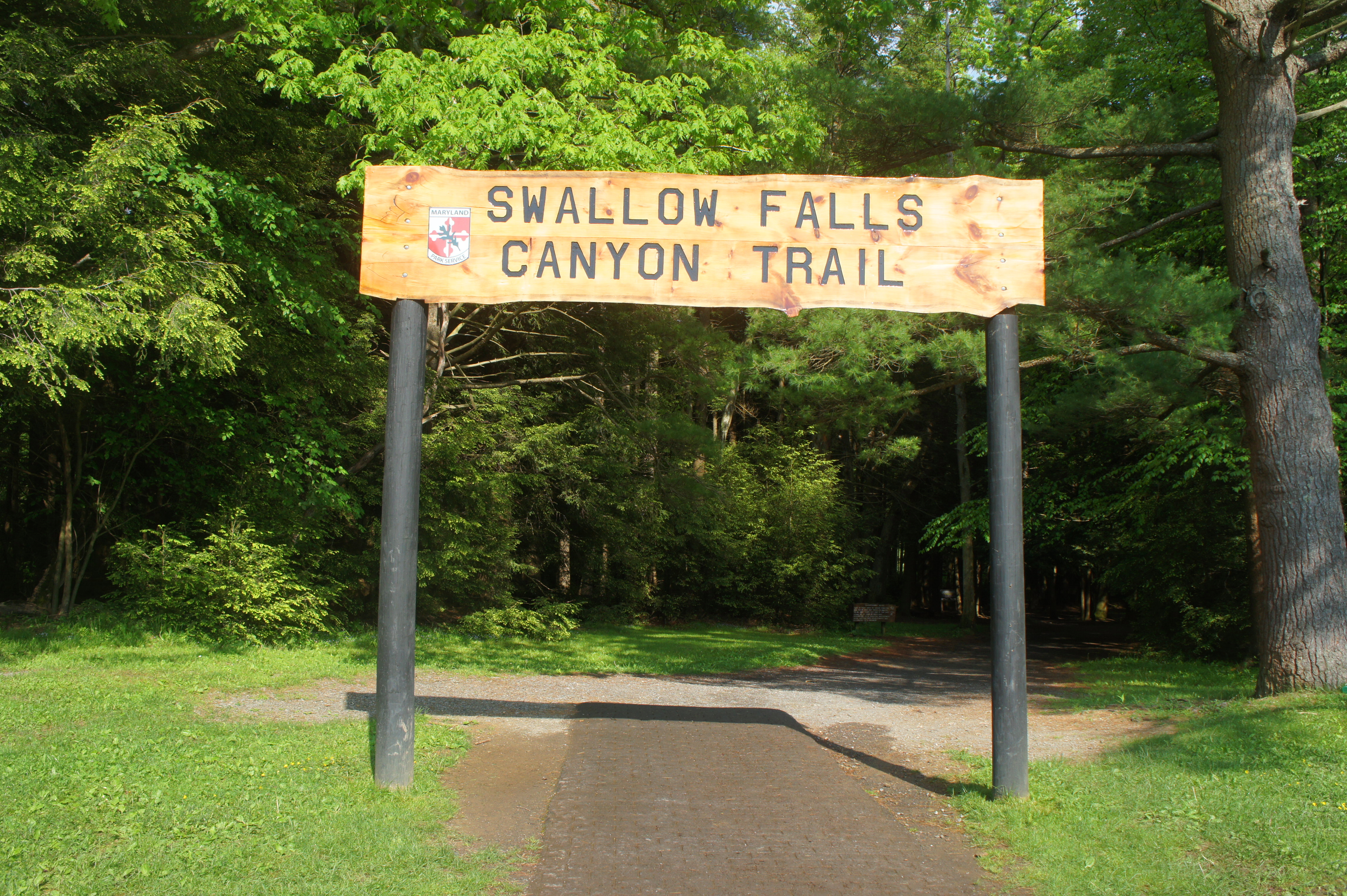
Expect to see plenty of people at Swallow Falls State Park, a popular destination in western Maryland near the West Virginia state line. But the crowds are largely there to swim, fish, and camp, leaving the hiking trail itself relatively breathable. The circuit begins at the main parking area in the park, just beyond the entrance on the right, where there is a small trailer that functions as a visitor center. The start of the Swallow Falls Canyon Trail is hard to miss: a towering entrance sign more than 10 feet high signals the way.
As soon as the hike begins, hikers enter the splendid forest of earthy hemlocks and pines, a beautiful combination and relative rarity in the Mid-Atlantic. The 37-acre Youghiogheny Grove includes trees that are more than 300 years old, casting a shadow that offers cool freshness on even the hottest days.

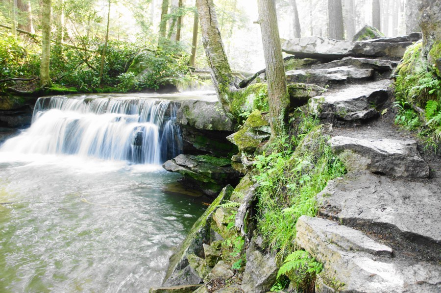
Within 50 yards, the trail forks, marking the start of the loop section. Bear left first, heading north through the woods. The broad and easy path gradually descends, reaching an additional parking area (for those with wheelchair placards). Stay straight on the path as it turns to a wooden boardwalk. About 300 yards into the hike, the boardwalk ends, and a flurry of trails head off in different directions. Make your way down the hill toward the edge of the sandstone gorge: here an overlook offers the first look at Muddy Creek Falls, a 53-foot chute that is the highest free-falling waterfall in Maryland.
Bear slightly left to find the trail heading down to the base of the falls. From here you can view Muddy Creek as it drops through neatly-carved layers of exposed sandstone and shale. The pool at the base fans out to fill a large basin before the creek continues down a set of cascades beyond. (Note: The presence of Muddy Creek Falls within a park bearing the name of another significantly smaller and less impressive waterfall is somewhat confounding.)

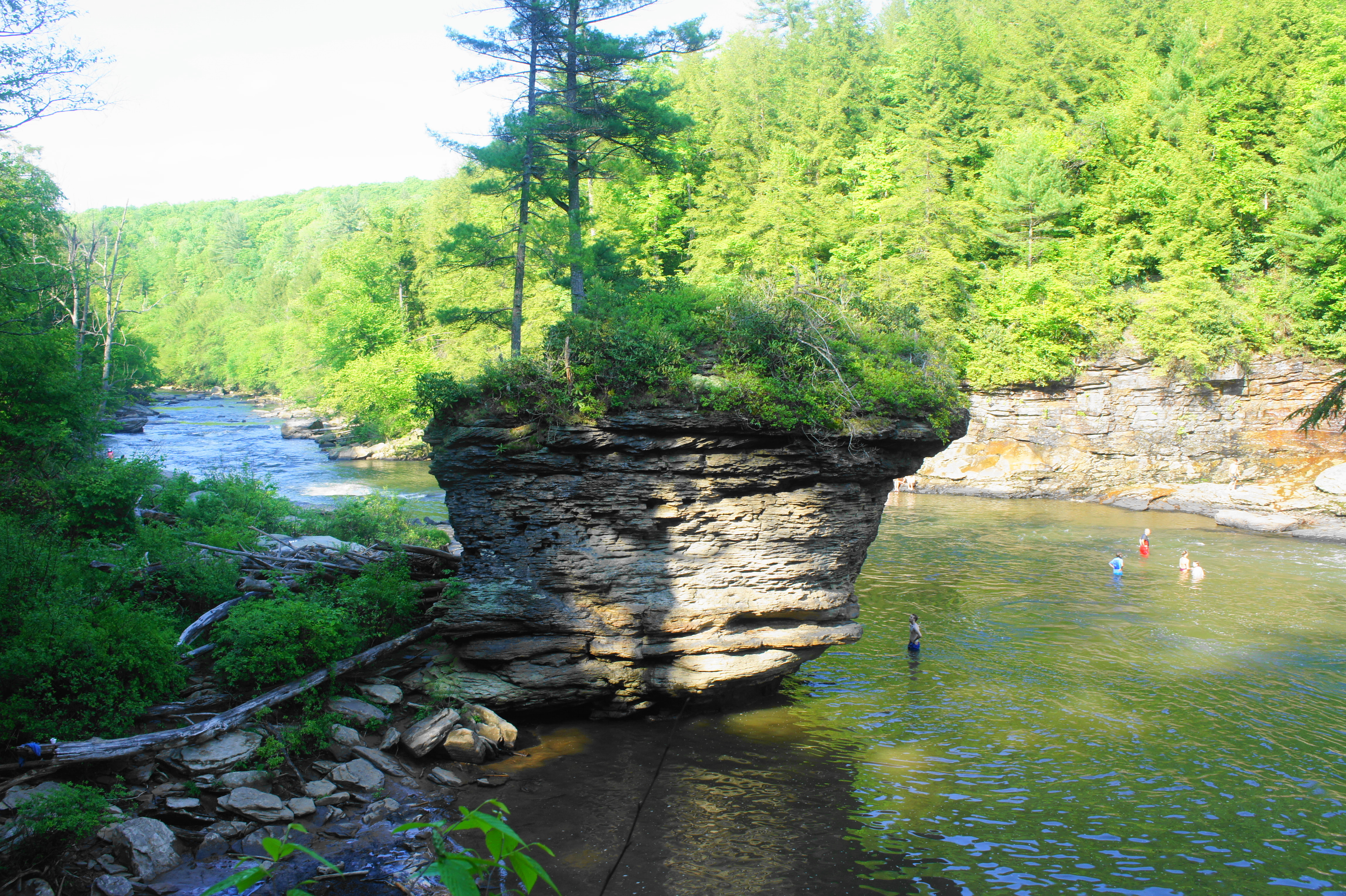
From the falls, follow the continuing trail, now fully dirt, as it hugs the edge of the sandstone cliffs. Beautiful rhododendrons dot the landscape, offering further shade. At about ¼ mile, the trail rounds a right-hand bend; just off to the left is the confluence of Muddy Creek and the larger Youghiogheny River, which cuts a steep gorge through the surrounding mountains.

Just beyond, climb a set of stairs, then follow a high wall before passing under two high overhangs. By 4/10 mile, the river on the left has actually calmed, a relative stillness that belies the waterfalls ahead. The ascending trail gradually narrows and weaves under another set of hemlocks.

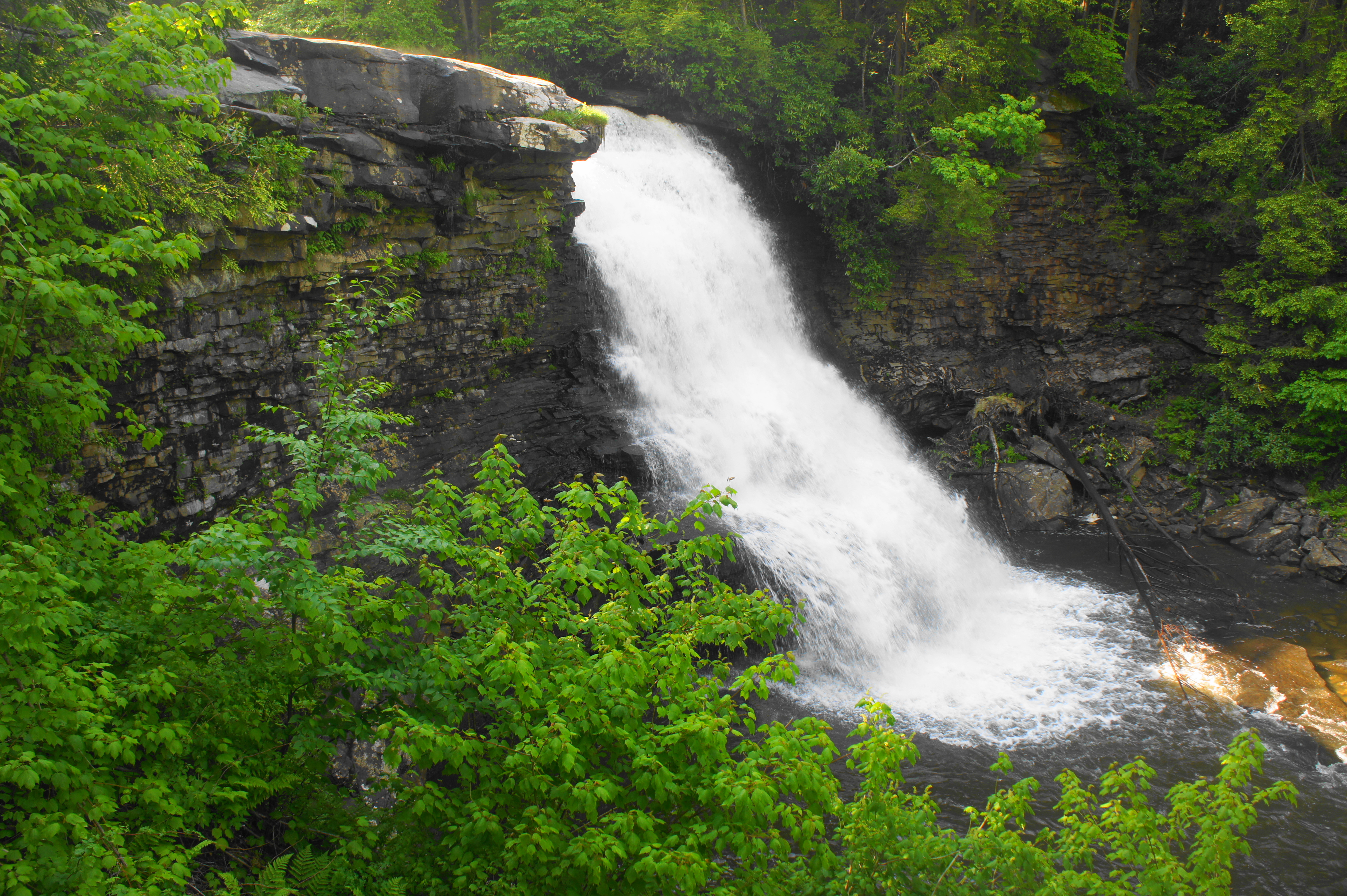
At ½ mile, the trail approaches Lower Swallow Falls, a short but pleasant drop along the Youghiogheny. After the falls, the trail ascends a spiraling wooden staircase, ending at a spur trail that heads left to a relatively distant view of Upper Swallow Falls, slightly more impressive than its smaller neighbor.


Returning to the main track, head south and stay left at the trail fork at 0.55 miles. About 125 yards later, stay left again at the next fork; by now you have reached the base of Upper Swallow Falls, a popular swimming hole for visitors. The waterfall fans out into an accessible spill, reachable by way of the shallow waters downstream.

Heading a little further on the trail brings one to the top of the falls, a popular spot for photos. Upstream, the river is calmer, with the bridge carrying Swallow Falls Road visible in the distance.
Continue south on the Canyon Trail as it bends sharply right, away from the Youghiogheny River. There is one more waterfall to be found: Tolliver Falls, a short but aesthetically-pleasing drop set in a shady ravine with an alluring pool. The tree canopy makes Tolliver Falls easier to photograph than its larger cousins.


After the falls, the trail bears right again, following a sign pointing toward the parking area. The path traverses relatively level terrain through thick forest, reaching a trail fork at 9/10 mile. Stay left, then follow the remainder of the track as it returns to the initial junction at the start of the hike. Bear left and exit the woods, returning to the sunny parking area and trailhead.
Swallow Falls State Park is an easy place to spend a whole day, but those looking just to hike can complete the entire loop in under an hour.

Pingback: Top 10 Hikes in 2019 | Live and Let Hike
Pingback: 15 Best Things to Do in Maryland - Perfect for Adventurers!
Awesome glimpse at a gorgeous place.