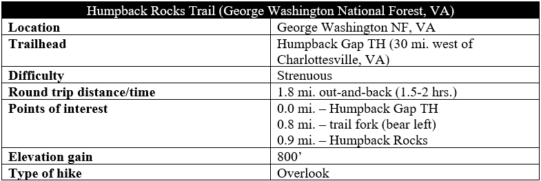
Once a prominent landmark for wagon trains travelling along the Howardsville Turnpike in the early 19th century, Humpback Rocks is today an iconic, jagged promontory in Virginia’s George Washington National Forest frequented by hikers. Its proximity to Interstate 64 and Charlottesville, Virginia makes Humpback Rocks a dizzyingly popular destination, but no amount of crowds can mar the spectacular views from the overlook, high above the Shenandoah Valley. Visitors must work for the vista, however, ascending a crushing 800 feet in elevation in less than a mile. (Note: Ambitious hikers can continue onward from the rocks to nearby Humpback Mountain for additional views.)
The hike
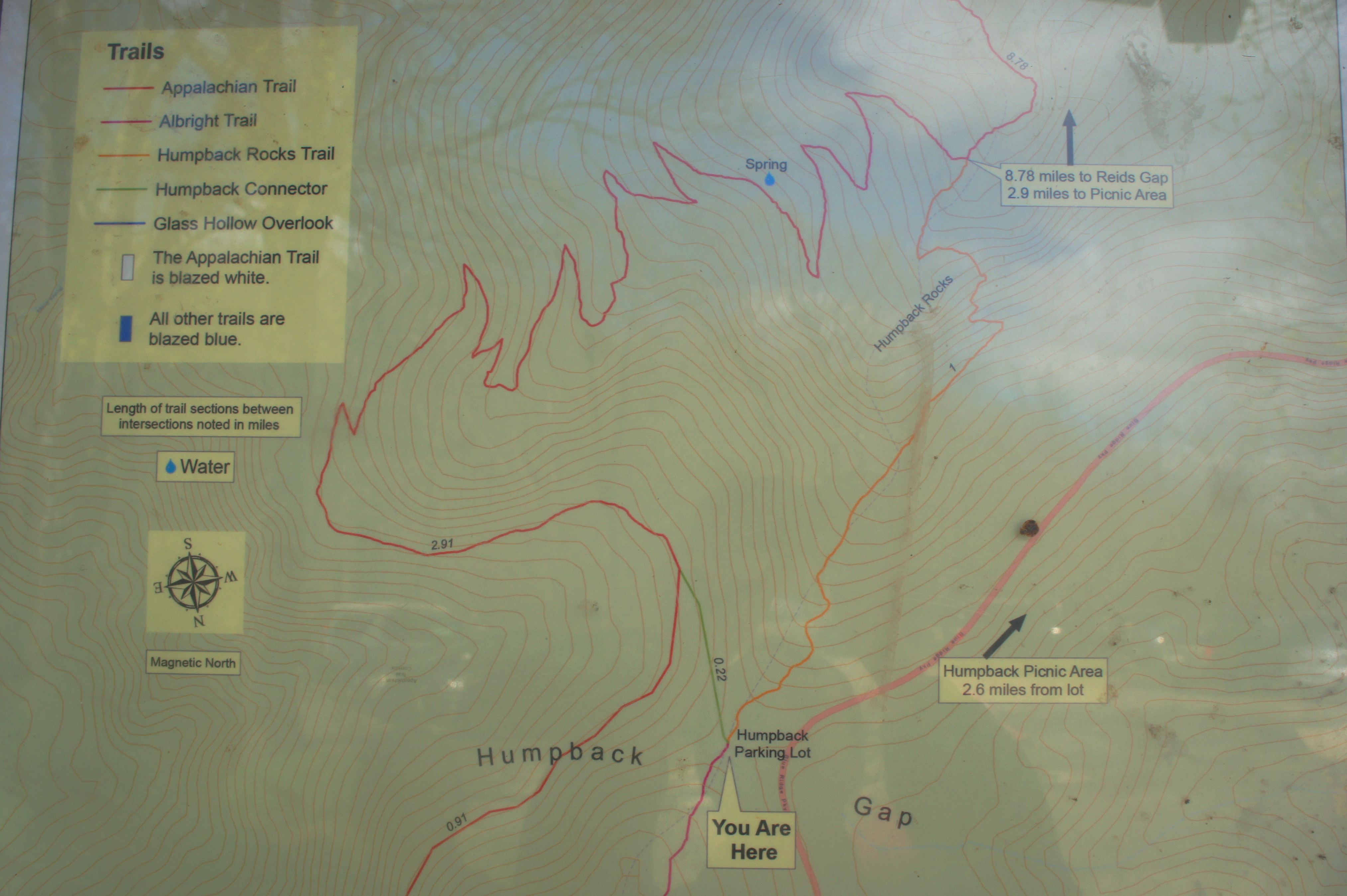
The out-and-back hike to Humpback Rocks begins and ends at the Humpback Gap Trailhead, situated just south of the Humpback Rocks Visitor Center and mountain farm along the Blue Ridge Parkway (around Mile Marker 6). The parking lot is small and sure to fill up quickly – best to arrive early or late in the day.
Humpback Gap itself is a grassy neck between Dobie Mountain (2,712’) to the north and Humpback Mountain (3,080’) to the south, both part of the broader Blue Ridge Mountains, which extend from Pennsylvania to Georgia. The well-trodden, 9/10-mile hike to Humpback Rocks climbs a section of Humpback Mountain, where ascents are steep and switchbacks few.
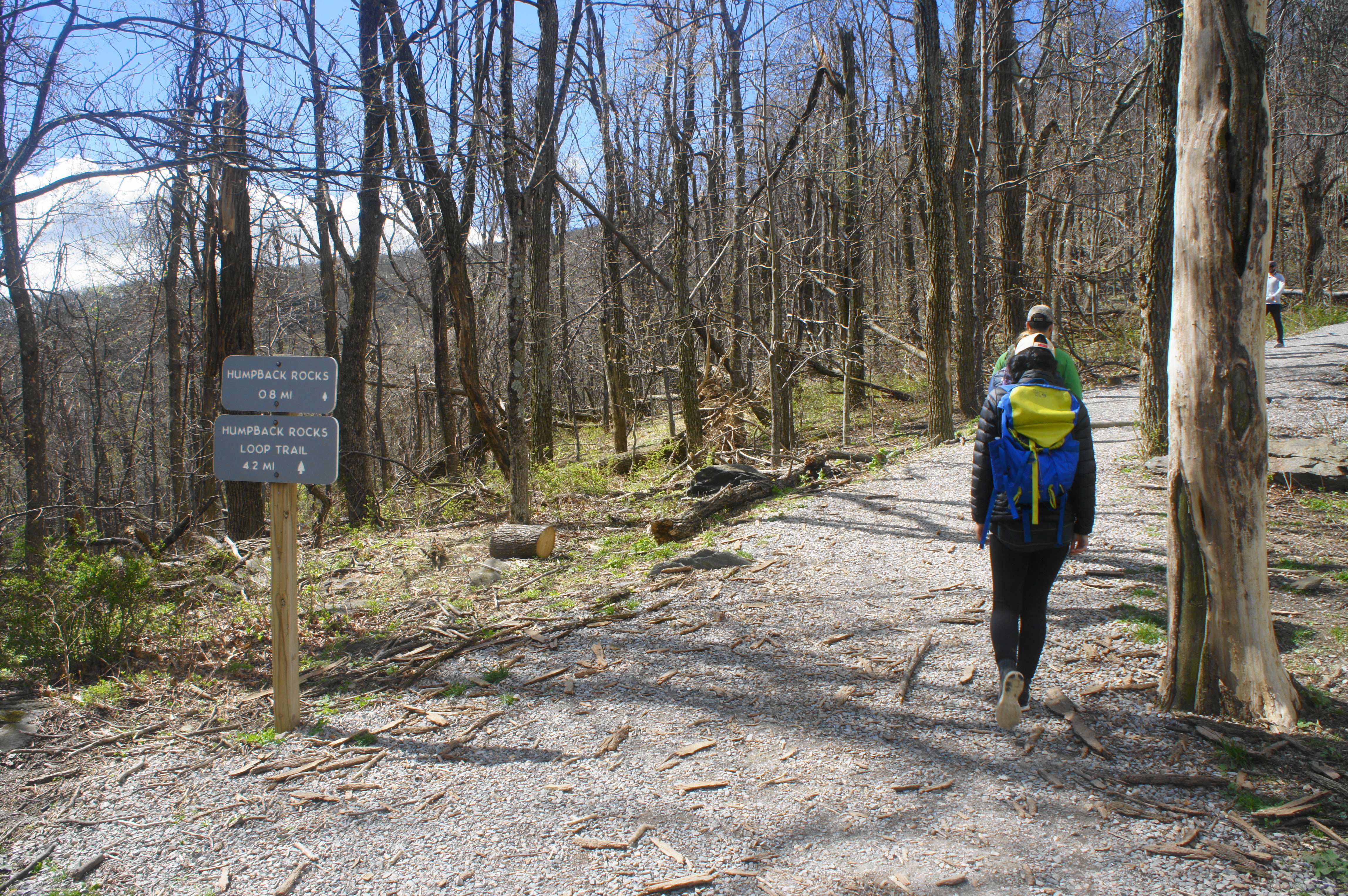
The aggressive climb begins immediately, ascending the spine of Humpback Mountain amid modest tree cover. The path is wide, partly graveled, and easy-to-follow, with occasional obstacles (fallen trees, sharp steps). In winter, when there is little foliage, it is easy to gain views to the east and west: to the right is the sweeping expanse of the Shenandoah Valley; to the left, the sharp edge of the Blue Ridge Mountains gives way to gentler hills and, eventually, the Piedmont plateau region that spans central Virginia. The blue-blazed Humpback Rocks Trail here is within striking distance of the 2,190-mile Appalachian Trail (AT), which ducks east from the summit of Humpback Mountain.
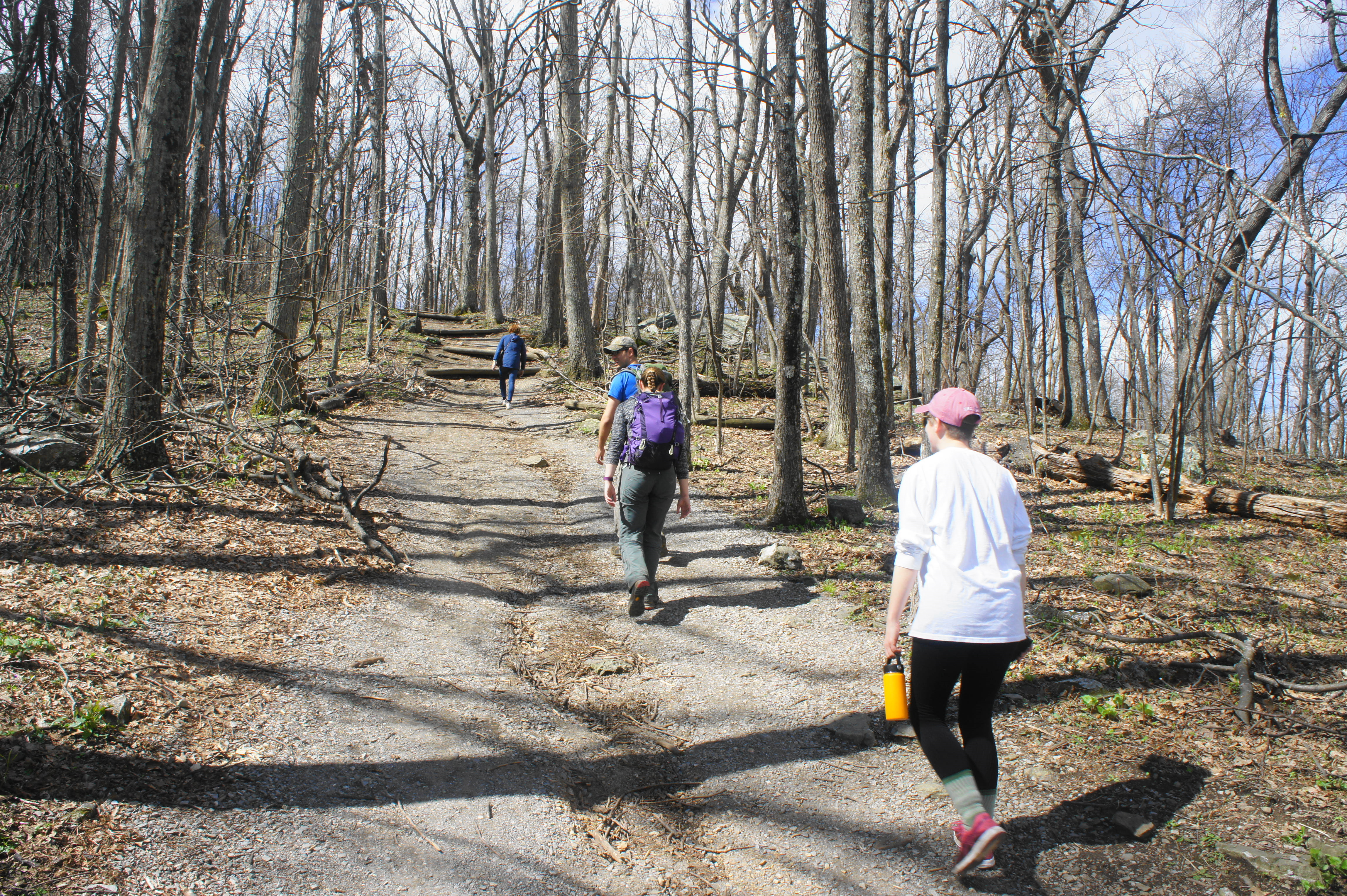
Around 4/10 mile, a large rock jumble comes into view on the left, while outcrops on the right offer obscured views to the west. The trail then briefly drops and traverses a welcome flat surface for a short period, curving westward to parallel a tall rock wall on the left. Astute hikers will notice, through the trees, a ship-like pinnacle high up above on the left: this is Humpback Rocks, your destination.
The Humpback Rocks Trail narrows and mounts a set of wooden steps, then sharply bends left and enters a steep climbing section. This group of short switchbacks is perhaps the most grueling part of the hike, but the incline begins to crest at around ¾ mile. Nearing the ridgetop, sharp protrusions of rock are visible on the right: these are collections of Catoctin greenstone—the same stuff of Humpback Rocks—that were thrust upward during the Alleghanian orogeny, a period of mountain-building that occurred 300-250 million years ago.
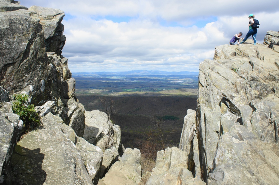
Once at ridge level, the trail forks, with the spur to Humpback Rocks heading left. (Note: The continuation to Humpback Mountain and the AT bears right.) From here it is a short climb to the overlook, itself an impressive jumble of greenstone, angled at a sharp diagonal and bisected by a rocky fissure.
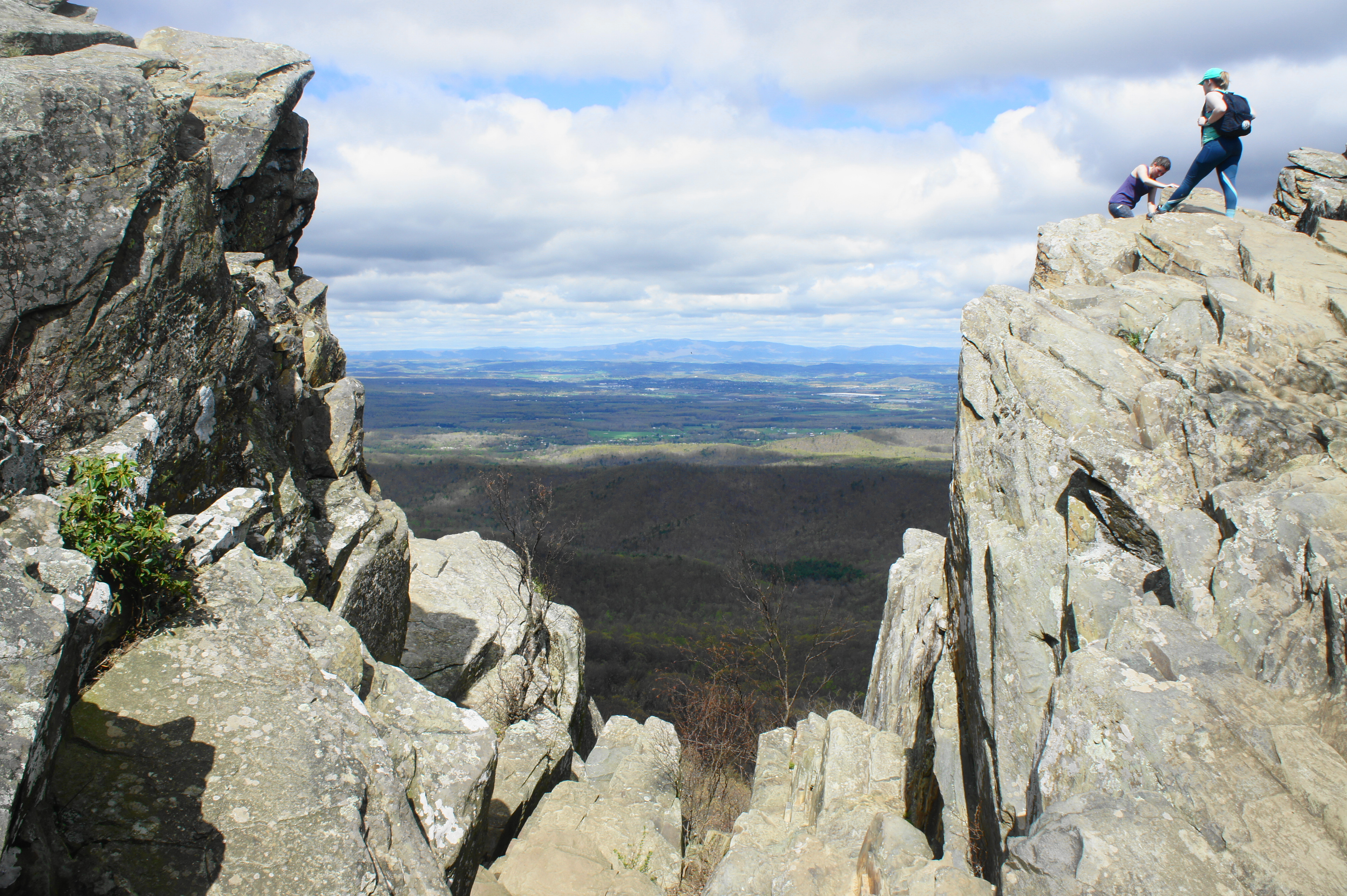
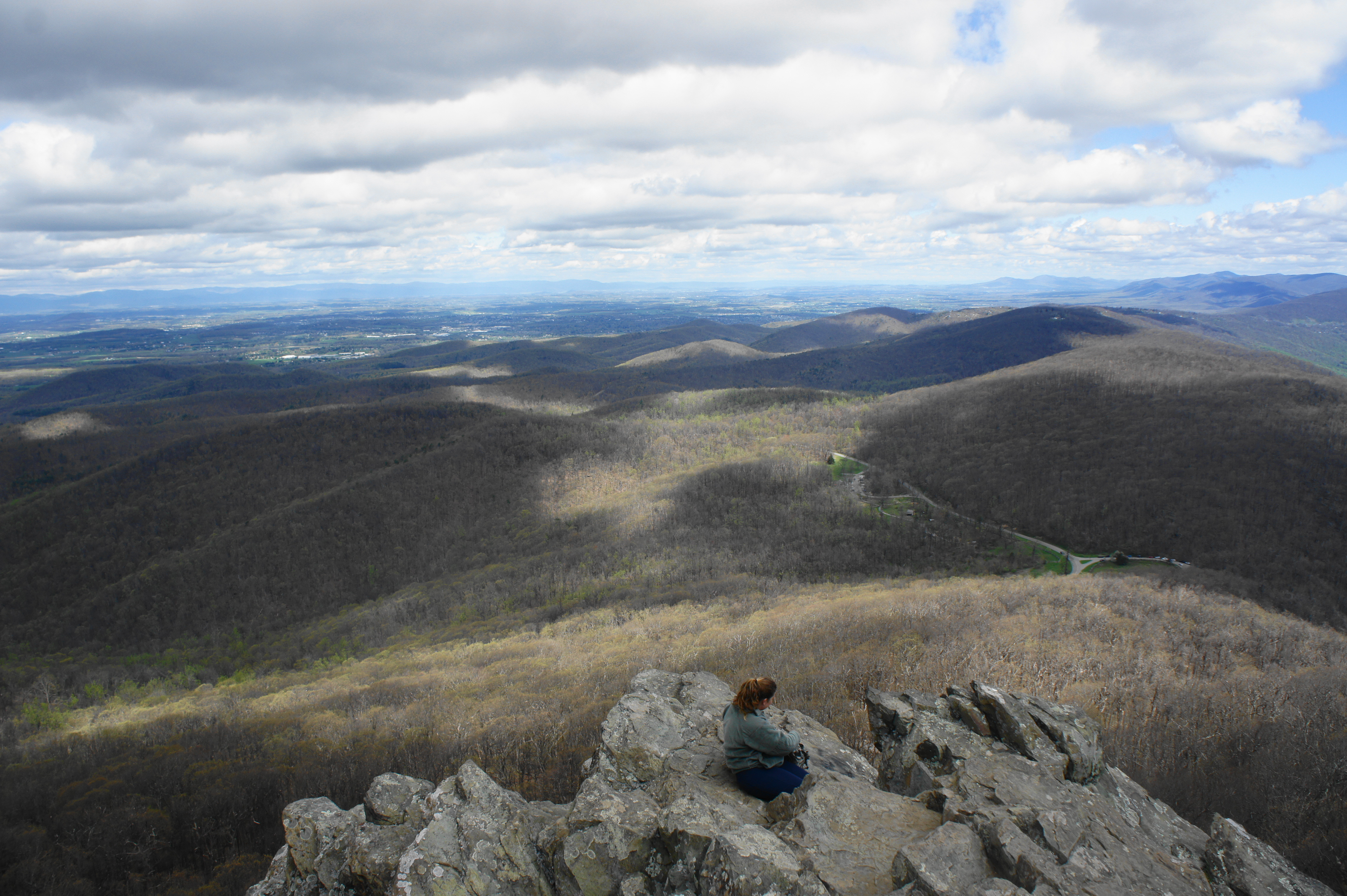
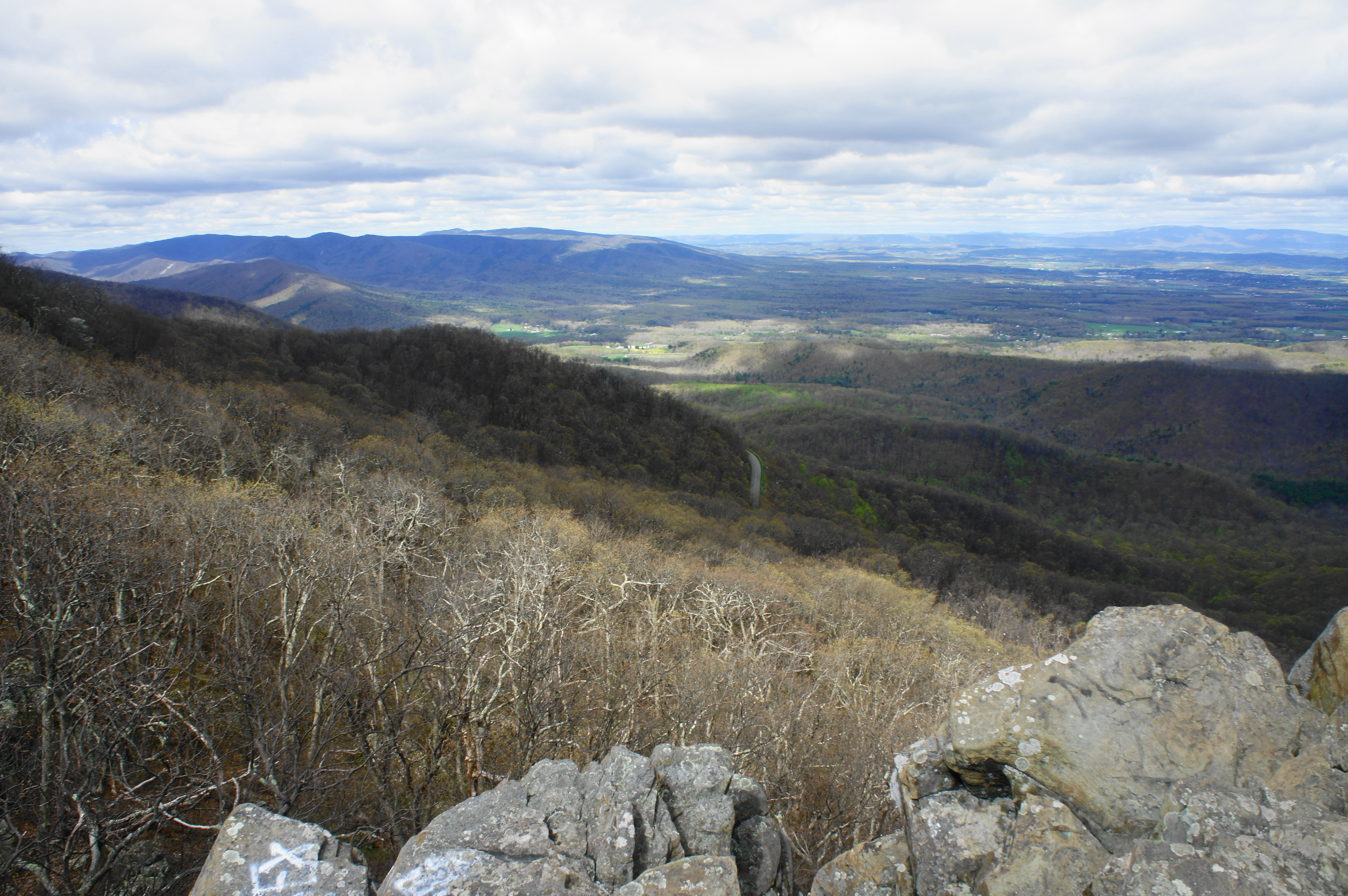
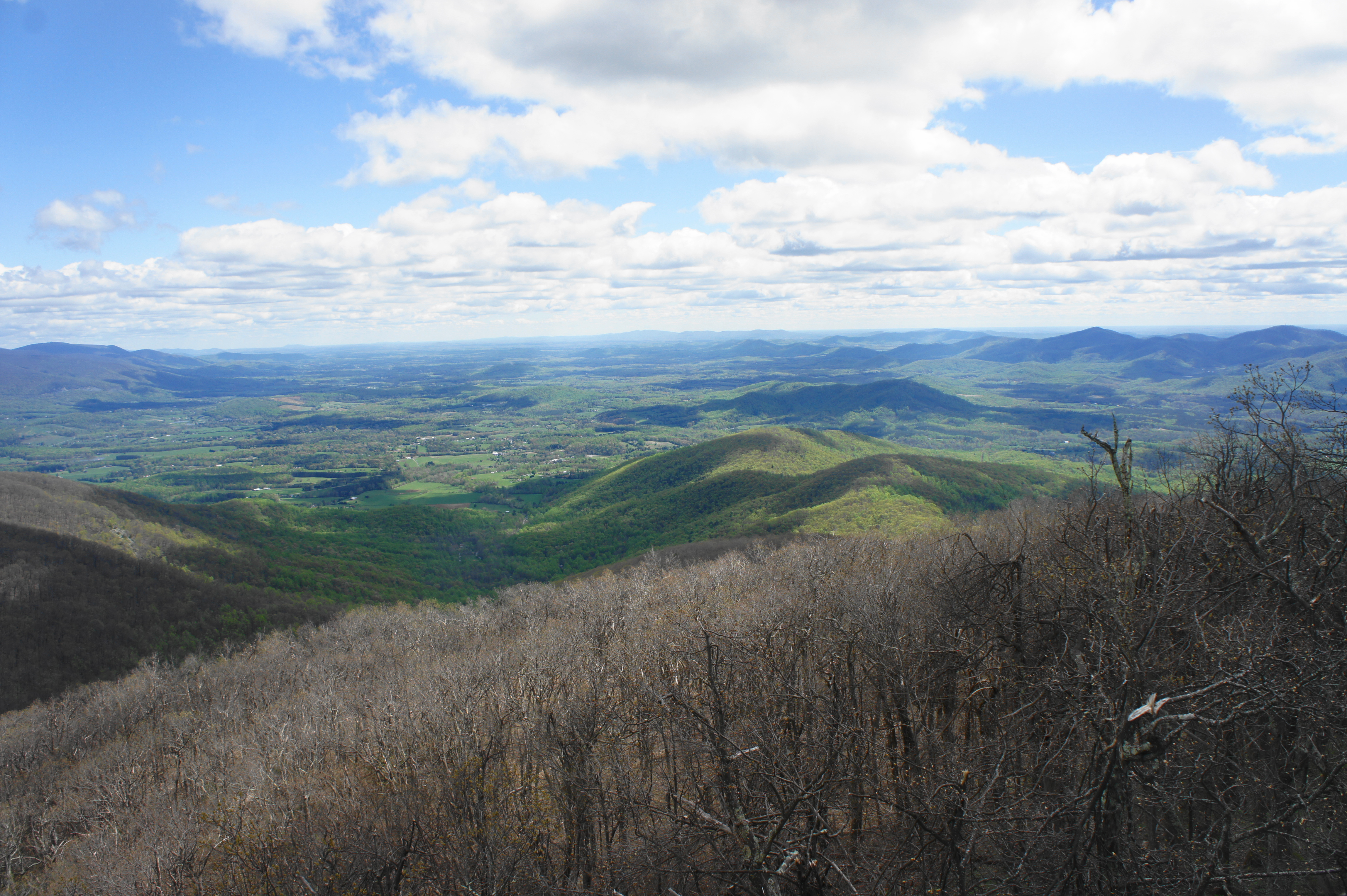
Climb either side for magnificent views. From left to right: the views span the Blue Ridge Mountains’ west flank to the southwest, with Torry Ridge, Kelley Mountain (3,280’), and Kennedy Ridge in the distance; then continue due west across the Shenandoah Valley to the Great North Mountain area; followed by northward views to Humpback Gap, Dobie Mountain, Rockfish Gap, and the South District of Shenandoah National Park; and finally, east, to Rockfish Valley and the Piedmont. Parts of the Blue Ridge Parkway can be found down below.


Humpback Rocks is a fine place to stop for an hour to eat a snack and reflect on the scenery—if you can tune out the thick crowds of others trying to do the same. After taking in the views, hikers can continue onward to Humpback Mountain for more serenity or head back the way they came: a much easier, 9/10-mile descent to the trailhead.
Allot at least 1.5-2 hours for the round-trip, out-and-back hike.
Extra credit
The other prominent highlight in this area of the Blue Ridge Mountains is the superb hike to Crabtree Falls, Virginia’s highest waterfall, and The Priest, a towering peak with excellent views. Best to leave this for another day, however, as it is also challenging with considerable elevation gain.

Pingback: Top 10 Hikes in 2019 | Live and Let Hike