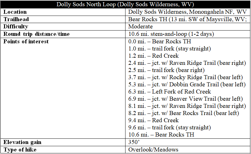
Straddling a windswept section of the Allegheny Front, West Virginia’s Dolly Sods Wilderness offers what is heralded by some as the best hiking on the eastern seaboard. The Dolly Sods North hike is arguably the best of the best: a stunning, 10.6-mile stem-and-loop through blissful meadows and spruce forests with terrific views of the Canaan Valley and the surrounding mountains. A popular backpacking destination, the route described below can nonetheless be completed as a long day hike.

The hike
Of course, remote beauty comes with a price—a lengthy mountain drive is required to reach the trailheads at Dolly Sods. The Bear Rocks Trailhead, the first of several entry points, is nearly 13 miles from the nearest town, Maysville, in the heart of an area notorious for its lack of reliable cell service. Forest Road 75, the principal thoroughfare servicing Dolly Sods, turns to gravel as it enters Monongahela National Forest, nine miles southwest of Maysville.

After a sharp climb up the Allegheny Front, the road rounds a corner at Bear Rocks—itself a worthy detour due to its fantastic eastward views. Just down the road (now heading south) is the trailhead for the hike; park along the shoulder or in one of the well-trodden parking spots in the grass. (Note: There are a few spots by the trailhead, with a good deal more parking up about 200 yards at the sharp bend on Forest Road 75.)
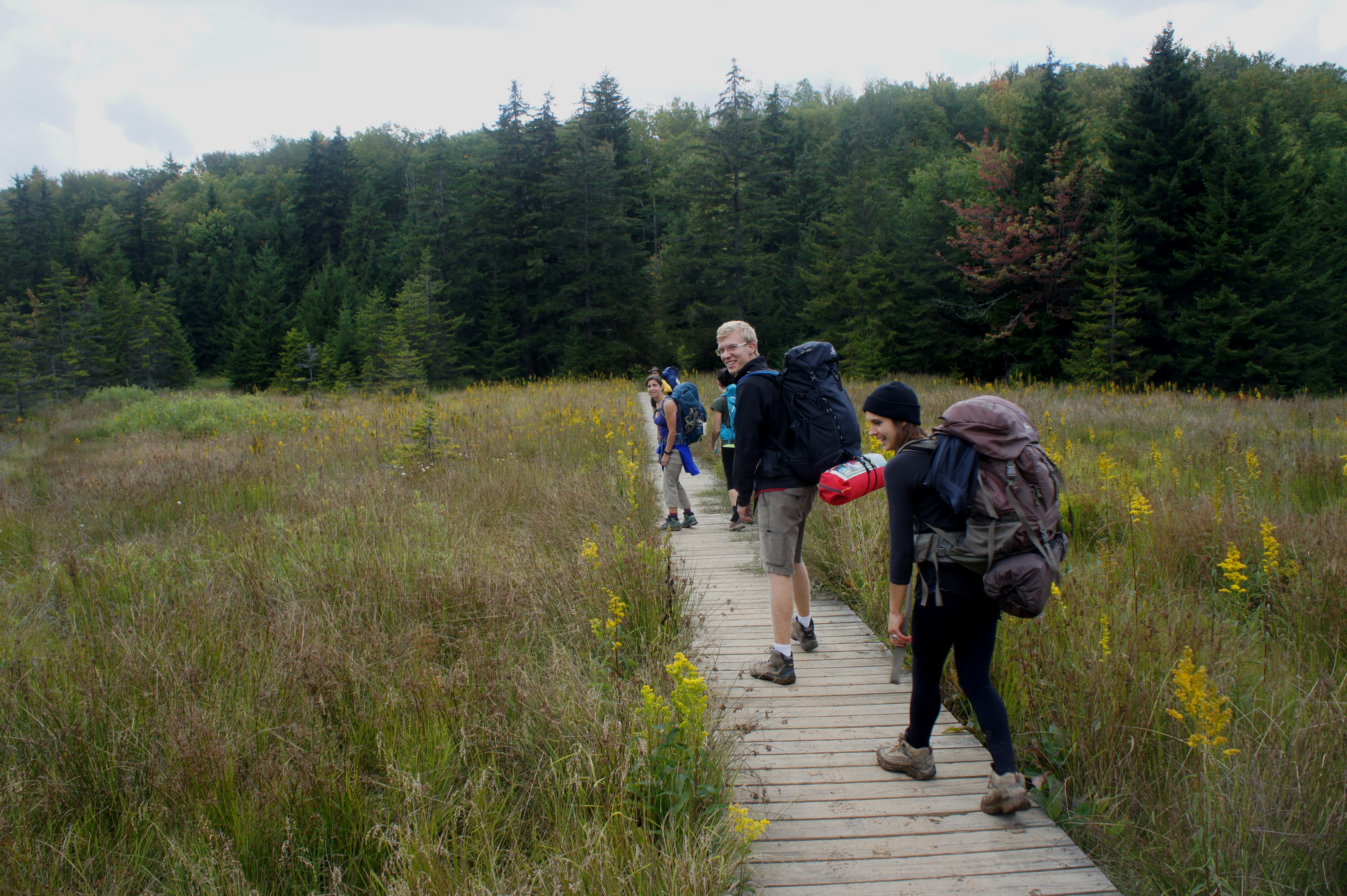
The Bear Rocks Trailhead, marked by a wooden trail kiosk, is easily found on the west side of the road. Here the Bear Rocks Trail strikes out westward across an open plain, gradually descending amid scrubby brush to the banks of a dry wash. The path then follows the wide arroyo and skirts the flank of a spruce pine grove as it crosses a perennial stream. (Note: It’s likely to be mud much of the year.) Nice views emerge to the left as the trail briefly gains some elevation and hugs a brushy slope.
The sweeping vistas of Dolly Sods were made possible in part, sadly, by extensive logging, which decimated the area in the late 1800s and 1900s. At one point (the dates are unknown), the German Dahle family—for which Dolly Sods is named—made use of the open areas for sheep grazing. During World War II, the US Army used the area for artillery training; unexploded ordnance is still found in the area to this day. (Note: Advice to today’s hikers…don’t be stupid. If you find something that looks like a bomb, don’t touch it.)
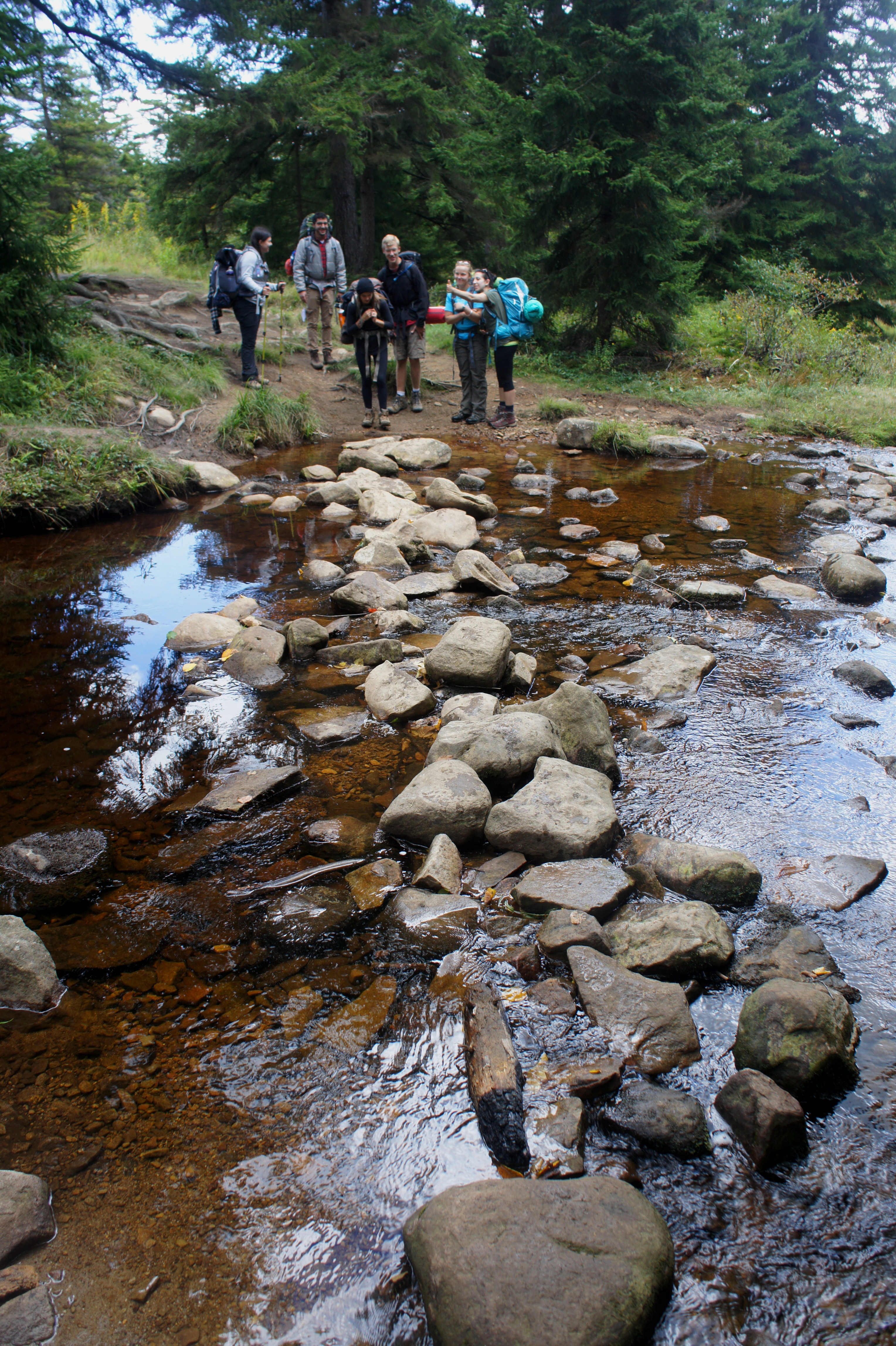
At about the 1-mile mark, the trail approaches a preserved spruce forest and the hike’s first route junction. Bear straight on the Bear Rocks Trail, leaving the muddy Dobbin Grade Trail (to the left) for another time. From here, hikers will cross a wooden boardwalk and then descend rather sharply to the banks of Red Creek, a gentle and shady stream. Ease of crossing depends on the time of year (spring brings considerable snowmelt) and whether there has been recent rainfall; stepping stones, which ease passage when the water is low, could be completed submerged part of the year. (Note: There is a nice campsite just beyond the crossing on the right.)
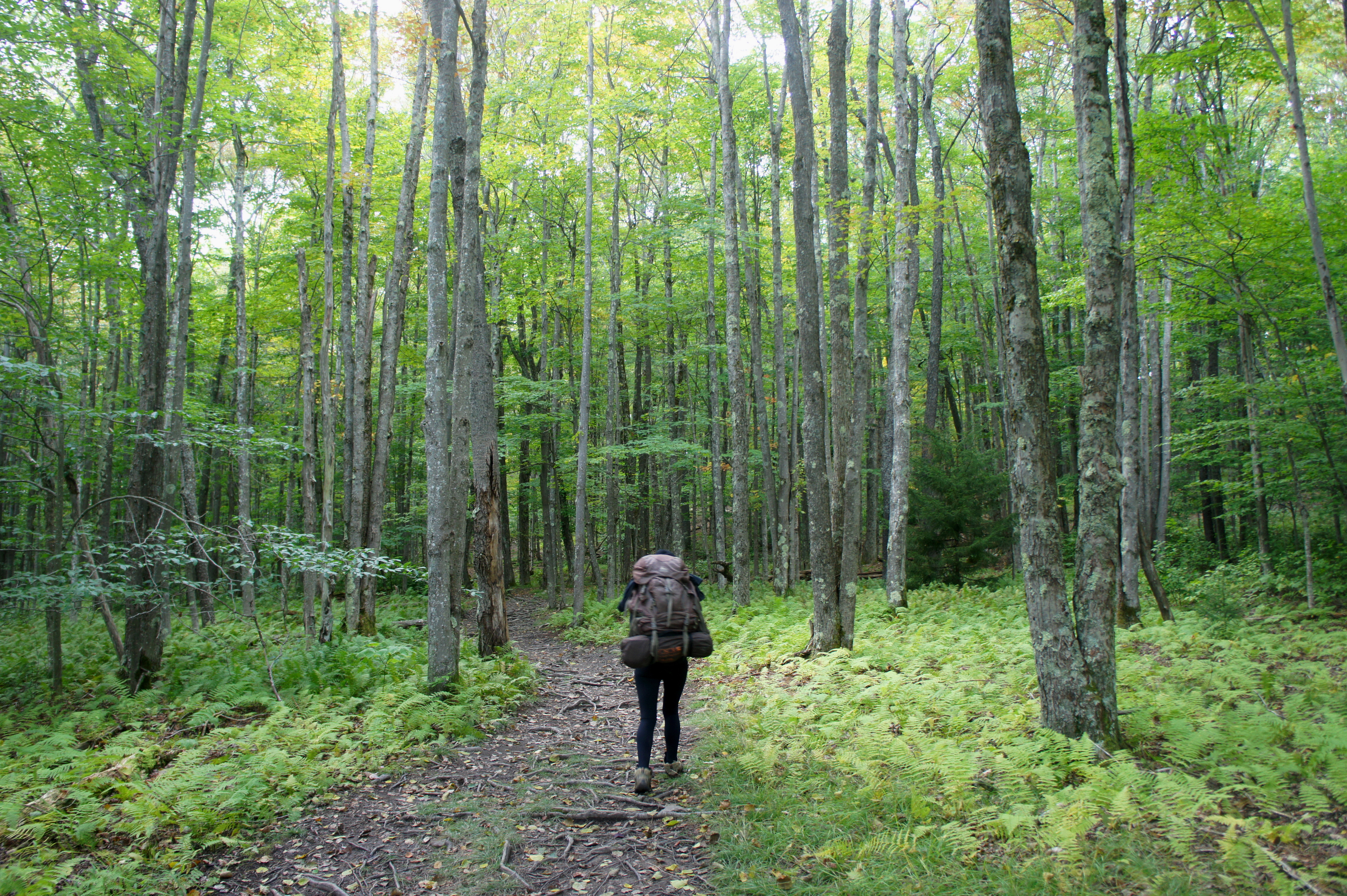
Beyond the creek, the Bear Rocks Trail climbs sharply through the woods to a minor clearing, then plunges into a northern hardwood forest dominated by red maple, yellow birch, and beech trees. The undergrowth is flush with ferns in summer. After a stretch of flat terrain, the path crosses a muddy ravine and then climbs again.
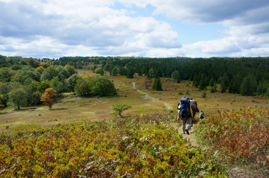
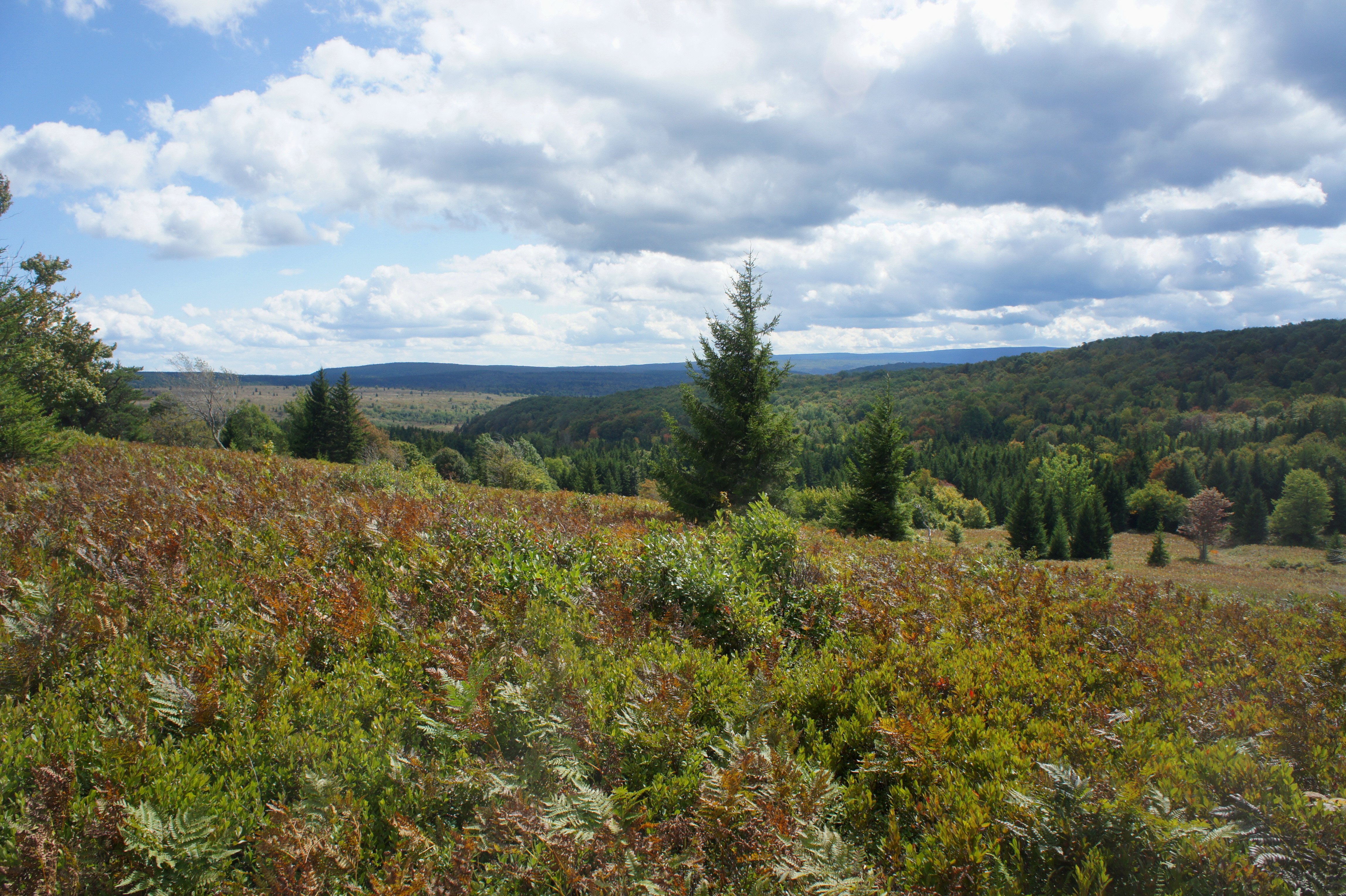
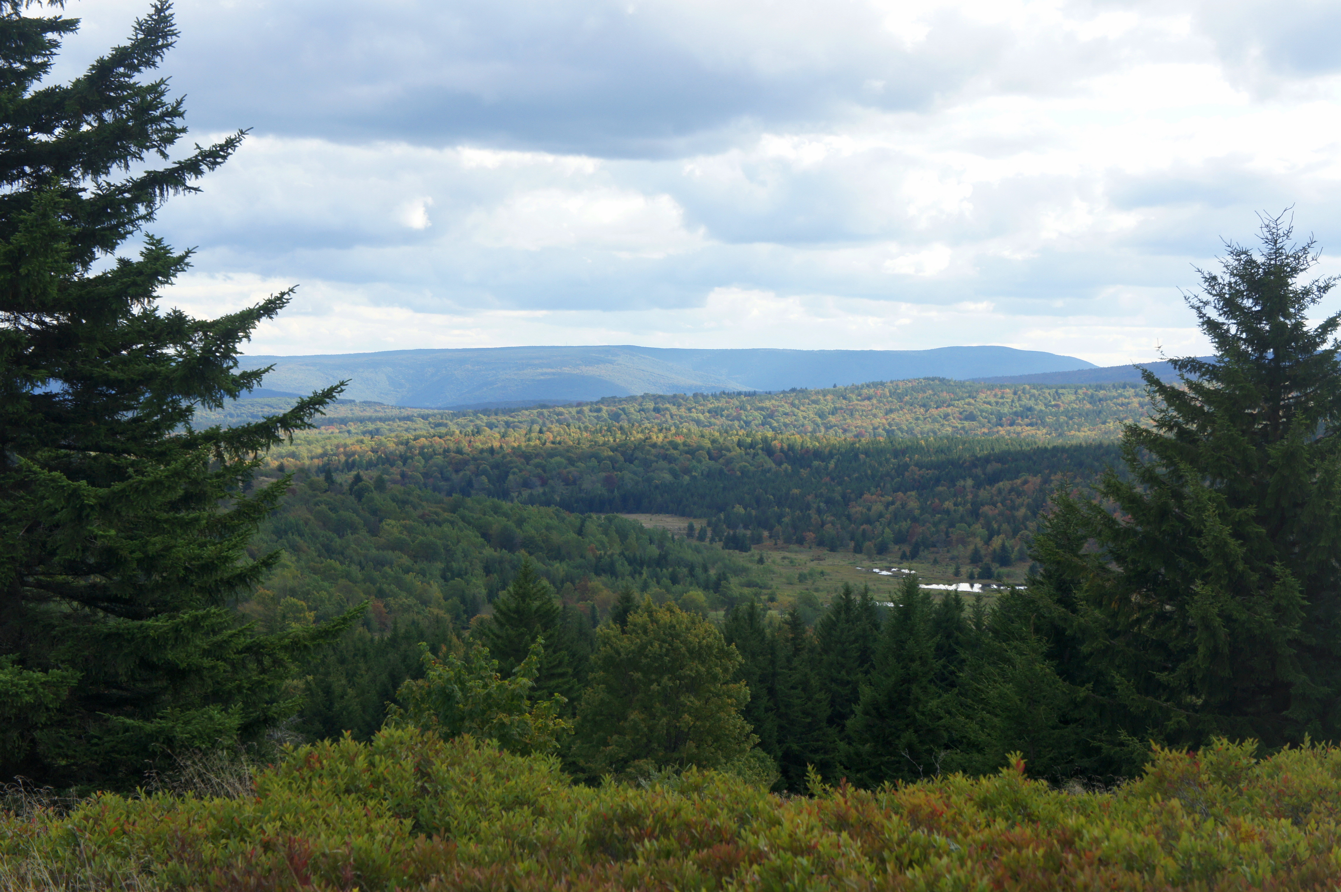
Up the slope, the trail emerges atop a grassy bald with terrific views; by now you have traveled roughly 1 ½ miles. The western slope of the hilltop leads down into an open meadow that feels like crossing the tundra in Alaska or northern Canada. In the distance to the right is a sea of spruces; to the left is a grove of deciduous trees, much more common on the east coast. The valley off to the south contains Red Creek and leads into the heart of Dolly Sods Wilderness.

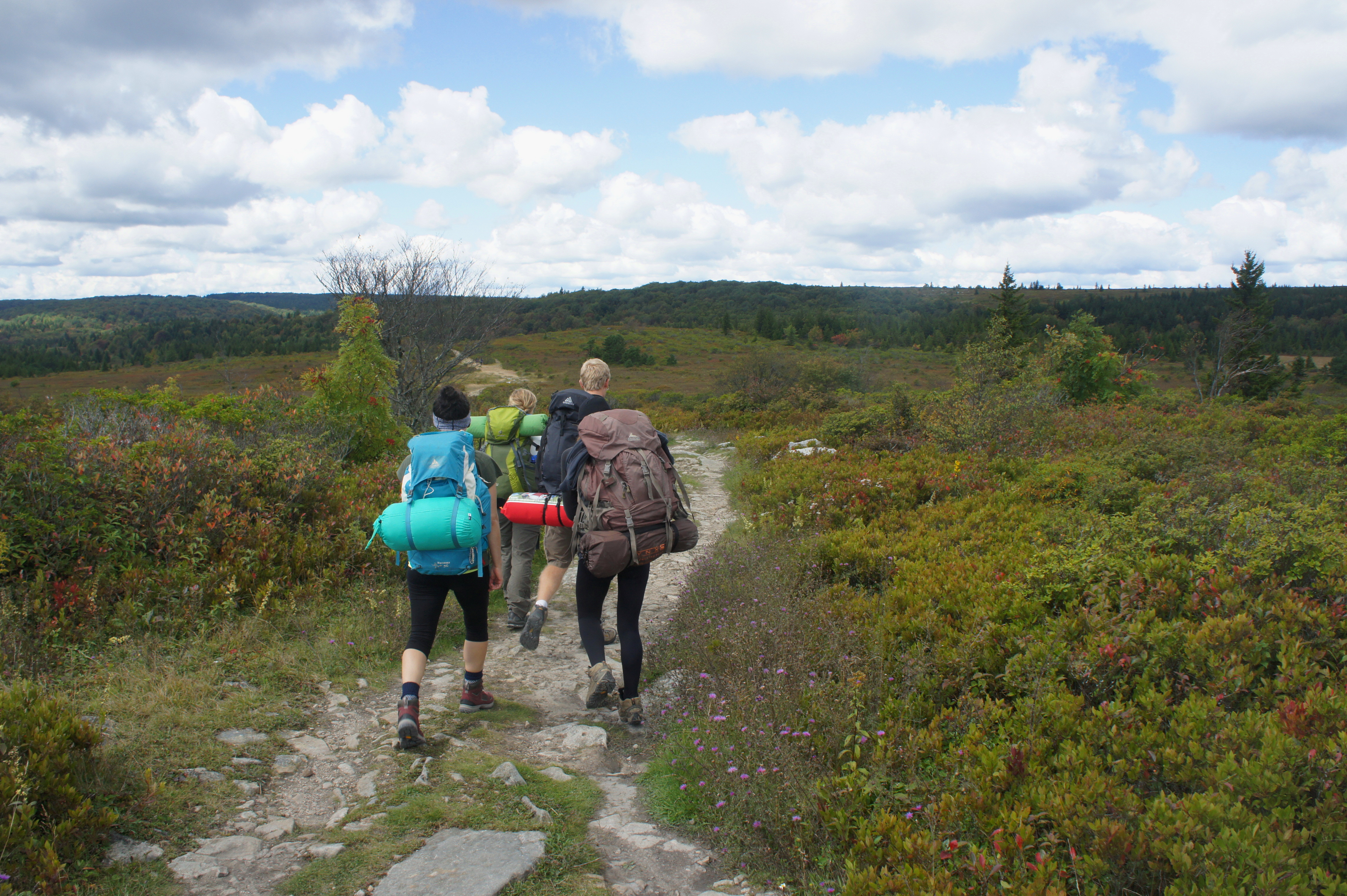
After an initial descent, the trail climbs gradually amid the shrub barrens to a second junction. This marks the end of the Bear Rocks Trail and start of the Raven Ridge Trail. Bear right, continuing through the meadow, bounded by spruces on left and right. Within minutes, you will arrive at another fork, marking the start of the 5.6-mile loop section of the hike. Bear right again on the Raven Ridge Trail.
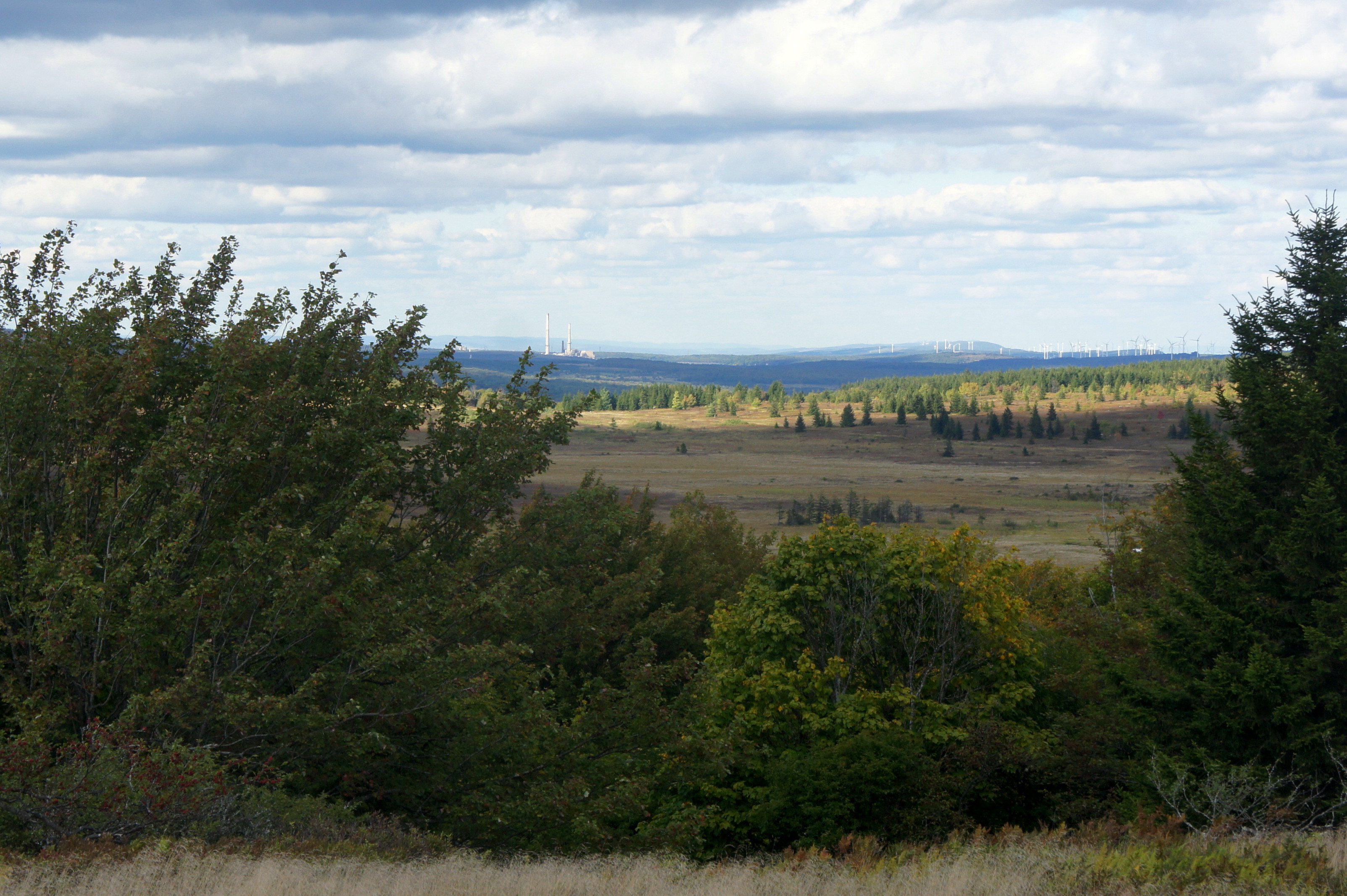
Beyond, the Raven Ridge Trail weaves in and out of spruce groves as it bears westward. At one northern view, hikers are able to peer out across a wide plain to the power plant at Mount Storm Lake. The ridgeline to the right is dominated by tall wind turbines. To the south, a beautiful valley contains a number of beaver ponds.
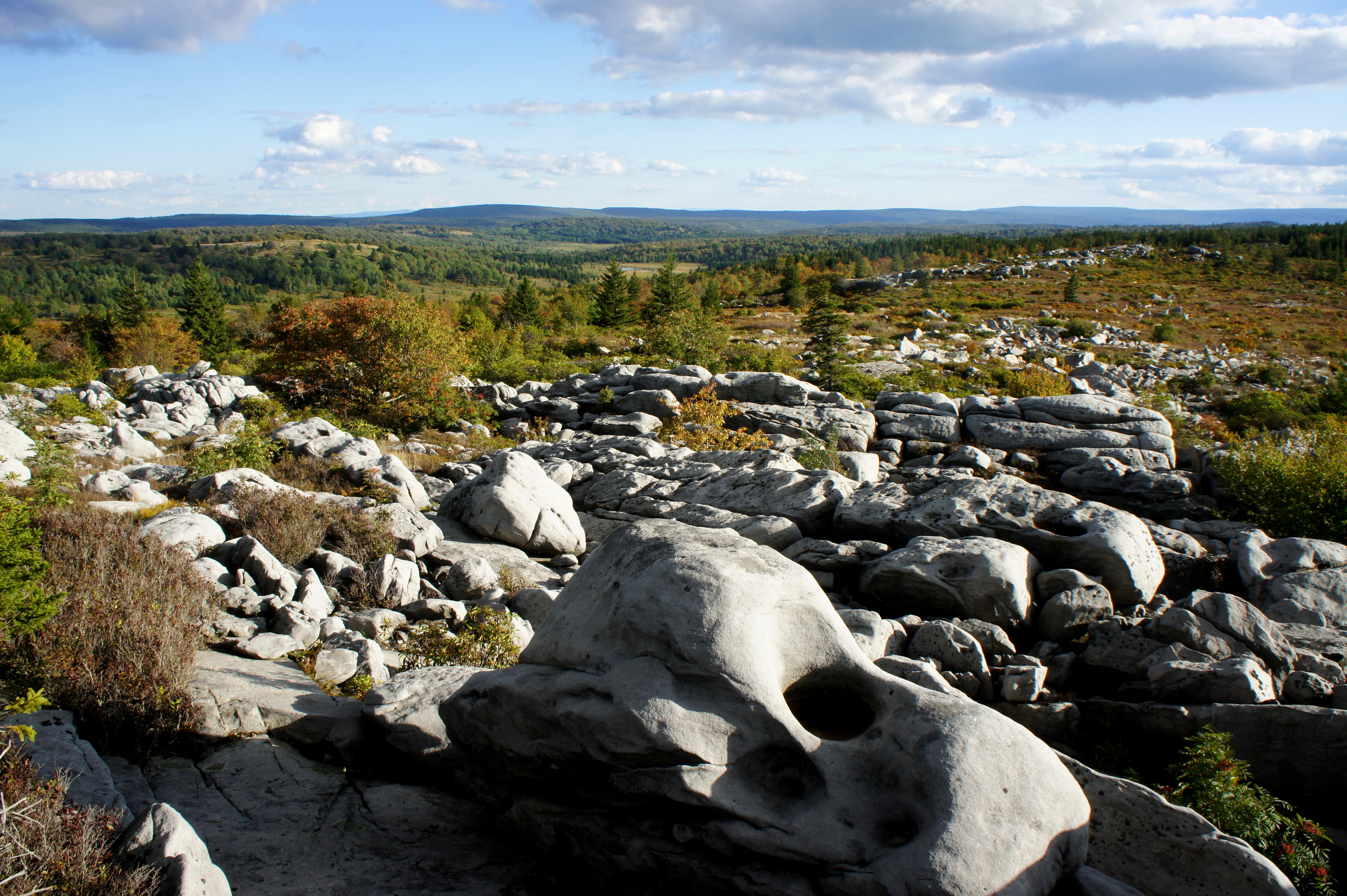
After a little time in the woods, the trail spits out again into the open and approaches another trail fork. Turn left on the Rocky Ridge Trail. Partway down the trail, views open up to the west over Canaan Valley, while a rim of Pottsville sandstone to the east offers a 360-degree view of the area.
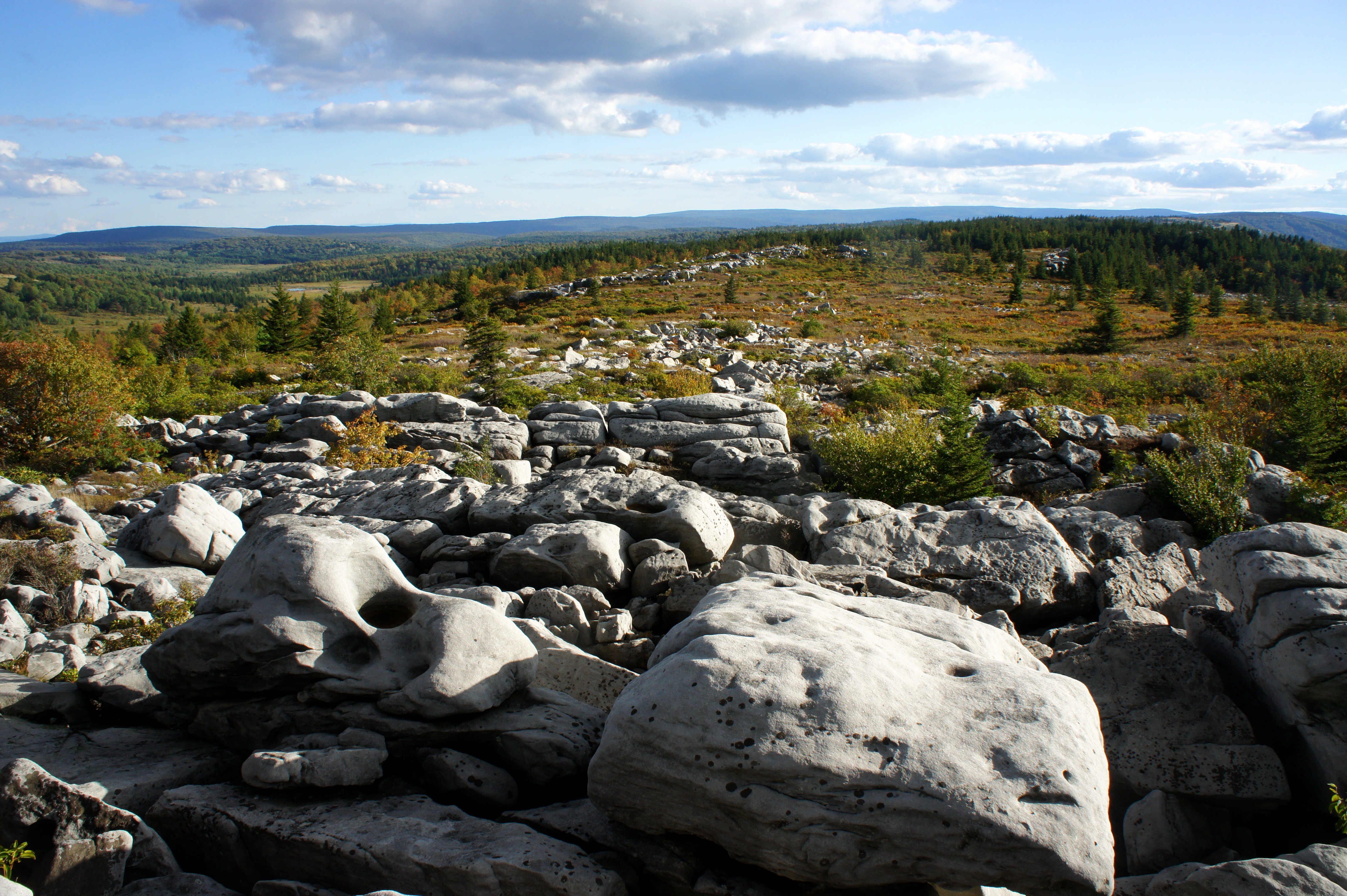
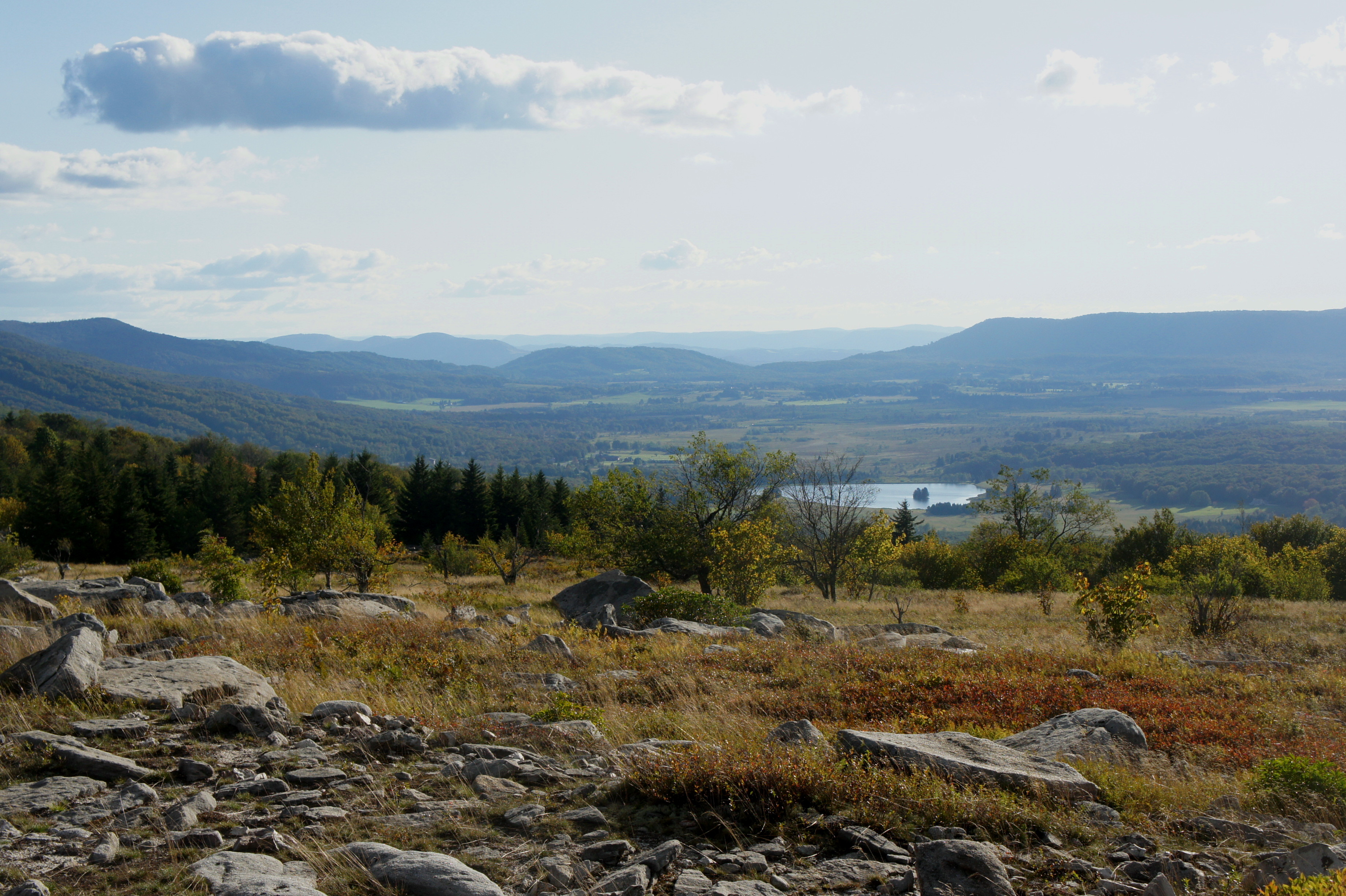
For the next mile, the trail wanders south, roughly following Rocky Ridge, and dives in and out of tree cover. At one point, the trail disappears onto the rocks themselves, requiring some route finding; the path, however, is relatively clear. A set of massive boulders with a view of Canaan Valley roughly marks the beginning of a descent to the next trail junction, which is 5.3 miles from the trailhead.


Turn left at the fork, and take the Dobbin Grade Trail as it descends to the east. The Dobbin Grade Trail is notorious among hikers for its muddy bogs—though the higher elevations covered on this hike are not nearly as obnoxious as sections of the trail farther east. Follow the wide path, an old road through the sods, for one mile to a crossing point over the Left Fork of Red Creek.


While the traverse of the creek can be mucky, late summer hikers are rewarded by passing through a wildflower display along the opposite bank. Continue of Dobbin Grade for another 6/10 mile, then bear left on the Beaver View Trail. The first part of this trail is through thick woods, suddenly interrupted at about the 7.5-mile mark by a tremendous vista atop a grassy knoll. The view stretches across the valley below to Raven and Rocky Ridges beyond. (Note: This is a popular camping area, for good reason, as the open terrain offers a chance to view a blissful night sky.)

The rest of the Beaver View Trail dives in and out of meadows and gradually climbs back to the junction with the Rocky Ridge Trail. From here, head eastward, back across familiar terrain—down the Raven Ridge Trail to the Bear Rocks route, then over the grassy knob, through the hardwood forest, and across Red Creek.
All told, the stem-and-loop hike covers roughly 10.6 miles, making for a long day hike or a leisurely 2-day backpack.

Superb blog entry (photos & text). Thanks for sharing!
Pingback: Blackbird Knob Loop (Dolly Sods Wilderness, WV) | Live and Let Hike
Pingback: Top 10 Hikes in 2017 | Live and Let Hike
Thanks for the share! Would you recommend this loop as a winter hike? Mostly given the change in scenery.
Hi Abigail – this hike can get very cold and snowy in winter (Dolly Sods gets more snow than most of the rest of WV), but if have snowshoes–and have a car that can make it up the snowy, unpaved roads–go for it!
Pingback: Best Of: A Long Weekend in West Virginia - The Wandering Road
I’ve been wanting to see Dolly Sods for a while now, and yesterday I decided to go by myself on a whim. I did this whole route yesterday with 5 hours before sunset, after a storm. It was foggy and dark and muddy the whole way and I almost got lost before loosing the light but well worth it!! Thought I was gonna have to crash under a tree for the night with no camping gear lol. I felt so accomplished when I finally made it back to my car. Great adventure. 🙂
Thanks for taking the time to document in detail this hike. Just got back from this loop and the directions were perfect.