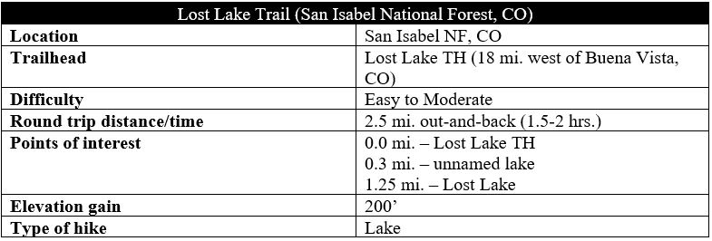
There are many spectacular alpine lakes in the Colorado Rockies, but there are perhaps few that match the picturesque splendor of Lost Lake, a poorly-advertised but easily-accessible lake near Cottonwood Pass in central Colorado. Not only are the icy waters a stunning turquoise-to-green color, but they also boast a rocky island in the middle of the lake, making this one of the most enjoyable destinations in the area. The short hike to the lake is not half-bad either, following a meadow-laced shelf near the timberline at about 11,700 feet, with fine vistas of the Cottonwood Creek drainage and nearby Jones Mountain (13,218’), Turner Peak (13,237’), and Mount Yale (14,196’).
The hike
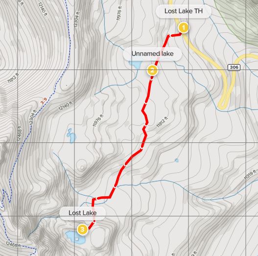
To be fair, while there is no official trailhead for Lost Lake, its presence near the Continental Divide to the west of Buena Vista, Colorado is not exactly a secret. There is often a line of cars along the shoulder at the trail’s start, about 1.4 miles south of Cottonwood Pass on Colorado Highway 306 (Cottonwood Pass Scenic Drive). Coming from Buena Vista, travel about 18 miles west on Highway 306; just after a hairpin right-hand turn and a left-hand bend, and before the tree-line, pull off to the left. (Note: If you begin to make the snaking final bend up to Cottonwood Pass, you have gone too far.)
At the pull-off, look for a well-trodden path heading west into the darkness of thick conifers. There is a brief climb at the beginning, and then the trail emerges out into the open, traversing a scrubby meadow that reveals views down the Cottonwood Creek drainage to the east. Working through the thick brush, the trail crosses a mild stream at 2/10 mile before merging with a much-wider double-track at the southern flank of an unnamed lake on the right. This chilly tarn is scenic—but only a teaser for the lake to come.

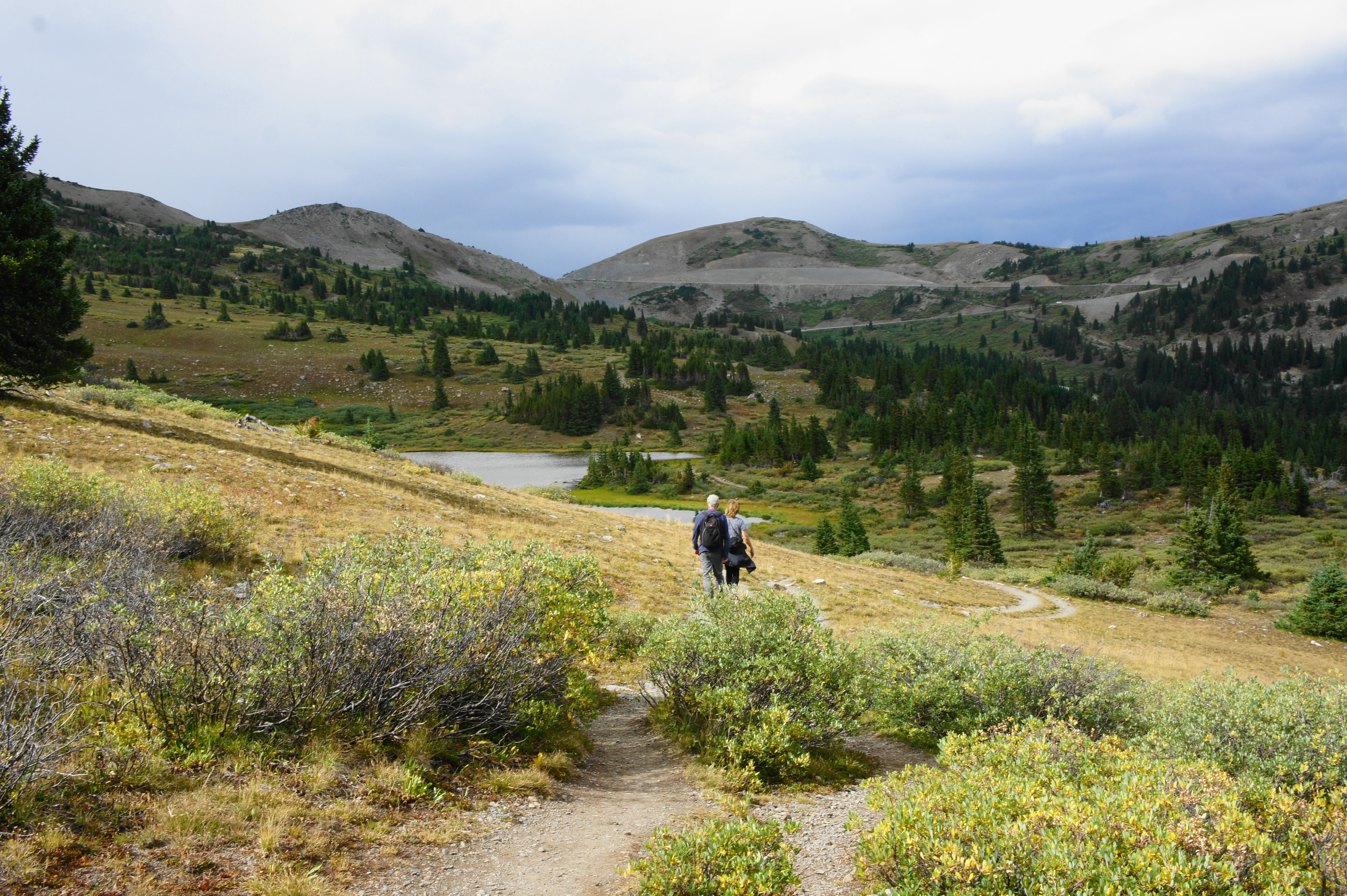
The barren slopes of the Continental Divide rise high off to the west while the onward trail veers upward to clear a hillside and then descends at about ½ mile. The path briefly bottoms out before climbing again, reentering the woods. At 8/10 mile, the trail splits, with the wider path heading left while a mild shortcut trail bears right; they meet up again at the edge of another meadow about 125 yards later.

After hugging the meadow for a short period, the trail traverses a muddy bog at about the one-mile mark—the biggest obstacle of the hike. If you’re lucky, the area will be relatively dry; otherwise, one has to hop from log to log to avoid a mucky mess. Back on dry land, the onward route climbs steeply through mixed conifer woodlands, reaching the base of an impressive rock slide. From here, the final push involves a steep ascent that clips the rock slide on the right. About 1.25 miles from the trailhead, the magical lake comes into view.
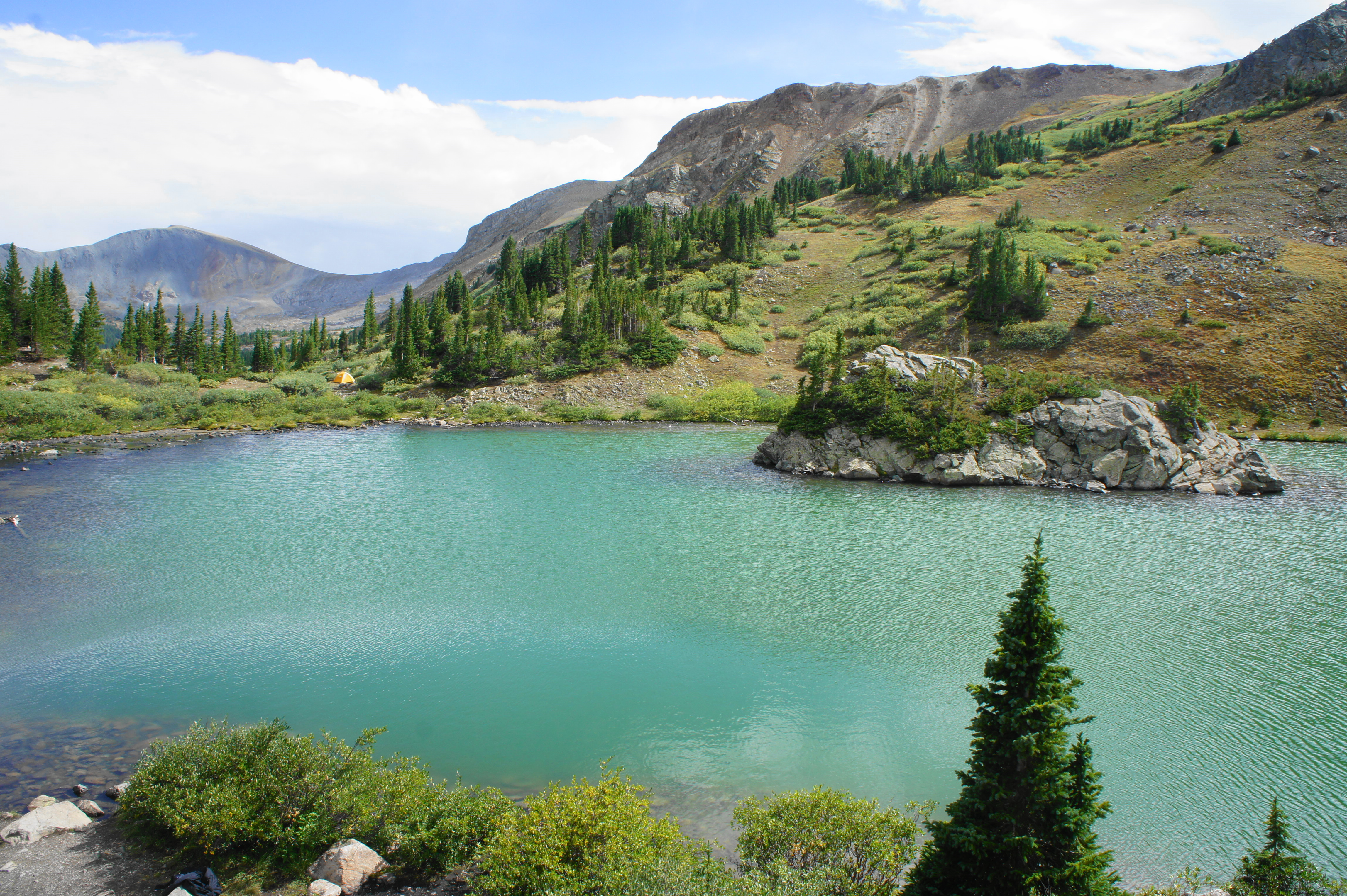
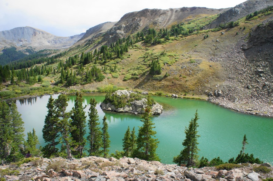
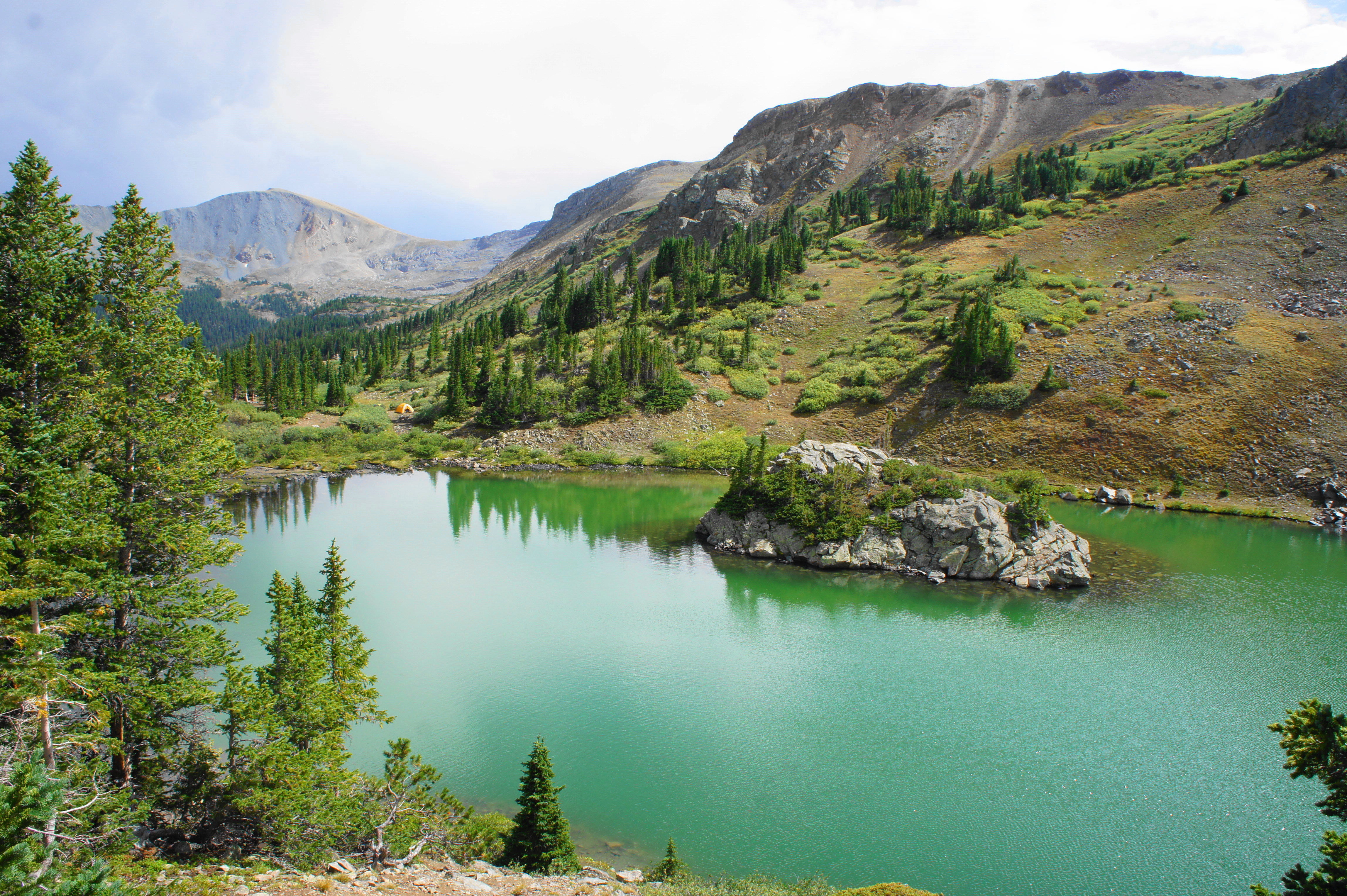
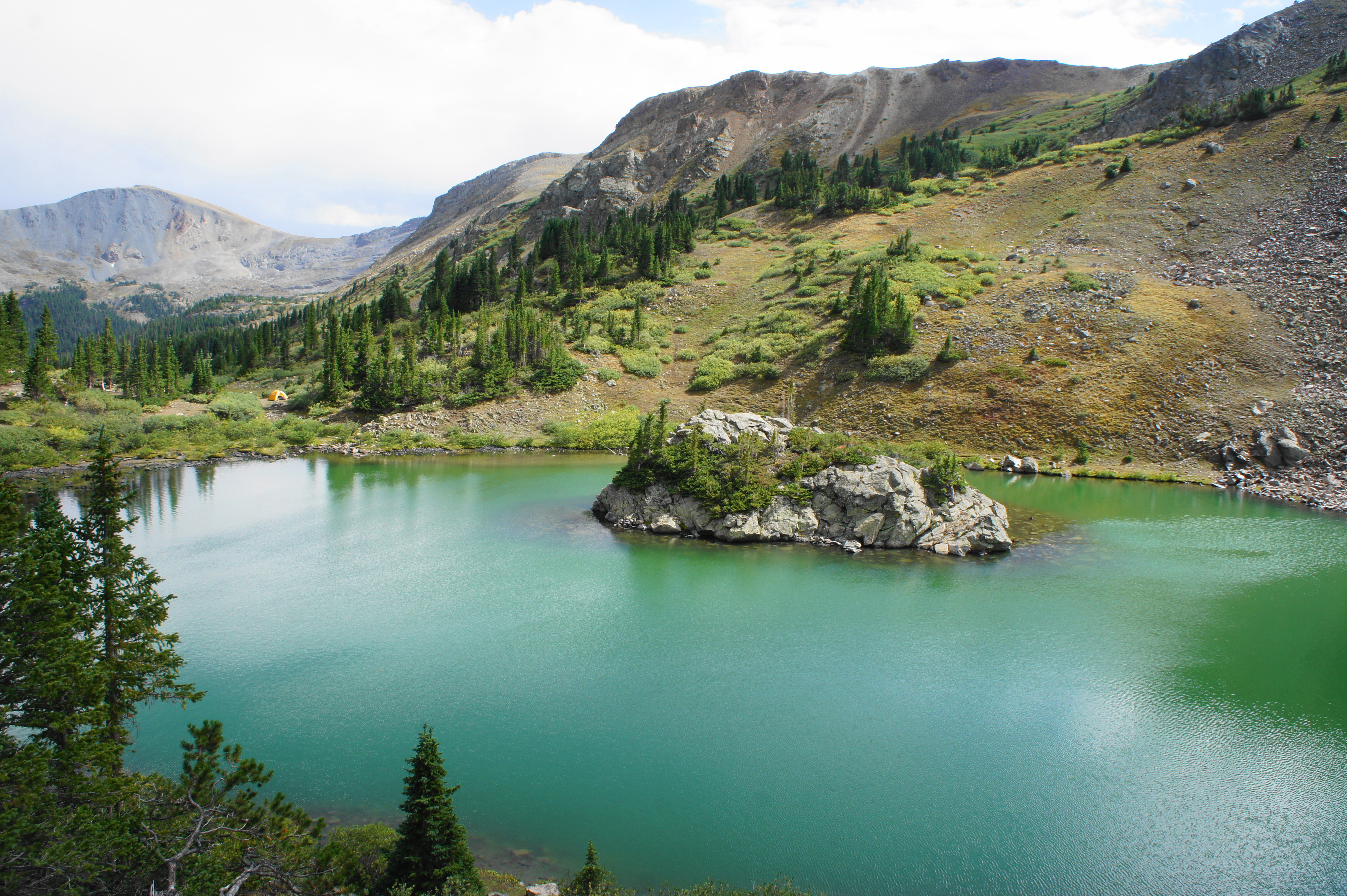
Lost Lake is situated in a stunning, bowl-shaped depression, with the rocky scree slopes rising steeply to the west and mild outcrops protecting the lake to the north and east. A line of peaks to the south takes on a reddish-orange hue, a remarkable contrast with the teal colors of the exceptional lake. On busy days, expect see a few paddleboarders—and perhaps swimmers. While the lakeshore is nice, the best vista involves ascending the outcrop off to the right. From atop this point, the colors from the lake really pop out, and the island gives the lake the appearance of a peculiar donut shape.

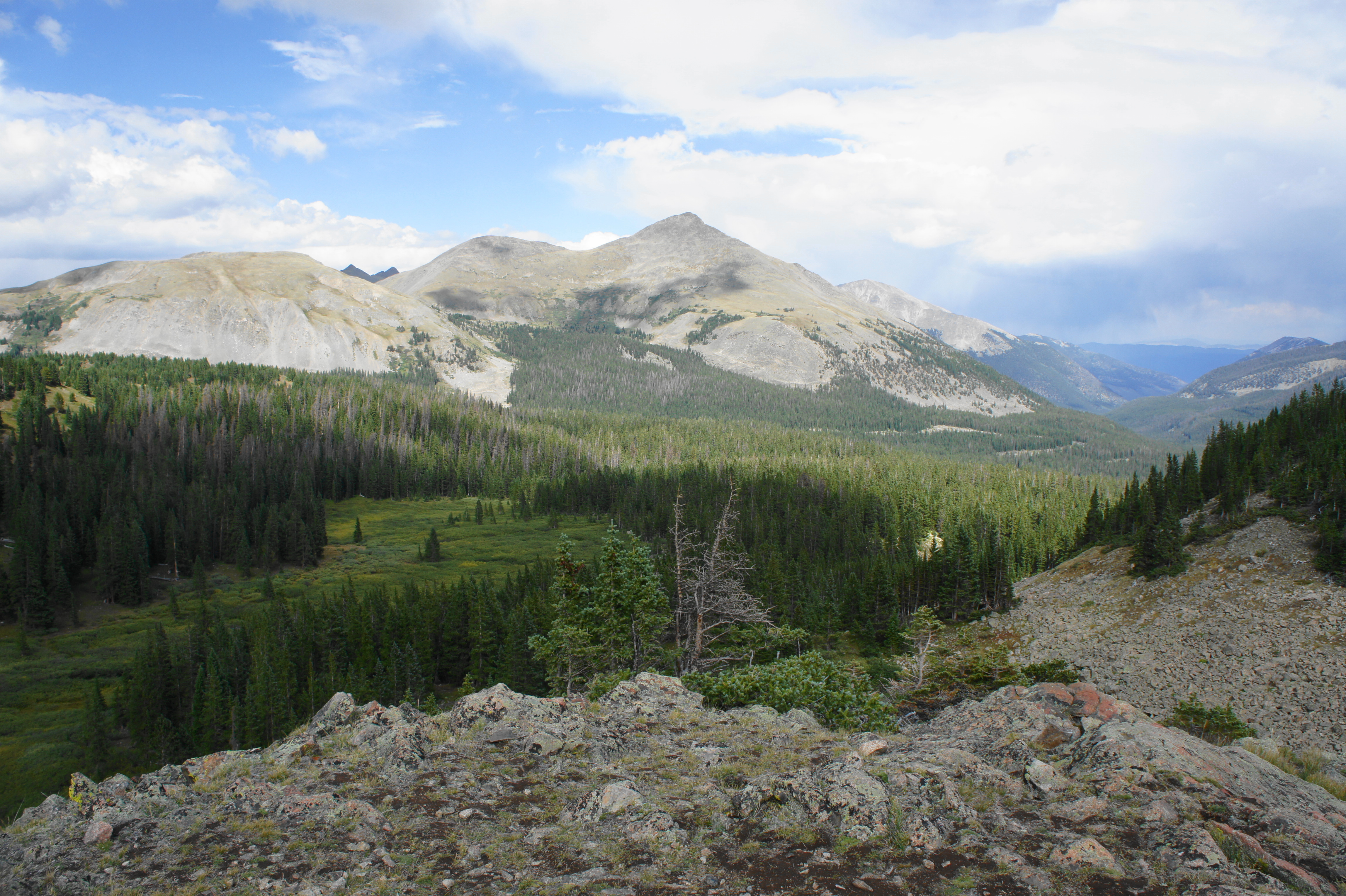
Looking east from the outcrop, hikers are also rewarded with excellent views of Turner Peak, Mount Yale, Gladstone Ridge, and the Cottonwood Creek drainage, which leads down toward Buena Vista and the Arkansas River.

Turner Peak, Mount Yale, and the Cottonwood Creek valley 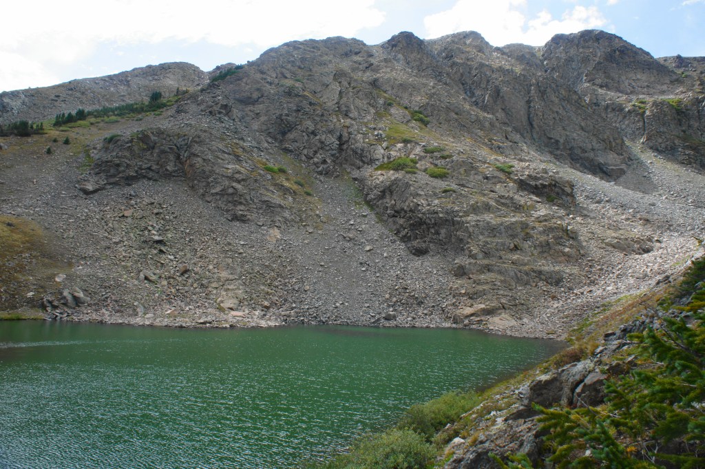
Lost Lake

One can easily linger for hours enjoying this exceptionally beautiful lake at 11,900 feet above sea level. But the threat of summer thunderstorms may cut some trips short. After taking in the views of the lake, head back the way you came. All told, the route is a moderately-difficult 2.5 miles out-and-back. (Note: Remember, at the unnamed lake, to bear right, off the main double-track, to find the single-track trail back to the start. Taking the double-track also leads back to the road but is longer and hillier.)

Lost Lake again 
Heading back toward the trailhead
Extra credit
This hike makes for a good half-day complement to a longer, 6.2-mile round-trip to nearby Ptarmigan Lake, which is 200 feet higher than Lost Lake.

Pingback: Browns Creek Falls (San Isabel National Forest, CO) | Live and Let Hike
Lost Lake looks like a very nice place to go for hiking!
Thanks for the nice post
Pingback: Top 10 Hikes in 2020 | Live and Let Hike
Pingback: Top 10 Hikes in 2023 | Live and Let Hike