
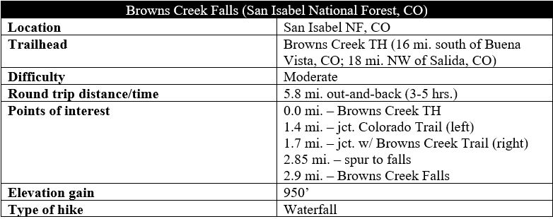
Large waterfalls are surprisingly few in number in the Collegiate Peaks area of central Colorado, but Browns Creek Falls is a prominent exception and popular destination between Buena Vista and Salida. The nearly three-mile walk to the falls is mild and pleasant, featuring sporadic views of the Arkansas River Valley and a couple of nice sub-alpine meadows. But the destination is the clear highlight: a high-volume cascade that tumbles in two stages through a narrow, rocky chute. Situated largely in the east-facing foothills of the Sawatch Range, this hike is likely to be clear of snow earlier in the season than nearby hikes at higher elevations closer to the Continental Divide. It is also relatively popular, a favorite among families with children and Boy Scout expeditions.
The hike
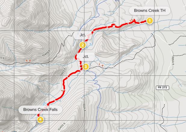
From the Arkansas River Valley in central Colorado, visitors can reach Browns Creek Trailhead by heading west on County Road 270 for five miles, entering San Isabel National Forest, where the pavement ends and turns to well-graded gravel. After turning south, the road passes numerous turnoffs for dispersed camping, finally reaching a large parking area for Browns Creek on the left. The trail sets off to the west, where there are two large information boards, including an overview of the 567-mile Colorado Trail, which runs through this area.
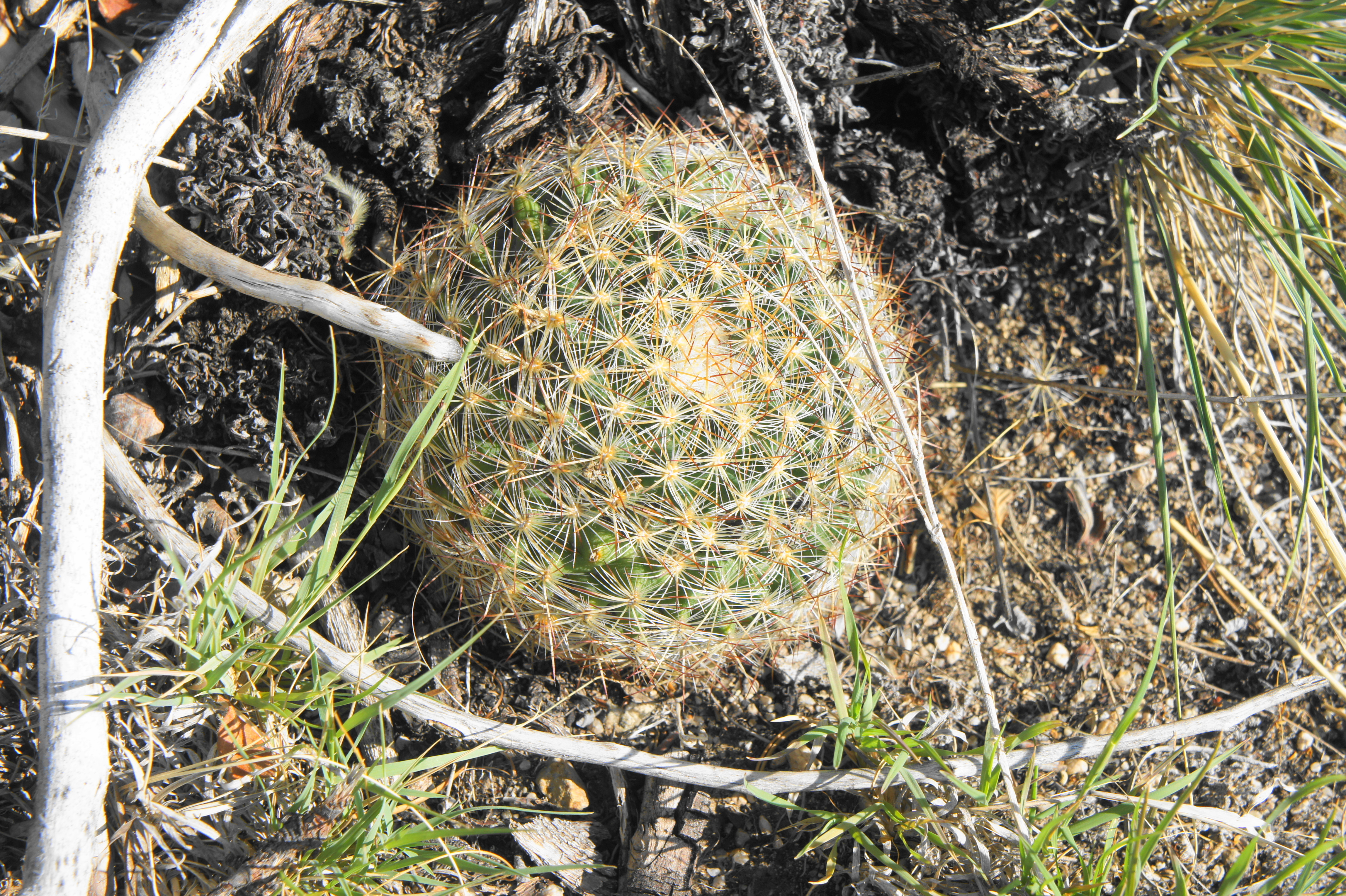
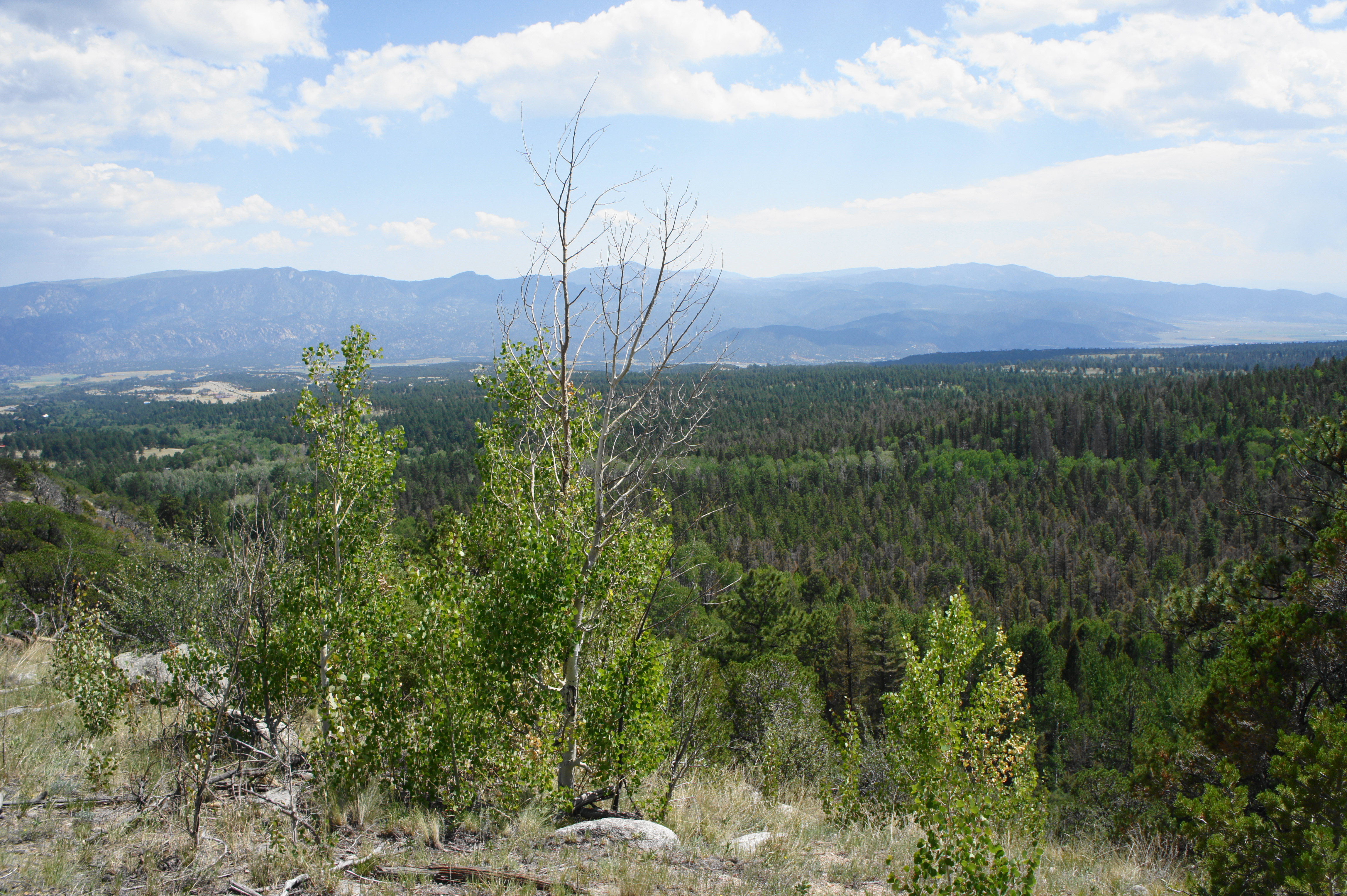
The wide, well-travelled path begins with a steady ascent, climbing through a sparse forest of conifers that gradually grows thicker as hikers gain elevation. Even among the pines there are a few surprises, including occasional yuccas and barrel cacti. After passing through a cattle gate, the drop-off to Little Browns Creek on the left steepens, and the trail switchbacks up to a brief plateau at 1/3 mile. From here it is up again, ascending a ridge with views overlooking the canyon, with the Arkansas River Valley beyond. At about 4/10 mile, hikers get their first good look at imposing Mount Shavano (14,229’), one of many fourteeners in the Sawatch Range.

Small barrel cactus 
Views of Mount Shavano

At this higher elevation, a larger concentration of aspens and junipers enters the mix, and the climb continues after a brief flat at around 7/10 mile. Minutes later, the trail flattens again and offers the best views yet of Shavano and Jones Peak (13,571’) to the southwest. Hikers can begin to hear the babbling creek below as the trail climbs a dry wash and takes a sharp left at 1.2 miles. This marks the last major climb of the hike—the rest is pleasantly gradual, even level, as the trail makes its way southwest toward the Browns Creek drainage.

At 1.4 miles, the route splits. Bear left on the Colorado Trail, following the signs for Browns Lake and Browns Creek Falls. Minutes later, the path reenters dense forest, crosses over Little Browns Creek, and approaches a second junction. Here hikers should sign in at the trail register and bear right again, leaving the Colorado Trail and then traversing Browns Creek. The onward route is very mild, passing amid the conifers, with the main Browns Creek weaving in and out of view on the left.
At 2.4 miles, the trees part abruptly, revealing a lovely, sunny meadow, framing views of the Shavano complex and Jones Peak in the distance. The canyon ahead bends right, but day hikers heading for the falls will not make it that far. (Note: It is possible to reach Browns Lake, however, on a long day hike beyond the falls.)

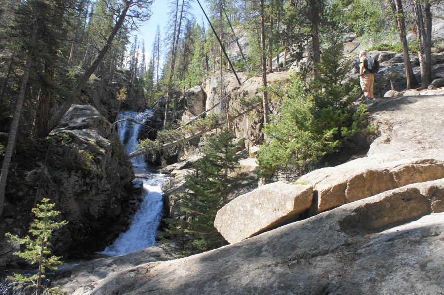
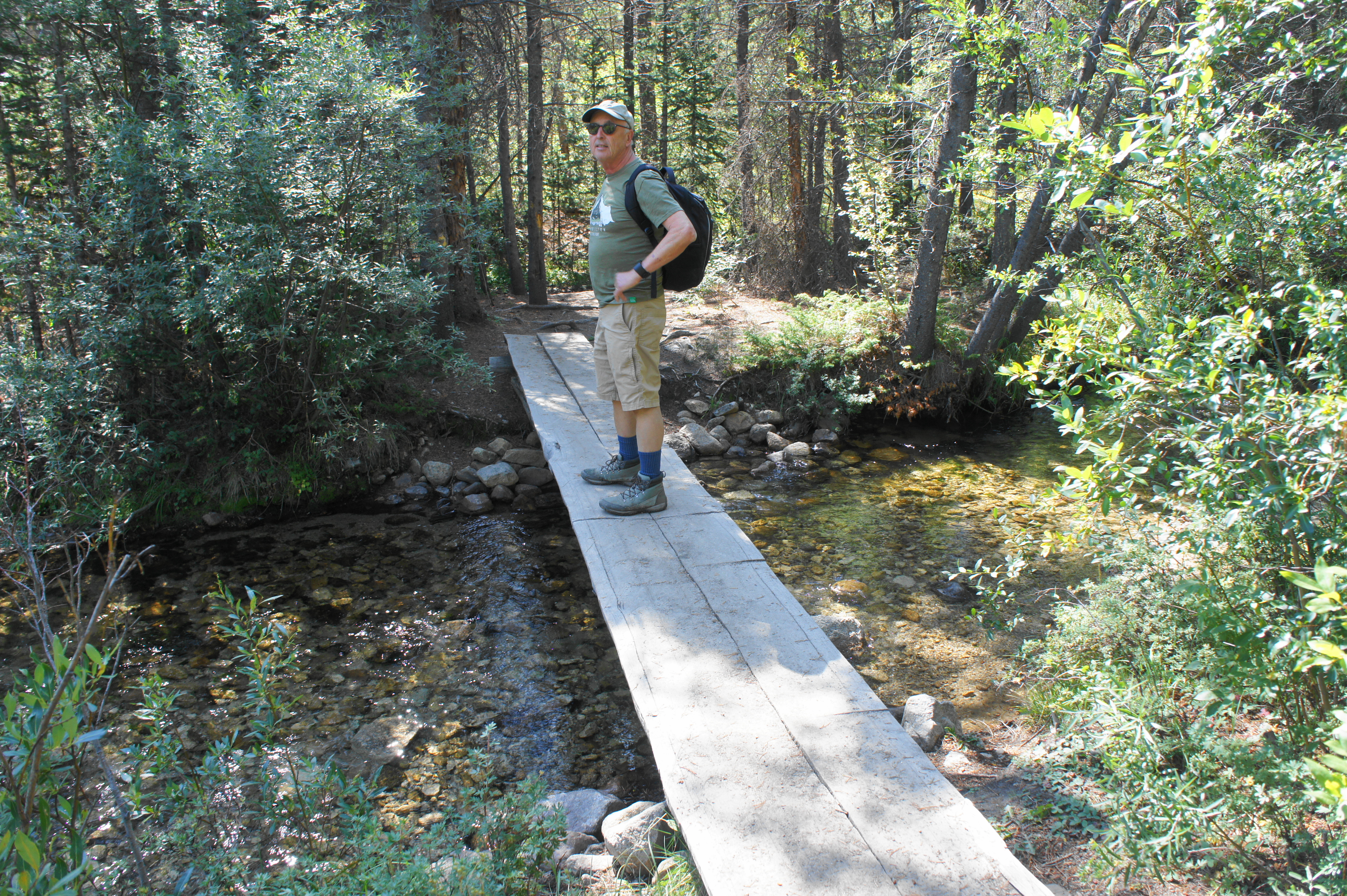
After following the wide, sandy track across the meadow, the route reenters the forest and approaches the first of two back-to-back crossings of Browns Creek. At the first, head right along the single-track, hugging the banks before reaching a plank bridge that leads across the shallow waters. A few minutes later, hikers reach a second bridge over the creek, heading back to the north side of the stream. At 2.8 miles, there is a horse corral on the right, following soon by the spur trail to Browns Creek Falls, marked with cairns and an etching on a small wood stump indicating “ß FALLS.” (Note: This can be easy to miss, so keep your eyes peeled after passing the horse corral.)

Small bridge over Browns Creek 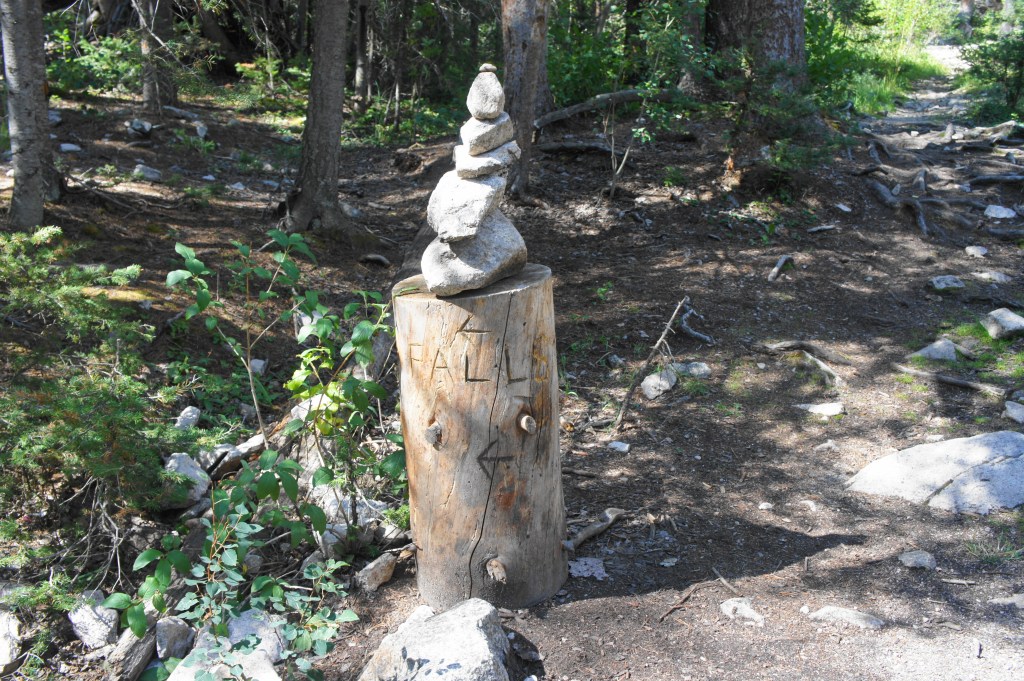
Spur to the falls

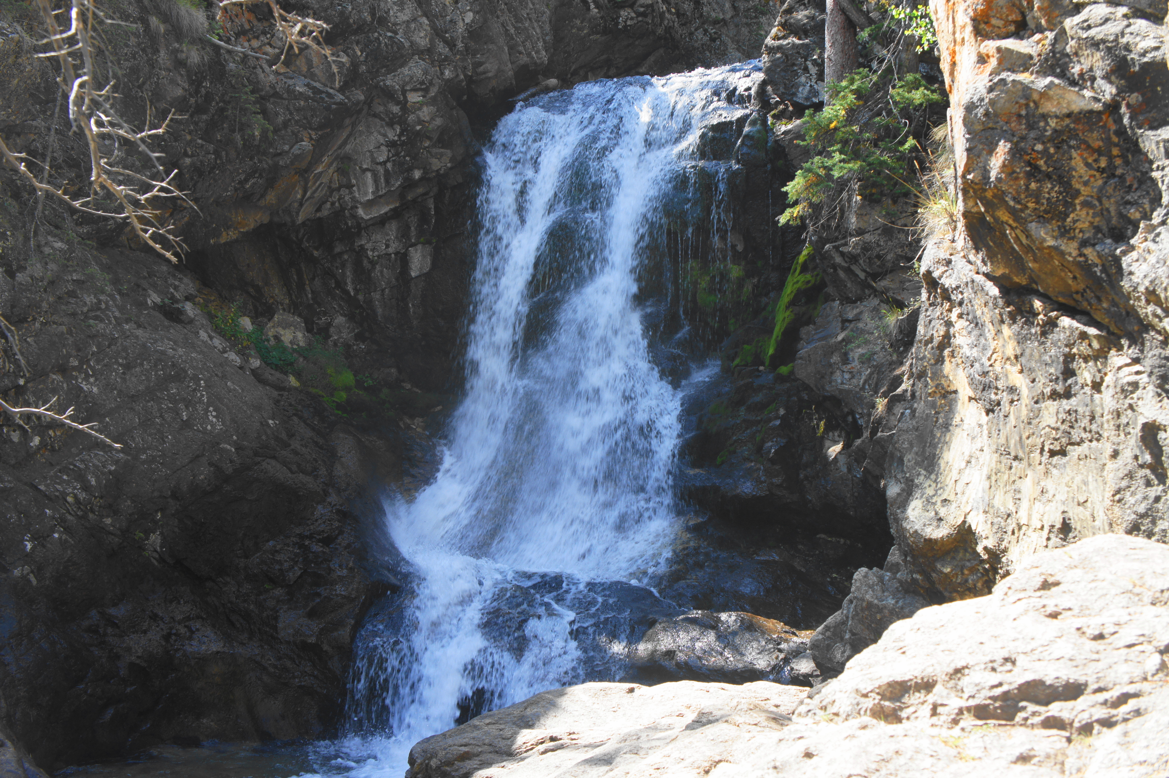
The spur is short and rocky, following an outcrop on the right flank of Browns Creek. Just ahead is the two-tiered waterfall. Set in a shady, rock-lined ravine, Browns Creek Falls is a terrific sight, holding good volume throughout much of the year. (Note: The pictures below show late August water levels.) Be careful approaching the falls, as there are several steep drops and potentially slippery steps.

After enjoying the roaring cascades, return the way you came to cap off the 5.8-mile out-and-back hike. Hikers should allot 3-5 hours for this moderately-difficult jaunt, which gains roughly 950 feet in elevation.

Wow, I did this one earlier in the year with snow on the mountains and so much water… amazing how different it looks!
Wonderful hike, and I especially loved the waterfall photo. Thanks for the post.
Pingback: Top 10 Hikes in 2020 | Live and Let Hike