

Ptarmigan Lake is a beautiful alpine tarn high in the Collegiate Peaks area of central Colorado, a short distance from the Continental Divide and Cottonwood Pass. In addition to the quiet lake above tree line, the hike also features some of the area’s best views of Mount Yale (14,196’) and an abundance of healthy conifers, which blanket the hillsides for much of the first two-thirds of the hike. After a mild ascent through the forest, the incline picks up after passing a first, unnamed lake at 2.4 miles, gaining about 400 feet in elevation in the final 2/3 mile.

The hike
While many flock to the Collegiate Peaks above Buena Vista and Salida, Colorado to summit the area’s many fourteeners, there are also a handful of other options for less arduous day hikes. One nice option is San Isabel National Forest’s Ptarmigan Lake Trail, situated roughly 15 miles west of Buena Vista along the paved road (Route 306) to Cottonwood Pass (12,126’). Just before the drive begins the winding curves up to the pass, look for the marked turnoff for Ptarmigan Trailhead on the left. The small parking lot has space for perhaps a dozen vehicles, which may not be enough on busy days—so plan to arrive early in the day to get a spot.
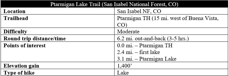
The well-trodden path takes off downhill from the trail, immediately dropping to traverse Middle Cottonwood Creek, the main crafter of the lush and green Cottonwood Valley. This is virtually the only downhill in the next three miles. After crossing the stream, the route bears eastward, climbing mildly through the dense thicket of pines, occasionally offering obscured vistas of the valley below. A brief rockslide at 2/10 mile offers a window view, then the trail returns to full tree cover and takes a sharp, right-hand turn at about ½ mile, entering the Ptarmigan Creek drainage.

Now bearing steadily southward, the trail continues to hug the slopes of Jones Mountain (13,218’) on the right, while the hulking mass of Gladstone Ridge (13,209’) comes into view across the drainage. Another rock slide at 6/10 mile provides a brief opening—and is a good spot to spot (or at least hear) chirping pikas, the lovable mouse-like creatures who thrive in rocky alpine locations of the Rockies.

At ¾ mile, the trail crosses the rock field and climbs back into the wooded cover, staying in the dense thicket for the next 1 ½ miles. At 1.25 miles, there is another sharp right-hand turn, and the incline increases slightly—although the ascent continues to remain relatively mild. Soon after, the trail traverses what was clearly an old road bed, then switchbacks right and climbs steadily through a modest uphill section. The occasional bends and turns continue, and a side stream comes within earshot—and then into sight—on the right at about 2.25 miles.

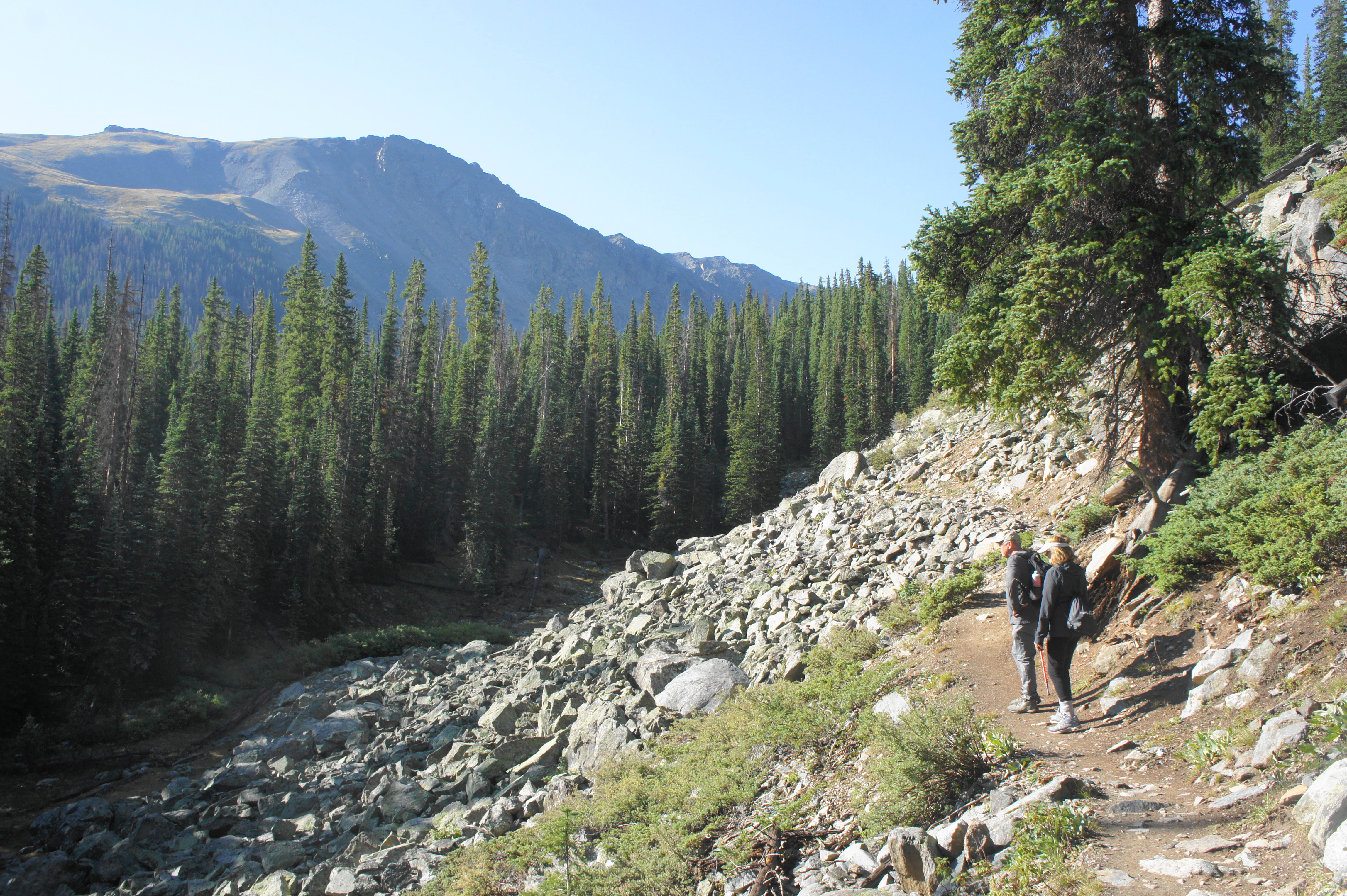
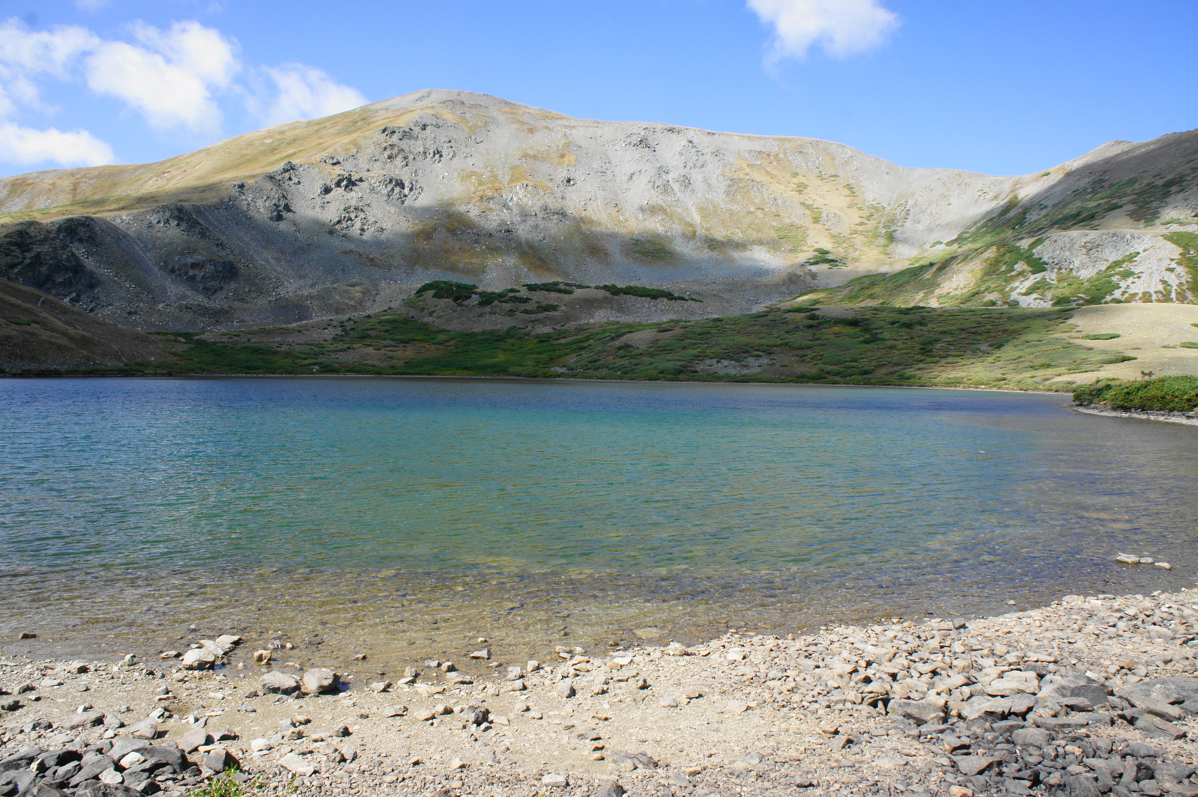
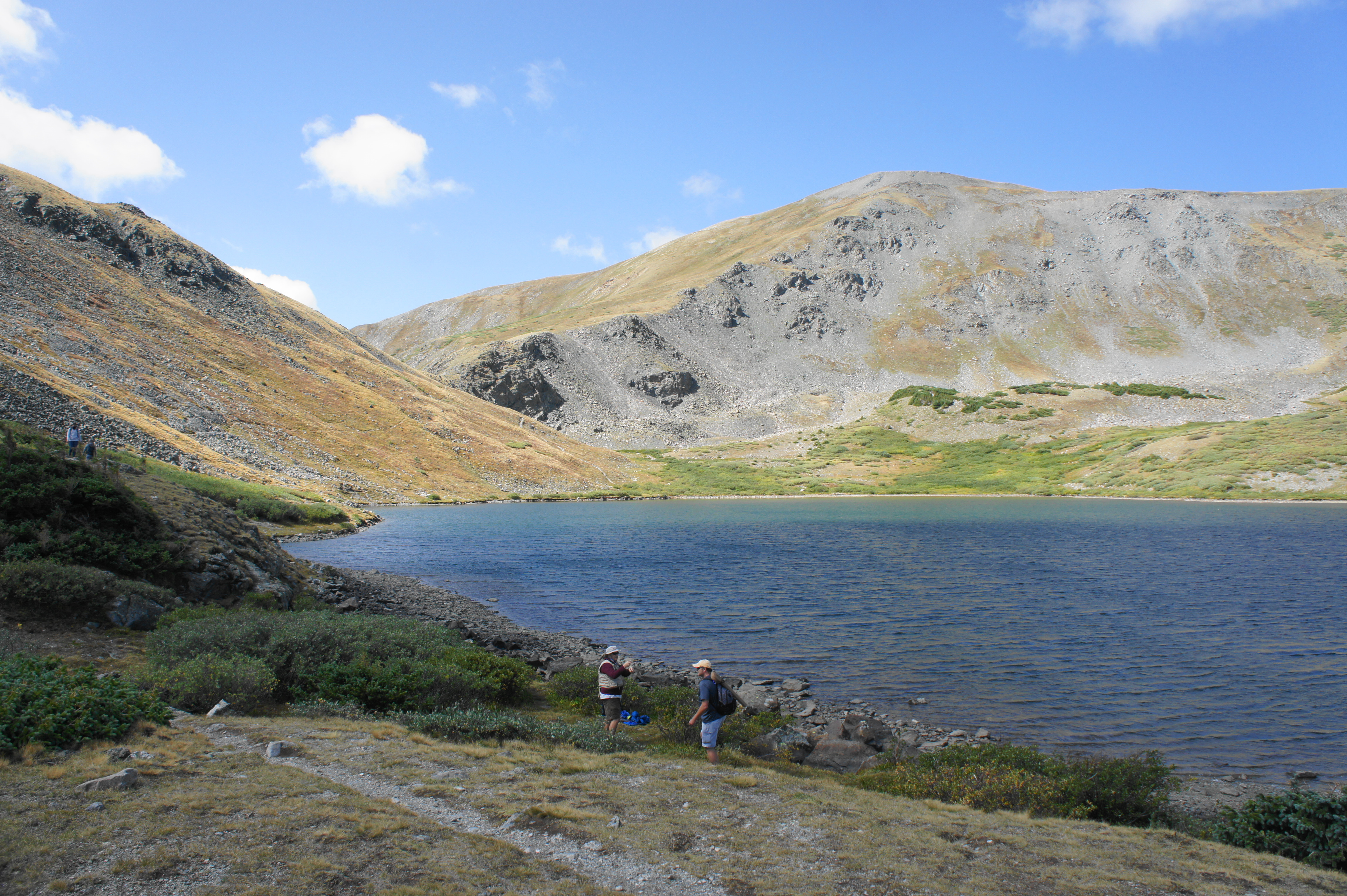
It is not until 2.4 miles that the trail emerges out into the open. The endless stand of pine trees suddenly dissipates, revealing scrubby tundra above. A small and beautiful pond is approached on the right, nestled below the steep slopes of Jones Mountain, a mostly barren, rocky hilltop with several humps. Off to the left, a much larger lake appears. This lake, situated at the edge of the forest, is often confused for Ptarmigan Lake; although beautiful, this body of water is actually unnamed. Back to the north, one gets the hike’s first unobstructed views of the summit of Mount Yale, as well as pyramidal Turner Peak (13,237’).


Unnamed lake below Gladstone Ridge 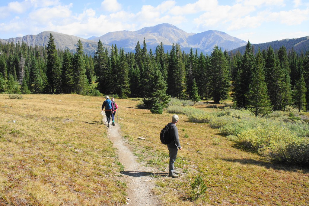
Looking back toward Mount Yale

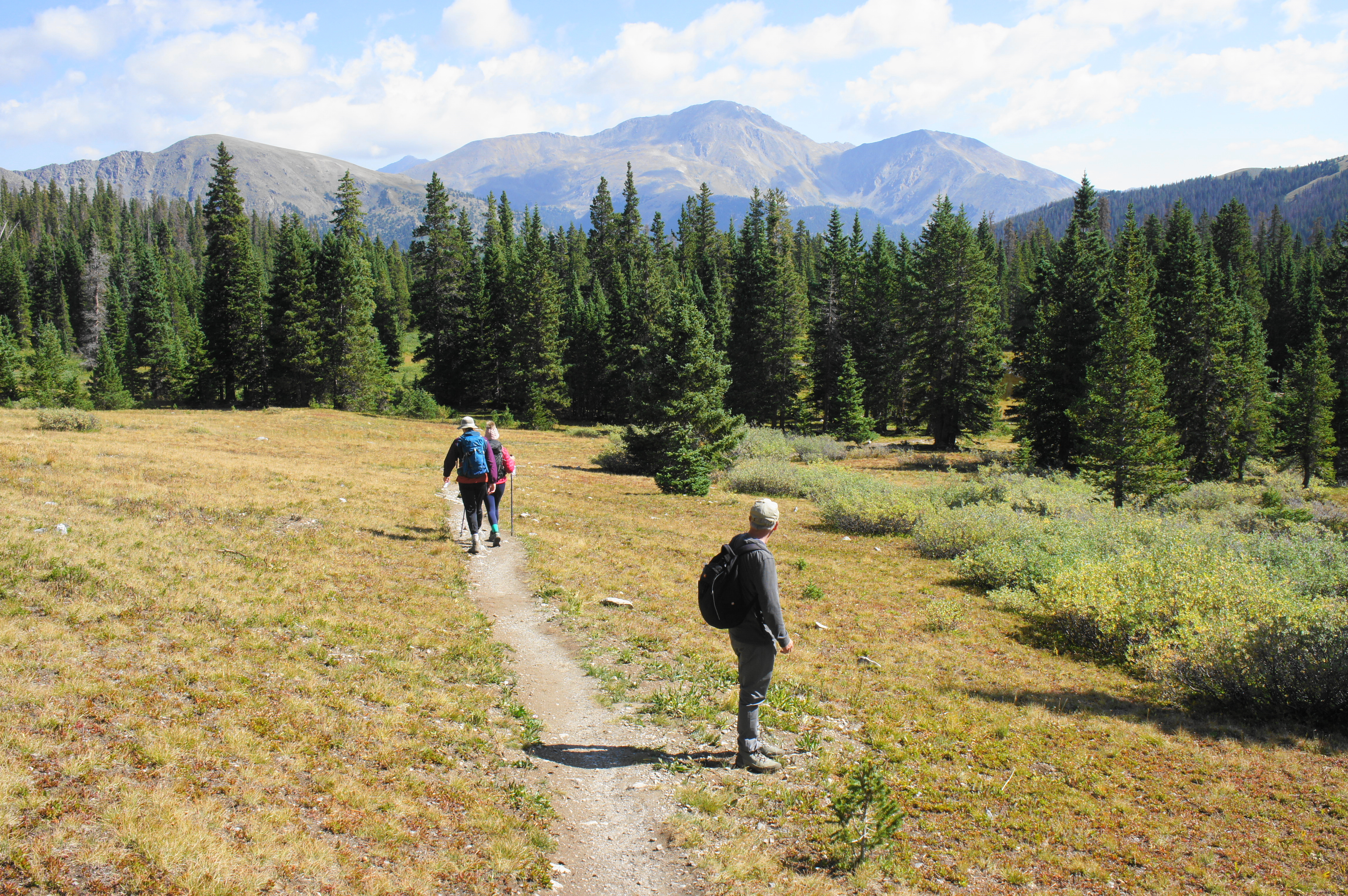
The onward trail continues around the right flank of the lake before beginning a steady ascent through a sparse stand of spruces, lush with wildflowers at sporadic times of year. This is perhaps the most enjoyable stretch of the hike, as the views of Cottonwood Valley and the peaks back to the north get better and better as you climb. Eventually, one can begin to make out Mount Harvard (14,420’)—Colorado’s third-highest peak—in the distance beyond Yale. One cannot quite spot Cottonwood Pass, but it is off to the left, beyond Turner Peak, with the Texas Valley obscured from view.

Ahead of you on the trail, hikers begin to approach the final basin, cradled between Jones Mountain and Gladstone Ridge. At 2.9 miles, the trail crosses a stream, surrounded by bushy thicket, and then embarks on a switchbacking ascent that is the hardest part of the hike—but completed relatively quickly. Atop the switchbacks, hikers get their first view of Ptarmigan Lake, a surprisingly large spectacle with crystal blue waters and easily approachable shores. Situated at 12,147 feet, the lake’s year-round temperatures are frigid—although the waters often sport trout, a local prize that attracts fishing enthusiasts.
The trail unofficially continues onward from here, skirting the left flank of the lake and cutting through a narrow pass that eventually meets up with a four-wheel-drive track beyond. Most will turn around at the northern shores of Ptarmigan Lake, however. Although the lake itself can be crowded on summer weekends, there is a lovely, smaller pond off to the left that offers a quieter and serene spot to take a break, while enjoying the view back down valley toward Mount Yale.

Perhaps the only significant downside of the Ptarmigan Lake Trail is that it is an out-and-back, with no obvious loop option. After exploring the area, return the way you came, descending back into the woods and reemerging at the parking area after a 6.2-mile round-trip trek. Allot 3-5 hours for this moderately-difficult hike, pairing perhaps with an afternoon hike to nearby Lost Lake and visit to Cottonwood Pass.

Pingback: Lost Lake Trail (San Isabel National Forest, CO) | Live and Let Hike
Pingback: Browns Creek Falls (San Isabel National Forest, CO) | Live and Let Hike
Pingback: Top 10 Hikes in 2020 | Live and Let Hike
Pingback: 15 U.S. Hiking Trails With the Highest Bear Encounters According to Rangers - Exploring Animals