

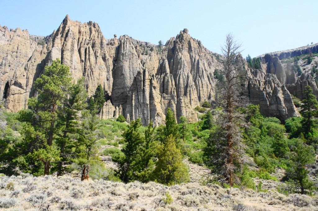
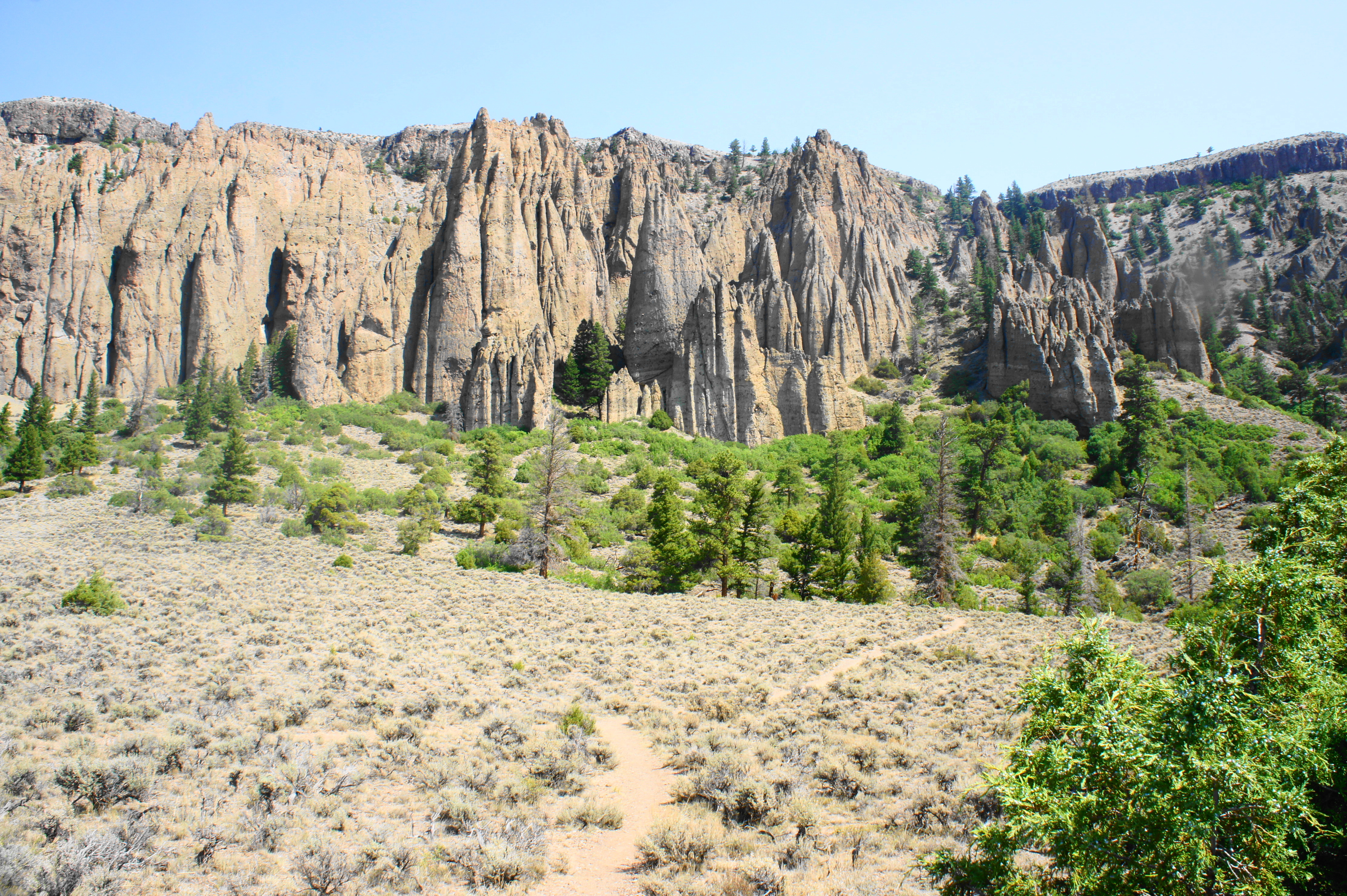
Curecanti National Recreation Area in central Colorado is popular with boaters but an otherwise oft-forgotten destination, serving more as a waypoint for passersby on Highway 50 and dwarfed by the hype of nearby Black Canyon of the Gunnison National Park and the San Juan Mountains. Yet while Curecanti is arguably marred by a scrubby landscape and three man-made reservoirs, the area has a rich geological history. Here the Gunnison River has carved deep chasms in the basement rock laid during the Precambrian Eon, while more recent volcanic activity (30-35 million years ago) produced the park’s walls of angular spires visible today along the northern shores of Blue Mesa Reservoir. Preeminent among these geological features is the Dillon Pinnacles, a miles-long display of volcanic breccia and Blue Mesa tuff and perhaps Curecanti’s most iconic destination.
Relative to boating and fishing, hiking is relatively uncommon in Curecanti. Yet there are seven official hiking trails in the park, including a moderately-difficult, 3.6-mile out-and-back to the base of Dillon Pinnacles. This hike, although far from the most spectacular in Colorado, offers fine panoramic views of Blue Mesa Reservoir and an up-close look at the towering breccia spires usually viewed only by road. The walk also makes for a decent leg-stretcher for those travelling between the Front Range and western Colorado, situated roughly two hours from Grand Junction and 3.5-4 hours from Denver, Colorado Springs, and Pueblo.
The hike
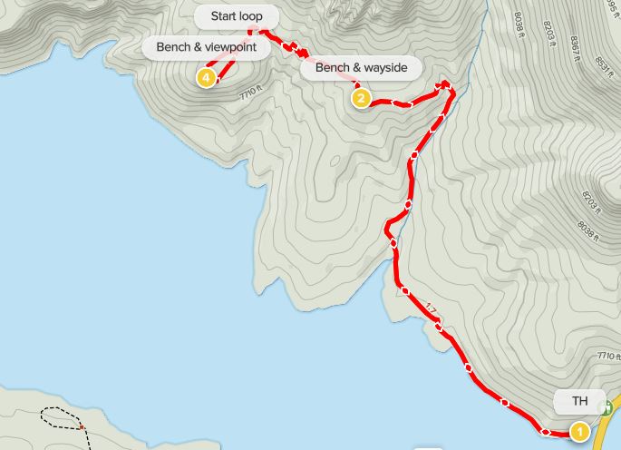
The Dillon Pinnacles Trailhead is situated near the middle of Curecanti National Recreation Area, roughly six miles west of the Elk Creek Visitor Center and just north of the point—Middle Bridge—where Highway 50 crosses Blue Mesa Reservoir, the largest lake located entirely within Colorado and a marvel of engineering formed by damming the Gunnison River in 1966. The parking lot at Dillon Pinnacles is small and includes a pit toilet.
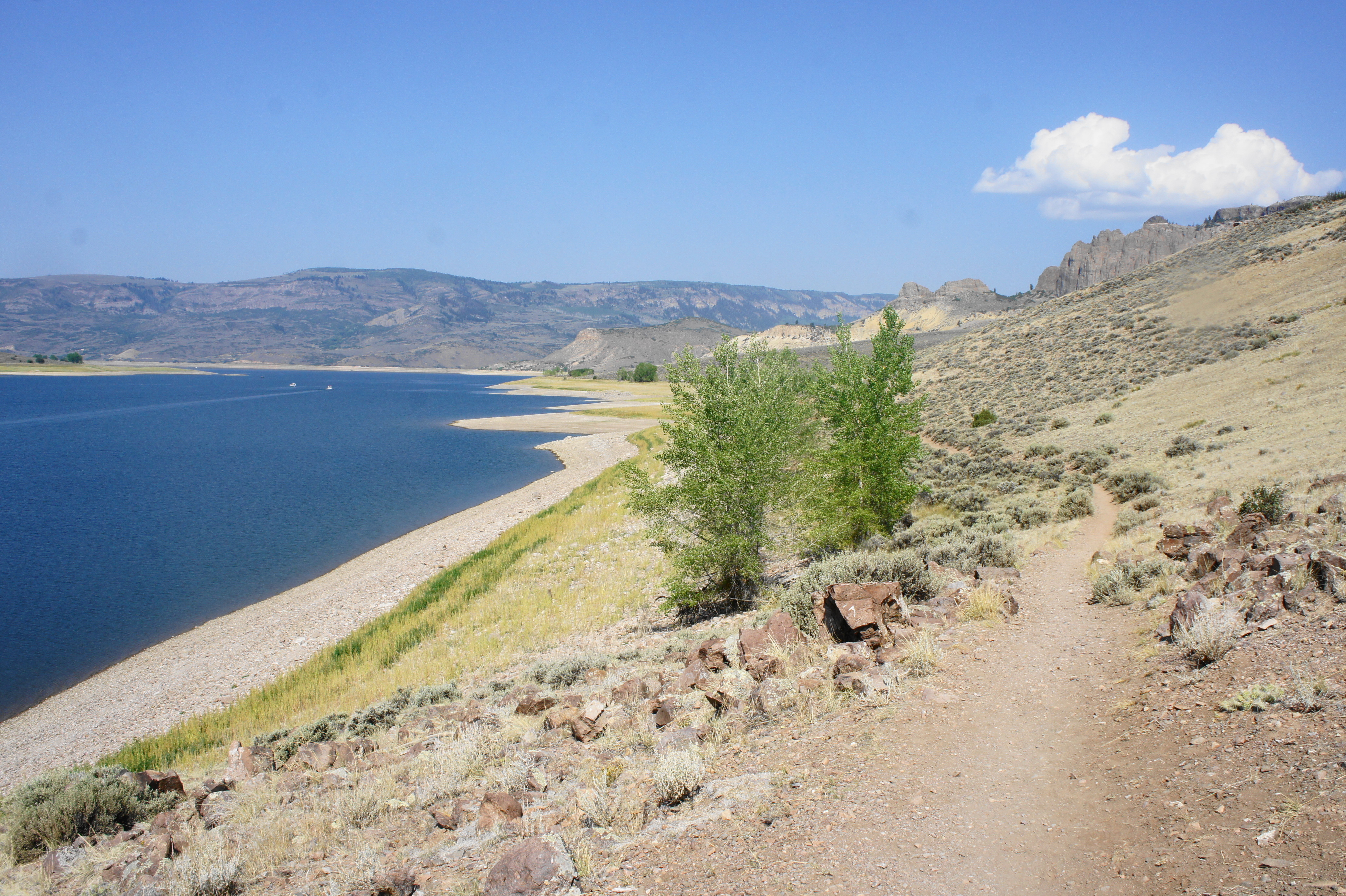
After parking, make your way down the boat ramp toward the reservoir; after a few dozen yards (before reaching the shores), the start of the Dillon Pinnacles Trail, a dusty single-track, is visible off to the right. The trail begins by paralleling Blue Mesa Reservoir to the left. Bunches of low sagebrush are interrupted occasionally by groups of lovely cottonwoods, given life by the crystal blue waters of the lake below. After 4/10 mile of pleasant strolling, the trail passes a wayside on prehistoric dinosaurs and then begins to turn away from the lake, descending to clear a riparian ravine called Dillon Gulch. By now the Dillon Pinnacles are in clear view ahead: these amalgams of breccia and Blue Mesa tuff rise hundreds of feet above the sagebrush slopes below and are visible all the way across Blue Mesa Reservoir to the south.

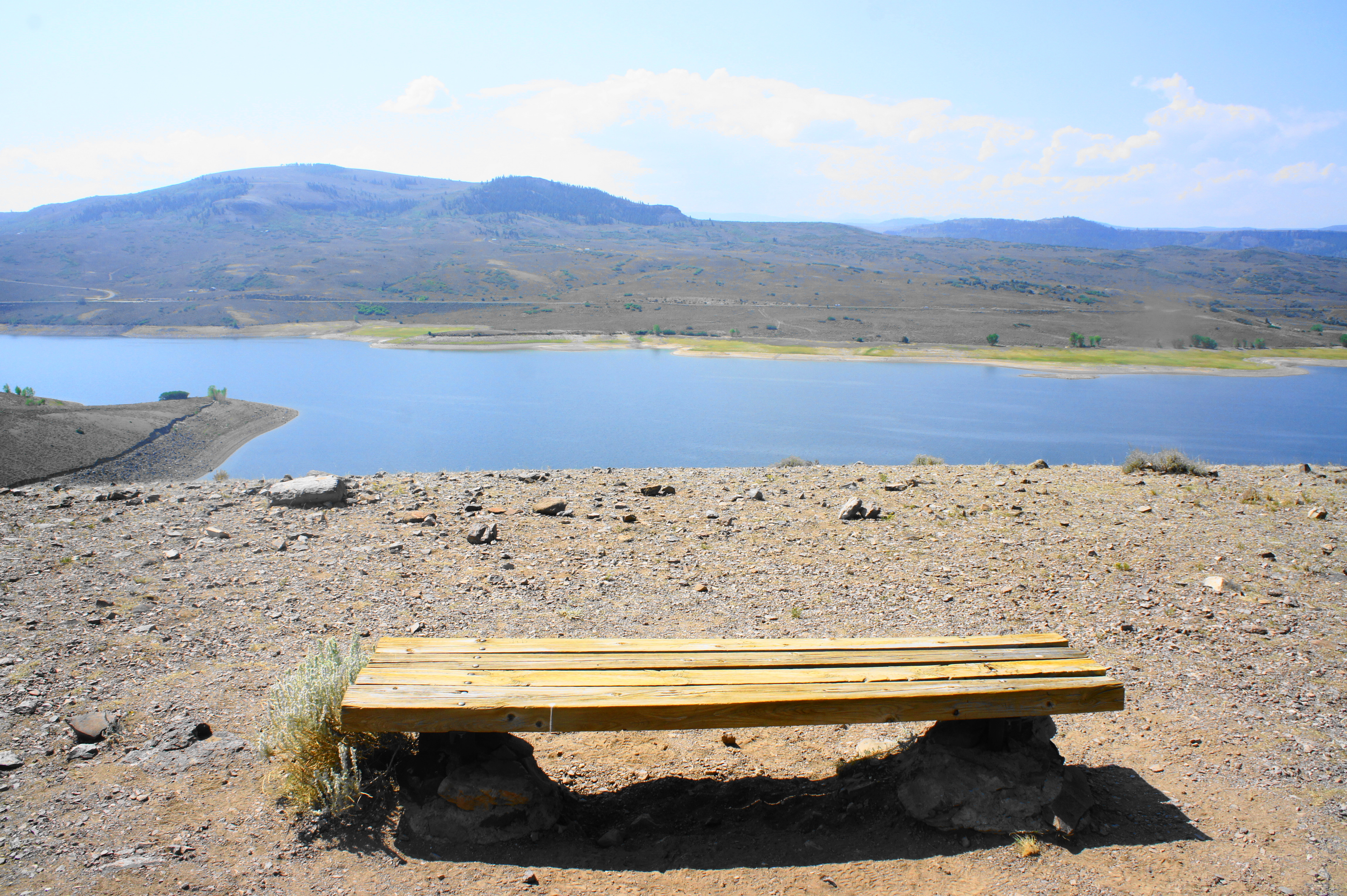
After a brief uphill, the trail hugs the left flank of the dry gulch, a riparian mix of oaks, pines, cottonwoods, and junipers. This area provides the hike’s first real shade, a welcome relief on a hot summer day in this often arid and sunny part of Colorado. Bearing north, the high tops of Dillon Mesa dominate the skyline. The trail begins to climb steadily, levelling off briefly under the shade of large pine tree at about 0.95 mile, where there is a bench available for hikers to catch their breath. Shortly afterward, the track makes a left-hand turn and heads west, climbing out into the open to clear a low plateau, now about 300 feet above the level of the reservoir.

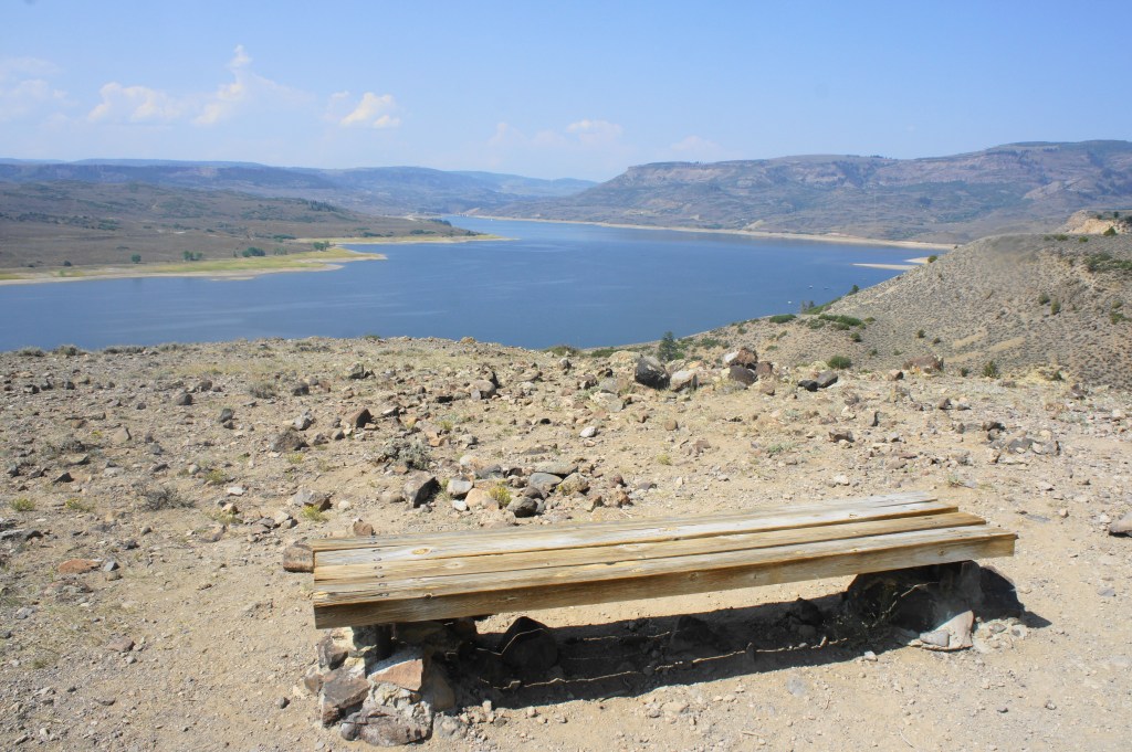
At 1.3 miles, there is another bench and fine vistas of both the reservoir and the pinnacles. Another wayside offers explanation for how the spires were formed: the relatively hard cap of Blue Mesa tuff keeps the walls in place, while the forces of wind, water, and ice have chipped away at the underlying breccia, forming the chiseled, gray-brown pinnacles visible ahead.
Views across Blue Mesa Reservoir 
Dillon Pinnacles ahead
Moving forward, the trail continues westward, briefly descending before climbing mildly again, with ponderosa pines increasingly dotting the landscape. At 1.65 miles, there is another bench on the right, then the trail climbs out of the woods and back among the exposed sagebrush. At 1.7 miles, hikers reach the final section of the hike: a short loop that leads to the final overlook. Heading right first, hikers can visit a pinnacle-in-miniature, a speckled knob perhaps three feet high that was once perhaps a high spire like those visible along the wall to the north. A wayside offers more details on the forces of erosion that are causing the breccia formations to gradually crumble.
Close look at the pinnacles 
The remains of a former pinnacle?
A couple minutes later, hikers reach the culmination of the hike—a bench with a fine view across Blue Mesa Reservoir, with the often snow-capped San Juan Mountains visible in the distance to the south.

After taking in the views, continue left to finish the rest of the short loop, then continue 1.7 miles back the way you came—mostly downhill—and return to the trailhead along Highway 50. All told, this short hike should take 2-3 hours, depending on pace.

I love this hike! Great photos!
As always, your trail reviews are spot on! The photos and text are really very well done and targeted to the moderate hiking population!