

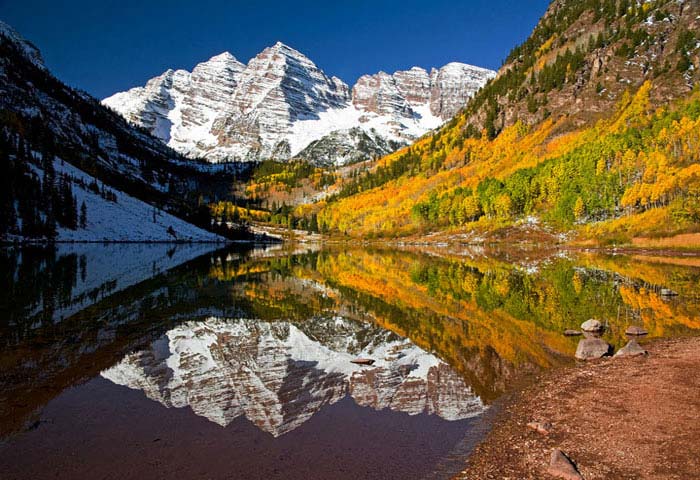
There is perhaps no landscape more iconic in Colorado than the classic view—used in nature calendars everywhere—of Maroon Lake, set before the beautiful backdrop of aspen trees and the snow-streaked Maroon Bells. Situated less than 11 miles from Aspen, Maroon Lake is a popular destination for photographers and hikers, and the short Maroon Lake Trail—wide and hard-packed—offers an up-close view of the lake for everyone. It also provides access to longer trails, including the Scenic Loop Trail and a more difficult hike to Crater Lake.
The hike
To reach Maroon Lake, drive west out of Aspen to the first roundabout, looping around to the exit marked “Maroon Bells.” Follow this drive around nine miles to its end or, after 8:30am in summer, park at Aspen Highlands Village to catch the mandatory shuttle to the Maroon Bells Recreation Area. Maroon Lake is accessible from both the very end of Maroon Creek Road—at the amphitheater—or, more commonly, from the day-use parking lot on the left.
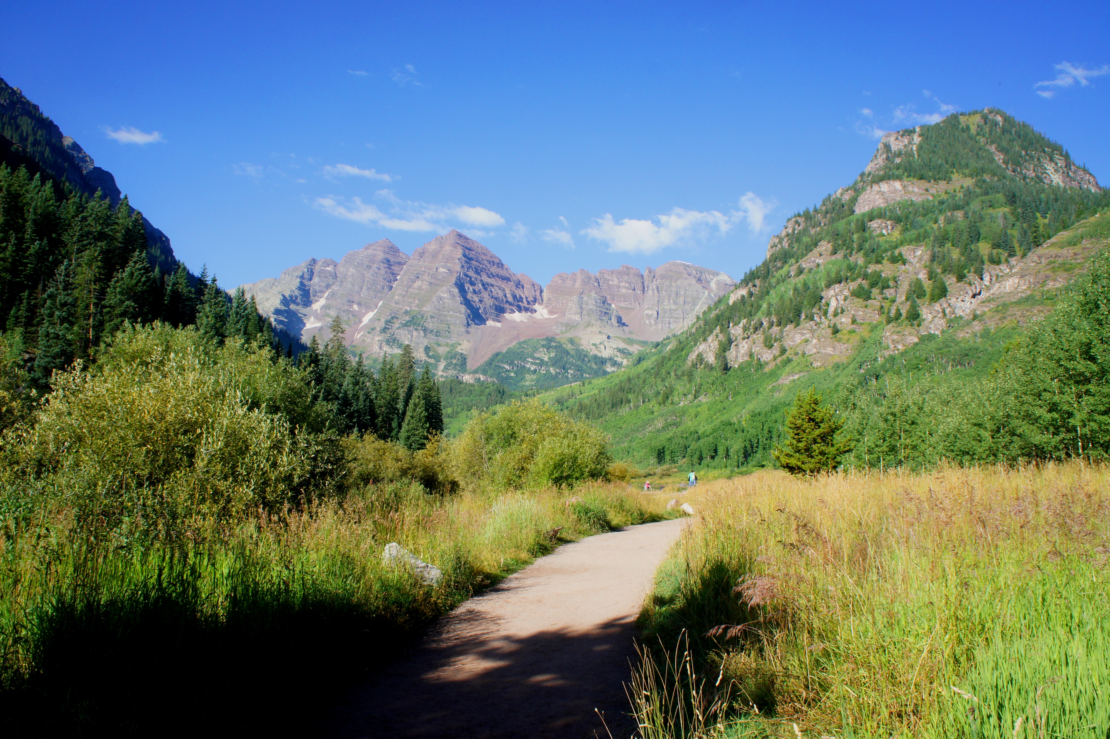
Heading west from the parking area on the broad, wheelchair-accessible path, the Maroon Bells—more specifically, Maroon Peak (14,156’) and North Maroon Peak (14,014’)—immediately come into view. Crossing through a field of tall grasses, the trail reaches the lake after roughly 1/10 mile.
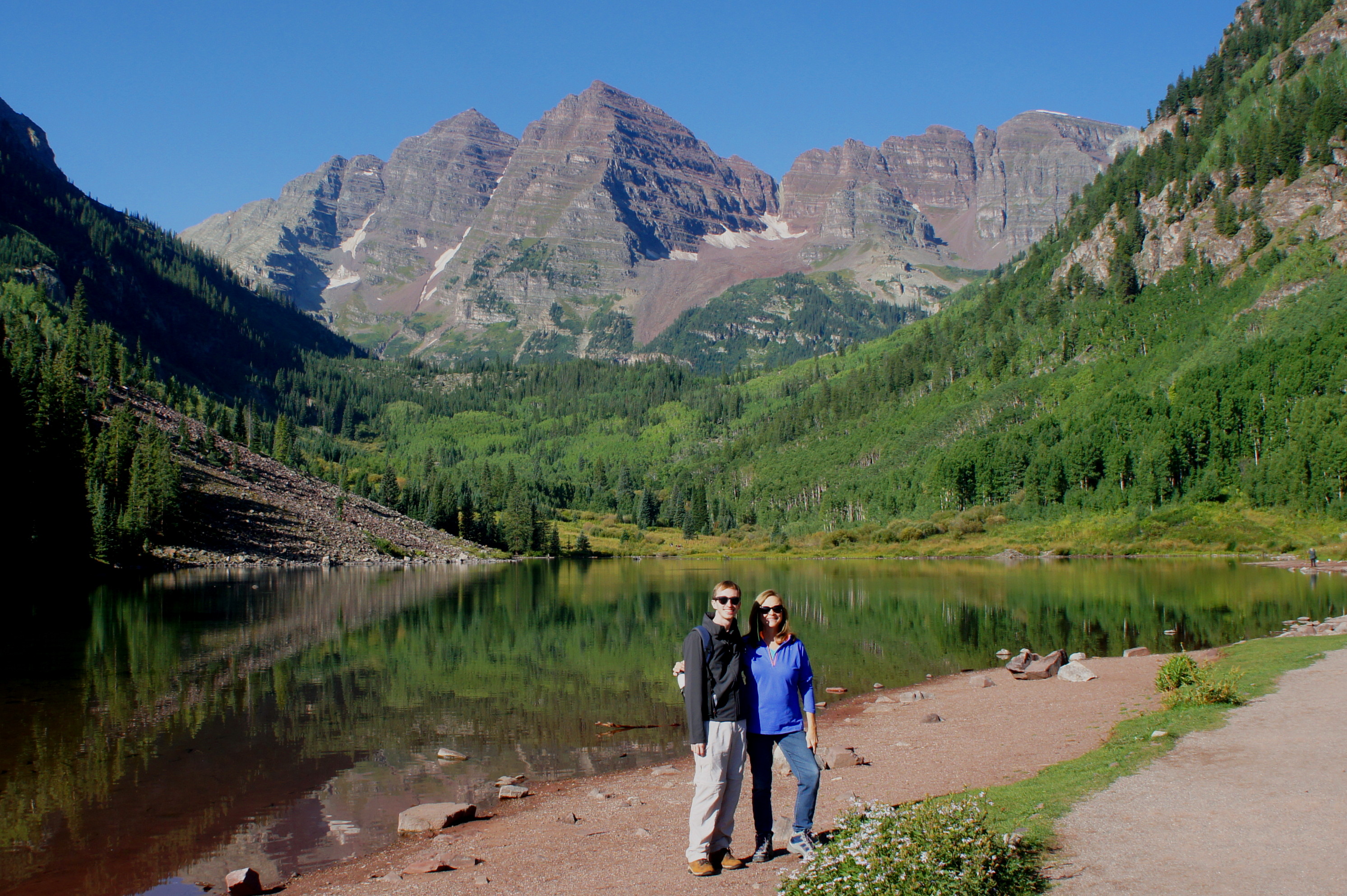
The best time to visit Maroon Lake is usually in the morning, well before afternoon shadows—and showers—begin to obscure views of the colorful peaks. On a clear, calm day, the reflection of the Maroon Bells in the still waters makes more a tremendous photo opportunity.

As you continue along Maroon Lake’s northern flank, a series of trails come in from the amphitheater area to the right. Occasional benches offer places to rest and soak in the beauty of Maroon Creek Valley. Also look for a third fourteener—Pyramid Peak (14,018’)—to the south, as well as rouge-colored Sievers Mountain (12,773’) to the north.

After around 1/3 mile, walkers will reach the so-called “Deadly Bells Kiosk,” effectively a series of warnings not to try to summit the Bells without significant climbing experience. Just beyond is the start of the Crater Lake Trail, which disappears into the aspens off to the right. The main trail continues to skirt Maroon Lake to the left, passing a couple beaver creations.
Wheelchair users will probably want to turn around at this point, as the trail beyond narrows and becomes clogged with rocks and tree roots. It is still possible, however, to push a stroller all the way to the end—a wooden bridge crossing Maroon Creek. This marks the start of the popular 1.5-mile Scenic Loop Trail and the official end of the Maroon Lake hike.
Wander onward, try your hand at the Crater Lake Trail, or return the way you came.

Pingback: Crater Lake Trail (White River National Forest, CO) | Live and Let Hike
Pingback: Maroon Creek Trail (White River National Forest, CO) | Live and Let Hike
Pingback: Lost Lake Trail (San Isabel National Forest, CO) | Live and Let Hike
Pingback: 4 Tips for Eloping at Maroon Bells Amphitheatre - The Epic Elopement
Great posst thank you
Pingback: Grinnell Glacier (Glacier National Park, MT) – Live and Let Hike