

Maroon Creek Recreation Area near Aspen, Colorado is generally swarming—for good reason—with visitors in the non-winter months. The scenic Maroon Creek Trail, however, is a pleasant change of pace. That the trail is sparsely crowded is not due to a lack of splendor: the rushing rapids and sweeping meadows make for a blissful hike through Maroon Creek Valley. It is also a very diverse hike, passing through dense pine forests, aspen groves, open meadows, and stony boulder fields over the course of 3.2 miles from Maroon Lake to the East Maroon Portal.


The hike
The Maroon Creek Trail is best tackled as a one-way hike, starting from Maroon Lake (at the end of Maroon Creek Road) and ending at the East Maroon Portal. The advantages of this route are twofold: first, the trail is nearly all downhill; and second, in the summer, you can pick up a free shuttle bus at the east portal to take you back to Maroon Lake or down the valley to Aspen.
Start the hike from the trailhead at the west end of the day-use parking area at Maroon Lake. Here the Maroon Lake Trail (see trail description here) takes off to the west. Instead of continuing to the lake, however, take the first left turn, which leads quickly to the trail’s first bridge crossing. After traversing West Maroon Creek, the path—marked with a wooden sign—bears east along the stream’s southern bank.

For the first quarter mile, the rocky Maroon Creek Trail refuses to stay flat, instead bobbing up and down over a series of minor slopes as it treads eastward. The ambiance is splendid: a dense thicket of pine trees with a verdant understory. The ever-rumbling stream separates the trail from a grassy meadow to the north; breaks in the trees offer views across Maroon Creek Road to colorful Sievers Mountain (12,773’).

About 1/3 mile from the start, the singletrack path suddenly leaves the shade and traverses an impressive boulder slide. Turn around for vistas of the Maroon Bells (14,156’ and 14,014’) and Pyramid Peak (14,018’) at the head of the valley.
It takes several minutes to cross the boulder field, but soon enough, the trail reenters a pine forest, occasionally interrupted by aspen groves. A brushy section where the trees briefly recede offers more vistas up and down the valley. The pines return at the start of an excellent section in which West Maroon Creek begins to more loudly tumble, and at a quicker rate. Roughly 2/3 mile from the trailhead, the trail forks. Here a short connector trail bears off to the left, crossing a wooden bridge en route to the West Maroon Portal. The main route continues right, hugging the southern bank.

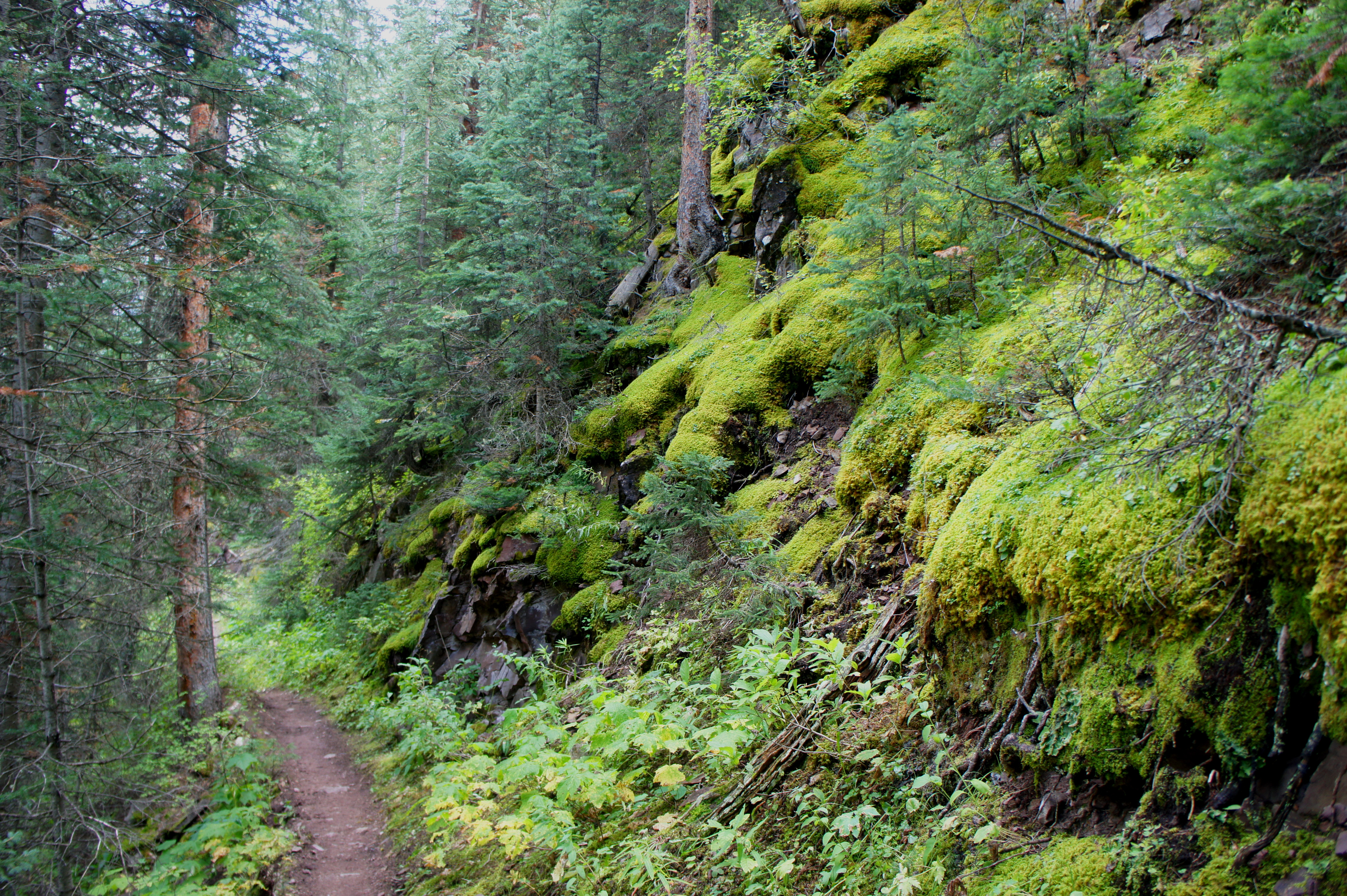
Downstream, West Maroon Creek gives way to a roaring sequence of cascades and chutes; unfortunately, however, the trail stays high above the stream bed for much of the next mile. It does not take away from the allure, however; moving higher up the bank brings the trail in contact with stunning verdant mosses, blanketing the rocky slopes.
Around a mile into the hike, a grassy meadow appears opposite the creek on the left; on an afternoon in August, I spotted a yellow-bellied marmot frolicking in the fields. About ten minutes from the first, a second meadow view emerges on the left.

From here, the character of the trail changes, as it leaves the creek behind and endeavors into a series of aspen stands. It is not until about 1.7 miles from the start that West Maroon Creek reappears again, after which the route descends sharply to a wooden bridge. Here the trail crosses East Maroon Creek, just before it merges with West. By this time, you’ve made it more than halfway.
After nearly two miles of easy downhill walking, the short section that follows can be jarring. After crossing the bridge, the trail immediately begins to climb sharply, gaining about 100-150 feet to pull out of East Maroon Creek Valley. At the top of the ascent lies a route junction; continue left on Trail 1982.

Three minutes later, the path hops over a minor tributary. Aspens and meadows abound as the trail returns to descending at a slow but steady grade. The trail is now more than a hundred feet above the main creek, well within earshot, off to the left.
By now the valley has bent northward, and Highland Peak (12,381’) emerges on the right. Geologists will find the mountain interesting, as it demonstrates a clear uplift of sedimentary rock layers. Naturalists may be able spot deer or other species, as well as a gluttony of butterflies.

The final stretch comprises a steady drop through aspen groves back to creek level; just before the end, the route crosses Maroon Creek. From here the parking area at the East Maroon Portal is only steps away. Pick up the shuttle bus to return to Maroon Lake or head down-valley to Aspen.
Allot at least 1.5 hours for this scenic, one-way journey.

Beautiful hike with lots of water:)
Pingback: Trading Post Trail (Red Rocks Park, CO) | Live and Let Hike